In 1965 I was in the Navy, stationed at U. S. Naval Facility Centerville Beach, Ferndale, California, about 100 miles south of the Oregon border. This provided a great jumping-off place to visit Oregon. I had every reason to visit Oregon. My college buddy Chuck Mattox lived in Eugene, where he was doing graduate work at the University of Oregon. There he had met his fiancée Elouise, and they were married in Portland in June – and I served as best man.
The NAVFAC, for all its shortcomings, had a generous leave and liberty policy, and I was able to get away for several long weekends in the ten months I was stationed there. Most of them I spent in Oregon. Chuck and Elouise lived in married housing at the University of Oregon in those days. They took me on several outings – at least one into the Cascade mountains east of Eugene, another to the Oregon coast. I brought my camera along and shot pictures, and I also took photos en route back and forth from Centerville Beach. Here they are.
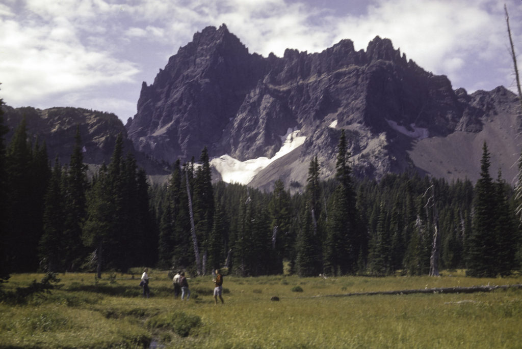
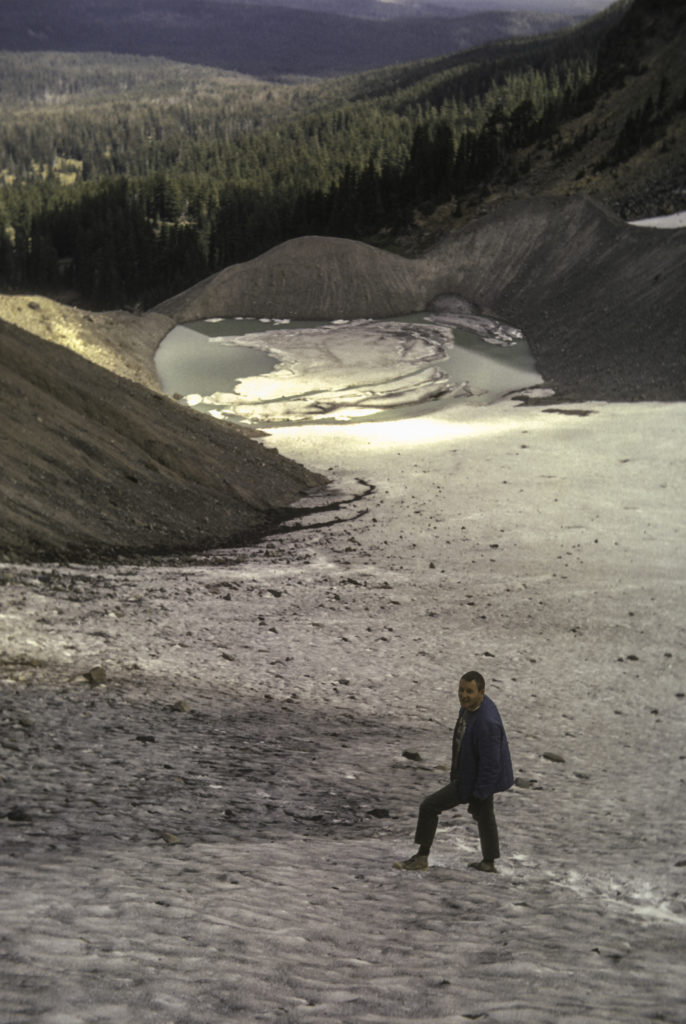
One outing took us up to Three-Fingered Jack, an inactive shield volcano in the Cascades, 7,844 feet high. Unlike some other volcanoes in the Cascades, such as Mt. Jefferson and the Three Sisters, Three-Fingered Jack is very irregular and jagged, and its highest peak appears from a distance to consist of three jagged spikes, hence its name.
In a shady area on the northeast side of the mountain is a glacier, which (surprise!) is called Jack Glacier. We climbed up to it and shot a few pictures.
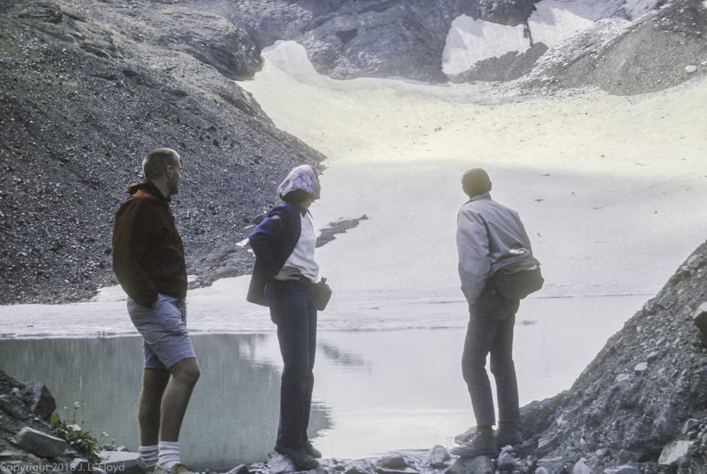
There is a pool formed by meltwater at the bottom of the glacier. Part of it is visible in the picture above, but you can see all of it in the following photo, which also features me standing on the surface of the glacier.
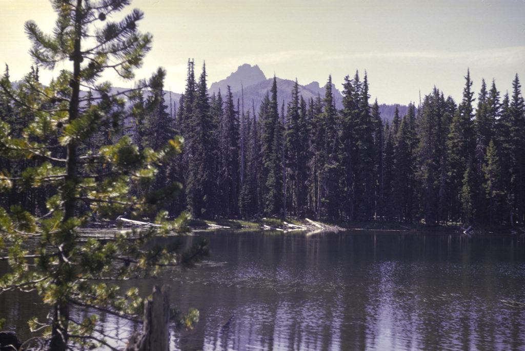
Near Three-Fingered Jack there is also a small mountain lake, Jack Lake, with a campground where we stayed.
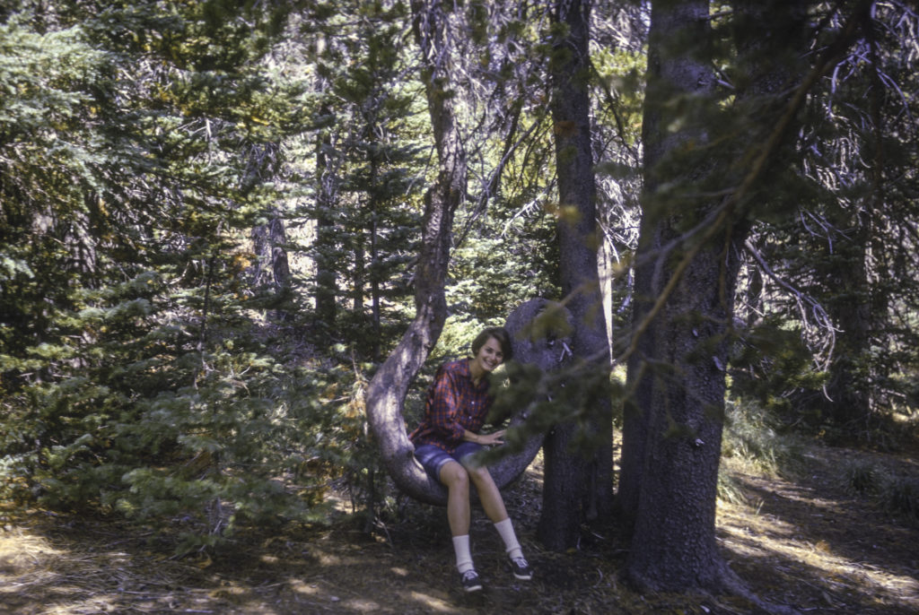
While on a hike, we came across an old hulk of a tree with a hugely deformed branch growing out of it in the shape of a J. Elouise sat in the crook of the J, and the picture I shot of her in this natural “tree swing” is one of my most treasured mementos.
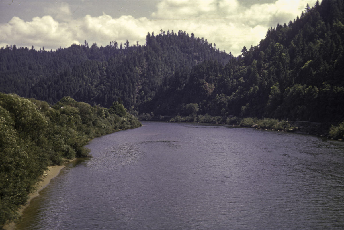
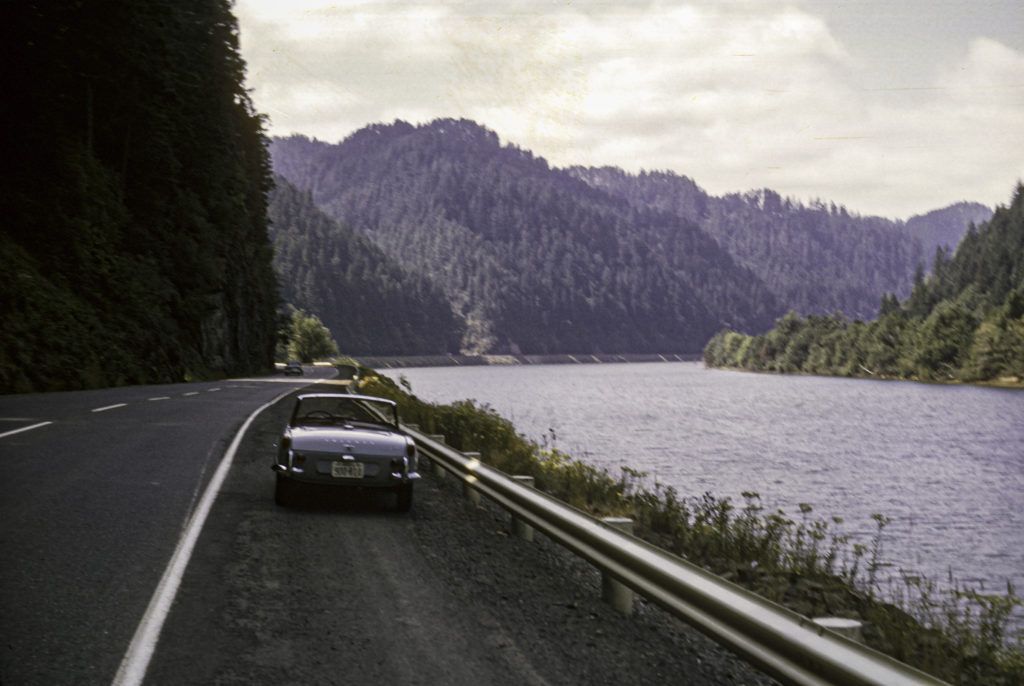
On my way to visit Chuck and Elouise from Centerville Beach, the shortest way was to take Highway 101 through the redwoods to Crescent City, then cut inland through the Smith River Valley on US 199 to Grant’s Pass, and finally shoot up Interstate 5 the rest of the way to Eugene. A slower, but more picturesque, way was to continue on Highway 101 past Crescent City and on up past Coos Bay to Reedsport, then cut inland on Oregon State Highway 38, which follows the Umpqua River, and runs into the I-5 near Drain, a few miles south of Eugene. Sometimes I would take that route go back to Centerville Beach too. Either way there were plenty of opportunities for pictures.
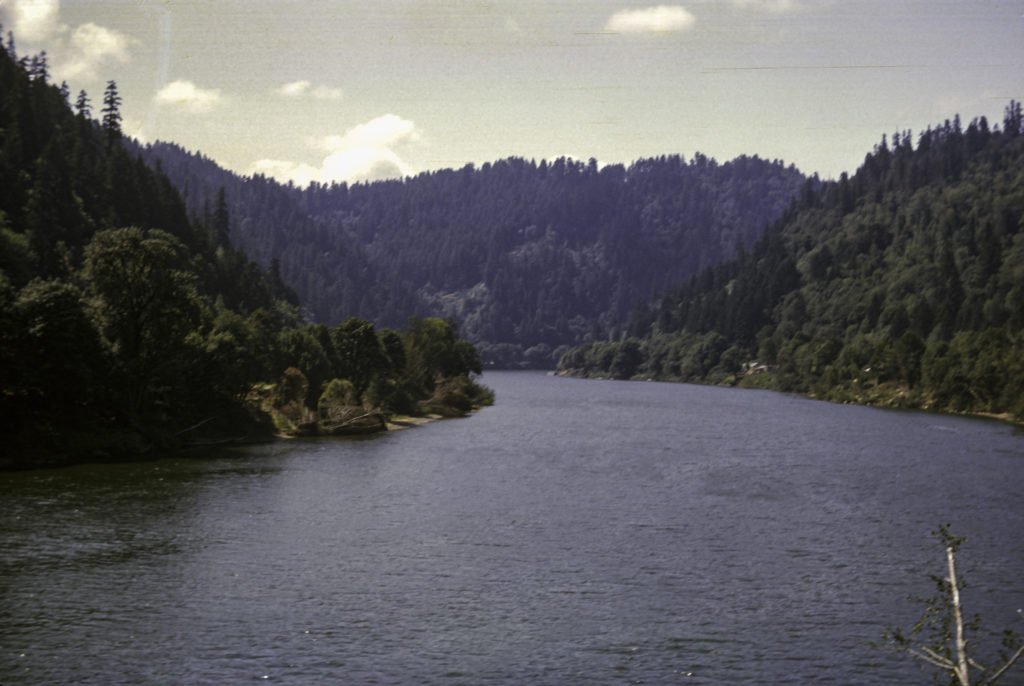
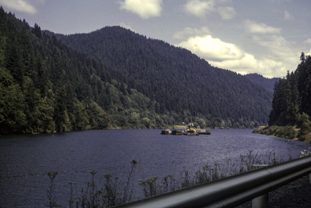
The Umpqua River Valley is a beautiful area, and the road ran right next to the river. Sometimes I would stop the car along the highway to take a rest, soak up the scenery, and take a picture or two.
There was little commercial traffic on the river; occasionally a barge would drift by carrying logs or other forest products down to Reedsport.
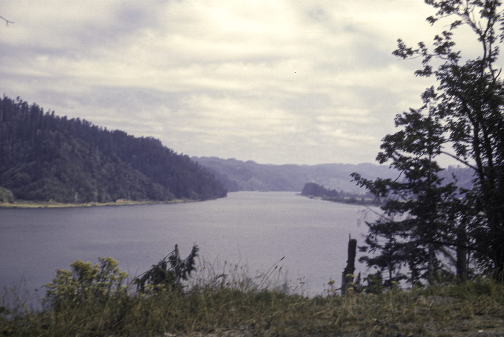
As you got nearer to the mouth of the Umpqua, the river grew wider and more meandering.
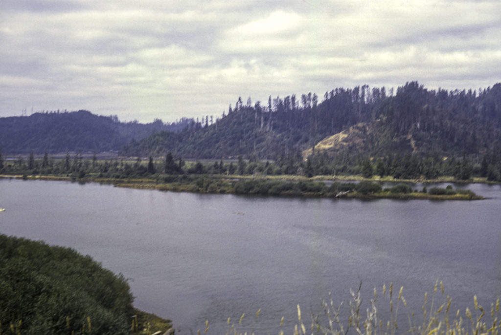
Although the Umpqua didn’t quite branch out into a river delta at its mouth like the Nile or the Mississippi, it did sport a few islands.
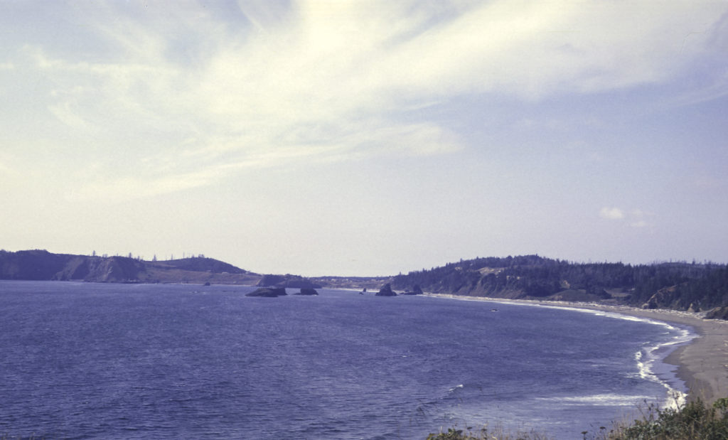
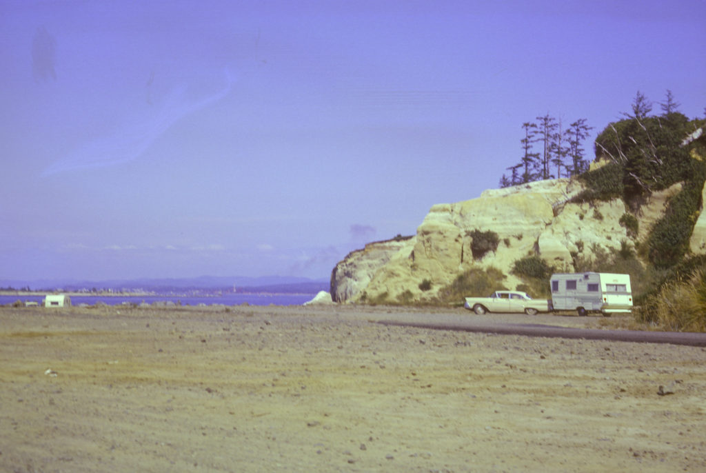
When I drove north along US 101 from Crescent City, I passed through Brookings, Gold Beach, Ophir, Port Orford, Bandon, Coos Bay and North Bend before reaching the Umpqua at Reedsport. The Oregon Coast is rugged and often stormy. Several times I drove through driving rains in poor visibility, with huge trucks spraying tsunamis on my poor little Spitfire, threatening to swamp it. But in good weather, the vistas are fabulous.
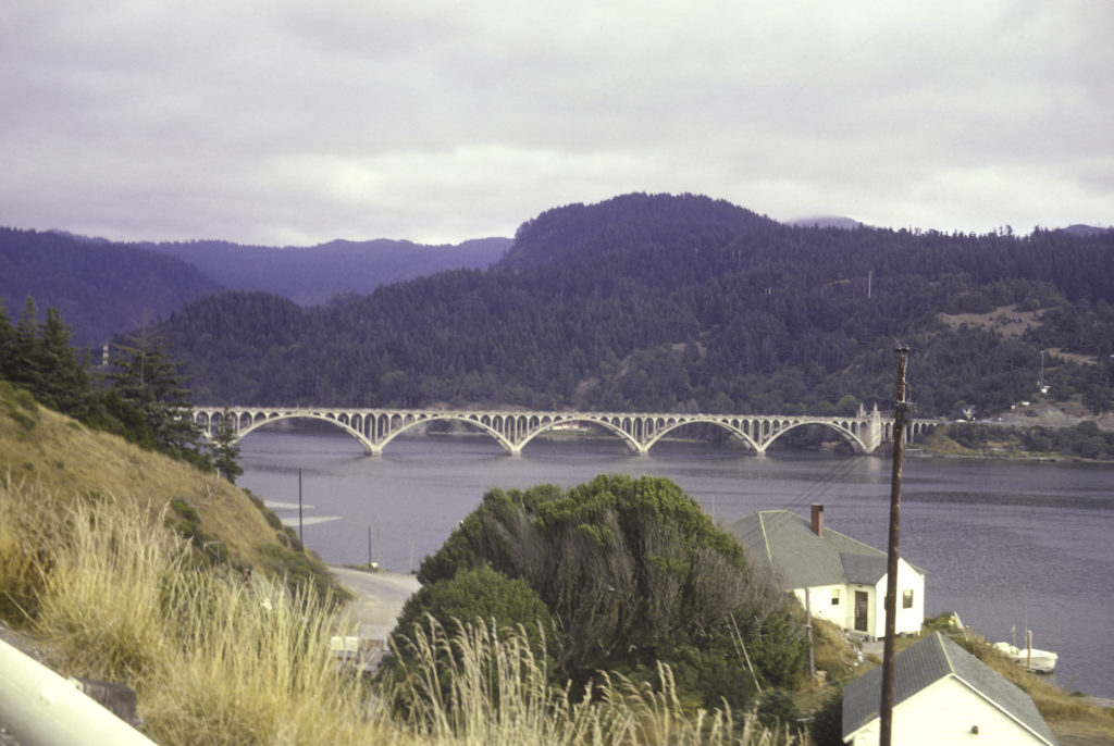
The Rogue is one of the most famous rivers in Oregon. It flows into the Pacific near the towns of Gold Beach and Wedderburn, and US 101 crosses it via the Isaac Lee Patterson Bridge, pictured below. This 1938-foot-long bridge was built in 1931 and shows strong Art Deco influences.
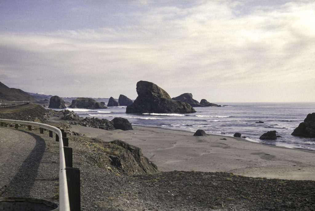
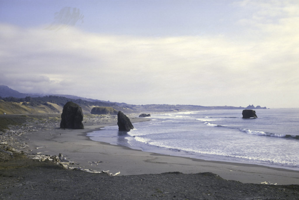
Continuing north from Gold Beach, one encounters some of the most spectacular stretches of the southern Oregon coast, with rocky shores and driftwood-strewn sandy beaches.
One also encounters picturesque towns such as Port Orford and Bandon. Unfortunately none of my pictures of those places have survived. Bandon in particular lingers in my memory because Brent Parker, one of my classmates at OCS, came from there, and also because it was the site of a famous cheese factory, which rivaled Tillamook in the excellence of its product. You could stop at the Bandon Cheese Company and sample their wares for free. Unfortunately, their competitor Tillamook, whose factory is also on the Oregon Coast but much farther north, bought up Bandon Cheese in 2005, fired the staff and shut down the factory. However, that isn’t the end of the story. I recently read that in 2013 a new company, Face Rock Creamery, started up on the old Bandon Cheese factory site with the help of the city government and participation of some of the former Bandon staff.
North of Bandon lies Coos Bay. With a population of around 16,000, the town of Coos Bay is the most populous city on the coast of Oregon, and together with the adjoining town of North Bend and other nearby small municipalities, forms a metropolitan area of around 32,000 people, known as the “Oregon Bay Area”. Coos Bay is considered the finest natural harbor on the West Coast between San Francisco and Puget Sound, and its port is the second busiest in Oregon after Portland (which is not on the coast but a ways inland on the Columbia River). During the ’50s and early ’60s the port of Coos Bay thrived on lumber exports and fishing, but with the decline of the logging industry and the fisheries it fell on evil days. But my interest in the Coos Bay area was focused on Coos Head, the promontory on the south side of the entrance to Coos Bay – because of the US Naval Facility located there.
NAVFAC Coos Head was a SOSUS station just like the ones I was stationed at farther south – Centerville Beach and San Nicolas Island. (There were two other NAVFACs on the Pacific Coast, Point Sur and Pacific Beach.)
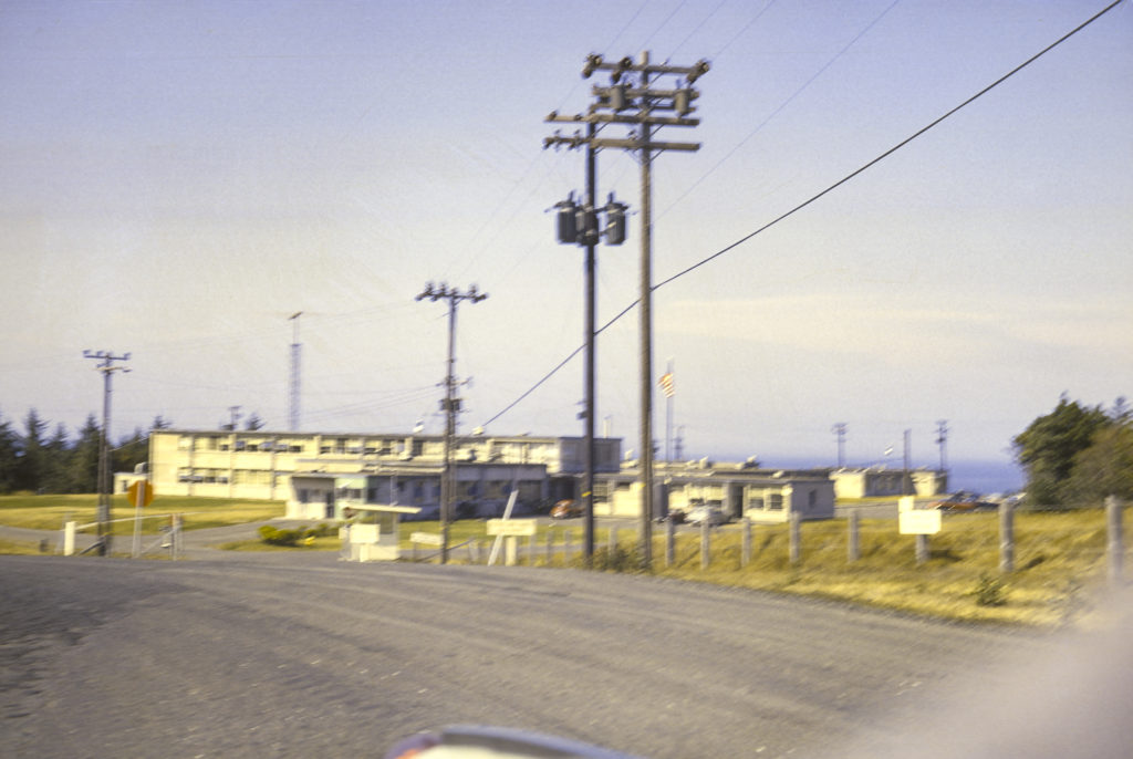
While I was stationed at Centerville Beach, on one of my trips north to Oregon, I dropped by Coos Head and shot a photo of the NAVFAC. Months later, while stationed at NAVFAC San Nicolas Island, I visited Coos Head as part of an Oceanographic System Pacific inspection team. I remember that the people there tried to “influence” the officer in charge of the team, LCDR Stong, by giving him a beautiful Samoyed puppy. He took the puppy, but the gift didn’t have any effect on their grade on the inspection.
NAVFAC Coos Head, like all the other SOSUS stations, is now defunct, having been decommissioned in 1987. While I was in the Navy, all the SOSUS stations except the one operated by the Canadians (Shelburne, Novia Scotia) were manned exclusively by men, but later the U. S. Navy followed the Canadian example and assigned women to them; the last Commanding Officer of NAVFAC Coos Head was a woman, LCDR Sheila McCoy.
The closure of NAVFAC Coos Head, the largest U. S. Navy installation in Oregon, was an economic disaster for the local area. The impact was mitigated to some extent when a new tenant, the Oregon Air National Guard, was found for the base. However, in 1996 the Guard pulled out too, and the base was shut down.
The local Native Americans had had their eye on the property for some time, and after the closure of the base the Confederated Tribes of the Coos, Lower Umpqua, and Siuslaw Indians began efforts to have the property turned over to them, which occurred in 2005. Their intention was to use it for tribal housing, administrative offices and an “interpretive center,” whatever that is. But the property was badly contaminated by PCBs, various solvents and petroleum products, herbicides, asbestos, lead from ammunition used at a rifle range, and it had to be cleaned up before it could be used. A joint cleanup project shared by the Navy, Air National Guard, Army Corps of Engineers, Oregon Department of Environmental Quality and the Bureau of Indian Affairs was undertaken and was 80% complete by 2015. I haven’t yet found any information on the subsequent development of the property.