Categories
Europe, Summer 1964

Paris, Summer 1964

View of Paris from Boeing 707

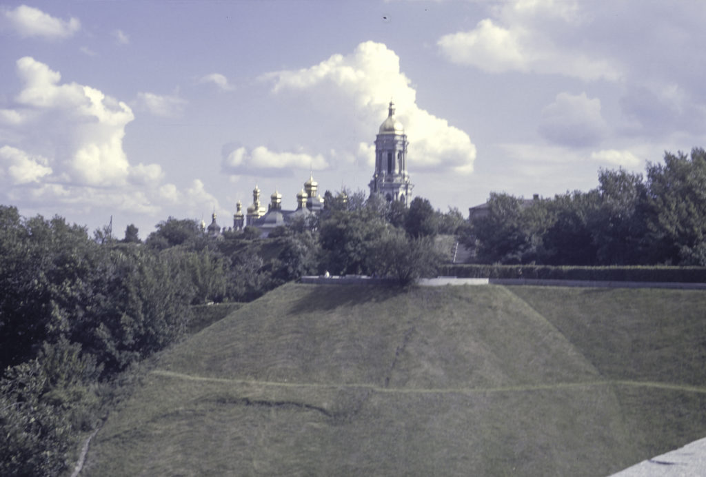
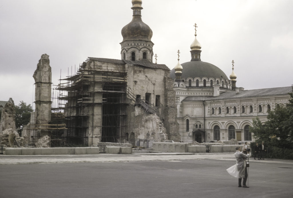
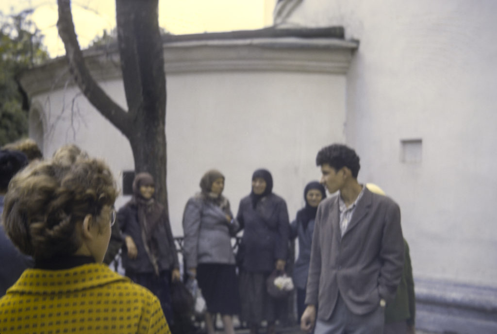
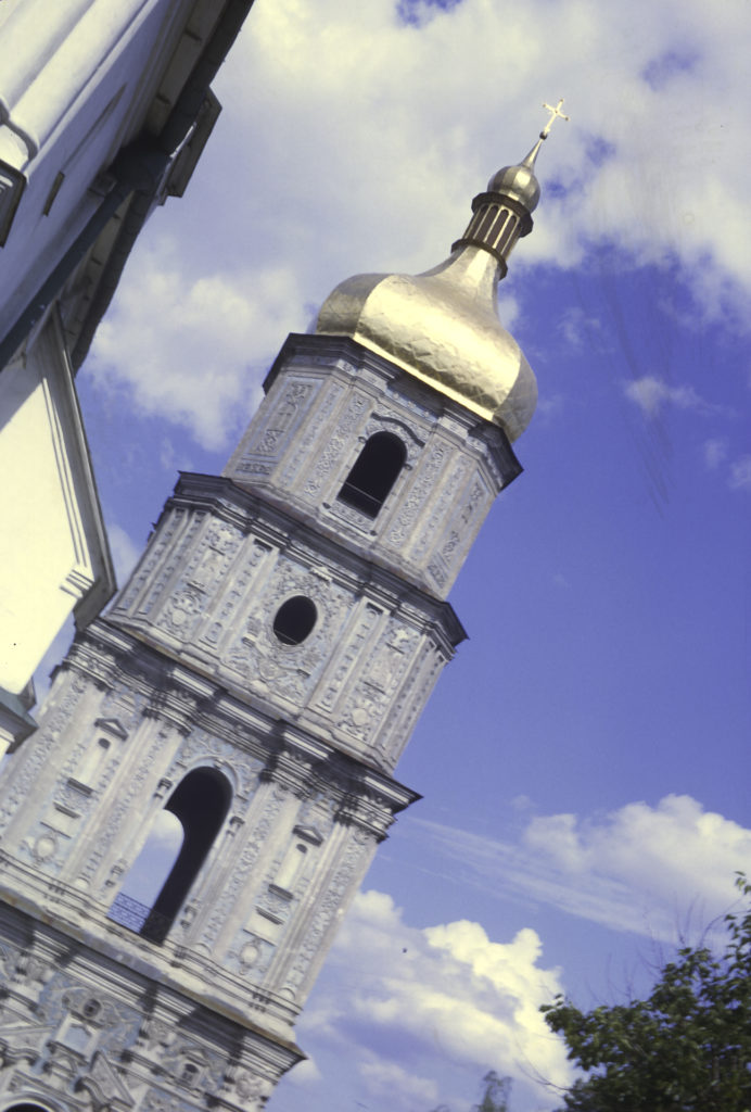
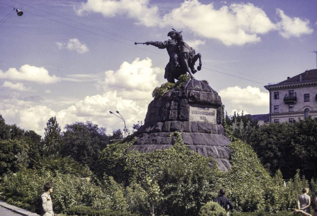
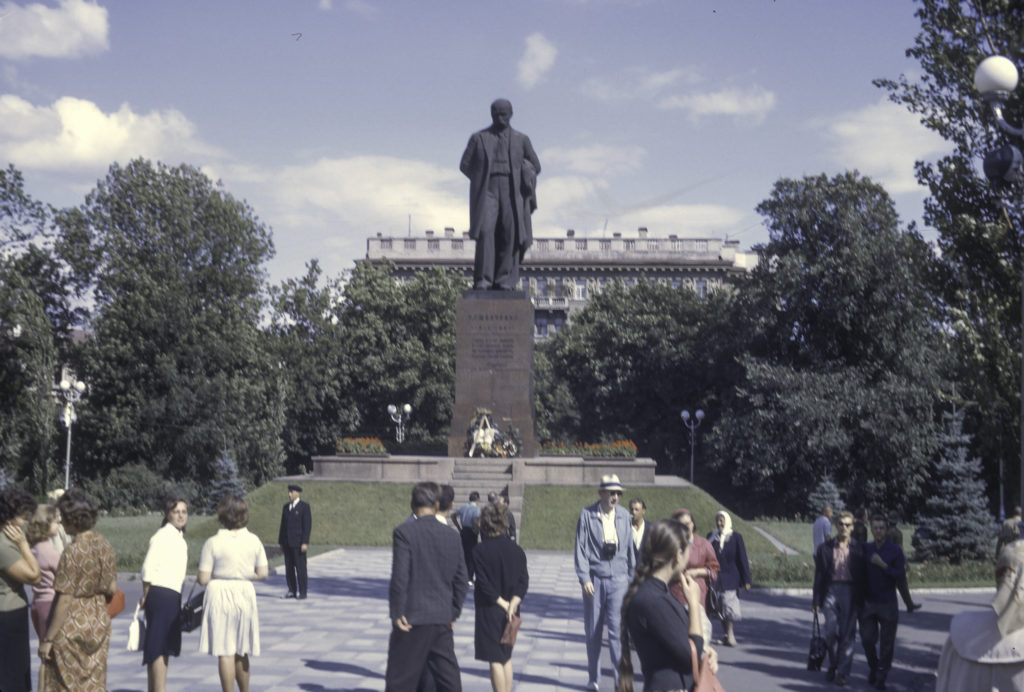
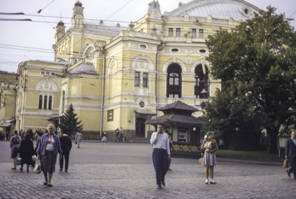
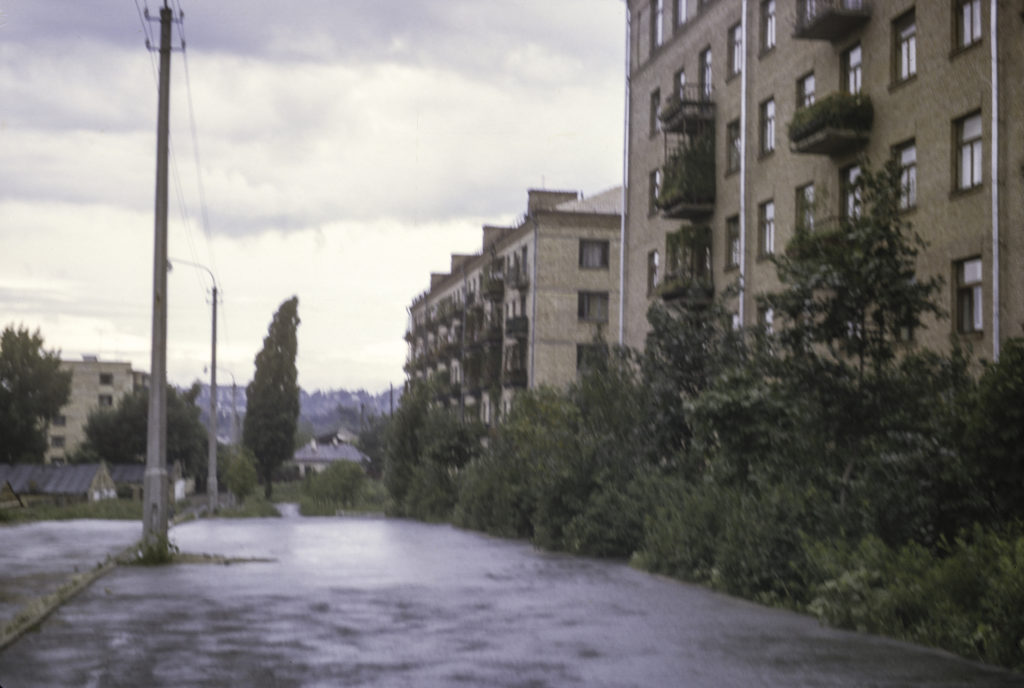
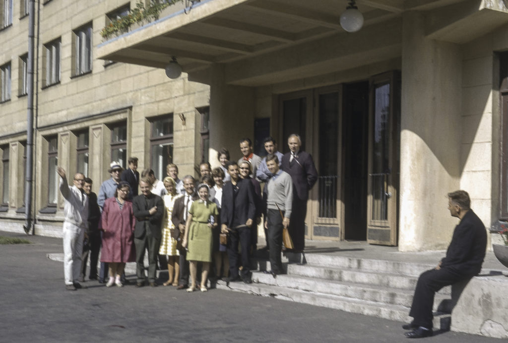
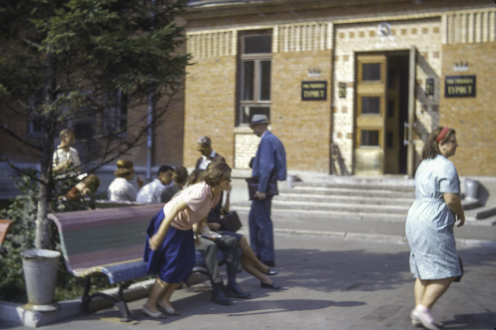
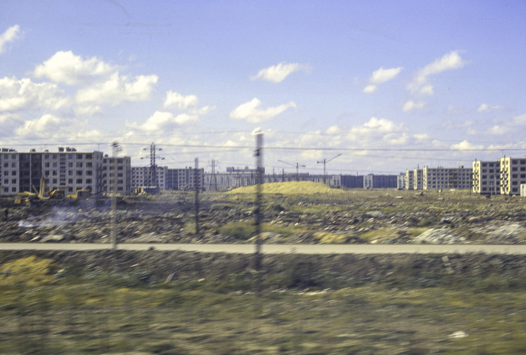
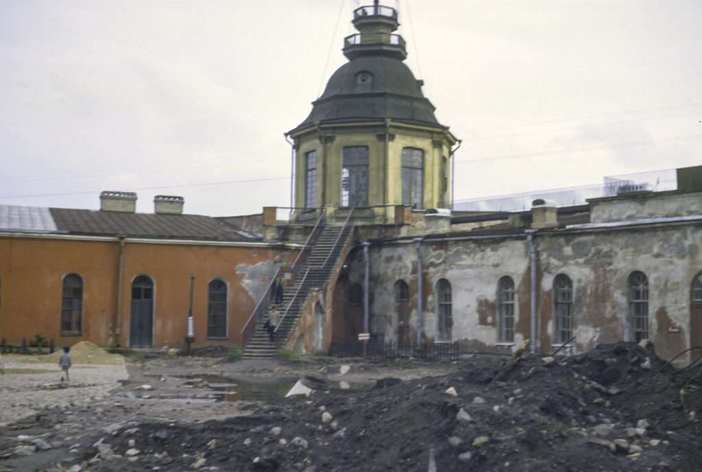
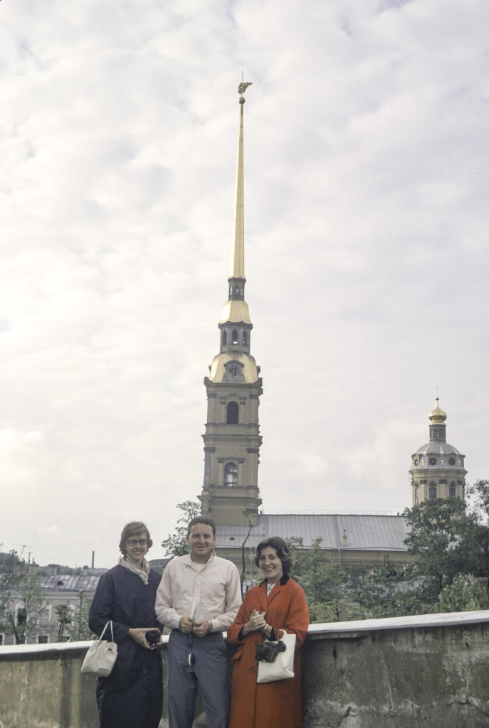
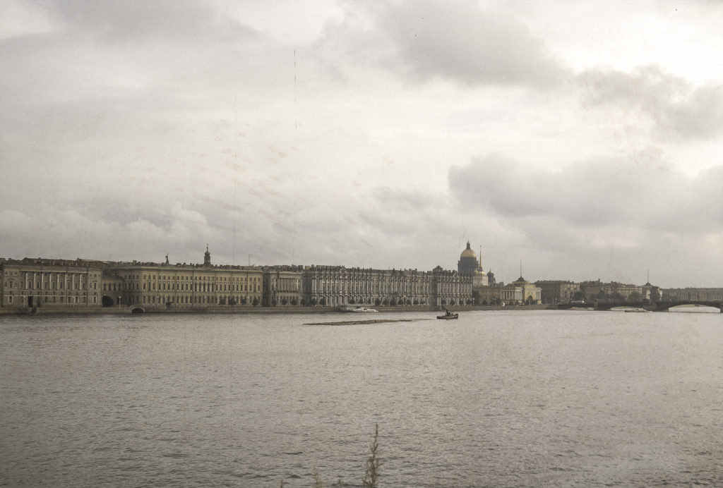
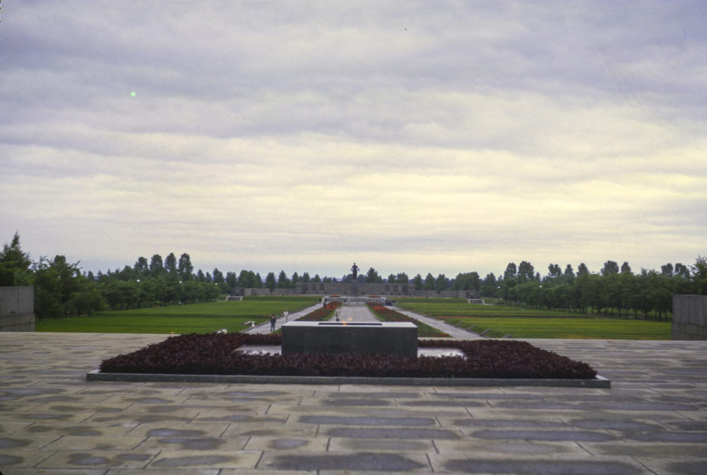
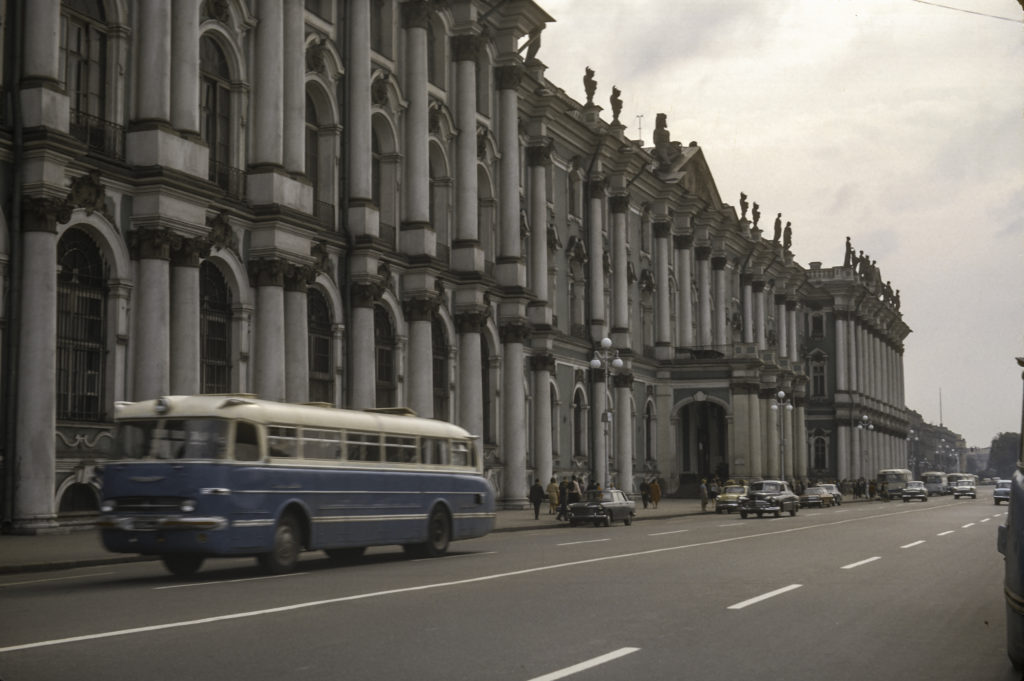
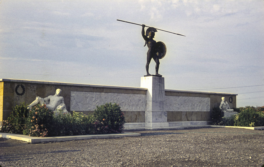
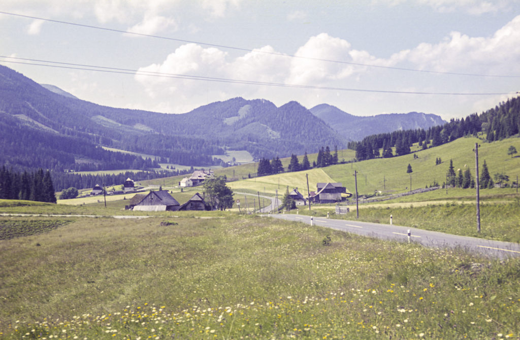
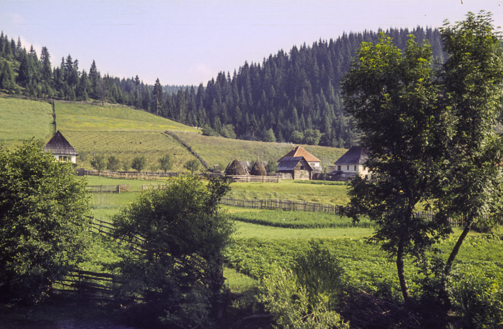
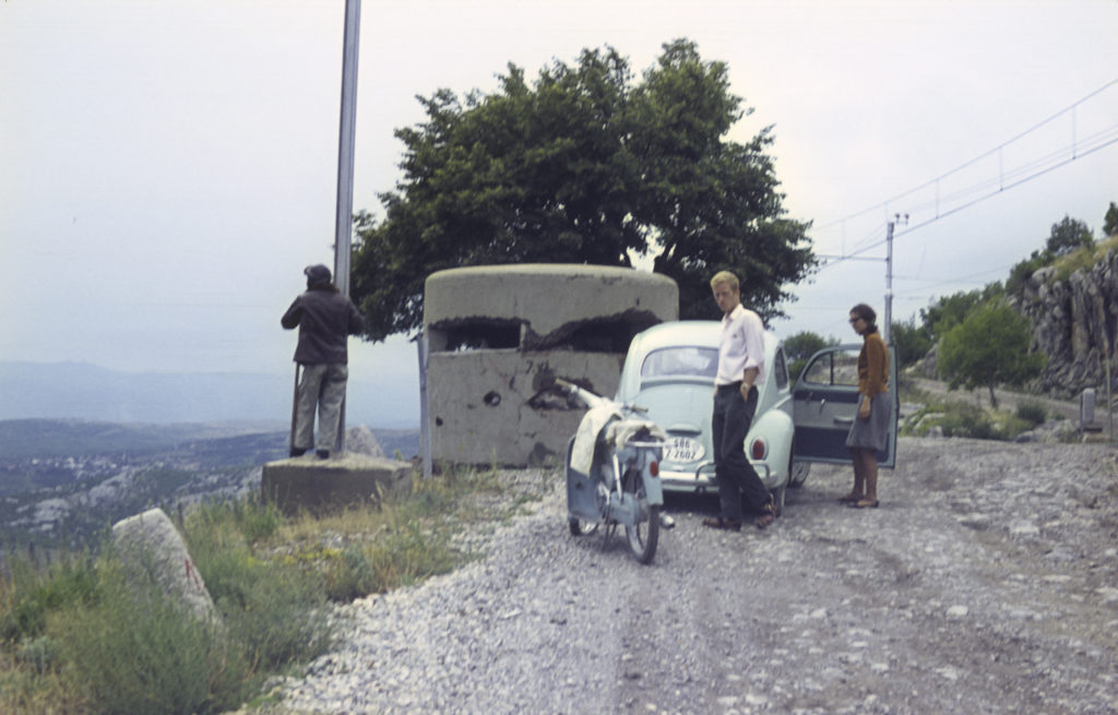
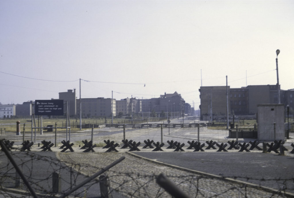
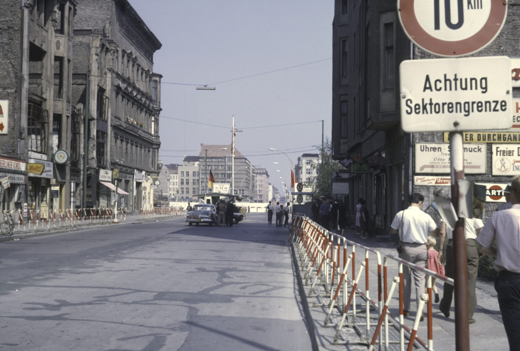
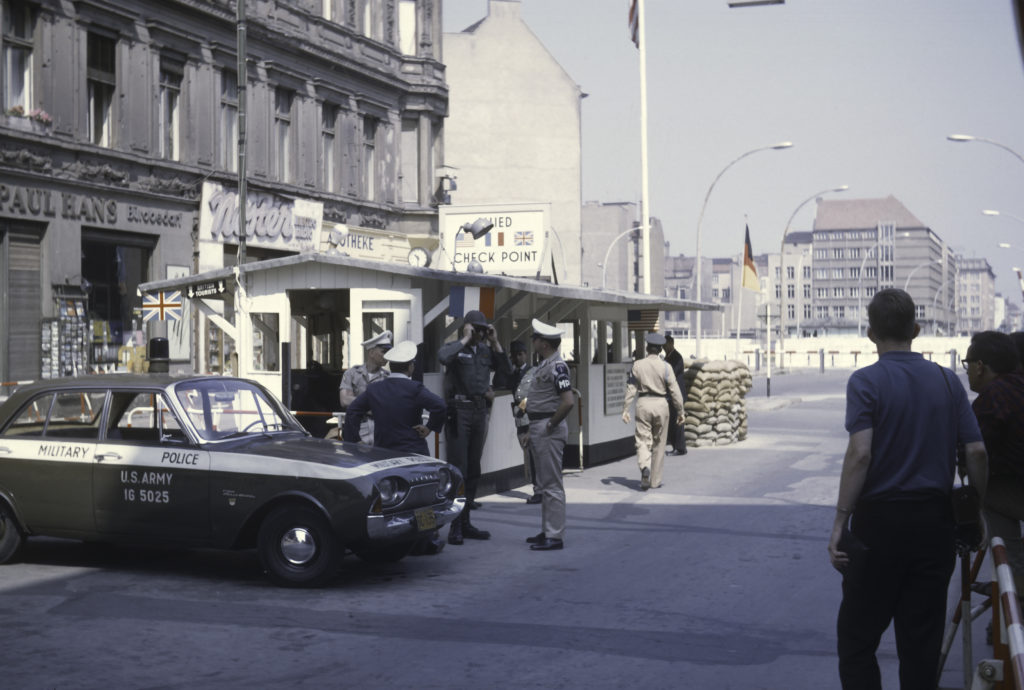
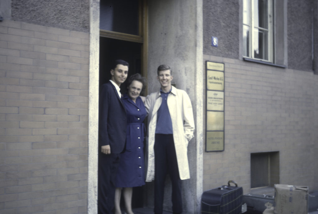
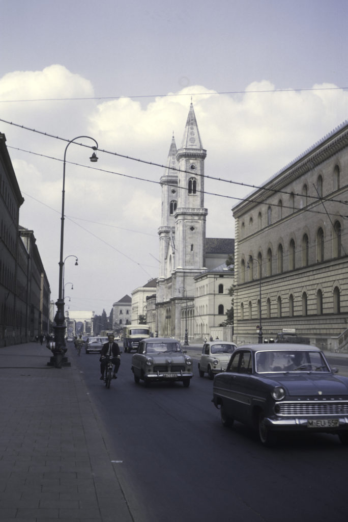
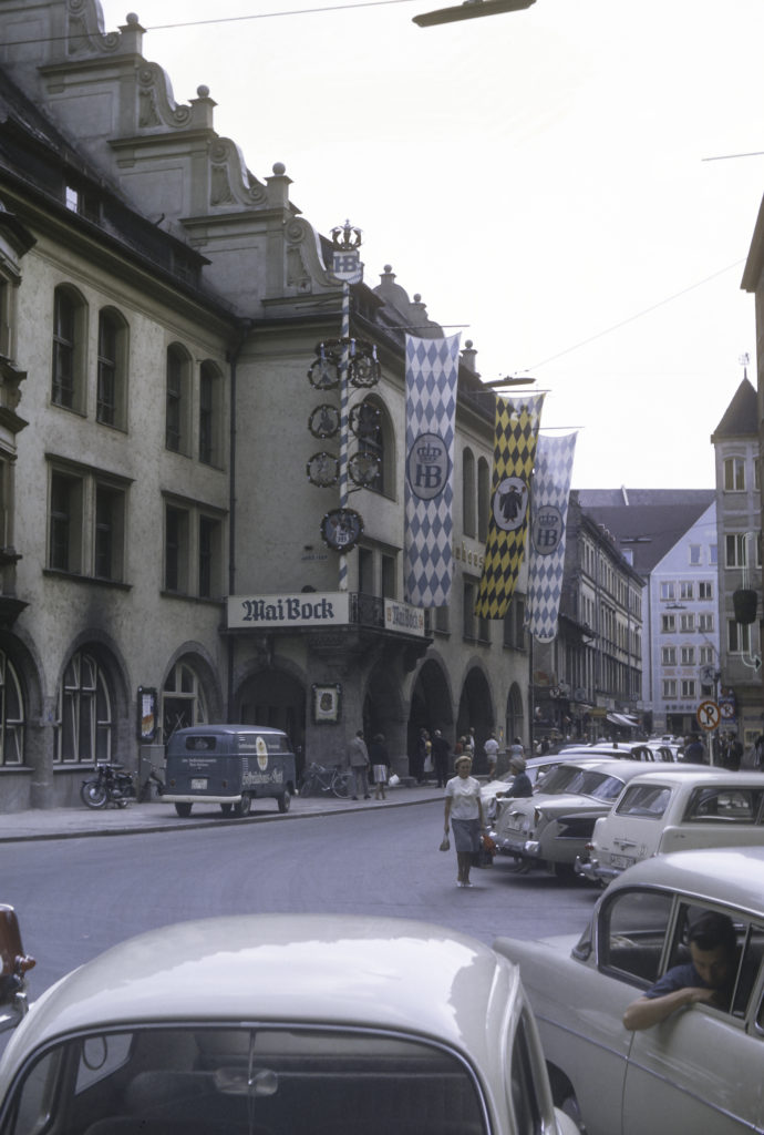
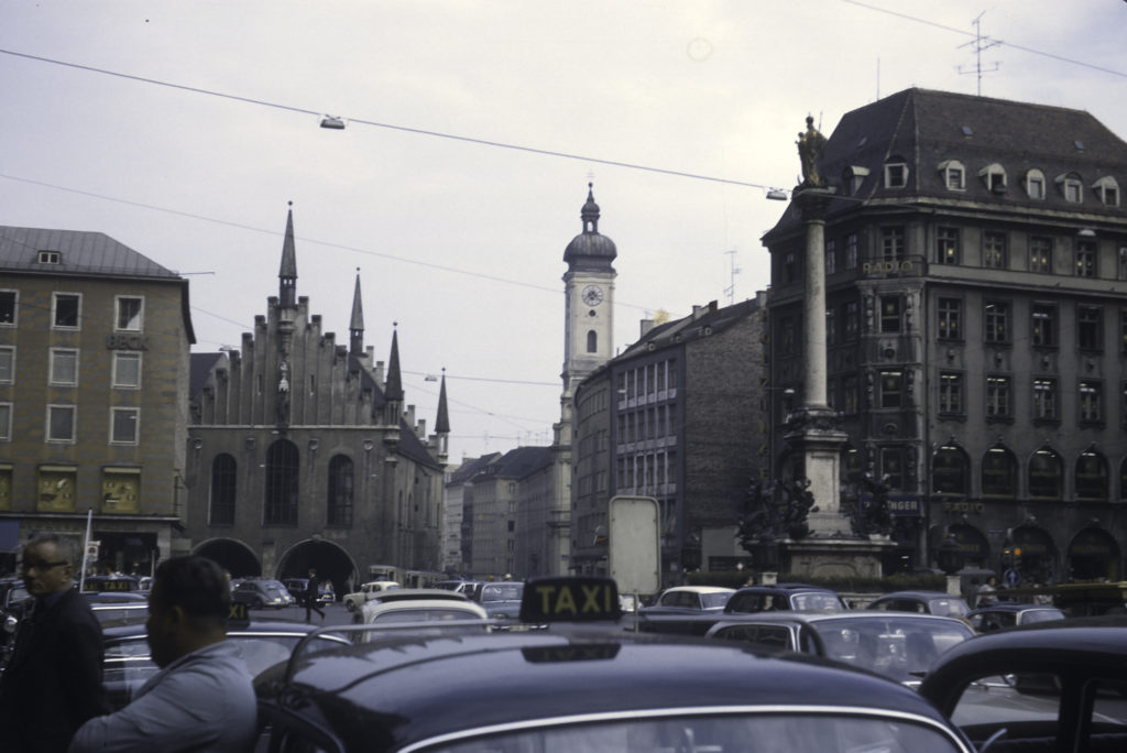
Our four-day sojourn in Paris was intended, I think, as a time to unwind and relax after an intense, sometimes stressful, two weeks in the USSR and a grilling on our experiences there by the emigre scholars of the Institute for the Study of the USSR in Munich after our return. It didn’t entirely turn out that way.

Seine – Pont des Arts in foreground, Pont du Carrousel in back

It’s well known that August is not the best time of the year to go to France. Most French people insist on taking vacation the entire month, or as much of it as they can, and those who can’t, e.g. because they have to stick around to cater to tourists foolish enough to venture to France in August, are generally not in a jovial mood, and even less inclined than usual to be nice to stupid Americans who can’t speak or understand French perfectly – people like me.

Musee d’Orsai – Formerly a railroad station, now houses art collections.

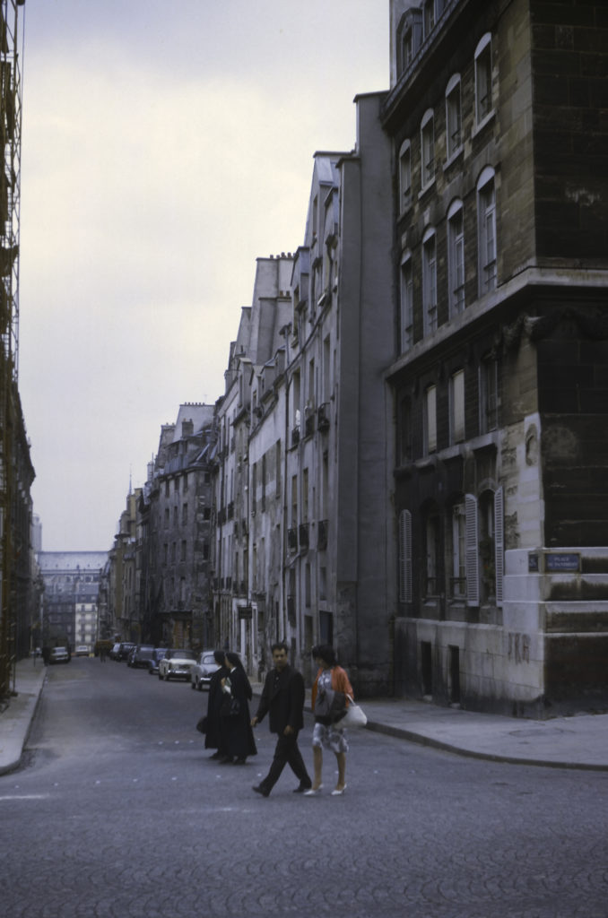
That said, I still had a good time in Paris and, although I found the Parisians sometimes curt and impatient, I encountered no outright rudeness or hostility. What I did encounter was more bizarre and unexpected, and I’ll be relating that shortly.

Sculpture by Baron Charles-Arthur Bourgeois, 1868. Encountered in Le Jardin du Luxembourg, Paris.

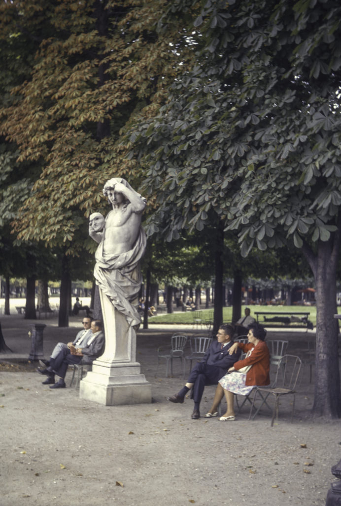
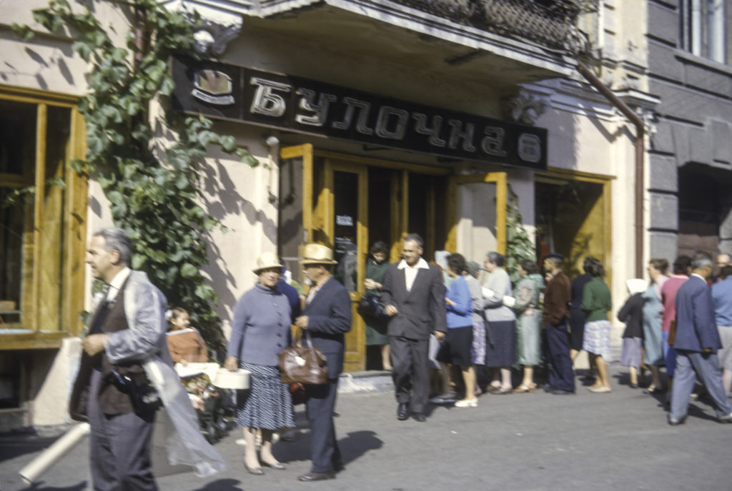
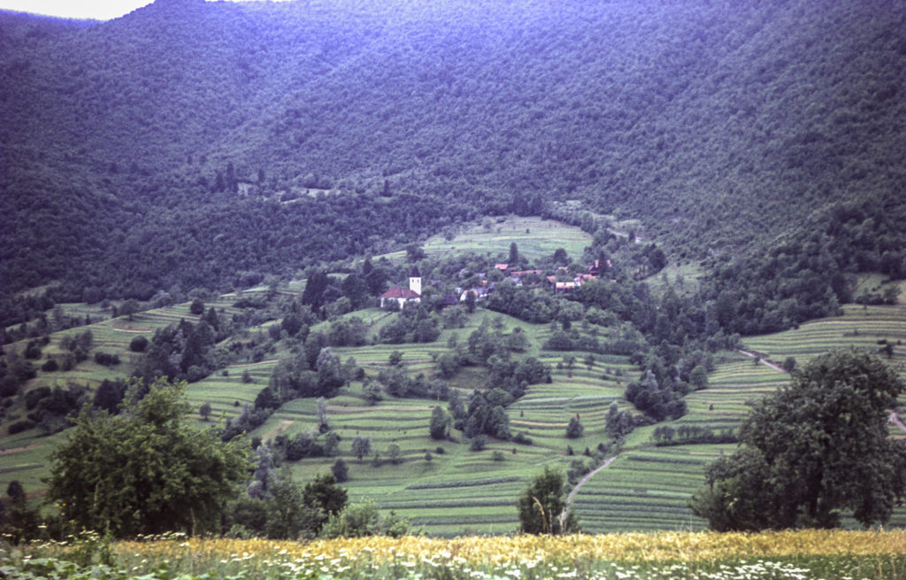
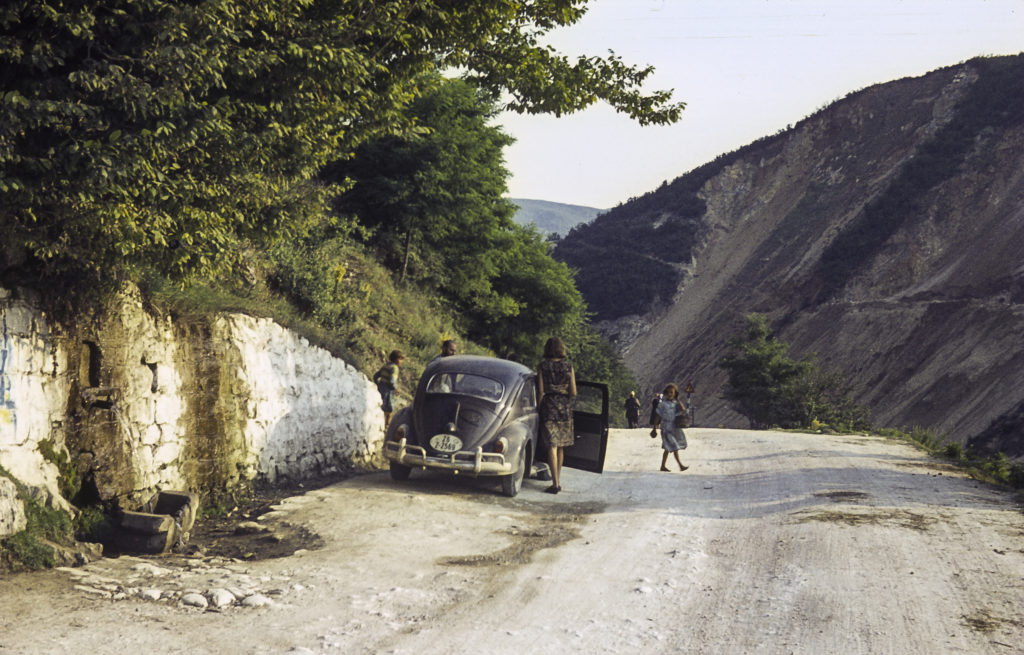
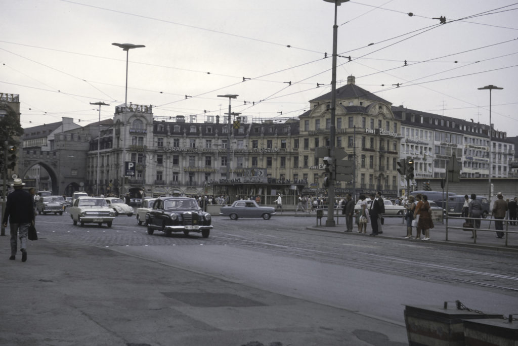
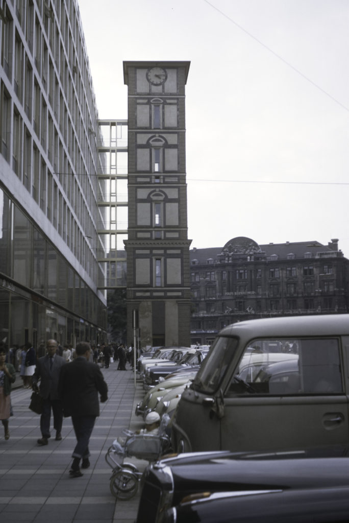
I didn’t try to take in all the major tourist sights while I was in Paris. Instead I spent much of the time wandering around the streets, either alone or in company with my fellow-students from the Munich Institute and the USSR trip.

One place where I did encounter a bit of outright rudeness was not in Paris itself, but in the Air France Boeing 707 on the way there from New York – that was before Munich and the USSR trip. At one point I asked for a glass of champagne, and received a curt “Non” in response (and I was not under-age; I was 23 at the time). I think the stewardess was just too busy at the time. Far more unpleasant was the person in the seat behind me, an American woman, who became enraged when I reclined my seat slightly, and started pounding on the back of it with her fist. I retaliated by reclining my seat all the way back, upon which she shouted “ARE YOU CRAZY?” I replied “Yes, and crazy enough to do you serious harm if you continue in this vein,” or words to that effect. Actually, I didn’t really say that, because before I could, the flight attendants stepped in and calmed her down, explaining that everyone had the right to lean their seat back. And this was in the days when seats in jet airliners weren’t quite the cattle-feed-lot cages that they are now, and you had a lot more space to move around.

Place Saint-Michel – Site of the Font Saint-Michel

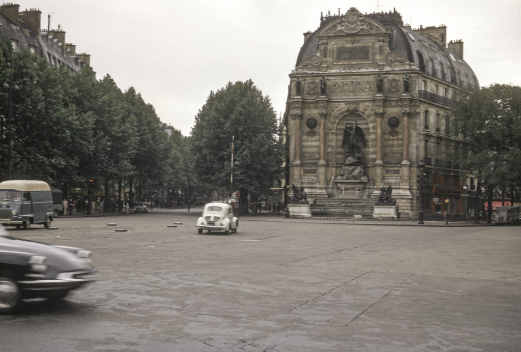
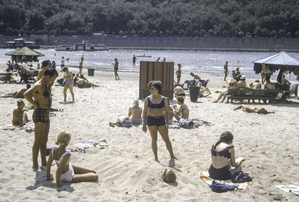
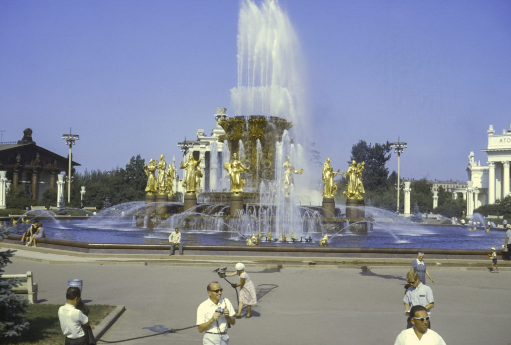
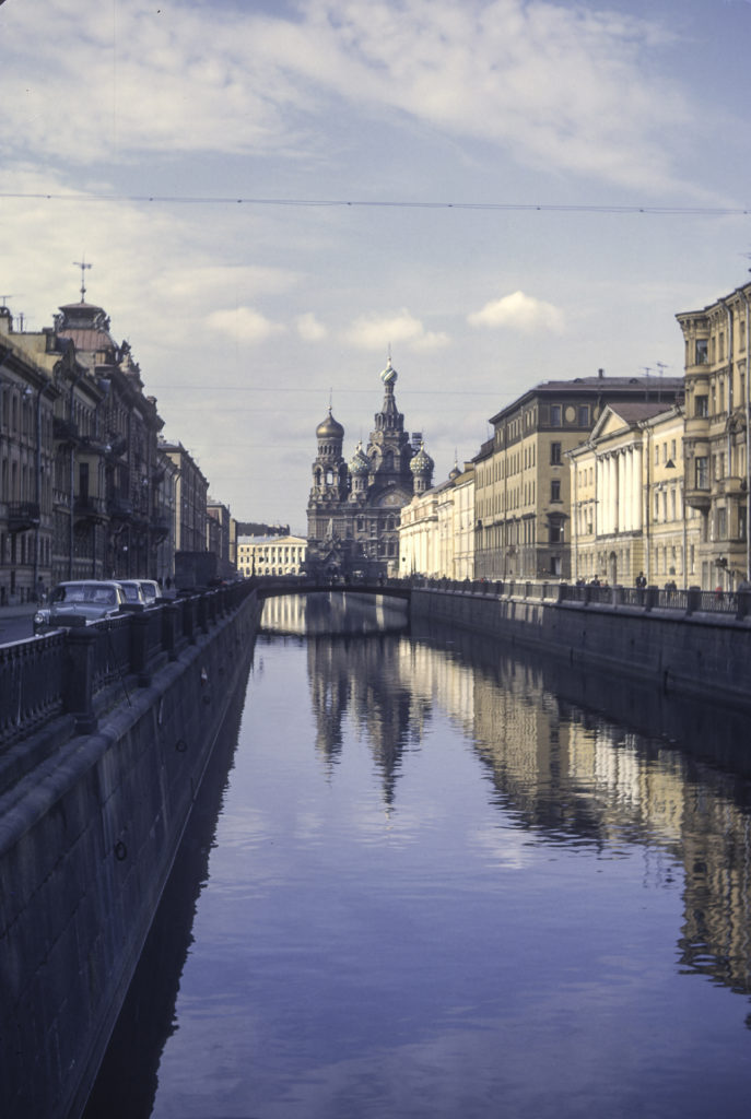
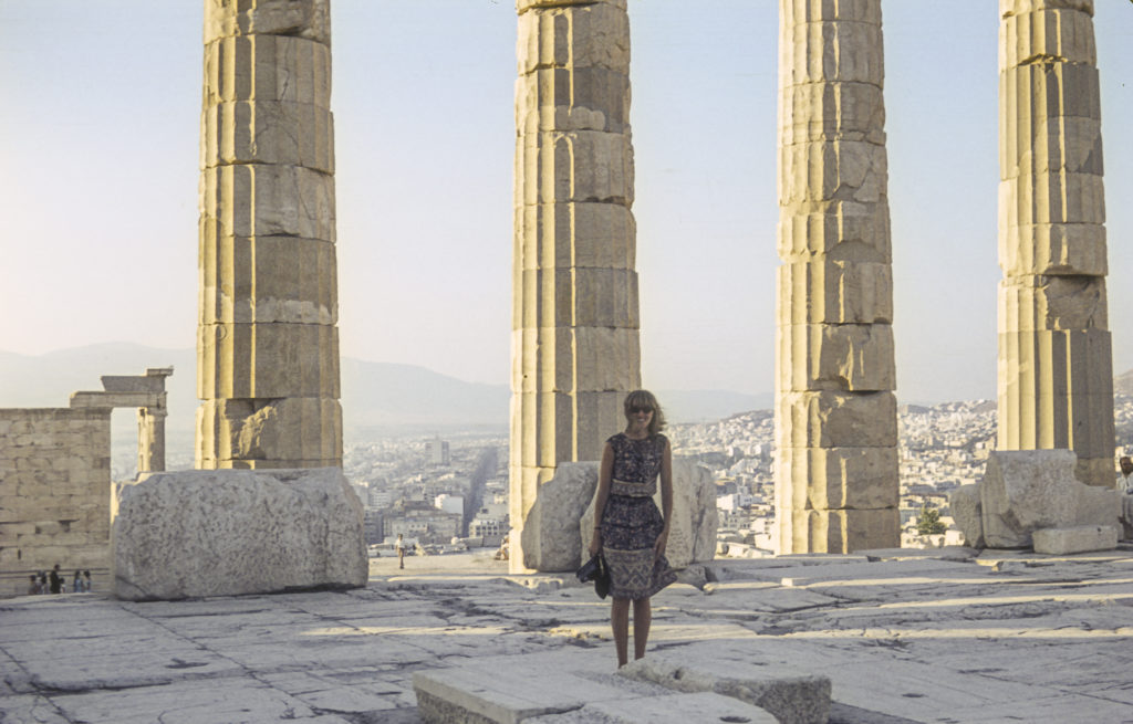
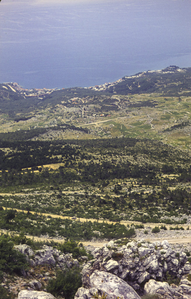
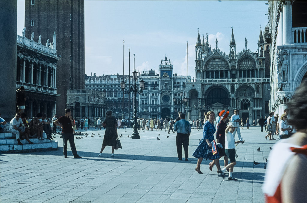
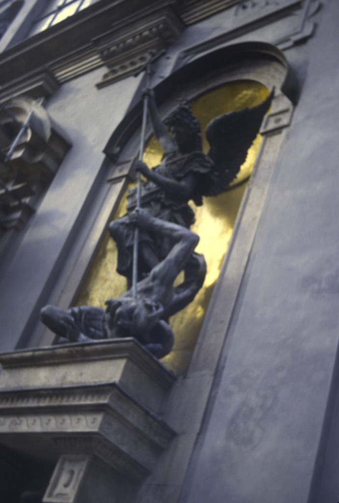
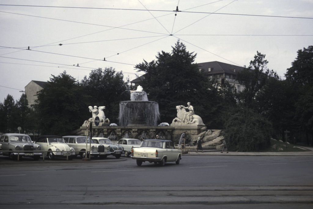
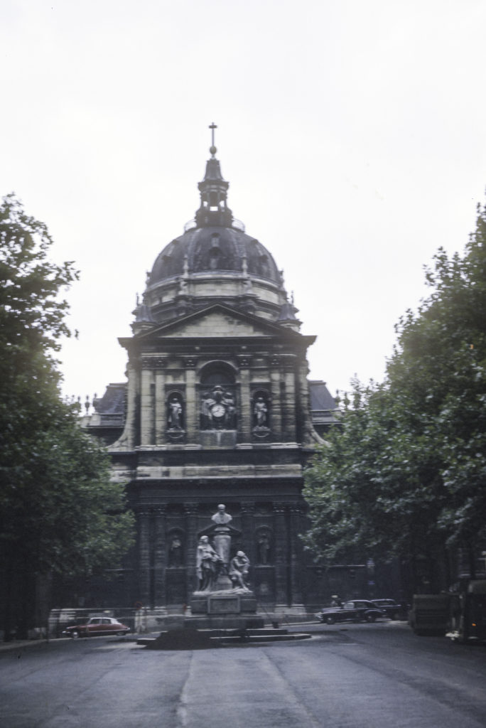
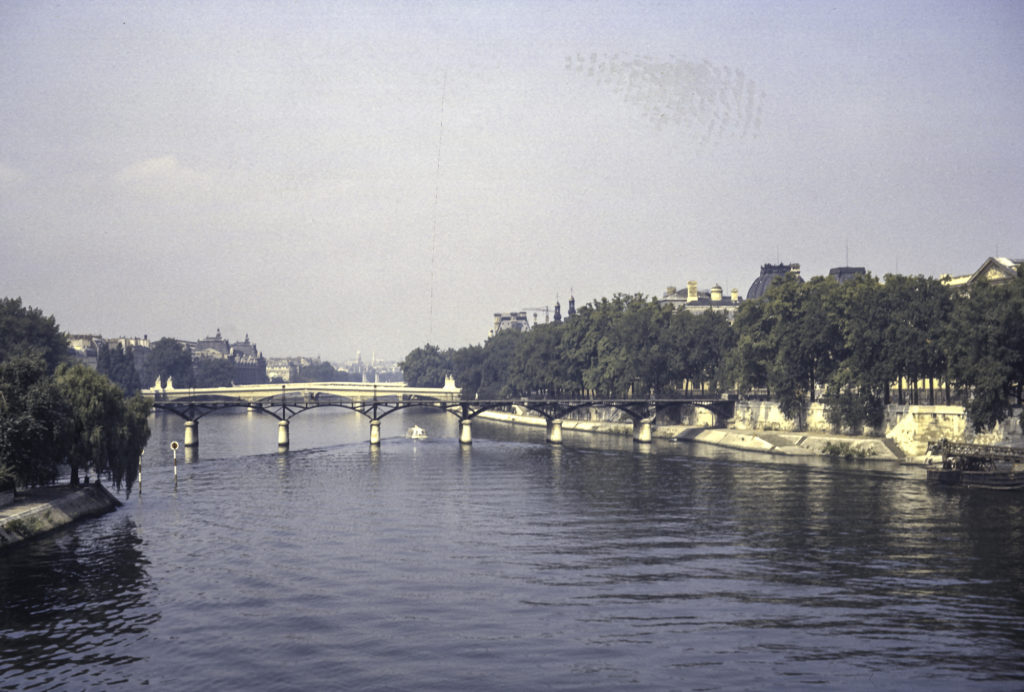
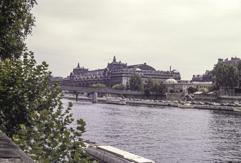
I found Paris itself delightful, enjoyed strolling along the Seine and seeing the parks, monuments and fountains. One fountain that caught my fancy was the Font Saint-Michel, dating from 1860, depicting the Archangel St. Michel and the four cardinal virtues. On either side there is a dragon which spews water into the fountain.

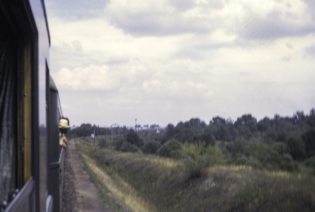
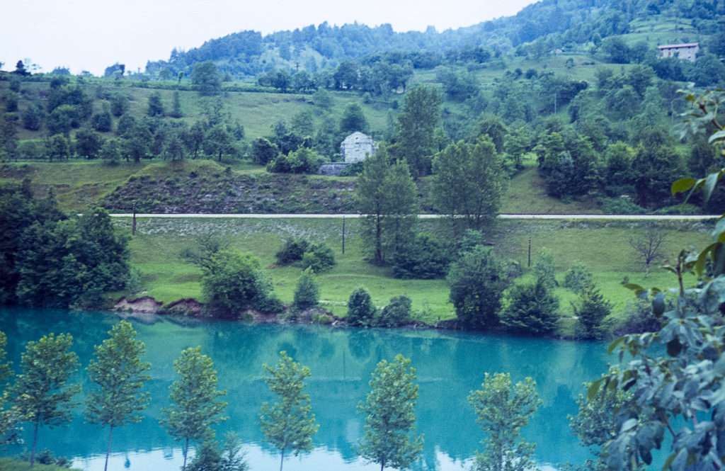
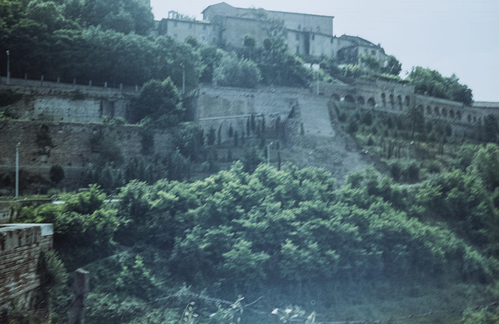
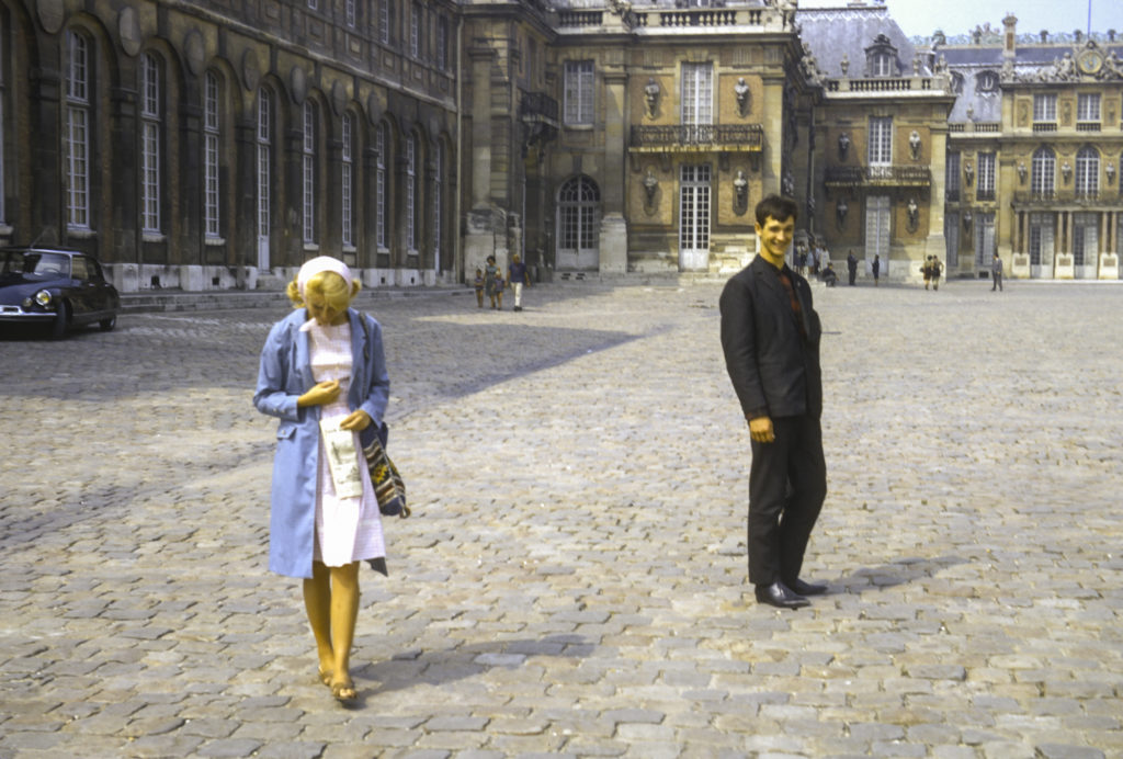
So I didn’t visit the Louvre or ascend the Eiffel Tower on this visit (in fact I still haven’t done either). But on the second day I did take the train out to Versailles, along with Diane, one of the girls from the USSR trip. All of my remaining Paris photos – at least those which have survived – are from Versailles.

Diane and Andrei at the Palace, Versailles

Diane and I sat opposite one another on the train, in window seats. I was reading a copy of the English-language Paris edition of the New York Herald-Tribune. This was 1964, and there was a front-page article about race riots in Patterson, New Jersey. A young couple came and sat down in the seats next to us and started talking volubly in French. The woman sat next to me, the man next to Diane. Diane, who had complained a lot about the conditions on the trip in the USSR, said to me, “These French stink almost as bad as the Russians do.” She hadn’t noticed that the girl also had a copy of the Herald-Tribune and said at one point, regarding the article about race riots, “Je pense que c’est une étude bourgeoise.” A few minutes later she turned to me and said, “I’m from Patterson, New Jersey.” It took me a minute to realize that she was speaking English and when I didn’t say anything immediately, she repeated, “I’m from Patterson, New Jersey.”

Parterre du Midi – Gardens of Versailles

The girl’s name, as it turned out, was Sharon Gordon. She was indeed an American and I presume that her claim to be from Patterson, New Jersey, was genuine, though it could have been just a conversational ploy to get my attention. What definitely was phony was that she claimed to be working for the “Socialist” Party in Paris. As we got to know each other, during the course of a long day in Versailles, it became increasingly clear that she had more than socialist leanings – she was seriously pro-Soviet. Moreover, her boyfriend, as I took him to be, was also not French: he was Soviet, his name was Andrei, and he claimed to be from Moldavia, the son of a captain in the Soviet Navy.

Versailles: Bassin (Pool) et Escaliers (staircases) de Latone

Diane, who had been put off by the couple from the start, was increasingly less interested in keeping company with them as the day wore on; also it was a warm day, she became overheated and tired, and before long she made her excuses and headed back to Paris. I continued to wander around Versailles with Sharon and Andrei, and got to know them a little better, especially Andrei.

Ornate marble vase in the gardens at Versailles

Andrei – I don’t remember his last name, or even whether he ever told us what it was – turned out not to be Sharon’s boyfriend, at least not on a permanent basis – it was clear that they had been sleeping together, but apparently only on a casual basis. In fact he claimed to have another American girlfriend, whom he wanted to marry. He said that he would like to get together with me again while I was in Paris, and before we parted we made arrangements to meet the following day.

Flowerbed, gardens of Versailles

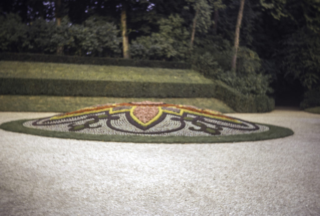
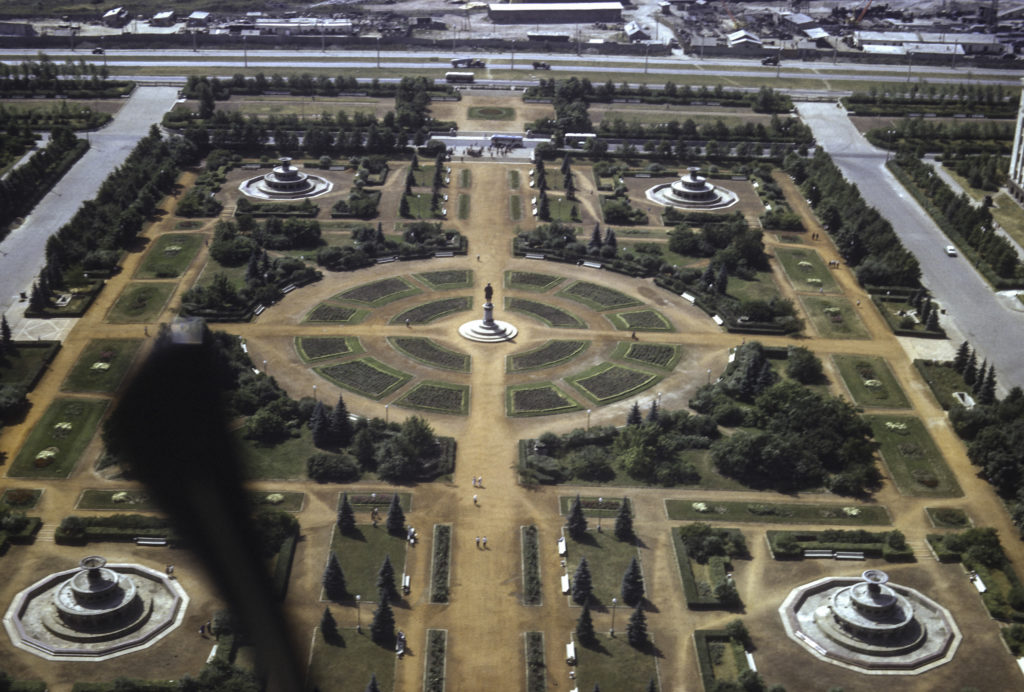
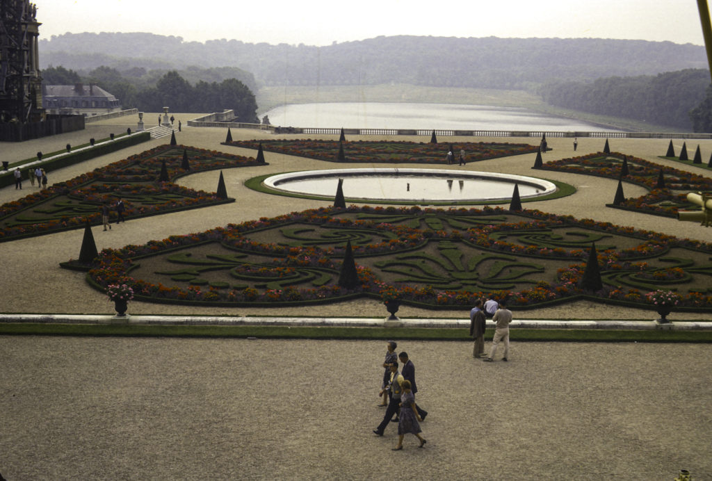
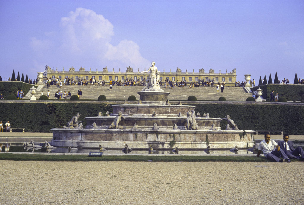
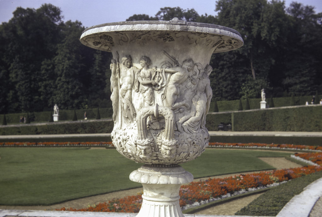
Meanwhile I continued my explorations of Versailles. After touring the main palace, I strolled through the gardens roundabout. These were and are formal French parterre gardens, which are highly structured and elaborately designed, featuring flowerbeds and hedges shaped into intricate geometric patterns and symmetrically distributed amidst pools and pathways.

Statue of Laocoon and his sons being strangled by snakes sent by Poseidon to keep him from blowing the whistle on the Trojan Horse. This is a copy; the original is in the Vatican. The couple to the right are Sharon Gordon and her friend Andrei.

From the French gardens, I continued on to the outlying areas of the Domain de Versailles, in particular Le Grand Trianon, Le Petit Trianon and Le Hameau de la Reine. The Grand Trianon was built initially as a retreat for Louis XIV, in which he could escape the constricting etiquette of the Palace (nevermind that it was he who had established the elaborate and rigid protocols of Versailles in the first place). The Petit Trianon is a much smaller chateau, built during the reign of Louis XV for the King’s mistress, Madame de Pompadour. She died before it was finished in 1668, but upon its completion Louis XV bestowed the Petit Trianon on his next mistress, Madame du Barry. When Louis XVI succeeded to the throne in 1774, he gave it to his Queen, Marie Antoinette, who was responsible for the next addition to the Versailles complex, Le Hameau de la Reine – the Queen’s Hamlet, a rustic retreat near the Petit Trianon.

Temple de l’Amour, near Le Petit Trianon, Versailles

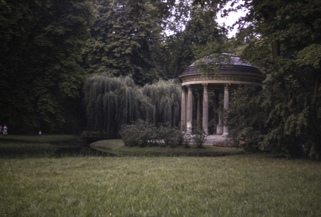
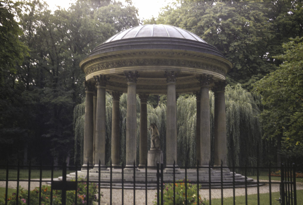
The first structure I encountered on my way to the Hamlet was the Temple of Love, a classical rotunda built in 1777, well before the Hamlet itself, which was constructed between 1783 and 1785. The Temple is situated in an English garden, which is less ordered and more natural-looking than the formal, highly stylized and “manicured” French gardens that surround the main Chateau of Versailles. Since the Temple was merely a rotunda with columns and provided no privacy, I doubt whether much love actually took place there.

Temple de l’Amour, Le Hameau de la Reine, Versailles

Le Hameau de la Reine was created as a place for Marie Antoinette to meet informally with her friends and to amuse herself by playing at being a peasant, while nevertheless being surrounded by all the comforts of aristocratic life. It includes among other things a working dairy farm, which supplied the Queen with milk and eggs; vineyards, orchards and vegetable gardens; streams, fishing ponds and meadows; a mill; and a barn which doubled as a ballroom.

La Maison de la Reine (Queen’s House), the largest building at Le Hameau de la Reine, a rustic retreat built for Marie Antoinette in the park of Versailles.

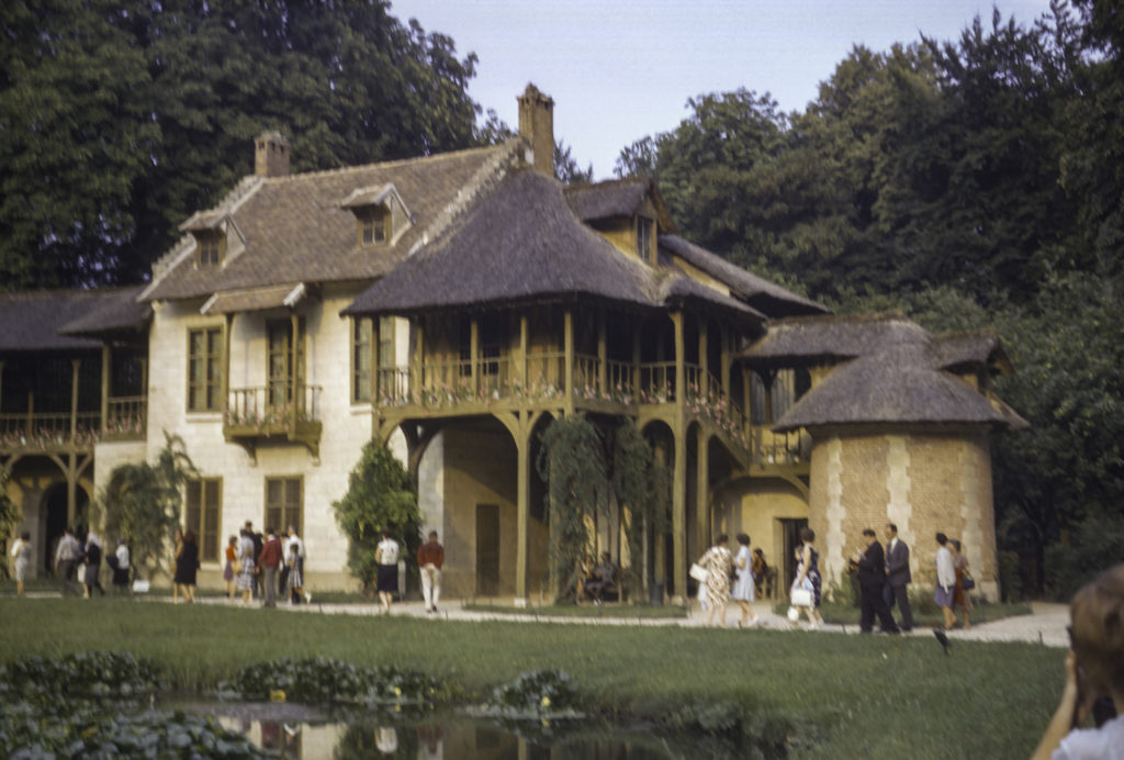
The buildings of the Hamlet are done in a peculiar style that combined Norman-French with Flemish elements. The largest building in the Hamlet is La Maison de la Reine, which contained the Queen’s private quarters, parlors and salons.

Doorway of Queen’s House in Le Hameau de la Reine

La Maison de la Reine actually consists of two buildings connected by a covered gallery. The first contains, on the ground floor, a dining room and “game room” used for playing backgammon. The upper floor contains a salon where the Queen could meet with her guests; an anteroom known as the “Chinese Cabinet”; and a living room with a harpsichord which the Queen herself played. The second building has a billiard room and a five-room apartment with a library.

Le Moulin – The Mill. The mill wheel is a fake, having been put in for appearances only. There was no mechanism for grinding grain in the structure.

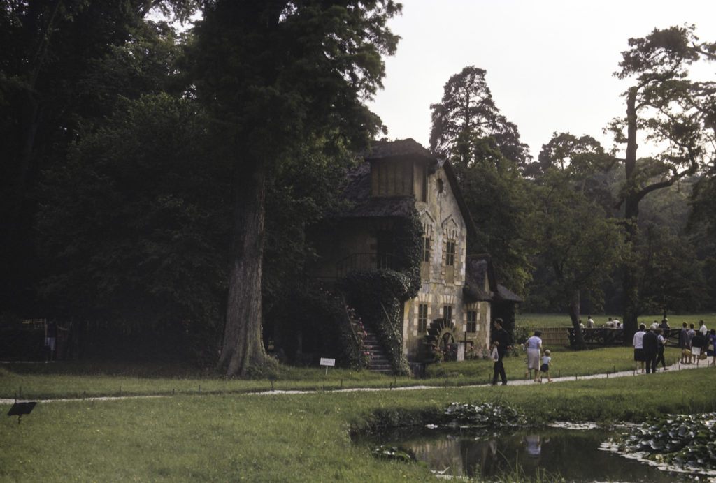
Though the Mill had an operating waterwheel which was turned by a stream flowing from one of the ponds, no grain was ground there, because no mechanism for that purpose was installed inside the building. The waterwheel was for decoration only. The building actually housed the Hamlet’s laundry facilities.

Le Boudoir, an intimate meeting place for the Queen and one or two friends.

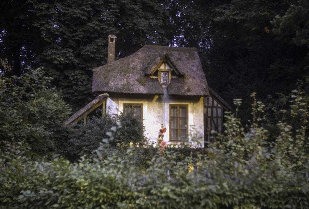
The smallest structure at Le Hameau de la Reine was known as Le Boudoir, which provided the Queen a place for solitude or for intimate meetings with a few of her friends. Le Boudoir probably contributed to the image in the popular mind of Le Hameau as a place where the Queen held wild orgies and cavorted with various male and female lovers (which was not true).

Back in Paris, I met up again with Andrei and Sharon, and became more closely acquainted with them (or at least with Andrei) than I would have preferred. I’ve already mentioned that Andrei claimed to have an American fiancée. He further related that while in Paris she had a nervous breakdown and had to return to the States, where she had been committed to a hospital, and could not now return to France. For his part, as the son of a high-ranking Soviet military officer, he could not go to the US except on a tourist visa, under which marriage was not allowed. He asked me whether I had any idea how he could find a way around this obstacle. I was at a complete loss as to how to respond to him, and furthermore his story seemed rather dubious to me. If his girlfriend was a nut case, why would he want to marry her? And why was he involved with Sharon, and what was she all about? It had already become apparent that she was, if not a Communist Party member, at least an outspoken Soviet sympathizer. Every time I made a remark about our trip to the Soviet Union which could be interpreted in any way as disparaging, Sharon would immediately jump to their defense, following with disparaging comments about the USA and Western Europe. By contrast, Andrei at one point assured me that “Mon amie est beaucoup plus Marxiste que moi.” But the question remained of what he was doing in Paris in the first place. He claimed to be studying at a technological institute. In the first place, the Soviet Union had excellent technical colleges of its own; but more to the point, Soviet citizens didn’t get to go abroad to study, or for any other purpose, unless they were exceptionally well-connected. When I commented on this to Sharon, she simply retorted, “Destalinization.” No. Destalinizaton never went that far. Andrei was obviously a member of a privileged elite, and as such he would have been sent abroad for other purposes than just to study.

I introduced the couple to some of the other Americans in our party, including Professor Frey, who immediately discerned that this was no chance encounter and that they were suspicious characters, to say the least. I remained nonchalant about it because I didn’t want to jump to any conclusions, and they didn’t seem to pose any particular threat. Of course it was obvious by now, if it hadn’t always been, that they were Soviet plants – what, really, are the chances of two American tourists just returned from the USSR encountering an American Commie and a Soviet military brat in Paris by coincidence? — And was it just by chance that they happened to sit down in seats next to us on the train? Yeah, right. Still — for what purpose were they set on us? It wouldn’t be likely that they were going to pry any key secrets out of us, because we didn’t have any. Nor would it be to prevent us from indulging in any further nefarious (from the Soviet point of view) activities in Paris, because there was nothing there to do except see the sights. My take on it was and is that the KGB had put them on us just to needle us a little, let us know that they were watching, that they were aware of our association with the Institute and Radio Liberty, and they would keep track of us for future reference. There were of course other possibilities, but they seemed unlikely. Maybe Andrei’s remark to the effect that Sharon was much more Marxist than he as possibly an attempt to disarm me a little, get me to drop my guard by playing the “good cop” as opposed to Sharon’s “bad cop” act. Maybe he hoped I could help him find some way of infiltrating the USA for espionage purposes. Maybe the KGB knew I was about to go into the Navy and wanted him to try to recruit me as a potential spy. At the time I dismissed all of these thoughts as excessively paranoid, and still do. On the other hand, as Henry Kissinger famously said about Muammar Qaddafi, “Even paranoids have enemies.” I’ll never know for sure – the encounter in Paris with Sharon and Andrei had no further consequences that I knew of, I never heard anything from or about either of them again, and the whole episode remains an enigma to this day.

Categories
Europe, Summer 1964

Kiev, Summer 1964

Kiev, the last stop in our two-week tour of the USSR, is known as the “Mother of Russian cities”.  Its significance for the emergence of Eastern Slavic civilization is gauged by the name by which the first Russian state is known to history – Kievan Rus.  In the 9th and 10th centuries CE Kiev was the seat of powerful rulers who converted the Eastern Slavs to Christianity, subdued the nomadic tribes of the steppe, and carried on trade with the Byzantine Empire, which became their cultural paradigm.  Eclipsed for centuries by the rise of rivals to the north and the Mongol conquests of the 13th century, Kiev eventually regained prominence as a provincial capital of the Russian Empire, of which it was the third largest city after Moscow and St. Petersburg.  In the Soviet Union Kiev became the capital of the Ukrainian Soviet Socialist Republic; and after the collapse of the Soviet Union in 1991, Ukraine became an independent state, with Kiev as its capital.

A shot of the Ukrainian countryside en route to Kiev, taken in defiance of Soviet rules against shooting photos from trains.

Kiev is a very green city, with lots of trees and parks. I wouldn’t have expected this, because I always think of the Ukraine as being a treeless steppe. Not so Kiev.

Kiev – a view of the Left Bank from the Right Bank of the Dnepr River

Kiev was originally built on the west (“right”) bank of the Dnepr River, and did not expand to the east (“left”) bank until the 20th century. The city center and most of its attractions are on the right bank, with the left bank (at right in the picture below) consisting of residential and industrial districts.

Bridge across the Dnepr River at Kiev

We spent our first day in Kiev visiting its two major historical and religious sites, the Pecherskaia Lavra and the Cathedral of St. Sophia.

Kiev – Pecherskaia Lavra

Pecherskaia Lavra is best translated as “Monastery of the Caves.” Founded in the eleventh century CE, it soon became one of the most important centers of Orthodox Christianity in Eastern Europe, and has remained so ever since. It functions both as a museum and a working monastery, the headquarters of the Ukrainian Orthodox Church.

Pecherskaia Lavra – Bell Tower at center, domes of monastery churches to left of center

There are indeed caves at the Pecherskaia Lavra, and the monks lived in them and are buried in them. We toured the caves, as well as the rest of the complex, and viewed the remains and relics of the monks in the catacombs as well as various objets d’art – icons, crucifixes, chalices, textiles, etc. – in the museum collections.

Restoration work; large dome at right belongs to Refectory Church

The monastery suffered extensive damage during World War II; its main church, the Dormition Cathedral, was destroyed, and for years afterward the Soviets dragged their heels on restoration work – the cathedral was not fully reconstructed until 1995, after the Ukraine became independent. But the Refectory Church, shown at right in the picture above, dating from the nineteenth century, was impressive.

Babushki and a youth visiting the Pecherskaia Lavra

While strolling the grounds of the monastery, I was able to sneak a shot of some citizens who might not have consented to be photographed if I had asked. It was mostly old retired folks, especially elderly women, who frequented churches and other religious institutions in the Soviet era. Young people usually avoided them, since it could hurt their career or employment prospects if they were found to have religious inclinations. But there were exceptions, of course, and in any case the monastery was a tourist site as well as a religious institution.

Bell tower at Pecherskaia Lavra, Kiev

The crowning glory of the Pecherskaia Lavra is its bell tower, seen in the picture above. I had to take the picture at an angle because that was the only way I could get the tower to fit in the frame from my vantage point – and even then I had to chop off part of the bottom. In the next picture, which I took from a vantage point further away, I managed to squeeze in the entire tower, except for the cross on top. Also, I was facing into the sun, so that the tower is shaded, and the streetcar wires got in the way. But it was the best I could do with the time and equipment I had.

Bell tower of Pecherskaia Lavra (Cave Monastery) in Kiev, with other structures of monastery in background

Our next stop was the Cathedral of St. Sophia. First built in the early eleventh century, only a few decades after the Kievan Grand Prince Vladimir initiated the conversion of his realm to Orthodox Christianity, the cathedral was inspired by the church of Hagia Sophia in Constantinople. Somehow it survived the myriad episodes of pillage and destruction which afflicted Kiev in the ensuing centuries, though only barely, and in an advanced state of decrepitude. In the seventeenth century efforts to restore the cathedral began, and the exterior was rebuilt in the Ukrainian Baroque style. The work continued into the eighteenth century, with new additions such as a bell tower being added.

Our Sputnik tour group has just debarked from the bus to visit St. Sophia Cathedral.

In the 1930s the Soviet regime confiscated the cathedral and laid plans to demolish it and turn the grounds into a park, but in the end was dissuaded from this course by the pleas of prominent scientists and historians. Instead, the regime converted the cathedral complex into an architectural and historical museum, which it remains to this day, although the Ukrainian government has allowed Orthodox services to be conducted in it at times.

Facade of St. Sophia Cathedral

Both the St. Sophia Cathedral and the Pecherskaia Lavra are considered part of the same UNESCO World Heritage site, although the two are located in different districts of the city of Kiev.

One of the cathedral doors.

By the seventeenth century much of the territory today known as Ukraine had become a possession of the Commonwealth of Poland-Lithuania, then the most powerful state in Eastern Europe. But the inhabitants found Polish rule oppressive, and meanwhile another power was arising on the steppe – the Cossacks, bands of freebooters who welcomed into their ranks the castoffs of all the neighboring lands. In 1848 a dispossessed landowner, Bohdan Khmelnitsky, was elected Hetman – leader – of the Cossacks of the Zaporozhian Host and raised the standard of revolt. After a series of victories, Khmelnitsky entered Kiev with his forces just before Christmas, and the cheering townspeople greeted him on Sophia Square, then the main square of Kiev. In 1888, the monument featured in the photo below was installed on Sophia Square to commemorate the events of 1848.

Monument to Bohdan Khmelnitsky in Sophia Square, Kiev. The building at the right has since been replaced by a Hyatt Hotel.

Khmelnitsky’s uprising began a long and incredibly complicated series of conflicts involving all the countries of Eastern Europe, and in the end leaving Poland and Lithuania destitute and no longer a Commonwealth, and Ukraine under the sway of Moscow, soon to be transformed into the Russian Empire under Peter the Great.

Monument to Taras Shevchenko, Ukrainian national poet, in the Kiev park named after him. In the background is a building of the university which is also named him.

Taras Shevchenko (1816-1861) was born a serf in a Ukrainian village. By hook or crook he managed to obtain a smattering of elementary education and also discovered a talent for painting. His master, a wealthy landlord, once had him whipped for painting a portrait surreptitiously, without permission, but later, realizing that he could use Shevchenko’s talent for his own gain, sent him to study in a studio in St. Petersburg. There Shevchenko met other artists and intellectuals, who helped him buy his freedom in 1838. Shevchenko also began writing poetry as a serf, and his first collection of poems was published in 1840. Over the next few years, while still residing in St. Petersburg, Shevchenko made several trips to the Ukraine, and, finding himself distressed by conditions in his homeland, became involved with a secret society called the Brotherhood of Sts. Cyril and Methodius, dedicated to Ukrainian national rebirth and independence. The society was soon exposed and suppressed by the Tsarist regime, and Shevchenko, whose case was personally investigated by Tsar Nicholas I, was sent into exile as a private in the Imperial Russian army, and for good measure forbidden to write or paint. The long exile, under harsh conditions, broke his health; although he was given amnesty in 1857 by Tsar Alexander II, he died in St. Petersburg in 1861, at the age of 47. Although famous in life both as a painter and a poet, he is now mostly known for his literary impact; though he had important predecessors, he is nevertheless considered to be the founder of the modern Ukrainian language. In an ironic turn of historical justice, the university founded in Kiev by Shevchenko’s persecutor Nicholas I, is now named the Taras Shevchenko National University of Kiev.

Kiev Opera House, where Stolypin was assassinated in 1911

The Kiev Opera was established in 1867. After the first building in which it was housed burned down (1896), a new one was built, which opened in 1901. It was considered to be one of the finest in Europe, and was patronized by the Imperial family. On September 14, 1911, a performance of Nikolai Rimsky-Korsakov’s opera The Tale of Tsar Saltan was held there. Attending the performance were Tsar Nicholas II, two of his daughters, and a number of high officials including Pyotr Stolypin, Prime Minister and Minister of the Interior since 1906. During an intermission, despite the presence of 90 guards, a man named Dmitry Bogrov, a revolutionary who also happened to be a double agent working for the Okhrana, the Tsar’s secret police, shot Stolypin, who died a few days later. Bogrov was quickly tried and hanged. The episode has been shrouded in mystery and controversy ever since, especially regarding the motives and actions of the assassin. Stolypin had been conducting a somewhat successful agrarian reform program aimed at assuaging discontent among the agrarian population and creating a class of peasant landowners who would support the regime; his efforts were anathema to both the revolutionaries, who aimed at maximum destabilization, and the most right-wing elements in the government, who found Stolypin too liberal. In killing Stolypin, was Bogrov trying to fulfill the agenda of the revolutionaries, or of the reactionaries, or both? Nobody really knows for certain, and the question remains unresolved to this day.

Sputnik did not maintain a full schedule while we were in Kiev, and we were fortunate to have some time to explore the city and become acquainted with parts of it not associated with the usual tourist attractions. One evening Bob Barrett, our group leader, took a couple of us with him to visit a friend in his Kiev flat inside one of the typical post-World-War-II Soviet apartment block-buldings (see picture below). I don’t remember the name of the friend or how Bob had become acquainted with him in the first place. But I do remember his television set, which was one of those ancient tiny-screen models with a magnifying glass in front of the screen to make the picture look bigger. And I remember him telling us that he was happy with the way things were going, because he was enjoying what he considered a decent standard of living and his situation had been improving year after year.

We went to visit someone who lived in one of these typical post-WWII Soviet-style apartment blocks.

Our tour group actually had two leaders. One was the aforementioned Bob Barrett, who was an Uzbek specialist, and the other was Professor William Frey from Pennsylvania (I don’t remember which institution he was associated with). Actually, Professor Frey was supposed to have taught the Russian class in Munich, but he had to cancel out because his wife was ill. He did manage to come for the USSR trip, though, and he proved to be a jolly fellow and an excellent guide. He appears on the left of the following photo, which I shot in front of a Kiev bakery, where people were queued up waiting to purchase their daily bread.

Professor William Frey (at left) in front of a Kiev bakery

Professor Frey had a birthday while we were in Kiev, and the group wanted to get him a present. Kitty, one of the women in the tour group, volunteered to buy the present, and I agreed to keep her company, since she didn’t want to wander alone through downtown Kiev. In order to buy a present, though, she needed to get hold of some additional Soviet currency, because she didn’t have enough for a proper gift; and when we went to the bank to exchange some dollars for rubles, we found that it was a holiday and the bank was closed, though stores in general remained open. I was ready to quit and go back to the hotel, but Kitty insisted that there must be someplace or some way we could change money, so we wandered around the downtown area for hours looking searching in vain. I don’t remember whether we ever somehow came up with a birthday present for Professor Frey, but I did take the opportunity to snap a photo of downtown Kiev.

Street scene in downtown Kiev, Summer 1964

One of the high points of our stay in Kiev was a visit to the beach. Being from Southern California, surfing capital of the world, I wouldn’t have expected to find much of a beach in Kiev, but there were beaches on the banks of the Dnepr, complete with umbrellas, cabanas and sand though not with surf; and one afternoon Bob, Bill, Kitty, Jan, Diane and I went to one of them.

Excursion to a beach on the Dnepr River in Kiev. From left, standing: Bill, Diane, Bob; seated, Kitty and Jan.

Whether it was because Bill did something annoying or just on general principles, we decided to bury Bill in the sand. Bill graciously went along with his own interment; Bob, Jan and Diane did the digging, while I shot pictures and Kitty read a book.

Bill annoyed everyone, so Jan, Bob and Diane buried him in the sand, while Kitty (hidden behind Jan) recused herself from our criminal activities.
Having buried Bill in the sand, we debate whether to leave him there, while Kitty ignores it all.

From Kiev we took a train back to Brest-Litovsk, which had also been our entry point to the Soviet Union. We expected the reverse of the process we had encountered upon our entry: we would debark from the train, go through customs and re-embark on the same train once the railroad-car “uppers” had been transplanted from the wide-gauge Soviet platforms to the narrower-gauge Western ones. This was not what happened, as it turned out.

First of all, going through outbound customs proved to be a more arduous process than on the inbound direction. Rather than a cursory examination of the contents of our suitcases on the train, we were subjected to a meticulous inspection in a closed room, where the border guards went through our suitcases item by item, asking searching questions about each piece they didn’t immediately recognize. This included tampons and feminine napkins, which apparently were not available in the USSR at that time (or for years afterward; I never saw evidence of them in 1972-3 either). The same was true for condoms. It was embarrassing, especially for the women, to have to explain the usage of these articles in our mostly inadequate Russian to the border guards. We thought that we were perhaps being subjected to extra scrutiny (not to mention irritation) because of our association with the Institute in Munich, but as it turned out, we got off easy compared to some of the other Western tourists.

The worst part, though, was being told that our nice train with its sleeping cars was being expropriated for the use of people more important than us, and that we would be put on a different train, which was not yet available, so we had to wait for the better part of a day in a hot, uncomfortable (not air-conditioned, of course) train station. I endured the ordeal by drinking lots of a sweet, mediocre sparkling wine, which was pretentiously labeled “Soviet Champagne”. At last, in the late afternoon, we were told that we could board our train. It turned out to be a bare-bones Polish train with no sleeping cars; we got to sit upright on hard wooden benches while the train clattered all night through Poland and into East Germany. We boarded the train at the same time as a British group, one of whose members had his camera taken away by the customs officials. In response to his bitter protests, they promised him that they would develop the film onsite to verify that he had taken no illegal pictures during his stay in the USSR, and if they found nothing incriminating, they would return the camera and film before his train left. When the time came to board the train, they still had not done so. He threatened to lie down on the track in front of the train if they didn’t give him the film before the train left. Finally, literally at the last minute, as the train was starting to pull out of the station, a border guard showed up and handed him the camera and the film, to everyone’s great relief. But then, as the train left the station behind, he took a look at the developed film. It was color film, and the Soviets had processed it as if it were black-and-white, wrecking it, so he lost all his pictures.

Leaning out of the window of a Polish train departing from Brest-Litovsk

I don’t remember anything about the trip back from Berlin to Munich, probably because I was so groggy after not getting much sleep on the Polish train from Brest. I do remember that, after we got back to Munich, the staff of the Institute for the Study of the USSR took us to a beer hall and plied us with beer and pretzels while they pumped us for all the information they could get out of us on current conditions in the Soviet Union. So that’s the brief history of my career as a spy for the CIA.

Categories
Europe, Summer 1964

Moscow, Summer 1964

In July, 1964, after a few hours of sightseeing in Berlin, along with the rest of the tour group from the Institute for the Study of the USSR, I boarded a Soviet train bound for Moscow.  There were about 25 of us in all.  It was a comfortable train with sleeping cars; the journey was leisurely and pleasant, with a brief stop in Warsaw, where we were able to get off the train and look around a bit.  I remember seeing soldiers with AK-47s roaming the streets.  Crossing the Soviet border, we went through customs at Brest-Litovsk.  They made us open our suitcases and did a cursory inspection of the contents, just to make sure we weren’t bringing in any suitcase nukes or stacks of Bibles, etc., and we had to get off the train and wait while they lifted the train cars off the narrow-gauge Western-style wheel-beds and put them onto wide-gauge Russian wheel-beds.  Then it was on to Moscow.

There were two ways of visiting the Soviet Union as a tourist in those days.  You could go under the auspices of the official state travel agency, Intourist (a contraction of the Russian words inostrannyi turist, “foreign tourist”).  This generally involved going as an individual or in a small group, with an assigned guide, car and driver, and was quite expensive, unaffordable for most.  I remember reading accounts of trips with Intourist, usually written by wealthy conservatives such as William F. Buckley, who complained about lousy accommodations, tasteless food, boorish guides with garlic on their breath, annoying restrictions and dreary, cheerless tours.  I never traveled with Intourist, so I can’t speak to that.  The other way to go was with the “youth” travel agency, Sputnik, which handled large groups, not necessarily composed entirely of young people – ours certainly wasn’t.  Sputnik was more affordable, with corresponding reductions in the level of amenities.  Our group, of course, was under the auspices of Sputnik.  Sputnik’s hotels, naturally, were more spartan than those of Intourist.  We didn’t get to stay in any of the ritzy Intourist hotels such as the Metropol.  Our lodging in Moscow was graced with the imaginative name of “Hotel Tourist”.

Hotel “Turist” (“Tourist”), – our palatial accomodation in Moscow

Sputnik gave us two guides, Natasha and Sasha, women in their thirties as far as I could tell. Natasha was heavy-set and relatively easygoing, at least compared to Sasha. Sasha was trim and svelte, and would have been attractive but for her stiff demeanor and severe expression. She was aggressively propagandistic and seemed to have a chip on her shoulder, always on the lookout for provocative behavior and insults against the regime. We got off on the wrong foot with them at the start. On our way to our first sightseeing stop, we passed the statue of Felix Dzherzinsky in Lyubyanka Square. Dzherzinsky was the first head of the Soviet secret police, initially known as the Cheka. Sasha pointed out the statue to Bob Barrett, our tour leader, and asked him if he knew who it was. Upon receiving the correct answer, i.e. that Dzherzinsky was the head of the Cheka, Sasha said, “Yes, a very excellent organization.” Bob replied, “Perhaps at first, but later it overfulfilled its plan.” Enraged, Sasha ordered the bus driver to stop and take us back to the hotel. After some acrimonious discussion, Sasha relented and allowed the tour to continue. Our first stop was Red Square.

Red Square and the Kremlin, Moscow, Summer 1964

Of course it was de rigeur to visit Lenin’s Mausoleum. The length of the line waiting to get into it was appalling, but we didn’t have to stand in it. Foreign tour groups were privileged, and our guides took is right to the head of the line. I wasn’t able to take a picture inside the mausoleum, but I remember that Lenin’s head looked yellow and waxy, and I irreverently wondered whether they had substituted a wax dummy for the real thing.

Red Square – the Lenin Mausoleum queue

Behind the mausoleum, between it and the Kremlin wall, is a row of graves. In them are buried important Bolshevik and Soviet figures, such as Yakov Sverdlovsk, Mikhail Kalinin, Mikhail Frunze, Felix Dzherzinsky. When I visited, all of the graves except one had a pedestal with a bust of the person buried therein on top. The one grave without a pedestal or bust was the one on the end of the row – that of Josef Stalin.

Graveyard at the Kremlin Wall

When Stalin died in 1953, his remains were placed in the Mausoleum side-by-side with Lenin’s body. But in 1961, when Nikita Khrushchev was in power, Stalin was kicked out of the Mausoleum and entombed in the grave pictured below. Some years later, in 1970, a pedestal and bust were added to Stalin’s grave.

Stalin’s Grave at the Kremlin Wall

Since I visited the site, other leaders of the Soviet Union, such as Brezhnev, Andropov and Chernenko, have been added to the row of graves at the Kremlin wall. Mikhail Suslov, the hard-line party ideologue in the Brezhnev years, who died in 1982, is now buried to the left of Stalin. Behind the row of graves, in the Kremlin wall itself, there is a series of niches containing the ashes of other noted figures, including Soviet and foreign Communist leaders, cosmonauts, military men, writers, etc.

St. Basil’s Cathedral on Red Square

Also on Red Square next to the Kremlin is St. Basil’s Cathedral, the most widely recognized symbol of Russia. Many people mistake it for the Kremlin itself. It is not really a cathedral because it is not the seat of a bishop. St. Basil’s was built from 1555 to 1561, i.e. during the early part of the reign of Ivan the Terrible, to commemorate the conquest of the Khanate of Kazan’ in 1552. The origins of the church are shrouded in myth and legend. One of the legends has it that there were two architects, named Barma and Postnik, and that Ivan the Terrible had them blinded after the completion of the church so that they could never build anything so beautiful again. Historians tend to dismiss this story. Some believe that there was only one architect, named Postnik Yakovlev, and that he worked on later projects such as the restoration of the Cathedral of the Annunciation inside the Kremlin in the 1560s. Whatever the truth may be, St. Basil’s burned down or was badly damaged by fire restored several times over the ensuing centuries, and each time was restored with modifications, so that today’s church is somewhat different from the original. Oddly, even though Napoleon ordered the church to be blown up during his invasion in 1812, his order was not carried out and it escaped unscathed on that occasion.

There are also urban legends surrounding the treatment of St. Basil’s under Josef Stalin. One of them I heard from a friend in Moscow. He said that during the thirties, Stalin was considering urban plans that envisioned demolishing St. Basil’s, and consulted a Jewish architect (my friend was also Jewish) to ask him how this could best be done. The architect replied “Over my dead body,” to which Stalin genially replied, “That can be arranged.” Wikipedia presents a somewhat different story. The important point, however, is that St. Basil’s was spared, unlike some other priceless legacies of history, one of which I’ll deal with later in this post.

GUM – Gosudarstvennyi Universalnyi Magazin (State Department Store) on Red Square

Another famous attraction on Red Square is GUM. When I was in Russia, the letters stood for Gosudarstvennyi Universalnyi Magazin (State Department Store), but that name is no longer appropriate because the building was privatized after the 1991 revolution, and they now stand for Glavnyi Universalnyi Magazin (Main Department Store). The structure was originally built in the 1890s as an indoor shopping mall known as the Upper Trading Rows. After the 1917 revolution it was confiscated by the government, and in 1928 Stalin turned it into an office building, but it again became a department store after his death. I didn’t take any photos of the interior, but Wikipedia has an article with pictures showing how it looks. The appearance is striking – it has a glass roof, three levels of shops and facades of marble, granite and limestone. The design was far in advance of its time.

Ivanovskaya Square, in the Kremlin, with St. Basil’s beyond the wall. The towers flanking St. Basil’s are the Nabatnaya to the right and the Tsar’s Tower to the left; the building at left is the Senate Palace.

The Kremlin, a fortress within a city, has existed since the beginnings of the city of Moscow, but it was initially constructed in wood, and only began to take form in stone in the 1360s. The existing walls and towers were built by Italian architects in the reign of Vasily III from 1485 to 1495. The Kremlin was the seat of government and residence of the ruler until Peter the Great moved the capital to St. Petersburg; afterward it continued to be the residence of the Tsars when they visited Moscow. After the 1917 Revolution, the Bolsheviks moved the capital back to Moscow, and it again became the seat of government; both Lenin and Stalin had living quarters there. The Kremlin was closed to tourists until 1955, and until then the only foreigners allowed inside were official visitors.

Tsar’ Kolokol (Bell), in the Kremlin

The Tsar-Bell, which stands near the Ivan the Great Bell Tower in the Kremlin, is the world’s largest bell, but it has never rung. It was cast in 1735 on the orders of Empress Anna, Peter the Great’s Niece. The casting was initially successful, but a fire which broke out in the Kremlin in 1737 resulted in a huge piece cracking off the bell. You can see the hole it left in the picture above. The piece that cracked off is displayed with the bell, but it cannot be seen in the picture above because of the crowd blocking the view – mostly members of our tour group.

Tsar’ Pushka (cannon), in the Kremlin, with members of our group in foreground

The Tsar’-Pushka, or Tsar-Cannon, which stands on Ivanovskaya Square in the Kremlin, was cast in 1586, during the reign of Ivan the Terrible’s successor Fedor Ivanovich. It is the largest cannon ever made by caliber, with a bore of 890 mm (35 inches). As far as was known when I was in the Soviet union, it had never been fired (Voltaire once said that the two most noteworthy items in the Kremlin were a bell that had never been rung and a cannon which had never been fired). However, according to Wikipedia, in 1980 experts from the Artillery Academy determined that it had been fired at least once. Even so, it was never actually used against an enemy, and its value was primarily as a propaganda tool, to frighten the tsar’s enemies. I have a scale model of it in my house, which I use as a doorstop.

Uspensky Sobor – Cathedral of the Dormition

The Uspensky Sobor, or Cathedral of the Dormition, completed in 1479, was the work of an Italian architect, and combined Russian with Renaissance traditions. All the coronations of Russian monarchs from 1547 to 1896 were held here, as were the installations of metropolitans and patriarchs of the Russian Orthodox Church, who are also buried here.

Entrance to the Exhibition of Achievements of the National Economy (VDNKh). Ukraine pavilion in center.

Our tour of Moscow included a visit to the Exhibition of Achievements of the National Economy (the initials in Russian are VDNKh), a permanent trade show and amusement park serving as a showcase for Soviet industry and agriculture. It was somewhat like a world’s fair (I had visited the New York World’s fair before leaving on the Munich summer school trip). It had pavilions devoted to each Soviet republic, such as the Ukraine (whose pavilion appears in the center of the picture above), Armenia, Kyrgyzstan, etc., and to regions of the Russian Republic, such as the North Caucasus, as well as pavilions devoted to specific fields or industries, such as Space, Atomic Energy, Engineering, Electronics, Education, etc.

VDNKh – Statue of Worker and Collective Farm woman

The most striking structure at the VDNKh was the 25-meter (78 feet) stainless-steel Statue of Worker and Collective Farm Woman, originally designed for an exhibition in Paris in 1937. It is a gigantic statue in Socialist Realism style, depicting a worker and a peasant woman holding a hammer and sickle together pointing at the sky – in other words, something as unrealistic as could possibly be imagined. The designer, a woman named Vera Mukhina, won a Stalin Prize for it. If there were an award for the most banal statue in the world, this would surely be the hands-down winner by popular acclaim. I cannot recall every having met anyone, even any Russian (except for our guides, who had to toe the party line), who felt otherwise. Yet to this day it stands at the Exhibition, which has undergone many changes in the years since I visited it.

Fountain of the Friendship of Nations

Much more attractive than the stainless-steel statue was the Fountain of the Friendship of Nations, pictured above.

MGU – Moscow State University – with a local

Moscow State University, or, to use its full title, the M. V. Lomonosov Moscow State University, was founded in 1755, during the reign of Empress Elizabeth, the daughter of Peter the Great. Lomonosov was Russia’s first great scientist and is often called Russia’s Ben Franklin, of whom he was a contemporary. He is credited with important scientific discoveries and sometimes is cited as the inventor of the light bulb, over a century before Edison. He also played a key role in the founding of Moscow University. The university is usually referred to by its initials in Russian, MGU. The circumstances of my initial visit to MGU in 1964 are worth relating. I had brought a couple cartons of cigarettes with me on the trip, even though I never smoked them myself, because I had been told that offering people a cigarette was a good way to initiate contacts with people in Europe and the USSR. This, of course, was not in the interest of the Soviet regime, who were interested in tourism as a means of spreading propaganda and obtaining hard currency, but not at all in promoting unsupervised acquaintences between Soviet citizens and foreigners. Our guides accused me of wanting to sell cigarettes for profit and confiscated the cartons I had brought, but later, about the time of our visit to MGU, they returned the cigarettes, and I was able to use them there. At that time my Russian was very rudimentary – I hadn’t learned much either in two years of college classes or the Munich summer school – but I found I was able to exchange cigarettes for znachki – little pins with Soviet motifs, such as red stars or images of Lenin – which made great souvenirs (I still have some of them). There were a number of locals hanging out near the university, and I managed to snag a few znachki there, and one of the kids there even let me shoot his picture with the main MGU building as the background.

Grounds of Moscow State University. Statue of M. V. Lomonosov at center.

The main building of MGU is located in an area formerly called Sparrow Hills, later renamed Lenin Hills, five kilometers from the center of Moscow. The central tower is 240 meters (787 feet) tall, with 36 stories, and at the time of its construction in 1953 was the tallest building in Europe and the tallest in the world outside New York. Our guides took us up to the top floor, and we were able to take pictures of the city from there, despite a Soviet rule against taking pictures from tall buildings, which even our guides cited and then disregarded. Unfortunately, I somehow contrived to get part of the left earpiece of my sunglasses in the field of a couple of my pictures, such as the one above, which shows the immediate grounds of MGU looking east, with a statue of Lomonosov in the center.

View of Moscow from MGU, looking northeast

It was a mostly clear day and the view from the top floor of MGU was great. I attempted to shoot a panorama, starting on the left (northeast) and ending on the southeast. The three tall buildings in the picture, jutting above the rest of the city skyline, from left to right, are the Hotel Ukraine, the Kudrinskaia Square Building, and the Ministry of Foreign affairs. These, including MGU, were all part of a skyscraper construction program ordered by Joseph Stalin, who thought that Moscow needed skyscrapers to assert the moral authority of the USSR as the socialist homeland. His original vision called for nine skyscrapers, but only seven were built. In addition to the four already named, there were the Leningrad Hotel, the Red Gates administrative building, and the Kotelnicheskaia Embankment building.

Lenin Stadium, as seen from the top of Moscow State University

The center shot of the Moscow panorama captures the neat rectangle of University Square, stretching out to what is now Kosygin Street, just this side of Moscow River. On the other side of the river is the Luzhniki sports complex and Luzhniki Stadium, the national stadium of Russia. It was built in 1955-56 as Lenin Stadium and renamed Luzhniki Stadium in 1992. It was the main venue for the Olympic Games of 1980, for which many other buildings were constructed near it as well. It is used primarily as a football (soccer) stadium, but hosts other types of sporting events, such as motorcycle racing on the ice in winter. It was demolished and rebuilt in 2013-2017 with an increased seating capacity (from 78,000 to 81,000).

View from MGU, looking southeast

The third or right-most shot of the panorama series looks southeast, across the Moscow River. The edge of Luzhniki Stadium is on the left; the large structure just to the left of center is the Luzhniki Underwater World Aqua Club – that’s a literal translation of the name; it is more commonly known in English as the Luzhniki Aqua Complex. The Luzniki Metro Bridge is on the right.

Moscow open-air swimming pool. No longer exists; was replaced in 1990s by restored Temple of Christ the Savior

During our stay in Moscow, we went for a swim in the Moscow Swimming Pool, the largest open-air swimming pool in the world. The dressing rooms were staffed by babushki – old ladies. Russians told us to be circumspect about undressing there because “even though they are old women, they are still women.” The story behind the origins and ultimate fate of this site is worth telling. I first heard it from a Jewish friend whom I was trying to help to get out of the Soviet Union in 1972.

After the War of 1812, Alexander I determined to build a new cathedral in Moscow in honor of Christ the Savior, to express the gratitude of all Russia for its deliverance from Napoleon. However, construction only began in earnest under Alexander’s successor, Nicholas I, in 1839, and the cathedral was not completed until 1882. When completed, it was 103 meters (338 feet) tall and had domes gilded with 20 tons of gold. The interior featured 11,000 square feet of marble plaques listing battles, commanders, units, casualties and awards of the Napoleonic wars.

In 1931 the cathedral was dynamited into rubble. Joseph Stalin had selected the site for the building of a skyscraper to serve as a monument to Lenin and a showcase of socialism, called the Palace of Soviets. (Another motive for demolition was to get hold of the gold in the domes, which was needed to help finance the industrialization programs.) It was projected to be the tallest building in the world at 415 meters (1362 feet), and was to be crowned with a 100-meter (328 feet) statue of Lenin weighing 6,000 tons. Construction on this monstrosity actually began in 1937, but was interrupted by World War II and never resumed. Construction of the 129.5-meter (425 feet) diameter swimming pool began in 1958 and was completed in 1960.

The demolition of the cathedral was one of the more notorious esthetic transgressions of the Stalin era. Even non-Christians were scandalized by it. After the collapse of the Soviet Union, the cathedral was rebuilt with the aid of donations from millions of Russian citizens, and the newly rebuilt cathedral was consecrated on August 19, 2000.

Yours Truly in front of the American Embassy on Chaikovskii Street, Moscow; unfortunately the picture was taken just as a large truck drove by

One day we visited the American Embassy, on Chaikovsky Street, where I had a friend take a picture of me across the street in front. I didn’t notice, and apparently neither did the picture-taker, that as the photo was being shot a large truck zoomed by in back of me, obscuring the lower floors of the Embassy.

Categories
Europe, Summer 1964

Leningrad, Summer 1964

Although Leningrad has long since reverted to its pre-Revolutionary name of St. Petersburg (quite appropriately, in my view), I’m still calling it Leningrad in this post, just to underline that this trip took place in the Soviet Union.  Our 1964 University of Oklahoma tour group took an overnight train from Moscow to Leningrad and stayed at the Sputnik Hotel Druzhba (“Friendship”).  It was comparable in appearance and amenities to our lodging in Moscow – i.e. drab and mediocre, but quite adequate, especially in view of the reasonable cost of the trip.

Hotel “Druzhba” (“Friendship”) – our accomodation in Leningrad
Our tour group in front of the Hotel Druzhba

We posed in front of the Hotel Druzhba for a group picture, and I shot my own picture of our tour group also. It’s now been fifty-six years since I made this trip, and I can’t remember even the first names of all my fellow-travelers, and only a few of the last names.

Our Soviet guides Sasha (left, jumping from bench) and Natasha (at right)

But I remember our Soviet guides vividly. They remained with us all through our trip in the Soviet Union. They never told us their family names.

Leningrad – apartment buildings under construction

On our way to our excursion destinations, we caught glimpses of residential construction sites. These of course were typical Soviet apartment block buildings – they were going up by the hundreds. It portended a considerable rise in living standards for Russians, who had been living in cramped communal apartments for years.

Leningrad cruise boat docks

Our first excursion in Leningrad was to the palace of Peterhof, then called Petrodvorets to avoid using the original Germanic name. (The name “Peterhof” was restored in 1997.) Peter the Great built the palace in imitation of Versailles, and it has often been called the Russian Versailles. Peterhof is some distance from central St. Petersburg and is best reached by water. We went there by hydrofoil. This was my first trip on a hydrofoil and I was surprised to find out how far in advance the Soviet Union was of the USA in the use of this technology, since I had never seen any hydrofoils in use in the United States.

Soviet hydrofoil at speed
Meteor-14 Hydrofoil – similar to the boat that took us to Peterhof

Peterhof, like most of the Russian imperial palaces in the St. Petersburg area, was overrun by Hitler’s armies in 1941 and many of its artistic treasures were looted or destroyed. In particular, the Grand Palace was blown up and burnt down. But rebuilding began almost immediately when the war was over, and by 1964, when I visited, most of the buildings and fountains had been restored.

Peterhof – The Grand Palace , Grand Cascade and Sea Canal

The Grand Palace of Peterhof sits atop a 52-feet high bluff. Down the face of the bluff runs the Grand Cascade, at the center of which is an artificial grotto, with 64 fountains below and on both sides of it. The waters flow into a semicircular pool, which is the terminus of the Sea Channel, also lined with fountains, as seen in the picture above. The fountains at Peterhof all work without the aid of pumps; water is supplied from springs, collected in reservoirs in the Upper Gardens atop the bluff, and pressure is maintained simply by the difference in levels. Unfortunately, although there are many splendid fountains at Peterhof, some of them quite ingenious such as the mushroom fountain which sprays water on you when you stand underneath it, and the fruit bowl which squirts you in the face, the pictures I took of them have not survived.

Peterhof – small chapel

The St. Alexander Nevsky Chapel at Peterhof is a blend of Gothic and Orthodox elements. There is also a larger Imperial Chapel, where the children of the Tsar were traditionally baptized, and which was attached to the Grand Palace; unlike the rest of the palace, it was not completely rebuilt after World War II – in particular only one dome out of the previous five was restored, and the chapel became a post office. But from what I can gather, the Imperial Chapel was eventually restored to its prewar state after the 1991 revolution and reconsecrated in 2011.

View of the Peter-Paul Fortress from the Neva River

Back in Leningrad, we visited the Peter-Paul Fortress, established when St. Petersburg was founded in 1703. The structure with the golden spire projecting high above the fortress is actually the Cathedral of Sts. Peter and Paul, which is enclosed by the fortress. The cathedral was begun in 1712 and completed in 1733 and houses the remains of all the Russian rulers from Peter the Great to Nicholas II, except Peter II and Ivan VI, the remains of Nicholas II and his family having been laid to rest there in 1998.

Saint Petersburg – Cathedral of Saints Peter and Paul

During the 18th and 19th centuries, the Peter-Paul Fortress served as headquarters for the city garrison and also as a prison, mainly for persons of high rank and important political prisoners. One of the first was Alexei Petrovich, son of Peter the Great, who was disinherited by his father and died after interrogation under torture. Later, in the 19th century, such persons as the Decembrist revolutionaries, Fyodor Dostoevsky, Peter Kropotkin (who became the first person to escape), Mikhail Bakunin, and Leon Trotsky were imprisoned there also. The Bolsheviks – including our guides – portrayed the Peter-Paul fortress as a hell on earth, a place where prisoners were kept in filthy, overcrowded dungeons, starved and tortured; actually conditions there were mild – for example, prisoners were allowed tobacco, writing paper and books – and compared to Soviet prisons and the gulag, it was a paradise.

A corner of the Peter-Paul Fortress

The Bolsheviks initially also used the Peter-Paul Fortress as a prison, and from 1918 to 1921 conducted over 100 executions there. In 1924 it was converted into a museum. During World War II, the Peter-Paul Fortress suffered considerable damage from bombing, and restoration work was still going on when I visited in 1964.

Peter-Paul Fortress – yours truly posing with the ladies in front of Peter-Paul Cathedral spire

At the top of the list of attractions in St. Petersburg/Leningrad is the former Winter Palace, the official residence of the Russian emperors from 1732 to 1917. Now known as the Hermitage, it is one of the world’s greatest museums. We were all anxious to see it, but our guides had other priorities, of which the first and foremost was to impress upon us the terrible suffering that the people of Russia had endured in the war against Nazi Germany, at that time only two decades past. For this reason, before they would let us tour the Hermitage they insisted that we visit the Piskaryovskoe Memorial Cemetery on the outskirts of the city, where over 400,000 of the more than 900,000 victims of the Siege of Leningrad are buried, along with 50,000 of the Red Army soldiers who defended the city.

Looking across the Neva River from the Peter-Paul Fortress toward the Winter Palace, Admiralty, and St. Isaac’s Cathedral

Let me say unequivocally that I fully understood and supported our guides on this point. Few Americans understand what the people of the Soviet Union underwent in World War II. The German onslaught that began in 1941 was the greatest invasion in history. The Red Army, its officer corps drastically weakened by the Stalinist purges of 1937, faced a surprise attack by an enemy which had overrun every opponent it had faced on the European continent in a matter of days – an enemy, moreover, which was intent not just upon conquest but enslavement and extermination, and shrank from no extremes of horror in the pursuit of its aims. Survival, and ultimate victory, had been obtained only at the cost of immense sacrifices and privations inconceivable to most Westerners. The siege of Leningrad, which lasted from September 8, 1941 to January 27, 1944, is a case in point. Hitler sent an entire army group, Army Group Nord, against Leningrad, with orders to seal off the city, let the entire population starve to death, then raze it to the ground. No surrender negotiations were to be entertained.

Piskaryovskoe Memorial Cemetery, with its eternal flame in the foreground, and in the distance behind it, the Motherland monument.

Almost half the population of Leningrad was evacuated before the siege ring closed round the city, but many of the evacuees themselves died of the hardships endured then and afterwards. During the siege itself, a million and a half soldiers and civilians perished from all causes. Many civilians were killed by air and artillery bombardments, but most died of starvation.

State Hermitage Museum (former Winter Palace) – Embankment Side

So I had no objection to going to the cemetery, nor I think did anyone else in our tour group. Of course all of us, as students of Russian language and history, were already well aware of the events of World War II, and we didn’t really need to have the horrors of the Nazi invasion further impressed upon us; but that wasn’t a major issue. It was the timing of the visit that proved objectionable. Because of inept scheduling, the cemetery visit took longer than planned; and by the time we arrived at the Hermitage, we had about half an hour left before closing to see it all. In the upshot, I didn’t get a good chance to tour the museum until 1972.

The Hermitage Museum (former Winter Palace) – Palace Square side

We were also given a tour of a vodka distillery; unfortunately, I wasn’t able to take any pictures there since I didn’t have a flash attachment for my camera. At the conclusion of the tour we were taken to a conference room with a very large table covered by a green felt tablecloth (these were ubiquitous in any kind of conference room in the Soviet Union). For each person in our group there was a place setting with several plates, silverware and five crystal glasses, one for each type of vodka we were to sample. The table was also copiously laden with zakuski – hors d’oeuvres – and many, many bottles of vodka. We understood, of course, that it would be considered rude and very gauche to excuse oneself from sampling the vodka. In the group were several underage college students and at least one teetotaler, a Mormon who was obliged by his religion to abstain from alcohol. I believe he coped with the situation by pretending to sip, then pouring the contents of his glass into a potted plant when he thought none of the staff was looking his way. But not everyone was able to get away with that, and some of the coeds, who weren’t used to imbibing the amounts of alcohol involved, came off rather badly, and practically had to be carried back to the bus.

St. Isaac’s Cathedral, with equestrian statue of Nicholas I in front

Emperor Alexander I initiated the construction of St. Isaac’s in 1818, but did not live to see its completion, since he died in 1825 and the church was not completed until 1858, in the reign of Alexander II. Alexander I did ensure, however, that St. Isaac’s was built in his favorite Empire style, which was a late phase of the Neoclassical style popular in Western Europe, ascendant especially in France. (“Empire” in this case refers to the French empire of Napoleon, not the Russian Empire.) An equestrian statue of Nicholas I stands in front of the cathedral, though it is difficult to make out in the picture above. In the Soviet period St. Isaac’s was turned into a museum, which it still remains, although Russian Orthodox services are held on holidays and other occasions.

Kazan’ Cathedral in St. Petersburg, July 1964

The Kazan Cathedral, or Cathedral of Our Lady of Kazan, was begun in 1801 and completed in 1811, just in time for the War of 1812. The architect modeled it on St. Peter’s Basilica in Rome, over the strenuous objections of the Russian Orthodox Church, but these went unheeded by Emperor Alexander I, who favored the Neoclassical/Empire style of architecture in fashion during the Napoleonic era. The Soviets converted it into a Museum of the History of Religion and Atheism, and that was what it was when I visited it in 1964. The anti-religious propaganda was jejune and pedestrian, and probably would have convinced few believers to renounce their faith. Following the revolution of 1991, the Kazan Cathedral was returned to the Russian Orthodox Church and is now the seat of the metropolitan of St. Petersburg.

Church of the Savior on the Blood on Griboedov Canal, St. Petersburg: site of the assassination of Alexander II

March 13, 1881, was one of those days when history seems to hold its breath. On that day, in St. Petersburg, capital of the Russian Empire, the terrorist society Narodaya Volya – the “People’s Will” – after several unsuccessful attempts, finally succeeded in assassinating the Emperor Alexander II, a few hours after he had signed a document which might have (and in the Tsar’s own opinion, would have) set Russia on a path to transformation from an autocracy into a constitutional monarchy. Alexander II’s son and successor, Alexander III, was of a much different mind; he immediately reversed course and embarked upon a program of iron-fisted repression. Another outcome of the assassination was the building of the Church of the Savior on Spilled Blood, on the exact spot on Griboedov Canal where the assassination took place. Intended as a memorial to the slain Tsar, the church was begun in 1883 and funded by donations from the Imperial family. Unlike the Baroque and Neoclassical structures which had dominated St. Petersburg ever since its founding by Peter the Great in 1703, the Church on the Blood was an explicit revival of the church architecture of pre-Petrine Muscovy, as embodied in St. Basil’s Cathedral in Moscow. It was finally completed in 1908, but never functioned as a public place of worship, only for conducting memorial services for Alexander II, as intended by the Imperial family. It suffered badly from looting and vandalism during the 1917 Revolution, and was closed afterward. During the Soviet period it was used for various secular purposes, such as a morgue for victims of the siege of Leningrad in World War II, and a storehouse after the war. It was not open to the public at the time I visited in 1964, but restoration began in 1970, and the church was reopened as a museum of mosaics in 1997.

Categories
Europe, Summer 1964

Greece, Summer 1964

We arrived in Greece toward evening, and immediately everyone in the car sensed a change of atmosphere.  Maybe this was partly because we were out of the mountains and it was warmer, but there was more to it than that; the country had a more prosperous and welcoming look to it as well.  As we had done the previous few nights in Yugoslavia, we pulled over to the side of the road and spread out our sleeping bags in the fields nearby.  In the morning, when we awoke, we encountered some locals who invited us to stop for breakfast in their town, which was called Katerini.

Arrival in Katerini, Greece

It turned out that the people we met owned a bakery and a cafe. In fact, they owned the whole town. They treated us to breakfast and loaded us with goodies that lasted all the way to Athens. Here is Rob shaking hands with the cafe owner.

Hobnobbing with the Locals in Katerini

After breakfast we continued southward toward Athens, stopping for lunch and rest in a park in the shadow of Mount Olympus, the tallest mountain in Greece and, of course, the home of the gods. I didn’t see any gods (the guy in the striped shirt to the left of the tree is Alan, my roommate in Munich, who was from New York), but it was a great picnic spot.

Lunch in Mount Olympus National Park, Greece

South of Olympus, the road turned inland, but then encountered the coastline again at the narrow pass of Thermopylae, site of the most famous last stand in history. In 480 BC, King Xerxes of Persia invaded Greece with a gigantic army, aiming to crush the Greeks, who had been a thorn in his side for years, once and for all. The Greeks were forever fighting among themselves and it was only with difficulty that they managed to suspend their internecine quarrels to the extent of raising an army of 7,000 men, plus naval forces, to oppose the Persians. The Greeks, led by King Leonidas of Sparta, decided to meet the Persians at Thermopylae, where the narrowness of the road prevented the Persians from bringing their massive numbers to bear and permitted a small force to deny passage to a much larger one. This worked well for several days, until a Greek traitor led the Persians over a path through the mountains that enabled the Persians to take the Greeks in the rear and outflank them. Leonidas became aware of this in time to send the bulk of the Greek army away before the Persians trapped it; but he remained behind with 300 Spartans to hold the pass long enough for the others to get away. The 300 Spartans, along with 700 soldiers from the city of Thespiai, fought to the death. The Persian juggernaut rolled on south to Athens, which they occupied; but the Athenians had evacuated the city and burned it. The Persian conquest of all Greece seemed imminent, but then the Greek fleet, under Athenian command, attached and shattered the Persian fleet in the Battle of Salamis; and the following year, the Greeks got their act together and defeated the Persian army decisively at the Battle of Plataea, ending the Persian invasion.

Memorial to Leonidas and the 300 Spartans

Arriving in Athens, we wandered around looking for a place to stay. It was hard to find our way because we couldn’t read the street signs. I knew only the capital letters of the Greek alphabet, but unfortunately the Greeks, like everyone else, use lower case too. However, we soon found that if we stood on a street corner looking stupid, which is never hard for me to do, a crowd of Greeks would soon collect around us and help us figure out how to find what we needed. We needed an inexpensive place to stay, and with the help of people on the street we not only found one, but ended up in the penthouse.

Our hotel room in Athens

Well, OK, it wasn’t exactly a luxury hotel, and the penthouse didn’t have air conditioning, and the temperature was in the 90s, but on the other hand, we only paid a dollar per night apiece. It was a bargain. Near our hotel was this venerable little Greek Orthodox basilica.

Greek Orthodox Church near Our Hotel

For dinner, we found a nice little taverna nearby and ordered moussaka, a Greek specialty made with eggplant and ground meat. While enjoying our dinner, we made the acquaintance of a 14-year-old Greek girl who was dining at the next table with her family and wanted to practice her English (which was excellent). We were only too glad to take her up on that. She became our native guide, and the next day she and her brother took us to the beach near Piraeus.

On the Beach near Athens, Greece. Our party is at right of center.

This was my first view of the Aegean sea, famed in history and legend. Our hostess went diving for sea urchins, which are considered a delicacy in Greece (as in many other places, but I have never cared much for them), and she got some spines stuck in her foot.

Our hostess: The girl with Afro-style hair, center-front, and her little brother

Our Athenian hostess also helped with directions as how best to see the sights of the city. Of course the main stop had to be the Acropolis, the heart of ancient Athens. It was higher than I would have expected, and the view from the top was stunning.

Athens, from the Acropolis. The tall escarpment on the right is Mount Lycabettus, highest point in Athens at 900 feet. A cable car runs to the top.

On the south side of the Acropolis are the remains of the Theatre of Dionysus Eleuthereus, the birthplace of Greek tragedy, dating from the fifth century BC. Here is where the plays of Aeschylus, Sophocles, Euripides, and Aristophanes were first performed.

Theater of Dionysius Eleuthereus

The Propylaea is a monumental gateway constituting the principal entrance to the Acropolis. It was intended to provide a fitting approach to the Parthenon, which was in the final stages of construction when the Propylaea was begun in 437 BC. Work on the Propylaea was interrupted by the outbreak of the Peloponnesian War in 431 BC, and never resumed, but the structure was substantially complete by then.

The Propylaea – Gateway to the Acropolis

The Erechtheion was a temple to various gods, begun in 421 BC during a truce in the Peloponnesian War and completed in 406. It was named for a mythical king of Athens, Erechtheus. In a war with another city, Erechtheus was supposed to have slain a son of the sea-god Poseidon, but then was himself slain in revenge by Poseidon. Afterward, Poseidon became conflated with his victim, and, under the name Poseidon Erechtheus, was one of the gods to whom the Erechtheion was dedicated. It’s all very confusing.

The Erechtheion

The figures holding up the roof of the porch on the south side of the Erechtheion are the Caryatids, or Korai in classical Greek. In 1801 the British Ambassador to the Ottoman Empire, Thomas Bruce, 7th Earl of Elgin, claiming to have obtained permission from the Turkish authorities, removed one of the Caryatids and attempted to remove another, but only succeeded in wrecking it. He also took pieces of the Parthenon. He then loaded on shipboard and sent it to England; the ship was wrecked on the way, but after much trouble and expense, the marbles were recovered by divers. Elgin incurred considerable opprobrium for his activities, and eventually sold the marbles to the British Museum, where they remain today.

The Erechtheion with the Porch of the Caryatids at left

The crowning glory of the Athenian Acropolis is, of course the Parthenon, perhaps the most famous building in the world. It was built between 447 and 438 BC as part of a building program (which also included the Erechtheion and the Propylaea) instigated by Pericles, the great statesman of Athens’ Golden Age, to celebrate the Greek victory in the Persian Wars and the subsequent rise of Athens to predominance in Greece. The Parthenon was dedicated to Athena, patron goddess of the city, and originally contained a large statue of the goddess, covered in gold. Pictures of the exterior of the Parthenon are ubiquitous; you can find one easily on the Internet, so I’m not going to post one here. Instead I’ll post a couple pictures I took inside the Parthenon.

Interior of the Parthenon

The Parthenon survived various wars, revolutions, fires, earthquakes and other catastrophes for many centuries. The gold was stripped off the statue of Athena by a later ruler of Athens, Lachares, who used it to pay his troops in 296 BCE. In 276 AD Athens was sacked by pirates, who inflicted heavy damage on the Parthenon and other buildings on the Acropolis, but repairs were made. In the fifth century, when paganism became illegal in the Roman empire, the Parthenon was converted into a Christian church, and the statue of Athena was removed to Constantinople, where it was later destroyed. (Many replicas were made of it in antiquity, so we have a good idea of what it looked like.) After the Turks conquered Greece in the fifteenth century, they turned the Parthenon into a mosque. Nevertheless, the structure remained intact until 1687, when, during a war with Venice, the Turks fortified the Acropolis and used the Parthenon to store gunpowder and also as a shelter for local residents. The Venetians fired a mortar shell into the Parthenon and the gunpowder blew up, killing three hundred people, and causing the worst damage suffered by the Parthenon in its history. (The fact that any of it survived at all is testimony to how strongly it was built in the first place.) In 1801 Lord Elgin, as described above, plundered many of the sculptures and other pieces of the Parthenon which had been knocked off by the 1687 explosion, as well as others that weren’t. When Greece gained its independence from the Turks in 1830, efforts at restoration of the buildings on the Acropolis were begun, but these early attempts were generally ill-conceived and inept, and resulted in more harm than benefit. But since 1975, the Greek government has sponsored a more well-considered program to restore the Acropolis structures, with funding and technical help from the European Union. The Greek government has also held talks with the British about recovering the Elgin Marbles, though these have not yet borne fruit. When I visited the Parthenon in 1964, of course, the restoration program was far in the future, but it was still a grand sight.

Janet in the Parthenon

Janet, the girl in the picture above, was from Providence, Rhode Island. I kept in touch with her after the trip and when I was in Naval Officer Candidate School in Newport during the fall of 1964, she invited me for Thanksgiving dinner at her parents’ house in Providence. She picked me up in her Morgan roadster – a fairly uncommon car then, and quite rare nowadays – and brought me back afterward. It was a pleasant interlude in an otherwise rather dreary and arduous period, and I was very grateful to her for it.

Categories
Europe, Summer 1964

Austria and Yugoslavia, Summer 1964

About three weeks into the summer Russian language classes in Munich, a few of us decided that we’d had enough of mind-deadening rote memorization exercises, and when an opportunity to play hooky and do something fun offered itself, we took it.  There was a fellow just out of the Army, I’ll call him Rob, who had a VW and wanted to drive down to Greece, and he wanted some company for the trip.  He already had one passenger, a very tall and personable woman named Janet.  My roommate at Frau Burge’s pension, Alan, and I were only too glad to volunteer for the third and fourth seats.  And so we set forth on what would prove to be an epic odyssey.

To get to Greece from Munich by car, we had to pass through Austria and Yugoslavia.  So, for the second time, I found myself riding through the beautiful Austrian countryside, which is why the first few pictures in this series were taken in Austria.

Austrian Farm Country

I remember that at times during our travels through Austria, I was amazed that there could be so many shades of green in one landscape.

Shades of Green
Austrian Schoolchildren on Bicycles at Bus Station

Many years after making this trip, I saw a movie called “The Last Valley,” which was about the Thirty Years’ War in the seventeenth century. The screenplay was written by James Clavell, the author of Shogun. Although the film was set in Germany, it reminded me of the mountain valleys I had seen in Austria in the summer of 1964. Austria also participated in the Thirty Years’ War, but since it was the stronghold of the Habsburg Monarchy, which was mostly an aggressor rather than a victim in that conflict, Austria suffered much less than the German lands to the north and west of it.

Sheltered Valley in the Austrian Alps

Prior to the Thirty Years’ War (1618-1648), Austria had for a while been a hotbed of Protestantism, but in the late sixteenth century, with the acceleration of the Counter-Reformation, strongly backed by the Hapsburgs, the Protestants were suppressed and Austria returned wholly to the Catholic fold. The Hapsburgs cemented their domination with castles like the one in the picture following.

Castle on Hilltop

The road leading up to the Loibl Pass, where we crossed the border with Yugoslavia (the second time for me) was extremely steep and narrow. On the way up, an Alfa-Romeo driven by a madman sideswiped our VW, causing a few scratches, nothing serious. The two drivers got out and talked about it for a minute, agreed that the damage wasn’t serious enough to go to all the trouble of dealing with insurance companies, and we all went on our way without further ado. A short while after, we passed through Ljubljana – another deja vu for me – but did not tarry there, though we did stop long enough for me to take a picture of a tract of modern-looking apartment houses.

Apartment Buildings in Ljubljana

We headed toward the seaport of Rijeka, where we spent the night. We had no idea where to look for a room, but a woman came up to us in a parking lot and asked, “Wollen Sie zimmer?” – “Do you want rooms?” – assuming we were Germans, because we were driving a VW with German plates, and all the other tourists in town were German. It turned out that she lived, along with the rest of her family, in a large, roomy house that had most likely been expropriated from a bourgeois family by the Communist government of Yugoslavia after World War II and given over to multiple working-class families; that was my guess, anyway, since they clearly only occupied part of the house, and they had to sleep together in one room while we slept all together in another. But the price was right, about a dollar for the night. In the morning, we got up, found something to eat in a nearby marketplace, and went on our way. I didn’t take a picture of the house because what the occupants were doing was illegal and they didn’t want to get in trouble, but I did take a picture of the marketplace.

We spent the night in a private house not far from this square.

The quickest way to get to Greece through Yugoslavia would have been to go east via Zagreb and Belgrade before turning south, and we did come back that way, but we wanted to see other parts of Yugoslavia on the way down to Greece, so we took the Dalmatian coastal route, planning to turn inland after reaching Dubrovnik. Our map showed a four-lane superhighway all the way from Rijeka to Dubrovnik.

The Dalmatian coast is quite picturesque, with lots of little islands offshore which in ancient times were havens for pirates, and more recently for Partisans fighting the Italians and Germans in World War II. The major towns on the way to Dubrovnik are Zadar and Split. There are many coves, bays, and peninsulas, and it turned out that at one or two places we had to take a ferry to get across a body of water that had inconsiderately interposed itself in our way. This accounts for the blurriness of some of the next few photos.

View of Zadar from a ferry

Along the coast there were some splendid rocky beaches with clear emerald-green water and a good many swimmers enjoying it, since it was the middle of summer.

Rocky beach on Dalmatian coast

Somewhere along the way, we parked the car and went for a dip ourselves.

A beach interlude on the Dalmatian coast

An odd fact about the Dalmatian coast is that most of it is owned by Croatia. If you look at a map showing the boundaries of the countries in the area, you will note that Slovenia’s access to the sea is limited entirely to a narrow strip between Trieste, which belongs to Italy, and the Istrian peninsula, which juts out into the northeastern Adriatic and looks like it should be an extension of Slovenia but is in fact part of Croatia. Farther south, if you go just a few miles inland from the seacoast, you find yourself in Bosnia-Herzegovina, which enjoys access to the sea only via a tiny strip of land a few miles north of Dubrovnik, which thus finds itself in an enclave separate from the main part of Croatian Dalmatia. This situation is the result of a lot of complex historical events which I won’t try to relate here, but it deserves mention.

At the Harbor in Split

Somewhere south of Split, we came to a sign with the one word “ASFALT” overlain by a big red “X”, and a little way beyond, the end of the superhighway that was depicted on the map as extending all the way down to Dubrovnik. Another, smaller sign was posted next to what appeared to be a donkey path taking off up the mountain; it said “Dubrovnik >”. With some trepidation, we took it.

A dizzying view of the steep and twisting road up the mountainside from the Adriatic coast.

The donkey path took us inland, into the wilds of Bosnia. We bounced along for miles with no idea how far out of our way we would have to go to get to Dubrovnik. We saw signs pointing to Sarajevo, but we never got anywhere near Sarajevo; I think the largest town we passed was Mostar, but we only saw it from a distance and didn’t drive through it.

A view looking back over the hilly country we had to cross, with the Adriatic in the background.

It was a very dry, treeless, hilly area. We saw rock walls in some places, but little evidence of farming in the fields between them. I wondered what people did for a living in this bleak land.

The dry, rugged hills with scrub vegetation reminded me of Southern California.

You probably thought I was kidding when I called the road a donkey path, but that was indeed what it was. At one point we had to stop for a troika of donkeys standing in the road. We didn’t mind; they were gentle creatures and we made friends with them.

Somewhere near Mostar in Bosnia, we stopped along the road to make friends with three donkeys. The people in the picture are, from left, Rob, Alan and Janet.

When night came on, we were still in the highlands of Bosnia far from any sign of civilization, so we simply stopped and rolled out our sleeping bags on the side of the road. In the morning, when we got up, there were several people, mostly women and children, a little way down the road, waiting for a bus. They didn’t speak English, and we didn’t speak Serbo-Croatian, but we somehow communicated with them and socialized a bit before continuing on our way.

Making friends with some of the locals. Standing next to the car on the passenger side is Janet, with Rob on the left.

Eventually, after what seemed like a couple hundred kilometers, we made our way back to the Adriatic coastline a few miles north of Dubrovnik. We breathed a sigh of relief, little knowing what was still in store for us ahead.

The road back to the Dalmatian coast from the highlands of Bosnia

Finally we arrived in Dubrovnik, which for centuries was an independent city-state, known as the Republic of Ragusa, and a rival of Venice. I knew of it in connection with the Crusades; in 1204 Venice diverted the armies participating in the Fourth Crusade, who found themselves short of travel funds, to pay for their passage by seizing first Ragusa, then Constantinople, instead. Dubrovnik/Ragusa remained subject to Venice until 1358, when it became a vassal-state of the kingdom of Hungary and later of the Ottoman Empire, but enjoyed de facto independence in return for tribute payments. During the Napoleonic Wars, it was occupied by the French, but afterward came under the rule of the Habsburgs. With the breakup of the Austro-Hungarian Empire after World War I, the city was incorporated into the Croatian component of Yugoslavia, and remained in Croatia after the latter declared independence from Yugoslavia in 1991. It is a beautiful city and a mecca for tourists. We did tarry to savor its delights, however, because we wanted to press on to Greece before we ran out of time.

The picturesque city of Dubrovnik, formerly known as Ragusa, is the premier tourist destination on the Dalmatian coast.

From Dubrovnik we headed south to the Bay of Kotor, which is in the mountainous country of Montenegro. This is an Italian name, not what the natives call it, which is Tsrna Gora. Both mean the same thing in English – Black Mountain. The name implies something fearsome and forbidding, and to me, knowing a little about the history of the region, it’s not entirely inappropriate. Anyway, we found ourselves faced with another steep climb up into the mountains from the Bay of Kotor, with a spectacular view awaiting us at the top.

Bay of Kotor, from the road up the mountains into Montenegro, July 1964

The road was taking us toward a town called Cetinje, which was the capital of Montenegro during the days when the country was a monarchy; nowadays the capital is Podgorica. But now we were faced with another problem – we couldn’t get anything to eat. It turned out that it was a holiday, and most shops were closed. The few that were opened mostly refused to serve us and turned us away. We eventually figured out it must be because people thought we were German, since we were driving a German car. This was 1964, only two decades after World War II, and people in that area have long memories. They hadn’t forgotten the atrocities during the occupation, when the Germans killed a hundred villagers for every one of their soldiers killed by the Partisans. Unlike the coastal areas, they didn’t get many tourists in the mountains, and they didn’t feel obliged to cater to them. We dealt with this situation in two ways. One, we scrawled “USA” in the thick coat of dust on the car; and two, we spoke to them in Russian, which is is close enough to Serbo-Croatian that we could at least convince them that we weren’t Germans and were hungry.

Nevertheless, there was still the fact that it was a holiday and few stores were open. But once we got to Cetinje, our luck took a turn for the better. Reaching what looked like the center of town, we parked the car and got out. An old man walking by checked out our car and said in English, “What does this USA on your car mean?” We answered, “That’s where we’re from,” and he said, “Oh, I used to live there.” It turned out that he had emigrated to the United States before the First World War, had enlisted in the US Army and fought on the American Side during the war, and after the war had returned to Cetinje and remained there ever since. But he hadn’t forgotten his English, though he said he had trouble at his age remembering things that happened yesterday. By then a crowd had gathered round us and he had to explain to them what was going on. Soon people were showing up with bread and other things to eat, and we had enough food for several days. In addition, he queried us about where we were headed and told us which roads to take and which to avoid; this turned out to be a godsend, because our map, as we had already found, was somewhat over-optimistic about the quality of Yugoslavian roads.

Cetinje – Old Royal Capital of Montenegro – July 1964

The route recommended by our benefactor sent us on took us north through the canyon of the Neretva River, on a narrow road dug into the side of the cliffs. The views were spectacular.

Neretva River Canyon, Yugoslavia, July 1964

We really didn’t want to take any risks on this road. There were few places to stop or pass, and it was long way down to the river below. I can’t imagine what the roads would have been like had we taken the more direct routes shown on our tourist map; I suspect they would have required four-wheel drive.

Neretva River Canyon, Yugoslavia, July 1964

Having miraculously emerged unscathed from the Neretva Canyon, we continued northeast, and entered the Sanjak of Novi Pazar, one of the most godforsaken places I have ever been. There were no towns, no gas stations, no cafes, and few people. The few people we did see were mostly women herding goats, and from their dress I guessed that they were Muslim. Evidently they didn’t get many outsiders in this area, because most of them gave us the sign to ward off the evil eye as we passed. We never saw the major town, Novi Pazar, because we reached our next turnoff before we got there. This took us into the region of Kosovo, which we had never heard of at the time. Then it was part of Serbia; now it is a separate country, as is Macedonia, the last part of Yugoslavia we had to traverse before arriving in Greece.

Somewhere on the road in Kosovo we had to stop for the night, and as usual we rolled out our sleeping bags at the side of the road, in what turned out to be a farmer’s field. The farmer himself came along just as we woke up in the morning, shook hands and greeted us cordially, and we made what conversation we could with him before heading down the road. Which continued to be awful; it seemed that we could only make about 5 or 10 kilometers per hour. I remember, though, seeing a Frenchman pass us nonchalantly in a Citroën pulling a trailer, going about 40; although I never had much regard for Citroëns, they obviously had better suspension than the VW. The poor Beetle’s muffler was totally destroyed by driving on Yugoslavian roads, and we had the first of five flat tires about that time – the other four occurred on the way back from Greece. We had the flat fixed at our next destination, which was the city of Skopje, capital of Macedonia.

Skopje had been hit by a tremendous earthquake (a common occurrence in the Balkans) about six months before our arrival, and it was a mess. It didn’t look like it could have been very prosperous before the earthquake, either. I hope that its fortunes have improved since Macedonia achieved independence. Anyhow, we got the flat fixed and went on to Greece.

When we came back from Greece, we took a different and faster route, up the valley of the Morava, which flows north through the middle of Serbia, to Belgrade. I took few pictures on the way back because I had used up most of my film, but I did get a shot of the National Assembly building in Belgrade. From Belgrade we went west to Zagreb, and thence through Slovenia and Austria back to Munich, arriving a couple of days before our tour group’s scheduled departure for the USSR.

In 1964 this building housed the Federal Assembly of Yugoslavia. After the breakup of Yugoslavia, it resumed its role as the House of the National Assembly of Serbia, which it had been before the formation of Yugoslavia after World War I.
Categories
Europe, Summer 1964

Austria and Italy, July 1964

One weekend we drove down through Austria to Italy, cutting off a corner of Yugoslavia (Slovenia) as we went.  Our first stop was Salzburg, where Mozart was born and raised.  We did not linger there long.  Not that I would have minded, but it wasn’t my car and I wasn’t driving.  We parked in the lot pictured below and went to get something to eat.  I don’t remember exactly where in Salzburg this was; I don’t think it was Mozart Square because the statue in the photo doesn’t look anything like the statue of Mozart there.  When backing his VW out of the parking place, Bill sideswiped another car, a Mercedes.  The damage to both cars was minimal, but the owners of the Mercedes were dining on a balcony a little way off and they heard the crash; they jumped up, shouting and yelling, and began to come after us.  We got out of there fast.  Not very nice of us, but we got away with it.

Parking Lot in Salzburg, Austria, Summer 1964

We drove on through Austria, enjoying the beautiful scenery of the Austrian Alps.

Austrian Countryside, July 1964
On the Road in the Austrian Alps, July 1964
Farmhouse in the Austrian Alps, 1964
River Valley in the Austrian Alps, 1964
Chateau and Farmhouse in the Austrian Alps, 1964

Eventually we wended our way down to the Austrian border with Yugoslavia at the Loibl Pass, and thence to Ljubljana, then as now the capital of Slovenia. However, in those days Slovenia was part of Yugoslavia, whereas now it is an independent state, a member of the European Union, the UN and NATO. We spent the night in a hotel in Ljubljana, then went on our way down to the Adriatic coast at Rijeka, and up the coast to the Italian border.

Street scene in Ljubljana, near our hotel, 1964
Island in the Adriatic
Adriatic Seacoast and Islands
Adriatic Coastline

Crossing into Italy, we arrived at the city of Trieste, a lovely city which was the major seaport of the Austro-Hungarian Empire before World War I and its fourth-largest city. With the dismemberment of the Empire after World War I, Trieste was allotted to Italy as part of the spoils of victory. During the interwar period, Italy subjected the city, which had a mostly Slovenian population until then, to forced Italianization and most of the Slovenes emigrated. During World War II, the Jewish community – which until then had the third largest in Italy – was destroyed and its members sent to death camps. After World War II, Trieste became a bone of contention between Italy and Yugoslavia. It was briefly occupied by the Yugoslavs, then by the British and Americans. In 1947 it was declared a Free City under the protection of the UN, but continued to be administered by an Allied military government until 1954, when the Free Territory of Trieste was divided between Italy and Yugoslavia, with the portion containing the city itself going to Italy and the rest, which was mostly rural, going to Yugoslavia.

The Outskirts of Trieste, July 1964

Trieste is located at the head of the Gulf of Trieste, at the northeast corner of the Adriatic Sea, across from Venice, which is at the northwest corner of the Adriatic. It is built at the foot of mountains, and the views of the city from the approach roads are stunning.

Trieste Bay from the South Side, July 1964
Trieste Bay from the North Side, July 1964

Trieste has an imposing seafront. After the dismantling of the Austro-Hungarian Empire at the end of World War I, the port went into decline until the 1930s, when Mussolini’s government poured resources into it in an attempt to develop industry there. After World War II Trieste again became somewhat of a backwater, but it appeared prosperous enough when we were there in the 1960s; and since then it has experienced an economic revival, again becoming a major trade hub with extensive container ship and oil terminal facilities. It is also considered the coffee capital of Italy, importing more than 40% of Italy’s coffee, according to Wikipedia.

Trieste Bay

Descending the steep road down to the harbor, we parked the car and strolled around for a few minutes. We discovered that Trieste had a very fine marina with many well-appointed yachts.

Parked at water’s edge in Trieste Harbor (VW – Zoya at left, Bill just behind the VW, and Jim in the open passenger seat door)
Trieste Marina
Dock and Boatyard in Trieste Marina

Then it was on to Venice. But somehow, on the way to Venice, we got sidetracked, or took a wrong turn, and wound up in the Dolomites, the steep and rugged peaks of Northern Italy. The area had been the scene of bitter battles between the Italians and Austrians in World War I, and I remember seeing old ruined forts and concrete pillboxes with rusty gun emplacements during the journey.

A stop along a mountain rod in the Dolomites near a pillbox left over from World War I; Bill and Zoya next to Bill’s VW, with an unidentified Italian and his moped nearby.

Coming south again, we happened on the town of Longarone. I had no idea we would encounter this place, but once I saw it I remembered reading in the newspapers about it. The town is located on the Piave River, a few miles below the Vajont Dam, one of the tallest in the world at 860 feet high. A few months prior to our arrival, a large section of Monte Toc, the mountain above the dam, had crumbled away and fallen into the reservoir, creating a wave that overflowed the dam and roared into the valley below, wiping out most of the town of Longarone as well as several others in its path. In an instant, over 2,000 people were swept away. When we came to the town, we saw that the huge wave of water had acted like a knife, slicing houses in two, leaving one half standing while the other was carried away. The passage of water left the bottom of the valley filled with mud, which dried into a white and bare desert, marked here and there by wreaths placed by the relatives of the dead.

Italy – Town of Longarone
Italy – Longarone flood plain

Eventually, after an exciting drive along narrow mountain roads where mad Italians continually threatened to kill us by suicidally passing us and each other in their underpowered Fiats, we descended into the Venetian plain and made our way to La Serenissima, the Queen of the Adriatic.

We were able to spend an afternoon in Venice, enough time to cruise on the canals and see a few of the major landmarks. Venice then as now was mostly closed to automotive traffic, and we made our way around on the vaporetti, motorized pedestrian ferries that are ubiquitous on the canals. We didn’t ride in any gondolas.

Venice – St, Mark’s Campanile, as seen from vaporetto en route to Murano
Venice – Vaporetti on Grand Canal
Venice – Grand Canal with Gondolas
Venice – Grand Canal from Vaporetto

We didn’t venture far from the Grand Canal, but there was plenty to see on it. We did make it to Murano, the island which is famous for its glassmaking industry, and I bought some glassware there.

Yacht moored on the Grand Canal
Venice – Basilica di Santa Maria della Salute
Venice – Piazza San Marco; St. Mark’s Clocktower at rear, St. Mark’s Basilica at right, Campanile at left

From Venice we headed south along the coast, then turned inland and arrived at a place which I had no idea existed until then – the independent country of San Marino. Completely surrounded by Italy, San Marino is like something out of a fairy tale. It is built on a mountain, Monte Titano, which towers a thousand feet above the surrounding plain. Perched atop the mountain are three castles; the oldest, Torre Guaita, pictured below, dates from the 11th century.

San Marino was founded in 301 AD and claims to be the oldest sovereign state in the world.

San Marino – Torre Guaita – San Marino’s oldest fortress
San Marino – Torre Guaita

Torre Cesta, shown below, stands on the highest of Monte Titano’s three peaks. It was built in the 13th century on the ruins of an old Roman fort and now contains the Sammarinese Museum of Ancient Arms, a showcase of medieval weaponry. We did not see the third tower, the Montale, which is privately owned and not open to the public.

San Marino – Torre Cesta

Continuing on from San Marino, we wanted to head for Tuscany, but to do so we first had to head southward to get to the main highway over the Apennine mountains, which bisect the Italian peninsula. We traversed the regions of Marche and Umbria, passing through a lot of pleasant Italian farm country along the way, and stopping occasionally to rest and take pictures.

Italian countryside
Italian farm country
River in Central Italy
Farm and Vineyard
Italian countryside
Italian Farmstead

Somewhere along the way we passed a walled city perched on a high sloping hill – I think it was Urbino, though I can’t swear to it.

Walled City in Central Italy, probably Urbino

Finally we came down from the Appenines to the plains of Tuscany and turned north toward Florence. One of the signs in the picture below points the way toward Florence – Firenze in Italian – but it’s impossible to make it out in this very blurry photo. I think I took this from the moving car, and my little Voigtländer would only go down to 1/125 second, not quite fast enough to freeze the motion. At this point we were traveling fast and not stopping much, because it was Sunday and Bill, the driver, for some reason needed to be back in Munich by Monday morning.

Town in Tuscany on the way to Florence

We were only able to spend a few minutes in Florence, probably less than an hour, but I did have time to shoot this picture, which features the great cathedral of Florence, the Duomo, in the center, with the tower of the Palazzo Vecchio at left.

Florence – Duomo

We headed back to Austria via Bologna, Verona and the Brenner Pass, and thence to Munich via Innsbruck, stopping nowhere along the way except for gas. We had to drive all night to get back to Munich by 9 AM Monday morning. I remember that somewhere outside Innsbruck, in the dead of night, a luminous skull and crossbones suddenly popped up in front of us, like a jack-o’lantern on Halloween, scaring us nearly to death. It was just a warning sign for a railway crossing – a very effective attention-getter. We actually had a very close shave, though, after crossing the German border on a narrow mountain road; sometime after dawn Bill nodded off at the wheel and I was startled out of a near-doze by the sight of a bus hurtling head-on toward us because we had strayed onto the wrong side of the highway. I shouted and woke up the others, we all started yelling and woke up Bill, who righted the car and got us out of harm’s way. We were pretty worried about going any further with Bill driving, but he wouldn’t let anyone else drive because it was his dad’s car and the insurance didn’t cover us. He insisted that he would be all right after that, and he was as good as his word; we arrived back in Munich that morning without further incident.

Categories
Europe, Summer 1964

Berlin, July 1964

In July 1964, at the end of the six-week Russian language summer school at the Institute for the Study of the USSR in Munich, those who had signed up for the two-week trip to the Soviet Union boarded a train for Berlin. There, after passing through the border crossing to East Germany, we caught a different train, bound for Moscow. In between our arrival in West Berlin and our departure from East Berlin, we were given a few short hours to see the sights, and we used them as best we could.

The Siegessäule (Victory Column)

The Siegessäule (Victory Column) is a 289-foot column with a gilded statue of Victoria, the Roman goddess of victory, on top. It commemorates the German victories over Denmark, Austria and France in the wars leading to German unification in the 19th century. It was originally built on the Konigsplatz near the Reichstag, but in 1939 the Nazis moved it to a different location, the center of the Tiergarten park, thus saving it from destruction, since the Reichstag area was heavily bombed and shelled in World War II. In its new location, the Siegessäule survived the war unscathed, and remains one of Berlin’s major tourist attractions.

Berlin – Victory Column (Siegessaule)
The Reichstag

The Reichstag was built in the 1890s to house the Imperial German Diet (parliament). It fulfilled the same role for the Weimar Republic after World War I, but in 1933, following Hitler’s accession to power, a fire broke out in the Reichstag, supposedly set by a Dutch communist named Marinus van der Lubbe, who was convicted and executed for the act. The fire gave the Nazis a pretext to suspend civil rights and impose a police state. The Reichstag building was not fully restored after the fire, and the legislature, having ceded its powers to Hitler, held its infrequent meetings in a nearby opera house. During World War II the building was further damaged by bombing and by the Soviet assault on Berlin in April 1945, which focused on the Reichstag as a major target. Nevertheless, it survived, and after the division of Berlin into occupation zones by the allies, it ended up in West Berlin, in the British zone. The West German government partially restored it in the early 1960s, but the dome which originally topped it was not included in the restoration, so I saw it without the dome. Meanwhile, the West German legislature, the Bundestag, met in Bonn, the capital of the Federal Republic. This state of affairs continued until German unification in 1990, after which the Reichstag was fully restored (including a large glass dome), and the Bundestag has met there since the completion of the restoration in 1999.

Reichstag as it appeared in July 1964, after partial restoration
Brandenburger Tor (Brandenburg Gate)

Located a block south of the Reichstag, the Brandenburg Gate is perhaps Berlin’s and Germany’s most famous monument. It was built in the late 18th century at the orders of Prussian King Frederick William II. The architectural style is neoclassical, and on top of the Gate there is a sculpture depicting four horses drawing a chariot driven by Victoria, the Roman victory goddess. The Gate was badly damaged during World War II, and the Quadriga was shattered, but after the war the governments of East and West Berlin restored it, Quadriga and all, in a joint effort. During the Cold War it marked the boundary between East and West Berlin, and until the Berlin Wall was erected in 1961, people and vehicles could pass freely through it, but when the Wall went up it was closed. It remained closed until 1989.

On June 12, 1987, U. S. President Ronald Reagan made his famous “Mr. Gorbachev, tear down this wall!” speech at the Brandenburg Gate. Two years later, after the “Peaceful Revolution” in East Germany in the fall of 1989, the Berlin Wall came down, and on December 22, 1989, the Brandenburg Gate was reopened.

The Brandenburg Gate in July, 1964
The Tiergarten – Soviet War Memorial

The Brandenburg Gate is located at the east end of the Tiergarten, a large inner-city park in West Berlin, 520 acres in size. The Tiergarten began as a royal hunting ground for the Elector of Brandenburg; after Brandenburg became the Kingdom of Prussia, King Frederick II (the Great), who had little interest in hunting, initiated its transition into a public park. When the Red Army took Berlin in 1945, the Soviets built a memorial to their war dead in the Tiergarten (pictured below), but unfortunately for them, when the city was divided up between the victors, the Tiergarten turned out to be in the British sector. Though the British graciously allowed the Soviets to keep an honor guard at the memorial, after the Berlin Wall went up the monument became inaccessible to East Berliners, so the Soviets had to build a new war monument in East Berlin for their edification.

Soviet War Memorial, Tiergarten

Atop the memorial there is a statue of a Red Army soldier, and there are tanks and howitzers positioned around it. The memorial also marks the burial site of 2,000 of the 80,000 Red Army soldiers killed in the assault on Berlin. (Since at least 8 million Soviet solders died in World War II, not to mention another 18 million civilians, I don’t begrudge the Russians a war memorial anywhere in Berlin.) Today the memorial is maintained by the City of Berlin. Unfortunately, I took the photo shown below in great haste, thus contriving to obscure the central section with a lamppost.

Soviet War Memorial Tiergarten
Die Mauer – the Berlin Wall

When I visited in July 1964, the Berlin Wall had been up for three years and would stand for another twenty-six. Nobody knew then if it would ever come down. You could read all you wanted about it and see programs about it on TV, but none of that ever prepared you for seeing it in person. The watchtowers and barbed wire and hedgehogs, the guards with machine guns, the crosses and wreaths marking the places where East Germans died trying to get out, really brought home to you the difference between East and West. It was ugly, dismal, depressing.

At intervals along the wall there were platforms with stairs where you could climb up and get a look at East Berlin. Most often what you saw was a wide no-man’s land between the built-up area on the east side and the wall. For the edification of Westerners, the East Germans had put up signs at intervals to assure them how miserable life was on the West side of the wall in contrast with the socialist paradise of East Germany.

View of East Berlin over the Wall

In some areas there were still buildings remaining close to the east side of the wall. These appeared to be were vacant hulks which had been gutted by bombing during WWII and had not been rebuilt after the war. There were also wide empty spaces on the Western side of the wall – my guess is that the buildings there had also been bombed in the war and that the West Berliners had cleared away the rubble afterward. In any case, all these areas look very different today.

Empty Spaces and Vacant Hulks

When the Wall was built, buildings directly in its path were wholly incorporated into it. The occupants were forced to leave and the windows were bricked up. In the picture below, there are two crosses and a wreath placed in memory of people who were killed trying to get over the Wall.

Wreath and Crosses by Wall (Die Mauer)

If you were in East Berlin, and you wanted to escape over the wall, you would first have to get through a wire fence, then pass through rows of steel hedgehogs (these of course were meant to stop vehicles, not people), then run across an open space and cut your way through a jungle of barbed wire, all the while being shot at by guards with rifles and machine guns. Nevertheless, many people tried; some succeeded (about 5000, according to Wikipedia) and some died (136 to 200, according to the same source).

View of East Berlin over the Wall
Checkpoint Charlie

In Berlin there were two points at which Westerners could enter the Eastern sector – the Friedrichstrasse railway station and Checkpoint Charlie. Our group crossed via the railway station, since we were boarding a train there, but before we went to the station we made a stop at Checkpoint Charlie. The sign at right says “Attention – Sector Boundary.”

Checkpoint Charlie, East Berlin beyond

The Western post of Checkpoint Charlie consisted of a plain wooden shed, as seen in the picture below. On the Eastern side, there was, in addition to the Wall, a watchtower, a series of zigzag barriers, and a multi-lane facility where cars were stopped and searched. When the Wall was initially erected, the barriers were somewhat makeshift, and people had been able to escape by crashing cars through the gates, or in some cases, driving low-slung cars with windshields removed under the barriers. In response the East German government constructed the elaborate arrangements which were in place by the time I visited.

The Western “Guard Post” at Checkpoint Charlie
Categories
Europe, Summer 1964

Munich, Summer 1964

The Russian Summer School class at the Institute in Munich began in early June, forcing me to miss my college graduation ceremony on June 12 (not that I cared about that), and was supposed to last until about the middle of July, when we were to leave for the USSR.  At least that was the plan.  Actually, as I’ll explain in another post, things worked out somewhat differently.  Nevertheless, I had time to see the major landmarks in Munich, and to capture them on film.

The Institute for the Study of the USSR

This was a CIA front, a subsidiary of Radio Liberty, which broadcast American propaganda into the USSR. It existed from 1951 to 1972, when the US Congress cut off its funding, though support for Radio Liberty continued. Staff consisted largely of Soviet emigre scholars. Its headquarters was located on Mannhardtstrasse in Munich. I’m not actually sure whether I took the following photo on Mannhardtstrasse, but it does give you an idea of what the place looked like, since all the streets in that local looked very similar.

Street Scene in Munich, Germany – July 1964
Lodgings

A number of us were quartered in a pension (rooming house) down by the Isar River, which flows through the middle of Munich. It was a very pleasant area, the rooms were small but adequate, and the proprietor, Frau Burge, was an efficient German hausfrau who kept the place neat and spiffy. The only thing I didn’t like about the rooms were the beds, or rather what was on them. Here I was introduced to duvets, heavy quilts which to my mind were not at all appropriate for summer; under a duvet I was hot and sweaty and found it hard to sleep.

Our Lodging – Frau Burge’s Pension

The neighborhood was quite pleasant, with the Isar River right across the street from the pension, and it was a great area to start my career as a travel photographer.

Frau Burge and two of my fellow-“pensioners” – the one on the left being my roommate, Alan, from New York City
The Isar River

Wandering the banks of the Isar was a good way to start seeing Munich. The riverside is quite picturesque, lined with parks and historical sites.

Isar River, St. Luke’s Church in distance

St. Luke’s is a Lutheran church in a historically a Catholic city where Protestants were generally unwelcome until the 19th century. It was built in the 1890s and is the largest Protestant church in Munich. It is a very imposing church, with a central dome is almost 64 meters (209 feet) high and two secondary towers that are little less tall. The architecture is a combination of Romanesque and Gothic; the architect chose these styles with the express purpose of conforming to the local traditions and catering to the preferences of the Catholic rulers.

St. Luke’s Church, on the banks of the Isar

The Isar is, improbably, the birthplace of surfing in Germany. This came about in the 1970s, long after I was there, so I did not see any of it myself. It mostly happens at the Eisbach, near the English Garden, somewhat upstream of the location in the picture below, which was taken near the pension where we were staying. The salient feature of this photo is the weir – a low dam built to raise the upstream height of the river and regulate its flow. There was also a Fischentreppe – a “fish stairway” to allow fish to bypass the weir and prevent them from being trapped on the upstream side, but it is not visible in this picture. In the background is the Maximiliansbrücke (Maximilian Bridge), named after Maximilian II, King of Bavaria from 1848 to 1864.

Isar River – Maximiliansbrücke – “Maximilian’s Bridge”

Continuing along the banks of the Isar, I came to a park called Maximiliansanlagen, and eventually to the monument shown below, which is the Friedensengel, the Angel of Peace. Originally built to commemorate the 25 years of peace following the Franco-Prussian War in 1870-71, it was completed in 1899 and is located on Prinzregentenstrasse (Prince-Regent Street), where it crosses the Isar on the Luitpoldbrücke. The gilded bronze figure atop the 82-foot column is modeled after a statue of Nike, the Greek goddess of victory, unearthed by German archaeologists at the Temple of Zeus in Olympia in 1875. In 1981 the statue fell off the column and was damaged, but it was subsequently repaired and replaced on top of the column in 1983.

Friedensengel (Angel of Peace) Monument on Prinzregentenstrasse

Further up along the Isar, and after crossing the river, I finally arrived at the English Garden, an enormous (900-acre) park on the Isar River, which, as already noted, is famous for river surfing, and also for naked sunbathing. It also holds a structure called the Monopteros, which is a Grecian-style bandstand located on an artificial hill, another product of King Ludwig I’s building spree in the 19th century.

Monopteros, English Garden

The vast open fields of the English Garden also provide a nice view of downtown Munich, as seen in the photo following. The twin towers at the center of the picture belong to the Frauenkirche (“Cathedral of Our Lady”) , the largest and most famous church in Munich. Built in the fifteenth century, it is the seat of the Archbishop of Munich and Freising and holds the tombs of a number of members of the Wittelsbach dynasty, the rulers of Bavaria from medieval down to modern times. For some reason I never took a proper picture of it while I was in Munich, but thanks to municipal restrictions on the height of buildings, it remains the tallest building in town and is visible from a long way off, dominating the city skyline.

View of Downtown Munich, with the Frauenkirche at Center

Heading west toward the city center from the English Garden, I came across another famous Munich monument, the Siegestor, (“Victory Gate”). Initially commissioned by King Ludwig I (Bavaria was an independent principality until the formation of the German Empire in 1871), the Siegestor was completed in 1852 and was dedicated to the glory of the Bavarian Army. It was heavily damaged in World War II and only partially restored by the time I saw it in 1964. The inscription above the arches reads “Dem Sieg geweiht, vom Krieg zerstört, zum Frieden mahnend, “Dedicated to victory, destroyed by war, urging peace”. I didn’t realize it at the time, but I only shot the back side of the Siegestor, not the front. Originally the Siegestor had statues on top; in the early 21st century the monument was more fully restored and the statues with it.

Siegestor

Just south of the Siegestor, on Ludwigstrasse, is the academic center of Munich, where one finds the University, formally titled the Ludwig-Maximilian University of Munich, and the Bavarian State Library. Next to the Library is another of the major Catholic churches of Munich, name of (surprise!) St. Ludwig’s. Constructed in the neo-Romanesque style and completed in 1844, St. Ludwig’s proved to be quite influential, serving as a model for numerous other churches, synagogues and even secular buildings, especially in America. It also contains a number of frescoes by the famous German painter Peter von Cornelius, one of which, depicting the Last Judgment, claims to be the second largest altar fresco in the world – 62 feet high by 38 feet wide.

The University Area
Ludwigstrasse – St Ludwig’s Catholic Church with University buildings at left and Bavaria State Library at right; Siegestor in background

Near the University I came upon a couple of French art students hoping to sell their oeuvres to passers-by on the street. I didn’t have enough Deutschmarks with me to purchase any of them, so I wished them well and went on my way.

French Art Students

Continuing south down Ludwigstrasse, I came to Odeonsplatz, the site of the Feldherrnhalle (“Hall of Field Marshals”). This is a 19th century monument commissioned by King Ludwig I and dedicated to the Bavarian Army. The statue on the left side of the monument is of Johann Tserclaes, Count of Tilly, the commander of the forces of the Catholic League (of which Bavaria was a member) in the early years of the Thirty Years’ War. He won a series of great victories against the Protestant forces in the early years of the war, but he was not a Bavarian – he was originally from the Netherlands, and spent many years in the service of the Spanish trying to suppress the Dutch Revolt before coming to fight the Protestants in Germany. The statue on the right is of Karl Philipp Josef, Prince von Wrede, who was thus honored for being a leader in the German resistance against Napoleon in the early 19th century. However, though he was indeed a Bavarian, and the leading Bavarian soldier of his day, the distinction is dubious; at first he fought for Napoleon, and even led the Bavarian contingent in the French invasion of Russia in 1812; after the debacle in Russia, Bavaria switched sides and fought against the French, but Napoleon badly mauled Wrede’s troops at the Battle of Hanau in 1813.

Odeonsplatz, with Feldherrnhalle Monument

The sculptural group in the center of the Feldherrnhalle was added in 1892 to commemorate the German victory in the Franco-Prussian War of 1870-71, and the subsequent unification of Germany.

When the Nazis staged the abortive Beer Hall Putsch in 1923, they marched from the Bürgerbräukeller to the Odeonsplatz, where they had a brief gun battle with the Bavarian State Police, leaving 4 policemen and 14 marchers dead. The coup was suppressed and Adolf Hitler was convicted of treason and sentenced to five years in prison, of which he served only nine months. Later, after Hitler took power in 1933, the Nazis turned the Feldherrnhalle into a monument to the members killed in the Putsch, and used the Odeonsplatz for rallies and ceremonies in which new members of the SS were sworn in. After World War II, the Feldherrnhalle was restored to its pre-Nazi condition. But right-wing groups still occasionally try to use it as a venue for rallies and demonstrations.

Not far from the Odeonsplatz, on Max-Joseph-Platz, stands the Bavarian State Opera House, opened in 1818. The statue in front of the Opera House is a memorial to Maximilian I Joseph, King of Bavaria from 1806 to 1825. Beneath the square there is an underground garage, and if I remember correctly, the Munich subway system was under construction at the time I was there, which would account for the work site in front of the monument.

Munich Opera House, Max-Joseph Platz

A couple blocks south of the Opera House stands the world’s most famous beer hall, the Hofbräuhaus. Founded in 1589, the Hofbräuhaus was originally a brewery; it was remodeled into a beer hall in 1897, when the brewery was relocated to the suburbs. In 1919, just after the end of World War I, it became the headquarters of the short-lived Bavarian Communist government in 1919. It was not the scene of the abortive Beer Hall Putsch of 1923 – that dubious honor belongs to another beer hall, the Bürgerbräukeller, which no longer exists – but the Nazi Party did hold a number of its early organizational meetings in the Hofbräuhaus. It was bombed heavily during World War II, but was rebuilt afterward and fully restored by 1958, long before my arrival. Besides Adolf Hitler, famous or infamous patrons and visitors across the centuries include Wolfgang Amadeus Mozart, Vladimir Ilyich Lenin, Mikhail Gorbachev, Louis Armstrong, Thomas Wolfe, John F. Kennedy and George H. W. Bush.

Hofbräuhaus am Platz, Munich

At this point, I found myself at the very center of Munich. It was a crowded, bustling area in 1964, and I doubt that it is any less so today.

Downtown Munich

In Marienplatz, the central city square, stands the New City Council building – in German, Neues Rathaus (there is also an Old City Council building, as we’ll see shortly). (I always thought that the word “Rathaus” was most appropriate to the seat of municipal government in English as well as in German.) The Neues Rathaus is a neo-Gothic building constructed during the 19th century. The tower balcony houses the famous Glockenspiel: Three times a day, at 11 AM, 12 PM and 5 PM, little clockwork figures emerge from the tower and chase each other round and round on two levels.

Das Glockenspiel

The Neues Rathaus is also adorned with sculptures and reliefs depicting various real and legendary figures, including most of the rulers of the city from its founder, Henry the Lion, and the Wittelsbach line of dukes and kings, as well as the allegorical slaying of the dragon in the picture below.

Neues Rathaus – Architectural Detail

Looking away from the Neues Rathaus to the east, one sees the Mariensäule, a 68-foot column with a statue of the Virgin Mary on top; the Old Town Council House (Altes Rathaus) at left, with spires; and the Church of the Holy Ghost (with white tower, at right). The Altes Rathaus, unlike the Neues Rathaus, is indeed old, dating from the fourteenth century.

View from Marienplatz, with Mariensaule (Mary column) in foreground, above sea of taxis; Altes Rathaus in background at left, Holy Ghost Church (with tower) at right

From Marienplatz, I turned west and strolled to Karlsplatz, known locally as Stachus, another major plaza in downtown Munich. It was named after Karl Theodor, Duke and Elector of Bavaria from 1777 to 1799. However, the Bavarians detested Karl Theodor and celebrated joyously when he died, and ever since they have called the square Stachus, after an old pub that previously existed there. Karlsplatz is the site of a Gothic-style gate (seen at the left of the picture below), which was part of the medieval fortifications of the city and had been known for centuries as the Neuhauser Tor until Karlsplatz was built. Judging from photos I have seen recently, the appearance of the area has changed quite a bit since 1964; there is now a fountain in front of the Karlstor, and an ice-skating rink operates there in wintertime.

Karlsplatz/Stachus as it appeared in 1964

Not far from Karlsplatz/Stachus is Lenbachplatz, site of the Wittelsbacherbrünnen, a monumental fountain in neoclassical style dating from the 1890s. The fountain’s design celebrates the elemental force of water: the horseman tossing a boulder, on the left side of the fountain, depicts water’s destructive power, and on the right, the woman seated on a bull, holding a bowl, symbolizes water’s healing qualities.

Wittelsbach Fountain, late nineteenth century, on Lenbachplatz

This modernistic tower on Pacellistrasse, just east of Lenbachplatz, caught my eye; it appears to be an elevator for the building next to it, which happens to be the Amtsgericht, the Munich Municipal Court.

Pacellistrasse – Amstgericht (Municipal Court); Lenbachplatz and Bernheimer Palais in background

Somewhere in my Munich wanderings, I encountered this Baroque-appearing structure, which I have not been able yet to identify. A sign nearby said “Prinz-Carl-Palais,” but that name actually belongs to a Neoclassicist mansion – see https://en.wikipedia.org/wiki/Prinz-Carl-Palais.

Unidentified Baroque Palace, Munich

Munich is a city of many fountains – we have already encountered the Wittelsbacher Fountain on Lenbachplatz – but the one I liked best, probably because of the naked woman in the middle, is the Fortuna, which I encountered in Isartorplatz, on my way back to my pension from downtown Munich.

Fortuna Fountain, Isartorplatz