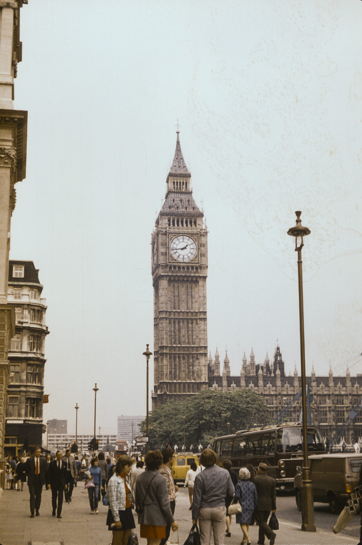
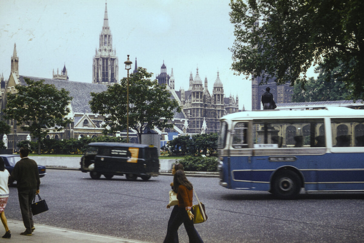
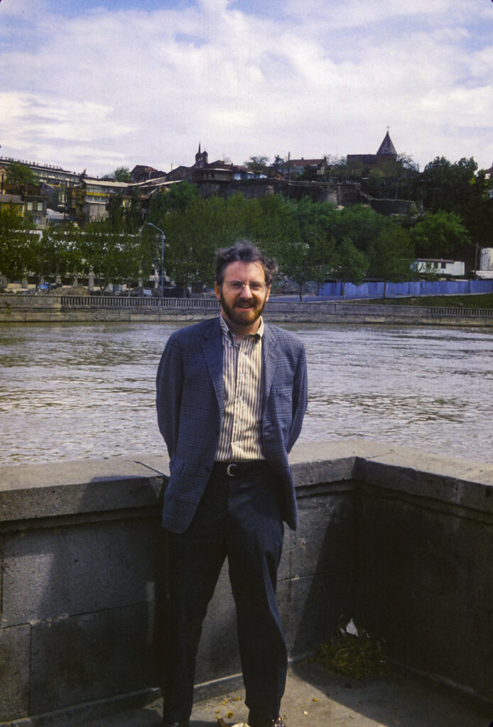
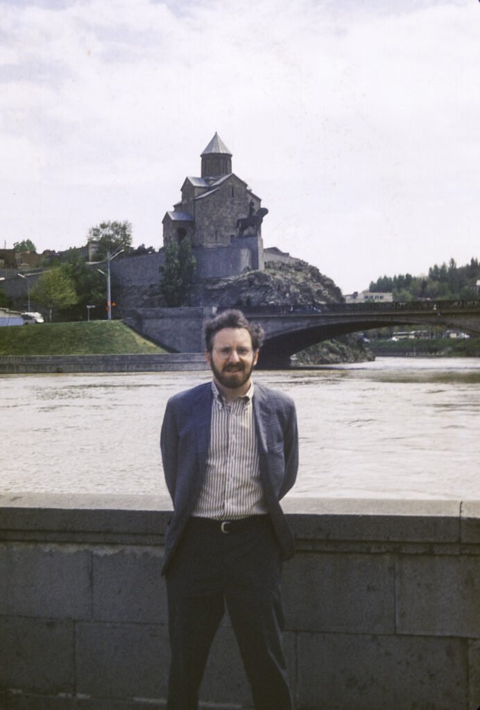
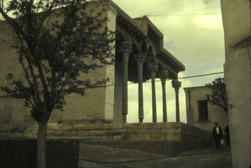
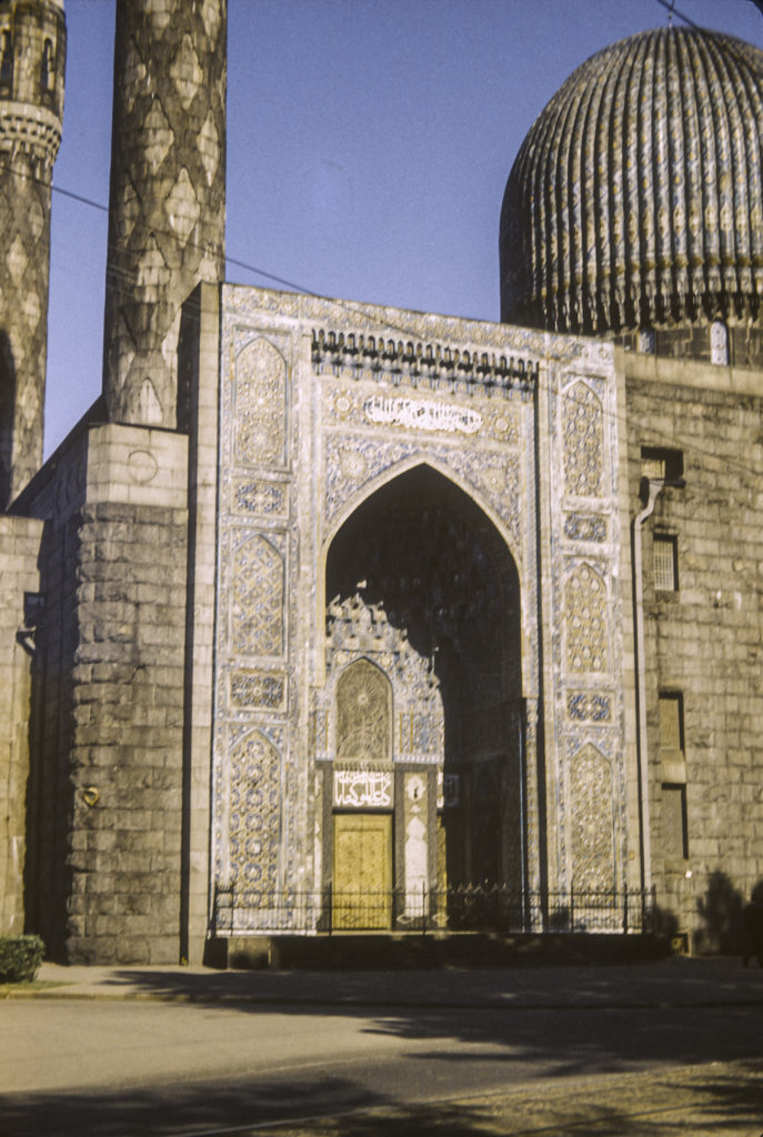
My last stop on the way home from the Soviet Union in July 1973 was London, England. I had been invited to stay with friends who were living there, in a house near Gatwick Airport to the south of London. I didn’t take many pictures during my short stay, and I have only a few to offer here.
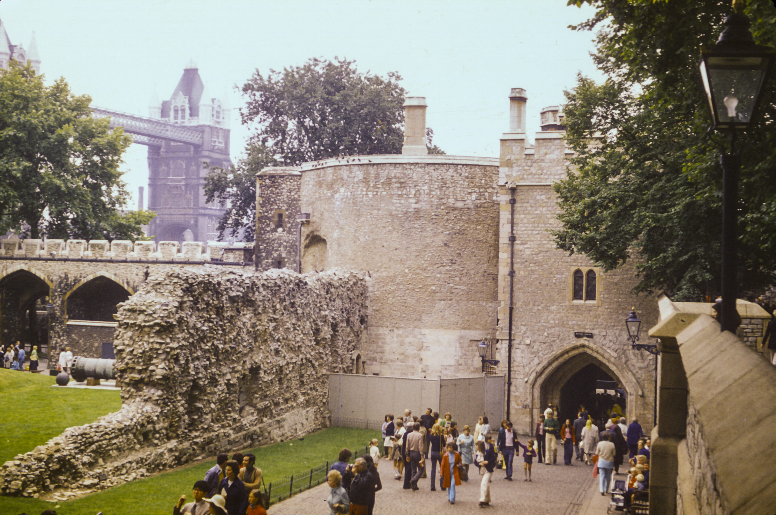
Of course I could not visit London without seeing the Tower of London, first built by William the Conqueror in 1068 and expanded during the following centuries. It has served as a royal residence and grand palace, armory, treasury, prison and public records office; it has also housed the Royal Mint and the Crown Jewels of England.
The Tower of London – Tower Bridge in background
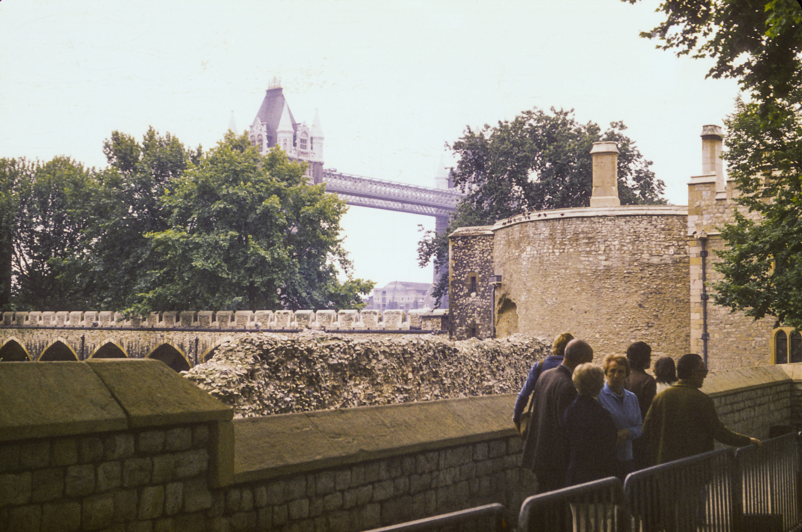
Near the Tower of London stands the Tower Bridge. It is much newer than the Tower itself, having been built in the 19th century (1886-1894), but it is equally well-known as a landmark. It is often confused with London Bridge, but that is another bridge in a different location. That bridge, the one commemorated by the nursery rhyme, has a longer and rather interesting history, dating from Roman times. Originally it was built of wood, but under King John (who is also commemorated by a nursery rhyme, Humpty-Dumpty), a stone bridge was completed (1209). That bridge, known as Old London Bridge, lasted until the 19th century. Hundreds of houses were built upon it, and at the south end was a gatehouse where the heads of convicted “traitors” were impaled on pikes – figures such as William Wallace, Thomas More, and Thomas Cromwell.
The Tower Bridge – as seen from the Tower of London
In 1831 the Old London Bridge was replaced by the New London Bridge, which didn’t last as long. By the 1920’s it was found that the bridge was sinking by an inch every eight years, and in 1967 construction on a new one was begun; it was completed in 1973. The old New London Bridge was sold to an American businessman, Robert McCulloch. It was dismantled and shipped in pieces to Long Beach, California, whence it was trucked to Lake Havasu City, Arizona, and rebuilt over the Colorado River in 1971. It was reconstructed around a steel frame so it wouldn’t sink into the Colorado as it had in the Thames. The stones were used as cladding for the steel framework.
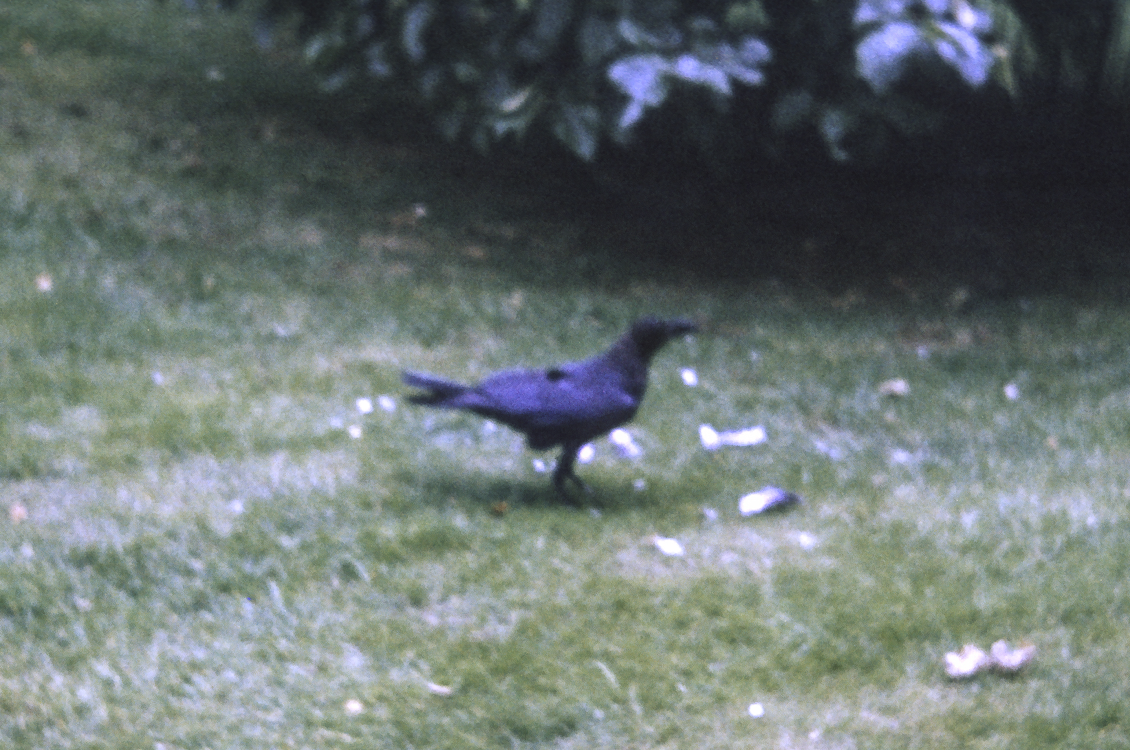
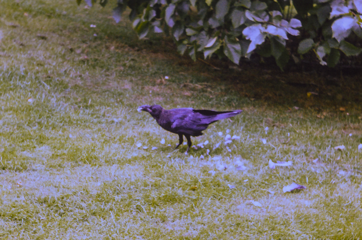
Tower Raven
Nothing I had ever read or heard about the Tower of London prepared me for the spectacle of the Tower Ravens. These birds inhabited the garden and were quite accustomed to the presence of humans. Their wings were clipped so they could not fly far, though they were certainly able to get around the Tower grounds with ease. They were well-cared for by the custodians of the Tower; they had bands around their legs to keep track of them and were quite aware of their privileged status.
A Tower Raven enjoying its lunch in the garden.
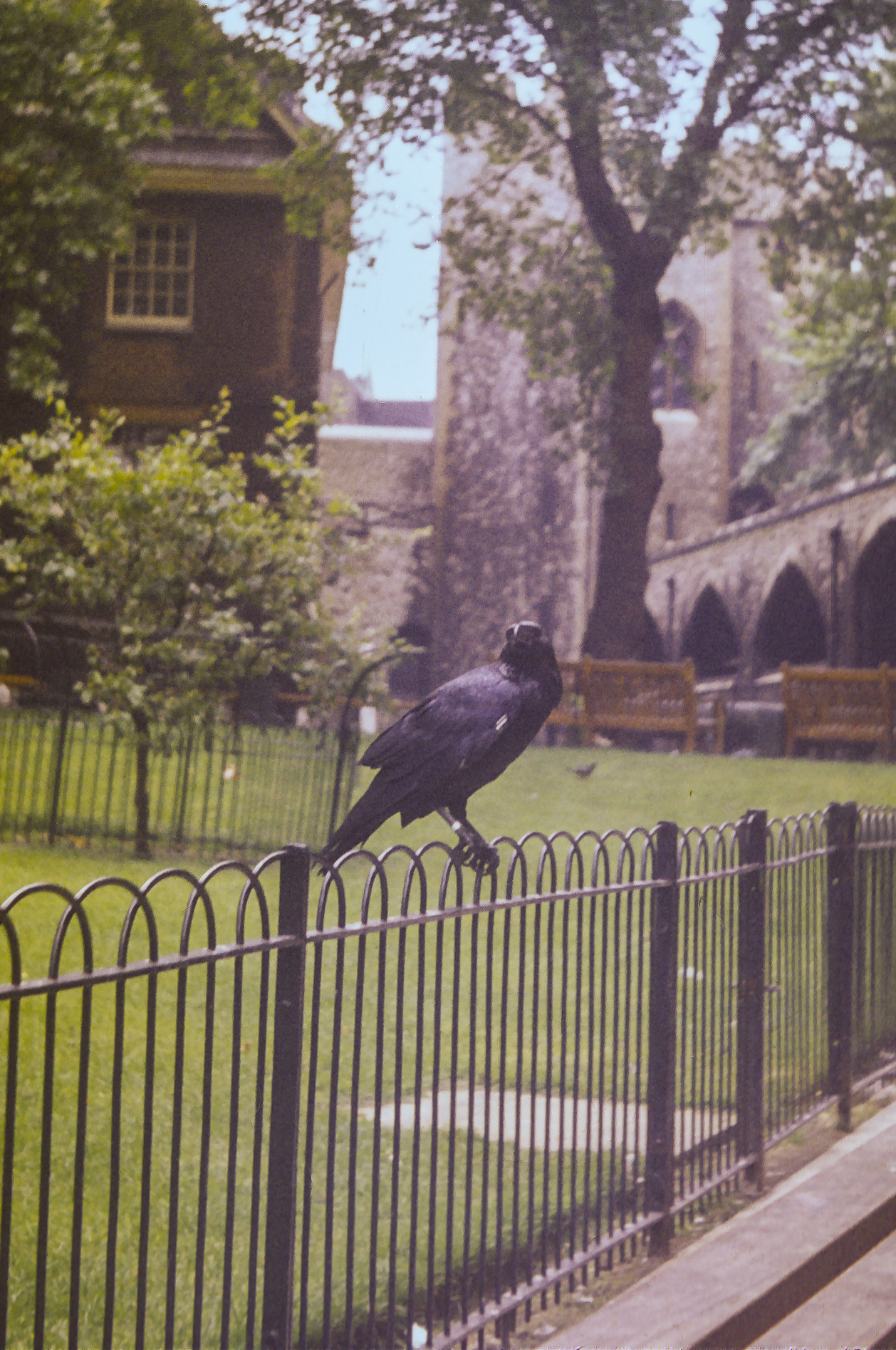
The ravens were fractious and quarrelsome; they fought amongst one another ferociously, and at one point I saw one raven pinning another down on the ground and pecking its head like a hammer. I was not quick enough to get a picture of that episode, and when I turned back after retrieving my camera, the peckee was gone and its assailant was digging into a piece of bloody meat. I first thought with horror that the dominant bird had dismembered its victim and was eating it, but it turned out that while I wasn’t looking the victim had fled and the victor was merely enjoying chunks of meat that the keepers had thrown in the yard in the interim. But there was no doubt that these birds are rowdy characters.
The Tower Ravens had their wings clipped so they couldn’t fly away, but they could still hop on the fence
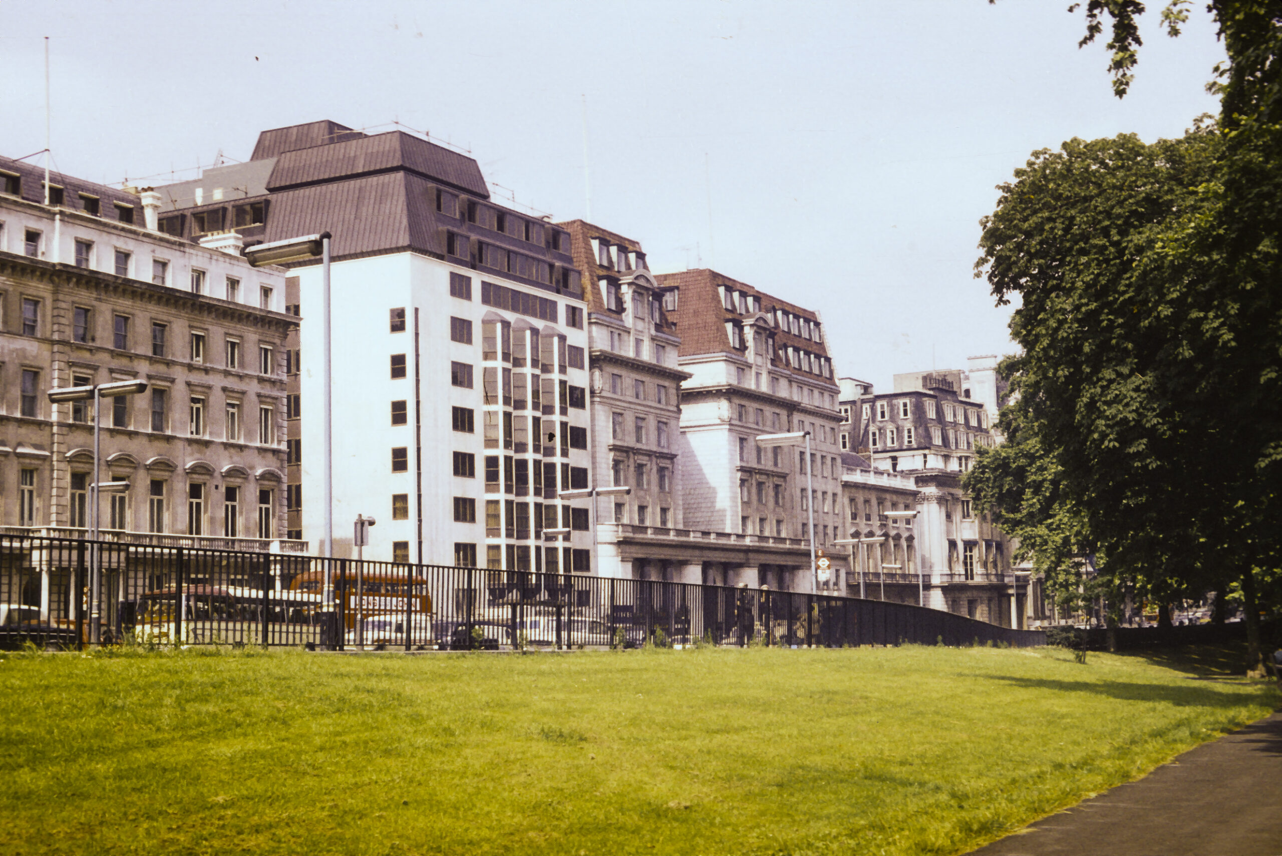
Elegant residential and office buildings facing a London park, which might have been the location of master detective Hercule Poirot’s office. Actually his office was in Florin Court, aka Whitehaven Mansions, on the eastern side of Charterhouse Square in Smithfield, London. But I didn’t know that at the time.
Mansard-roof office buildings in London
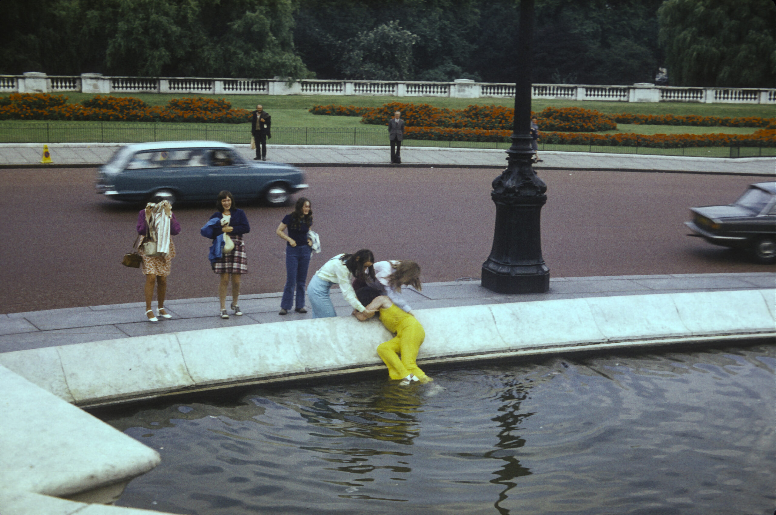
While strolling near Buckingham Palace I was witness to a scene where a girl got tossed into the pool beside Victoria Memorial by a couple of her friends, who then pulled her out, soaking wet. I called it the Case of the Drenched Debutante.
Someone got dunked in the pool at Victoria Memorial, near Buckingham Palace
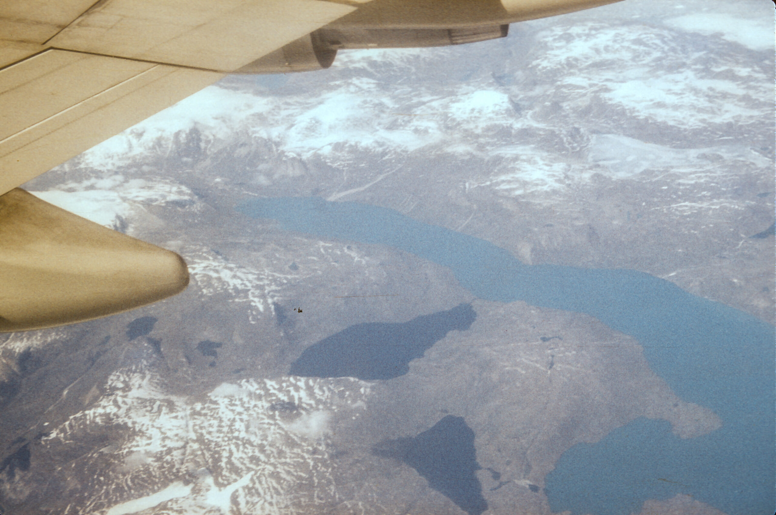
After an all-too-short stay in London, I hopped a Boeing 747 for the flight back to Los Angeles. On the way I was able to get a shot of the coast of Greenland from the plane.
The coast of Greenland, as seen from the window of a Boeing 747 en route from London to Los Angeles
The University of Bergen, founded in 1946, has 16000 students, 3000 faculty and staff, and is noted for climate research, petroleum geology (!) and medieval studies.
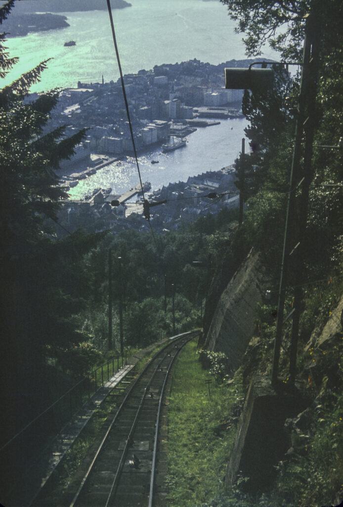
From the stop at Finse, the train embarked upon the final stretch of the Oslo-Bergen railway. First it passed through a long tunnel, then it embarked on a dizzying descent toward the city of Bergen, allowing me to get some nice photos along the way.
I caught my first glimpse of Bergen from the train as it descended from the mountains into the city.
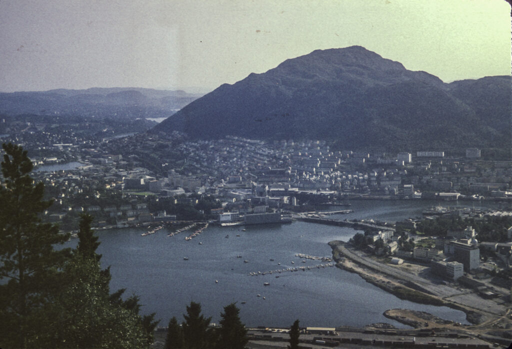
Bergen is one of the most beautiful cities I have ever seen. I caught my first glimpse of it from the train on the crazy-steep descent from the mountains into the city. It has a magnificent harbor in one of Norway’s famed fjords, framed by the mountains. Fortunately I was able to get some shots from the train as it plummeted toward the harbor.
The Oslo-Bergen Railway makes a steep descent from the mountains toward Bergen Harbor.
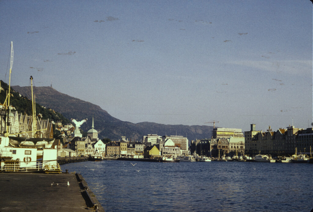
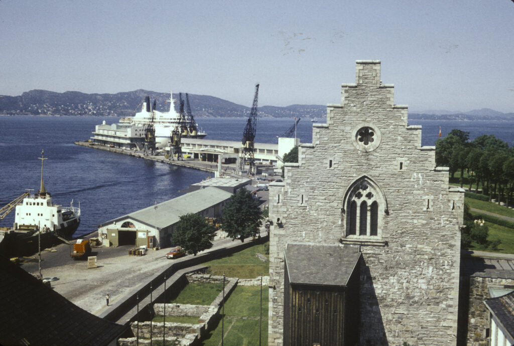
In Bergen I stayed with Sidsel Larsen, one of the Norwegians I had met in the Moscow University dormitory, and she showed me around the city and its environs, starting with the harbor. In Bergen the harbor is ubiquitous; you cannot overlook it. For its entire history Bergen has been a maritime commercial city, as it is today. It was founded in 1070 and grew to be the largest city in Norway, which it remained for centuries until it was overtaken by Oslo in the nineteenth century, and for a while in the 13th century it was also the capital of Norway. It also became an outpost (kontor) of the Hanseatic League, the commercial and defensive confederation of merchant guilds and market towns that dominated trade in medieval northwestern Europe.. (The great medieval city-republic of Novgorod in Russia also hosted a kontor of the Hanseatic League, and I presume that is where the Russian word kontora, meaning office, came from.)
In the medieval period Bergen became a great entrepot for the export of cod caught in north Norwegian waters to the rest of Europe, and was granted a royal monopoly on the trade. The Hanseatic merchants came to Bergen each summer to buy fish from the fishermen from the north; they had their own separate quarter of the town, next to the wharf where their ships docked, which is called Bryggen; it is visible in the picture below.
Part of Bergen Harbor, with the Old Wharf (Bryggen), Schøtstuene (Hanseatic assembly hall, now a museum) and Holy Cross Church at left. On the right is an open-air fishmarket.
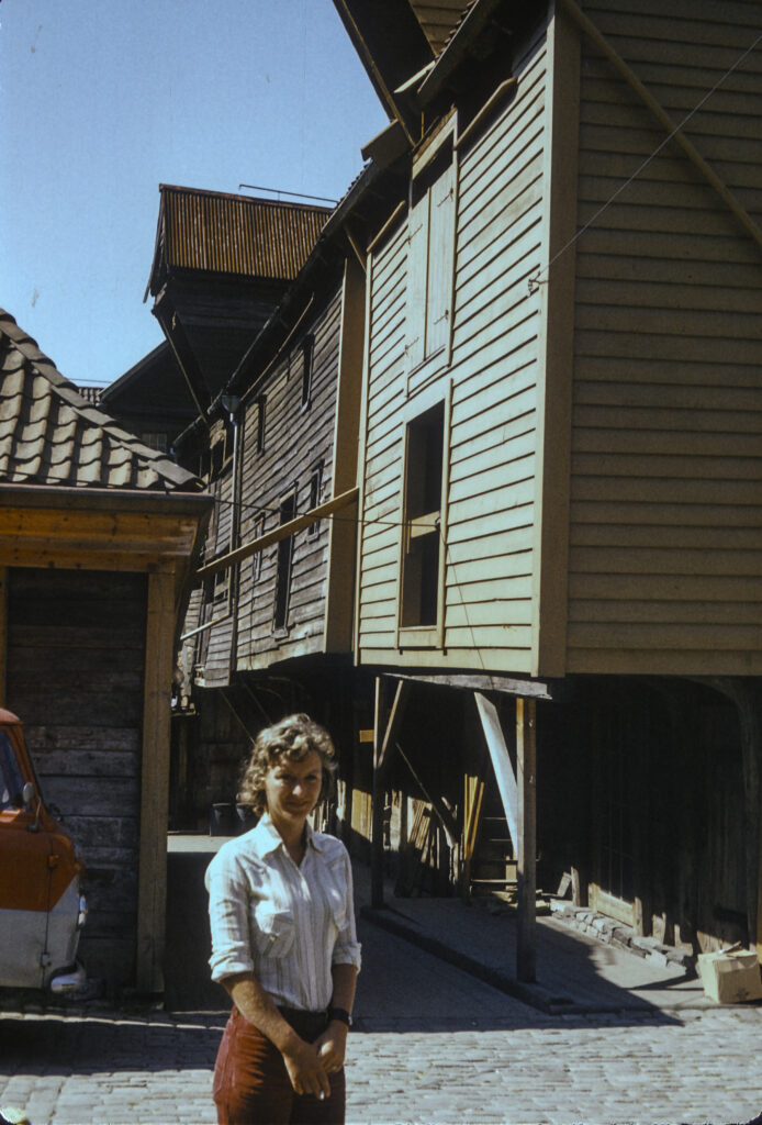
Sidsel Larsen took me on a walking tour of the Hanseatic Quarter. I was struck by the excellent state of preservation of the warehouses and other buildings. It turns out that they are not the originals; Bergen, like many other Scandinavian and Russian towns, was built almost entirely from wood in premodern times and was subject to terrible fires, the worst of which, in 1702, burned down 90% of the city. The structures I saw have all been built since then, and many of them rebuilt and restored multiple times. Nevertheless they are mostly authentic.
Sidsel Larsen, my hostess in Bergen, poses in front of some of the old Hanseatic warehouses in Bergen.
Oh NO! The disheveled ruffian has popped up again in Bergen! How did he follow me all the way from Tbilisi!
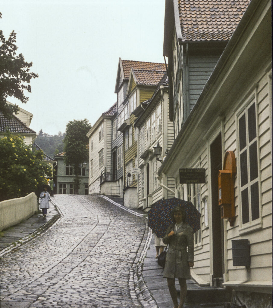
Bergen is one of the rainiest cities in Europe; the mountains surrounding it cause the moist incoming air from the Gulf Stream to rise, cool and precipitate their moisture onto the city. We had to take umbrellas everywhere and frequently found ourselves sheltering from the showers.
Sidsel Larsen shelters under an umbrella as we explore the old Hanseatic district of Bryggen.
One exception to the predominance of wood construction in the medieval city was the Bergenhus Festning, a stone fortress (Fortress) guarding the entrance to the harbor, dating from the 1240s. It contains a tower called the Rosenkrantztårnet, which we were able to climb and get a great view of the city from. I also looked for a Guildensterntårnet, but couldn’t find one anywhere.
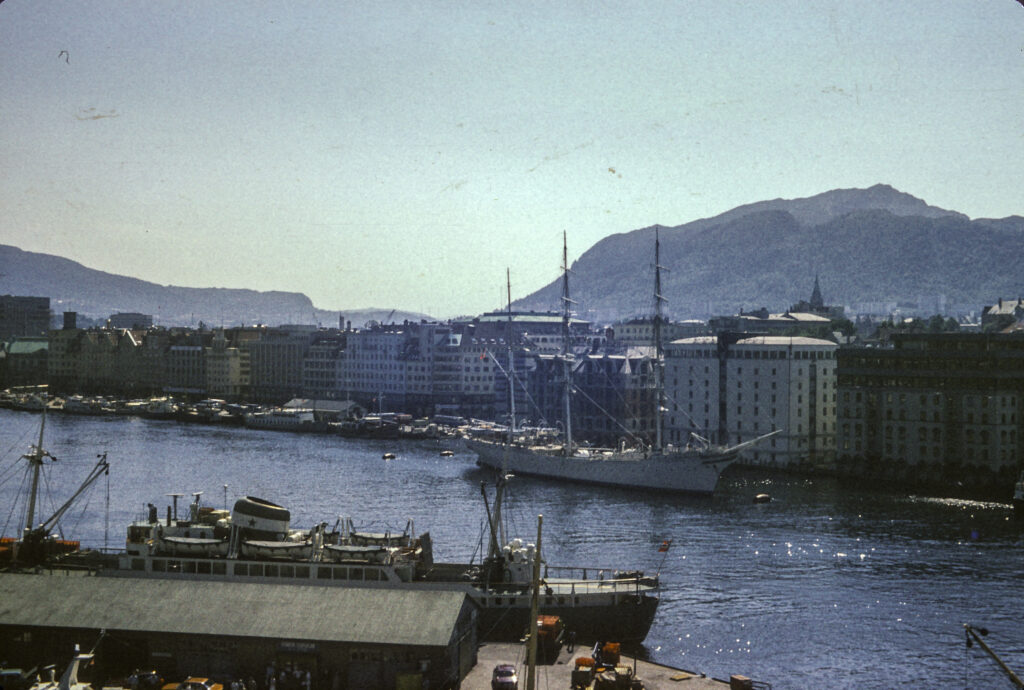
Harbor scene shot from an upper story of the Rosenkrantztårnet in Bergenhus Fortress. Visible in the foreground is Hakonshallen, the royal residence when Bergen was the capital of Norway. A cruise ship is docked at a pier in the background.
On the other side of the harbor, I saw the Norwegian Navy’s latest hi-tech dreadnought, the Statsraad Lehmkuhl, a three-masted barque which is actually used as a training ship for Norwegian naval cadets. It has an interesting history. It was originally built in 1914 as a training ship for the German merchant marine, under the name Grossherzog Friedrich August. At the end of the First World War the victorious British took it over as war booty, but then sold it in 1921 to a former Norwegian cabinet minister named Kristofer Lehmkuhl, who renamed it after himself (Statsraad = “cabinet minister”), and who donated it to his eponymous foundation. In World War II the Germans repossessed it when they invaded Norway, but of course they had to return it to the Norwegians upon being defeated. The Statsraad Lehmkuhl Foundation now contracts it out, mostly to the Norwegian Navy, but also upon occasion to other customers, including, ironically, the German Navy. Although I did not get a chance to board it during my visit to Bergen, years later the ship put in at Long Beach Harbor during a round-the-world summer cruise, and I was able to tour it then.
The latest advanced battleship of the Norwegian Navy, the 3-masted sailing ship Statsraad Lehmkuhl, docked in Bergen Harbor. Actually this was and is used as a training ship for naval cadets.
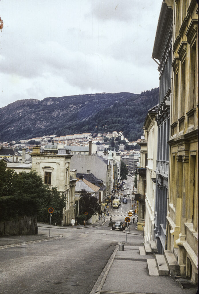
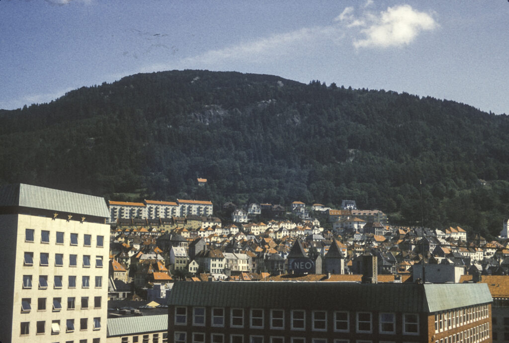
Bergen is a city built on hills. The seventeenth-century writer Baron Ludvig Holberg, who was born in Bergen, decided that since Rome was built on seven hills, Bergen must be the same. Unfortunately, there is much disagreement as to which ones are to be included in the seven or whether that is really the correct number – many would argue for nine. I think it’s a silly controversy, and the operative maxim is that Bergen is a city of very uneven terrain, with lots of hills and grades. If you like San Francisco, you should feel right at home in Bergen. And I did.
Bergen has a lot in common with San Francisco and other cities built on hills by the sea.
There is a caveat about that, though, which is that I visited Bergen in the summer; in the winter it gets a lot of snow – something you don’t see much of on the California coast. Be that as it may, the two most prominent mountains around Bergen are Ulriken and Fløyfjellet or Fløyen – the second is of course named after me. Fløyen is on the north side of the city, Ulriken to the east; Ulriken is the higher at 643 metres (2,110 ft), Fløyen comes in at 400 m (1,300 ft) above sea level. Both have aerial tramways running to the top. I’m not sure which one appears in the picture below.
An aerial tramway runs to the top of this mountain peak above Bergen.
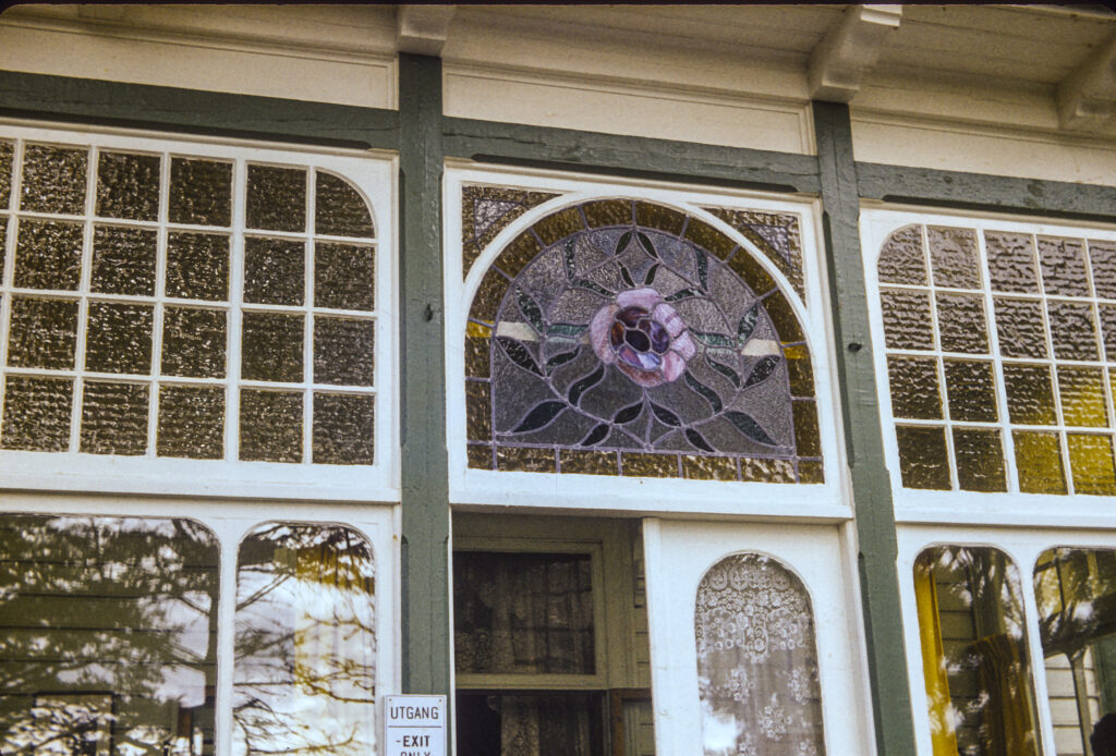
Perhaps the most illustrious native of Bergen is the composer Edvard Grieg (1843-1907), who composed the music for my favorite play, Henrik Ibsen’s Peer Gynt. (Ibsen, a contemporary of Grieg, came from the town of Skien in Telemark, in eastern Norway.) So it was a big thrill when Sidsel took me on an excursion to Grieg’s house and estate, Troldhaugen (which translates, appropriately for a fan of Peer Gynt, as “Troll’s Hill”). Now, as in 1973 when I visited, it is the Edvard Grieg Museum. When I visited the house itself served as the museum; in 1993 a separate structure was built to house the museum. The house has been described as “a typical 19th-century residence with panoramic tower and a large veranda,” which doesn’t do it justice. Built in 1885, it’s a beautiful late 19th-century house exhibiting not only outstanding craftsmanship but deft artistic features, most notably the wonderful stained glass transom window above the front door.
Entrance to Edvard Grieg’s house, focusing on the beautiful stained-glass transom window above the door.
The Troldhaugen estate is situated on a small peninsula of a large lake or inlet from the ocean, with a jetty projecting into the water.
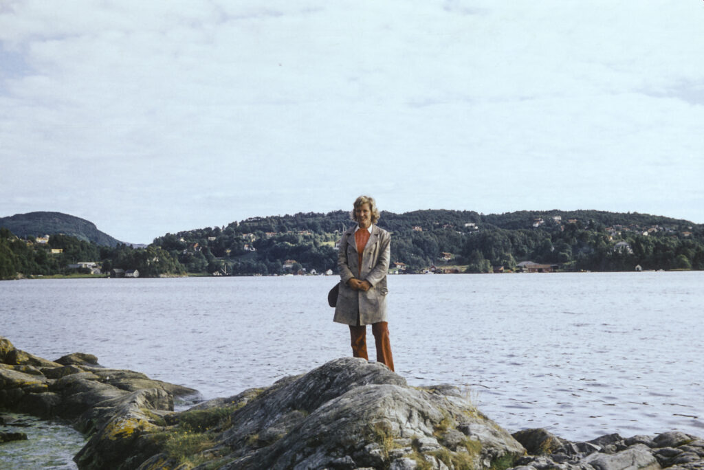
Sidsel Larsen pauses for a picture during our tour of Grieg’s estate.
We scrambled out on the jetty and took pictures of the lovely setting, which were again infiltrated by the ragged rapscallion who had followed me all the way through the Soviet Union.
While exploring the grounds of Grieg’s estate, we were again accosted by our pestiferous vagabond, who appeared out of nowhere.
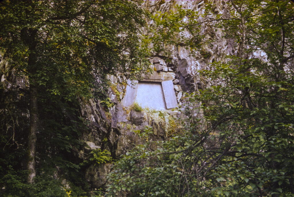
Grieg and his wife Nina were Unitarians. Upon his death in 2006, Grieg was cremated, and his ashes were interred in a crypt in the side of a hill near his house. His wife Nina moved to Copenhagen after his death, but when she died, she also was cremated and her ashes placed beside her husband’s. Strolling around the estate, we encountered the hillside crypt where their remains are interred.
The final resting place of Edvard Grieg and his wife Nina.
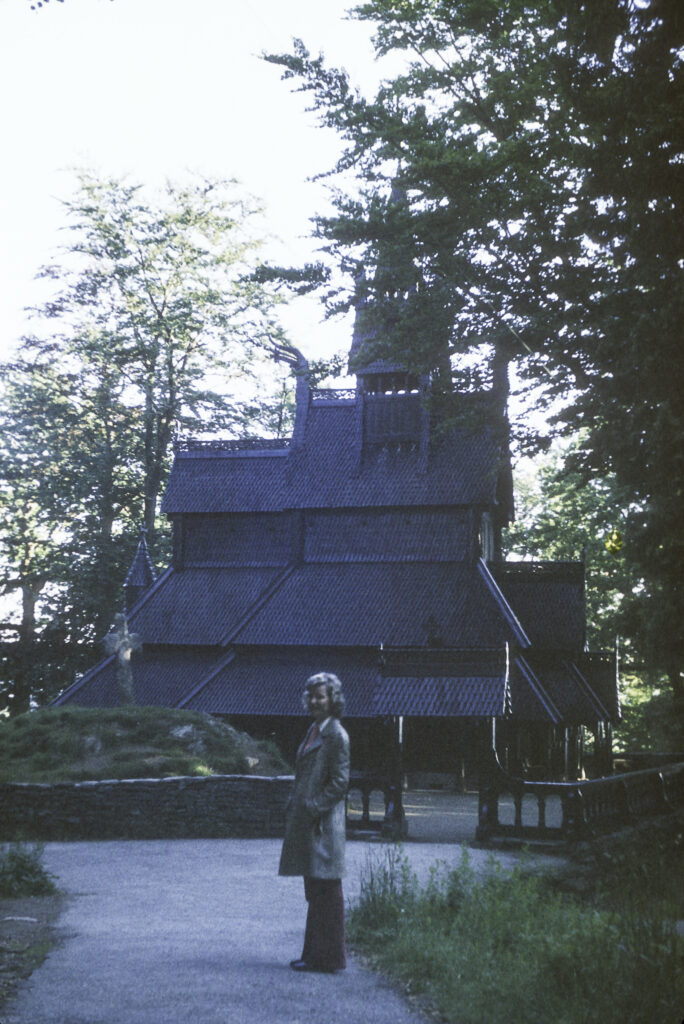
Returning to Bergen, we visited the Fantoft Stave Church. It had originally been built around 1150 at the village of Fortun, near the eastern end of Sognefjord, Norway’s longest and deepest fjord, about 60 miles northeast of Bergen. In 1879 a replacement church was built, and the original was slated for demolition, but was saved by a Norwegian businessman who had it disassembled and moved to Bergen, where it was reassembled.
In 1992, l9 years after I visited the Fantoft Stave Church, it burned to the ground. The cause was determined to be arson. A series of other Norwegian stave churches were also torched, and the police arrested and charged a man named Varg Vikernes with starting the fires. Vikernes was (and is) an interesting, though unsavory, character. He was born in 1973, the same year I visited Bergen. In the early ’90s he became an influential member of the Norwegian black metal scenc. Black metal (most readers will probably know this, but I did not, having never paid much attention to such matters) is an extreme type of heavy metal music, characterized by “fast tempos, a shrieking vocal style, heavily distorted guitars played with tremolo picking, raw (lo-fi) recording, unconventional song structures and an emphasis on atmospheres.” Many black metal artists paint themselves up as corpses and adopt pseudonyms. They also tend to espouse fringe viewpoints and ideologies, including extreme anti-Christian views, Satanism, ethnic paganism, and neo-Nazism. Some of them are fascinated with the lore and imagery of J. R. R. Tolkien’s Middle-Earth. Varg Vikernes was such a person. In 1991 he founded a one-man band named Burzum, which is the word for Mordor in the language of that land, which was the abode of Sauron the Great, the evil arch-villain of Middle-Earth and his minions, the orcs. Vikernes had previously been a member of a band called Uruk-hai, a name for a particularly nasty type of orc. He also took the stage name Grishnakh, from one of the orcs in The Two Towers. He flirted with neo-Nazism in his teenage years, and later developed his own ideology, which he described as “Odalism,” a fusion of paganism, traditional nationalism, racialism, environmentalism, simple living, self-sufficiency, and opposition to anything he deemed a threat to his vision of a pre-industrial pagan society, e.g. Christianity, Islam, Judaism, capitalism and materialism.
On August 10, 1993, Vikernes murdered his fellow-musician Øystein “Euronymous” Aarseth, one of the founders of the black metal “scene,” in circumstances that have never been completely clarified (Vikernes claimed self-defense). On August 19, Norwegian police arrested him for the murder of Euronymous, the arson burnings of Fantoft and several other churches, and the theft and possession of 150 kilograms of explosives which were found in his home. (He may have been planning to blow up a leftist enclave with the explosives, but this has never been proven.) In 1994 he was convicted of most of the charges, including the burning of some of the churches, but was somehow found not guilty of torching the Fantoft church. He was sentenced to 21 years in prison, the maximum penalty under Norwegian law (this was also the sentence passed on the mass murderer Anders Breivik), but he was released on parole after 15 years. He eventually moved to France, where he got in trouble with the French police for inciting hatred against Jews and Muslims.
However, in the end the mad vandalism of Vikernes failed in its intended purpose, at least in the case of the Fantoft Stave Church. Work on reconstruction of the church began soon after the fire and was completed in 1997. The restored church now has a security fence around it to impede recurrences of the 1992 attack. The picture below, of course, shows the church as it appeared in 1973.
Sidsel Larsen at the Fantoft Stave Church, an 1879 replacement for a medieval stave church built around 1150.
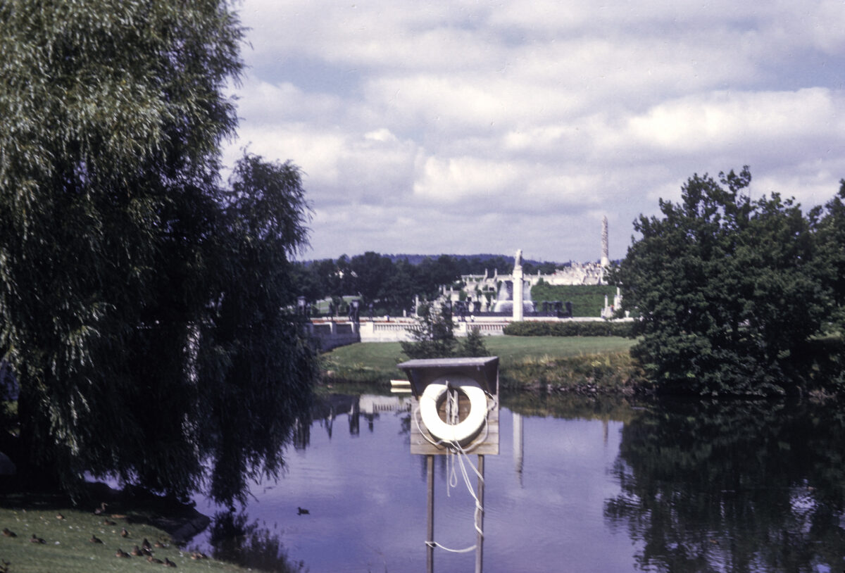
Vigeland Sculpture collection as seen across Frogner Pond, Frogner Park, Oslo, Norway.
I left the Soviet Union in July 1973. Living in the Moscow State University dormitory, I had struck up friendships with a number of visiting foreign students, including several Norwegians. I was not homesick, and I knew I would not have a chance to travel again for a while, so it was perhaps not strange that I decided to prolong my year abroad by making a detour via Norway instead of flying directly home.
My first stop was Oslo, where I stayed with a Norwegian lady named Eva, who showed me around the city. Oslo is of course the capital and largest city in Norway, with a population of over a million. It was founded in the eleventh century, at the end of the Viking Age, when Norway converted to Christianity, and the city celebrated its millenium in 2000.
Eva showed me around the city, taking me first to Frogner Park, the largest park in Oslo and also Norway’s largest tourist attraction. It was originally part of an estate called Frogner Manor, established in the eighteenth century. The manor house still stands and now houses the Oslo Museum. The park is also the location of the Vigeland Sculptures, a collection of 212 granite and bronze sculptures designed by Gustav Vigeland (1869-1943). This encompasses some of the most original and imaginative creations I have ever seen and makes Frogner Park worthy in itself of a visit to Norway.
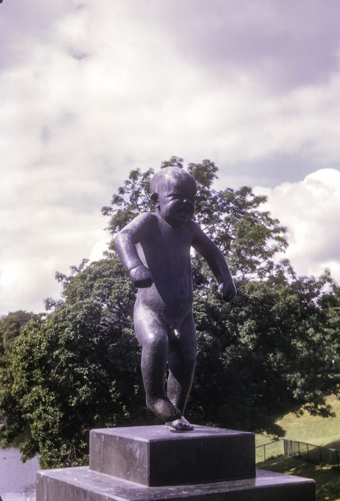
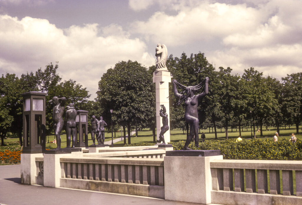
The sculptures occupy 80 acres of the park and are distributed along an 850-meter (2790 ft.) axis, starting at the main gate on the east. From there one crosses the 15 meter (49 feet) wide Bridge over Frogner Pond to arrive at the Vigeland Fountain, 100 meters (328 feet) west of the gate. The Bridge is lined with 58 statues, the most famous of which is the Angry Boy, depicting a toddler having a temper tantrum. I prefer to call it the “Screaming Spoiled Brat Having a Tizze” statue. Unfortunately, when I photographed it the light came from in back of it, making the Brat’s face difficult to see. You can see a better shot of it in the Wikipedia article on Frogner Park.
The Angry Boy (Sinataggen) statue in Frogner Park, Oslo, Norway.
Like the Angry Boy, all the statues in the park depict naked people, both men and women, adults and children. Many of them are engaged in ordinary human activities such as walking, running, dancing, hugging, etc.; but some also represent more abstract conceptions. Some are pensive or placid, others are more animated and dynamic, some are surreal, a few are even violent. The next photo captures the full range: on the left is a group engaged in low-key activities; on the right, a woman dancing and pulling her hair out; behind her, in front of the white column, a man bouncing a small boy on his shoulders; on the column itself, a man fighting a huge lizard.
Dancing Young Woman sculpture in Frogner Park, with Old Man Holding Little Boy behind her, and others in background, including Man Fighting with Lizard on top of column.
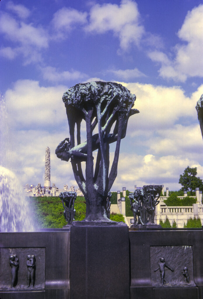
Sometimes I found it hard to figure out what the people depicted by the statues were supposed to be doing. For instance, the girl in the next picture might be swimming, but if so she appears to be doing so in a tree. One web page I came across calls it “Dreams and Flights of Fancy.”
I didn’t know what to make of these sculptures surrounding the fountain, which all seem to depict people caught in trees. The one in front, which I call “Falling Woman,” was one of the more interesting.
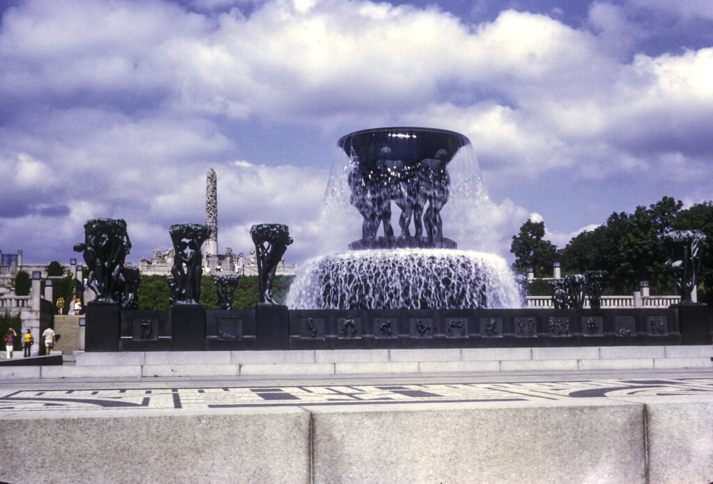
This was just one of 20 sculptures surrounding Vigeland’s Fountain, all depicting people involved with trees. According to the museum’s web page, “The tree groups represent a romantic expression of Man’s relationship to nature. They also form the setting for life’s evolving stages, stretching from childhood and adolescence through adulthood to old age and death.” The Fountain itself is a giant bowl held up by six men, who, according to the fountain’s web page, “representing different ages, may be interpreted as toiling with the burden of life.”
Vigeland’s Fountain, Frogner Park. Each of the 20 sculptures surrounding the fountain represents a different stage of human life, from childhood to death.
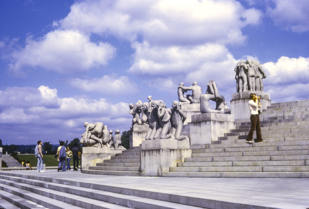
As you can see from the following photo, beyond Vigeland’s Fountain lies the centerpiece of Frogner Park, the Monolith. As you approach the Monolith, you climb a granite staircase festooned with statues of groups of people in all kinds of poses, some rather bizarre.
Surrounding the monolith, and scattered throughout the park, are a variety of sculptures depicting naked human bodies — male and female, young and old — in a vast spectrum of activities and relationships. Frogner Park, Oslo, Norway.
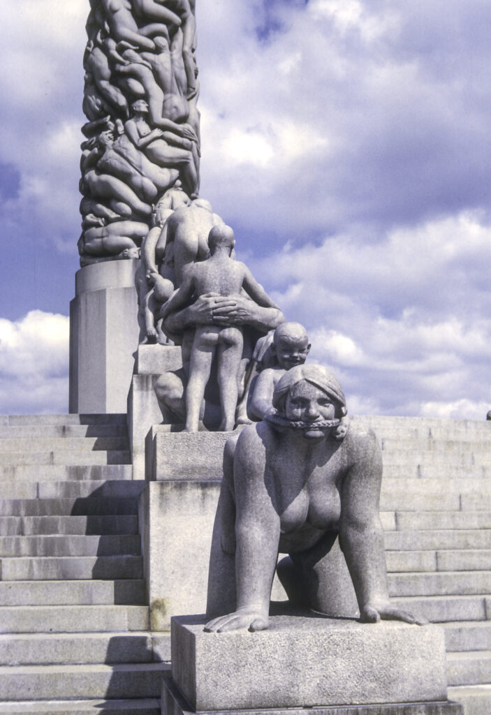
One of my favorites was a woman on her hands and knees, bearing a child on her back. Apparently they are playing horsey, with the child using a braid of the woman’s hair as a bridle, which also serves as a gag, while the child’s expression is one of sadistic delight. It all serves to convey the notion that motherhood turns women into beasts of burden, who are supposed to accept their lot meekly and in silence.
The foreground statue represents a woman on all fours, apparently harnessed with a bridle that also serves as a gag, carrying her gleefully callous child on her back.
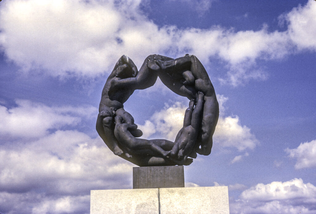
The Monolith towers 46.12 meters – 46.32 feet – over its plaza and resembles a giant granite totem pole, with 121 human figures entwined in it, all seeming to struggle to get to the top.
According to the Vigeland Museum’s Monolith web page, “The sculpture depicts 121 human figures clinging and floating together. There are women and men of different ages, and the top of the Monolith is crowned with children. The sculpture has been interpreted as a kind of vision of resurrection, and our longing and striving for spirituality.”
Vigeland began designing the monolith in 1919 and continued working on it for the rest of his life. Construction actually began in 1927 when a huge granite block was brought to the site and a shed erected over it to protect the workers from the elements. Three stone masons worked on transferring the design from plaster to stone from 1929 to 1943. Vigeland, who died in 1943, did not live to see the unveiling of the Monolith to the public; this occurred in 1944, oddly enough during the Nazi occupation. Apparently the Germans were not hostile to Vigeland’s work, nor he to them, and some critics considered his designs to be an expression of Nazi or Fascist esthetics. Personally, I didn’t find that to be the case.
The Monolith, Frogner Park. Carved out of one enormous piece of granite 46 feet tall, this monument depicts 121 figures climbing in and around each other, all fighting their way to the top.
At the west end of the sculpture area stands the Wheel of Life, carved in 1933-34, depicting four adults, a child and a baby linked together in a circle.
The Wheel of Life sculpture
Not very far from Frogner Park, on the Bygdøy peninsula, I visited two fascinating museums, the Vikingskiphuset (Viking Ship Museum) and the Norsk Folkesmuseum, or Norwegian Museum of Cultural History. The former houses three famous Viking-era burial ships, named for the places at which they were excavated – Oseberg, Gokstad and Tune. Because I didn’t have flash equipment, I didn’t take any pictures of the ships, which are housed indoors. But the museum web site has plenty of them.
The Norwegian Museum of Cultural History, however, has a number of outdoor exhibits; in fact it claims to be the world’s first open-air museum, having been founded in 1881. It has extensive collections of artifacts from all regions of the country, including 150 buildings relocated from towns and rural districts. The centerpiece is the Gol Stavkirke, a wooden church originally built in the town of Gol sometime between 1197 and 1216, but disassembled, brought to Oslo and re-erected in 1880. Stave churches, a type of wooden church commonly built in northwestern Europe in medieval times, replaced an older type, the post church, in which the posts – the vertical timbers supporting the walls and roof – were sunk directly into the ground, making them vulnerable to rot and insects, whereas in the stave church the posts rested on stone foundations, affording better protection from decay. I have always been struck by the resemblance between the Norse stave churches and some types of Russian wooden churches such as those at Kizhi, on Lake Onega in Karelia. I wonder whether the similarity is the result of influence or convergent development.
Gol stavkirke – Stave Church originally built in Gol in the early 13th century; disassembled and rebuilt in Oslo in 1880.
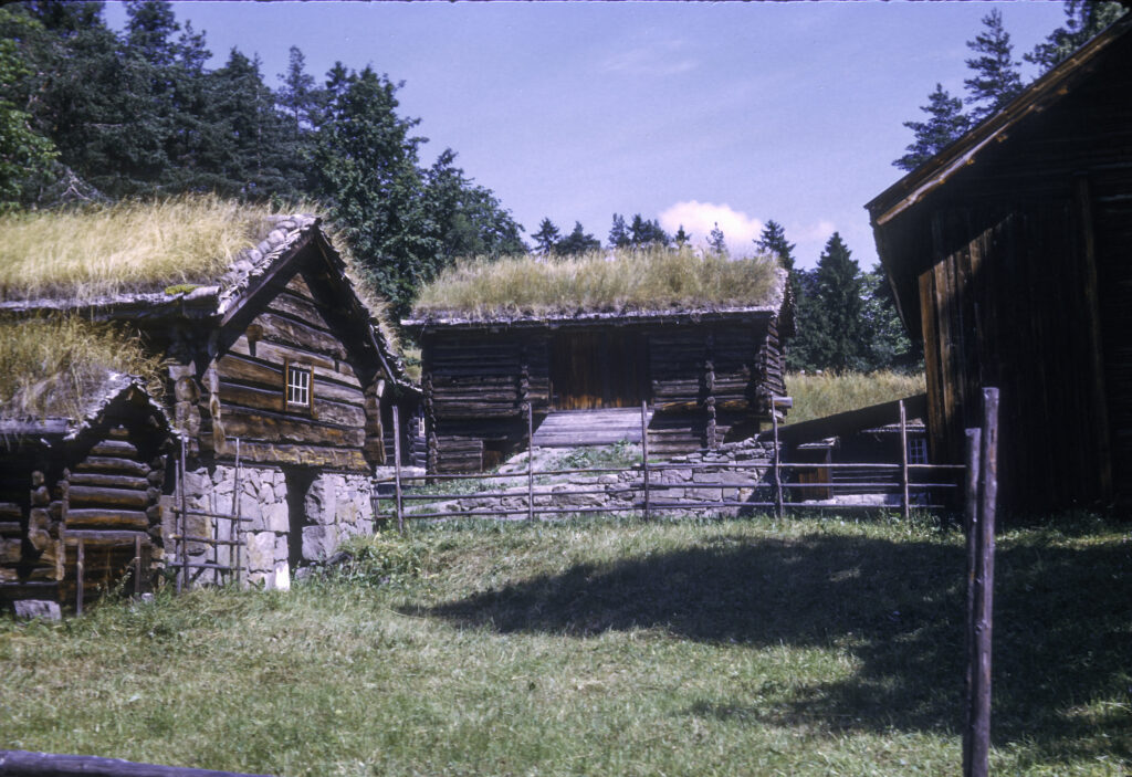
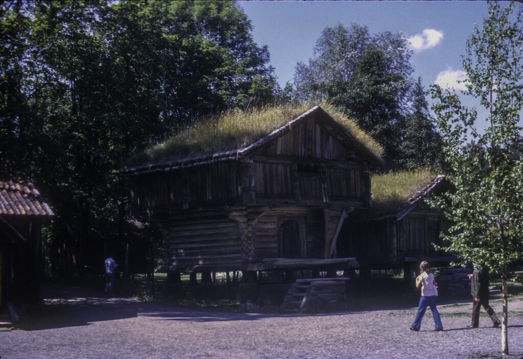
Another legacy of medieval times is the 14th-century Rauland farmstead from Østerdal, consisting of several log buildings as seen in the next photo.
14th-century farmstead from Osterdal, Norwegian Museum of Cultural History, Oslo
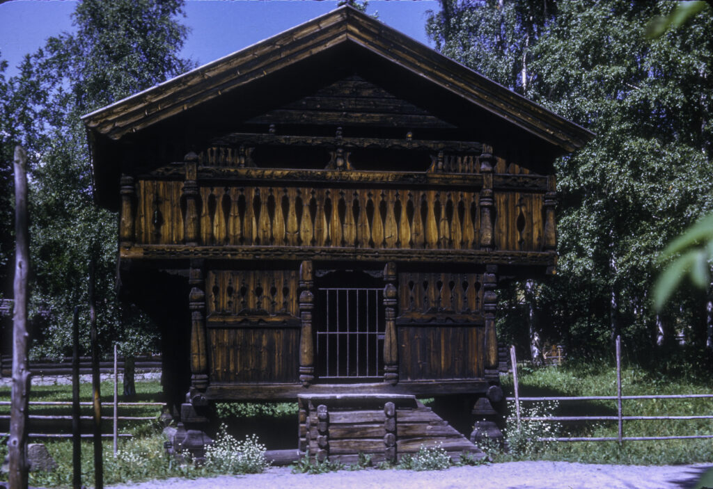
The elegant wooden cabin with its carved balustrade is clearly designed for extreme Nordic weather conditions. The ground floor has a small footprint with sturdy timbers to support the weight of the larger upper floor, which contains the main living quarters and is so designed that in winter, when heavy snowfalls have inundated the ground floor, one can step off the balcony onto the snow wearing skis or snowshoes. The roof is extremely thick and robust in order to withstand huge weights of snow, and slanted to encourage the snow to slide off.
Elegant traditional wooden house, built to withstand long, cold, snowy winters
Another set of historical buildings had been transplanted from Hovin and Gransherad, former municipalities in the former county of Telemark. Telemark county is famous for originating a skiing technique that combines elements of Nordic and Alpine skiing. The municipalities are “former” presumably because they have become depopulated, while the county of Telemark is “former” because it has been combined with another county to form the county of Vestfold og Telemark. But this took place only in 2020, long after I visited in 1973. In any case the name Telemark remains forever memorialized in the skiing term.
Historic buildings from Hovin and Gransherad in Telemark – Norwegian Museum of Cultural History, Oslo
I did not have an opportunity to visit one of Oslo’s most famous historical attractions, the Akershus Festning (fortress). I was only able to snap a photograph of it from across the bay, and the view was obstructed by a stone rampart that I could not climb.
The construction of Akershus Fortress began around 1290, at the order of Norwegian King Haakon V, in the aftermath of an attack on Oslo by a rebel baron and pirate named Alf Erlingsson. Begun as a defensive bulwark, it also came to serve as a royal residence and eventually a prison as well. Its importance soon grew to such a degree that it was said that “Whoever controls Akershus, controls Norway.” Although it doesn’t appear particularly formidable compared to many other famous strongholds I have seen, in the many sieges it has endured over its long history it has never been taken by force. Even the great military genius Charles XII of Sweden failed to capture it. But it surrendered without a struggle to the invading Germans in 1940, when the Norwegian government evacuated Oslo. During World War II, the Germans and their puppet government, headed by the Norwegian traitor Vidkun Quisling, used the fortress as a prison and place of execution for members of the Norwegian Resistance. After the defeat of Germany, the Norwegian Resistance in its turn executed Quisling and other Norwegian traitors, as well as German war criminals, at Akershus. Today it contains two military museums, the Royal Mausoleum and government offices.
An obstructed view of Akershus Fortress. Built around 1300, it served as a defensive bulwark of Oslo as well as a royal residence.
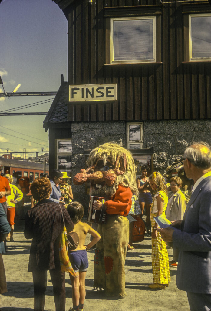
Following my all-too-short stay in Oslo, I went on to Norway’s second-largest city, Bergen, via the Oslo-Bergen Railway, which runs over the rugged snow-covered interior of Norway. My relatively primitive camera allowed me to get only a few pictures from the train, but when it arrived at the halfway point of the journey, the mountain village of Finse, I was able to stroll around a little and get some decent shots of that picturesque hamlet.
The Troll at Finse Station, on the Oslo-Bergen Railway Line. Same one that plagued Peer Gynt.
I was enamored of Finse Station, and I suppose one of the major reasons was the railway station’s Troll, who reminded me of the Mountain King in my favorite play, Henrik Ibsen’s Peer Gynt (pace Elouise Mattox). In the play, the callow and foolish title character gets involved with a girl from the Troll community, whom he is to marry, after obtaining permission from her father, the Troll King, who lives in a mountain fastness. In the upshot, Peer arouses the ire of the King by rejecting some of his conditions for the marriage, barely escaping with his life, but not before he has accepted the motto of the Trolls: instead of “To thine own self be true,” which is the human version, the Troll motto is “To thine own self be enough.” This comes back later to haunt him.
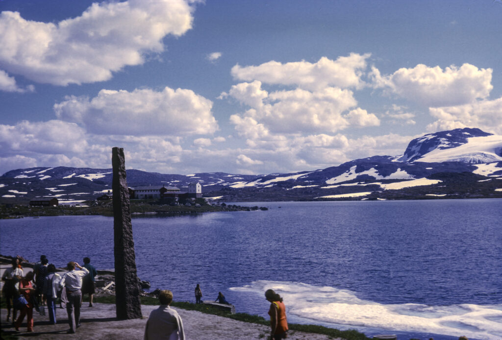
Finse sits on the shore of a lake, Finsevatnet, at an elevation of 1,222 meters or 4,009 feet above sea level, the highest point on the Bergen line – or on any Norwegian railway line, for that matter. This doesn’t seem very high compared to the European Alps or the Sierra Nevada in California. In fact my astronomical observatory, in the hills near Anza, California, is higher, at an elevation of 4300 feet, and it rarely snows there. But Finse’s location in the far north ensures that the ground has snow on it the year round.
Lake Finsevatnet, Finse, Norway
Finse is said to be a Mecca for recreation both in winter and summer. It is also a base for training expedition personnel and first responders. In winter there is snow skiing and iceboat-sailing on the lake; in summer there is hiking, including hiking on the nearby Hardangerjøkulen glacier, and mountain biking. Finse was the location for the shooting of the Hoth ice-planet scenes in Star Wars: The Empire Strikes Back.
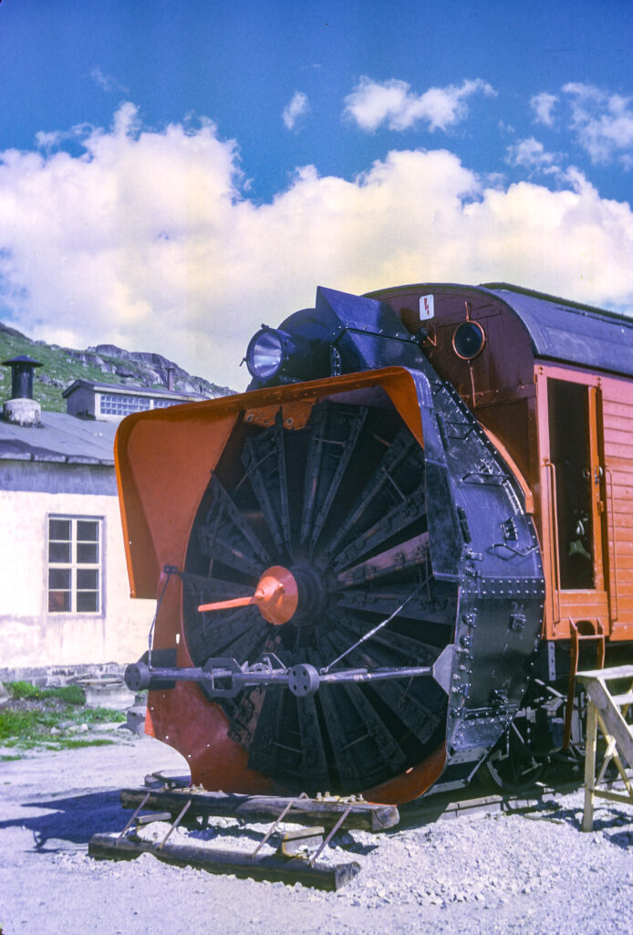
Finse also hosts a railway museum. I did not go into the museum, but I did note some of the external exhibits, such as the huge railway cars that were built to serve as snowplows. They had been decommissioned, presumably because they were obsolete; I was not able to find out what had replaced them.
Decommissioned snow clearing engine at Finse Railway Museum, Norway
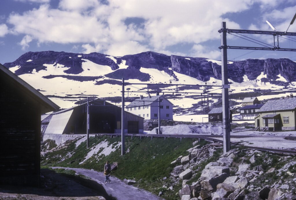
One possible reason was that they were no longer needed, though I found this difficult to believe. It turned out that just west of Finse, a tunnel had been bored through the mountain to reroute the section of the road most prone to blockage by snow and avalanches. The entrance to the tunnel is visible in the next picture.
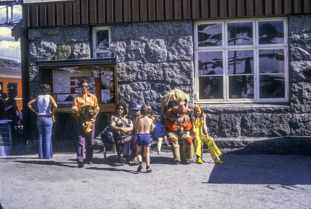
I took my leave of Finse after shooting one last picture of the Troll cavorting with children outside the railway station. I had wanted to wait until he had finished lulling them into complacency, in preparation for seizing them, trussing them up and cooking them for dinner. But the train was leaving, and I had to go.
The Finse Troll cavorts with kids in front of Finse railway station, lulling them into complacency before cooking and eating them…
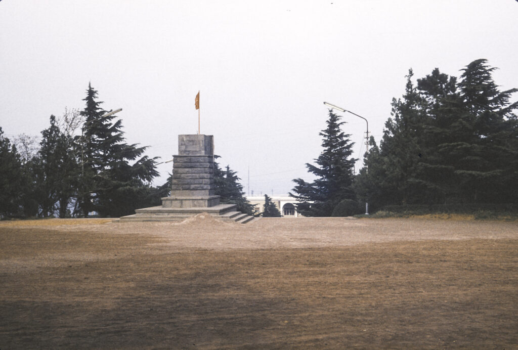
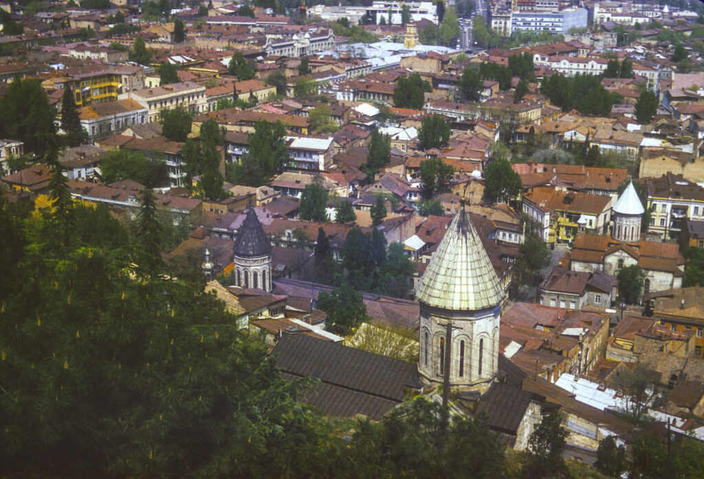
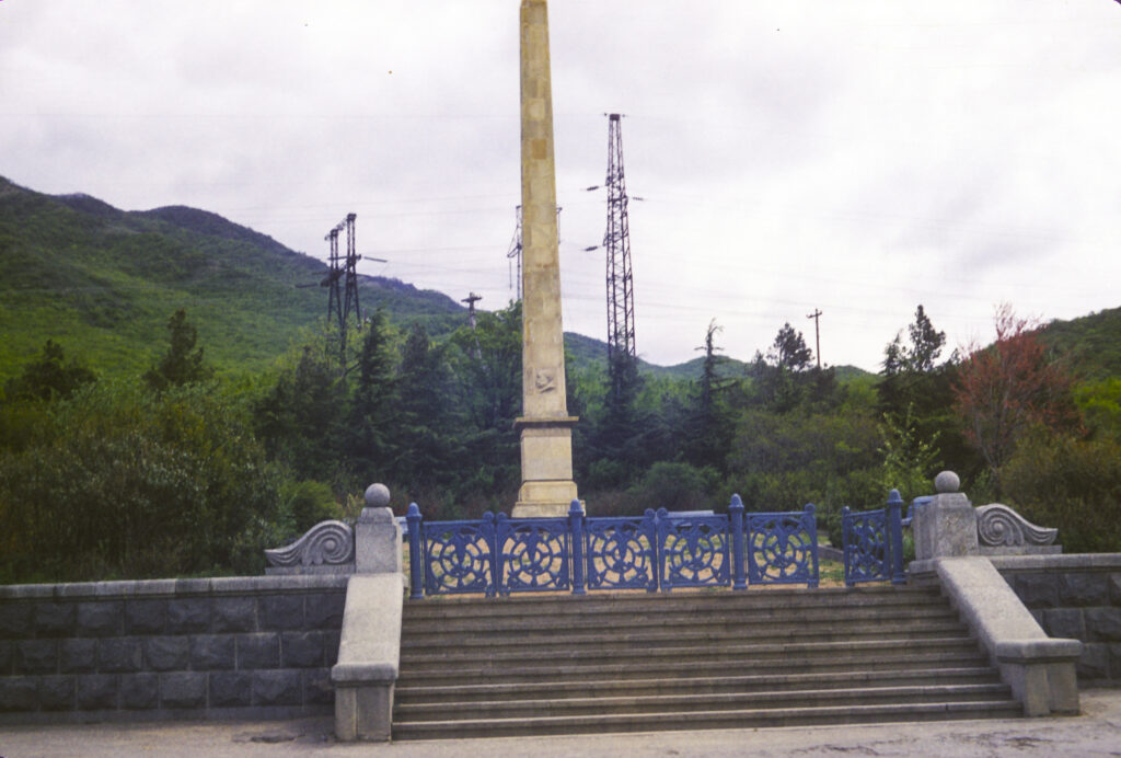
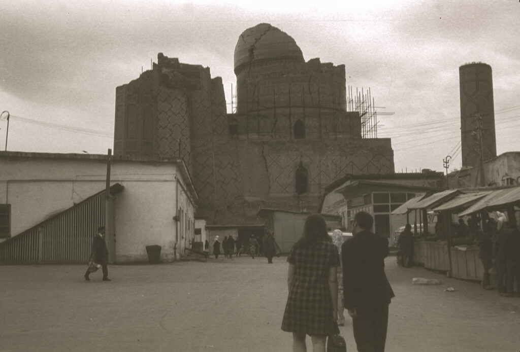
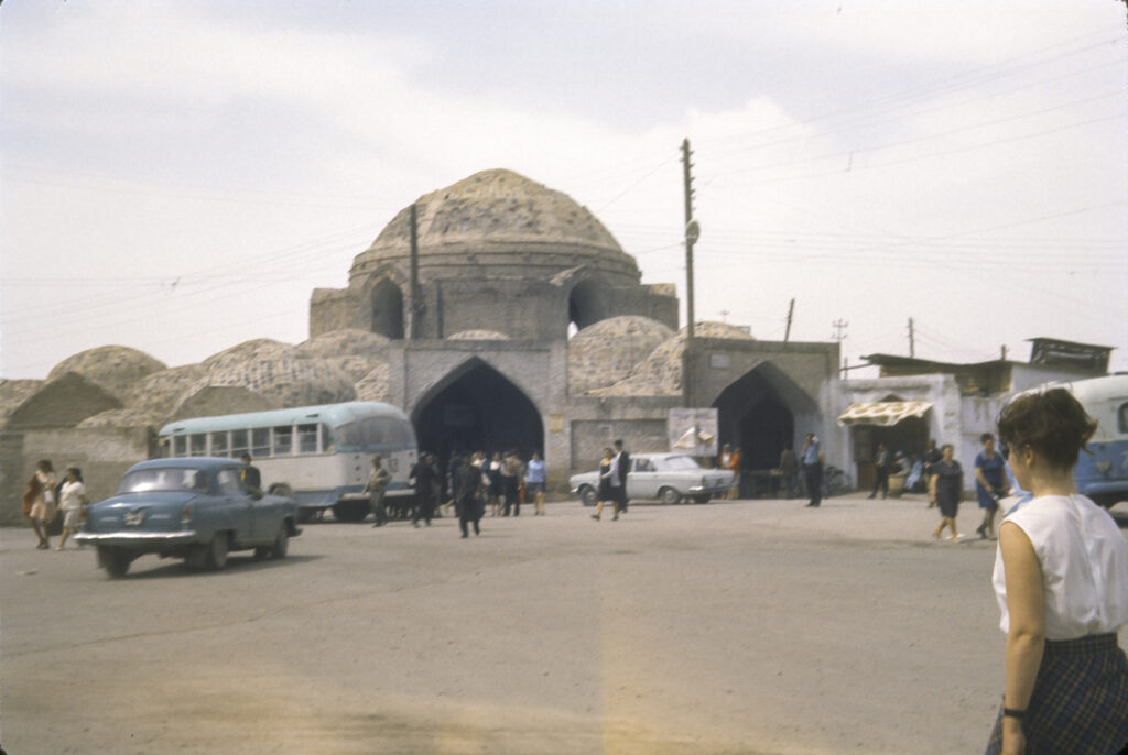
A view of Central Tbilisi from Narikala Fortress area; in the picture are Rustaveli Theatre, Supreme Court of Georgia and other landmarks
Tbilisi was a fitting climax to our whirlwind April 1973 tour of Central Asia and the Caucasus. It is a magnificent city and the capital of one of the most distinctive, mysterious and intriguing countries in the world. Georgia, or Sakartvelo as the natives call it, is an ancient, unique and fascinating land. The inhabitants are possibly descended from the original modern humans to people the area and speak a language (actually several languages, the so-called Kartvelian group) related to no other known linguistic family in existence, written in its own script which is derived from neither Latin, Cyrillic nor Arabic. The country is mountainous, rugged, and stunningly beautiful. The men arc noted for being brave and skilled warriors, generous and welcoming but quick to anger, with a strong sense of honor; the women for being beautiful, proud and assertive – a Georgian woman is queen in her own household. Georgian hospitality is legendary, and we were to experience it in full.
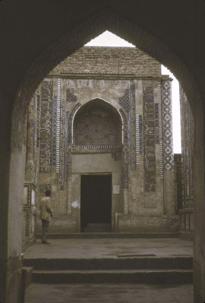
Georgians have been Christian since the 4th century CE. Their national church belongs to the Eastern Orthodox branch of Christianity but is autocephalous, owing obedience neither to Rome, Constantinople or Moscow. The Georgian ecclesiastical architecture is also sui generis. Some of the most important examples of this genre are found in the town of Mtskheta, about 20 kilometers northwest of Tbilisi, which was also the destination of our first excursion in the Tbilisi area.
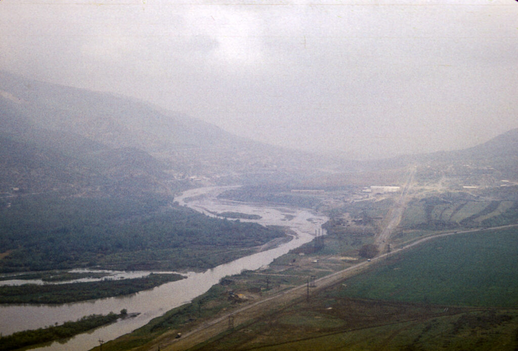
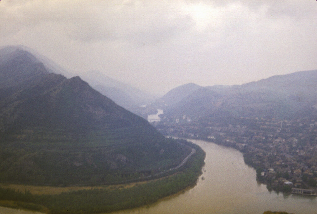
Mtskheta is a very old city; it was the capital of the early Georgian Kingdom of Iberia from the 3rd to the 5th centuries CE, and is still the site of the headquarters of the Georgian Orthodox Church. It lies at the confluence of the Mtkvari and Aragvi Rivers; from there the Mtkvari continues to flow eastward through the heart of Tbilisi.
The confluence of the Aragvi and Mtkvari Rivers at Mtskheta, Georgia
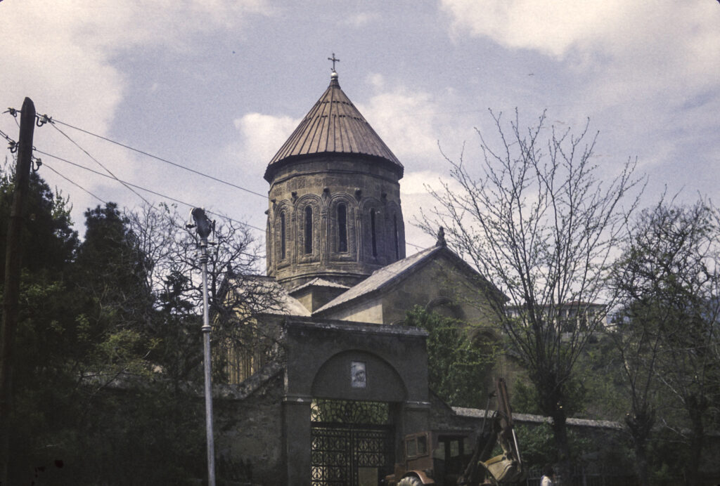
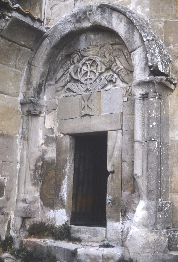
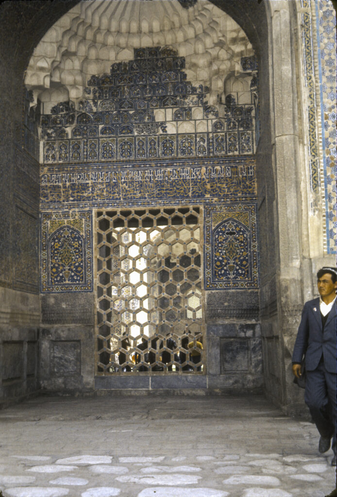
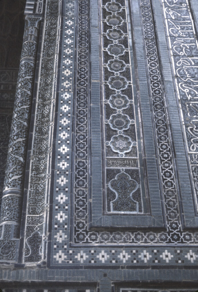
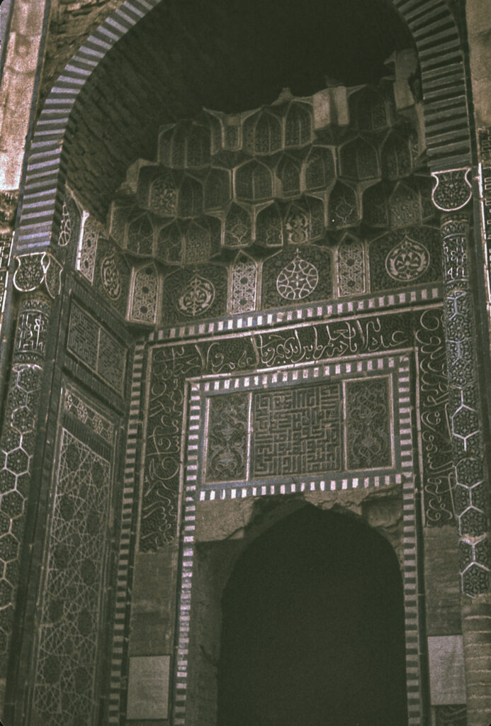
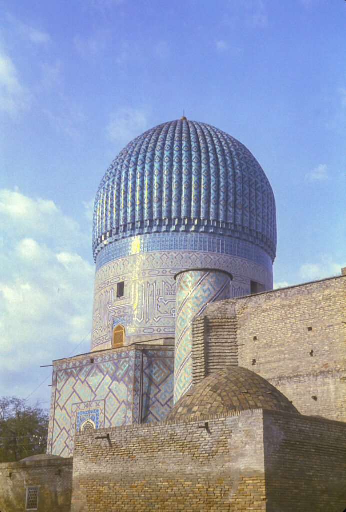
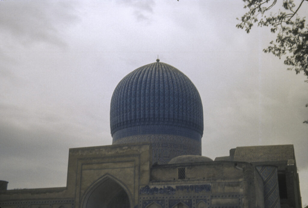
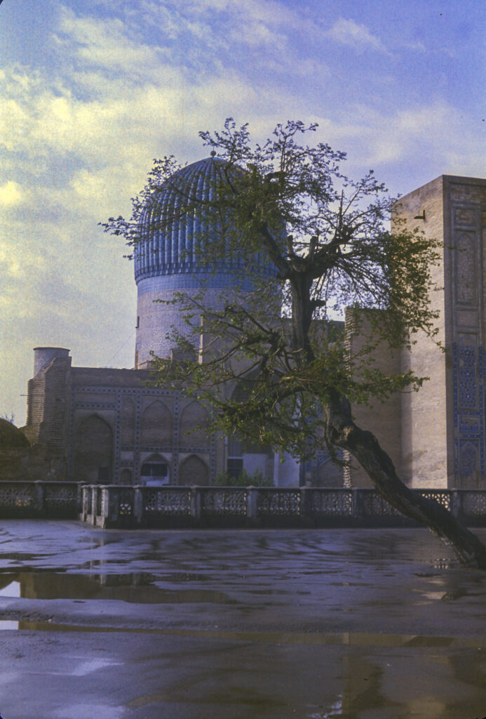
The crowning glory of Mtskheta is the 11th-century Svetitskhoveli Cathedral. The cathedral’s origins date back to the conversion of the Georgians to Christianity in 337 CE, when a wooden church was built on the site, followed by a stone basilica in the 5th century, and eventually by the current cathedral in the 11th century. The name Svetitskhoveli means “life-giving pillar” and is associated with a Georgian legend which holds that a Georgian Jew named Elias visited Jerusalem at the time of the Crucifixion of Christ, purchased the mantle of Jesus from a Roman soldier, and brought it back to Mtskheta. There he showed it to his sister Sidonia, who took it in her hands and immediately died from overexcitement. The mantle could not be extracted from her grasp and was buried with her; over her grave grew a great cedar tree. Many years later, it was decided to build a church on the site, the wood for which was to be acquired by cutting down the tree. However, the tree refused to fall and instead levitated into the air; when, following a full night of prayer, a local saint persuaded it to return to earth, it formed the first pillar of the new church. Its wood turned out to have magical properties, supposedly emitting a liquid that cured people of disease. The cathedral now contains a ciborium (freestanding canopy supported by columns), dating from the 17th century, under which the mantle of Jesus is supposed to have been buried along with Sidonia.
Svetitskhoveli Cathedral, Mtsekha – view from outside the gates
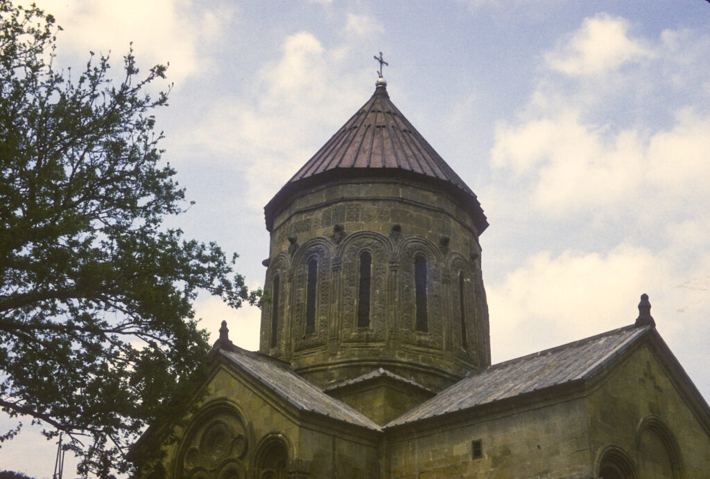
The current version of the cathedral was built between 1010 and 1029. It is constructed in the so-called cross-dome or cross-in-square style, which features a square central structure called a naos, topped by a dome, with rectangular extensions on the sides to form the overall shape of a cross. The cathedral has been damaged and restored several times since it was first built. It was destroyed by Tamerlane in the late 14th century and then reconstructed, with the present dome added, in the 15th.
Dome of the 11-century Svetitskhoveli Cathedral, southwest view
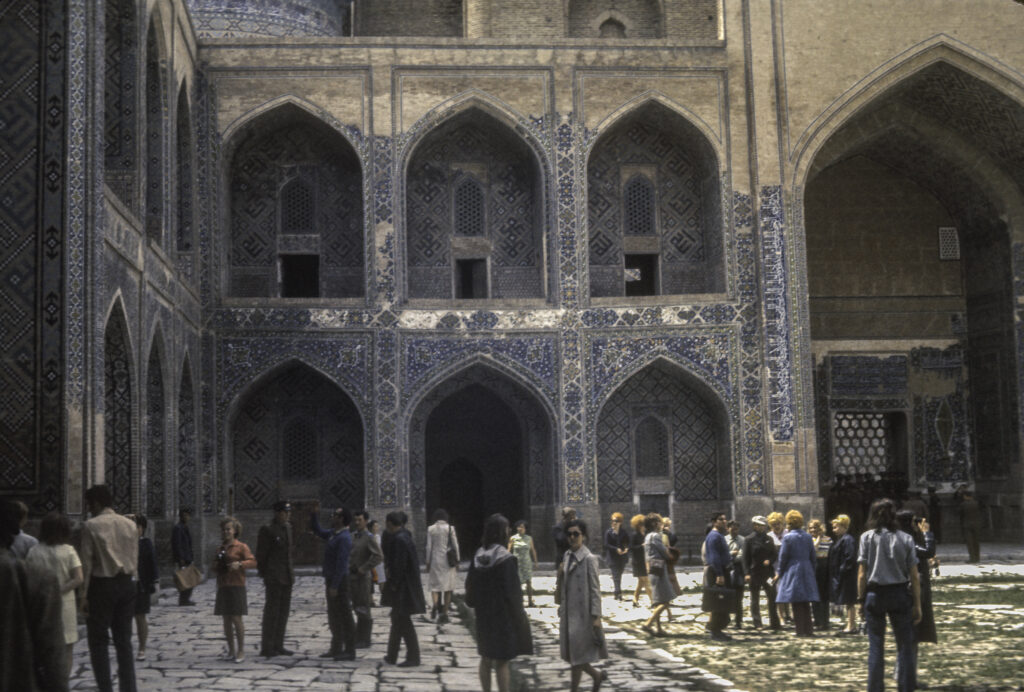
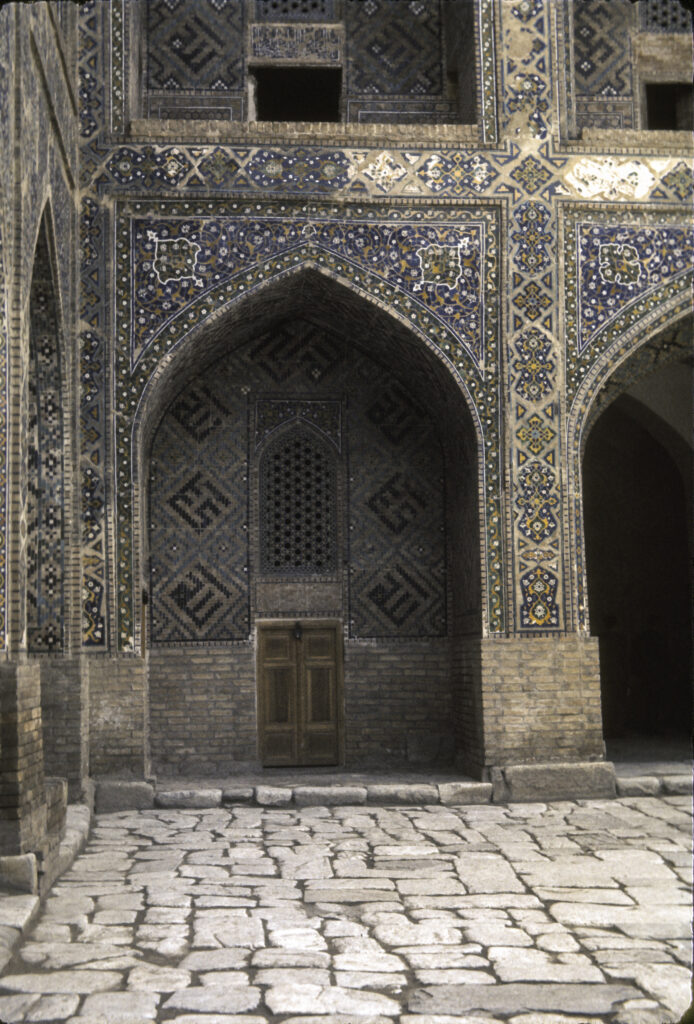
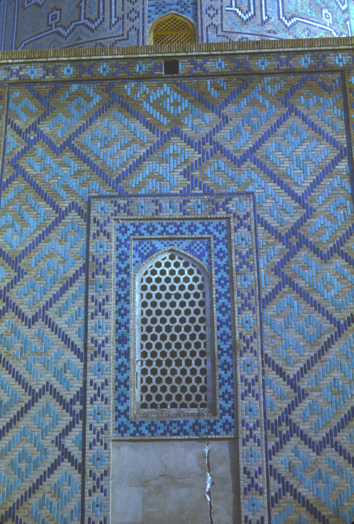
Svetitskhoveli Cathedral stands in the middle of a large courtyard, surrounded by walls built in the 18th century. Entrance to the courtyard is from the western wall.
IREX group and guides in the courtyard of Svetitskhoveli Cathedral
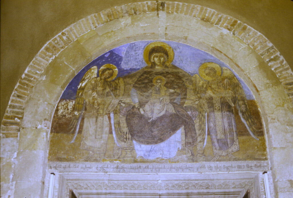
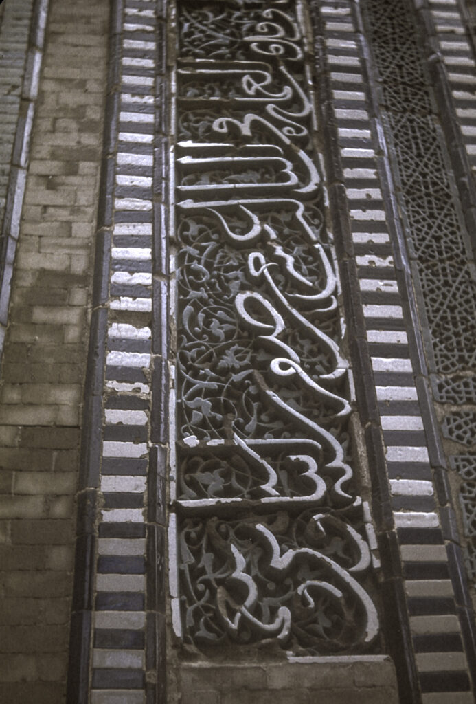
Entrance to the cathedral is also on the west. Originally there were portal galleries on the north and south sides as well. But in the 1830s, in anticipation of a scheduled visit by Emperor Nicholas I, the Russian authorities decided that the cathedral needed to be tidied up a bit and made to look more respectable; they chose to do so first by razing the portal galleries on the sides. They also thought it would be a good idea to improve the appearance of the interior walls by whitewashing them, thereby obliterating a number of priceless medieval frescoes. In the end the tsar’s visit was canceled. Fortunately, modern-day restorers have been able to recover some of the frescoes that were thus obscured.
Fresco above the main doorway at Svetitskhoveli Cathedral
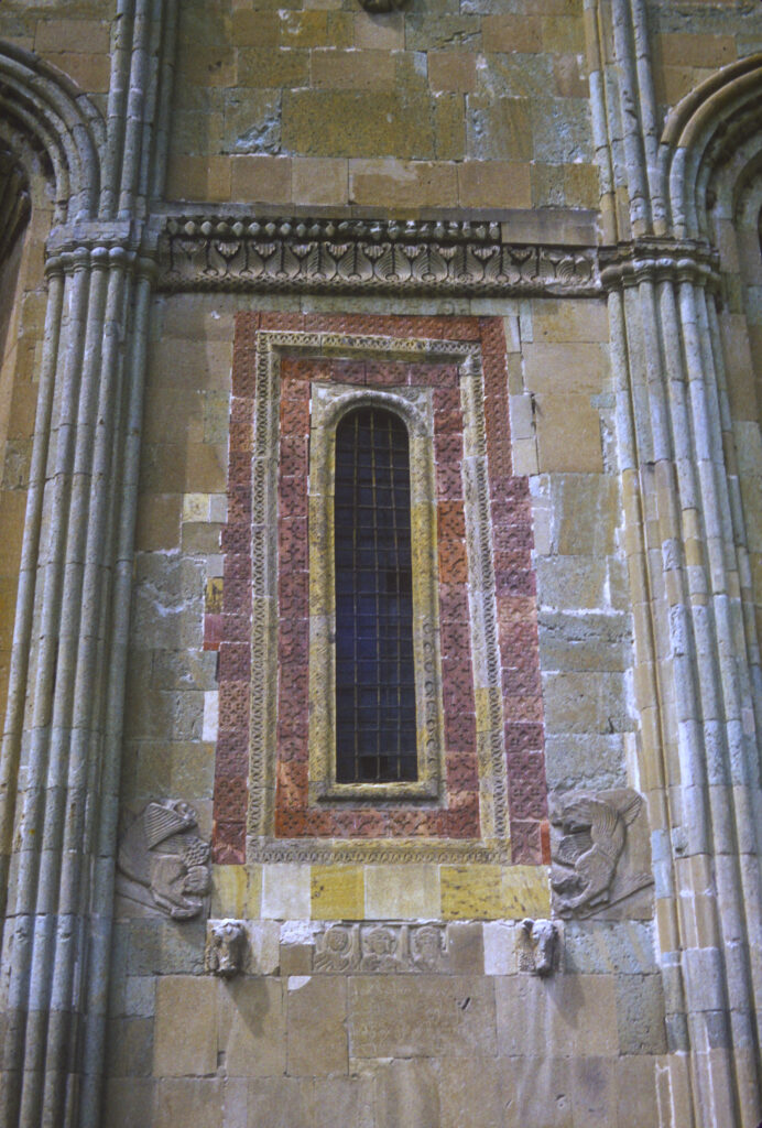
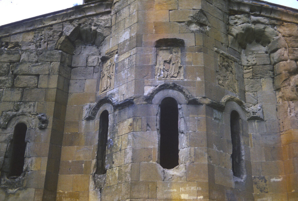
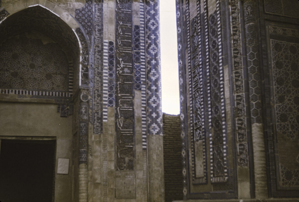
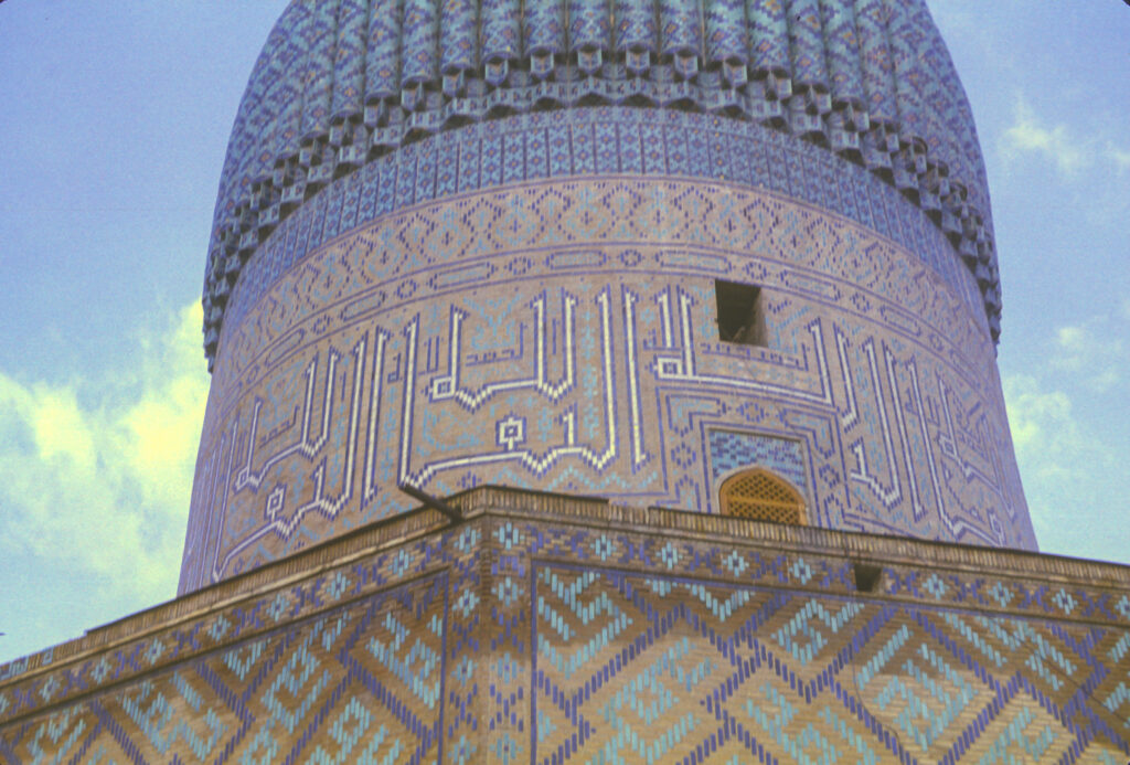
The eastern facade of the church features two high and deep niches on either side, with a window in the middle illuminating the apse, framed in red stone and surrounded by stylized decorations, including two bull’s heads beneath the window.
Svetitskhoveli Cathedral – lower part of the eastern facade, featuring the central window and its decorations
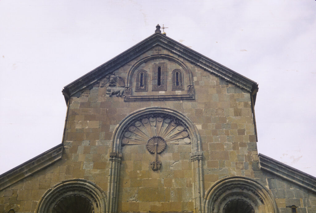
Above the window on the eastern facade is a decoration resembling a peacock’s tail; still higher, just beneath the roof, are three small windows, and to the left of those is a bas-relief decoration representing an eagle with spread wings hovering above a lion.
Svetitskhoveli Cathedral – the upper part of the eastern facade. The decoration to the left of the three windows near the roof is an eagle with spread wings hovering above a lion.
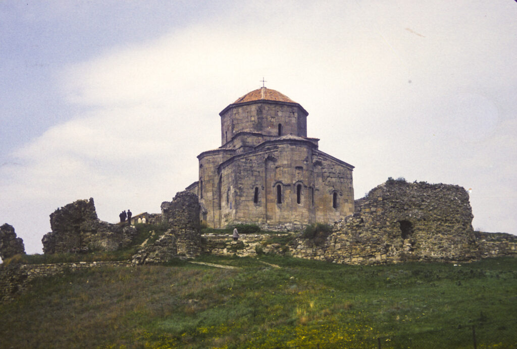
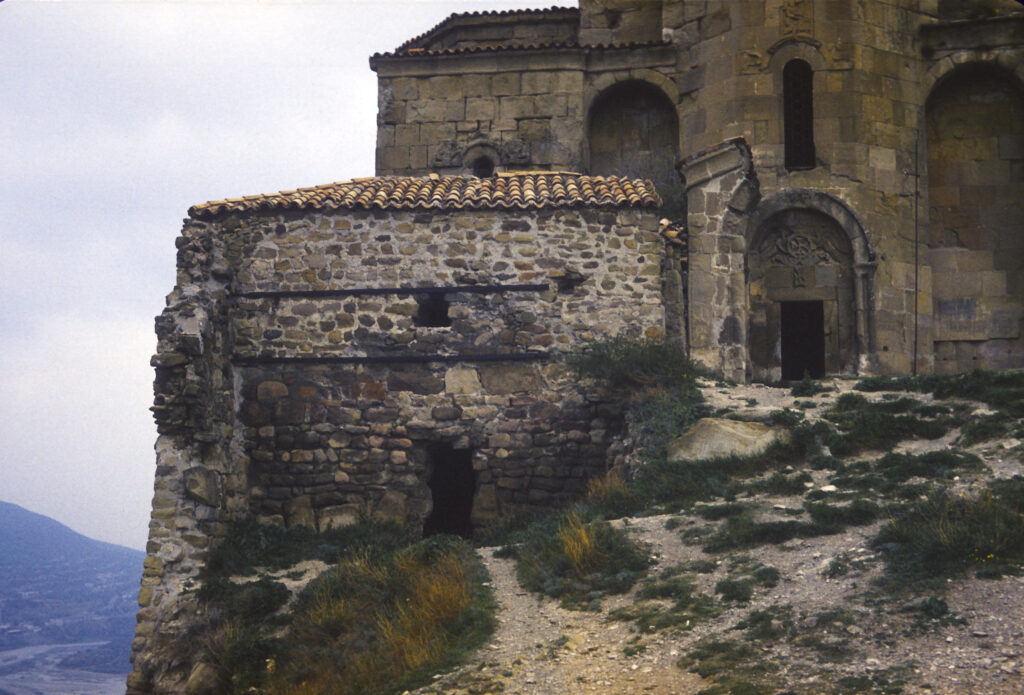
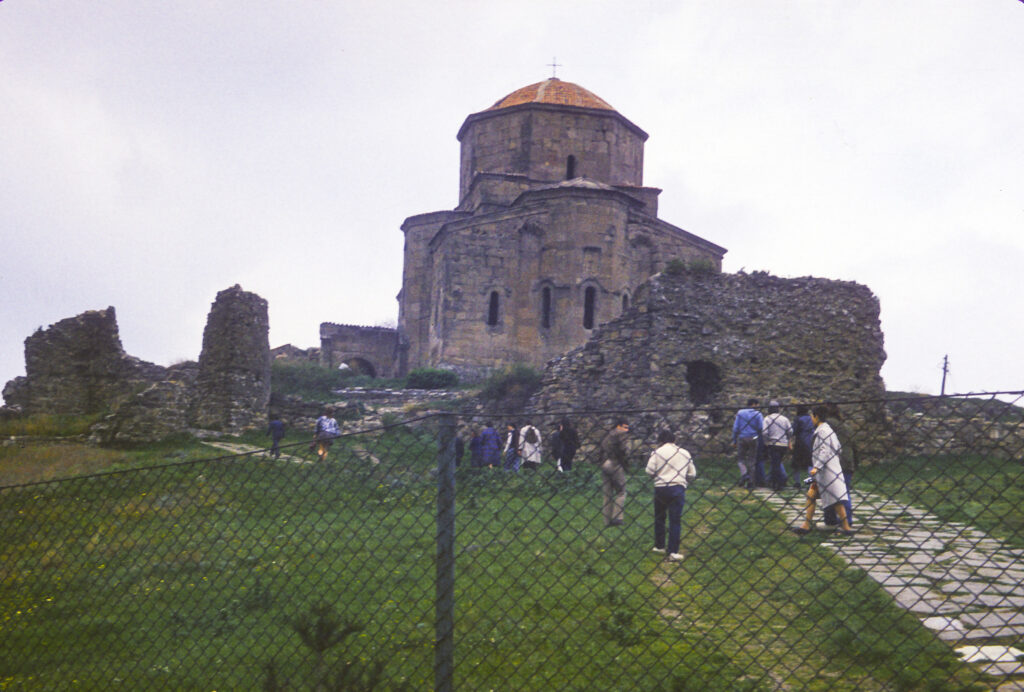
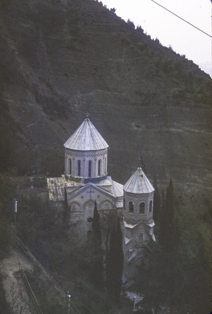
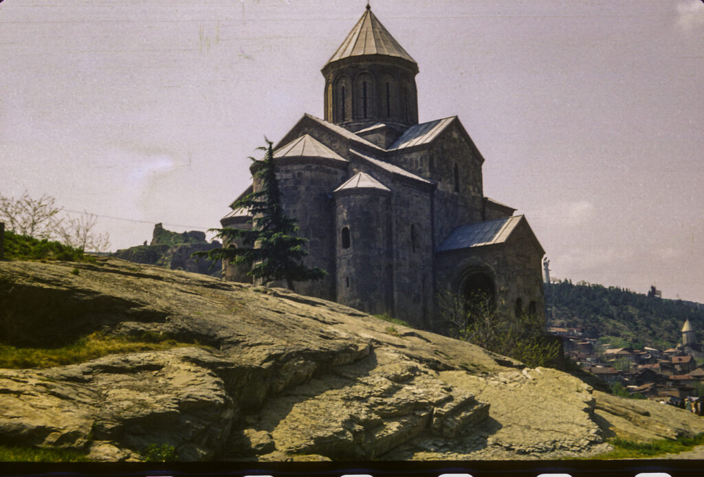
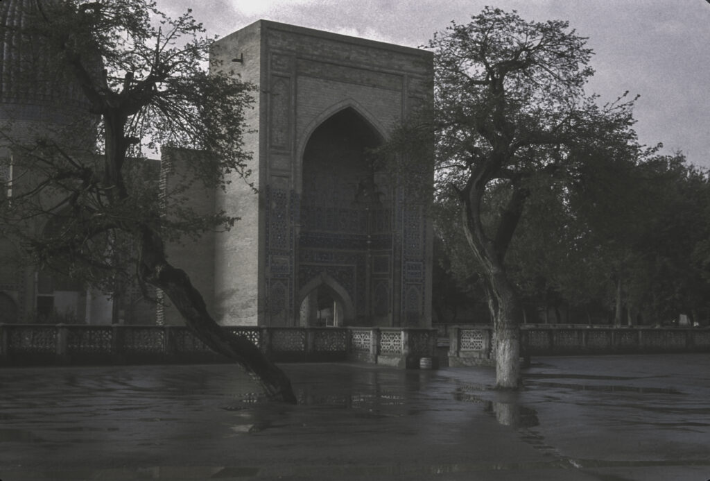
From Svetitskhoveli Cathedral we moved on to the spectacular Jvari Monastery, which stands on top of the mountain of the same name overlooking Mtskheta. The religious significance of this site dates from the early 4th century CE. Legend says that Saint Nino, a female evangelist credited with converting the King of Iberia to Christianity in 337 (and also the same saint who prayed to bring the cedar tree back to earth as described above), erected a miracle-working wooden cross there. The cross attracted pilgrims from all over the Caucasus, and eventually, in 545, a small church was built over it. Later, between 590 and 605, a larger church was built to accommodate a growing influx of pilgrims, and that became the “Great Church” of Jvari, pictured here.
Jvari – 6th Century Georgian monastery near Mtskheta, former capital of Iberia
The Great Church of Jvari monastery is perched on the edge of a cliff overlooking the confluence of the Mtkvari and Aragvi Rivers, with a dizzying drop down to the river below.
Jvari Monastery Great Church, view from the south
From its juncture with the Aragvi, the Mtkvari River continues to flow down through the middle of Tbilisi a few kilometers to the east.
View of the Mtkvari River from Jvari Monastery, Mtskheta, Georgia
The Great Church was built in a style known as “tetraconch” – from the Greek words for “four shells” – which is characterized by a cruciform plan with an apse at the end of each cross arm, and three-quarter cylindrical niches between the apses. (An apse is “a large semicircular or polygonal recess in a church, arched or with a domed roof, typically at the eastern end, and usually containing the altar.”)
Jvari Monastery, view from the east
The three-faceted apsis (projective enclosure) on the eastern facade is decorated with bas-reliefs depicting scenes of Georgian rulers consorting with Christ and the archangels.
Eastern facade of “Great Church” at Jvari Monastery, 6th Century CE.
Above the southern entrance to the Great Church is another bas-relief featuring two angels lifting a Bolnisi cross, known as the Ascension (or Glorification) of the Cross. The Bolnisi cross is a Georgian national symbol which traces its origin to the oldest surviving Georgian Orthodox church, Bolnisi Sioni Cathedral, built in the fifth century CE in the village of Bolnisi (which we did not visit). Unfortunately, it closely resembles variations of the cross used by medieval crusading orders, including the Teutonic Knights, which evolved into the Iron Cross used by the German military, with which the Bolnisi cross is often confused.
Ascension of the Cross, bas-relief above the southern entrance of the Great Church at the Jvari Monastery
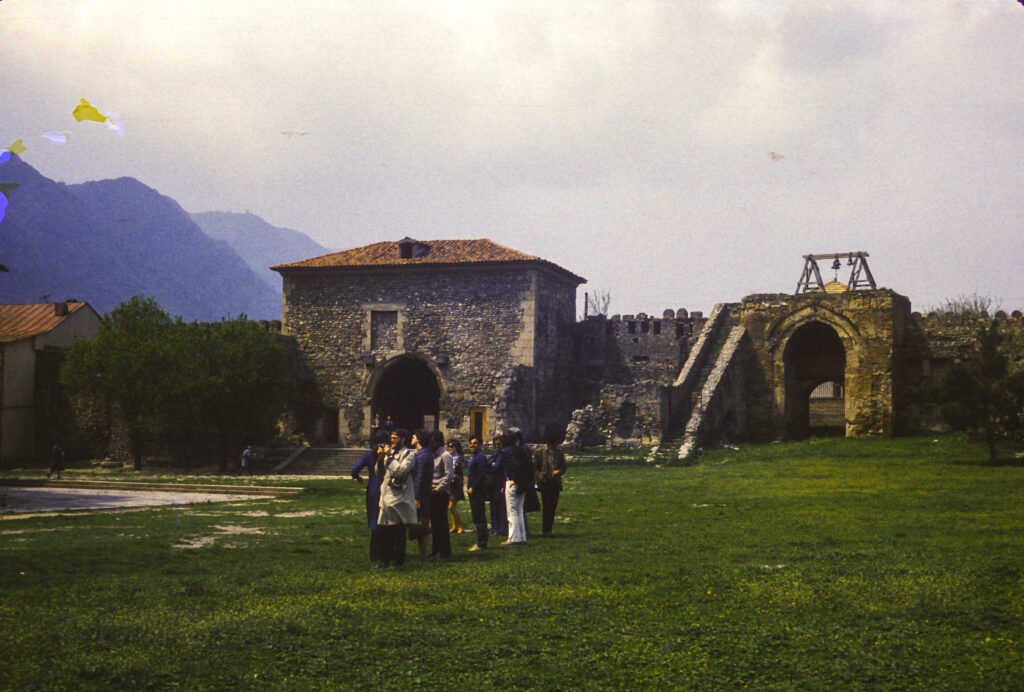
The monastery complex is surrounded by the ruins of walls and towers, as seen in the picture below. In 1973, at the time we visited, access to Jvari Monastery was supposedly severely restricted because of its proximity to a nearby Soviet military base, but it was a scheduled stop on our tour and we had no trouble getting permission to visit it.
Ruins of part of Jvari Monastery
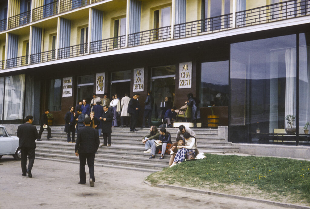
Our lodging in Tbilisi was a typical Soviet hotel, not exactly the Ritz-Carlton but better than some I’ve stayed in. After the breakup of the Soviet Union, it was abandoned for a while, but eventually it became a hostel for refugees fleeing the upheavals in the Caucasus.
The Hotel Abkhazeti, where we stayed in Tbilisi.
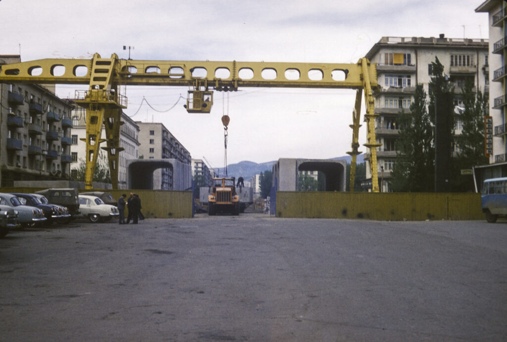
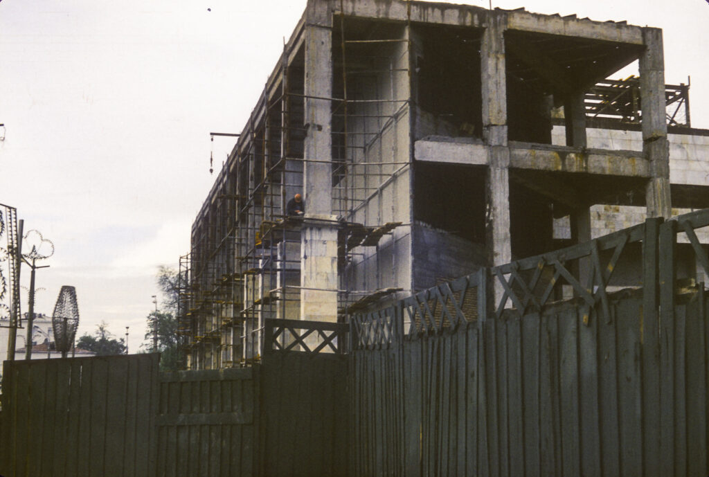
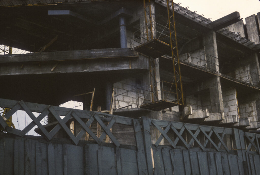
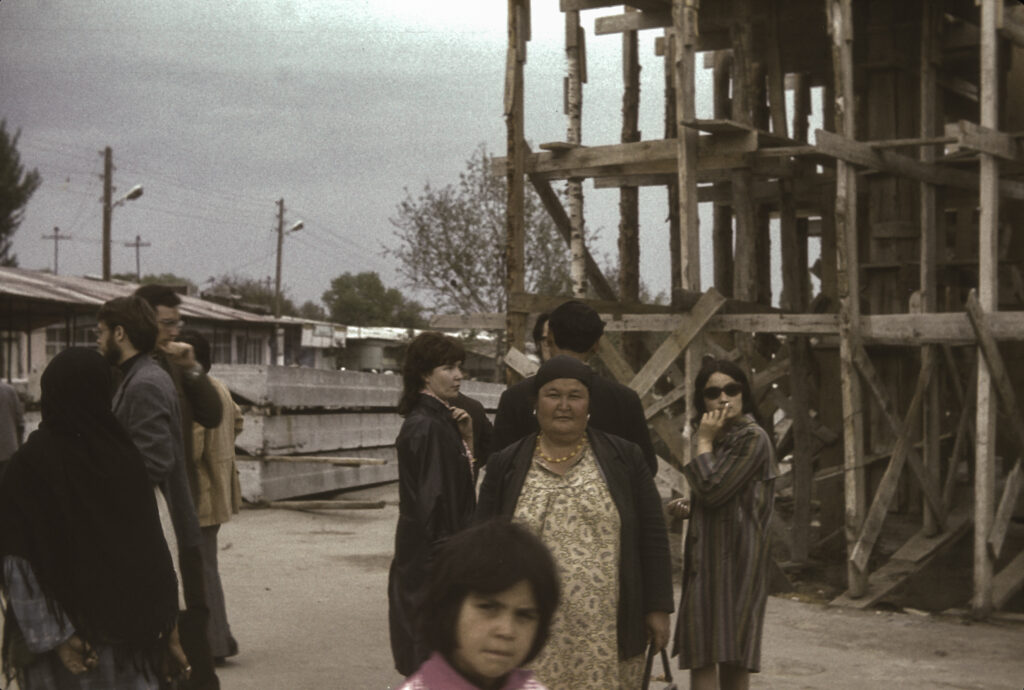
There appeared to be some major construction going on not far from our hotel. I never found out exactly what was being built; the concrete structures under the crane in the picture below look like sections of tunnels for subway cars, but if so they must have been replacements for parts of existing lines since the Tbilisi subway had been completed in 1966.
Construction in Tbilisi
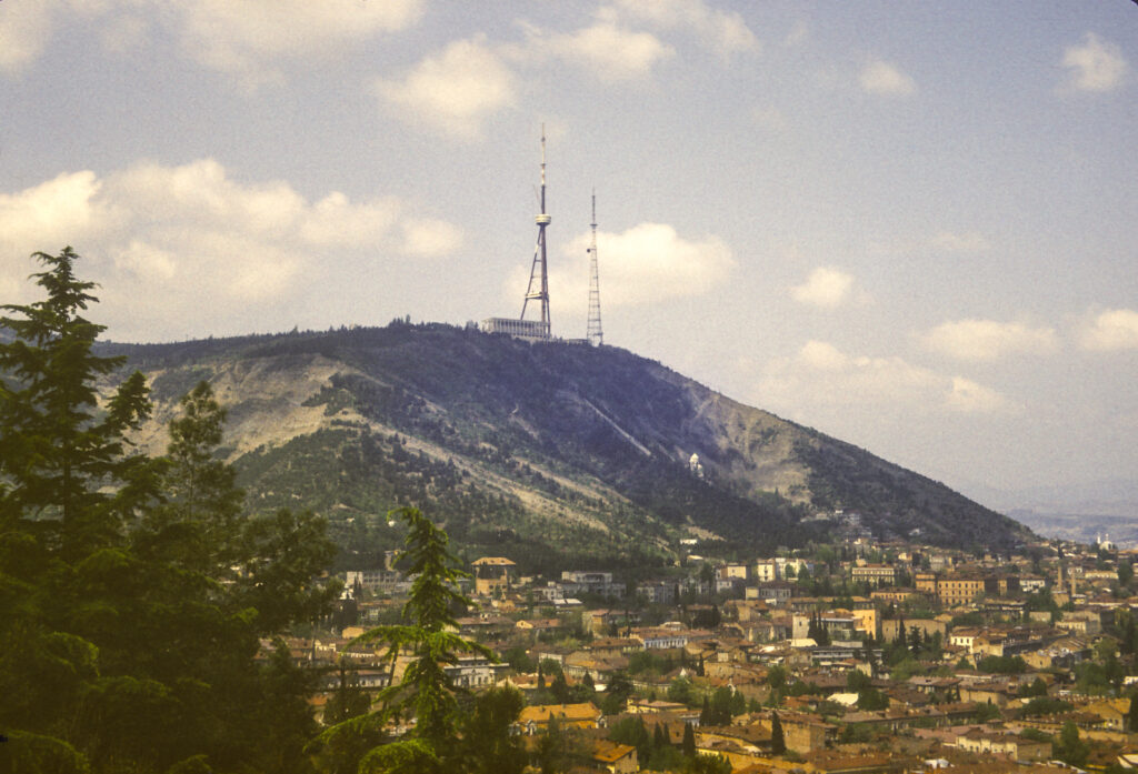
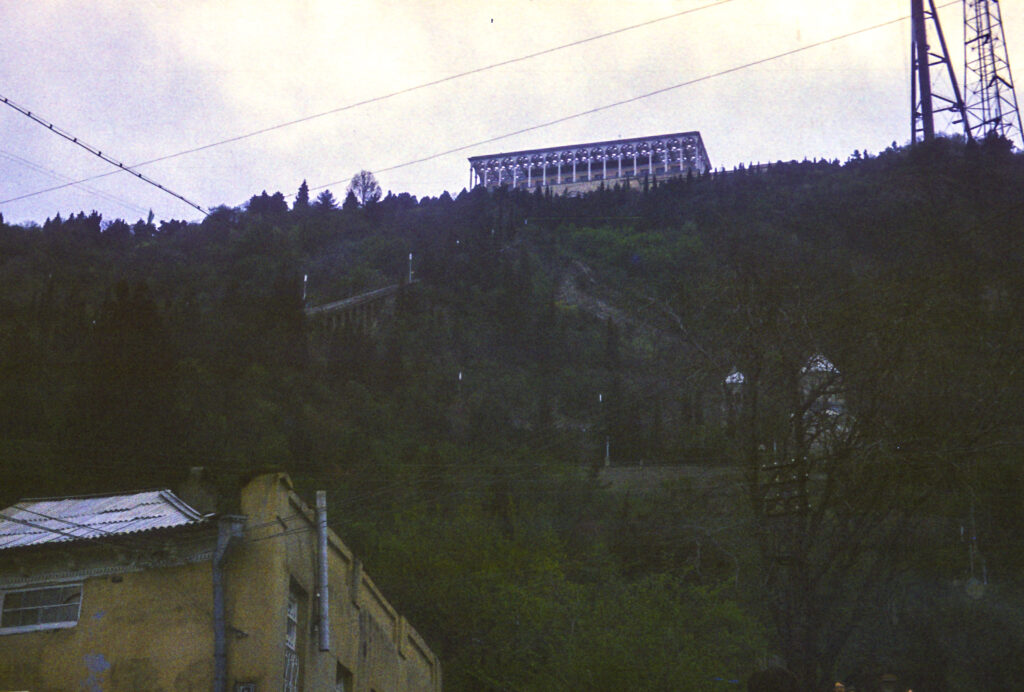
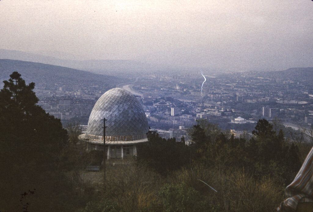
Georgia is a mountainous country, and Tbilisi is nestled amidst mountains. The highest point in the city is Mount Mtatsminda, at 770 meters (2526 feet). In 1930, the Soviet government established a park atop the mountain. TV towers and a restaurant pavilion were also built there.
A view of Mount Mtatsminda, from Narikala Fortress area to the southeast, with the restaurant pavilion at the base of the TV towers and the Mtatsminda Pantheon visible halfway down.
You might think that Tbilisi, being a very hilly city, would have a number of aerial tramways and cable cars. You would be right, and this was true while we were there. The top of Mount Mtatsminda can be reached both by road and by a funicular railway which has been in existence since 1905. There were also seven aerial tramways. One of them ran from Rustaveli Avenue to the top of Mount Mtatsminda. However, on June 1, 1990, there was an accident on that line which resulted in 20 deaths. The ultimate cause of the accident was never determined, but its lethality was the result of a failure to maintain the equipment properly, causing a malfunction of the brakes which would have stopped the cars if they had been working properly. The line was closed, and after the collapse of the Soviet Union, all the other aerial tramways, and the funicular railway as well, were shut down. In 2012 the funicular reopened, and eventually some of the aerial tramways as well. In 2017, construction began on a new aerial tramway line to the top of Mount Mtatsminda.
Looking up the slope toward the restaurant pavilion on the top of Mt. Mtatsminda
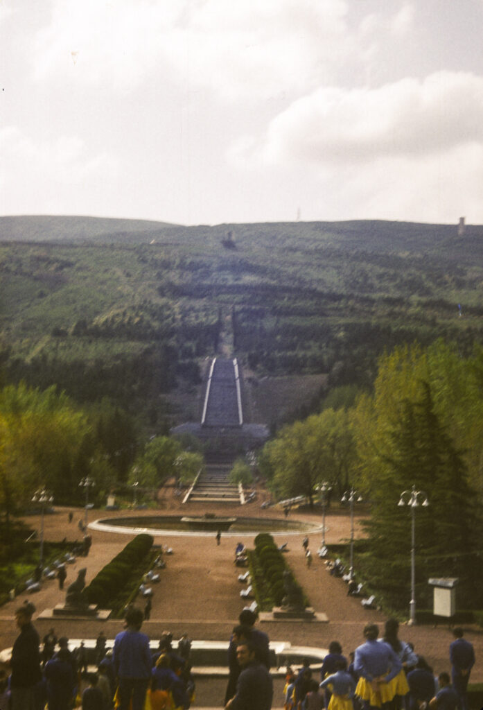
We rode the funicular railway up to the park. Halfway up there is a station where one can get off and walk to the Mtasminda Pantheon, a necropolis where a number of celebrities are buried, and which I’ll describe in more detail later.
Park and Funicular Railway
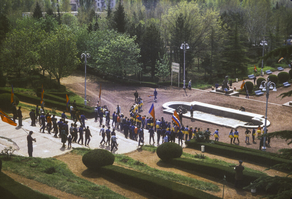
When we visited, the Mt. Mtatsminda park was just a quiet landscaped area where one could stroll amidst the trees, and the serenity was only occasionally interrupted by events such as the ceremony pictured here. But in recent years, since Georgia became independent again, the locale has been transformed into an amusement park, with carousels, water slides, a roller-coaster, dark ride, funicular, and a ferris wheel.
A public ceremony being held at Mount Mtatsminda Park
Up the hill from the restaurant pavilion we came across a flat, open area with a pedestal for a statue, but instead of a statue we found only a Georgian flag. It turned out that the pedestal had once been occupied by a statue of Joseph Stalin.
Park at the top of Mount Mtatsminda Park; now an amusement park with a giant ferris wheel. A statue of Stalin once stood on the pedestal.
As one might expect, Mtatsminda Park offers spectacular views over the city. Here is one to the north.
Looking from the summit of Mt. Mtatsminda to the north. I don’t know what the egg-shaped structure in the foreground contained, but my guess is that it was a radar dome constituting part of an aircraft control system.
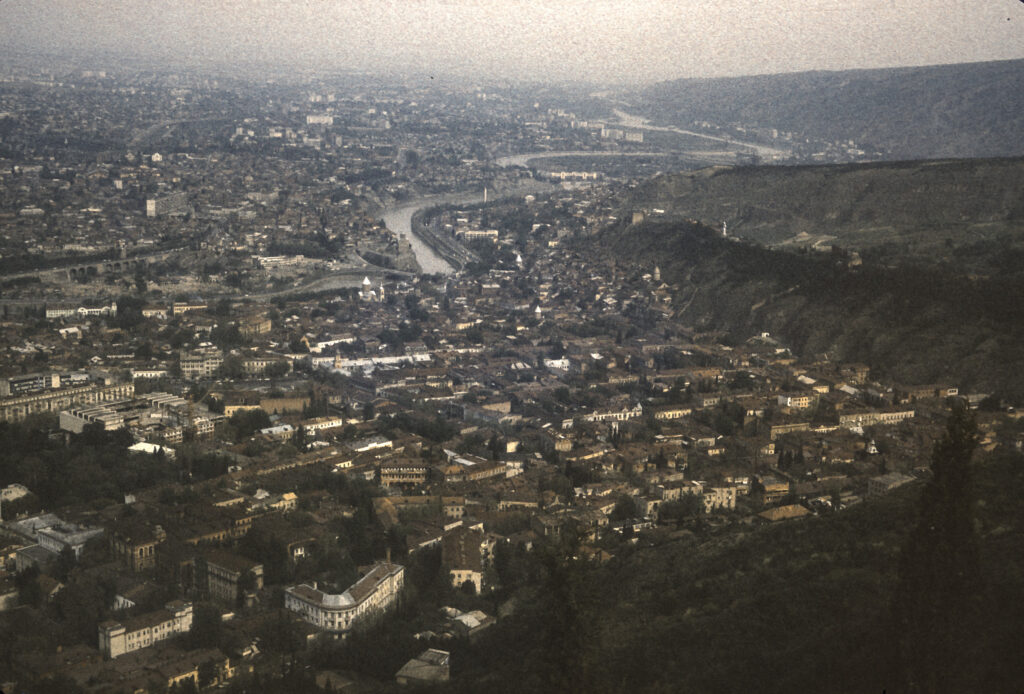
And here is a view to the south. I found, however, that some of my most interesting shots were to be taken from locations lower down, which provided better resolution and enabled me to more easily identify the points of interest.
View of Tbilisi from the summit of Mt. Mtatsminda to the south.
Taking a bus from the top of Mt. Mtatsminda, we rode down to the Pantheon halfway up the mountain. Debarking from the bus, I was able to admire and photograph some of the fine stonework which borders the winding road leading to the Pantheon.
The Mtatsminda necropolis is located in the churchyard around St. David’s Church, as seen in the following photo taken from Mtatsminda Park. Among the notables buried there are the Russian diplomat and playwright Alexander Griboedov. Chiefly remembered today for his play Gore ot Uma (Woe from Wit), in 1829 Griboedov was appointed Minister Plenipotentiary to Persia. Russia had just defeated Iran in the Russo-Persian War of 1826-28 and forced its Shah to sign a humiliating treaty; anti-Russian sentiment in Iran was strong. Shortly after arriving in Tehran, an incident arose in which several Armenian escapees from the royal harem – a eunuch and two women – sought sanctuary in the Russian Embassy. When the Shah demanded their return, Griboedov refused, on the grounds that the Treaty of Turkmenchai, which ended the recent war, Georgians and Armenians held against their will in Persia were to be repatriated to their homelands. The Iranian mullahs refused to acknowledge that this provision applied to women in Muslim harems, and stirred up a mob to storm the Russian embassy, slaughtering Griboedov and the rest of the legation. Griboedov’s body was mutilated and dragged through the streets. Eventually his remains were recovered and returned to Georgia, where he was buried. Also buried at the Mtatsminda Pantheon are Nino Chavchavadze, Griboedov’s wife, and other members of the Chavchavadze family; the first democratically elected president of Georgia, Zviad Gamsakhurdia; and various Georgian artists, scientists, scholars, and public figures.
St. David’s Church and Mtatsminda Pantheon as seen from Mtatsminda Park
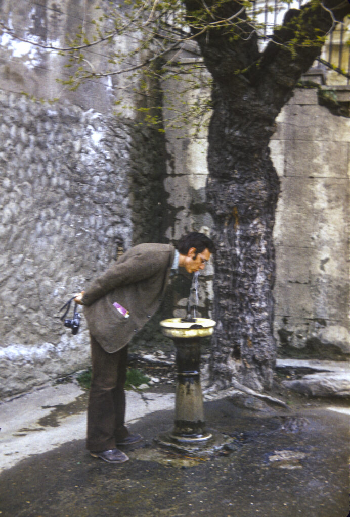
At the Pantheon I encountered the first, and to my recollection still the only, public drinking fountain I saw in the Soviet Union. Jerman Rose obligingly posed for me to take a picture of him drinking from it.
Jerman Rose takes a sip from the first public drinking fountain I encountered in the Soviet Union
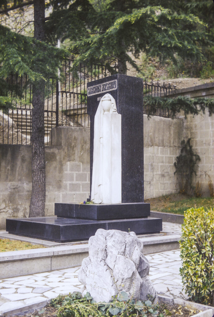
In one corner of the cemetery I came across a plain marble headstone, with an alabaster decoration, inscribed only in Georgian script. Here was interred one Ekaterina Geladze, the mother of Iosif Vissarionovich Jugashvili, better known as Joseph Stalin.
Grave of Ekaterina Geladze, mother of Iosif Vissarionovich Jugashvili, at Mtatsminda Pantheon Park
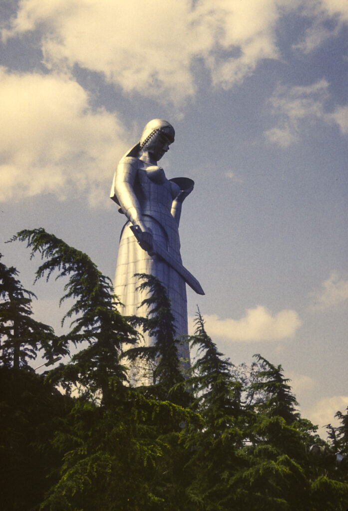
From Mount Mtatsminda, we took a road which runs eastward on a ridge to Sololaki Hill. To celebrate the 1500th anniversary of Tbilisi in 1958, the twenty-meter-tall (65 feet) Kartlis Deda statue was erected on the top of Sololaki Hill. Also known as Mother of Kartli or Mother Georgia, the statue depicts a woman holding a winecup and a sword—the winecup symbolizing the hospitality accorded to friendly visitors, the sword expressing the readiness to defend against enemies.
Kartlis Deda (Mother of Kartli) monument in Tbilisi
The Kartlis Deda site also provides a viewpoint offering some of Tbilisi’s most striking vistas. At the base of Sololaki hill are a pair of fine old churches, the Upper and Lower Bethlehem.
In foreground – Holy Mother of God Church of Bethlehem; down the hill at left is Church of St. Stepanos of the Holy Virgins (Lower Bethlehem Church).
Further to the north of the Kartlis Deda viewpoint, near the river, lie the Sioni Cathedral, the Norashen St. Virgin Mary’s Armenian Church and a church with the improbable name of Jvari’s Mama’s Church.
View to north (or NNE) of a Tbilisi residential district from Kartlis Deda viewpoint, with Sioni (Zion) Cathedral at upper right near river, Norashen St. Virgin Mary’s Armenian Church (back) and Jvari’s Mama’s Church (front) at left
To the northeast of Kartlis Deda one obtains a stunning view of the Mtkvari River, crossed by the Metekhi Bridge. Near the bridge, on the far bank, is the Metekhi Street Virgin Church, and on the near bank is the St. George Armenian Church. On the bridge stands a statue of King Vakhtang I Gorgasali of Iberia (c. 449-c. 522), traditionally recognized as the founder of Tbilisi.
View to ENE from Kartlis Deda View Point, featuring Metekhi Bridge, with Metekhi Street Virgin Church at right on far bank and St. George’s Armenian Cathedral on near side of river. Statue of King Vakhtang Gorgasali stands between bridge and Metekhi Church.
The Metekhi Street Virgin Church, properly the Metekhi Church of the Assumption, stands on an elevated cliff above the Mtkvari River. I was later able to photograph it from the northeast. It was originally built in the late thirteenth century, during the reign of King Demetrius II, and was damaged and restored several times thereafter. It was built in a style called cross-dome, with three projecting apses on the east side and four freestanding pillars supporting the dome. Stalin’s fellow Georgian and head of the NKVD Lavrenti Beria wanted to demolish it, but somehow it survived; it was used as a theater until the 1980s, when the Soviet regime acceded to popular demand and returned it to the control of the Georgian Patriarchate.
Metehki Church of the Assumption.
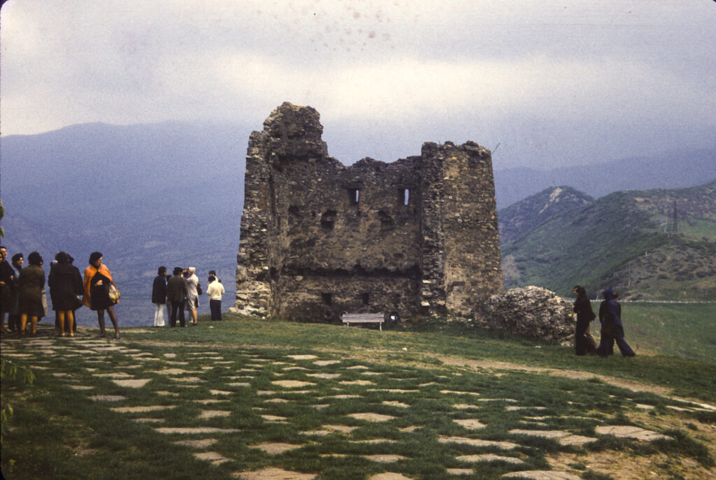
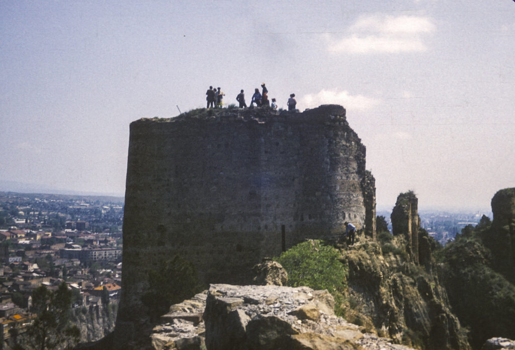
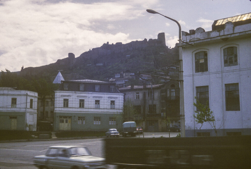
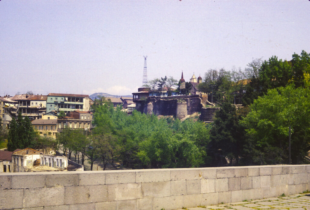
Continuing along the ridge from the Kartlis Deda statue, we arrived at the Narikala Fortress. Originally built in the 4th century by the Sassanian Persians, the fortress was expanded and rebuilt over the years, most recently in the 16th and 17th centuries; but an earthquake in 1827 damaged it badly, and it fell into ruin.
Narikala Fortress, originally built in the the 4th century AD; current fortifications date from 16th-17th centuries; damaged by earthquake in 1827
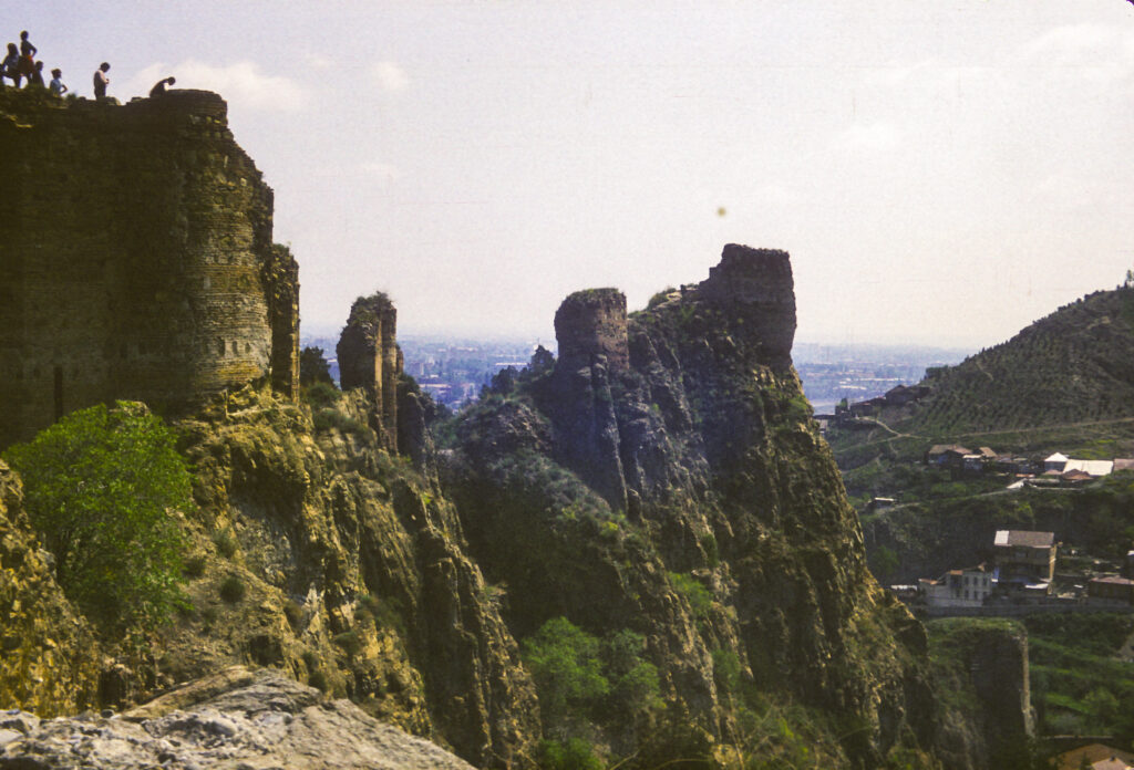
Another section of Narikala Fortress
The Narikala Fortress is another great location for capturing panoramic views of the city.
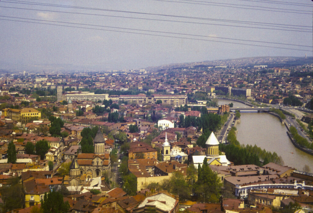
Looking upriver from the Narikala Fortress – Sioni Cathedral and Tbilisi History Museum in lower right corner; lower left of center, Norashen St. Virgin Mary’s Armenian Church (back) and Jvari’s Mama’s Church (front) at left; Baratashvili Bridge center-right
We had plenty of free time in Tbilisi to stroll the streets and wander on our own. Except for the churches, which somehow have survived the vicissitudes of the ages, most of the construction in Tbilisi dates from no earlier than the nineteenth century. Prior to that time, for several centuries Georgia had been carved up between the Ottoman Empire and Persia, with the western part subject to the Turkish sultans, and the eastern areas vassals of the Persian shah. In 1783, however, Erekle II, ruler of the eastern Georgian kingdom of Kartli-Kakheti, hoping to improve the security of his domain by finding a more reliable protector, signed the Treaty of Georgievsk with Empress Catherine II of Russia, which made his kingdom a protectorate of the Russian Empire. Unfortunately this move backfired, provoking a Persian invasion, the destruction of Tbilisi and the massacre of its inhabitants, which the Russians failed to prevent, in 1795. In 1800 Catherine’s successor, Tsar Paul, proclaimed the outright annexation of Kartli-Kakheti to the Russian Empire, deposing the king. Under Tsar Alexander I the Russians secured their control of Georgia by defeating the Persians and forcing them to acknowledge Russian hegemony in Georgia by the Treaty of Gulistan in 1813. Alexander I also began the incorporation of Western Georgia into the Russian Empire, a process which was completed during the Russo-Turkish wars of the 19th century.
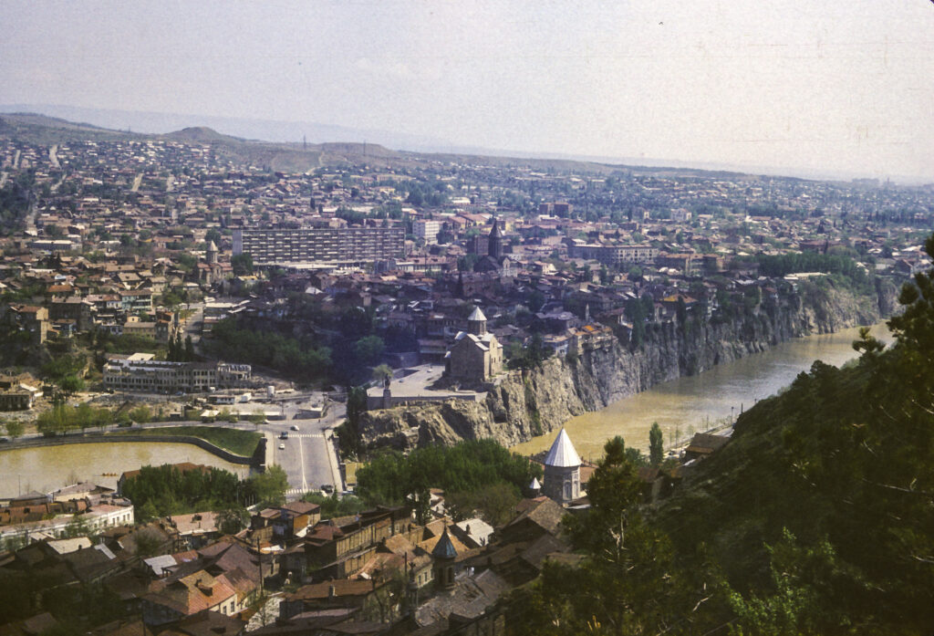
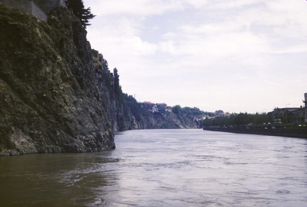
The Mtkvari River flows through the middle of Tbilisi.
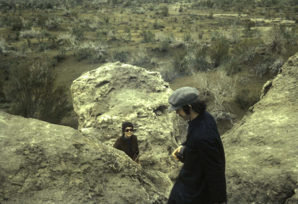
The Mtkvari River is very scenic and provided many vantage points for beautiful photos, but it seemed that wherever we went there was this slovenly, disreputable character, perhaps a terrorist, who kept popping up and insinuating himself into my pictures. Somehow we could never get rid of him.
This disheveled ruffian kept popping up everywhere we went. Here he is on the banks of the Mtkvari River in Tbilisi.
The advent of Russian rule, though heavy-handed and insensitive, provided the peace and security which enabled the rebuilding of Tbilisi to proceed unhindered, and the Russian authorities placed their stamp on the city by devising a new city plan and commissioning new buildings in Western styles.
Interesting facade with bas-relief and baroque carving above doorway. Sadly, the light globe on the right of the doorway is broken or missing.
Whimsically decorated building facade with Tritons supporting the balcony above the entrance transom.
An elegant portico with intricate ironwork fringes fronting an entrance to a building in Tbilisi
Finely wrought iron fences and gates, elegant stonework and elaborately decorated lampposts were another legacy of 19th century Imperial Russian rule
I remember being impressed by the apparent modernity and prosperity of Tbilisi, and the general European appearance, in contrast to many of the towns we had visited in Russia itself. Also, there seemed to be many foreign cars – Mercedes, Volvo, even a few American cars – on the streets.
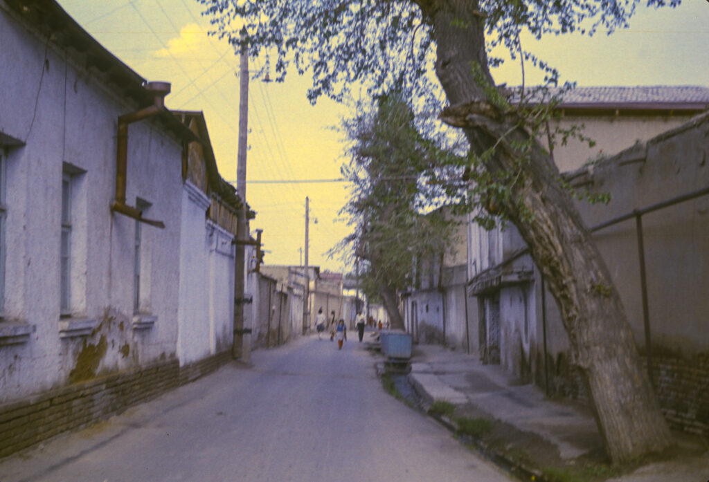
Residential district of Tbilisi, with Narikala Fortress on hill in background
Except for the scheduled tours, for which buses were furnished, we did our sightseeing via public transportation. On one occasion, several of us took a bus to the downtown area, and when we got off, I discovered that my wallet was missing. I immediately realized that someone on the bus had picked my pocket. This was was not a hazard exclusive to Tbilisi; in Moscow my first roommate, Ariel, had once had his pocket picked on a subway escalator by a man who had bumped into him pretending to be a drunk. I reported the theft to the guides, though of course I knew that nobody would be able to do anything about it. They were quite apologetic about the incident, but we all had a good laugh when I told them that the stolen wallet, which I had kept in my pants pocket, contained nothing more than seven rubles and an expired California driver’s license. I kept my passport and most of my cash in another wallet, much more securely concealed.
Many buildings in Tbilisi are built on the edge of precipices and are vulnerable to earthquakes
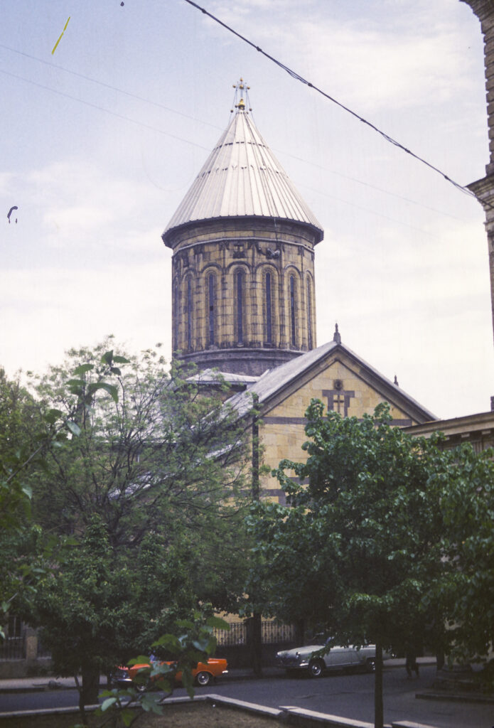
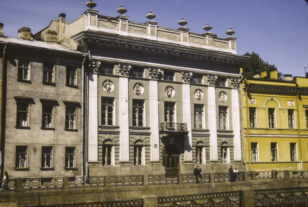
The major legacy of Georgian architecture surviving from before the 19th century are the many Georgian and Armenian churches (historically many of the inhabitants of Tbilisi have been Armenian). The Sioni (Zion) Cathedral in downtown Tbilisi is an outstanding example. Its basic elements date from the 12th century, but it was destroyed and rebuilt many times since then. At the time of our visit, the Sioni Cathedral was the seat of the Catholicos-Patriarch of all Georgia, and remained so until 2004, when it was replaced by the newly built Holy Trinity (Sameba) Cathedral in the Avlobari district on the other side of the Mtkvari River.
Tbilisi Sioni (Zion) Cathedral – the main Georgian Orthodox cathedral and seat of Catholicos-Patriarch of All Georgia until 2004.
On April 12, 1802, the Russian Commander-in-Chief in the Caucsasus, General Karl von Knorring, assembled the nobles in the Sioni Cathedral and read to them the proclamation of the annexation of Kartli-Kakheti to the Russian Empire. He also required them to take an oath of allegiance to the Empire, enforcing it by having the soldiers which he had previously disposed around the cathedral arrest those who refused.
Slovenly terrorist lurking on bank of Mtkvari River, with Metekhi Bridge, Metekhi Church and the statue of Vakhtang I Gorgasali in the background. We just couldn’t get rid of him.
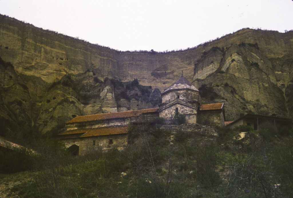
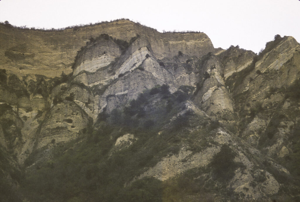
On the last day of our stay in Georgia, our hosts took us to the cave monastery site of Vardzia. The caves were carved in the cliffs of Mount Erusheti, on the south bank of the Mtkvari River over 200 kilometers west of Tbilisi. Although cave settlements have existed there for thousands of years, it was only in the twelfth century CE that large-scale development of the site began. Most of the work was done in the 12th and 13th centuries, during the “Golden Age” of Georgia under Queen Tamar. A severe earthquake in 1283 devastated Vardzia, and though it was partially rebuilt, further development was at an end. With the decline and fragmentation of Georgia in the 14th and 15th centuries, along with ruinous foreign invasions, Vardzia fell into decline. In the 16th century, after the division of Georgia by the Ottoman Turks and the Safavid Persians, with the eastern areas going to the Persians and the western parts, including Vardzia, to the Ottomans, Vardzia was abandoned.
Upon our arrival at Vardzia, we found this pleasant park with a huge old oak tree and a wayside shrine.
Our tour bus brought us to a pleasant park setting, presided over by a stone church nestled under the cliffs towering nearby.
Monastery church at Vardzia
Whatever notes I took at the time have not survived, and I don’t remember the name of the church or anything else about it, such as when it was built. I think it must have been of relatively recent construction. The main church at Vardzia is the Church of the Dormition, which is carved out of the rock at the foot of the mountain, but it was not open to the public at that time.
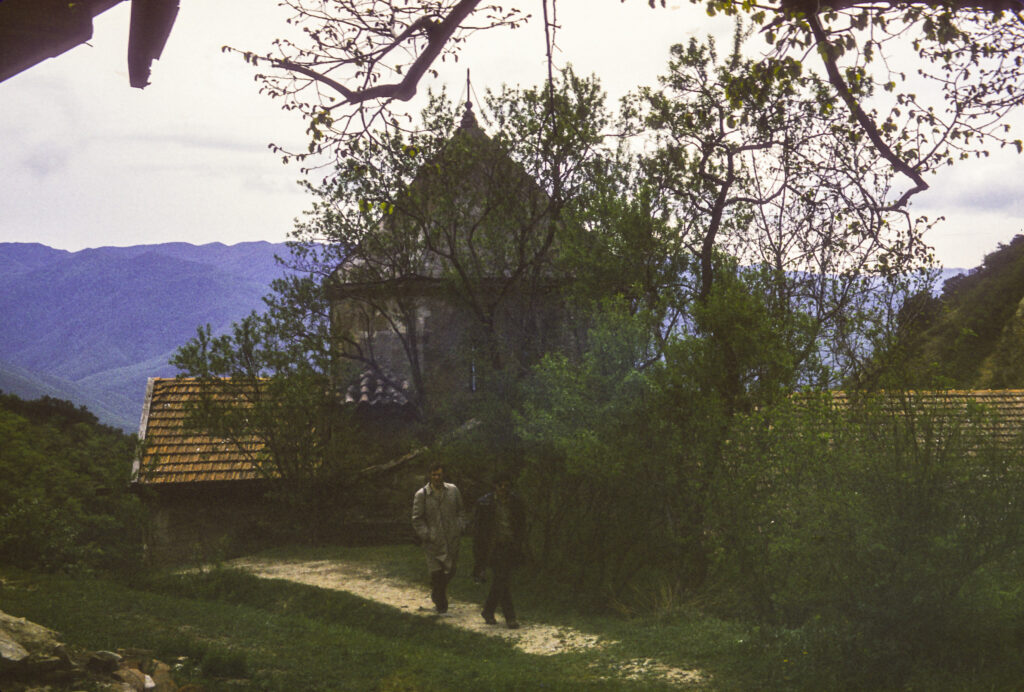
Starting from the church, we explored the approaches to the monastery caves
From the church, we proceeded up a path to the foot of the cliffs, where we were able to get a closer view of the caves in which the monks had lived.
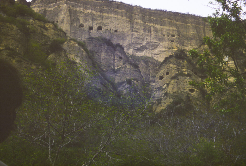
Part of the cliff wall containing the monastery caves of Vardzia
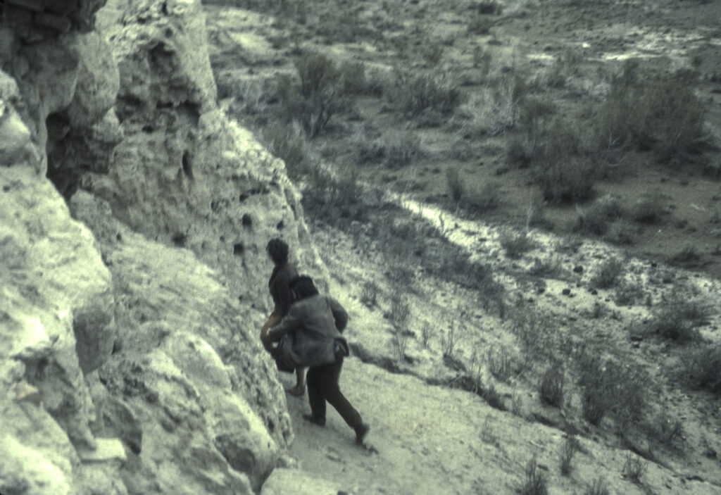
Some members of the group even tried to climb up to the caves themselves, but I don’t think any of them actually made it that far.
Some of the more intrepid members of the American IREX group scale the cliffs of Vardzia
View of the monastery church from the mountainside above
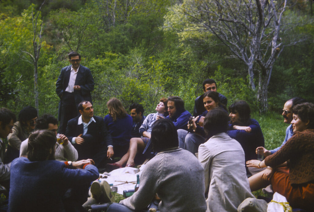
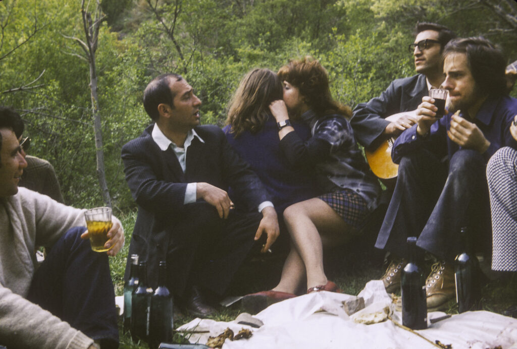
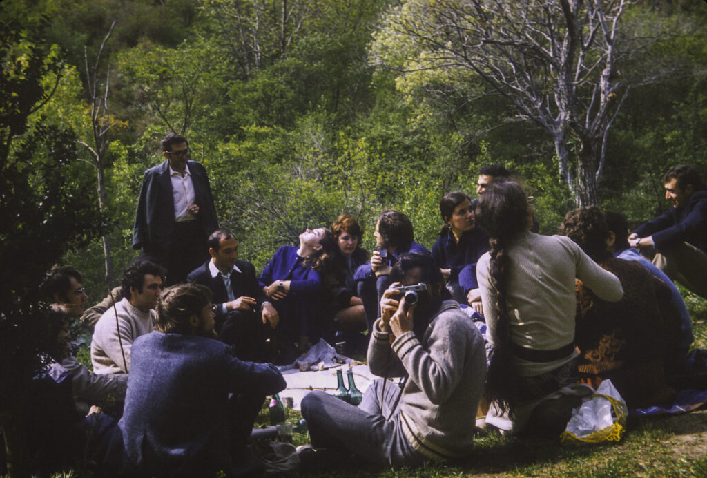
After we tired ourselves out hiking round the site and taking pictures, our Georgian guides lit a fire and prepared a barbecue for us, which served as our farewell dinner. They had brought abundant supplies of pork, beef and lamb, which they cut up into kebabs and roasted over the fire. In the Caucasus, shishkebab is known as shashlik, and this usage has spread to Russia as well, where kebab restaurants are known as shashlichnye. Our hosts had also brought abundant supplies of Georgian wine, and we feasted and toasted our hosts until nightfall.
Georgian guides and American IREX exchange scholars enjoy a picnic in the Vardzia cave monastery reserve.
Our Georgian guides hosted a barbecue with grilled beef, lamb and pork near the church
Georgian guides in the center, Americans on the sides; Mel Nathanson at left, Bob Drumm at right, sipping on wine provided by our hosts.
Chris Buck takes a picture of me while I take a picture of the group at Vardzia
A mountainside full of cave retreats where monks lived
Another section of the cliff wall containing monastery caves at Vardzia
The next day we boarded a TU-104 twin-engined jet for Moscow. This was our second flight on a TU-104; we had also flown on one from Tashkent to Tbilisi. I don’t remember much about the first flight, but I do remember the second. The Tbilisi airport is distinguished by a takeoff runway with a sharp drop-off, in fact a high cliff, at the end, so if the aircraft hasn’t reached takeoff speed by the time it reaches the end of the runway, the results can be unpleasant. The TU-104 was the world’s second passenger jet aircraft to enter service, after the British Comet in the early 1950s – not an auspicious precedent since the Comet was taken out of service following several disastrous crashes which resulted from design defects. The TU-104 also had its problems. It was unreliable, unstable, control response was poor, and it had a tendency to stall at low speeds. This last shortcoming caused pilots to make their landing approaches at higher than recommended speeds, with attendant risks. One person I knew had been on a TU-104 flight to Kiev, where the aircraft came in too fast, overshot its touchdown point and ended up a couple hundred feet beyond the end of the runway in a swamp. Our flight from Tbilisi was relatively sedate, but I do remember that when taking off the aircraft seemed to take forever to get up to takeoff speed, and I wondered whether we were going to fall off the end of the runway before we became airborne. The plane did dip a little when the runway ended, but did not stall, and off we went to Moscow. On the plane I sat next to my Moscow roommate, Chris Buck. On our approach to Moscow, the crew turned off the cabin pressurization at 15,000 feet. The drop in pressure causes Chris’s sinuses, which had been giving him trouble, to explode, and I was alarmed to see him suddenly doubled over in agony. Fortunately this didn’t last long; the pressure shortly equalized and by the time we landed he was more or less back to normal.
Later I learned a little verse that Russians sang about the TU-104: TU-sto-chetyre luchshe v mire samelyot, Skazal, vylezaya, obuglennyi pilot. “The TU-014 is the best airplane in the world, said the charred pilot as he crawled out [of the burned cockpit].” The TU-104 was retired from service in 1979.
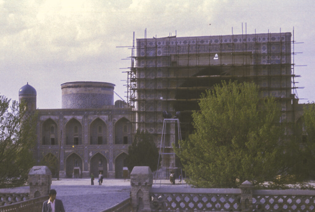
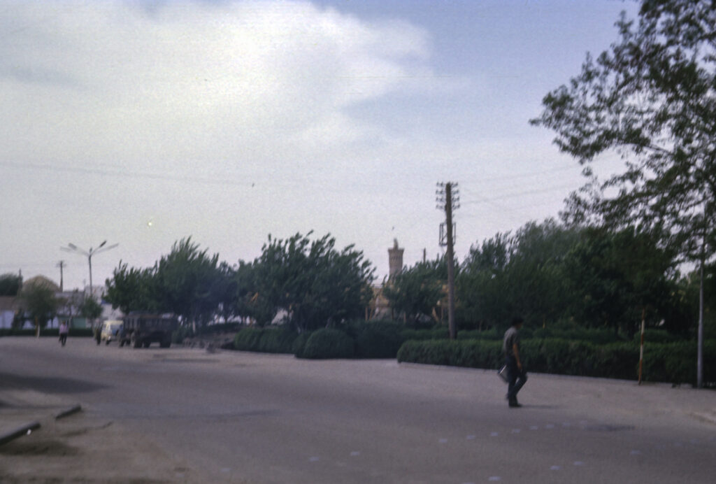
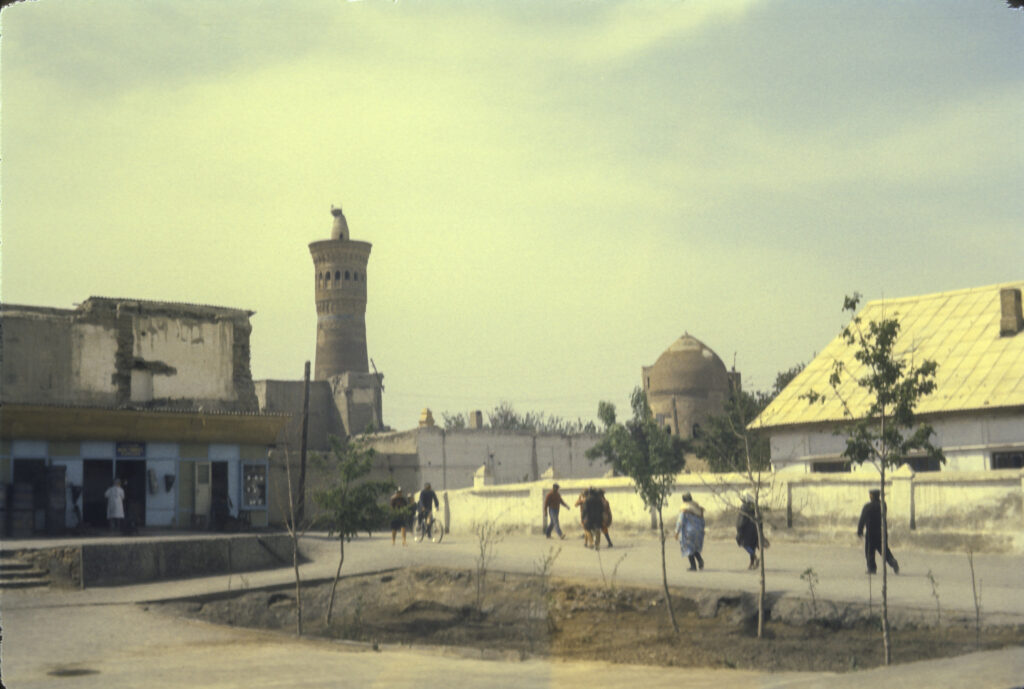
Our final stop in Central Asia was Tashkent, the capital and largest city of Uzbekistan. After the glories of Bukhara and Samarkand, Tashkent was a letdown. Like the other two cities we had visited, it was a major stop on the Silk Route, but little was left of its pre-Soviet heritage. A powerful earthquake in 1966 had leveled most of the old city, and it had been rebuilt as a “model Soviet city,” i.e. lackluster and boring. Thus there was little of historical interest to see. Nevertheless, we found plenty to do there.
I can’t remember the name of our hotel, and there was nothing much else memorable about it either, but at least it was a real hotel, with basic amenities like bathrooms.
The hotel where we stayed in Tashkent
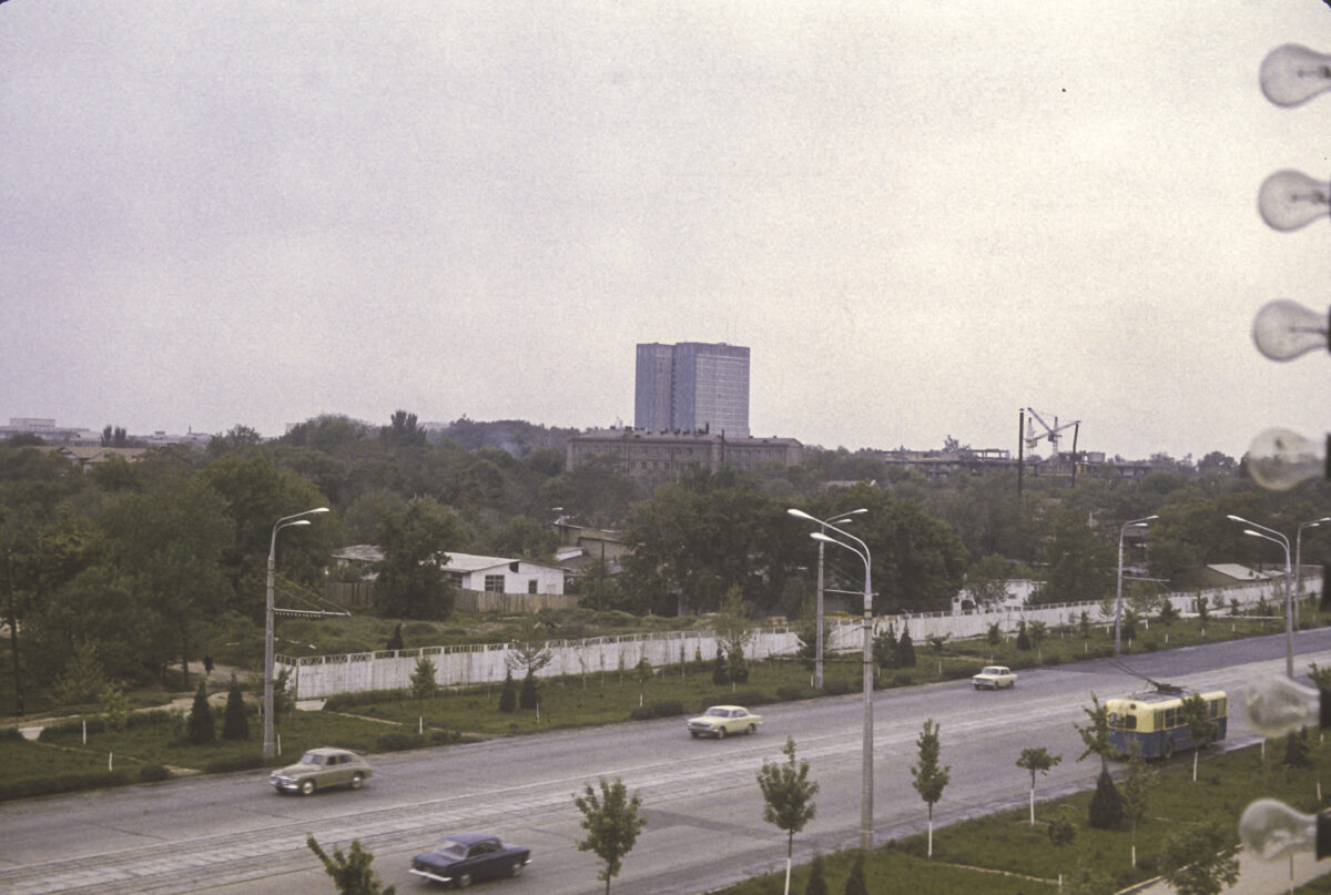
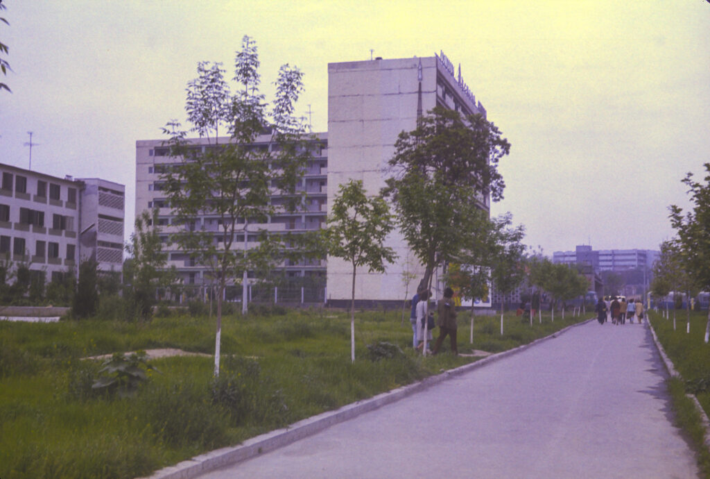
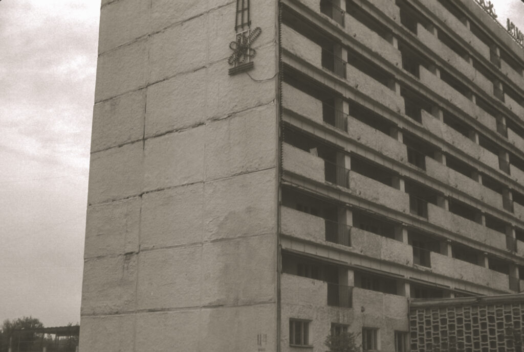
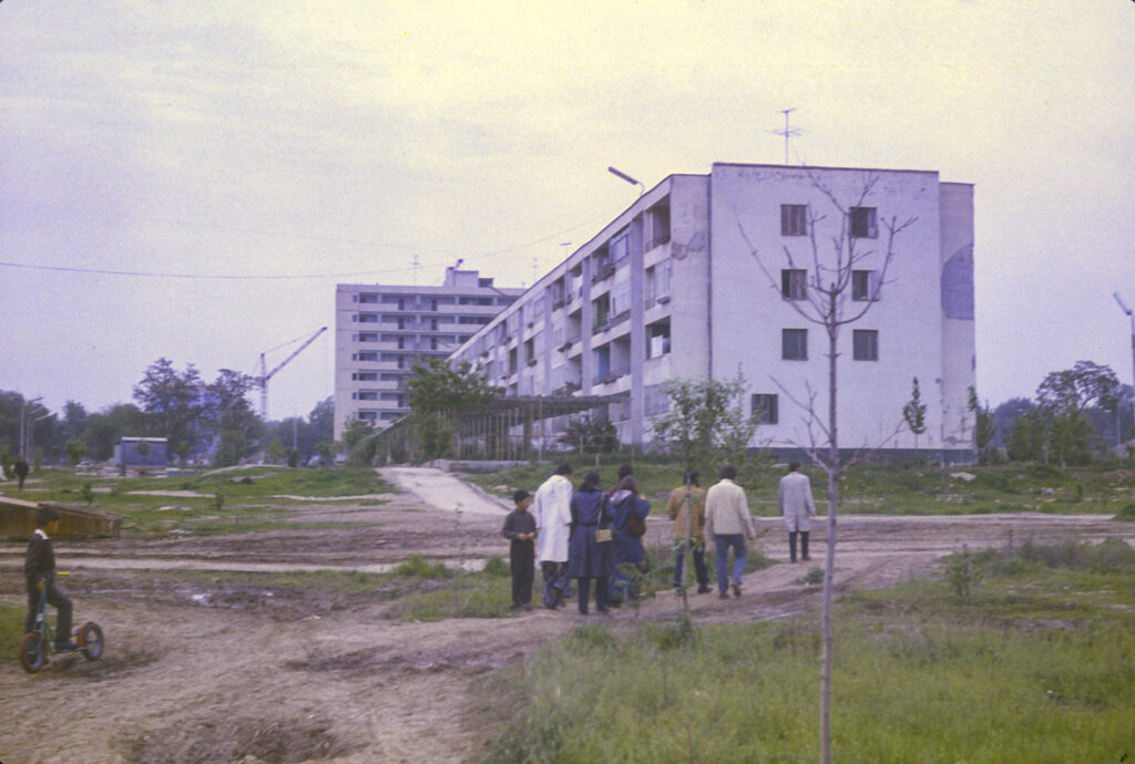
Tashkent was quite open and spacious, with wide expanses between structures. Our hotel was located in an outlying residential district, situated amidst clusters of brand-new apartment buildings with children playing in the wide vacant spaces between the structures. In contrast to Bukhara and a lesser extent Samarkand, where we could walk from our hotel to many of the sights we wanted to see, in Tashkent we had to take the bus to get anywhere. (Sputnik did furnish tour buses in all the cities we visited, but only in Tashkent did we need it on a full-time basis.) Our tour schedule in Tashkent was leisurely, and since there was no place easy to get to by walking and public transportation was something of a mystery, we spent a lot of time in our rooms, from which we had excellent unobstructed views.
A close-up shot of our hotel in Tashkent
Chris Buck, who was my roommate in Tashkent as well as in Moscow, passed the time by reading the local newspapers. In one of them there was an article about a gang of criminals who had been apprehended after staging armed robberies of payroll offices in a number of large factories, including some where the gang’s members were employed. (In the USSR workers were generally paid in cash, so payroll offices tended to have large sums of cash on hand.) In the course of their crime spree the bandits had shot and killed people, so that when they were put on trial, some of them received death sentences. According to the newspaper article, just before pronouncing sentence on one of them, the judge asked him, “Why did you rob the very place where you worked? Didn’t you realize that your comrades couldn’t get paid?” “Yes, Comrade Judge,” replied the bandit, “but then I couldn’t get paid either.”
Newly constructed apartment building near our hotel in Tashkent
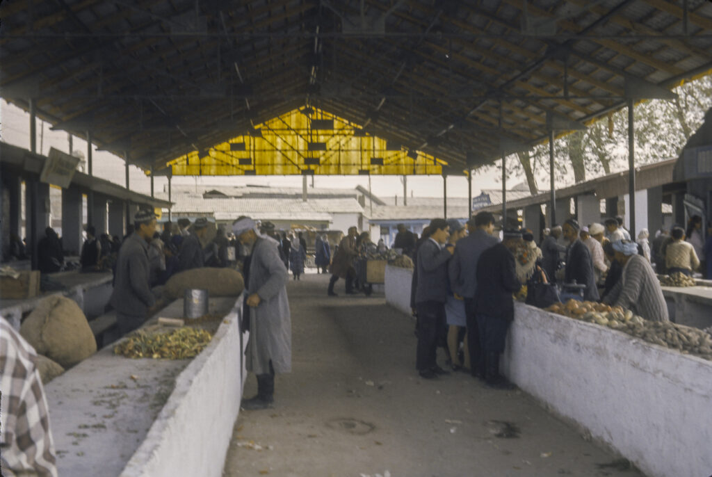
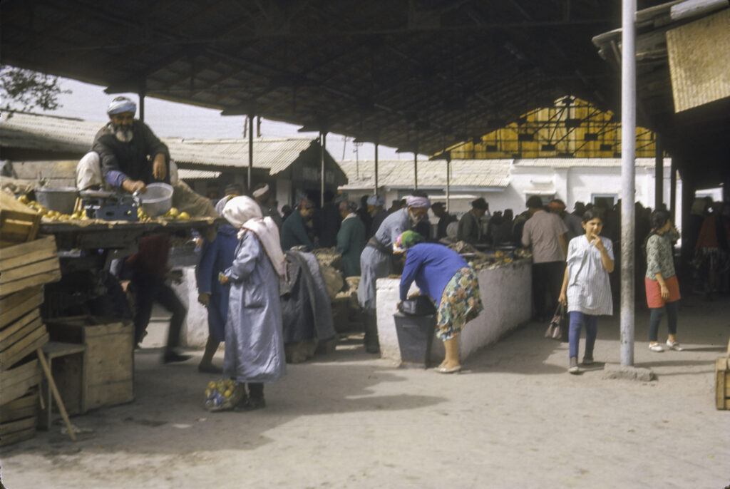
Perhaps because it was the capital of the Uzbek SSR – capital cities in the USSR always seemed to be better-provisioned – food in Tashkent seemed to be more plentiful and of a higher quality than elsewhere in Central Asia, and we took full advantage of this abundance. Above all we hogged out on plov – rice pilaf – which is the Uzbek national specialty. The basic recipe calls for chunks of meat, onions and grated carrots, often with other fruits and vegetables such as chickpeas, raisins, apricots, etc. in the mix, There are many different variations of plov, and the food stands and street vendors which were ubiquitous in the city (not to mention the restaurants) sold them all. We hardly ever ate in the city’s restaurants.
New office building under construction
The earthquake that struck Tashkent in 1966 measured only 5.1 on the Richter scale, but its epicenter was in the center of the city, and buildings in the densely packed older quarters were especially vulnerable to the tremors. Relatively few people perished in the quake, although official Soviet figures of 15 killed are considered untrustworthy, and other estimates place the number at anywhere from 200 to 5,500. Over 80% of the city was destroyed, including somewhere between 75,000 and 95,000 homes and most of the old mosques and other historic buildings.
The Soviet government responded to the disaster with a massive rebuilding effort, dispatching considerable resources and large numbers of workers from other Soviet republics to participate. Many of the workers who came to the city in that period stayed, resulting in a net increase in the population of the city and a change in its ethnic makeup. By 1970 100,000 new homes had been built, more than enough to replace those lost in the earthquake, but still not enough to accommodate the new arrivals, and more were needed.
New office building under construction
When we visited, seven years after the earthquake, it seemed that the reconstruction efforts had not slackened. New buildings were going up all over Tashkent, and construction was proceeding at an especially frenzied pace as one ventured into the city center. All kinds of structures – office buildings, shopping centers, hotels, etc. were going up, many of them quite massive, but few, it seemed, of any special distinction or interest. A major exception was the Lenin Museum, seen in the picture below.
V. I. Lenin Museum – now the State Historical Museum of Uzbekistan
That the most original and striking new architectural work in the capital of Uzbekistan should be dedicated to Lenin, who never set foot in the place, would seem to be not only outlandish but rather an affront to the Uzbek people, who have their own proud history; so it is not surprising that when Uzbekistan became independent, the name was changed to the State Historical Museum of Uzbekistan. As I recall, although the exterior of the Museum was certainly worth a picture, none of our party went inside to view its contents, which would have been unlikely to include anything that we had not seen in Moscow or Leningrad.
There was some irony, especially after we had seen Bukhara and Samarkand, in the fact that so many of the attractions we saw in Tashkent, including those which had survived the earthquake, were structures built by Russians. One such was the palace or mansion of Grand Duke Nikolai Konstantinovich. Grandson of Tsar Nicholas I, nephew of Tsar Alexander II, he was the proverbial dissolute scion of the royal family. A prodigious womanizer, he became involved in an affair with an American actress, Fanny Lear; having spent all his money on her, and unable to borrow more, he stole some diamonds from the revetment (frame) of a treasured family icon. The theft was discovered, and to hush up the scandal, Nikolai was declared insane and banished to Tashkent, where he spent the rest of his life.
Palace of Grand Duke Nikolai Konstantinovich Romanov, now a reception hall for the Uzbekistan Ministry of Foreign Affairs
Once in Tashkent, he seems to have turned over a new leaf, and committed himself to good works, such as building canals, schools and a theater. He also built a magnificent mansion to house and showcase his large and magnificent art collection. He died in Tashkent in 1918, and the Soviet regime nationalized his mansion and its contents. The mansion for a while became a museum, but in 1935 his collection was moved elsewhere, and is now in the national Museum of Art of Uzbekistan. The mansion is now used as a reception hall for the Uzbekistan Ministry of Foreign Affairs.
Palace of Grand Duke Nikolai Konstantinovich Romanov, Tashkent
Not all of the Islamic monuments dating from before the Russian conquest were destroyed in the earthquake, but as far as I can recall our tour did not include any of them. On one occasion, I vividly recall, we were on the tour bus with an Uzbek native guide who started to talk about some of the more interesting historical sites, when another, more senior guide, apparently an ethnic Russian, got on the bus and quite literally shoved the Uzbek guide aside, started talking about Tashkent’s newest and most palatial hotel (not the one where we were staying), how many rooms it had, how much it cost to build, how spiffy and wonderful it was, etc. I wonder if this turkey ever realized how close he came to being lynched.
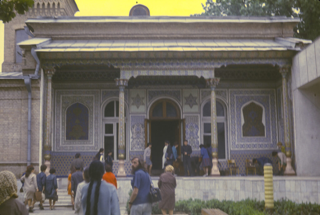
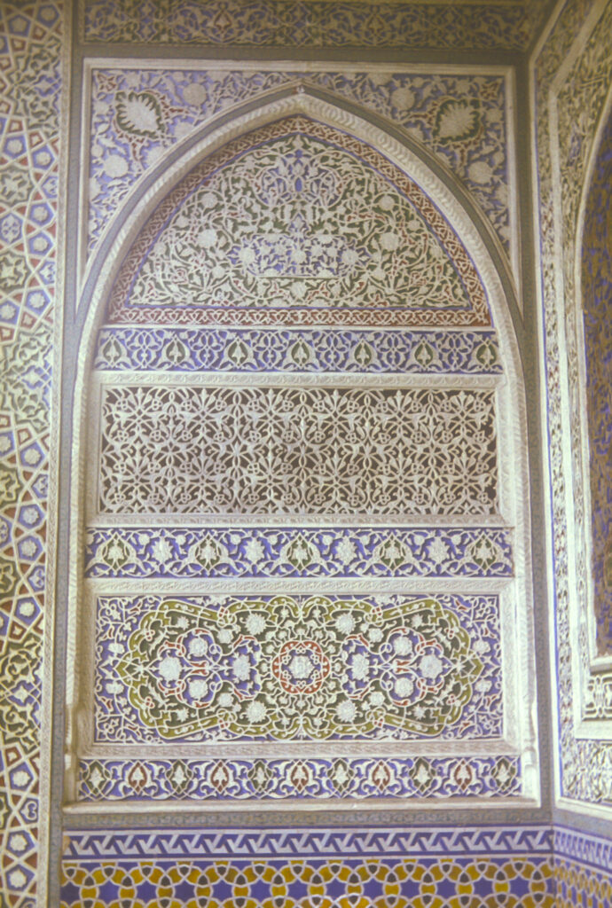
The final and most memorable stop on our itinerary in Tashkent, at least for me, was the Museum of Applied Arts. It was noteworthy not only for the contents of the museum, but even more so because of the building in which it was housed. It was beautifully furnished and decorated, both inside and out. The exterior was remarkable not only for its amazing ganch carvings framing the windows and door, but also, and most unusually, for the Stars of David which appear on either side of the transom above the entrance doorway, as seen in the following photograph.
Museum of Applied Arts, Tashkent – a treasure-house of Central Asian domestic architecture and decorative art, dating from the late 19th century. Note the Stars of David on either side of the entrance door transom.
I don’t recall whether the museum staff told us anything about the history of the house. They may have mentioned that before the 1917 Revolution it belonged to a Russian diplomat, who had it remodeled in a manner reflecting his taste for Asian art and furnishings. But it seemed quite unlikely that a Russian diplomat would have his house decorated with Stars of David, and if the museum staff had any explanation for it, I have long since forgotten. Only recently, when I began the online research for this account, did I come across information which shed some light on the subject. It’s a long and complicated story, though, and may not be of interest to all readers; so before I get into it, let me finish my account of our visit to the Museum of Applied Arts.
Decorative ganch-carved wall panel at entrance to the Museum of Applied Arts, Tashkent. Ganch is a mixture of gypsum and clay, widely used in Central Asia to create sculptures, bas-reliefs, lattices and other forms of decor.
When we went inside the Museum, it turned out that the exhibits included not only antiques but also a good deal of recent work by Central Asian artists – ceramics, fabrics, metalwork, leather, etc. – which was of exceptionally high workmanship. Not only that, but the museum staff assured us, the same type and quality were on sale in local shops and bazaars, readily available. This was especially intriguing to many of us as up until then we had seen practically nothing worthy of attention for sale in any of the places we had been so far. Indeed, it was puzzling that the Soviets were missing out on a potentially very lucrative opportunity to pull in some foreign currency by marketing products of native craftsmen as souvenirs. So, after leaving the museum, we spent some of our remaining time in Tashkent scouring the local shops and bazaars in search of the kinds of beautiful and exotic wares we had encountered in the museum.
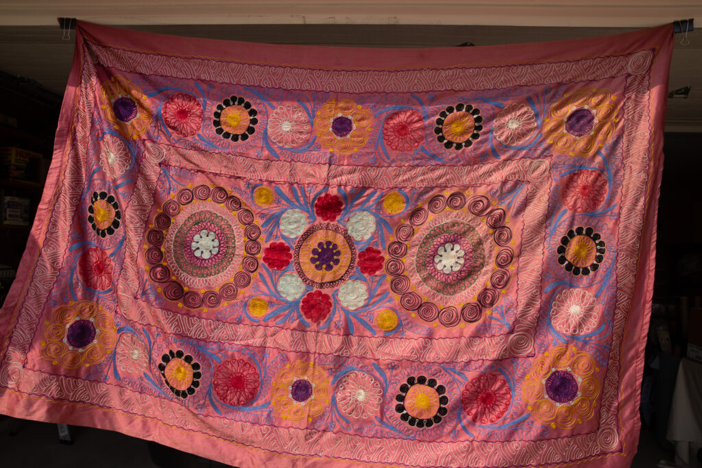
We were to be bitterly disappointed. I don’t know whether the museum staff was lying to us or whether the types of items on show in the museum were only accessible in stores not accessible to us as student travelers (such stores did indeed exist in the Soviet Union), but most of the merchandise we encountered was junk – inferior stuff, crudely made, perhaps as training exercises by children. However, I did manage to come away with a couple of trinkets that, while not representative of the best craftmanship, at least served as pleasant mementos of the trip. One was a tapestry embroidered with complex geometric designs; it may appear to be hand-made from silk at first glance, but is actually machine-made from artificial fabrics.
Faux-silk embroidered tapestry from Tashkent
The other was a serving platter, made of I don’t know what, with complex lacquered designs including both human and animal as well as geometric figures. I don’t suppose that it is authentic traditional craftsmanship by any means, but it is representative of the better sort of merchandise available in the ordinary bazaars.
Serving platter from Tashkent, April 1973
Returning to the subject of the museum house, I found several sources online which illuminated its origins. It was originally a private house which belonged to a Russian business magnate, Nikolai Ivanovich Ivanov. Ivanov was an interesting person in his own right, an industrial pioneer who was involved in a variety of industries, including breweries, wineries and distilleries, pharmaceuticals, coal, transportation, etc., in Tashkent and indeed throughout Russian Turkestan. After building himself a new mansion, he sold his old house to a Russian named Alexander Alexandrovich Polovtsev.
But my sources diverge as to who exactly was this Polovtsev. There were two Alexander Alexandrovich Polovtsevs, father and son. The father was a leading figure in the government of Tsar Alexander III and Nicholas II; he served as State Secretary, was a member of the State Council, and one of his areas of responsibility was the overseeing the settlement (of Russians) in Central Asia. (He was also a founder of the Russian Historical Society and served as its chairman from 1879 to 1909.) According to an account by one Arslan Tashpulatovich Jabbarov, writing in the online publication Letters about Tashkent (Письма о Ташкенте), it was he who bought the house. However, another source, an anonymously written article in Wikipedia, ascribes the purchase to the son. Although the Wikipedia article has less depth, I judge it to be more trustworthy, for reasons which will shortly become apparent.
In 1896 Polovtsev arrived in Tashkent on a special assignment from the Ministry of the Interior to study the progress of Russian resettlement in Central Asia and the Caucasus. This must have been Polovtsev Junior, because the father was far too senior an official to undertake such a relatively low-level assignment. But since the task was within his area of responsibility, he would likely have been responsible for selecting the person to be entrusted with it, and an obvious candidate for the job would have been Polovtsev Junior. The younger Polovtsev at some point entered the diplomatic service, and was eventually appointed as Russian Consul-General in Bombay, India; again, this would not be an appropriate assignment for such a highly-placed personage as the elder Polovtsev. My guess is that the latter selected his son for the mission to Central Asia and the Caucasus as a means of cutting his teeth in the diplomatic service, since these areas were in some sense foreign countries, populated by non-Russian, non-Slavic peoples only recently incorporated into the Russian Empire.
In any case, upon arriving in Tashkent, Polovtsev found that he needed an assistant who knew the area, and for this purpose he hired Mikhail Stepanovich Andreev. Andreev was a remarkable figure in his own right; a Russian born in Tashkent, the grandson of a common soldier, he had attended the Tashkent Teachers’ Seminary, the only school where Central Asian languages such as Tadzhik and Uzbek were taught, and had demonstrated considerable aptitude for them. After graduation he soon gained a reputation as a talented linguist, educator and ethnographer and became well-known to local officials, one of whom recommended him to Polovtsev.
Andreev soon became not only indispensable to Polovtsev but his constant companion as well, eventually even accompanying him on diplomatic assignments abroad in Paris and India. Polovtsev was an aesthete, an avid traveler and collector of art, and shared Andreev’s interest in the cultures of Central Asia and the Caucasus. Having become fully conversant with his patron’s preferences, Andreev arranged the purchase of Ivanov’s house, had it remodeled in accordance with Polovtsev’s tastes and sensibilities, and filled it with treasures from Polovtsev’s collections.
The senior Polovtsev died in 1909. According to Jabbarov, just before he died, he donated the house in Tashkent to the municipal government. However, this seems unlikely if in fact the younger Polovstev – who lived on until 1944 – was the actual owner of the house; and indeed, this is affirmed by some of the comments posted on Jabbar’s article in Letters about Tashkent. Moreover one commentator (who identifies himself as “David”), referring to an unspecified archive, states that the “final purchaser” of the house was a Jew from Bukhara, who remodeled it yet again and added not two but six Stars of David. David does not say when the sale took place or why, and the Wikipedia article on the Museum does not mention the sale at all, mentioning only that in World War I the house served as quarters for captured Austro-Hungarian officers, and after the Revolution, having been nationalized, it served as an orphanage until 1937.
It is unclear when and how Andreev’s association with Polovtsev ended—evidently it was over by 1914, when Andreev returned to Turkestan and resumed his earlier career as an educator, taking a position as a regional school administrator in Samarkand. But the Revolution of 1917 opened up new opportunities for him. For many years he had cherished a dream of establishing an institute for the study of Asian languages in Tashkent. In 1918 the new Soviet regime invited him to organize just such an institution, which became the Tashkent Oriental Institute, and eventually the Department of Asian Studies of the Central Asian State University, with Andreev as its chairman.
Like many other leading Soviet scholars, Andreev became the target of Stalinist persecution in the 1930s. He was first arrested in 1933, but was soon released and returned to Tashkent. In 1937 he managed to exert his influence to save the Polovtsev house, which had deteriorated badly during the intervening years, by persuading the authorities to turn it into a museum of Central Asian handicrafts. It underwent restoration on several occasions thereafter, and in 1960 was renamed “Permanent Exhibition of Applied Arts of Uzbekistan.” By the time I visited in 1973, it had been more or less restored to the condition in which its final private owner had left it, with at least two of its Stars of David intact (if the other four had survived, I didn’t see them). In 1997, after being taken over by the Ministry of Culture of the Republic of Uzbekistan, it was again renamed, this time to “State Museum of Applied Art”.
Andreev was arrested again in 1938, on the accusation of spying for the British. This time he managed to talk his way out of the clutches of the “organs” by convincing the head of the Uzbekistan NKVD that he had important secret information which he had collected for Soviet intelligence while traveling in India and Afghanistan in the 20s. He survived the purges and the war, and was even elected to the Uzbek Academy of Sciences in 1943. But in the postwar period, when Stalin was cracking down again, Andreev transferred to the newly-founded University of Stalinabad (now Dushanbe, the capital of Tadzhikistan), which oddly enough was lacking in Tadzhik language instruction, in order to escape the watchful eyes of the Tashkent NKVD. There, sadly, he was done to death not by the “organs” but by a crazed woman with an axe, whose romantic overtures he had rejected. I should caution that I found this tale of Andreev’s demise only in Jabbar’s not-always-trustworthy account, and not in the Wikipedia articles.
At the end of our stay in Tashkent, we embarked on our first flight on a Soviet jet airliner, which was to carry us to the fabled city of Tbilisi, capital of the Soviet republic of Georgia.
Gur-e Amir ("Tomb of the King"), the mausoleum of Timur, his sons and grandsons
Samarkand, our second stop in Central Asia, is another Silk Road city in existence since time immemorial, i.e. the 8th or 7th century BCE. It first entered history as the capital of the Sogdian satrapy (province) of the Achaemenid Persian Empire, and was conquered by Alexander the Great in 329 BCE. Thereafter it was ruled by a succession of Iranian and Turkish rulers until 1220 BCE, when it fell to the Mongols of Genghis Khan. After Genghis Khan’s death, his empire became divided up into semi-autonomous, and later independent, khanates such as the Golden Horde in Russia, the Ilkhanate of Persia, and the Chagatai Khanate (named after Genghis Khan’s second son, its first ruler), which extended from the Aral Sea to the borders of China, and included the cities of Bokhara and Samarkand.
But Samarkand is indelibly associated with the name of one of history’s most formidable conquerors, Timur the Lame or Tamerlane, under whom Samarkand reached the apex of its glory. Timur reunited the lands of the Golden Horde, the Ilkhanate and the Chagatai Khanate, devastated large areas of the Middle East, and was on his way to invade China when he died in 1405. He was notorious for leaving huge pyramids of skulls on the sites of the cities he conquered, and his campaigns are estimated to have caused the deaths of around 17 million people, about 5% of the world’s population at the time.
Born in relatively modest circumstances near Samarkand sometime in the 1320s, Timur first rose to prominence as a general under the Chagatai khans, rose in their service, and eventually turned the Khan into a puppet ruler before casting off the pretense and assuming power in his own name. By 1370 he had made Samarkand his capital and begun a construction program aiming at making it the wonder of the world.
Timur’s last and most ambitious project, the Bibi-Khanym mosque, was constructed from 1399-1405, ostensibly in memory of the mother of his wife. Beyond that, his intent was not only to create a mosque which would be one of the largest and most magnificent in the world, but also to host the entire male population of Samarkand, a city of 150,000, for Friday prayers.
Ruins of Bibi-Khanym Mosque, from a distance to the north. At left is the massive entry portal; at the center right, the main iwan and the dome.
The Bibi-Khanym Mosque enclosed an area 167 meters (548 feet) long and 107 meters (358 feet) wide, oriented northeast by southwest (conforming to the Qibia, i.e. direction of Mecca). No less than eight minarets graced the perimeter.
The entry portal of the Bibi-Khanym Mosque, as seen in 1973.
Entering from the northeast via a vast parade portal, 35 meters (115 feet) high, one found oneself in a great courtyard, at the other end of which stood the massive main iwan. An iwan is a feature of traditional Persian architecture described as “a rectangular hall or space, usually vaulted, walled on three sides, with one end entirely open,” and a formal gateway called a pishtaq, or projecting portal. Beyond the main iwan was the main dome, which was not visible from the courtyard.
The Main Iwan (left) and Dome of the Bibi-Khanym Mosque. Note the shopkeepers’ stalls at the right.
The sides of the courtyard were framed by two smaller iwans, each with its own dome. In the center of the courtyard was a massive stone stand which was designed to hold a very large Koran.
The marble stand in the center of the courtyard was designed to hold a rather large Koran.
Unfortunately, Timur’s specifications for construction of the mosque exceeded the technological capabilities of his architects and engineers, and right from the day of its completion the mosque began to fall apart, with bricks falling out of the main dome.
The main dome of the Bibi-Khanym Mosque
Timur’s successors made attempts to repair and reinforce the mosque, but by the the 16th century the Timurid dynasty had been replaced by the Shaybanids, ruling from Bukhara, and they evinced little interest in maintaining the monuments of Samarkand. The Bibi-Khanym continued to deteriorate, and for centuries the local inhabitants plundered it for building materials. In 1897 a great earthquake demolished much of what was left. At the time I visited in 1973, it was in sorry shape, but at least some scaffolding had been erected to retard the continuing disintegration of the main iwan.
A poultry market occupied some of the stalls near Bibi-Khanym Mosque. Unfortunately, the color in this picture faded so badly that I just converted it to black-and-white.
Restoration efforts began in the 1970s, gained momentum after Uzbekistan became fully independent in 1991, and continue down to the present. From what I can gather the exterior of the mosque has regained much of its original appearance.
Locals and tourists infested the ruins of the Bibi-Khanym Mosque. Some restoration work had begun, which was responsible for the scaffolding seen here.
Our next stop in Samarkand was Registan Square, the heart of old Samarkand, which is bounded by three great madrasas: the Ulugh Beg, the Tilya-Kori, and the Sher-Dor. If I recall correctly, the first two were in early stages of restoration and covered in scaffolding, so our attention focused mainly on the third.
After Timur’s death in 1405, his son and successor, Shah Rukh, moved the capital of the Timurid Empire to Herat, in modern-day Afghanistan, and left Samarkand in charge of his son Ulugh Beg, who set about to make Samarkand the intellectual and cultural center of the Timurid Empire. He built the madrasah which bears his name in 1417-1420 and invited some of the foremost scholars and intellectuals of the Islamic world to teach there, especially astronomers and mathematicians.
In the 17th century the then ruler of Samarkand, Amir Yalangtush Bakhodur, ordered the construction of the Sher-Dor Madrasah on the east side of Registan Square, opposite the Ulugh Beg Madrasah. Construction began in 1619 and was completed in 1636. Ten years later work began on the Tilya-Kori Madrasah, which was completed in 1660.
Sher-Dor Madrasah on Registan Square
The Sher-Dor Madrasah is very similar in exterior appearance to the Ulugh-Beg Madrasah, but there are some important differences. Both have enormous Persian-style facades and are flanked by flat-topped minarets, but the Sher-Dor has two large domes, one on either side of the facade, which are absent from the Ulugh Beg. Also, whereas the Ulugh Beg facade is adorned with orthodox Islamic geometrical figures, the Sher-Dor facade flouts the Islamic prohibition against depicting living creatures, with mosaics depicting tigers and other animals on the facade.
The facade of the Sher-Dor Madrasah; note the unusual mosaics depicting tigers with rising suns on their backs
Critics consider the architecture of the Sher-Dor represents a degenerate form by comparison with the “golden age” of the fifteenth century, as embodied in the Ulugh-beg Madrassah, but it is still impressive.
Closeup of entrance to Sher-Dor Madrasah
IREX tour group explores the courtyard of the Sher-Dor Madrasah
Alcove with entry to one of the rooms of the madrasah
The third of the great Registan Square madrasahs is the Tilya-Kori, which as already mentioned was undergoing restoration and closed to the public. It stood on the north side of the square and had a somewhat different plan from its neighbors. It still had an iwan-type facade, but the corner towers of the structure were not as tall and the building plan was asymmetric. It served as both a mosque and a residential college for students; the mosque section was on the west side and was crowned with a dome. The name Tilya-Kori means “gilded”, and the interior of the mosque was abundantly covered with gold.
Tilya Kori, the last to be built of the three great madrasahs on Registan Square
We did not have as much time to stroll around the residential areas of Samarkand as we did in Bukhara; I have the impression that the city seemed a little more prosperous than Bukhara.
Residential District of Samarkand
On one of the several days we spent in Samarkand, we visited the observatory built by Timur’s grandson Ulugh-Beg in 1428. Ulugh-Beg had become interested in astronomy at an early age after visiting the famous Maragheh Observatory of Persia, built in 1259 under the patronage of the Mongol Ilkan Hulagu; and he is said to have modeled his observatory on the Maragheh.
Chris Buck contemplates the remains of the Ulugh Beg Observatory, built by Timur’s grandson in 1428, destroyed in 1449 and rediscovered in 1908. The long covered structure contains the remnants of the Fakhri sextant.
Ulugh Beg’s observatory of course was unable to benefit from using telescopes, which would only be invented nearly two hundred years later. Astronomers of the fifteenth century had to make do with other instruments, such as the sextant, a device for measuring the altitude of a celestial object above the horizon. The centerpiece of Ulugh Beg’s observatory was the giant Fakhri sextant, which was used to make very exact measurements of transit altitudes of stars, from which their precise coordinates in the sky could be calculated. Ulugh Beg used these measurements to compile a catalog of stars and their locations which was far in advance of anything previously available.
The Fakhri sextant was constructed with one segment and a supporting structure above ground, and the rest underground. Only the latter part has survived. In 1447 Ulugh Beg’s father, Shah Rukh, died, and in the ensuing struggle for succession Ulugh Beg was defeated and dethroned by his own son, who subsequently had him assassinated. His scientific activities had aroused the enmity of Islamic obscurantists, who after his death succeeded in having his observatory dismantled. It was only rediscovered in 1908.
Shah-i-Zinda, on the northeast of Samarkand, is a necropolis, a complex of tombs and mausoleums. The name means “the living king” and is associated with a cousin of the prophet Muhammad who supposedly came with Arab invaders in the 7th century CE to convert the population of Samarkand to Islam and was beheaded by the locals for his trouble. The legend has it that he did not die but instead escaped into a well, where he has lived ever since. Eventually, in the 11th century a shrine was eventually erected over the well, initiating the development of the Shah-i-Zinda necropolis. The complex continued to expand thereafter, with the most important additions occurring in the 14th and 15th centuries under the Timurids.
Shah-i-Zinda Necropolis: Qazizadeh Rumi mausoleum at right, mausolea of Shirin Biqa Aqa, Amirzadeh, and Shad-i Mulk Aqa on the left, up the hill.
About 1435 Ulugh-Beg had a monumental main entrance gate to the ensemble built. A tradition now somewhat in doubt holds that he also commissioned a large two-domed mausoleum for the scientist and astronomer Qazizadeh Rumi, the first director of his observatory.
Shah-i-Zinda Necropolis: the stone stairway and chartak (archway) leading to the middle tier of mausolea.
Entering the complex from the south, through the grand archway, after passing by the Qazizadeh Rumi mausoleum, one comes to a stone staircase leading to another archway. Beyond that is a group of mausolea in part associated with the female relatives of Timur, in particular his sister, Shad-i Mulk Aga, and his niece, Shirin Biqa Aga. There is also the Tughlu Tekin mausoleum, built by a friend of Timur for his mother, and the Amirzadeh mausoleum, built in 1386 by an unidentified party.
Shah-i-Zinda Necropolis: looking south toward the entrance archway (background) and the stairs leading to the middle section of the ensemble.
Here, in the middle group, one first encounters the incredible tilework that I found to be the most memorable feature of the Shah-i-Zinda complex.
Shah-i-Zinda Necropolis: view from the walkway between the Shad-i Mulk Aga (rightmost) and Amirzadeh (second from right) Mausolea, and the Shirin Biqa Aga mausoleum on the left; in the background, beyond the chartak (archway) are the domes of the Qazizadeh Rumi mausoleum.
Particularly striking to me were the deep-relief inscriptions featuring verses from the Koran and other sacred texts; from what I can gather, these were produced by applying dozens of layers of lacquer and then carving through the layers. This must have required an astounding level of skill and a great deal of expenditure to pay for it; it seems to have flourished mainly in the era of the Timurids, i.e. mid-14th – early 15th centuries, and some have found evidence of Chinese influence in it.
Shah-i-Zinda Necropolis: left to right, the Shirin Biqa Aga Mausoleum; center, chertak and dome of the Qazizadeh Rumi Mausoleum; right, the Amirzadeh and Shad-i Mulk Aqa Mausolea.
I have not been able to ascertain who commissioned the Amirzadeh Mausoleum or who is buried in it, but an inscription on the front dates its construction to 1386. It is also known as the Octahedron, because of the eight-sided structure on which the dome rests.
Shah-i-Zinda Necropolis: Restoration work in progress on the Shirin Biqa Aqa Mausoleum at left
The Shad-i Mulk Mausoleum, built for the sister of Timur, was perhaps the best-preserved structure in the complex, with exquisite terracotta tile in and around the archway, including some of the deep-relief Koranic embedded inscriptions.
Shah-i-Zinda Necropolis: Entrance to Shad-i Mulk Aqa Mausoleum
A close examination of the facade of the Shad-i Mulk Aqa reinforced my initial impression – this was tilework of unsurpassed artistry and craftsmanship.
Shah-i-Zinda Necropolis: Detail of Shad-i Mulk Aqa Mausoleum facade
Located at the north end of the complex are the oldest structures, including the Khwaja Ahmad Mausoleum, an anonymous mausoleum of 1361 possibly built for one of Timur’s first wives, Qutlugh Ata, and others, most notably the shrine of Qutham ibn Abbas. Unfortunately, I do not have any surviving photos of the shrine; I also don’t have any photos of the interiors of any of the structures, because my camera was not equipped with a flash. I don’t remember whether any of the buildings were open to go inside when I was there.
Shah-i-Zinda Necropolis, north end: Khwaja Ahmad Mausoleum (left) and anonymous 1361 mausoleum (right)
The Khwaja Ahmad Mausoleum, not to be confused with the Mausoleum of Khwaja Ahmad Yasawi in Kazakhstan, was built in the 1340s, and closes off the north end of the Shah-i-Zinda complex. Although the interior was said to be in ruins (we didn’t get a look at it), the exterior featured some of the most original and outstanding tilework in the complex.
Shah-i-Zinda Necropolis: Chris Buck inspects the facade of the Khwaja Ahmad Mausoleum
In particular, one of the outstanding examples of the deep-relief calligraphic tile in the Shah-i-Zinda complex decorates the facade of the Khwaja Ahmad Mausoleum.
Shah-i-Zinda Necropolis: one of the deep-relief carved-tile inscriptions featuring quotations from the Koran – Khwaja Ahmad mausoleum
The 1361 Qutlugh Ata Mausoleum was especially noteworthy for the muqarna over its doorway. An archetypal feature of Islamic architecture, a muqarna is an ornamental vault, a self-supporting arched honeycomb form intended to provide a smooth, decorative transition from a wall to a ceiling and thus enliven what would otherwise be a bare, uninteresting space.
Shah-i-Zinda Necropolis: terracotta-decorated muqarna (ornamental honeycomb-styled vault) at entrance to the 1361 Qutlugh Ata mausoleum near the north end of the complex.
Our final stop in Samarkand was Gur-i-Amir, the mausoleum of Timur. It is a monumental work, well-preserved, visible from afar, and the model for many subsequent tombs, such as the Taj Mahal.
Entrance to Gur-e Amir complex
Gur-e Amir contains not only the tomb of Tamerlane, but also those of his sons and grandsons. Timur had originally built a smaller tomb for himself in his native city of Shahrisabz, south of Samarkand, and he began Gur-e Amir as a tomb for his grandson and heir apparent Muhammad Sultan, who predeceased him in 1403. However, when Timur himself died in 1405, Shahrisabz was inaccessible because the passes to it were blocked with snow, so he was buried in Gur-e Amir instead. Later, his other grandson Ulugh Beg made Gur-e Amir the family crypt, and Timur’s sons Miran Shah and Shah Rukh were buried there, as well as Ulugh Beg himself.
Gur-e Amir (“Tomb of the King”), the mausoleum of Timur, his sons and grandsons
Like the other monuments of Samarkand, the Gur-e Amir fell into disrepair once the glory days of Samarkand were over. However, it was the first of the major structures to undergo restoration; the Soviets government undertook some early efforts in that direction just before the war with Germany began in 1941, as we shall shortly see, and after the war work began in earnest, with much being accomplished in the 1950s and after. Thus, by the time I visited in 1973, Gur-e Amir was in a much better state of preservation than most of the other monuments of Samarkand, and it was a glorious sight indeed.
Gur-e Amir – Another view, focusing on the dome
Timur’s tomb was engraved with two inscriptions. One read “When I Rise From the Dead, The World Shall Tremble”; the other, “Whosoever Disturbs My Tomb Will Unleash an Invader More Terrible than I’. In June, 1941, an expedition led by Soviet scientist Tashmuhammed Kari-Niyazov began excavations in Gur-e Amir and on June 20, 1941, the excavators opened the tomb of Timur. On June 22, Germany invaded the Soviet Union.
Gur-e Amir – Another view
Supposedly, after a month or two of horrific reverses Joseph Stalin started to believe in the curse and ordered the remains of Timur reburied, which was done in December 1942. Legend also has it that Stalin ordered a plane to fly over the front lines at Stalingrad for a month with the remains of Timur, and that the Muslim soldiers fighting there with the Red Army were fully informed of this to stimulate their zeal for fighting the Germans. In January 1943, the German Sixth Army surrendered, giving the Soviets the victory in one of the decisive battles of history.
Close-up of the dome of Gur-e Amir
All of this, of course, is coincidence. World War II began in 1939 with the invasion of Poland; Hitler had always intended to destroy the Soviet Union, and began planning the invasion in 1940. I am not in a position either to verify or refute the legend about the plane flying over the Stalingrad battlefield with the remains of Timur, but I am certain of one thing: even though the exhumation of Tamerlane’s remains did not “unleash” him, and even though he lost in the end, Hitler was indeed a more terrible conqueror than Tamerlane. If indeed Timur was responsible for the deaths of 17 million people, he was still no match for Hitler, who accounted for far more than that. Also, Timur sponsored the creation of some wonderful masterpieces of art and architecture. Hitler only caused destruction and ruin.
An architectural complex known as the Po-i-Kalan (Persian title meaning "Grand Foundation", containing the Kalyan Minaret and Mosque and the Miri Arab Madrasah.
In April, 1973 most of the American IREX students signed up for a trip to Central Asia and the Caucasus. We boarded an Aeroflot IL-18 four-engine turboprop at Domodedovo airport for the first leg of the trip. It was a long, noisy, uncomfortable, boring flight, about 12 hours if I remember correctly. The chicken served as an in-flight dinner really was made of rubber and could not be eaten. The plane shook and rattled its way to Samarkand, where we transferred to an AN-24 twin-engine turboprop headed for Bukhara.
When we arrived in Bukhara, it was rainy and cold. Our first stop, after dropping our luggage off at our hostel, was the Amir’s Palace. The amirs are long gone, of course, the last one having been deposed by the Bolsheviks in 1920. His summer palace, the one we visited, is now a museum.
The Sitori-i-Mokhi Khosa was the summer palace of Alam Khan, last Amir of Bukhara.
Bukhara is an ancient city, founded in 500 AD, and for much of its history has been an important outpost of Persian civilization. After the Arab conquest of the Persian Sassanid Empire in the 7th century CE, Bukhara fell under Arab domination for a while, but in the ninth century it became a center of the revival of Iranian language and culture as the capital of the Samanid Empire. In medieval times, as a major stop on the Silk Road, Bukhara profited greatly from the silk trade.
Entrance to the Amir’s Summer Palace
In 1220 it was destroyed by the Mongols. After the Mongol conquests, Central Asia became increasingly dominated by Turkic peoples, and in the 16th century Bukhara became subject to the rule of Turkic Uzbek rulers, who remained in control until the advent of the Russians in the 19th century. In 1873 the Emirate of Bukhara became a Russian protectorate, but continued to remain under the rule of the amirs until 1920.
Intricate designs adorning a wall in the interior of the Amir’s Summer Palace, now a museum
In 1920, the Red Army invaded and occupied Bukhara, and the People’s Republic of Bukhara was established under its aegis. This lasted until 1925, when Bukhara was incorporated into the Uzbek Soviet Socialist Republic.
Elaborate doorway decoration in the Amir’s Palace
Currently Bukhara is a city of about a quarter of a million people; I do not know how many people were living there when I visited in 1973, but I would guess that the city was somewhat smaller then.
Part of a collection of Chinese vases in the museum of the Amir’s Summer Palace
There seems to be some controversy regarding the ethnic composition of the population of Bukhara. Official statistics of the Republic of Uzbekistan, the city’s population is composed of 82% Uzbeks, the majority ethnic group of the country, 6% Russians, 4% Tajiks, and 8% various other ethnic groups. But some sources maintain that the majority of the population actually consists of Tajiks who have been misidentified as Uzbeks for various reasons.
Part of the garden of Amir Alam’s Summer Palace.
From the Amir’s palace we proceeded next to an old fort on the outskirts of town. This was part of a series of defensive outworks that protected the city before the Russian conquest. Although not particularly interesting, it did provide an opportunity for some fresh air and exercise after our long plane and bus rides.
This old fort was part of an ancient system of defensive works surrounding the Bukhara.
While we scrambled among the ruins, I used the opportunity to snap pictures of some of my fellow-travelers.
Members of our group clamber into the ruins of the old fort outside Bukhara.
John Bushnell and Emily Klenin explore the ruins of the old fort.
John and Chris Bushnell pose for the camera at the parapet of the old fort.
Right to left: Emily Klenin, Liz Shapiro, Joel Shapiro, and a scruffy, bedraggled intruder who somehow managed to attach himself to the party.
During our stay in Bukhara, we were housed in a madrasah, the front part of which is a famous mosque known as Char Minar. One of the most striking structures in Bukhara, the Char Minar has four towers, each with a slightly different decorative motif. On top of the rightmost rear tower perched an odd, irregular structure apparently made of sticks, like a large basket. It turned out that this was a stork’s nest, one of many we would see in the following days.
Entrance to the Char Minar Madrasah, which served as our hotel in Bukhara. Note the stork’s nest on the rightmost tower.
Adjoining the rear of the mosque was the madrasah, known as the Madrasah of Khalif Niyaz-kul after the wealthy merchant who was responsible for building both in the early 19th century.
The courtyard of our hostel, the Char Minar Madrasah. Each alcove provides entry to one of the guest rooms.
Although a madrasah generally is a school for Islamic instruction, some madrasahs served primarily as hostels, and this was one of them. It was a two-story structure built around a central courtyard, with rooms on both stories.
David Macey inspects our quarters in the Char Minar Madrasah.
Construction of the structure was extremely solid, and so contrived that the rooms were relatively warm in winter and remained cool in the heat of summer. The quarters were comfortable though rather spartan. We were billeted three to a room.
I shared a room in the Char Minar Madrasah with David Macey, left, and Bob Drumm, right.
The hostel’s major shortcoming was the lack of bath or toilet facilities on the premises. There were only public latrines in the otherwise vacant fields next to the madrasah. This was particularly hard on the ladies, who during our excursions kept an eye out for actual toilets. On one occasion they found a school nearby, which they thought would surely have real toilets. They boldly marched into the hallways and found that the school did indeed have toilets, but they had long since fallen into disrepair, were filled with trash and debris and were completely unusable.
A local Russian couple who were passing by the Char Minar agreed to stop and pose for me near the entrance to my room .
To me, the lack of amenities was more than compensated by the opportunity to spend a few nights in a historic architectural treasure.
A view of the neighborhood in which our hostel was situated.
The city of Bukhara was not large, and most of the major attractions were located near enough to the center that they were accessible by foot. As it turned out, we had lots of time to explore the city unsupervised, providing plenty of opportunity to get into trouble.
Overlooking part of the city from the roof of our hostel.
Not far from our hostel there was a pond surrounded by an architectural complex known as the Lyab-i-Haus (“by the pond” in Persian), where people gathered to relax and socialize. The pond was the last remaining of several which had existed before the 20th century, but had been found to be vectors of disease and filled in. The Lyab-i Hauz consists of a large 16th-century madrasah, the Kukeldash on the north side, and a smaller 17th-century madrasah and a guest house on the eastern and western sides; on the south is an open area where the locals sat and sipped tea, gossiped and played chess.
The Lyabi-Hauz, one of several ponds which existed in old Bukhara and served as the primary sources of water in the city.
Bukhara is home to many architectural treasures, of which the most massive and imposing is the Ark, a great citadel constituting a city within a city. Built on the site of the original settlement, the Ark was in existence at least since 500 CE. According to the great Islamic Persian scholar Avicenna, in medieval times it contained one of the world’s greatest libraries. The library was probably destroyed at the time of the Mongol conquest, along with the Ark and the rest of the city. The Ark was rebuilt, without the library, and survived into modern times; but it was badly damaged when the Red Army assaulted the city in 1920. It had still not been restored at the time of our visit, and was closed to the public, so we were able only to view the exterior. However, I understand that since then it has been reopened and now houses several museums and exhibits.
Local residents and an invading American (Chris Buck at extreme right) stroll by the Ark, the great fortress that dominates the city of Bukhara.
Opposite the gate of the Ark stands the Bolo Hauz Mosque, the official place of worship of the amirs of Bukhara, built in 1712. Its most noteworthy feature is the carved and painted wood columns holding up the porch roof.
Bolo Haouz Mosque, an ornate structure built in 1712.
To the west of the Ark lies the Chashma Ayub Mausoleum, built in the 12th century with a peculiar tent-like roof, rare in Central Asia. The name Chashma Ayub means “Job’s Spring,” and legend has it that on this site the biblical Job smote the ground with his staff, causing a spring to gush forth which cured him of his ailments. It was not open when we were there, but nowadays it houses an exhibit devoted to water management in Bukhara.
The structure with the unusual conical dome, in the center of the picture, is the Chashma-Ayub (Job’s Spring) Mausoleum.
Nearby the Chashma Ayub was a kolkhoz (collective farm) market where, despite all pretensions to modernity, local farmers sold their produce directly to consumers as they had for centuries.
Produce stalls in the farmers’ market.
Strolling through the farmers’ market, one could get the impression that life in Bukhara had not changed much since the 19th century.
Strolling around the city, we encountered many sharp contrasts between past and present. The city center consisted of broad, spacious streets and boulevards showcasing the architectural masterpieces of the centuries….
The broad boulevards of the city center provided a sharp contrast to the narrow streets of the old residential districts.
…whereas the residential districts featured shabby tenements densely packed in narrow streets.
Built before the 20th century, these streets were not designed to accommodate motorized traffic.
Mercifully, vehicular traffic seemed to be absent from the old residential districts, since it would have been extremely hazardous to pedestrians, especially children playing in the streets.
However, modern amenities were not entirely lacking. I don’t know what the inhabitants had for sanitary facilities, but at least they had gas for cooking. The gas lines ran overhead along the outside of the houses, supported by tall posts, an arrangement which would probably be considered very hazardous in developed countries, but here there was probably no other option.
Note the gas lines running overhead.
I got the impression that basically Bukhara was a quiet provincial town where not much ever happened and there was little excitement or entertainment to be had. Many inhabitants seemed to be hanging around with little to do and the atmosphere was very relaxed, with a few exceptions, which I’ll come to later.
For the most part, Bukhara seemed to be a sleepy hinterland town with quiet streets and densely packed residences.
One of the most delightful features of Bukhara, to me, was the abundance of storks’ nests. As a native of California I have never seen storks in the United States; they are mostly found in subtropical areas of the Southeast, but in Europe and Asia they are plentiful. Unfortunately, at the time of year we visited, the storks themselves were absent, not yet having forsaken their winter quarters in the south. But it gave me great pleasure to see their nests in high places all over town, not only in trees but also, most irreverently, on the tops of mosques, madrasahs and minarets.
One of the chief delights of Bukhara was the many stork’s nests found in high places in the city.
The most lively sector of the city was the central commercial district, in which was located the Tim Abdullah Khan Trading Dome, a market featuring carpets and coffee.
Shoppers stroll down a street heading for the Tim Abdullah Khan Trading Dome.
Interestingly, many of the Uzbek women liked to braid their hair in long, thin, twisted braids, much like Afro-American women in the West. In one of the shops, we encountered a man, apparently in his 20s or 30s, who asked us where we were from. People in Bukhara were always asking us where we were from, and some of the group, had taken to responding that we were from Moscow – this was because they had become tired of answering the barrage of questions invariably evoked by a truthful answer, not to mention the inevitable entreaties for handouts which followed. When this particular gentleman received the answer “Iz Moskvy” (From Moscow), he rejoined, “Eto menya ne ystraivaet” (loosely translated, “That’s not what I wanted to hear”). In other words – quite understandably, since we looked like what we were, foreign tourists – he didn’t believe us, and continued to pester us for more information. This sort of thing happened more than once.
Uzbek women, some with long, intricately braided hair, stroll through the streets of Bukhara.
The centerpiece of the commercial district was the Toqi Zargaron, an imposing multi-domed structure dating from the 16th century, perhaps the earliest example of an indoor shopping mall I have ever seen.
Toqi Zargaron Bazaar, a multi-domed covered shopping mall dating from the 16th century.
Between our hostel, the Char Minar Madrasah, and the Ark lies the Poi Kalyan (“Great Foundation” in Persian) complex, which hosts some of the most striking architectural gems of Bukhara. From the approaches, as seen in the picture below, it didn’t look too promising, but up close it was quite imposing.
An architectural complex known as the Poi Kalyan (Persian title meaning “Grand Foundation”, containing the Kalyan Minaret and Mosque and the Miri Arab Madrasah.
The Poi Kalyan contains three major attractions – the Miri Arab Madrasah, the Kalyan Mosque, and the Kalyan Minaret. If I recall correctly, the Miri Arab was in an early stage of restoration and not open to the public at the time of our visit. The Kalyan Mosque was also undergoing restoration, but was open, or at least so we thought.
The Kalyan Mosque (Masjid-i Kalân in Persian) with its dome undergoing reconstruction, topped by yet another stork’s nest.
“Kalyan” means “great” in Persian and the Mosque, built in the 16th century, was intended to accommodate 10,000 people. In Soviet times it was used as a warehouse and only reopened as a place of worship after the breakup of the USSR in 1991.
Entrance to the Kalyan Mosque, a place of peril.
The Kalyan Minaret was built in 1127, during the reign of Arslan Khan, a ruler of the Turkic Karakhanid dynasty, which supplanted the Iranian Samanid rulers in the 11th century. At the time of its construction it was the tallest building in Central Asia, at 47 meters (154 feet) tall. Genghis Khan was said to have been so awed by it that he spared it from the destruction inflicted on the rest of the city. Inside is a spiral staircase with 150 steps, leading to a rotunda with 16 windows, which in turn is surmounted by a “stalactite cornice”, a conical pillar, which inevitably had a stork’s nest on top, giving it somewhat the appearance of a rearing cobra from afar. The Kalyan Minaret is also known as the Tower of Death, because according to legend criminals were executed by being thrown off the top.
A view of Kalyan Minaret, from inside the Kalyan Mosque. The little knob situated askew on the top is a stork’s nest.
The Kalyan Mosque and Minaret very nearly became the scene of grief for some of our party, too. Five of us, of which I was one, entered the courtyard of the mosque, and while we were checking it out, three of us decided that it would be fun to climb to the top of the minaret. I refrained from doing so, as did one other of our group, Jerman Rose, because I knew what would happen. Jerman and I continued to snoop around the mosque while the others made the ascent. A while later, when the three making the climb didn’t return, Jerman and I went to the entrance to the minaret staircase, where we heard shouting and banging on the door. It turned out that someone had barred the door from outside, preventing them from getting out of the minaret. Fortunately there was no lock, and Jerman and I simply unbarred the door so that they could escape. As we exited the mosque we encountered an old man, looking very much like the one in the next picture, who was muttering curses and imprecations and threatening to call the police. He was the one who had barred the door, and evidently, even though the mosque was not then functioning as a place of worship, he evidently considered it a sacrilege for infidels to be violating its precincts. We didn’t wait to find out whether we were indeed violating some local ordinance or other, and hastily evacuated the area.
A local Uzbek gentleman in traditional dress. The structure in the background (no, not the telephone pole) is the Kalyan Minaret.
Back in our rooms in the Char Minar, we packed up and waited on the benches for the bus to take us to the airport and begin the next stage of our odyssey, to the fabled city of Samarkand.
Members of our tour group relax on the benches of the Char Minar courtyard while awaiting the bus to take us to the airport.
I much prefer the original name of the city, St. Petersburg, to the Soviet name, Leningrad, and I was very pleased when by popular referendum the name was changed back to St. Petersburg in 1992. Nevertheless, since the city was known as Leningrad when I was there, I’ll refer to it by both names here, depending on the context.
I went to Leningrad twice during my year in the Soviet Union. The first time was in midwinter, January and February. I was wholly occupied with research on my dissertation, which I performed in the Central State Historical Archive of the USSR (the Russian initials are TsGIA SSSR). Also, it was quite cold and I was ill with a bad cold much of the time I was there. Consequently I didn’t take any photos during that period. But I went there again in May, and then I did take pictures, so all my photos of Leningrad on this page are from May 1973.
In general I didn’t take pictures of the major tourist attractions, most of which I had seen and photographed on my earlier visit in 1964, which I have described elsewhere on this site. I had a very limited quantity of color film left by that time, and not all the photos I did take have survived, so the pictures I have included here represent only a small fraction of what I actually saw. But I did try to take pictures of some of the most interesting sights that tourists don’t normally get to see. In this I had the aid of a native guide, a gentleman by the name of Oleg, whom I had “inherited” from my colleagues at Yale who had been there the previous spring. Oleg was quite knowledgeable and directed me to places I would never have even known existed otherwise, and brought to my attention details which I would never have noticed on my own.
My Moscow roommate, Chris Buck, was also along on that trip. Chris was noted for his quick wit. I remember that one time we were riding on a streetcar together, when I noticed a coin on the floor in front of me. I picked it up and found that it was a one-zloty Polish coin. (The zloty is the official currency of Poland.) I said to Chris, “I wonder what I can do with a one-zloty coin?” Chris replied, “You could put it in a zlot machine.”
St. Petersburg is a city of canals, and has sometimes been called the “Venice of the North.” (So have Amsterdam, Bruges, Copenhagen, Hamburg, Manchester and Stockholm.) Actually, since St. Petersburg was built on a swamp, some of the “canals” are actually little streams which were there before the city was built; but they have been tamed and constrained within granite embankments. Some of them, like the Moika and the Fontanka, became lined with elegant mansions built by the nobility.
Perhaps the most famous of these is the Yusupov Palace on the Moika. It owes its renown not least to the fact that it was the scene of the murder of Grigori Rasputin in 1916. The original version of the palace was built in 1776, but it was not acquired by the Yusupov family until 1830. The Yusupovs were an old noble family, descended from Tatar princes, and immensely wealthy. They had the palace remodeled and stocked it with thousands of paintings, including some by Rembrandt, and other works of art.
However, in the late 19th century, the Yusupov line was on the verge of dying out. The elderly head of the house, Prince Nikolai Borisovich, had only one surviving child, Zinaida Nikolaevna, a famous beauty. In 1882 she married Count Felix Felixovich Sumarokov-Elston, a lieutenant in the Imperial Horse Guards. In order that the family name of Yusupov should not become extinct, Count Felix took his father-in-law’s name after the latter’s death in 1891.
In 1908 the elder of Felix and Zinaida’s two sons, Nikolai, was killed in a duel, leaving the younger, Felix, as heir to the family fortune. The young Felix married Tsar Nicholas II’s niece, Irina Alexandrovna, in 1914. He thus enjoyed access to court circles, and as an only son was exempt from military service in World War I. Along with other devout monarchists, Felix viewed with alarm the growing influence of the starets (holy man) Grigori Rasputin, over the Imperial family. Through his apparent ability to alleviate the hemophilia from which the Tsar’s son, the heir to the throne, suffered, Rasputin by 1916 had acquired undue power over the appointment of top government officials, with disastrous results. A series of incompetent ministers compounded the catastrophic impact of military defeats and economic setbacks suffered in the war. Finally, in December 2016, Felix Yusupov joined with Grand Duke Dmitry Pavlovich and Vladimir Purishkevich, a right-wing politician, in a conspiracy to save the monarchy from itself by getting rid of Rasputin. On December 30, they lured him to the palace on the Moika and there poisoned, shot, clubbed and finally drowned him.
Yusupov Palace on the Moika
For his part in the murder of Rasputin, Yusupov was banished to one of his provincial estates. The Empress had wanted all the conspirators shot immediately, but was persuaded to relent. In any case the Revolution followed soon after, and when the Bolsheviks seized power in October 1917, they confiscated all the nobles’ property. The palace on the Moika was eventually turned over to the Commissariat of Education, which turned it into a museum. Confusingly, the sign above the door says “Club of Voters,” which I found puzzling, because in Soviet Russia everyone was a voter, although elections didn’t mean anything. A second sign posted on the door itself says “Palace of Culture.” According to the Wikipedia article on the building, it serves as a “Palace of Culture for Educators,” and the second floor reception areas and the parts of the building associated with Rasputin’s murder are maintained as a museum with scheduled tours. However, when I was there, I saw no indication of this, and as far as I could tell it was closed to the public.
I saw a number of other fine pre-revolutionary mansions on the Moika, and elsewhere in St. Petersburg, such as the one in the following picture. Unfortunately, I haven’t yet been able to find its name in my notes or to identify it from online pictures of St. Petersburg palaces and villas.
Mansion on the Moika
According to my notes, the house in the next picture is the Stroganov Palace. However, this looks nothing like the building pictured in the Wikipedia article about the Stroganov Palace, which is pink rather than green, and much more imposing than the townhouse pictured here; nor are the Sphinxes on either side of its much more magnificent doorway anywhere to be seen. On the other hand, the Wikipedia article also notes that the Stroganov Palace is located at the intersection of the Moika and Nevsky Prospect, the main street of downtown Petersburg, and that in the mid-twentieth century it was painted green and was quite dilapidated; so perhaps the house in the picture really is the Stroganov Palace. The Wikipedia article also states that it was thoroughly restored and painted pink after 1991. But it doesn’t say what happened to the sphinxes.
Stroganov Palace in 1973
The Stroganovs were an ancient and illustrious Russian noble family, already important under Ivan the Terrible in the sixteenth century, when they financed the conquest of Siberia. They amassed their vast fortune from the salt and fur trades, among others. The Stroganov Palace in St. Petersburg was begun in 1752, in the time of Empress Elizabeth. In the 19th century the family gave its name to Beef Stroganov, which is thought to have originated with French cooks in their employ. (I’m rather fond of it, myself.) After the October Revolution of 1917, the remaining Stroganovs emigrated and the Bolsheviks nationalized the palace, at first turning it into a museum, but eventually turned it over to the Ministry of Shipbuilding, which occupied it until 1988, when it was deeded over to the Russian Museum.
Not far from the Stroganov Palace, at the corner of Nevsky Prospect and Griboedov Canal, is the pre-eminent example of Art Nouveau architecture in Russia, Singer House. Built in the early 1900s, it was designed by a Russian architect, Pavel Syuzor, for an American firm, which was of course the Singer Sewing Machine Company. Singer wanted to build it as a skyscraper, but was prevented from doing so by a government regulation that no building in St. Petersburg could exceed the height of the Winter Palace, 23.5 meters. Syuzor found a way around the rule by designing a six-story building with a purely decorative glass tower at one corner. On top of the tower is a glass globe designed by an Estonian artist, A. H. Adamson, who was also responsible for the sculptures adorning the building. The globe is 2.8 meters in diameter and was encircled by a band with the company logo, illuminated by lighting within the globe. The Singer building was technically innovative in several ways; it was the first in St. Petersburg to have a metal frame, which made possible the very large glass windows on the ground floor; it also had the latest elevators, central heating and air-conditioning, and even an automated system for clearing snow off the roof! I don’t have a surviving picture of the entire building, but there are many easily found online. I was very impressed by Adamson’s sculptures, and the photo I have included here shows a couple of them.
Dom Knigi (House of Books) – Former Singer Building – Exterior Detail
Singer House was intended to be the headquarters of the Russian branch of the company, but it did not get to fulfill this role for long. During World War I the building housed the U. S. Embassy, and after the 1917 Revolution it was nationalized and handed over to the state publishing house. In 1938 it became a bookstore, called Dom Knigi, literally “House of Book”; this became an alternate name for the building, and for many years it has been Leningrad/St. Petersburg’s largest bookstore. It was damaged by bombs in World War II, but repaired afterward, restored again in the 1960s, and yet again in 2004-06. It still houses Dom Knigi, but also the Café Singer and several other businesses as well.
Just down Nevsky Prospect from Dom Knigi, but on the opposite side of the street, is the Great Gostiny Dvor (Bol’shoi Gostinyi Dvor), the oldest shopping center in St. Petersburg. Begun in 1761, completed in 1785, it is also one of the first shopping arcades ever built. It is also quite large, with an area of 570,000 square feet. Around the turn of the 20th century, it had 178 shops. It was badly damaged in World War II, but reconstructed afterward, and transformed from a collection of small shops into one large store, which it remains to this day – St. Petersburg’s main department store, with 122 departments covering 15,000 square feet. However, when I was there in 1973, I saw only the exterior and did not go into the department store itself. (Soviet department stores rarely held anything worth buying.) Looking at it from outside, I saw no evidence of any retail activity, only an empty shell, as in the picture below. Evidently whatever postwar reconstruction was done did not include the arcade. That is certainly not the case today; toward the end of the 20th century a big makeover was done on the Gostinyi Dvor, including the exterior, and in current photos it looks quite impressive.
Two men arguing in the Gostinyi Dvor shopping arcade
Gostinyi Dvor is at the corner of Nevsky Prospect and Sadovaya (Garden) Street. If you go north from Gostinyi Dvor along Sadovaya Street, you eventually arrive at the Summer Garden (Letnyi Sad). Conceived by Peter the Great in 1704, the Summer Garden was completed in 1719 as a formal French garden with allegorical marble sculptures, fountains depicting scenes from Aesop’s fables, patterned parterres, grottos, etc. Peter the Great’s Summer Palace, now a museum, occupied the northeast corner of the garden. Unfortunately, in 1777, during the reign of Catherine the Great, a disastrous flood – one of many in the history of St. Petersburg – wrought a great deal of devastation, wrecking the fountains and sweeping away some of the sculptures. Catherine had the Summer Garden restored largely in the less formal style of an English garden. Also during the reign of Catherine the Great an iron fence was installed along the north – the Neva River side – of the park, consisting of 36 granite columns topped with urns and vases, with the fence grille suspended between the columns. In 1820 another iron fence was added which runs along the Moika (south) side of the park, featuring columns in the style of Roman fasces (double-headed axes bound with sticks) ornamented by medallions in the form of Medusa heads.
An ornament in the shape of a Medusa head, on a wrought-Iron fence on the Moika side of the Summer Garden
The use of the Summer Garden was restricted to the nobility until the reign of Nicholas I, who opened it to all classes but with a dress code that was so restrictive that in practice access was limited to those who were sufficiently affluent as to afford the required finery. The Summer Garden was the scene of Dmitry Karakozov’s unsuccessful attempt to assassinate Tsar Alexander II in 1866, which took place as the monarch was leaving the Garden. Today, the Summer Garden is a favorite place for Petersburgers and visitors to enjoy peaceful and romantic strolls in all seasons of the year.
Double-Headed Eagle Monument in the Summer Garden
Some distance east of the Summer Garden, on Shpalernaya Street, is the Tauride Palace, built in the late 18th century as the St. Petersburg residence of Prince Grigory Potemkin, but after his death in 1791 acquired by Catherine the Great, who made it her summer townhouse. Potemkin played a leading role in Russia’s acquisition of the Crimea, for which he was awarded the title of Prince and the surname addition Tavricheskii – the Russian rendition of Tauride, an alternate name for the Crimea – hence the name of Tauride Palace. The architectural style of the Tauride Palace is known as Palladian, a variant of classical Greek and Roman temple architecture derived from designs of a Renaissance Venetian architect named Andrea Palladio. I find it rather plain, humdrum and unappealing, but in 18th-century Russia it was all the rage, and the interior was exceedingly palatial and luxurious. As with the Summer Garden, I found one of its most attractive features to be its fence, which is adorned with unusual and ornate urns which are themselves decorated with faces of magical creatures of some sort, maybe cheburashki. (Cheburashka is a Russian name for a certain type of beast, unknown to science.)
Tauride Palace Fence – Shpalernaya Street – Smolny Cathedral in background at left
After Empress Catherine’s death, her son and successor Paul, who hated his mother and all her works, turned the Tauride Palace into a cavalry barracks. After the Revolution of 1905, it became the seat of the first Russian parliament, the Imperial Duma. Following the February Revolution of 1917, the Tauride Palace was the first seat of the Provisional Government and the Petrograd Soviet. Later it hosted the abortive Constituent Assembly, and in May 1918 the 7th Congress of the Russian Communist Party (Bolsheviks). Later still, it housed the Higher Party School, a sort of graduate school for senior Communist Party officials. In the 1990s, it became the home of the Interparliamentary Assembly of the Soviet Union’s successor, the Commonwealth of Independent States (IPA CIS).
Down the street from the Tauride Palace, and just visible at the left in the picture above, is the Smolny Cathedral. This is one of several masterpieces by the great Italian architect Bartalomeo Rastrelli, who was also responsible for the Winter Palace, the Grand Catherine Palace in Tsarskoe Selo, and other landmarks of St. Petersburg. It is part of a larger complex, the Smolny Convent, which was originally built for Elizabeth, the daughter of Peter the Great. After the reign of her mother, who had succeeded Peter the Great as Empress Catherine I in 1725 but herself died in 1727, Elizabeth had been pushed into the background and disallowed succession to the throne, and for a time she had considered becoming a nun. However, she changed her mind in 1741 and, taking advantage of circumstances following the death of Empress Anna, decided to become Empress instead, which she did in a bloodless coup with the help of the Preobrazhensky Guards regiment. Work on the convent continued, however, and the Cathedral was built between 1748 and 1764. Rastrelli also planned to build a great bell-tower which would have been the tallest building in St. Petersburg and, indeed, all of Russia; but Elizabeth died in 1761 and Catherine II, who did not like the Baroque style championed by Rastrelli, refused to fund the construction of the great bell-tower. A smaller bell-tower, which may be seen in the picture below, was built instead.
Part of Smol’nyi Convent, the complex which houses Smol’nyi Cathedral
Smolnyi Convent should not be confused with the Smolnyi Institute, which was a finishing school for daughters of the nobility founded by Catherine II, and from 1808 on housed in a Palladian-style edifice located near the Smolnyi Convent. That building is famous as the headquarters of the Bolsheviks during the October Revolution of 1917, and the subsequent location of the city hall during the Soviet period; it is now the governor’s residence. The name Smolnyi originated with the fact that in the early days of St. Petersburg the site was the location of a facility which processed tar (“smola” in Russian) for shipbuilding and other purposes.
On the Moika River west of the Yusupov Palace one encounters an imposing arch, built in red brick with massive columns of Tuscan granite, which serves as a gateway to Novaya Gollandiya (New Holland) Island. This is an artificial island originally created in 1719 to house naval stores. The arch was added much later, during the reign of Catherine the Great. The island continued to be used by the navy until the Revolution of 1917, after which it was turned over to the army, which did little to maintain or improve its appearance. At the time I took this photograph, in May 1973, the arch was looking rather shabby.
New Holland Arch – gateway to triangular artificial island dating from the 18th century
In 2004, the Ministry of Defense vacated New Holland Island and made it available for civilian use. An initial project to refurbish the buildings for use as hotels and clubs failed, and in 2010 the island was acquired by an art foundation, which embarked upon a new project to redevelop the island with commercial and residential properties.
Somewhere in downtown St. Petersburg I came across the elegant building shown in the picture below, which I have not been able to identify but which appears to have been built somewhere around the turn of the twentieth century, probably in the same era as the Singer House.
Downtown St Petersburg Street Scene
Another structure which I have not been able to identify is this classical-style 19th-century mansion, probably built for a wealthy aristocratic family, but which at the time I photographed it was serving as the headquarters of a scientific institute.
Prerevolutionary mansion converted into office building
Not far from the building housing the Leningrad Central State Historical Archive (TsGIAL), where I did my dissertation research, is St. Isaac’s Cathedral, with its equestrian statue of my favorite Russian Tsar, Nicholas I, in the square in front of it. Actually, I’m not particularly fond of any of the tsars; I only said Nicholas I was my favorite because he was the tsar during most of the period my dissertation focused on, and therefore the one whose reign I have studied the most. But at least he was a forthright, unapologetic reactionary, not an erstwhile shallow liberal turned obscurantist like his elder brother, Alexander I, nor an on-again-off-again reformer like his son Alexander II.
St. Isaac’s Cathedral and Equestrian Statue of Nicholas I
It was Alexander I who instigated the construction of St. Isaac’s Cathedral in 1818. It was built on a site where three previous churches of the same name had stood. The architect was a Frenchman, Auguste de Montferrand, who built in the style of French Empire Neoclassicism – ironically, the same style favored by Napoleon Bonaparte, Alexander’s arch-enemy, whose disastrous invasion of Russia led to his downfall. Russian architects objected to Montferrand’s design on the grounds that it was squat, ugly and, most important, too huge and weighty for the swampy ground it was to be built on. They were right. Nevertheless, Alexander, who himself liked the Empire style, backed Montferrand and the project went ahead. It ran into the precise difficulties predicted by the Russian architects, and the foundation had to be secured by driving 25,000 piles into the ground, at enormous cost. The cathedral was not completed until 1858, the year Montferrand died. In the Soviet era, it was turned into a museum, and has remained one since, although religious services are now conducted there on holidays.
St. Petersburg is not a city where I would have expected to find a Muslim mosque, but there is one, and it is quite impressive. It is located on Kamenny (Stone) Island, not far from the Peter-Paul Fortress. Construction of the mosque began in 1910 and was not completed until 1920, though it was in use as early as 1913. It was designed to accommodate as many as 5,000 worshipers. Supposedly it was patterned after Gur-i-Emir, the tomb of Tamerlane in Samarkand (which I visited in April 1973), and the dome does have a distinct resemblance.
St. Petersburg Mosque
The Soviet government allowed the mosque to continue in operation until 1940, but then it was closed and used as a medical equipment storehouse. In 1956, at the request of Indonesian President Sukarno, Nikita Khrushchev allowed the mosque to reopen for worshipers. I was not able to go inside the mosque, but judging from pictures I have seen online, the interior is extremely beautiful.
Entrance to St. Petersburg Mosque
One day my friend Oleg took me to an outlying district, away south of the city center, to show me a most unusual structure, the like of which I had not seen in Russia before, nor have I since. This was the Church of the Nativity of St. John the Baptist at Chesme Palace, built in 1780 at the direction of Catherine the Great to commemorate a great Russian naval victory over Turkish forces in the Battle of Chesme Bay in the Aegean Sea in 1770. What is so unusual about it is that it was built in a Russian Gothic Revival style – the only example of this style that I have ever seen, although there are a few others.
Church of Saint John the Baptist at Chesme Palace, 1780
Catherine II supposedly chose the location of the church because it was there that she received the news of the Russian victory at Chesme Bay. At that time the site was a rural waystation on the road from St. Petersburg to Catherine’s summer palace at Tsarskoe Selo, but it has been overtaken by the city’s expansion in the centuries since.
After the Bolshevik Revolution, the Chesme Church was closed and used first as a storehouse, and later for other purposes. For a time it was on the grounds of the first Soviet forced-labor concentration camp. In 1930 a fire broke out which ravaged the interior and destroyed the iconostasis. After World War II, however, efforts were made to preserve and restore the church, and some renovation work was done especially in the 1960s and 70s, so that when I took these photographs in 1973, it was outwardly in fairly decent shape. In 1977 a branch of the Military and Naval Museum was opened there, devoted entirely to the Battle of Chesme Bay. In 1991, the Chesme Church was restored to the Russian Orthodox Church, and the religious motif of the interior has been restored, though not in its original form. The exterior has also been redone and is now pink and white rather than yellow and white as it was when I was there.
Another view of the Chesme Church
One fine day in May Chris Buck and I somehow stumbled into the Tikhvin Cemetery, which is by the Alexander Nevsky Monastery at the south end of Nevsky Prospect. It was opened in 1823 and immediately became a popular and prestigious burial ground; a number of famous literary and artistic personages are interred there, including the writers Nikolai Karamzin and Fyodor Dostoevsky, and the composers Mikhail Glinka, Modest Mussorgsky, Alexander Borodin and Pyotr Tchaikovsky. In the picture below Chris is looking at the grave of a less famous person, an engineer whose name I failed to record, but who had one of the more interesting tombstones in the place, one very reflective of his profession.
Tikhvin Cemetery; Chris Buck checking out one of the more interesting tombstones
Pictured below is the facade of my favorite Leningrad coffee shop. If memory serves me correctly, it was on the trolley car line from the dormitory where I stayed on Vasilievsky Island to the archive, just after crossing Blagoveshchensky Bridge. However, I can’t find a coffee shop at that location in Google Maps, so either I misremember the location or the coffee shop has been eliminated. But I do remember well passing it on the streetcar every day on the way to the archive. It would be a tragedy if this facade were demolished, but I think there is sufficient respect for the past in St. Petersburg that it would have been preserved in some form. Someday I’ll go back to St. Petersburg and try to find it again, and enjoy a cup of coffee there.
Yaroslavl was the largest of the Golden Ring cities I visited, and the farthest from Moscow, at a distance of 250 kilometers or 160 miles. I found it to be the most modern and spiffy of the Golden Ring cities we visited, but also the one with the fewest monuments surviving from pre-17th century times. The reason for this is not because it is younger than the others; it was founded in 1010 by Yaroslav the Wise, then Prince of Rostov, who subsequently went on to rule as Grand Prince of Kiev from 1019 to 1054, and it is considered the oldest of the Russian towns on the Volga. But for its first two centuries, it was a minor outpost of the principality of Rostov-Suzdal; eventually, in 1218, it became the capital of its own principality, but two circumstances conspired to delay its growth. Unlike Rostov, Suzdal or Vladimir, it lacked the princely patronage which provided those cities with great stone cathedrals and monasteries. It remained a city of wood, subject to devastating fires, one of which nearly consumed the entire town in 1222. Added to this was its exposed location on the Volga, where it was easily accessible to invaders, in particular the Mongols of the Golden Horde. The Horde first struck Yaroslavl in 1257 and returned several times in the century following, each time burning the city, decimating the population and forcing the survivors to start over from scratch. In the 14th century the Black Plague arrived, bringing another wave of mass death. Hardly had all these terrors begun to abate when, in 1463, the principality of Yaroslavl was swallowed up by the Grand Duchy of Moscow.
Paradoxically, the loss of its independence proved to be a blessing in disguise for the city of Yaroslav. Under Muscovite rule Yaroslav initially enjoyed a prolonged period of peace and stability, and it was able to take advantage of its favorable location on the Volga River to become the major entrepot for the river trade between the Baltic and England (via Arkhangelsk) and Moscow which developed in the 16th century. The prosperity thus engendered enabled the local elite to entertain thoughts of building in stone rather than wood, and as early as 1501, in the aftermath of a great fire which destroyed some of the city’s most venerated wooden structures, they began to do so. The rulers of Moscow provided substantial support by sending skilled artisans to help with the construction and munificent endowments for the projects undertaken. Ivan the Terrible was especially generous to Yaroslavl, making frequent pilgrimages to the city and bestowing rich gifts on its churches and monasteries.
The Time of Troubles at the beginning of the 17th century brought famine and foreign invasion to Muscovy, and Yaroslavl was not exempted from the general woe. Poles and Lithuanians, supporting pretenders to the throne of Muscovy, occupied Moscow and besieged Yaroslavl in 1609, inflicting severe damage on the city. Yet this proved to be only a temporary setback; Yaroslavl played a leading role in repelling the invaders and restoring order in the country, and with the end of the Troubles in 1613 its economic and demographic growth resumed. By the end of the 17th century it had become the second-largest city in Russia, with 15,000 inhabitants, and the accompanying prosperity gave rise to a proliferation of new building projects, mostly financed by local merchants. This is why most of the surviving historical treasures of Muscovite-era Yaroslavl date from the 17th century, with a few from the 16th.
The eighteenth century brought new challenges. The establishment of St. Petersburg on the Baltic Sea in 1703 adversely affected Yaroslavl, because it diverted the Western European trade which had formerly flown down the Volga river network from Arkhangelsk to more westerly routes, bypassing Yaroslavl. However, the city was able to compensate for this by investing in industrial enterprises, especially textiles. It also became a provincial capital in the 1770s, as well as the seat of an archbishopric, further enhancing its importance.
The development of Yaroslavl as an industrial, administrative and cultural center, as well as the enhancement of its municipal infrastructure, continued throughout the nineteenth century, right down to the outbreak of World War I. In 1897 the city had a population of over 71,000. But war and revolution brought a severe decline in the city’s fortunes. In 1918 Yaroslavl became a center of resistance against the Bolshevik Revolution, and the Red Army retaliated by besieging and shelling the city, inflicting numerous casualties and severe damage; subsequently the population and economy shrank precipitously. Yet eventually Yaroslavl managed to bounce back from that catastrophe too, becoming a key Soviet industrial and transportation hub during the later 1920s and 30s. In World War II, escaping occupation by the Germans, Yaroslavl’ became indispensable to the defense effort as a locus of armaments production as well as a source of manpower for the army. It continued to grow and develop as an industrial center following the war, with the population reaching half a million in 1968.
For me, one of the chief attractions of Yaroslavl, which none of the other Old Russian towns I visited could boast, was its location on the banks of the Volga River. This was the only time I ever saw that mighty stream in person, and I have to say that it is truly impressive. January is the coldest month of the year in Russia, and the Volga was completely frozen over. Although it’s less than a mile wide at Yaroslavl, it seemed much wider; I could hardly pick out distinct objects on the other side.
View of the left (east) bank of the frozen River Volga, from the west bank
There is a park on the west bank of the Volga, known as the Volga Embankment Park in Russian, but I prefer to translate it as Bluff Park, a more succinct name (and one it shares with a much smaller park on the shore of the Pacific Ocean in my home town of Long Beach). Yaroslavl’s Bluff Park was created in the early 19th century, in the aftermath of a visit by Emperor Alexander I, who found the disorderly and bedraggled condition of the riverbank outrageous and ordered the locals to rectify matters immediately. They did, and ever since that time the riverbank has remained the pride and joy of the city, its chief promenade and an ideal venue for superb views of the river in all seasons.
Bluff Park on the west bank of the Volga at Yaroslavl
The Volga freezes over along almost its entire length during the months of December, January and February, and during that time river traffic mostly ceases. I would say “entirely” but for a small amount of pedestrian activity that I observed in the form of a lone figure fishing through a hole in the ice.
Ice Fishing on the Volga River
I could see snowmobile tracks too, but I didn’t see any snowmobiles while I was there; I doubt if there were many privately owned snowmobiles in Russia in 1972, although I suspect there are quite a few now. There were also a few idiots who ventured out to have their pictures taken on the ice, like the one in the picture below.
Walking on (frozen) Water
Yaroslavl was truly a winter wonderland. There had recently been an ice storm and all the trees and bushes were wreathed in frost.
Winter Wonderland – near the Church of St. Elijah
As we ventured inland from the river, we encountered what many consider to be the crown jewel of Yaroslavl, the Church of St. Elijah the Prophet, built in the middle of the 17th century with funds provided by a couple of local magnates, the Skripin brothers. The actual work was done by local craftsmen, and the interior was furnished with frescoes by famous artists of the time. In 1778 the city center was reconfigured on the basis of a radial street layout; the Church of St. Elijah was at the focus, in its own square, with the streets of the city radiating out from it, and a suite of government buildings situated nearby.
Church of Elijah the Prophet, 1650
St. Elijah’s was refurbished and restored several times before the Revolution of 1917. In 1920 it was turned over to the Yaroslav Museum Reserve, and during the 1930s, when so many churches were being torn down to make way for Soviet construction, the museum workers succeeded in saving it from the wrecker’s ball. In 1938-41, however, it was turned into an antireligious museum, and a Foucault’s pendulum was hung under the dome (!). Nevertheless, after World War II, the Soviet regime occasionally permitted restoration work to be performed, and eventually, in 1989, allowed church services to resume in the summertime. But when I was there, in 1973, the interior was closed to visitors.
The government buildings behind St. Elijah’s enclosed a small park, the Governor’s Garden, which was apparently intended as a playground for children.
Gubernatorsky Sad (Governor’s Garden) – children’s playground, with the top of the bell tower of St. Elijah’s visible in the background over the government building in the center
Not far away from St. Elijah’s stands the Church of the Nativity of Christ. This was built in 1644 on the site of an earlier wooden church, which according to legend served as a hiding-place for a miracle-working icon saved from the Polish invaders who besieged the city in 1609. Construction was funded by three brothers of the Nazarev family, a prosperous clan of the Yaroslav merchant community. It is one of the earliest stone churches to be built in Yaroslavl, and is said to be the first to have its walls adorned with tiles. Other than that it was constructed on a plan typical for Yaroslavl in that period, with a four-pillared core surrounded by galleries and crowned with a five-domed roof. Following the initial construction, numerous additions, modifications and enhancements were made, so that the current church barely resembles the original. In 1831-32, during the course of a renovation project sponsored by the local bishop, four of the domes were removed, and the central dome was reconfigured.
Larry Lerner at the Church of the Nativity of Christ, 17th Century
The Nativity Church was closed in 1922, and in 1929, after some restoration work, it was turned over to the Museum Department of the Main Administration of Scientific, Science-Artistic and Museum Institutions (Glavnauka), a division of the Ministry of Education, which rented it out as storage and living quarters. In the postwar era, restoration work was begun in 1959 and continued for the following decade; in 1970 it was turned over to the Yaroslavl Historical and Architectural Museum Reserve.
Proceeding a little farther from St. Elijah’s, past the government buildings on the square and toward the downtown shopping area, we encountered an imposing edifice on Deputies’ Lane, which turned out to be the Sretensky (Candlemas) Church. A note on Candlemas is in order here, because it is not widely celebrated anymore in the Western world, and not everyone, especially in the USA, knows what it means. Candlemas commemorates the ritual purification of Mary, 40 days after the birth of her son Jesus, as well as the ritual presentation of the baby Jesus to God in the Temple at Jerusalem. Where it is celebrated, it is customary to place lighted candles in the windows of one’s home.
Sretenskaya (Candlemas) Church, on Deputatsky Pereulok (Deputy Lane), Yaroslavl, 1973
The original version of the Sretensky church was built in 1685. It was then only a simple two-story structure, and did not acquire the signature bell-tower until 1895, as part of a complete remodeling in pseudo-Russian revival style, financed by a wealthy Yaroslav industrialist, I. N. Dunaev, and conducted under the supervision of architect Nikolai Ivanovich Pozdeev. But it was to enjoy this enhanced status only until 1929, when it was appropriated by the Soviet regime and converted into a club for medical workers. Thereafter its maintenance was sorely neglected and it fell into decrepitude. In 1994 it was returned to the Russian Orthodox Church, but I have not been able yet to find out what has happened to it since.
Our leisurely meandering through downtown Yaroslavl eventually took us, as intended, to the Spaso-Preobrazhensky Monastery. Just outside it, we came across another striking attraction, the Church of the Archangel Michael. The original was built of wood in the early 13th century, but like so much else in Yaroslavl, the current masonry incarnation dates from the 17th century. Construction took place over a 25-year period between 1657 and 1682; during that period the architectural tastes of the local merchants who financed its construction changed, with the result that it incorporates elements from two stages in the development of Muscovite sacred architecture. The base of the church is very similar in form to the Church of St. Elijah (a four-pillar, three-apse structure completed in 1650), while the upper stories reflect the fashion of the 1670s and 1680s, which favored robust 5-domed roofs and large windows.
The Church of Archangel Michael has always had a close connection with the military, and for most of its existence has served as a garrison chapel. This was doubtless what the builders intended, given its location, which in the 17th century was known as the “Streltsy District” (streletskaya sloboda), the streltsy being the musketeers constituting the elite force of the Muscovite army in those days. The connection is also reflected in the church’s name: the Archangel Michael was considered the leader of the heavenly hosts in the wars against the hordes of Satan, and hence the patron of all Christian military forces. I have a poster from the Russian civil war period of 1918-21 which depicts Lenin and Trotsky, at the head of a mob of Bolsheviks, being driven over a cliff into hell by the Archangel Michael wielding a flaming sword. The association with the Archangel Michael was not calculated to endear the church to the Soviet regime, and in 1924 it was closed and began to fall into disrepair. Valuable artworks and sacral items were pilfered, and in general the interior suffered extensive damage. Judging from the pictures I took in January 1973, the exterior fared somewhat better, though not without some deterioration.
In 1994 the Archangel Michael church was returned to the Russian Orthodox Church, and by 2000 the exterior had been replastered and the stained-glass windows restored. But much else remained to be done, and I don’t yet have any information on the progress of the restoration in the last two decades.
The Church of Michael the Archangel
From the Archangel Michael church, we only had to cross the street to reach the final destination of our walking tour of Yaroslavl, the Spaso-Preobrazhensky Monastery. Actually, the monastery is only one component of a complex called the Yaroslavl Museum Reserve (Yaroslavsky Muzei-Zapovednik). Established by the Soviet government in 1924, this institution embraces a number of churches, museums, exhibitions and other attractions. Its collections contain over 350,000 items, which include icons, manuscripts, household goods, church implements, etc. Among the exhibits is one devoted entirely to the Lay of the Host of Igor, the great epic of medieval Russia, the sole surviving manuscript of which was discovered in the library of the Spaso-Preobrazhensky Monastery in 1795.
However, we had only a limited time to explore the complex before we had to catch the last train back to Moscow, so we decided to focus on the monastery, with its spectacular cathedral and bell tower.
The Spaso-Preobrazhensky Cathedral is the oldest surviving detached structure in Yaroslavl, having been built in the early 16th century, in the reign of Grand Prince Vasily III, who sent artisans from Moscow to assist with the construction. As was frequently the case in Yaroslavl, it replaced an older wooden version which had burned down in a fire in 1501. At the time I visited, the Spaso-Preobrazhensky Cathedral was undergoing restoration, as is evident in the preceding photo.
The 16th-century Spaso-Preobrazhensky Cathedral, at left; the classical structure adjoining it on the right is the Church of the Yaroslavl Miracle Workers; to the right of that church is the monastery’s bell tower.
Next to the Spaso-Preobrazhensky Cathedral, rather awkwardly placed to my way of thinking, is a very different structure, the Church of the Yaroslavl Miracle Workers (Tserkov’ Yaroslavskikh Chudotvortsev). It too replaced an older building, the Church of the Entry of Our Lord into Jerusalem, damaged in the fire of 1501, but only after an interval of several hundred years. In the meantime, the Church of the Entry of Our Lord into Jerusalem was rebuilt (1619) and continued to stand until 1827, when work on the present church was begun. The new name, Church of the Yaroslavl Miracle Workers, commemorated the discovery of relics of a miracle-working prince and his sons in the basement of the original church in 1463. The new church, completed in 1831, embodies a mishmash of architectural styles. Classicism is manifest in the western facade (shown in the photo above), with a triangular pediment supported by Ionic columns. But the eastern facade harks back to the old Russian architectural tradition, with three semicircular apses constituting the altar area, and a cupola with a small dome sits on top. It looks rather incongruous, sandwiched in between the 16th-century cathedral and the 17th-century bell tower.
Bell Tower of Spaso-Preobrazhensky Monastery
The bell tower was actually begun in the 16th century. The original tower consisted of two stories, with a chapel on the ground floor and the belfry on the second level. But over the following three centuries major modifications were made. In 1809 a third story was added which then became the belfry. The tower attained its final form in 1824 with the erection of the round 8-column gazebo on top.
The tower was badly damaged during the uprising of 1918, and although repair work was conducted in the 1920s and 1950s, it was not fully restored at the time I visited in 1973. In particular, the bells were still missing. They were finally remounted in 1991; among them were some original 16th-century bells.
Spaso-Preobrazhensky Monastery – Entrance to Cafeteria
The Spaso-Preobrazhensky Monastery has been in existence since the 12th century, and in 1216-1218 it held the first theological seminary in northeast Russia, though this was shortly moved to Rostov, and the original versions of the Spaso-Preobrazhensky Cathedral and the Entry into Jerusalem Church date from this period also.
As I have already noted, there was a great fire in 1501 which destroyed or badly damaged much of the existing monastery, but it was followed by a great building spree which produced not only the present-day incarnation of the Spaso-Preobrazhensky Cathedral and the original version of the bell tower, but also the first stone walls and towers of the monastery. Later in the century, the monastery became one of the favorite beneficiaries of Ivan the Terrible, who showered favors on it in the form of land grants, fishing grounds, salt mines, tax exemptions and legal immunities.
Old Russian monasteries were typically intended not just as places of worship but also as citadels – kremlins in their own right – providing defense against foreign and domestic enemies. This was especially true of the Spaso-Preobrazhensky Monastery, whose 16th-century stone walls, replacing an earlier wooden stockade, stood the monastery in good stead during the Time of Troubles in the early 17th century. In 1609 Polish-Lithuanian forces, which had already occupied Moscow, attacked and destroyed most of the city of Yaroslavl, but the monastery held out against them. Later, in 1612, the monastery became the waystation where the forces raised in Nizhnyi Novgorod by Kuzma Minin and Dmitri Pozharsky stopped on their way to liberate Moscow from the invaders. Mikhail Romanov, the future tsar, issued his letter of acceptance to the throne while staying in the Spaso-Preobrazhensky Monastery on his way to Moscow in 1613.
In the aftermath of the Time of Troubles, the monastery walls were further strengthened and new towers were added. A spate of new construction occurred in the late 17th century, when a new dormitory wing for the monks was built. In 1747 a Slavic-Latin Theological Academy, one of the first in Russia, was opened on the grounds of the monastery.
In 1787, in connection with the transfer of the archbishopric of Rostov to Yaroslavl, the monastery became the archbishop’s residence. In the following decades major new construction was undertaken – the Church of the Yaroslav Miracle-Workers, Smolensk Chapel, a seminary wing and a sacristy – the last two of which appear in the preceding and following photos.
Spaso-Preobrazhensky Monastery – Entrance to Sacristy
In the Soviet period, the monastery became the kernel of the Yaroslavl State Historical, Architectural and Art Museum Reserve.
In January of 1973, I took an overnight trip with a group of other American exchange students to a couple of the old Russian towns to the northeast of Moscow. Our first stop was Rostov. There are at least two cities in Russia named Rostov. One is way south of Moscow, on the Don River. It is usually called Rostov-na-Donu “Rostov-on-the-Don” to distinguish it from the other one, which is called “Rostov Veliky” (Rostov the Great). Confusingly, Rostov the Great is a small provincial town of around 30,000 people in the hinterland of Moscow, while Rostov on the Don is a major city of over a million people, close to the Sea of Azov. But it was not always so. Rostov Veliky is one of the oldest of all Russian towns, already an important settlement in 862, according to the Russian Primary Chronicle. At one time it was the capital of the Vladimir-Suzdal principality, although it later yielded that status first to Suzdal and then to Vladimir. Like the other old Russian towns, it was eclipsed and swallowed up by Moscow (1474); it also suffered greatly from the Mongol invasions and the wars with the Poles in the 17th century. But it remained an important ecclesiastical center down through the 18th century. In the 16th century, when the Metropolitan Bishop of Moscow was elevated to the status of Patriarch, the Bishop of Rostov was promoted to Metropolitan rank.
When we arrived in Rostov by train on a cold January morning, the town was shrouded in fog. The fog eventually lifted, but it remained for the most part a dreary, overcast day. But as we stumbled and groped our way from the railroad station through the center of town, suddenly there loomed up before us the Rostov Kremlin, a magnificent sight.
Larry Lerner in front of the Rostov Kremlin
The Rostov Kremlin, unlike most of the kremlins in other old Russian cities such as Moscow, was never intended as a defensive work. It was built in the later 17th century, long after the depredations of the Mongols and Poles had ceased, by the then Metropolitan of Rostov, Jonah Sysoevich, a protege of the great Muscovite church reformer Patriarch Nikon, as a statement of the importance and grandeur of the Rostov archbishopric. His residence inside the Kremlin was the Krasnaya Palata – “Red Chamber” – which is now a museum.
Inside the Rostov Kremlin: Krasnaya Palata (museum)
The main cathedral of the Rostov Kremlin is the Uspensky Sobor, or Cathedral of the Assumption, which resembles its counterpart in the Moscow Kremlin. Together with the Bell Tower and other structures, it presents an impression of a coherent architectural ensemble. But the construction of the original cathedral greatly predates that of the other structures. It was begun in the mid-12th century, rebuilt in the 1220s, just before the Mongol invasion (1237), again in the 1480s and yet again in 1512; and possibly further enhanced in the 1580s. The flaring onion domes were added in the late 17th century, replacing earlier low hemispherical cupolas to match the new structures built by Jonah Sysoevich. One of these was the Bell Tower. It has four bells, the largest of which weighs 35 tons; together with the three smaller bells, each of which is of a different size and has a different timbre, it constitutes a musical instrument sui generis, with a distinctive “Rostov sound.”
The Rostov Kremlin bell-tower. Uspensky Sobor at left.
Another component of the architectural ensemble is the Resurrection Church, built in 1670 at the main gate of the compound.
Resurrection Gate Church, 17th century. From inside the Rostov Kremlin.
Yet another church, the Hodegetria, clashes with the style of the others; an example of the Moscow Baroque style, it is rectangular in shape, with but one dome, and an exterior decorated with diamond-shaped cladding (this is called the “diamond rust” technique).
Hodegetria Church, inside the Rostov Kremlin, with the mathematician Mel Nathanson strolling past the Church of the Resurrection next to it.
Leaving the Kremlin, we retraced our steps back through town to the train station. By this time the fog had dissipated and the sun was beginning to shine weakly on the snowy streets.
Downtown Rostov
Traipsing through the downtown area, we shortly reached the residential district. By this time it was afternoon and there were a number of citizens strolling the streets, some of them pushing prams with children.
Rostov Street Scene
For some of us, it was our first look at a small provincial town in Russia. Wooden houses, many of them apparently built in a traditional style dating from before the 1917 revolution, predominated. Not a few of them were decorated with elaborately carved wooden window frames, which I found quite charming. Picket fences were also ubiquitous.
Rostov izba (log cabin) – elegant window frames
All of the houses seemed to have tall TV antennae, but they evidently lacked something I would consider still more essential: running water. This was apparent from the pumps that people clustered round to fill their buckets of water. I didn’t realize it at the time, having lived in Southern California most of my life, how much more of a luxury it is to have running water in a cold climate than in a warm one. A year or so later, after returning to the USA, I found out from a friend who was building houses in Connecticut that pipes in cold country have to be wrapped in electrical conduit to keep them from freezing and bursting in the winter. And of course the pipes have to be laid in the first place in the summer, when the ground isn’t too hard or too muddy to dig up.
People filling their buckets at the well in a Rostov residential district. Their houses did not have running water.
I was especially struck by this one modest dwelling which I called “the leaning cottage of Rostov” from its tippy appearance. When we were shooting pictures of this and the other wooden houses, some of the locals came up to us and said, “Don’t shoot pictures of the houses. The houses are bad. Shoot pictures of the school instead – it’s nice.”
The leaning cottage of Rostov
But we found the cottages, however humble, authentic and picturesque, while the school was quite ordinary and boring.
Rostov Schoolhouse
There were also some more modern and pretentious houses of more recent vintage, most likely belonging to the local notables.
Upscale house in Rostov
After blundering about in the snow for a while, and exploring the town in the pale light of a winter afternoon, we finally reached the station and boarded the train for Yaroslavl.
High-rent district in Rostov. In the background is the Spaso-Yakovlevsky Monastery, which has distinctive green domes.
I think Rostov – like most of the Golden Ring towns – is now much changed from when I was there. The impressions I have obtained from the websites that I have seen, such as Top 10 Travel and Russia Beyond, suggest that the provincial standard of living has considerably improved and that the historical monuments have been restored to a degree that was inconceivable under the Soviet regime. To what degree these impressions are correct I can only speculate, until I have a chance to return to the sites that I visited back in the dark age of 1973.