Categories
Spain, Portugal and Morocco, November 2017

Streets of Marrakesh, November 15-16, 2017

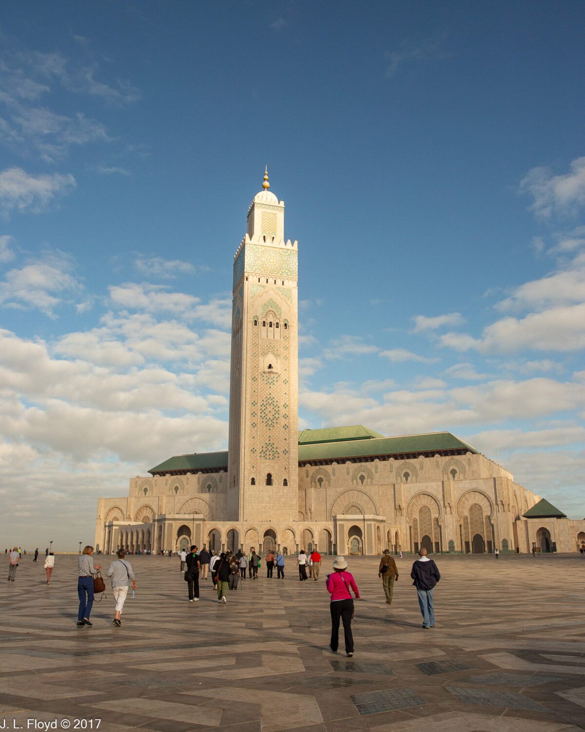
By the time our bus delivered us to our hotel in Marrakesh, on the evening of November 14, 2017, it was already too late, and we were too exhausted, to do anything except eat dinner and retire to our rooms. Our schedule for the following day, November 15, was quite full and left us no free time to go exploring on our own, except late that night. There was also a little time for free-lance discovery on the morning of November 16, after visiting the Jardin Majorelle. I took advantage of these brief opportunities, but they were limited mostly to scenes of the immediate area around our hotel and a few candid street shots from the bus while en route to and from the hotel. Although I shot these photos toward the end of our stay in Marrakesh, they are more suitable for an introduction than a conclusion, so – following a brief preface on the history and character of the city – I’ll begin with them and save the epic adventures of the following two days for the next few posts.

Marrakesh, now the fourth-largest city in Morocco, was founded around 1070 by the Almoravids, a Berber dynasty seeking to reform Islam. With Marrakesh as their capital, they expanded north and created an empire which eventually embraced not only most of the Maghreb (North Africa west of Egypt) but also al-Andalus, the Muslim-ruled territory in Iberia. For a time they brought to a halt the Christian reconquest of the peninsula, but their hegemony did not last long. Their decline began in the early 12th century and eventually they were overthrown by a rival Berber group, the Almohads, who captured Marrakesh in 1147 and went on to take over the Almoravid dominions in both the Maghreb and the Iberian peninsula.

Marrakesh grew rapidly under both the Almoravids and the Almohads and established itself as a cultural, religious, and trading center for the Maghreb. In the thirteenth century, the Almohads were in turn overthrown by another Berber dynasty, the Marinids, who made their capital at Fes. This led to a period of relative decline for Marrakesh, though it remained important.

In the 16th century Marrakesh regained its status as capital with the rise to power of the Saadian dynasty, which initiated a renaissance in the city by renovating the monuments left by its predecessors and building new ones of its own.

In the 17th century, a new dynasty, the Alawis, came to power and took Marrakesh in 1668. Although the Alawi rulers frequently moved their capital from one city to another – Fes, Meknes and Rabat as well as Marrakesh – and finally settled on Rabat, Marrakesh continued to thrive.

In the 19th century, France established an empire in North Africa, conquering Algeria outright and imposing a protectorate upon Tunisia. The French also had their eyes on Morocco, as did the Spanish, who established spheres of influence in far northern and southern Morocco, while the French focused on the areas in between, which included Fes and Marrakesh. Hassan I, the Sultan of Morocco from 1873 to 1894, undertook serious military and administrative reforms and was thereby fairly successful in resisting foreign encroachments, but the situation changed after his death. His son and successor, Moulay Abd al-Aziz, was only 16 and thus came under the aegis of Hassan’s Grand Wazir, Aḥmad bin Mūsa bin Aḥmad al-Sharqī al-Bukhārī, known as Ba Ahmed, who secured the succession of Abd al-Aziz and ruled more or less capably until he himself died in 1900. Ba Ahmed’s father, who was also Grand Wazir, began the Palais Bahia in Marrakesh, but it was mostly Ba Ahmed himself who was responsible for its construction. I’ll have more to say about this in my next post.

After Ba Ahmed’s death in 1900, Abd al-Aziz assumed full control of the government but quickly found himself in a deteriorating situation, having to contend both with accelerating foreign encroachments and serious domestic unrest. Increasing disorder eventually led to full-scale military invasion. Abd al-Aziz was replaced in 1908 by his elder brother Abd al-Hafid, previously viceroy of Marrakesh, but he proved no more able to manage the situation. With the Treaty of Fes in 1912 France turned its sphere of influence into a formal protectorate, and Spain quickly followed suit. Abd al-Hafid was in turn replaced as sultan by another son of Hassan I, Yusef ben Hassan, who however was little more than a figurehead; the French Resident-General, the same General Hubert Lyautey who had led the French invasion forces, had total control over foreign policy and primary control over internal affairs, with the Sultan retaining some authority in the domestic sphere, especially over religious matters.

Moroccan resistance to foreign domination did not cease with the establishment of the protectorates; it continued to fester and erupt in various places and forms, until finally, after World War II, with colonialism on the retreat everywhere, the Kingdom of Morocco regained its full sovereignty. Since then, the country has established strong ties with the outside world, both Islamic and Western, and the government has promoted tourism enthusiastically – an effort which has especially benefited Marrakesh, now the #1 tourist destination in Morocco.

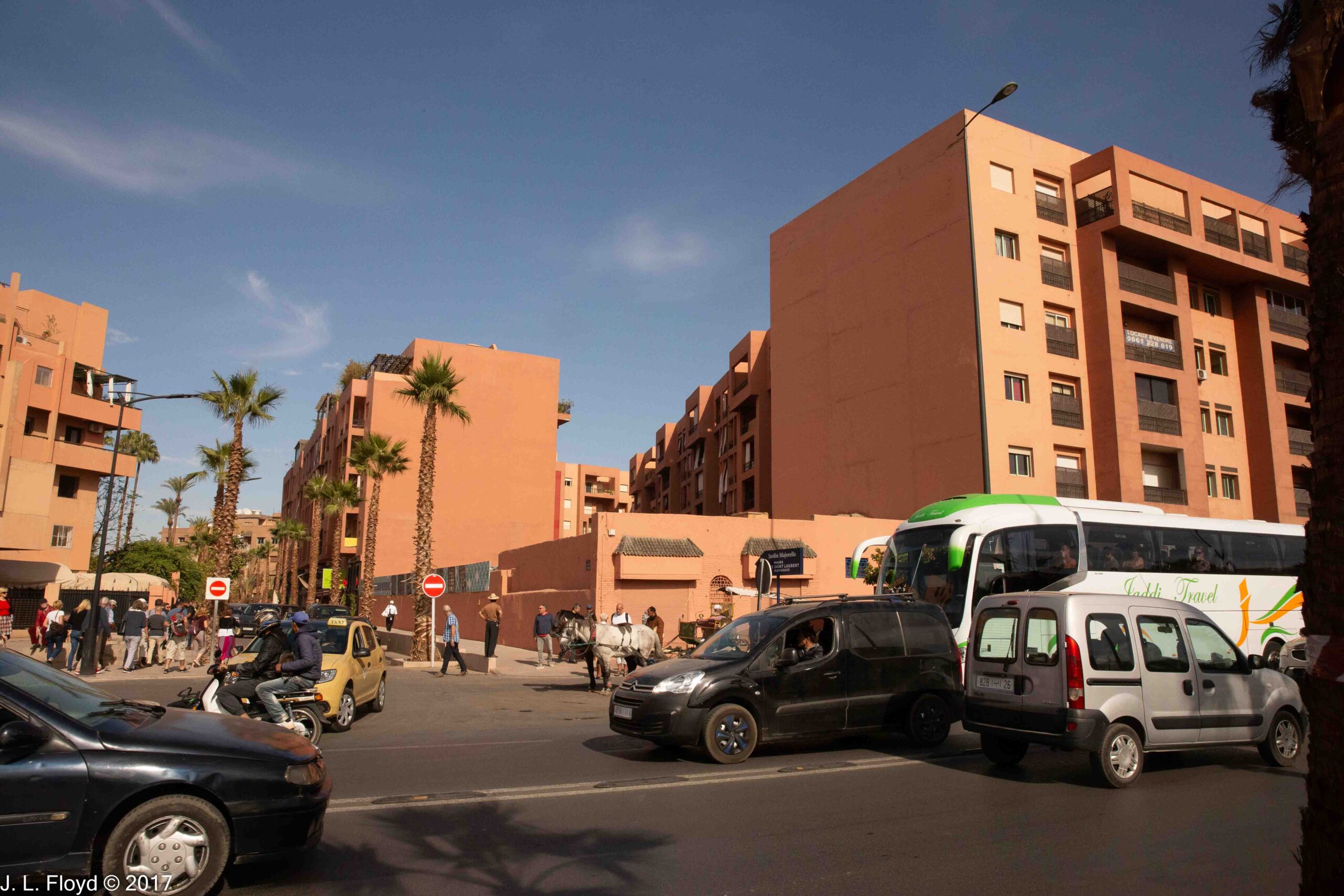
It was immediately evident upon our arrival why Marrakesh is nicknamed the “Red City.” Both old and new structures are overwhelmingly tinted in various shades of rose-red. There is no mystery as to why: the city is situated in a region rich in materials of high iron oxide content, such as red sandstone, which have a strong reddish tint, and these locally sourced substances impart their earthy tones to the structures in which they are used, as they have been for many centuries.

The builders of the Marrakesh city walls used a technique called pisé, a type of rammed-earth construction in which a mixture of earth, water and other materials is compacted within a framework of wooden boards. It is an ancient, durable and sustainable form of construction particularly suited to dry climates, and has been used in Marrakesh down to modern times. A similar type of construction has been extensively used here in America – it is called adobe.

Our hotel, called Le Meridien N’Fis, was situated not far outside the old walls, on Boulevard Mohammed VI near the corner of Rue Moulay Rachid, about 3 km south-west of the Marrakesh Medina. Across the boulevard was a major ultra-modern mall, the Menara, and south of Moulay Rachid were two large parks. It was hard to get a good photo of the hotel because of the vegetation surrounding it, which blocked the view. I couldn’t seem to find a vantage point that didn’t have a large palm tree blocking the view.

On our second evening in Marrakesh, not being ready to fall asleep yet, I went for an after-dinner walk in the hotel vicinity with my Canon EOS-6D and took some pictures of the area. I was surprised to find that after dark this part of Marrakesh felt more like a city in the southwestern USA at Christmas time than an Islamic country in Africa. The Menara Mall across the boulevard from the hotel reminded me in particular of malls in Los Angeles or Las Vegas. To enhance the holiday atmosphere, the street lights were festooned with something that looked like Christmas decorations.

The parks south of the hotel sprouted light sculptures in a form that appeared to mimic Christmas trees. I doubt whether the local inhabitants thought of them as such, but they nevertheless made a comforting contribution to the ambience of the place.

This brief pictorial introduction to Marrakesh highlights the modern aspect of the city; in the next post, we’ll begin to delve into the remarkable legacy of its past.

Categories
Spain, Portugal and Morocco, November 2017

Casablanca – November 14, 2017

Immediately after our arrival at the Hotel Golden Tulip Farah in Casablanca on the evening of November 13, I fell sick. It was the usual type of dysentery that comes from being far from home in an environment with different strains of gut bacteria. Nothing life-threatening, but very distressing and uncomfortable. I called Karim, our Moroccan guide, and he contacted a Moroccan doctor who came immediately. The doctor spoke no English, but he did speak French, so I had to communicate with him using my extremely rusty and very inadequate French – although I can read it well enough, I’m pretty much deaf to spoken French – but I did understand enough to know how to take the meds he provided. Those were quite effective and I was back on my feet in short order, although I had to miss dinner at Rick’s Café that evening. I consoled myself with the knowledge that it wasn’t the real Rick’s Café – actually there was no such establishment in Casablanca during World War II – and that Rick wouldn’t have been there anyway, since after the shooting of Major Strasser he had left with Captain Louis Renault to join the Free French in Brazzaville.🙃

By the next morning I was feeling well enough to go on that day’s outing to the King Hassan II Mosque. I’m glad I didn’t have to miss that because it was an amazing experience. In contrast to most mosques in Morocco, non-Muslims are permitted and indeed encouraged to visit. Both inside and outside, it is a stunning architectural achievement. According to Wikipedia, it is the second largest functioning mosque in Africa and the 14th largest in the world. The minaret, 210 metres (689 ft) high (60 stories) is also the world’s second tallest. Designed by the French architect Michel Pinseau, it was built by Moroccan artisans to King Hassan II’s specifications and completed in 1993. It stands on a promontory overlooking the Atlantic Ocean, and is situated half on land and half over the sea, and visitors can see the ocean through windows in the floor.

The mosque is built on a 22-acre complex which also contains a madrasah, a museum, conference halls, hammams (bathhouses), and a very large multimedia library, the Mediathèque. Despite the number of establishments, the complex was not crowded, and the esplanade on which it stands seemed mostly empty, a feature which maximized the towering majesty of the mosque itself.

The mosque took seven years to build, with 35,000 workers laboring on it day and night, and cost somewhere between $400 and $700 million. The Moroccan government could not afford the cost out of its normal revenues (the King paid for a third of it) and had to appeal to the public for donations, which were abundantly forthcoming, but still not enough; it was necessary also to take out loans from business sources and other governments, which were eventually repaid. The completed mosque is 200 metres (660 ft) in length and 100 metres (330 ft) in width.  The architecture is a blend of Moroccan and non-Moroccan Islamic elements as well as some modernistic features. The mosque is built of reinforced concrete, but the exterior, overlaid with marble, limestone and tile, is abundantly decorated using various materials such as titanium and bronze, pale blue marble and zellij tiles, all in traditional Moroccan motifs. For example, the minaret, faced with marble, is decorated with green and turquoise blue tiles. Seashell-shaped basins at the corner towers of the square arcade surrounding the minaret have a stunning backplane consisting of beautiful blue-green mosaic tilework, and are set into a horseshoe arch flanked by pillars with crosshatch façades matching those on the sides of the minaret.

Entering the mosque, we found ourselves in the great prayer hall, which is designed to accommodate 25,000 people (the plaza outside is designed to accommodate another 80,000, but I’m very glad that neither was filled to capacity the day we were there). The hall is said to be big enough to fit either St. Peter’s basilica in Rome or Notre-Dame de Paris Cathedral inside, although I’m a bit skeptical about that, and I’d hate to see anyone try to do so. It would be like putting a Volkswagen Beetle into a dorm room (this has actually been done) only on a grander scale, with the difficulty of undoing the deed exponentially multiplied.

The design of the prayer hall to me looked suspiciously similar to that of a Christian cathedral. Indeed, it is built on a basilica plan, with three naves perpendicular to the qibla (direction of prayer, facing toward Mecca) wall, where the apse and altar would be found in a Christian church; instead of an altar you find a mihrab, or prayer niche. (It should be noted that both mosque and cathedral have a common origin in the Roman basilica, which was originally a public building, containing courts or other government agencies, rather than a religious temple; the Muslims were not copying Christian churches.) However, the soaring arches with their elaborate muqarnas, the stucco carvings with their elegant Quranic epigraphy, and the profusion of zellij tiles with their lovely floral and geometric figures, all ensure that there was no way the mosque could ever be mistaken for a Christian church. Another quintessentially Islamic feature was provided by the two mezzanine floors on either side of the prayer hall, which appear to be suspended in the air between the columns lining the naves. Their square bases are faced with elaborately carved stone and tile, with elegant fences of dark carved wood lining the borders to keep people from falling off. The mezzanine floors are reserved for women, with entry restricted by electrically operated doors.

The ceiling panels too are made of intricately carved dark wood. 56 elaborate chandeliers made of Murano glass imported from Italy hang from the ceiling, making it especially hard to imagine how the roof could be retracted; but we were informed that it is indeed retractable, and that even though it weighs 1,100 tons, it can be retracted in five minutes. It was not opened during our visit, but we were told that it is often opened during services so that worshippers can pray in the sunshine or under the stars on clear days and nights.

Other than the Murano-glass chandeliers and the white-granite columns, also imported from Italy, all the materials used in the Mosque were sourced domestically in Morocco: cedar for the carved wooden furnishings from the Atlas Mountains, marble from Agadir and granite from Tafraoute. The six thousand or so highly skilled artisans who labored for five years to transform these materials into a mosque were drawn exclusively from Morocco and produced structures and decorations of traditional Moroccan design. It was all quite impressive and drove home to me that over the many centuries of its existence Morocco developed a truly unique and sophisticated civilization, the peer of any in the world, and today blends a distinguished heritage of Berber, Arab and Andalusian elements with modern technology.

One respect in which the designers of the mosque appear to have overreached themselves is in locating it partly over the ocean. After the first ten years of the mosque’s existence, the concrete foundations began to exhibit serious deterioration from the salt water soaking into it, rusting the steel rebar and eventually causing the concrete to crack. An elaborate and expensive restoration project, eventually costing 50 million euros, had to be undertaken to arrest the deterioration and repair the damage. It took three years of research to devise a plan for the restoration, which involved the development of new grades of seawater-resistant concrete and molybdenum-alloy stainless steel. But the results were impressive, and the work is supposed to have extended the life of the mosque by a century.

The section of the mosque built over the ocean replaced a huge municipal swimming pool, the Orthlieb Pool, which was built in 1934, during the French protectorate era. It was demolished in 1986 to make way for the mosque. Today one can look down at the water from large windows built into the floor of the mosque.

Muslims are obliged to perform a ritual washing (wudu) before prayer, and the King Hassan Mosque provides facilities for doing so in the basement. These include an ablution hall, where one can complete the basic wudu of face, arms, hands and feet, and a hammam (bathhouse), which accommodates 1,400 people. We were not invited to enter the hammam, but we did visit the ablution hall, which was accessed via a corridor from the outside of the mosque. The hall itself contains 41 mushroom-shaped marble fountains and 600 taps and is very elegantly decked out, with marble floors, granite columns, tiled walls, sculpted ceilings and strikingly original light fixtures. Both prayer and ablution halls were spotlessly clean and looked brand-new, as if they had been completed the day before.

Leaving the mosque, our tour group boarded the bus to go to lunch. On the way we dropped by the Royal Palace of Casablanca. As I think I’ve mentioned already, the King maintains palaces not only in the capital but in the largest cities, and since Casablanca is the largest city in Morocco, of course he would have a palace there. As I recall it is not an especially pretentious one, as palaces go, but we were unable to see what it was like inside, although Chuck Mattox respectfully knocked at the door to request admission. The cat who normally guards the door was absent this time, so there was nobody to let him in; and we were hungry, so we went on to lunch without further ado.

From the King Hassan II Mosque, there is a Maritime Promenade which extends westward between the seashore and the Boulevard de la Corniche, ending at El Hank Point, where the tallest lighthouse in Morocco proudly stands. The El Hank Lighthouse, 51 meters (167 feet) tall, can be mistaken for a minaret, but it is a working lighthouse, equipped with a Fresnel lens putting out 2.1 million candelas of illumination, visible for 30 nautical miles or 55 kilometers. Our lunch stop was somewhere to the west of the lighthouse – I forget the name of the café – and gave us a great view of the promenade, the seashore and the city itself. By this time my GI distress of the previous evening was a distant memory and I was able to enjoy a good meal without any discomfort.

After lunch we reboarded our faithful tour bus for the long (243-kilometers, about 3 hours) ride to our final destination in Morocco, the fabled city of Marrakesh.

Categories
Spain, Portugal and Morocco, November 2017 Adventures Abroad

A Day in the Capital of Morocco – November 13, 2017

Rabat is the political capital of Morocco, and has been effectively so since 1912, when the French established their protectorate and made Rabat the seat of their administration for safety’s sake, Fes being too unruly and hostile to infidels. After Morocco regained full independence in 1956, the monarchy, perhaps for similar reasons, continued to rule from Rabat. It was a smaller city than Fes, less xenophobic and easier to control.

We visited Rabat on November 13, 2017, on our way from Fes to Casablanca, spending most of the day there. I knew little about Rabat in advance and thus was pleasantly surprised at what we saw there, much more than what I expected. I did not know, for example, that Rabat has been around a long time, under different names; it probably began as Shallat, a Phoenician colony, early in the first millenium BCE, and in the first century BCE it came into the orbit of Rome. Under the name of Sala Colonia, it became a naval outpost and commercial trading waystation. After Roman times it became abandoned, but underwent a revival in the Islamic era. In the 10th century CE a ribat (Arabic word for small frontier outpost) was built on the south side of the Bou Regreg River, and later a new town of Sala, now known as Salé, was built on the north side of the Bou Regreg River (Roman Sala Colonia had been on the south side). In 1150 or 1151 the Almohad caliph Abd al-Mu’min built a full-scale kasbah, or fortress, on the site of the old ribat, but the city eventually derived its name from the older title, because it’s now Rabat instead of Kasbah.

In 1244 the new Marinid dynasty replaced the Almohads and ruled Morocco until it was in turn overthrown by the Wattasids in the 15th century. The Marinids made their capital at Fes, but they built a new mosque, as well as a major necropolis, called the Chellah (which we visited), in Rabat.

In 1609 the Spanish monarch Philip III (who also controlled Portugal at the time) decreed the expulsion of all the Moriscos – people of Muslim or Moorish descent – from the Iberian peninsula. (The Spanish had promised to allow them to continue to practice their religion after the conquest of Granada in 1492, but Cardinal Ximenes had reneged on the deal.) Many of the Moriscos landed in the vicinity of Rabat, which underwent a substantial growth in population a result. Perhaps in order to revenge themselves on their former persecutors, as well as to augment their incomes, some of these immigrants turned to piracy.

By the early 17th century the Saadian Sultanate, which had replaced the Wattasids in the early 16th, was on the skids, and its control over the area at the mouth of the Bou Regreg River was falling apart. The Moriscos and other inhabitants of Rabat – then known as Old Salé, with the town on the north side of the river called New Salé – established an autonomous polity known as the Republic of Salé, or Republic of Bou Regreg, which became a haven of pirates. The corsairs preyed on merchant shipping around the shores of Western Europe, seizing the cargoes and selling the crews and passengers into slavery in the Islamic world. Although a new dynasty, the ‘Alawis, came to power and took control of the Salé area in 1666, they allowed the depredations of the pirates to continue until the early 19th century. I suspect that they got a share of the spoils.

While maintaining their capital in Fes, the ‘Alawis took considerable interest in Rabat and undertook several building projects there, expanding the kasbah and building new palaces and mosques. Sultan Moulay Isma’il (r. 1672–1727) settled members of the Udayas, a tribe that furnished part of his army, in the kasbah, so that now it is known as the Kasbah of the Udayas (which we also visited).

In 1755 the enormous earthquake that destroyed Lisbon also wreaked havoc in Rabat, seriously damaging the Chellah necropolis, the Roman ruins and other historic structures as well.

When the joint French/Spanish protectorate of Morocco was established in 1912, the ‘Alawi Sultan Abd al-Hafid abdicated and was replaced by his brother Yusuf, the candidate of the French. Under French colonial rule the Sultan retained some of his prerogatives but was basically the puppet of the French government. However, in 1927 Yusuf died and was succeeded by Mohammed V, who increasingly became associated with a growing nationalist movement. After World War II Mohammed V, encouraged by token support from the USA, became increasingly vocal in his support of the movement, and altercations with the French government became more serious and violent. In 1953 the French attempted to neutralize the Sultan by exiling him to Madagascar, but this failed to defang the nationalist movement and agitation for independence only increased. By 1955 the French were ready to throw in the towel and allowed Mohammed V to return to Rabat, greeted by cheering crowds, in October of that year. In 1956 the signing of a Moroccan declaration of independence officially ended French rule in Morocco. A year later, Mohammed V exchanged the title of Sultan for that of King, and his successors have continued as Kings ever since.

After Morocco regained independence in 1956, Rabat – although still only the seventh largest city in Morocco – grew to a population of 577,827 in 2014; but the conurbation it forms together with the surrounding cities of Salé (890,403), Kenitra (431,282), and Temara (313,510) totals over 2 million.

Our visit to Rabat started at the Chellah. It is enclosed by a set of walls built by the Marinid sultans in the 14th century. We entered through the monumental main gate, completed in 1339 by the Marinid Sultan Abu al-Hasan. The elaborately decorated gate with its horseshoe arch and polylobed motifs is flanked by two towers with semi-octagonal bases and crowned with square turrets, and guarded by two tribesmen dressed in colorful red and green costumes. After passing through the gate, we strolled through a garden area through which we glimpsed a towering minaret with a stork’s nest on top.

The minaret beckoned us to the ruins of the Marinid necropolis (known as a khalwa in Arabic), which we explored first, beginning with the mosque, built around 1284-85 by the Marinid Sultan Abu Yusuf Ya’qub (not to be confused with Caliph Abu Yusuf Ya’qub al-Mansur of an earlier dynasty, the Almohads). It is a hypostyle hall (i.e. has rows of columns supporting the roof) divided into three naves by two rows of horseshoe arches. At the rear of the mosque are several qubba (tombs or mausoleums), the most elaborate and well-preserved of which is that of Abu al-Hasan, who reigned from 1331 to 1348. His qubba was likely built by his son, Abu Inan, who also may have built the adjoining madrasah and the tall minaret.

Not only the minaret, but also the mausoleum of Abu al-Hasan, the walls of the madrasah and virtually every other tall structure in the necropolis were appropriated by storks as nesting sites. I was reminded of a madrasah in another Muslim city, Bukhara in Uzbekistan, where I stayed in 1973 and which was also topped by a stork’s nest, although it was unoccupied at the time. The nests in the Chellah were fully occupied; the residents, who are of the type known as white storks (though they have wings that are partly black), spend the summer in Europe and in autumn fly across the Straits of Gibraltar to Morocco, where they spend the winter. I love these magnificent creatures, and I was gratified that the custodians of the Chellah made them welcome.

Opposite the necropolis, on the north side of the Chellah, we strolled amidst the ruins of the ancient Roman town, Sala Colonia. This was built on a slope and was laid out in three terraces, with streets laid out in a regular grid. At its west end stood the capitolium, a temple dedicated to the Capitoline Triad, a group of deities which included Jupiter, Juno and Minerva and occupied a central role in Roman religion. It was better preserved than some of the other structures, including a row of tabernae (shops) on its south side, which had collapsed, and a triumphal arch nearby, of which only the foundations remain. South of them, next to the Marinid necropolis, was another set of ruined structures, which included the Roman bathhouse, a nymphaeum (temple dedicated to nymphs) and a basilica (civic structure, like a city hall). Most of these have been dated to the early second century CE, a time of great prosperity for the Roman Empire.

At the east end of the Sala Colonia complex we investigated the old Roman Forum area, which also includes a temple and some tabernae. Its age has not been precisely determined, but it may be older than the west-end structures, possibly dating from from just before or after Rome annexed the area in 40 CE. In the forum we found some ruined statues, one of which Manuel Sueiras, our tour leader, adapted for use as a podium from which to harangue us on various subjects (mostly the necessity of sticking to the tour schedule and not being late for the bus). I thought of him as the simulacrum of Emperor Trajan, the great second-century CE monarch who presided over the Roman Empire at its apogee. This was quite appropriate because Trajan, like Manuel, was from Spain. Manuel was followed at the podium by Chuck Mattox, whom I imagined as playing the role of Mark Antony rallying the crowd at Julius Caesar’s funeral with the speech that (at least according to Shakespeare) begins with “Friends, Romans, countrymen, lend me your ears.”

Leaving the Chellah, we rode the bus a short distance to a wide esplanade where we visited the next couple of attractions, the Hassan Tower and the Mausoleum of King Mohammed V. Guarding the entrance to the complex were a couple of elite Moroccan lancers in colorful red uniforms mounted on white horses.

Nobody seems to know how the Hassan Tower got its name, because it was not built by anyone named Hassan. Its sponsor was the Almohad ruler Abu Yusuf Ya’qub al-Mansur (r. 1184 to 1199), who wanted to move his capital from Marrakesh to Rabat and make the latter into an imperial capital with the largest and most magnificent mosque in the Maghreb. He actually started construction on the mosque in 1191, but when he died work stopped and was never resumed. All that remains are parts of the walls, a forest of columns intended to hold up the roof, and the partially completed minaret, 44 meters (144 feet) out of a planned 64 meters (210 feet) or more in height. That unfinished minaret is the Hassan Tower. Its footprint is square, 16 meters on a side, and it is built of sandstone which has turned a reddish color over the centuries. One curious fact about the Tower is that there are no stairs to climb to the top; instead there are a series of ramps – this was done so that the muezzin could ride horseback up to the top to do the daily prayers.

On the south side of the mosque esplanade stands a modern complex of structures, consisting of a modern mosque, a pavilion, and the Mausoleum of Mohammed V. These were designed by a Vietnamese architect, Cong Vo Toan, and completed in 1971. The mausoleum is at the southeastern corner of the esplanade.

King Hassan II (r. 1961-1999) commissioned the mausoleum after the death of his father, Mohammed V, in 1961, and was later himself buried in it as well, along with his younger brother Abdallah, who died of cancer in 1983. The mausoleum stands on a raised platform, accessed by a long flight of steps, and is built of reinforced concrete, but is clad in white marble, with porticos of Moorish arches holding up the walls. A pyramidal green dome sits atop the roof with its crenellated parapets.

Venturing into the mausoleum, we found ourselves in an upstairs gallery which extends along all four sides of a rectangular chamber, looking down into the burial vault. The tomb of Mohammed V is carved in white onyx and illuminated by lamps in chased brass vessels which cast a soft light over the room. In one corner stands a reading platform holding a copy of the Quran, where a reader can come and recite its verses. Elegant zellij tiles cover the walls, and a polished mahogany dome with colored glass presides over the chamber.

At the opposite side of the esplanade, in the southwestern corner, is a rectangular open-air pavilion with rows of arches, built on a raised platform; this was designed as a museum to showcase the achievements of the current ruling house of Morocco, the Alawites (or Alaouites). Between the pavilion and the mausoleum stands the modern mosque, which we did not enter.

Our itinerary took us finally to the Kasbah of the Udayas, our last stop in Rabat. The Almohad ruler Abu Yusuf Ya’qub al-Mansur, who wanted to make Rabat his imperial capital, built several new ornamental gates in the walls of the Kasbah, most notably the Bab Oudaia, also known as the Bab al-Kbir, which translates to “Great Gate.” It is indeed impressive, but for some reason I failed to obtain a good photo of it, though I did photograph some of the other gates. However, you can find good shots of the Bab al-Kbir on Wikipedia.  

Immediately upon entering the Kasbah we discovered that Rabat is another Blue City, reminiscent of Chaouen. The walls are painted blue and white, and many of the doors and windows are blue also. The streets of the Kasbah, especially in the residential areas, were generally very narrow, as one would expect in a medieval walled city. However, they were neat and clean and the residents obviously took pride in their dwellings. Moreover, street lights had been installed to improve safety at night.

There was little opportunity for ostentatious display given the uniform character of the residential structures; what conspicuous consumption there was – and individual creativity as well – showed up mostly in and around the doors, some of which were quite remarkable. Sandie and I shot photos of some of the more striking ones, as seen in the next gallery.

In the 17th century the corsairs who then controlled the Kasbah built a broad platform on its northeastern edge, from which they could signal by semaphore to their own ships and repel pursuing enemy ships with artillery. Today the platform provides scenic views of the Rabat waterfront, the Bou Regreg river, the city of Salé across the river, and the Atlantic Ocean beyond. The jetties at the harbor mouth provide protection against the ravages of the tumultuous Atlantic Ocean and form a nice beach; a set of broad steps leads down from the Kasbah to the beach.

We did not spend the night in Rabat, instead boarding the bus to continue to Casablanca, Morocco’s largest city, where we were booked for dinner at Rick’s Café that evening.

Categories
Spain, Portugal and Morocco, November 2017

Dinner and a Show in Fes, November 12, 2017

The climax of our visit to Fes was a gala dinner and show in an impossibly elegant restaurant, the name of which I don’t remember and can’t find in any of our trip records; but it was as opulent and beautifully furnished as any of the palaces we saw in Morocco.

Fes is not noted for nightlife. According to one web site I visited, “Fes is a conservative city so raucous nightlife is not on the menu.” Another advised “If you are looking for a party town, try Marrakesh instead.” The entertainment presented to us was relatively sedate, but then we were not looking for a particularly raffish or outré experience.

It was inevitable, of course, that in a Maghreb Muslim country we would get belly-dancing, so that was no surprise. There was also dancing with audience participation to the accompaniment of what I assumed to be traditional Moroccan music. I have never gained much of a taste or appreciation for the dance in any of its forms, so I didn’t find these activities especially beguiling. My favorite part of the show was the magician, who pulled doves out of his hat and did other sleight-of-hand tricks. It was all good food and good fun in a beautiful setting, on the whole a suitable ending to our stay in the fascinating city of Fes.

Categories
Spain, Portugal and Morocco, November 2017

Fes, November 12, 2017: The Medina

The Medina, or Old City, of Fes is often considered as encompassing the two old quarters of Fes el-Jdid, where the royal palace is located, and Fes el-Bali, which constitutes the commercial and cultural hub. But the two are very different, and although both are quite old, Fes el-Bali is by far the older of the two, having been founded in the eighth century CE. Fes el-Jdid was begun in the 13th century as an administrative capital for Fes el-Bali. The wide boulevards and open squares of the palace area seem a world apart from the narrow alleys and packed market stalls of the Fes el-Bali. Entering those crowded lanes, I felt that I was traveling back in time to the world of the medieval and early modern era. Butchered meat was laid out on open tables for close inspection; traders hawked their wares in front of their shops; donkeys hauled their burdens through the streets, from which cars and trucks were banned. To me, life in such surroundings seems less constricted and sterile, earthier, more sensuous and piquant. Of course, it’s also less hygienic, but then it wasn’t entirely premodern; no open sewers or people throwing garbage out of windows onto the heads of passers-by. Also, as far as I remember, no beggars, although there were plenty of aggressive vendors.

But Fes el-Bali is not only a commercial hub – it is a cultural and religious center as well, home to some of the Islamic world’s most venerable institutions. Foremost among them is the University of Al-Qarawiyyin, considered by some authorities to be the oldest continuously operating institution of higher learning in the world. It was founded as a mosque in the ninth century, but for most of its history it operated as a madrassah, a school of Islamic studies. Since 1963, when it was incorporated into the Moroccan state university system, it has also taught some secular subjects, although the curriculum remains predominantly Islamic. We did not visit Al-Qarawiyyin, since its main attraction, the mosque, is not open to non-Muslims. Instead, wending our way through the crowded streets, we followed our guides (there were several, so as to ride herd on us and keep individuals from becoming detached and lost in the throng) to a nearby and no less venerable institution, al-Attarine Madrasah, which does welcome infidels. Perhaps this is because it is run by cats. This was evident when we entered the central court of the establishment, where a cat was strolling about near the central fountain, quite confident that it was in charge, and clearly well-disposed to us tourists as well as the staff. Al-Attarine was so named because it was located close to the spice and perfume market in the Medina (cf. the English word “attar,” as in “attar of roses,” deriving from an Arabic/Persian word for perfume).

The madrasah was a type of academy that originated in northeastern Iran in the early 11th century with the purpose of training students in Islamic subjects, especially religious law and jurisprudence. (I go back a long way with madrasahs, having stayed in one – the Char-Minar, at that time being used as a hostel – for a few days in Bukhara, Uzbekistan in April 1973.) But madrasahs really came into their own in Morocco in the 14th century CE.

In the 13th century CE a faction of Berber nomads known as the Marinids overthrew the ruling Almohad dynasty of Morocco and established their own regime. They made their capital at Fes, and they found the madrasah a useful institution for fostering orthodox Islamic teachings against what they considered the heretical doctrines of their Almohad predecessors, in the interest of bolstering their legitimacy. They established a number of madrasahs in Fes in hopes of securing the loyalty of the city’s notoriously unruly intellectual elite and of educating candidates for government service. The madrasahs, including al-Attarine, were mostly located near Al-Qarawiyyin University, and in addition to teaching their own curricula, they supported the university by providing food and lodging for poor students, which the university did not. The madrasahs were typically supported by charitable trusts endowed with properties by the sultan.

Entering al-Attarine via the vestibule at its west end, we passed through an archway into the courtyard. There our Moroccan guide, Karim, explained the layout and operations of the madrasah, while the cat who actually ran the place strolled about to ensure that the visitors observed correct decorum and did not get into mischief.

Entry to the al-Attarine courtyard is from the west; on the east side is the entrance to the prayer hall. On the north and south sides are galleries with square pillars and marble columns supporting a melange of wooden and stucco muqarnas arches. The galleries in turn support the second floor, which is accessible by a stairway, and which originally contained thirty rooms serving as a dormitory for the students. Some of our group, including our tour leader Manuel, ascended the stairway and took in Karim’s talk from the second-floor windows. The feline custodian made no objection.

We also visited the prayer hall at the eastern end, which is somewhat unusual for its time and place. Usually Marinid madrasahs were built with the main axis aligned with the qibla, the direction of prayer (i.e. toward Mecca), so that the prayer hall with its mihrab, or prayer niche, would also be oriented in that direction. That would have been on the east wall in this case, but the geometry of the space available to the builders did not allow for the normal arrangement, so instead they located the mihrab of the al-Attarine madrasah on the south wall of the prayer hall. They also built a square wooden cupola over the space in front of the mihrab, with a stunning bronze chandelier (flanked by two smaller bronze lanterns) dangling from the ceiling.

The al-Attarine madrasah is considered to represent the apogee of Marinid architecture, and nowhere is this more evident in the tilework. In the courtyard the floor, lower walls and pillars are all covered with zellij (mosaic tilework), arranged in geometric motifs; at eye level there is a band of sgraffito-style tiles with calligraphic inscriptions. Above the tilework, the courtyard as well as the interior rooms are adorned with intricately carved stucco decorations, including arches and niches sculpted with muqarnas. At the highest levels are ceilings, eaves and panels consisting of elaborately carved cedarwood. As with the Moorish palaces of Andalusia, the overall effect is overwhelming, a feast for the eyes, and I regard Moorish/Moroccan architecture as among the most sublime achievements of the human race.

But now it was time for lunch, which we enjoyed in an upstairs restaurant not far from al-Attarine. I’m not sure about the exact location, but afterwards we were able to venture out on the terrace to get a rooftop view of the Medina. It was quite an expansive vista, but given our brief acquaintance with the area, it was hard to identify many of the structures and landmarks we were seeing. Easily the most identifiable and striking was the Zawiya (or zaouia) of Moulay Idris II, who ruled Fes from 807 to 828 and is considered its primary founder. A zawiya is an Islamic shrine and religious complex, and the Zawiya of Moulay Idris II is considered one of the holiest shrines of Morocco. It contains the tomb and mausoleum of Idris II, lavishly furnished and decorated. It is recognizable from afar by its minaret, the tallest in Fes el-Bali, and the large pyramidal roof of the mausoleum chamber. It is closed to non-Muslims, but we were able to get a glimpse of the interior later in the afternoon.

Fes is historically a center of production for high-quality leather goods, and there are several tanneries in the Medina. It turned out that one of them was just downstairs from our vantage point. This was not a coincidence, but rather a planned stop on the tour itinerary, and as we surveyed the tannery from our aerie, our guide gave us a rundown on the process of tanning hides and turning them into fine leather articles.

Descending back to street level in the labyrinthine Medina, we were led past the portals of the Zawiya of Moulay Idris II, where we sneaked a peek into its gorgeously carpeted anteroom, to a shop where the final products of the tannery we had just visited are sold. The wares were attractive, but the prices not so much, and the salesmen were among the most annoying we encountered in Morocco. It was memorable only because Manuel Sueiras started a new fashion trend with a piece of headgear, composed entirely of string, that he tried on in the shop. It soon became all the rage, and before we left Morocco it had spread over the country like wildfire, displacing the traditional fez hat that had been worn in the city since time immemorial.

Of course I didn’t expect anyone to believe that last outrageous lie. Actually the fez, or tarboush – a short, cylindrical, brimless and peakless red hat with a tassel attached to the top – was associated mainly with 19th-century Ottoman Turkey, where Sultan Mahmoud II decreed it to be worn by all civil and religious officials. Though it may indeed have originated in the Maghreb, it was called the fez because Fes was the source of the dye used to color the felt. Tarboush was the Turkish name. I never saw one being worn in Fes – or Turkey, for that matter: it was outlawed in 1925 as part of Atatürk’s reforms.

Categories
Spain, Portugal and Morocco, November 2017

Fes, November 12, 2017: Two Palaces, a Fortress and a Pottery Workshop

Fes is a very old city, dating from the eighth century CE, and a large one, with a population of over a million. It has an illustrious history and although no longer the political capital of Morocco, it is considered the country’s spiritual and cultural capital.

The hotel where we stayed in Fes, the five-star Palais Medina, was indeed a palace, and I have devoted more than the usual space to it. It was an ultra-modern establishment, with a spacious lobby, luxurious rooms, and a full range of amenities, including a vast outdoor pool and lounge area. Although in general I prefer traditional settings with lots of history, I very much enjoyed the tastefully decorated lobby with its comfortable modern couches and easy chairs as well as the modernistic paintings on the walls, most of which were apparently created by contemporary Moroccan and Arabic artists, judging from the signatures on the canvases.

The morning after we arrived in Fes, I woke up early and had some time to explore the hotel and its grounds before breakfast. After checking out the lobby and the adjoining areas, I descended the impressive marble staircase leading to the patio and pool area, which turned out to be quite vast. It also turned out to be quite empty; nobody was interested in taking a swim or lounging around in the feeble sun of that chilly November morning. But it was impressive nonetheless, with two very large swimming pools and more chaises longues, cabanas and other amenities than you could shake a palm frond at.

After enjoying a sumptuous breakfast at the hotel, we embarked upon our tour of the city. Our first stop was the main rival of the Palais Medina Hotel, the Palace of the King of Morocco. Although the political capital of Morocco is Rabat, the King maintains palaces in all the major cities and actually shows up in them from time to time, in order to assure people that he still exists. On that date, November 12, 2017, King Mohammed VI was not present in Fes, but we were nevertheless greeted by royalty, in the form of a cat who obviously regarded the palace and its grounds as his own private territory, whatever members of the inferior human species might think.

From the palace our bus took us to the Borj Sud. This is one of two forts built by the then Sultan of Morocco, Ahmad al-Mansour, in 1582, with the purpose not only of defending the city against external attack, but also – and perhaps more so – of keeping the fractious population of Fes under control. The Saadian dynasty ruling Morocco in that time was based in Marrakesh and had encountered considerable opposition in Fes, which was a notoriously unruly city (and still is). Al-Mansour had the Borj Sud built on a commanding height on the south of the city, across the valley from its counterpart, the Borj Nord, located on a promontory on the hills to the north of town. By 1582 the Moroccans had acquired experience with the use of gunpowder in the course of their wars against Portuguese colonial expansion, and the Borj fortifications exemplify the results, being modeled after Portuguese forts of the time. Indeed, the forts are thought to have been built with the labor of prisoners captured in the Battle of the Three Kings in 1578, when the Moroccans defeated a Portuguese invasion and killed the King of Portugal, Sebastian I, precipitating a dynastic crisis which led to the takeover of Portugal by the Spanish monarch Philip II.

The Borj Sud provides a wonderful view of the city of Fes, especially its historic core, the districts of Fes el-Jdid and Fes el-Bali. The former is the newer of the two and contains the Royal Palace, which we had just seen, as well as the old Jewish Quarter, known as the Mellah. The Fes el-Bali, the oldest quarter, dates from around 800 CE and was itself composed of two districts on either side of the Fez River, which eventually merged into one, and now comprise the Medina (old town). We would see it later in the day. Beyond the two old quarters stretches the modern city, the Ville Nouvelle, which mostly grew up during the twentieth century.

Descending from the height of the Borj Sud, we shortly arrived at an establishment which styled itself the Art de Poterie. We debarked into the courtyard, which provided storage for the raw clay used to make the pottery and also served as the drying yard for the tiles which constituted a large share of the firm’s output. In the drying yard we shot pictures of the clay stockpile, the soaking pool, and newly formed tiles being spread out to dry; there also we met the proprietor (or manager, I’m not sure which), who took us around the shop and explained the various processes and operations involved in turning the raw clay into finished pieces of pottery.

We first observed the process of making the zellij tiles so characteristic of Moorish architecture. It begins with shaping them from raw clay and then clipping off the ragged edges. Many complex pieces such as urns and bowls, of course, have to be turned out on a potter’s wheel, and next we watched a master potter as he spun out these items with a speed and ease which we knew to be much harder than it looks. The potter may also shape and add other constructs such as handles and spouts.

The most intriguing part of the pottery creation cycle for me was the painting and glazing. Even after having observed the artists at work, I have no clue as to how they imprint the incredibly intricate designs on the clay and then apply the colors without smearing or deviating from the pattern. It must take years of learning. I remember the proprietor complaining that it was getting harder and harder to find people with the patience and talent to perform these operations, or who would take the time to learn how.

The workshop had two kilns, of ultra-modern manufacture, which appeared to be the only hi-tech equipment in the place. Stoneware pottery of the kind made in Fes is fired at temperatures of 1200 degrees Centigrade. After firing, the finished wares are placed on shelves to cure and await transfer to the showroom, where they are displayed for sale.

Our final destination at the Art de Poterie was of course the showroom, where the number and variety of items displayed was overwhelming. There was naturally also a horde of salesmen to assist in divesting us of our hard-earned lucre, but they did not need to be aggressive because the pottery was seductive enough to arouse the lust of all but the most blasé shoppers. The prices were also relatively affordable for wares of such high quality. The only restraint preventing us from spending a fortune in the place – I wanted to abscond with about half the contents of the room – was the improbability of fragile pottery surviving the journey back to the USA in buses, trains, and airplanes. Some people succeeded in bringing their purchases home in their carry-on bags, but that was not an option for me because I had too much heavy camera equipment to lug around. There was no room for additional items in my carry-on and even if there were, the breakage risk would have been little less than in checked luggage.

Sandie and I met this challenge by making a minimal selection and having it shipped. The shop was willing to pack purchases securely and ship them anywhere in the world, though they warned us that the cost would be prohibitive. Foregoing all the other attractions – the tagine pots, beverage decanters, vases, dinnerware, etc. – we settled on four beautiful hand-painted bowls. It turned out that the cost to ship to the USA was about the same as the cost of the bowls – $60 for four. For us it was worth it. The workers in the shop packed the bowls expertly – they obviously had a lot of experience – in what was essentially an iron cage with abundant protective padding, which they put together before our very eyes. The bowls did indeed all arrive intact, and we have them in our kitchen to this day, except for one which I broke. You may of course correctly retort that it’s possible to buy Moroccan pottery online these days, at reasonable prices, but I haven’t yet seen anything on the Web quite as pleasing to my eyes as the bowls we bought at that shop in Fes.

Categories
Spain, Portugal and Morocco, November 2017

Lunch in the Blue City: Chefchaouen, November 11, 2017

On the afternoon of November 11, 2017, Veterans’ Day in the United States (a holiday which I favor, being a veteran), our Go-Ahead tour group arrived in Chefchaouen, known as the Blue City because many of its buildings are painted in that color. It is usually referred to simply as Chaouen. There are several theories as to how blue came to be the theme color of Chaouen, one being that the color has a special spiritual significance for the locals, another that it is repellent to mosquitoes, and a third, which seems most probable to me, that it was adopted in recent times as way of attracting tourists.

Chaouen is not one of the most ancient cities of Morocco. In the fifteenth century, following the completion of the Reconquista in Portugal, the Portuguese began to take the offensive against the Moors in North Africa. They took a number of cities in northern Morocco, most notably Ceuta and Tangier, and one of the local mujahideen built a small kasbah (fortress) in the Rif Mountains as a stronghold of resistance to the invaders. Over the following years a city grew up around the fortress, its population augmented by Moriscos and Jews expelled from Spain after the fall of Granada in 1492. The influx of immigrants from the Iberian peninsula was the source of a strong Andalusi-Granadan influence on the local culture, manifested most visibly in local residential architecture.

Portuguese imperial ambitions in Morocco were dashed by the Battle of Alcazarquivir in 1578, in which the King of Portugal was killed, ending his dynasty and leading to the takeover of Portugal by Philip II of Spain in 1580. Spanish rule of Portugal and its colonial empire continued until 1540, when the Portuguese rebelled and regained their independence.

Fast forward to the 19th century, when the French were establishing their colonial empire in North Africa. By the end of that century, the Spanish had lost the last of their overseas domains – Cuba and the Philippines – in the Spanish-American War, and were looking for some sort of compensation in order to keep some vestige of their standing among the European powers. Morocco seemed a likely place since so much of it was up for grabs anyway. At the same time, France and Britain took pity on the Spanish and agreed to let them have a few crumbs from the imperial banquet in the form of small slices of Morocco at its northern and southern ends. The arrangement was sealed by the creation of a dual French and Spanish protectorate over the country in 1912. Spain’s slice in the north included the city of Chaouen. The heritage of the Spanish occupation there is most visible in the street names and commemorative plaques, which are generally in Arabic and Spanish (though often in English as well).

The Berber tribes of the Rif Mountains, where Chaouen is located, did not accept Spanish domination passively, and under a capable leader named Abd el-Krim, they rose in revolt, inflicting severe defeats on the Spanish forces. Abd el-Krim established a short-lived government, the Rif Republic, which lasted from 1921 until 1926, when the Spanish finally crushed it with much help from the French. In 1925, at the height of the Rif War, Chaouen was bombarded by the Lafayette Escadrille, a squadron of American mercenary pilots in the service of France.

Francisco Franco rose to prominence during the Rif War, and later, in 1936, launched his uprising against the Spanish Republic from Morocco. The Spanish protectorate in Morocco continued until 1956, when both French and Spanish protectorates were dissolved and merged into the newly independent Kingdom of Morocco. However, Spain did retain the cities of Ceuta and Melilla on the Mediterranean coast.

In the post-World War II era, especially since the 1960s, Chaouen became a popular tourist destination. At first this was primarily associated with the production of cannabis in the Rif; Chaouen emerged as a major hub of cannabis tourism. Cultivated in Morocco for centuries, cannabis was outlawed by King Mohammed V when the country gained independence in 1956. But it was tolerated unofficially to some extent because of its traditional usage by the local population and also because it provided an important source of income for poor farmers of the Rif Mountains, where few other crops can be grown profitably. In recent years, the recognition of the economic value of cannabis has led to its partial decriminalization: in 2021 Morocco declared it legal for medicinal, cosmetic and industrial, though not for recreational purposes. By 2024 Morocco had become the world’s foremost supplier of cannabis. However, I don’t remember seeing any evidence of cannabis commerce in Chaouen, and since I myself am not a cannabis consumer, I didn’t look for it.

Our bus had deposited us in the newer part of Chaouen, through which we had to make our way on foot to the main area of interest, the Chaouen Medina. It was immediately apparent why it was called the Blue City. Not everything was blue, but many of the major structures, such as the wall of the cemetery on Boulevard Hassan II and the local high school, were painted in a bright and deep blue that was quite distinctive, even flamboyant.

Entering the Medina through one of its main gates, the Bab El-Ain, we emerged on the Uta el-Hammam, the main square of the Medina, so named because there is a hammam (public bathhouse) in the northwest corner. There we were able to view the Grand Mosque of Chaouen. Its date of construction is uncertain but is thought to have been in the late 15th or early 16th centuries, though its distinctive octagonal minaret was erected later, sometime in the 17th. As the main mosque of Chaouen, it served as an assembly point where the local notables gathered to make obeisance to the Sultan and where the Sultan’s proclamations were read out to the populace. For me its most striking architectural feature consisted of the blind arches, filled with green-and-white tile inlays, on the sides of what I took to be the prayer hall. The minaret also incorporates blind arches, three tiers of them, with square panels inlaid with zellij tiles on the top tier; for some reason we failed to capture photos of the minaret, but it can be seen here.

We spent some time roaming through the backstreets and alleys of the Medina, where we found ourselves immersed in a sea of blue. Along with Chuck and Elouise Mattox, Sandie and I soon got lost in the maze.

When we finally extricated ourselves, we came out near the main entrance of the Kasbah, the old fortress which was the foundational structure of Chaouen. Next to the entrance there is a historic house which contains some of the archaeological and ethnographic exhibits of the Kasbah, which is now a museum. We did not explore the museum; I think it was closed on the day we were there. On the steps leading to the entrance were piled various household effects such as mattresses, other furniture and crockery. Apparently it was moving day for someone, but who that might be, and whether they were moving into the Kasbah, out of it, or into or out of one of the nearby structures, I was unable to figure out.

Of the native inhabitants of Chaouen, the most memorable for us were the cats. There were a fair number of them inhabiting the Medina, and they seemed to enjoy some sort of privileged or at least well-tolerated status. They mostly looked well-fed and groomed, and they strolled casually around the Uta el-Hammam, without fear or reproach except when tourists crowded in on them; but they seemed to have little trouble coping with that. They even lounged on tabletops in restaurants, which would have been a no-no in an American city.

We continued to roam around the Uta el-Hammam until it was time for lunch. Much of the square was occupied by the souk or bazaar, which was unsurprisingly devoted mostly to tourist-oriented shops and stalls. The wares on display consisted mostly of textiles, clothing, leather goods and ceramics. I was intrigued by some of the offerings, but time was growing short and anyway I had heard that it was advisable to wait until we got to the great entrepot of Fes, our next stop, before splurging on souvenirs.

Every place has its eccentrics, and while wandering around Uta el-Hammam I encountered an old fellow in a Moroccan djellaba (a loose, full-length robe-like garment with a hood) with an unkempt appearance and a glowering, wild-eyed mien. He roamed the crowd, haranguing tourists and locals alike, in what language I don’t know – I could not tell whether it was Arabic or Berber, but it certainly wasn’t French, Spanish or English. His counterpart in an American city would have been carrying a sign that said “Repent! The End of the World is Nigh!” I gave him a few dirhams (Moroccan currency), which he accepted, but that did not soften his tone or his hostile glare, and he went on his way, muttering and grumbling unintelligibly.

We enjoyed our long-awaited and much-needed lunch at Chez Hicham, where we were seated in an upstairs gallery with a superb view of the Uta el-Hammam and the landscape beyond the city. After dining we enjoyed a few more minutes of leisure in the square, enduring the rantings of the aforementioned madman, before it was time to begin the trek back to the bus.

Back in the bus, we began the long journey to Fes. It was soon interrupted by a brief stop just outside Chaouen, at a location which provided a great panoramic overview of the city; I took advantage of the opportunity to catch a few nice shots not only of the town, but also of the immediate surroundings, which included a walled villa with a cute little dog sleeping in its courtyard, oblivious to all the commotion on the highway passing by.

Categories
Spain, Portugal and Morocco, November 2017

Tangier, Morning of November 11, 2017

We had only one morning to spend in Tangier, and we had to make the most of it. Fortunately our Moroccan guide, Karim, and his associates were the right people for the occasion. I can’t speak highly enough of them.

Tangier is a very ancient city with an unusual history, most of which I’m not going to cover here; instead I’ll refer the reader to Wikipedia for the full story. Here I’ll just mention that after centuries of Islamic rule, it was seized by the Portuguese in 1471 and incorporated into their colonial empire. But in 1762, the Portuguese monarchy gifted Tangier to King Charles II of England as part of the dowry of the Infanta (Princess) Catherine of Braganza, whom he married in that year. It proved to be a troubled acquisition, however, because of attacks by mujahideen – Muslim holy warriors determined to expel infidels – and in 1684 the British abandoned it to the locals after destroying as much of it as possible. Subsequently Tangier became a pirate stronghold, and hence a source of irritation to the European powers, who in the 19th century began to eye it once again, along with the rest of Morocco, as an object of possible acquisition. The French established a protectorate over Morocco in 1912, but Tangier was excluded because the rival powers found it too useful as a free-trade city (i.e. tax haven). Instead it became an international city, a nesting-place for all sorts of shady financiers, spies, and smugglers. The creation of the Tangier International Zone in 1924 formalized this arrangement. Eventually, however, with the restoration of Moroccan independence in 1956, Tangier was re-incorporated into that country.

It’s worth noting that the similarity between the name of the city and the fruit known as the tangerine, a form of mandarin orange hybrid, is not accidental, because tangerines were in fact originally developed in the orchards of Tangier. Mass farming of tangerines, however, was only begun in Florida, during the 19th century.

We had to start our morning in Tangier early – around 7 AM, local time. We headed right for the oldest quarter of town, the Medina, entering it via a gateway from the Grand Socco. Officially known as the Place du 9 Avril 1947, this is a historic roundabout square (if that makes any sense) with a large, impressive circular fountain in the middle. It is a lively place, with a number of sidewalk cafes, shops, a movie house called the Cinema Rif, and the Sidi Bou Abid mosque, which I mistook at first for a police station because there were so many police vehicles parked near it (“Really classy police stations in this town,” I thought). Built in 1917, it is distinguished by the liberal use of colorful polychrome tiles, especially on its minaret, and a large clock over its front entrance.

From the Grand Socco we entered the Medina, strolling down its main street, the Rue Siaghine, toward the central square, known as the Petit Socco. The word “socco” is a corruption of the Arabic word “souk,” meaning bazaar or marketplace, familiar to readers of the science-fiction novel Dune. But the entire Medina in effect constituted the marketplace, because the shops lined every street, interspersed with dwellings and other establishments. I felt a particular affinity to one little market that sold nothing but olives, of various kinds and in enormous quantities. This is the real Olive Garden, I thought, and it puts the American restaurant chain of that name to shame. Olives were piled to mountainous heights on its tables.

The most imposing structure in the Medina is the Grand Mosque on Rue de la Marine. From time immemorial it was a site of religious worship, occupied successively by pagan temples, Christian churches and Islamic mosques. When the Portuguese took Tangier in the 15th century, they built a cathedral, which became a mosque again after the British left in 1684. It then fell into decrepitude, but was eventually rebuilt on the order of Sultan Moulay in 1818, and its present form dates from that time. It has been restored and enhanced several times since then, most recently in 2002, and at the time we visited it presented a very attractive appearance. The main portal, in the traditional Islamic horseshoe shape, is surrounded by radiating geometric designs in green, with a carved wooden canopy above. The mosque is graced by an elegant minaret crafted in the traditional Moroccan square shape, of which we would see numerous more examples during our sojourn in that country. Each side, like the main building, was walled with white stucco, framing rectangular inlays of green tile overlain with white stucco latticework and exquisitely sculpted Koranic verses.

From the Grand Mosque we continued down the Rue de la Marine to exit from the Medina on its east side, at the gate known as the Bab Dar Dbagh, where I found a great vantage point from which to capture some captivating views of the Port of Tanger, the harbor and the old city. The older quarters of the city, including the Medina, are situated on a hill overlooking the harbor, with the newer parts of the city located to the east. We descended stairs and steep ramps to a broad terrace bordered by the Avenue Mohammed VI, and shortly arrived at the Restaurante Diblu, where we had an ample breakfast and bid farewell to Tangier.

Boarding the bus which would carry us through the next five days of our Moroccan adventure, we began the drive to our next destination, the Blue City of Chefchaouen. This took us through the Rif Mountains, a rugged and wild area where I expected at any moment to be stopped by bandits or mujahideen, who would hold us for ransom and, since we had no wherewithal to pay the ransom, we would never be heard from again. Fortunately, our only stop turned out to be at a very welcoming establishment called the Salon de Thé, perched above a charming lake surrounded by forested hills all round. There we enjoyed refreshments and relaxing strolls, and took pictures until it was time to resume the journey, which concluded without incident at the azure town which is the subject of my next post.

Categories
Spain, Portugal and Morocco, November 2017 Adventures Abroad

Gibraltar – November 10, 2017

I expected Gibraltar to be somewhat of an anticlimax after the Arabian Nights fantasy of Granada. I knew little about it – a small area with a big rock, familiar from Prudential advertisements, but what else could there be? Quite a lot, as it turns out.

In ancient times Gibraltar was known as Mons Calpe (“Calpe” being a name perhaps of Phoenician origin), and it was considered one of the Pillars of Hercules marking the end of the known world. In 711 CE, a Muslim army led by the Berber commander Tariq ibn Ziyad crossed over from Africa, landed near Mons Calpe and proceeded to conquer the Iberian peninsula from the Germanic Visigoth kingdom, which had dominated the area since the fall of the Western Roman Empire. After that, Mons Calpe became known as Jabal Tariq, “the mount of Tariq,” a name subsequently corrupted by the Spaniards to Gibraltar.

The Moors controlled Gibraltar for hundreds of years, until their grip on the area began to loosen in the late Middle Ages. It finally came under the control of the Castilians in 1462, and remained so until 1704, when an Anglo-Dutch force captured it in the War of the Spanish Succession. The Treaty of Utrecht, which ended that war in 1713, left Gibraltar permanently in the hands of the British. Sovereignty over Gibraltar remains a sore point in relations between Britain and Spain; but the British refuse to discuss the issue unless the Gibraltarians themselves are allowed a say in the matter, and this the Spanish do not find acceptable. The Gibraltarians themselves voted decisively in 2002 to reject union with Spain. So Gibraltar remains under British rule to this day. But Gibraltar has its own Parliament and a degree of self-government.

Gibraltar is a tiny territory, with an area of 6.8 square kilometers or 2.6 square miles, and a population of around 32,000. But it has a vibrant economy and its importance in international trade far exceeds its size.

Thus, when entering Gibraltar we had to pass through an international border station complete with customs checks. These did not delay us for long, however, and soon we were back on our bus.

Threading its way through the tightly woven streets of Gibraltar town, our tour bus took us first to the southernmost tip of the peninsula, Europa Point. This is a picturesque place where the Alboran Sea, the westernmost part of the Mediterranean, meets the Strait of Gibraltar. On the way we drove through one of the many road tunnels bored into the side of the Rock and passed an artificial waterfall created by the desalinization plant which provides Gibraltar town with all of its fresh water. We were also able to catch sight of a squarish tower atop the Rock which turned out to be the Tower of Homage of the Moorish Castle, the most conspicuous legacy of the Islamic period in Gibraltar. Construction of the Moorish Castle was begun in the 8th century, not long after the initial conquest of the Iberian peninsula, but the Tower of Homage and other prominent parts of the castle as seen today are the product of a later era. In 1309 the Castilians took control of Gibraltar, then held by the Marinids, a North African Berber power, but the Marinids reconquered it in 1333 and, to solidify their hold on the Rock, they rebuilt and strengthened the castle, with the Tower of Homage as its most prominent feature. Although the Castilians expelled the Marinids from the Iberian peninsula in 1344, they did not then regain Gibraltar, which passed to the Nasrids of Granada until 1462, when Juan Alonso de Guzman, the first Duke of Medina Sidonia, finally took it for Castile, thirty years before Granada itself finally surrendered to the Spanish.

We were fortunate to arrive at Europa Point on a clear day, because we had wonderful unobstructed views of the Rock of Gibraltar to the north, the Bay of Gibraltar to the west, and to the south, the coast of Africa, including the town of Ceuta and the Rif Mountains of Morocco.

Europa Point is the site of an abundance of attractions, one of which is a famous old lighthouse, built in 1841 and variously known as the Trinity Lighthouse after the company which operates it, the Victoria Tower, La Farola (“lamppost” in Spanish) or simply the Europa Point Lighthouse. It is 20 meters (66 feet) high and is a working lighthouse, using the latest LED lighting technology.

Over the centuries of their tenure the British augmented the old Moorish and Spanish fortifications with their own, including a plethora of cannon installed in batteries in various locations around the peninsula. The archetype is Harding’s Battery at Europa Point, named after George Harding, Chief Engineer in 1844 and a hero of the Napoleonic Wars. Built in 1859, the battery was equipped in 1878 with a 12.5 inch 38-ton Rifled Muzzle Loading cannon firing 800-pound projectiles. This was obsolete by World War II, when it was replaced by 40mm anti-aircraft guns; and after the war the battery was abandoned altogether. But the site was restored in 2010 as part of a tourism-driven makeover of Europa Point, and the old magazine below the gun platform was converted into a Visitor Center with local history displays. As a crowning achievement a twin of the original 12.5 inch cannon was found, restored and installed back on the gun platform.

Europa Point seemed an odd place to find one of the most striking mosques we saw on our trip, but it is indeed the location of the Ibrahim al-Ibrahim Mosque, also known as the King Fahd bin Abdulaziz al-Saud Mosque after its donor, the late king of Saudi Arabia. It was completed in 1997 at a cost of £5 million. Muslims living in Gibraltar number about 1,000 and constitute 4% of the local population. Viewed against the backdrop of the Rock of Gibraltar from the south, at the very end of Europa Point, it is a spectacular sight.

From Europa Point our tour bus climbed up the steep switchback roads on the sides of the Rock, from which we had superb views of the harbor and the Straits. Our destination was St. Michael’s Cave, entry to which was high up on the Rock. Upon debarking from the bus, we encountered a troop of Barbary Apes, which are actually monkeys, of a type known as macaques. Their particular species is known as Macacus silvanus, and they are native to Africa, where they live mainly in the Atlas and Rif Mountains of Algeria and Morocco. Other than humans, they are the only wild primates living on the European continent. Their numbers are declining in Africa, but increasing on Gibraltar, where their troops must be periodically culled to avoid putting excessive pressure on the frail and limited habitat. Culling in this case means relocating selected numbers to places like the Atlas Mountains (their native habitat) or to zoos in Scotland, Australia and elsewhere. There is a legend that British rule in Gibraltar will continue as long as the macaques survive there; Winston Churchill took this seriously enough so that when the population shrank to only 7 during World War II, because of Axis bombing and other harassments, he directed that measures be taken to replenish them by kidnaping some from Algeria, so it’s kind of ironic that some now have to be sent back to Africa. They now number about 300, distributed among five troops. I have also read, though I’ve forgotten where, that during one of the 18th-century sieges when the Spanish mounted a stealth night attack to retake Gibraltar from the British, the macaques raised the alarm, waking the defenders in time to form up and repulse the onslaught.

St. Michael’s Cave is actually one of many caves on the Rock, some of which served as homes to prehistoric humans, e.g. the Neanderthals, about 50,000 years ago, and later on Homo Sapiens. With the advent of agriculture, people stopped living in the caves, settling in the Gibraltar Campo (hinterland) instead, but the Gibraltar caves continued to be used as religious shrines and hideouts in times of trouble.

St. Michael’s Cave was named after a similar cave system in Italy where the Archangel Michael was said to have appeared, and it is the most visited of the Gibraltar caves (1 million per year). Its entrance is 300 meters or 980 feet high on the western face of the Rock, with breathtaking views of the harbor area.

Upon entering St. Michael’s we shortly found ourselves in its largest chamber, the Cathedral Cavern, which has been converted into a concert hall and auditorium owing to its extraordinary acoustic properties. It has a concrete stage and a seating capacity of over 100. In addition to concerts of all known genres of music, the hall hosts plays and an annual beauty pageant. In the auditorium, as well as the other chambers we traversed, colorful lighting is used to enhance the experience.

The remaining chambers on our path through St. Michael’s, though smaller, were no less splendid than the Cathedral, and bore colorful names such as the Den of Dagon, the Blue Palace, the Chamber of Cthulhu, the Mouth of Hades, etc. Actually you won’t find most of these names on the St. Michael’s signboards because I made them up; however, I think they are quite appropriate.

If I recall correctly, the Den of Dagon is a name that I did not make up; if I had done so, I would have called it Batman’s Cave.

The lighting effects in some cases morphed the stalactites and stalagmites in the cavern into weird phantasmagoric shapes, to which I also gave names, such as the Hanging Dishtowel and the Violet Fountain.

Emerging back into the light of day, we encountered more of the Barbary nacaques; some of them were lounging nonchalantly on what looked like extremely uncomfortable and dangerous perches on the railings at the edge of a 2,000 foot dropoff, some were apparently practicing yoga, and one pair was studying a group of humans intently, with the obvious purpose of gathering data for anthropological monographs.

We continued to enjoy the views for a while before boarding the bus again for the descent to the harbor. Nearby the cave exit runs a cable railway which carries visitors from sea level to the top of the Rock, and I regretted that our stay was too short to allow us to take advantage of it and to see the remaining attractions, such as the Moorish Castle and the Great Siege Tunnels. The latter were constructed during the Great Siege of 1779-1883, when French and Spanish forces, fighting with the Americans during the Revolutionary War, attempted to take Gibraltar from the British. The British defenders needed to place artillery on the north side of the Rock to cover all possible approaches across the isthmus separating Gibraltar from Spanish territory, but one vital location was inaccessible because of the steep terrain, so they dug a tunnel to it instead. (The siege ultimately failed, of course.)

But now the afternoon was wearing on, and we had a major transfer coming up – not only to another city, another country, but even to another continent. This would be the first time I had ever set foot in Africa. (Sandie had been to Egypt in the 70s.) Our bus took us down to the Port of Gibraltar, where we boarded a large and comfortable ferryboat heading for Tangier. The voyage from Gibraltar to Tangier takes about an hour and a half. When we arrived in Tangier it was still daylight, but we found that there was some construction going on at the ferry terminal, which meant that the bus had to park in a temporary lot some distance away. We not only had to walk the entire way, we also had to haul our luggage. I’m not sure how far it was to the bus, but it seemed like at least a mile to us in our condition, and by the time we arrived it was dark and we were exhausted. The bus whisked us off to the Hilton Garden Hotel, and after a quick dinner we all fell gratefully into bed and slept the sleep of the near-dead.

Categories
Spain, Portugal and Morocco, November 2017

Granada after Dark, November 9, 2017

After recovering from the exhausting trek through the Alhambra and across the Albaicín during the day, we ventured out in the evening for a taste of the city’s vibrant nightlife. And what flavor of entertainment should we savor, other than the signature entertainment form of Granada and indeed of all Andalusia, Gypsy Flamenco?

Oh, wait – I gather that using the term “gypsy” violates current norms of political correctness – one is supposed to say “Romani” instead. Unfortunately I find that term confusing because it implies an association with Rome, which is inaccurate. The Romani people came from India about 1000 AD, according to the best information we have, and have nothing to do with Rome, either ancient or modern. But I’m told they consider “gypsy” to be a racial slur, so I’ll use it sparingly.

After dinner at the El Ladrillo Seafood Restaurant near the Mirador de San Nicolas in Albaicín, we headed over to the neighboring Sacromonte quarter, where we were ushered into the Cueva de la Rocio – “Cave of the Dew” – literally a cave in the mountainside, in the form of a long tunnel with seats on both sides and the far end. Our group sat on one side of the hall while a group of Turkish tourists occupied the other side.

I have to confess that I am not an avid aficionado of dancing in general – my favorite dance music is Beethoven’s Seventh Symphony – so I’m not the best person to evaluate the quality of the performance that evening. I do like flamenco music, though, so it was not entirely lost on me.

The performance lasted several hours and took place in two acts – the first dominated by female performers, the second starring a male/female couple. The women dancers wore elaborate tight-fitting costumes, which accentuated the grace and skill of their movements. I found the sartorial choice of the man – I only remember one, though there may have been more – a bit puzzling; he wore regular street clothes with a tie, not tied but draped loosely around his neck. This seemed a bit odd to me, even out of place. (It would have been a mistake to wear a tie like this in pre-modern India, where the devotees of Kali, the goddess of death, would have found it an invitation to perform their sacrificial rites, which involved strangling travelers from behind. I am of course referring to the notorious Thuggee cult, which gave rise to the word “thug”. Perhaps the Romani people emigrated from India to escape the Thugs, since they originated there as members of a caste of traveling musicians and dancers.) I thought perhaps the gentleman who wore the tie in this fashion perhaps had mislaid his costume that evening – I fancy it would have resembled the clothing worn by a matador – and was doing the best he could to come up with a substitute. Regardless, he and his cohorts were not lacking in skill, and the evening passed quickly as they whirled the hours away.

At the end of the show we decamped and went back to the Mirador San Nicolas, where we enjoyed a night-time stroll around its plaza and bid farewell to the fair city of Granada.

The views of the city and the Alhambra from the Mirador at night were stunning and I could not get enough photos of them. The entire Alhambra and the Generalife were illuminated with floodlights, which made it easy to shoot even with a telephoto lens.

I was pleasantly surprised that I could take viable shots with my 70-200mm telephoto zoom lens without using a tripod; I had not brought mine since it was too heavy and awkward to carry around. Instead of a tripod, I rested the camera on the parapet of the Mirador, which did the job just as well.

We had packed a lot of activity into the single day we had to enjoy this dazzling city, the pearl of Andalusia, and in seeing the Alhambra I had realized the dream of a lifetime. Still I found myself wishing for more. But it was now quite late, and it was time to head back to the hotel for some sleep in preparation for an early morning departure for Gibraltar and the crossing of the Straits to the fabled cities of Morocco.