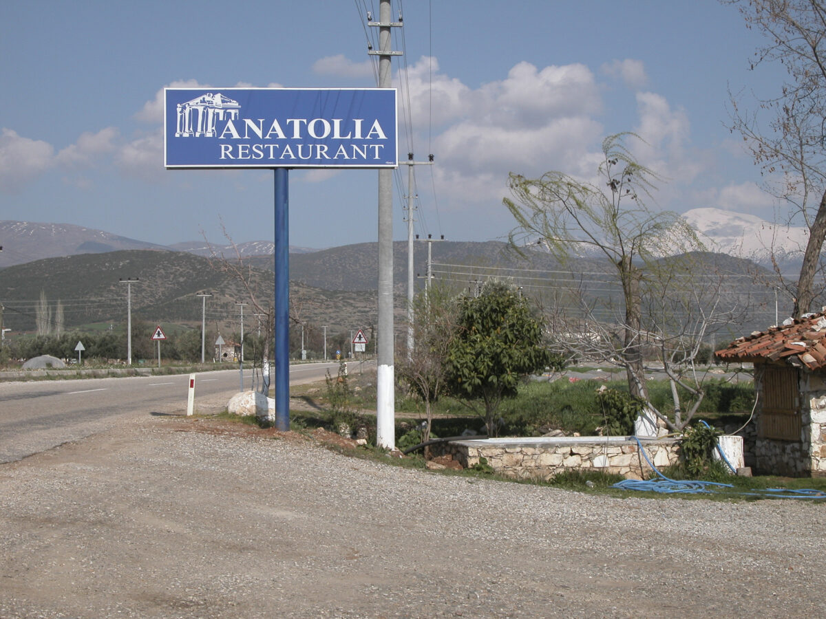
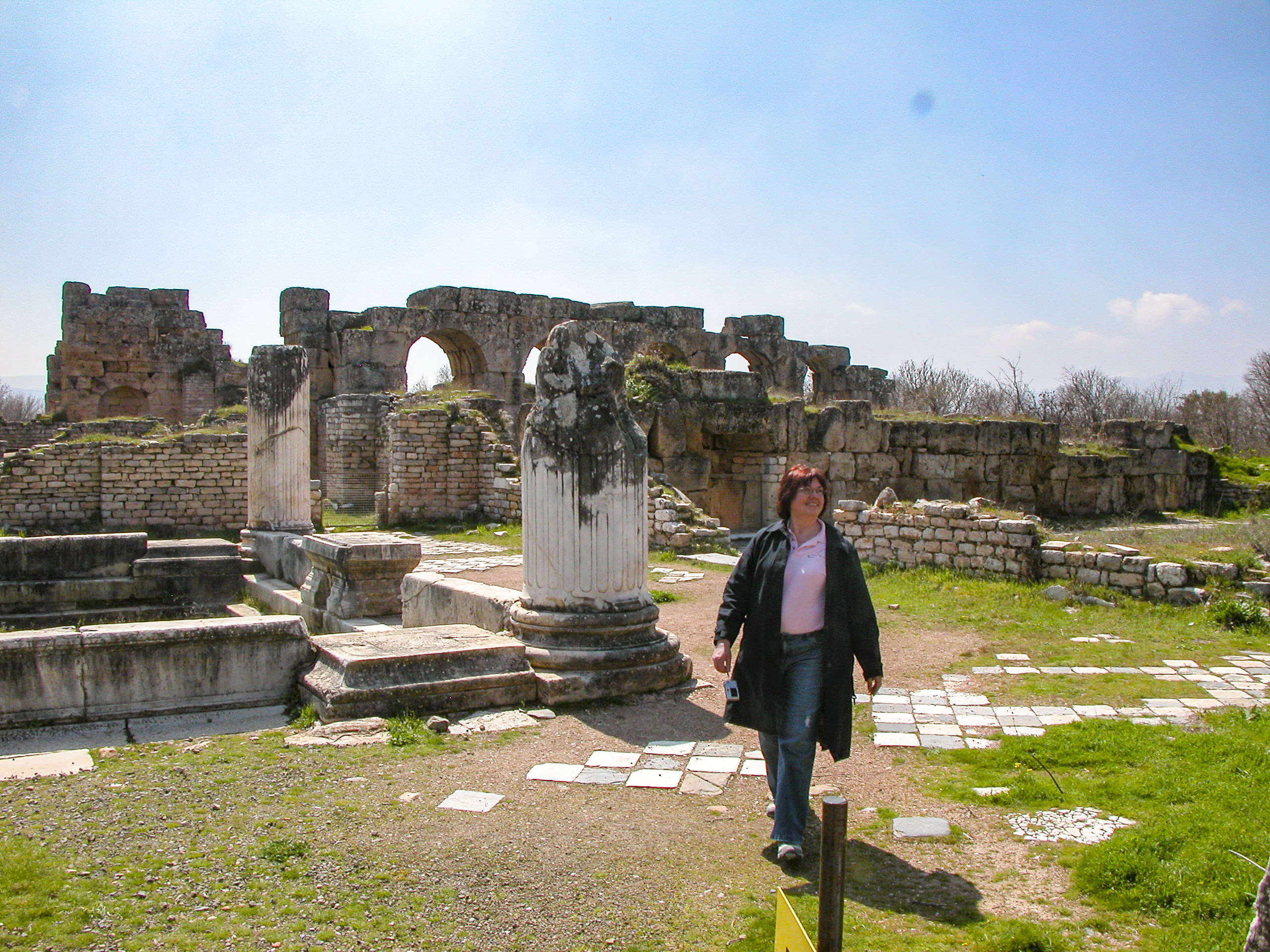
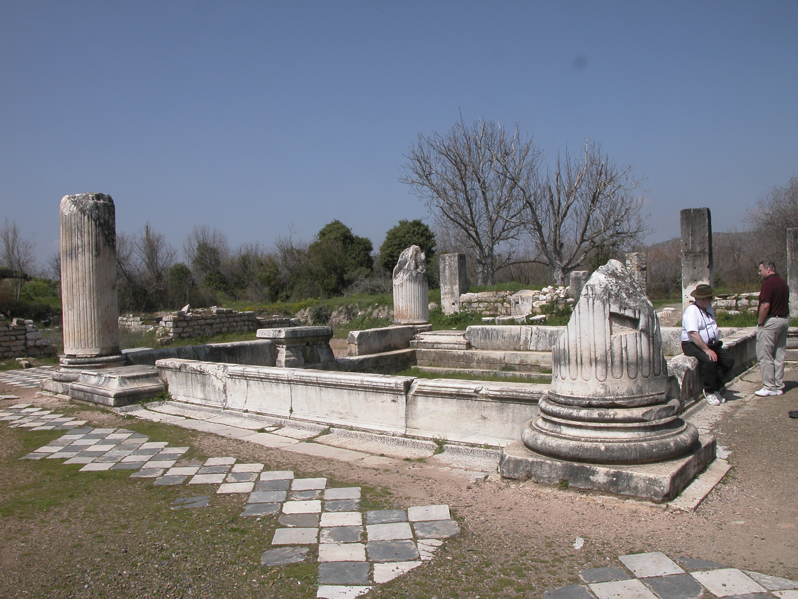
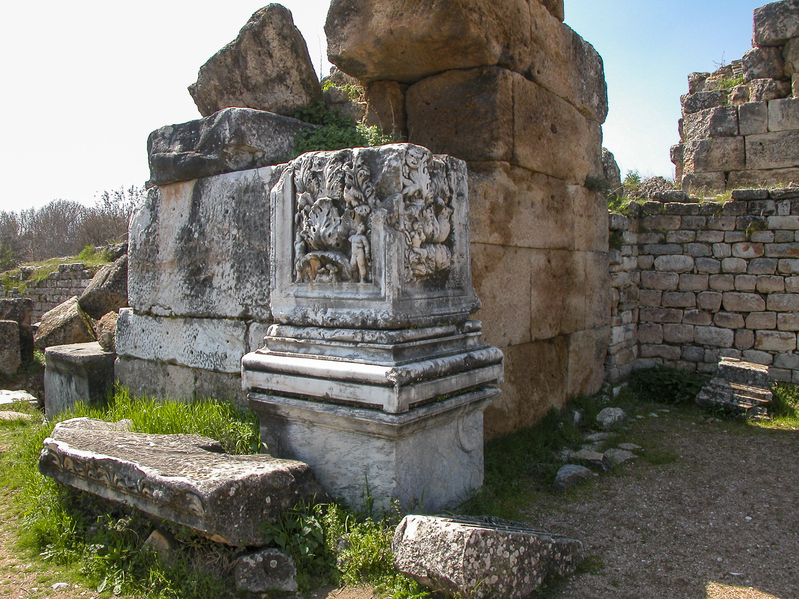
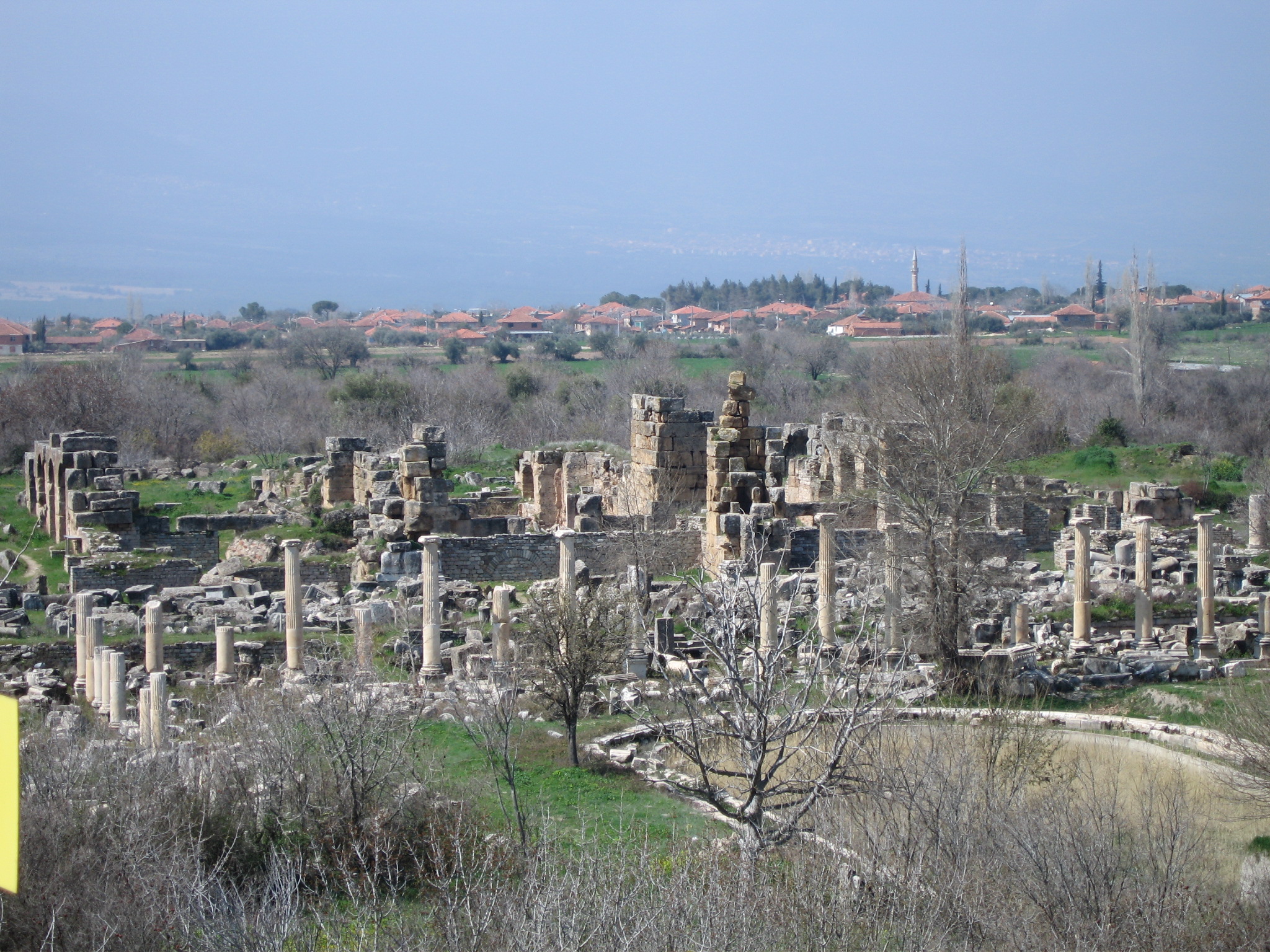
We stopped here for dinner after viewing the ruins of Aphrodisias.
A long bus ride awaited us after our sojourn in Aphrodisias, and for that we needed the fortification of a sumptuous dinner, which was provided by one of the more memorable establishments I’ve visited, the Anatolia Restaurant in Geyre.
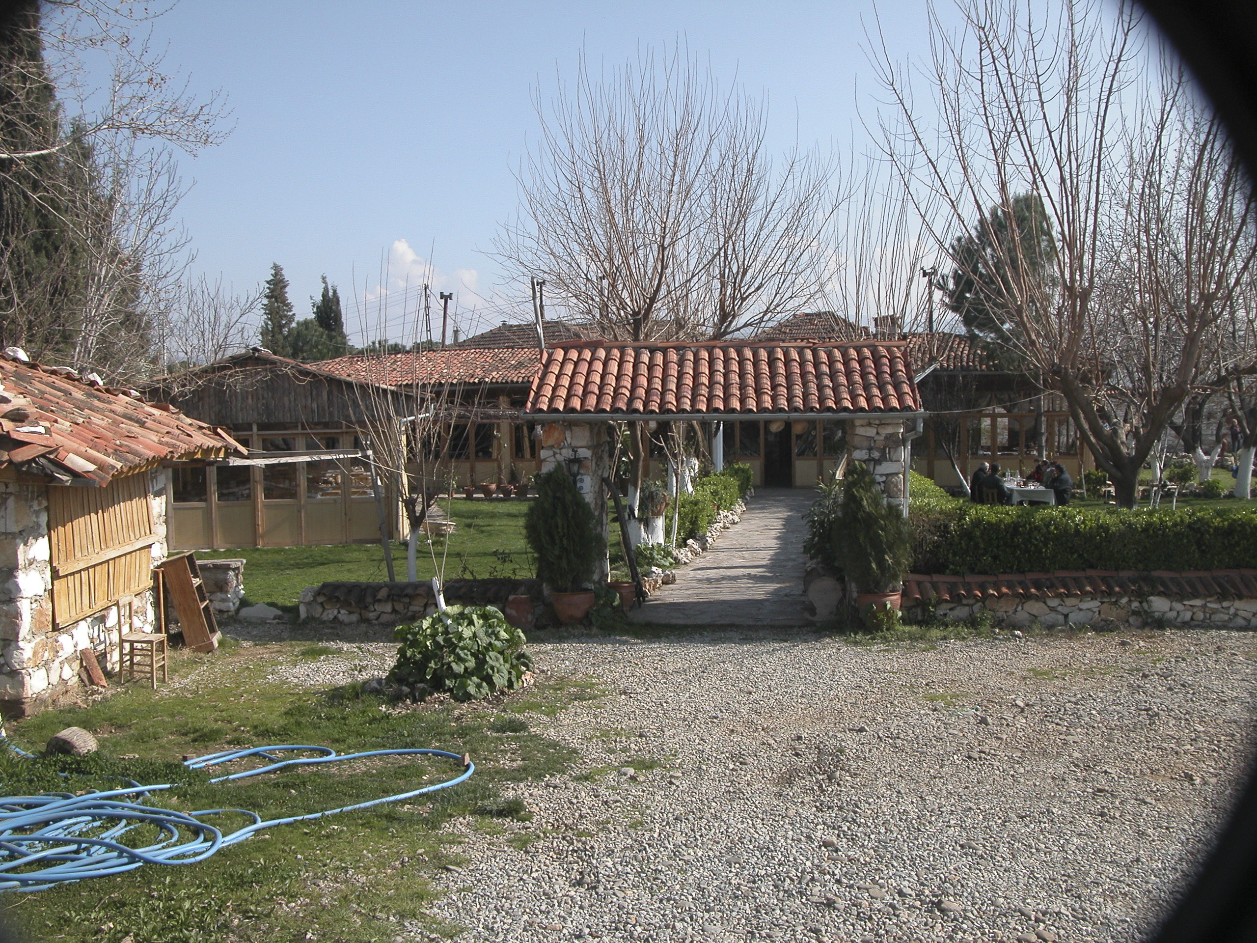
Entrance to the Dining Room.
The exterior of the restaurant looked most promising – it appeared to be built of beautiful Carian marble and other rock native to the area, with a red tile roof, and was surrounded by trees, which were still mostly bare of leaves since it was as yet early in the spring – one can only imagine how the place looked in summer or autumn.
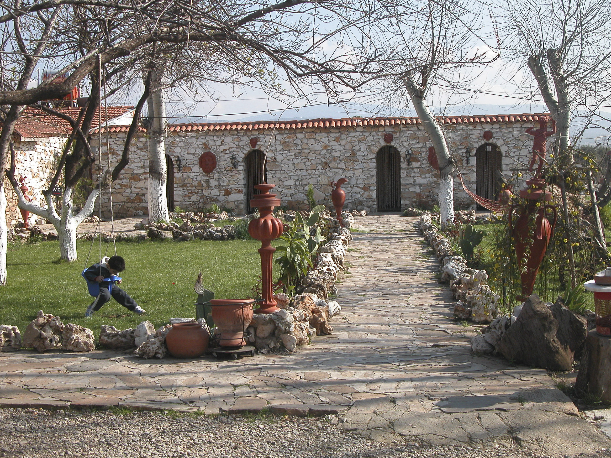
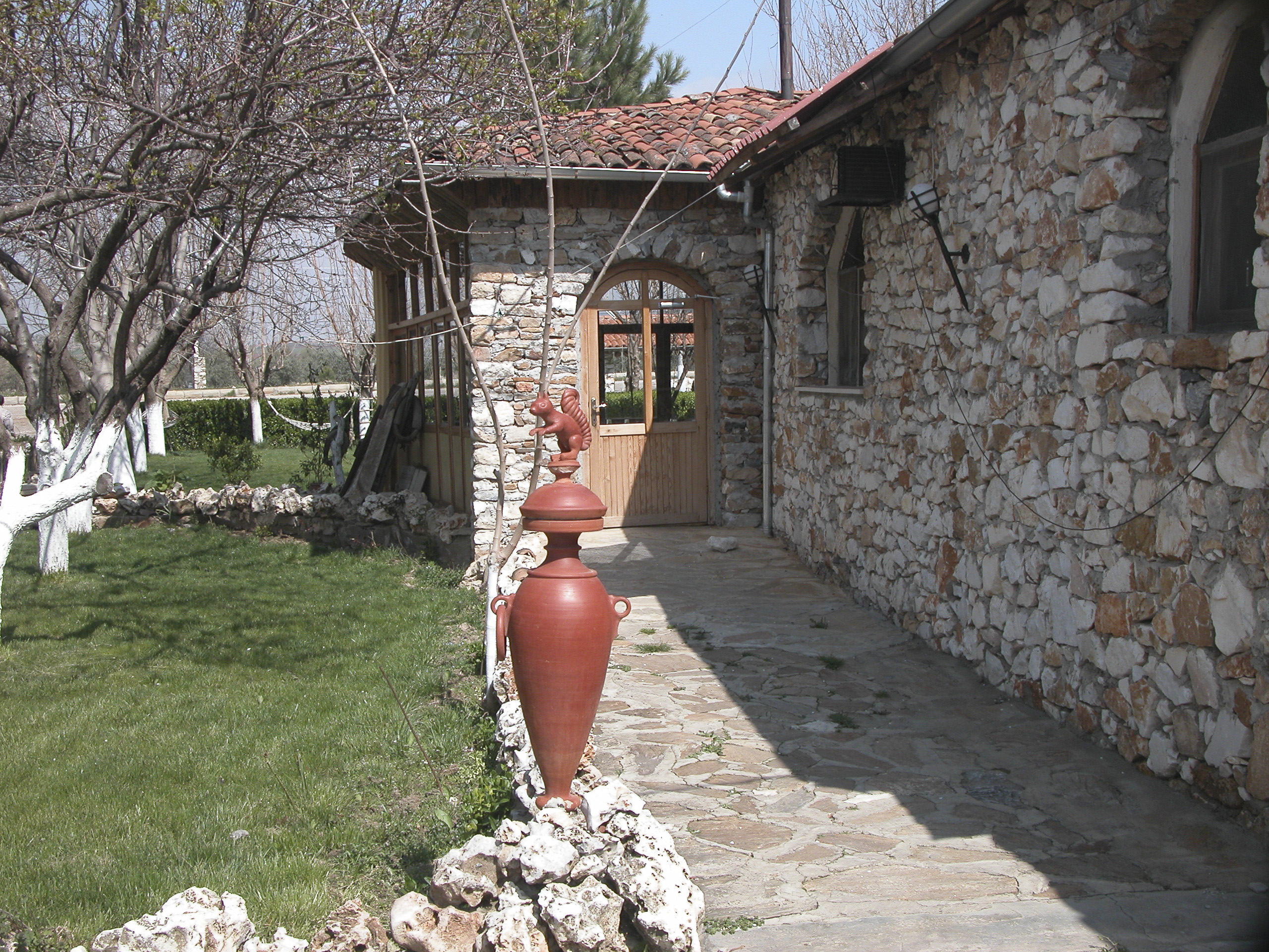
The side court of the restaurant, the entrance to the restrooms.This lovely rock structure housed the rest rooms at Aphrodisias.
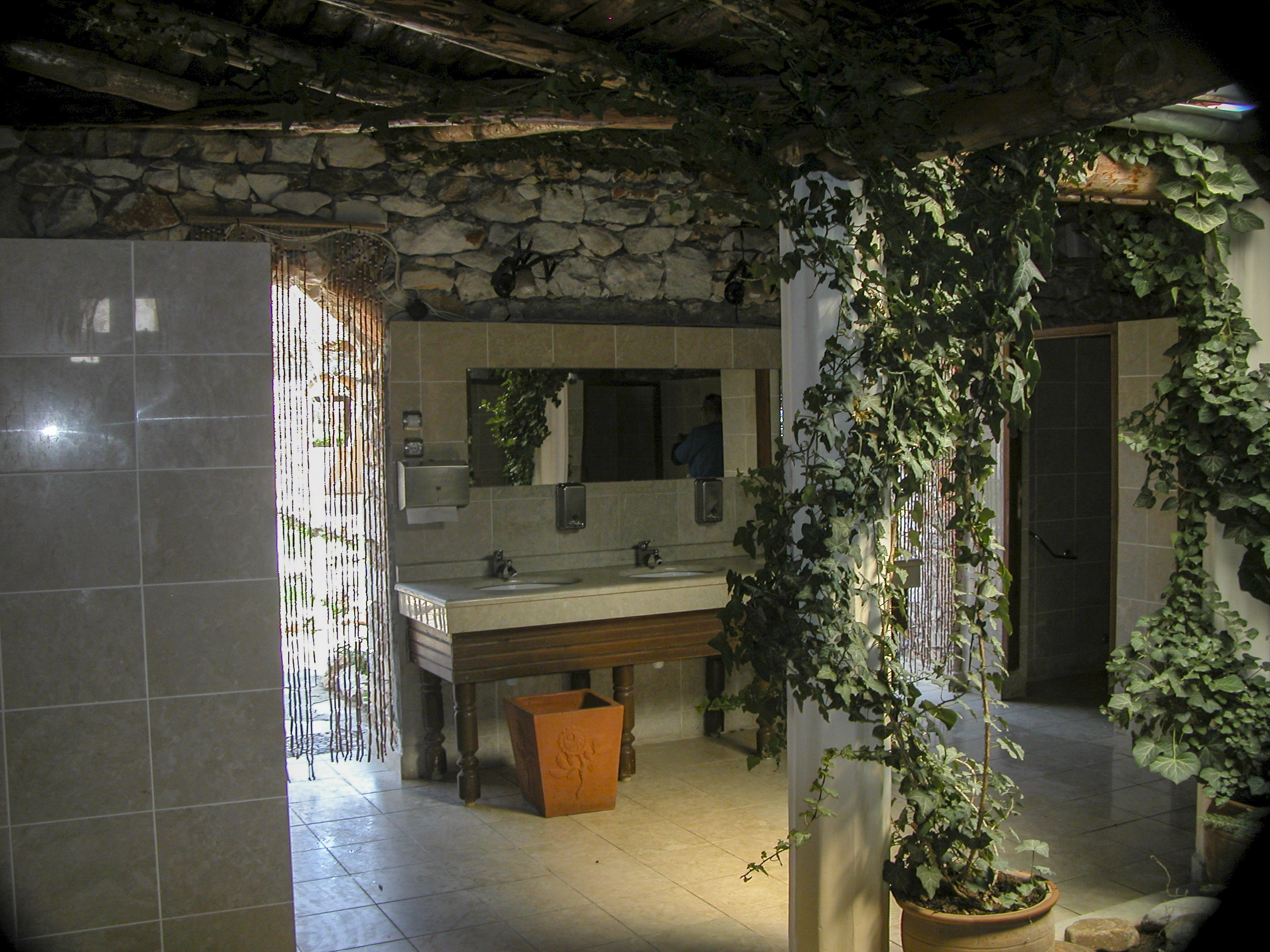
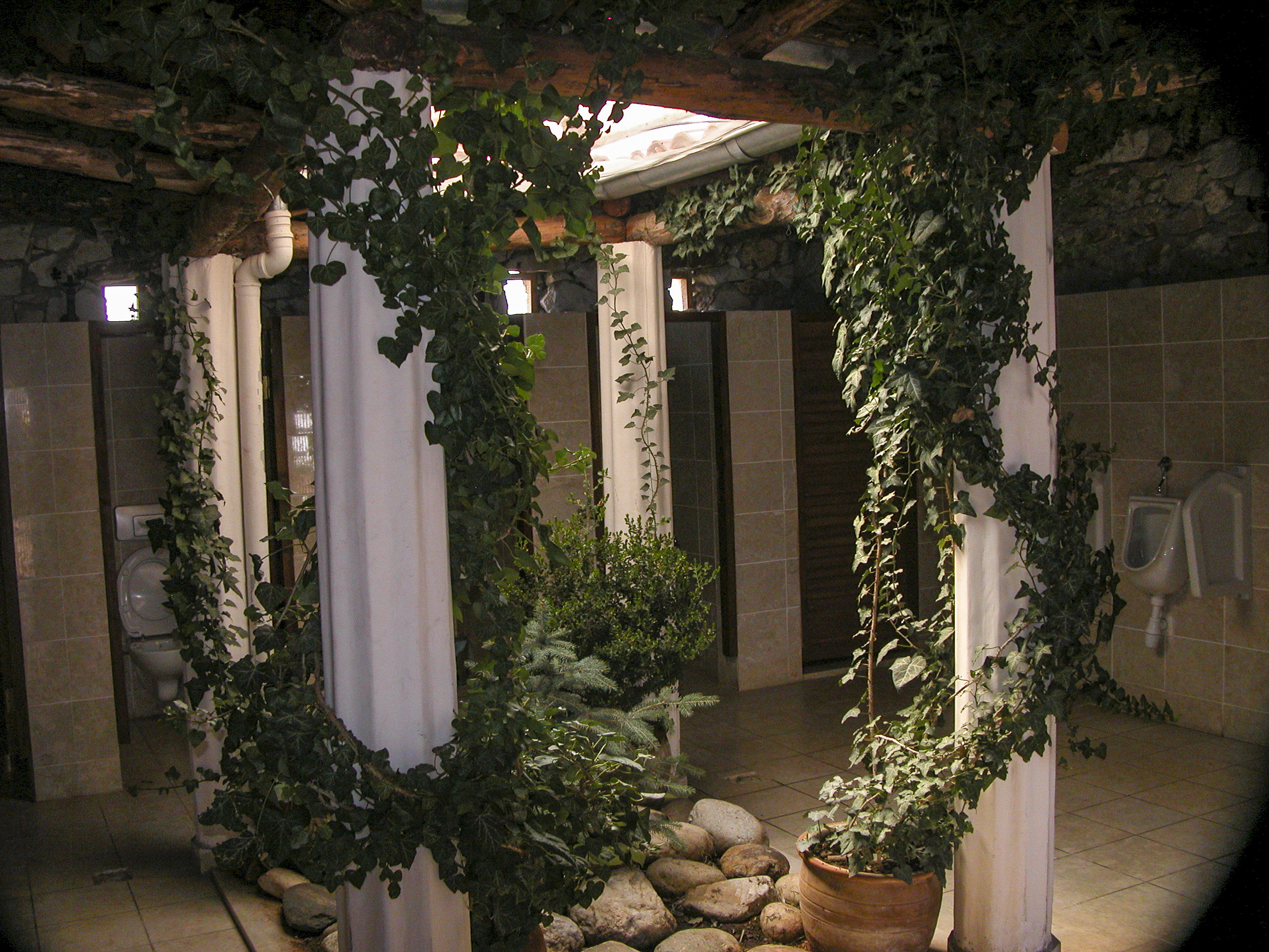
The rest rooms at the Anatolia deserve special mention – they were not only clean but also beautifully decorated.
The Men’s Room at the Anatolia Restaurant.
Liberal use of greenery helped to give the rest rooms a pleasant aspect.
Not only spiffy, but green too.
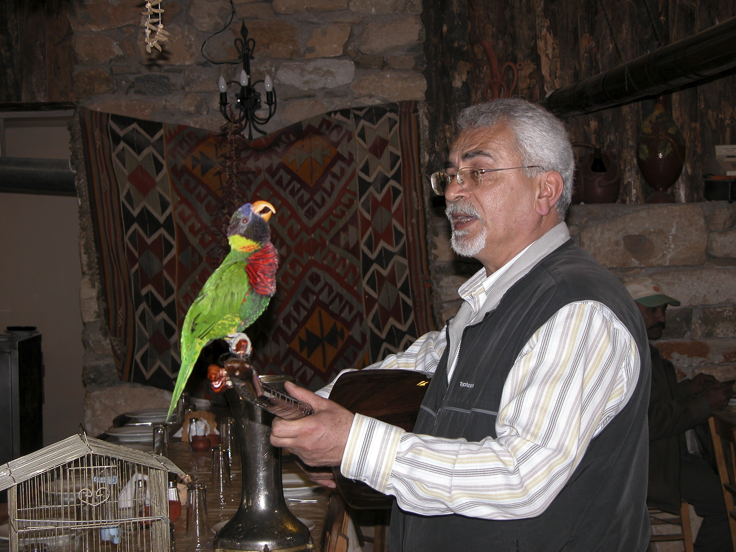
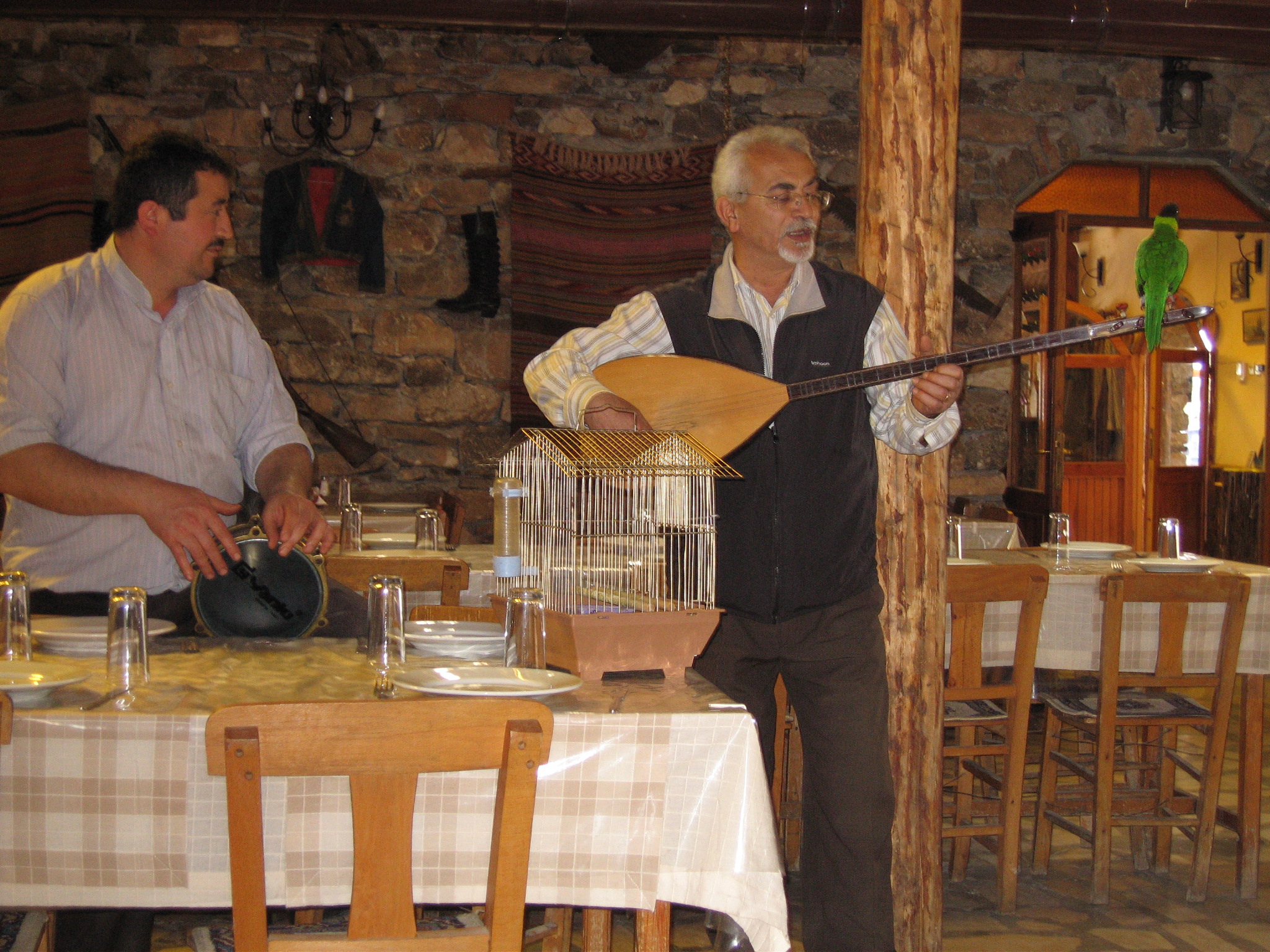
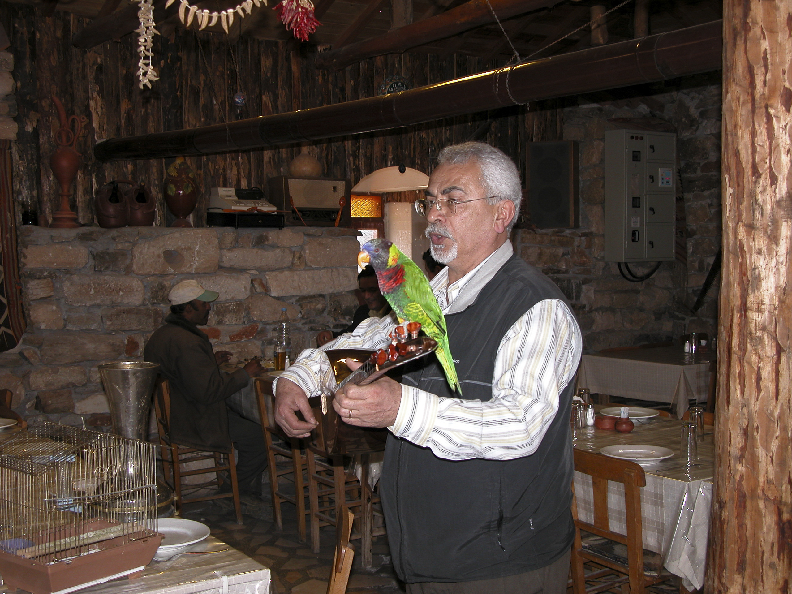
Dinner was a memorable feast, and not just for the food. The proprietor of the establishment – I presume he was the owner – put a lot of effort into making certain we were not only well-fed but also superbly entertained. I doubt whether he would have gone to such trouble if he were a mere employee. He regaled us with guitar playing and song as we dined.
The proprietor regaled us with guitar playing and song. The parrot sang back.
The star of the show, however, was the red-and-green parrot who sat on the guitar, and increasingly monopolized the action. In fact, it soon became clear that the parrot was the real proprietor of the restaurant and the human was just a puppet who danced on the parrot’s strings.
The parrot also played the guitar.
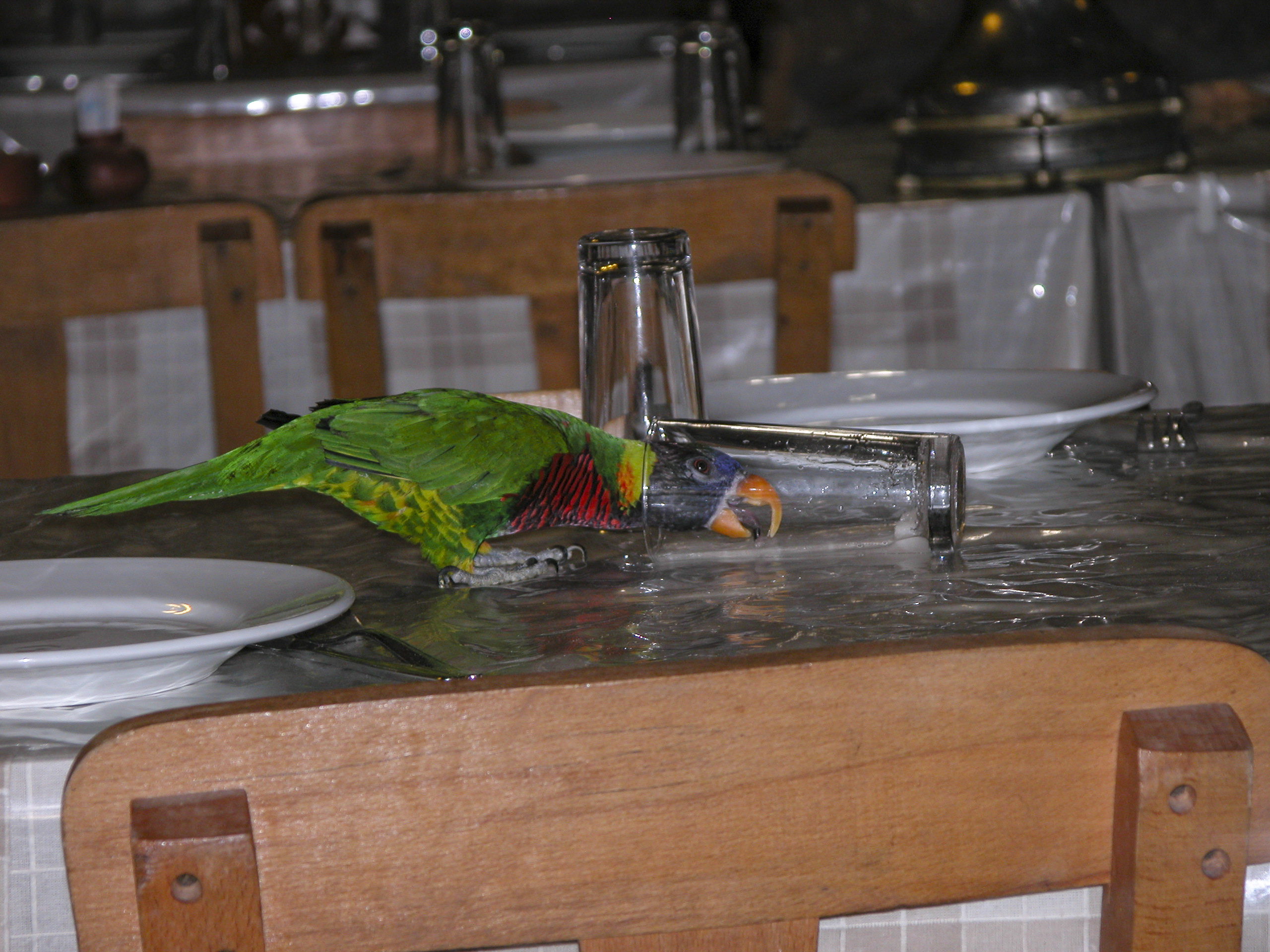
After the performance, the parrot slaked its thirst by upsetting glasses of wine on the table and guzzling their contents.
The parrot was not shy about claiming his share of the booze.
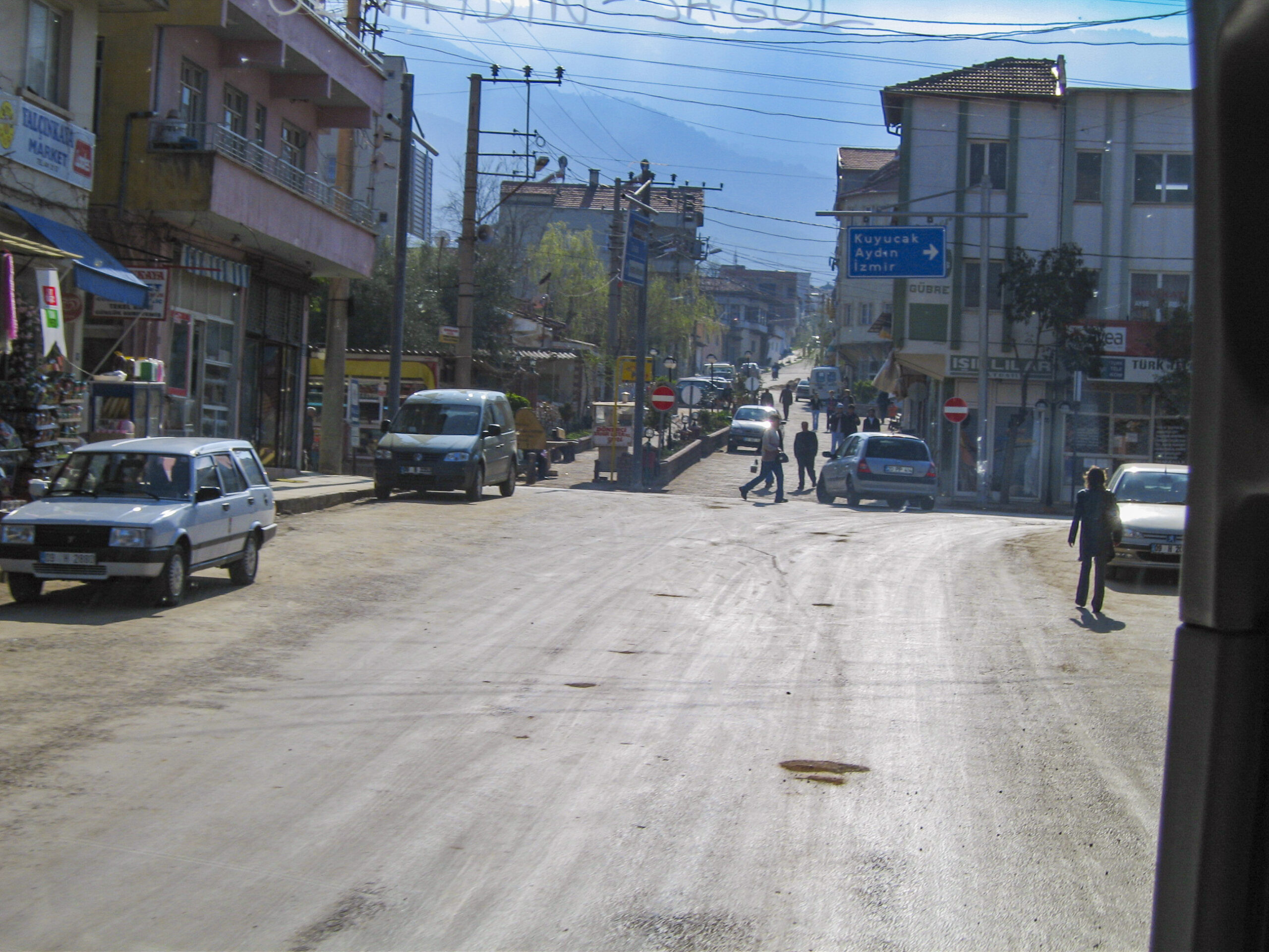
It was still daylight when we boarded the bus and continued on our way to Pamukkale. I think most of us, tired by the hike through Aphrodisias and sated with plenty of chow, slept most of the way; but Sandie did manage to get a couple of snapshots from the bus. This one she took passing through a sizeable town – I’m not sure which one, because I don’t remember exactly what route we took to get to Pamukkale – but I think it might have been Karacasu.
Provincial town on the way from Aphrodisias to Pamukkale.
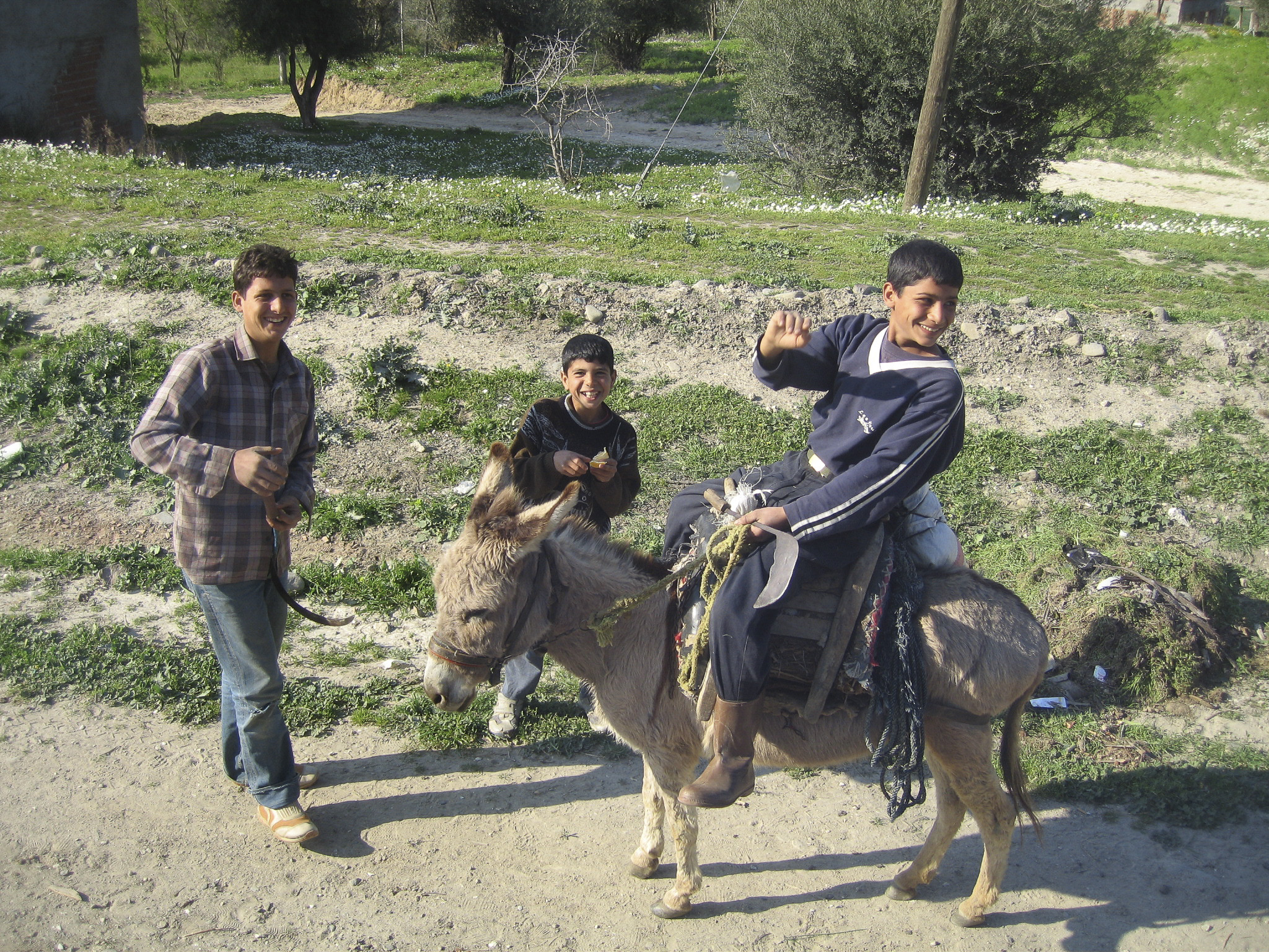
Sandie also took this picture of three smiling Turkish lads at the side of the road, one of them riding a little donkey.
Turkish kids and a donkey, somewhere between Aphrodisias and Pamukkale.
We arrived in Pamukkale late in the evening; it was too dark, and I was too tired, to take any pictures, and we had to get up early in the morning to see Hierapolis. The hot-spring baths of the spa beckoned, and many of our party were able to enjoy them, but I was too benumbed and missed my chance. Our hotel was luxurious, the beds were comfy, and we quickly fell asleep.
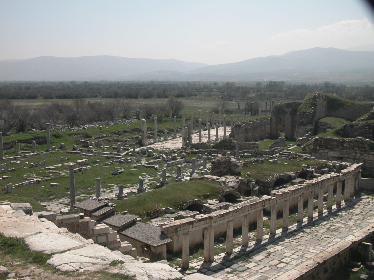
Overlooking the South Agora and the Baths of Hadrian (background, right).
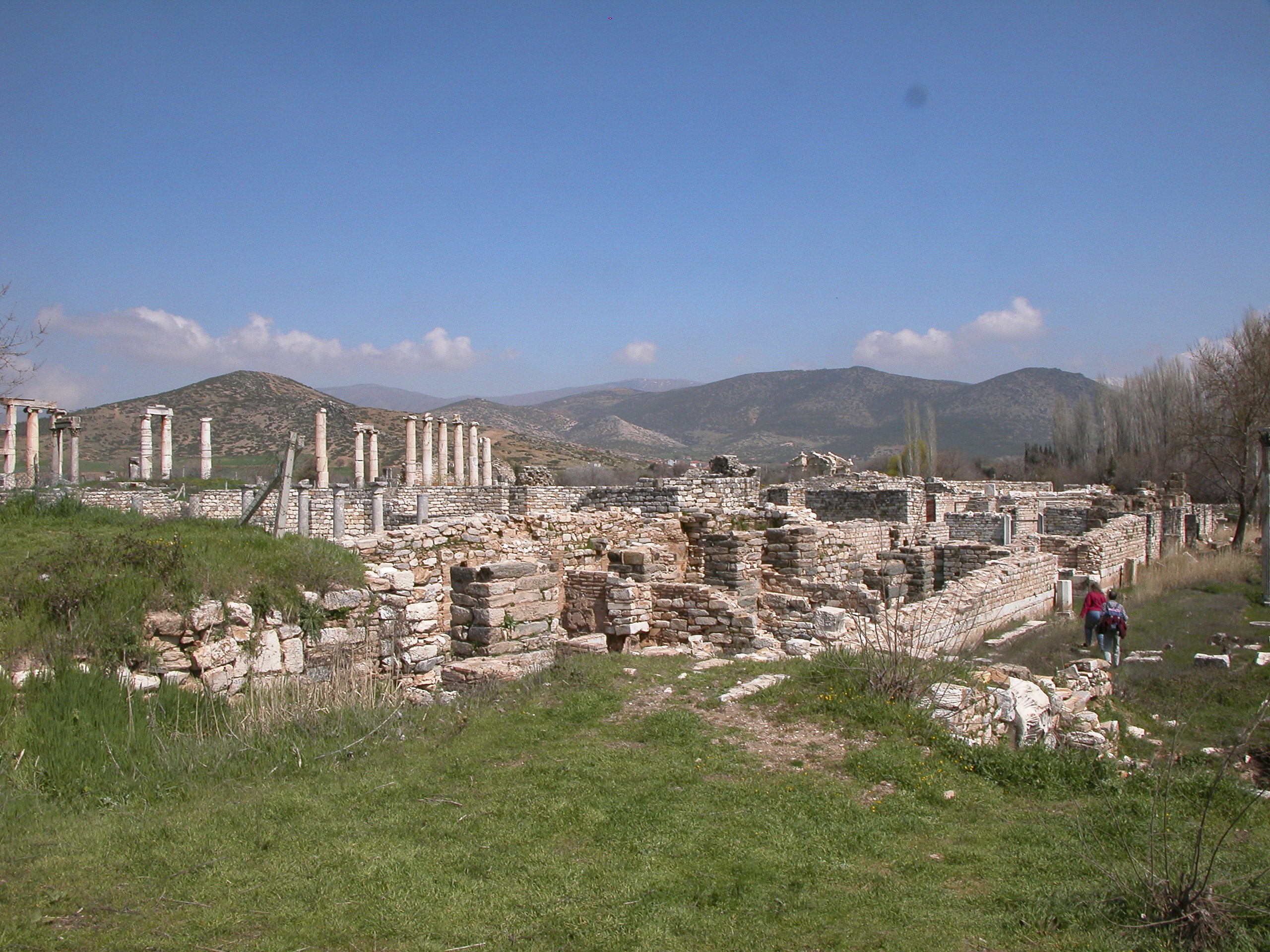
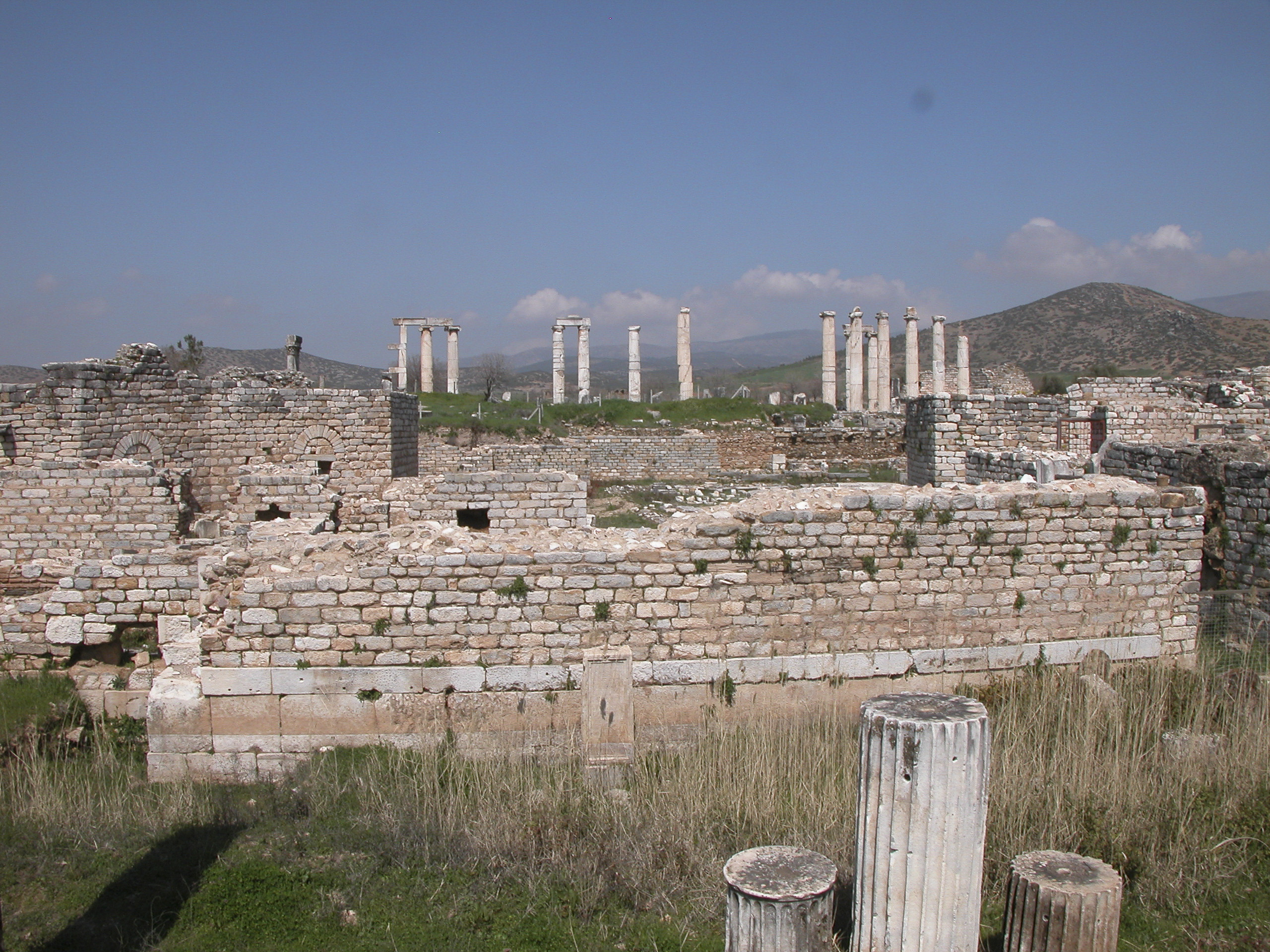
On March 26 our tour group boarded a bus which took us into the interior of Turkey. Our ultimate destination that day was the spa of Pamukkale, but along the way we took an excursion to the site of Aphrodisias, the city of Aphrodite, Greek goddess of love.
Aphrodisias was the capital of the Roman province of Caria. Among other things Caria was famous for its quarries of white and blue marble. Not surprisingly, favored with this advantage, Aphrodisias became famous for its school of sculpture; but it was also noted as a center of pagan philosophy into the late 5th century CE.
In 614 a mighty earthquake wrecked Aphrodisias, and it never recovered. Also, by that time the Roman Empire had converted to Christianity, and the city was renamed Stauropolis, City of the Cross, in an attempt to erase the old pagan associations. Later still, by the 8th century CE, it became known by the name of the province, Caria, and after the region came under Turkish control in the 13th century, this eventually morphed into the Turkish name Geyre.
Formal excavations at the site of ancient Aphrodisias began in 1904, but really got underway in earnest in the 1960s, led by the Turkish archaeologist Professor Kenan Erim of New York University, who supervised the work there until his death in 1991.
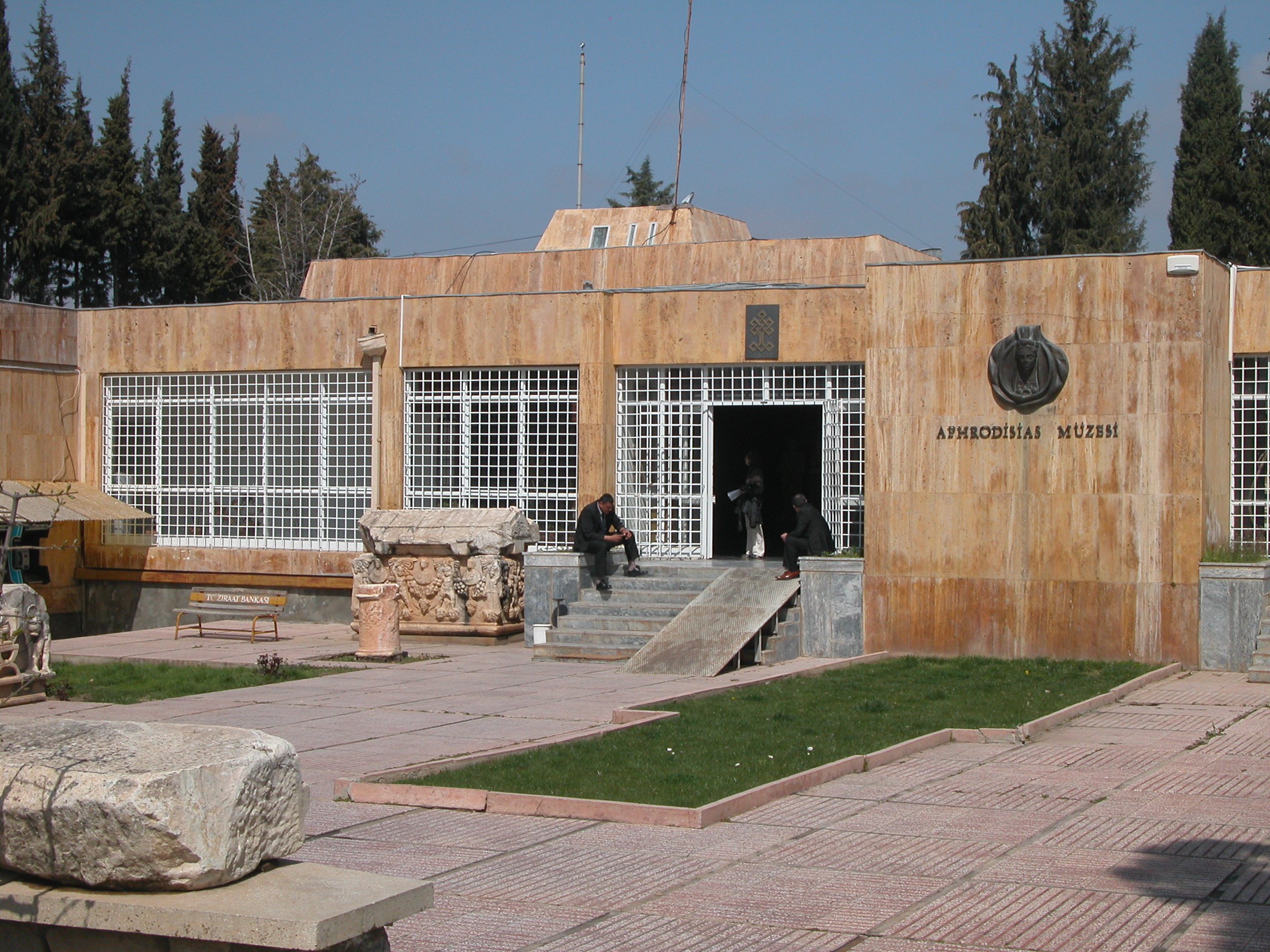
Many of the sculptures and other artifacts recovered by excavations are housed in the on-site museum, shown below. However, we left the museum for last and headed out to tour the city first.
The Aphrodisias Museum.
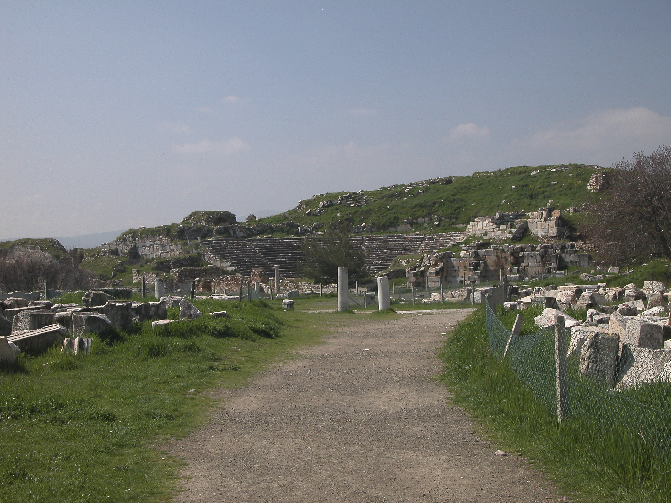
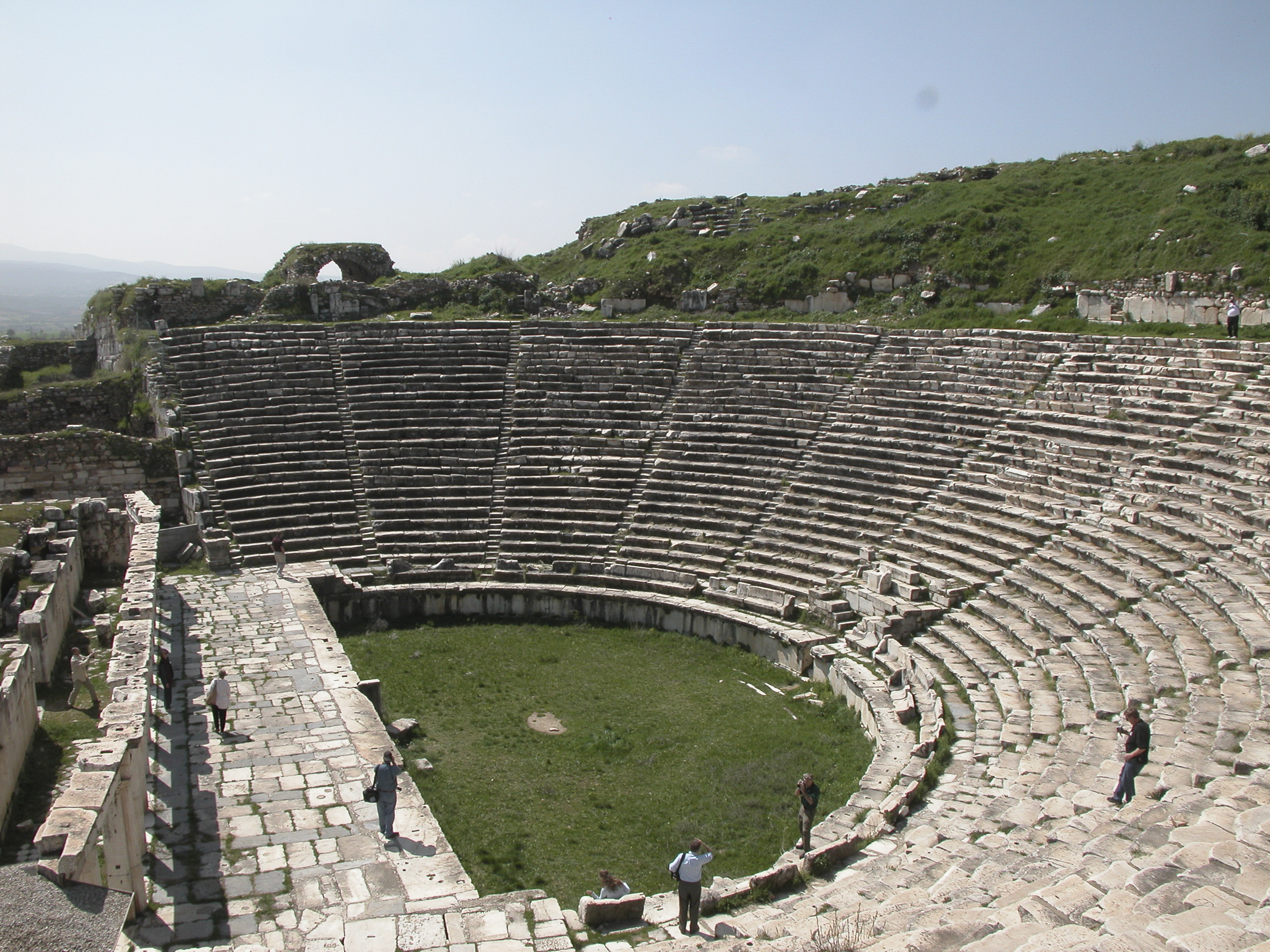
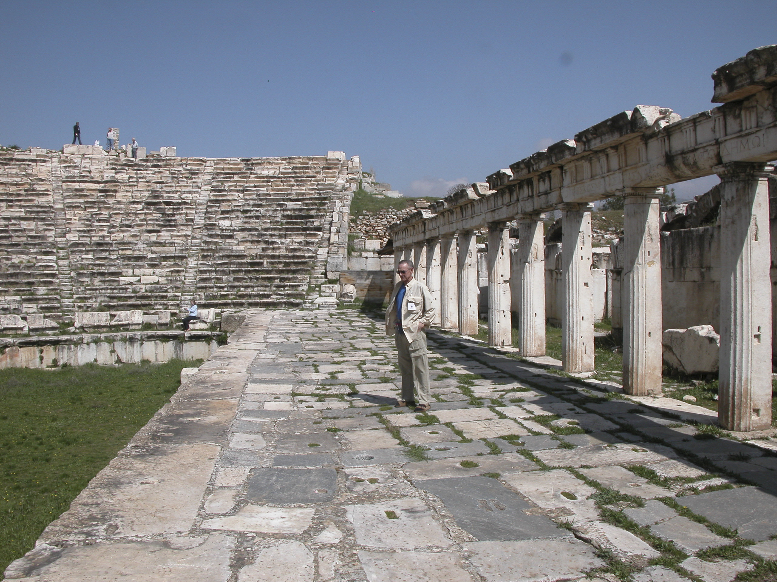
Our path first us first to the Amphitheater, which was built into the side of the Acropolis.
Looking west. The Amphitheater was built into the side of the Acropolis.
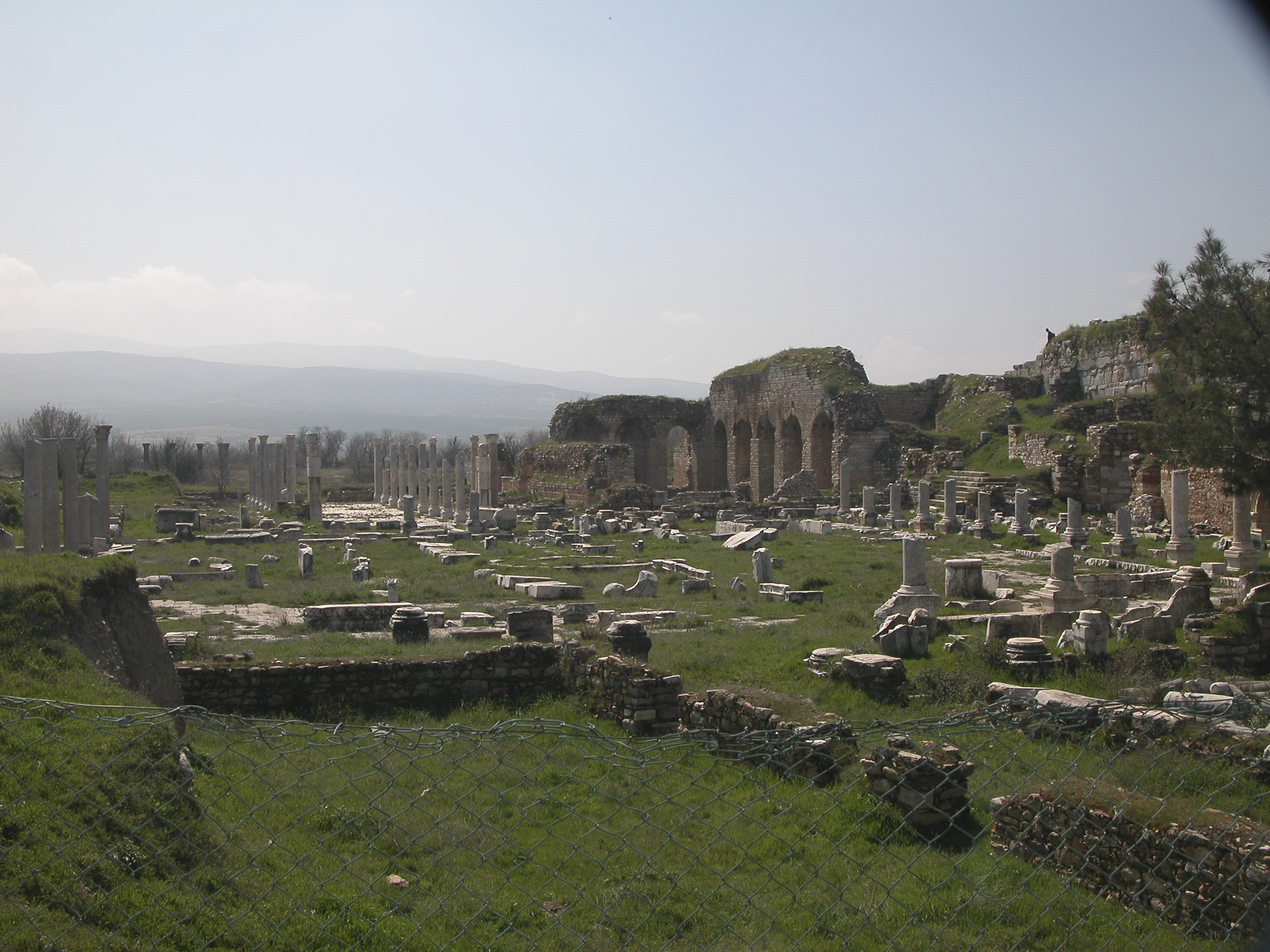
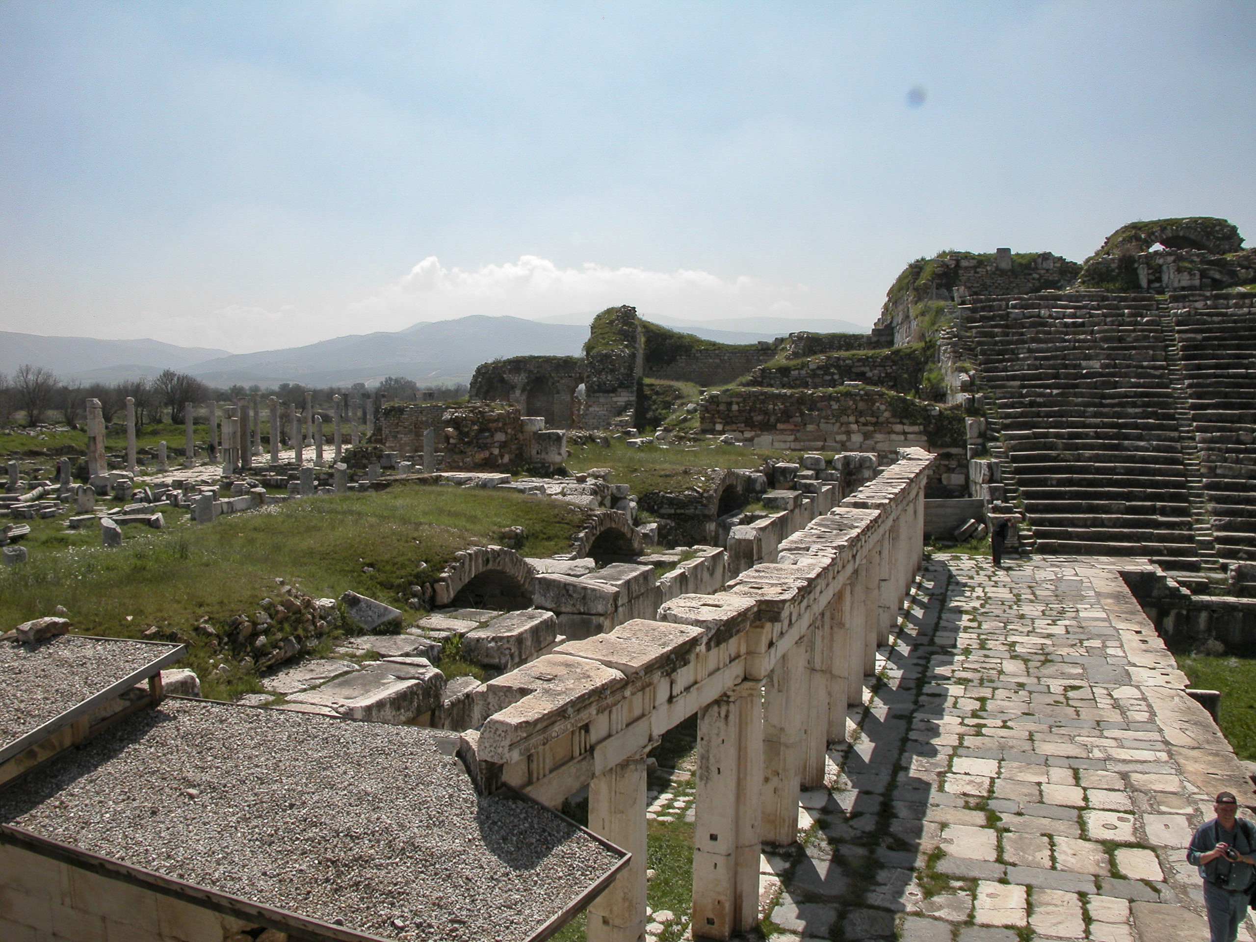
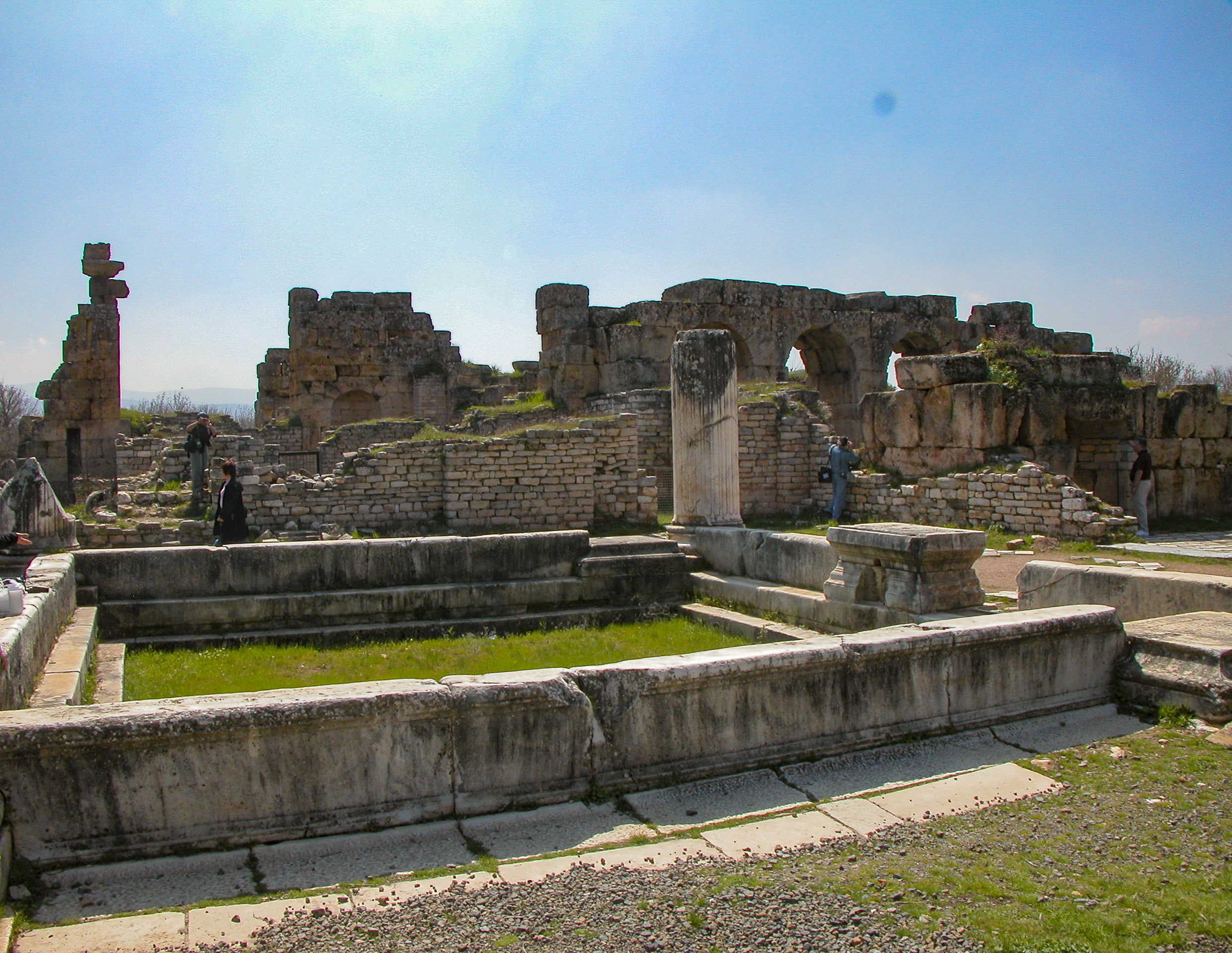
Next to the Amphitheater we encountered the South Agora and the Baths of Hadrian. The Baths of Hadrian, built across the west end of the South Agora, were massively constructed from large tufa-like blocks faced with marble veneer and consist of five great barrel-vaulted chambers, with an imposing colonnaded court in front.
Looking toward the South Agora and the Baths of Hadrian; the Amphitheater is off to the right.
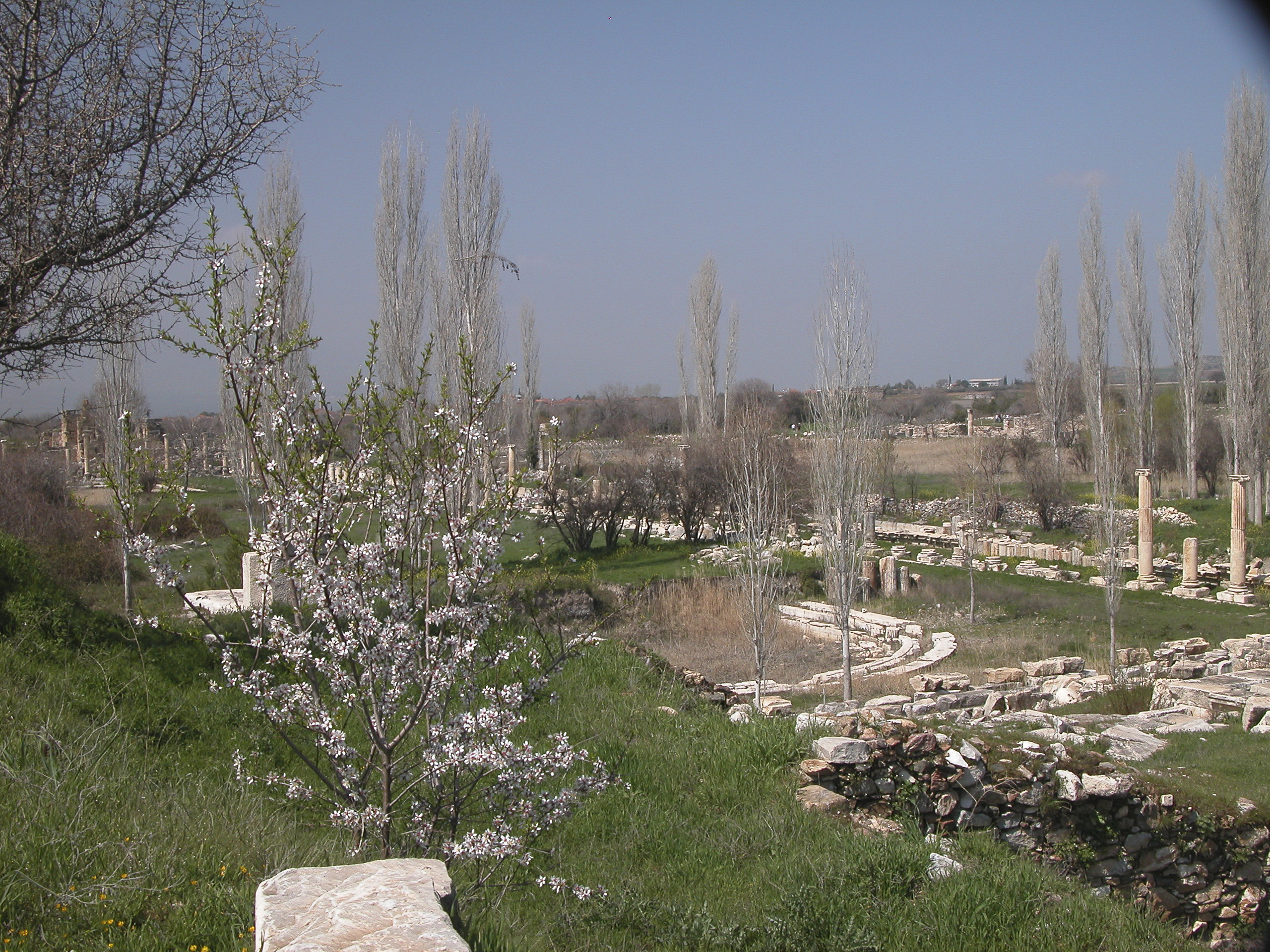
Aphrodisias is pleasantly situated amidst groves of trees and flowering bushes. As it was only the beginning of spring in Anatolia, the trees were mostly still bare, and just a few of them were starting to come into bloom.
A tree on the north side of the Acropolis was just starting to bloom in the early spring.
The Amphitheater was built in the late first century BC under the patronage of Gaius Julius Zoilus, a native of Aphrodisias who had become a slave of Julius Caesar but was freed by his heir Octavian. Returning to his birthplace a wealthy man, Zoilus initiated a vast building program, of which the Amphitheater was one of the first fruits. Zoilus also influenced the city’s leadership to support Octavian in his struggle with Mark Antony for mastery of Rome, thus securing Octavian’s lasting favor in the form of financial privileges that ensured the city’s subsequent prosperity.
A view of the Amphitheater from the top right.
The amphitheater had a large structure behind the stage which originally consisted of 3 stories, only one of which has been restored.
Remains of the amphitheater’s stage building.
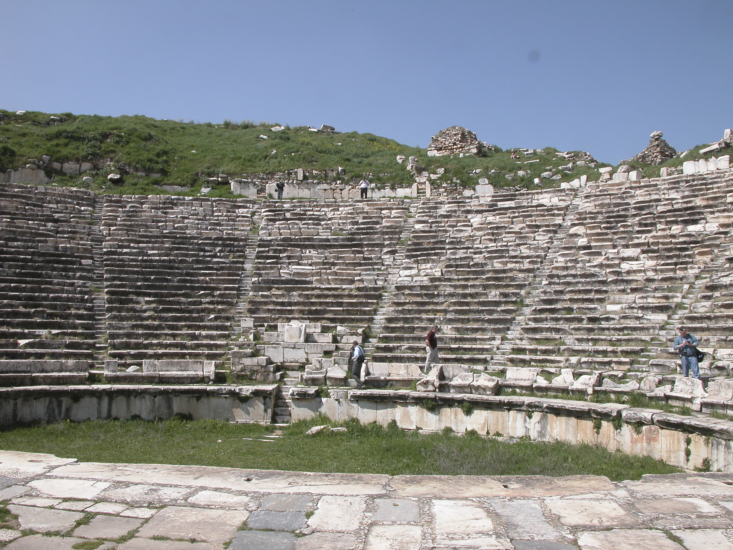
The Amphitheater was severely damaged by earthquakes in the 7th century CE. Later, the local inhabitants built cottages on top of the cavea (seating section), which became the village of Geyre, but when excavations began in 1966 the entire village was relocated about a mile away.
The cavea (seating section).
Chuck Mattox took the visit to the Amphitheater as an occasion to ponder the ephemerality of human creations.
Chuck Mattox on the stage of the Aphrodisia Amphitheater.
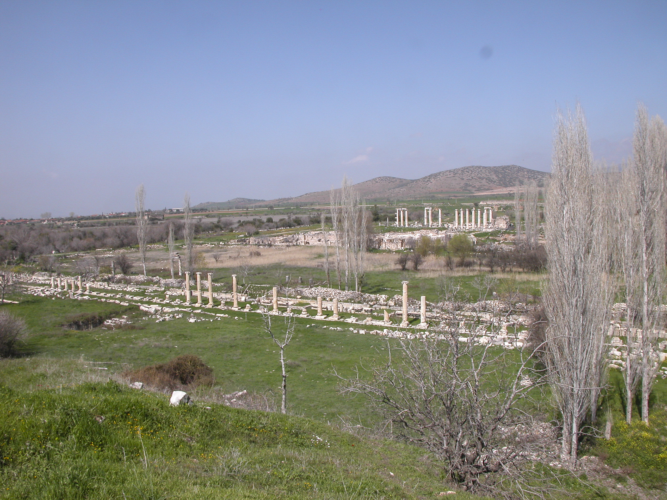
On the north side of the Acropolis, opposite the Amphitheater, lay the North Agora, a large public square of 202 by 72 meters, originally enclosed by stoas (porches) on all sides. Parts of the south and east stoas have remained standing since antiquity, and the north stoa was partially uncovered in excavations in the 1960s. Archaeologists believe the North Agora was the original center of Hellenistic Aphrodisias.
The North Agora.
Begun in the reign of Tiberius (14 to 37 CE), for whom it was named, the Portico includes a large pool, 175 meters long, 25 meters wide and 1 meter deep, where devotees of Aphrodite could frolic in the nude and disport themselves in wild orgies. (I made up that last part, but the measurements of the pool are real.)
The Portico of Tiberius.
Near the Portico of Tiberius stood the Sebasteion, a product of the building program of Zoilus, dedicated to his patron Octavian/Augustus, the first Roman Emperor. Sebasteios is the Greek form of the Latin name Augustus.
Members of our tour group check out the Sebasteion.
Actually, the Sebasteion was jointly dedicated to Augustus and Aphrodite, the patron goddess of Aphrodisias. There was a well-known connection here: the Emperor Augustus, as nephew and adopted son of Julius Caesar, was a member of the Julian family, which claimed descent from the goddess Venus, the Roman name for Aphrodite.
Sandie strolls by the Sebasteion.Al Treder and Jim Windlinger take a break at the ruins of the Sebasteion.Corner detail of the Sebasteion, showing some of the intricate stonework.
Remember, I mentioned above that the village of Geyre, which had been built on the Acropolis, was relocated after excavations at Aphrodisias began in 1966? Here you can see the relocated village, over the ruins of the Sebasteion.
The village of Geyre, relocated 2 km to the west after excavations began in 1966, is seen in the background.
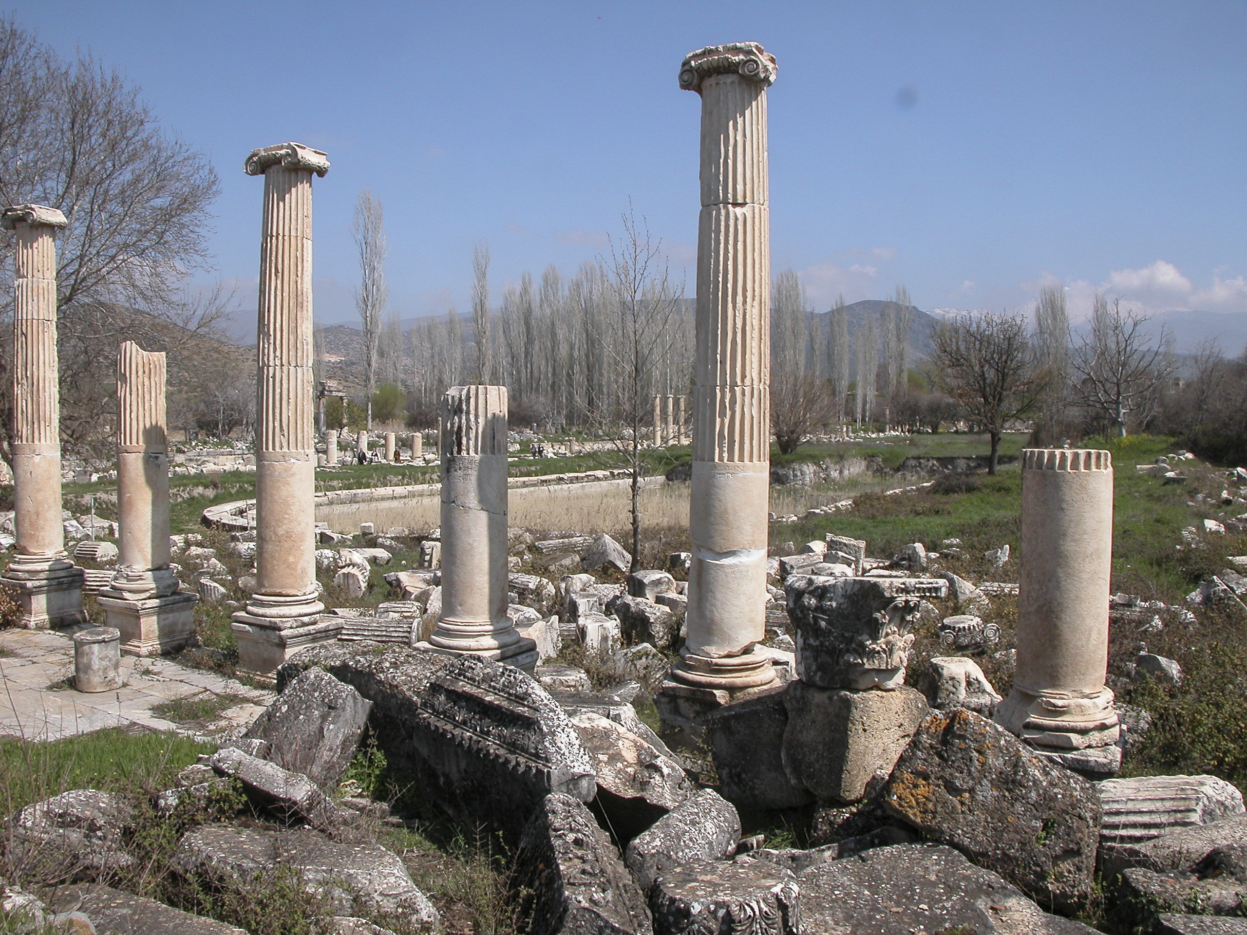
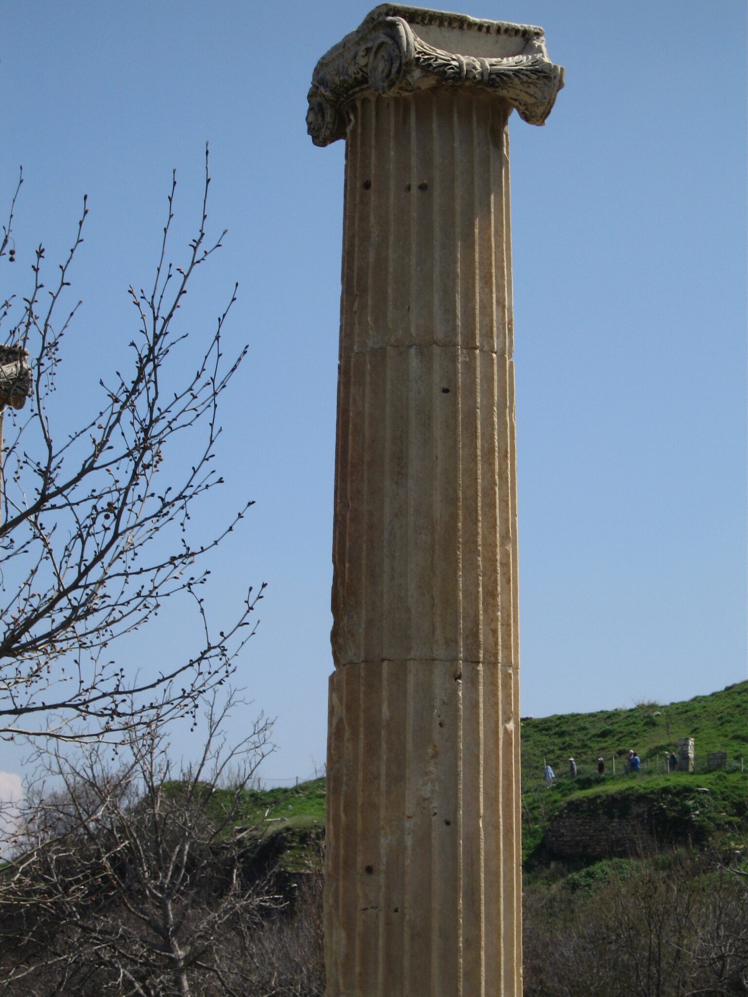
I’m not an architectural expert, but I remember that there are three styles of column capitals inherited from the ancient world – Doric (simple), Ionic (a bit more complicated) and Corinthian (sort of baroque). Aphrodisias had all of them. Here’s one in the Ionic style.
A column in the Ionic style.
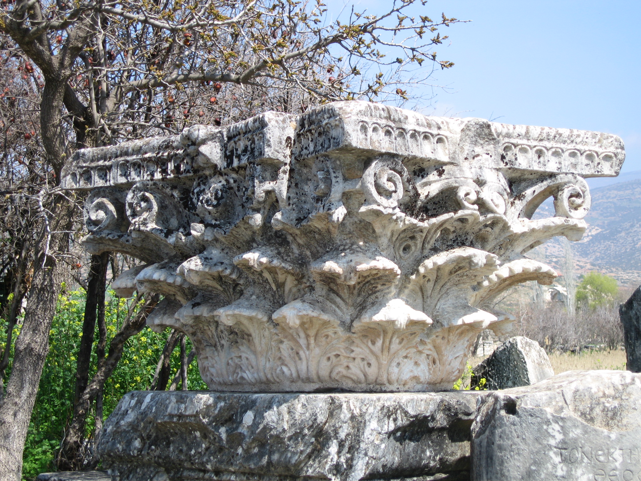
And here’s a column capital in the Corinthian style.
A column capital in the Corinthian style.
The Sanctuary, or Temple, of Aphrodite was a “focal point of the town” and one of its most magnificent structures. It was another erection of the first-century BCE building progam of the wealthy freedman Zolius, replacing an earlier structure which had been built around the 6th or 7th century BCE as the cult center of a local fertility goddess, who later became identified with Aphrodite in the same way as the local deity of Ephesus came to be identified with the Greek goddess Artemis.
After the conversion of the Roman Empire to Christianity in the fourth century AD, Aphrodisias remained a center of pagan worship and became a focus of resistance to Christianization.
After the conversion of the Roman Empire to Christianity in the fourth century CE, the imperial authorities began to persecute pagans far more effectively than the pagans had ever persecuted the Christians, and Aphrodisia, unsurprisingly considering its heritage as a pagan cult center, became a hotspot of resistance to Christianization. In the late fifth century, the Aphrodisians supported the revolt of the general Flavius Illus against the Emperor Zeno, because Illus had promised to restore the pagan rites. The revolt failed and Illus was executed. In retaliation, Zeno had the temple of Aphrodisias converted to a Christian basilica.
In the late fifth century, after the suppression of a pagan-oriented rebellion against the Eastern Roman Emperor Zeno, the Temple was expanded and converted into a Christian basilica.
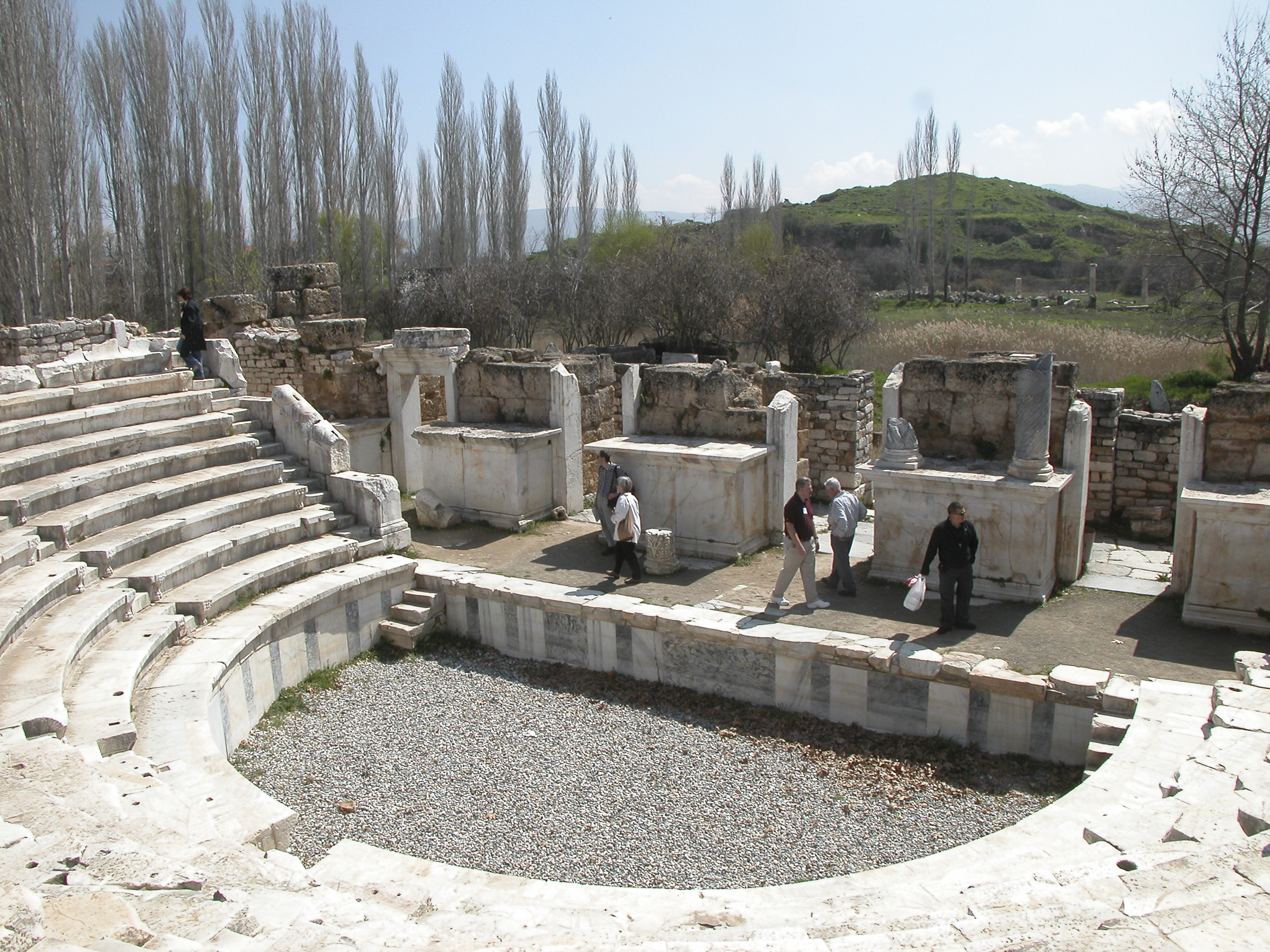
The Odeon, or Bouleterion, was a small theater-like structure where city council meetings were held, among other events. It was built in the late second or early third century CE and seated 1,750 people. It originally had a vaulted ceiling supported by massive buttresses with tall, arched windows in the curved outer wall, but the roof collapsed sometime in the late fourth or early fifth century, along with the upper twelve seating rows, so that now only nine rows are left.
The Odeon, or Bouleterion.
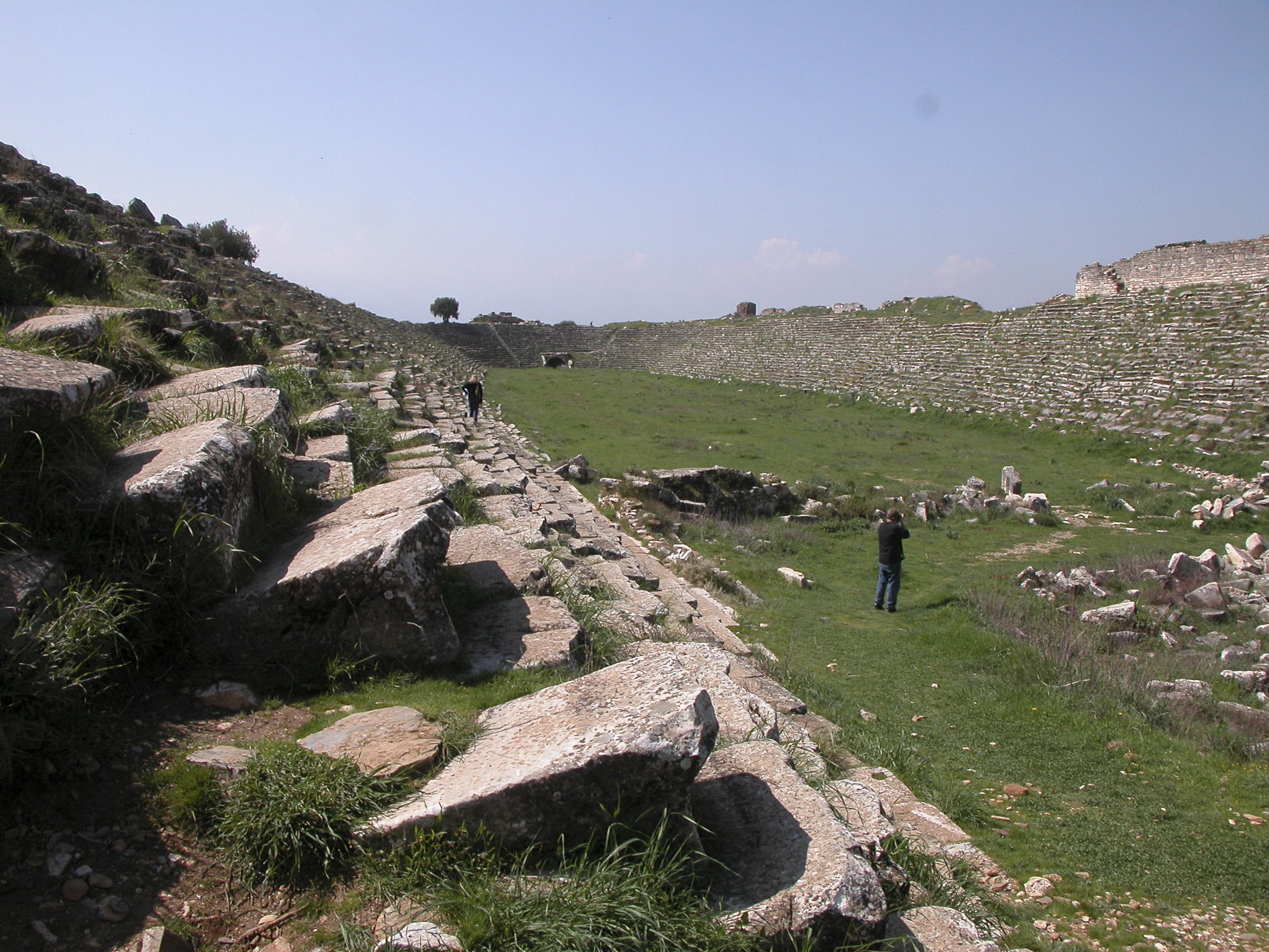
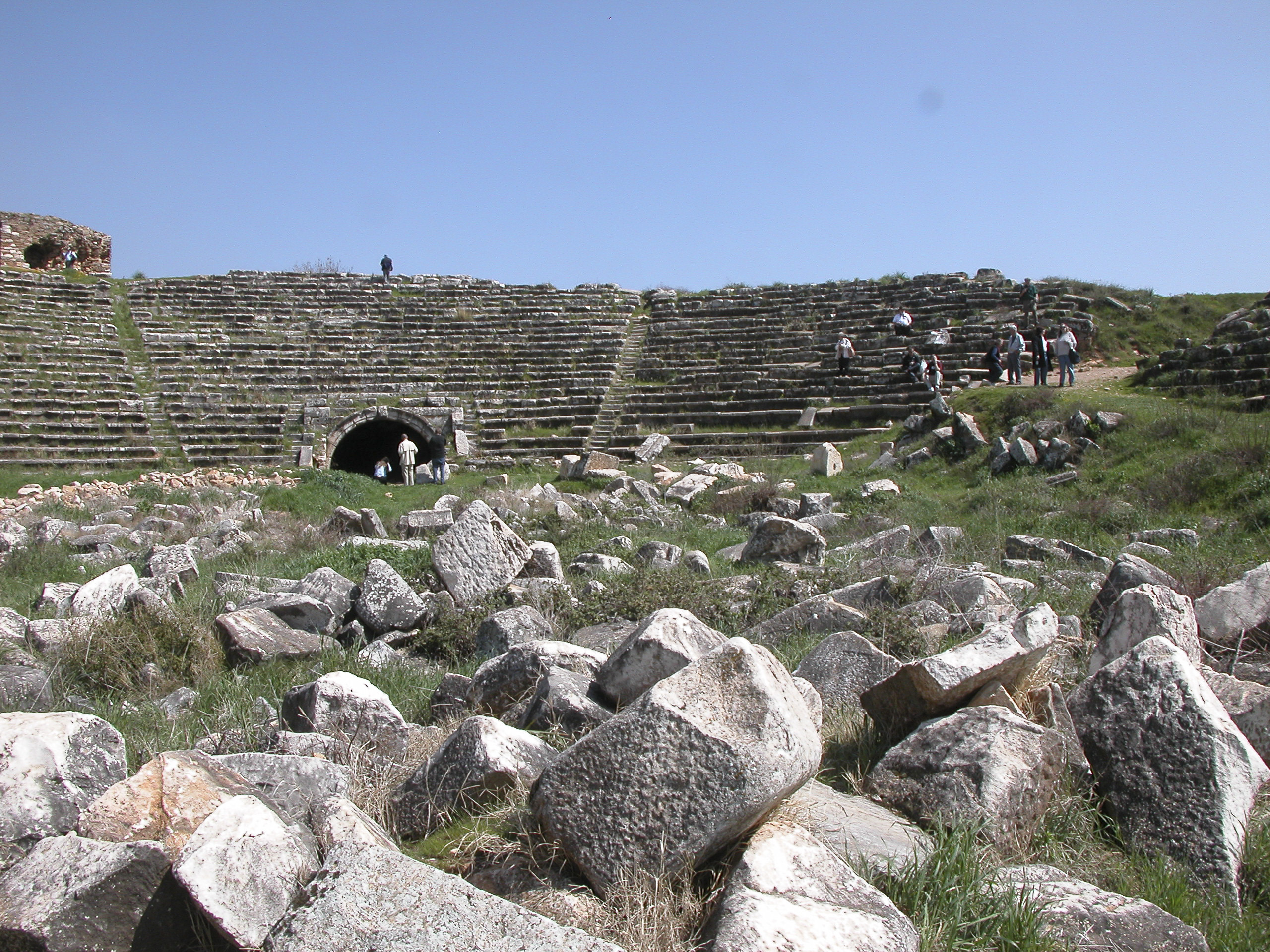
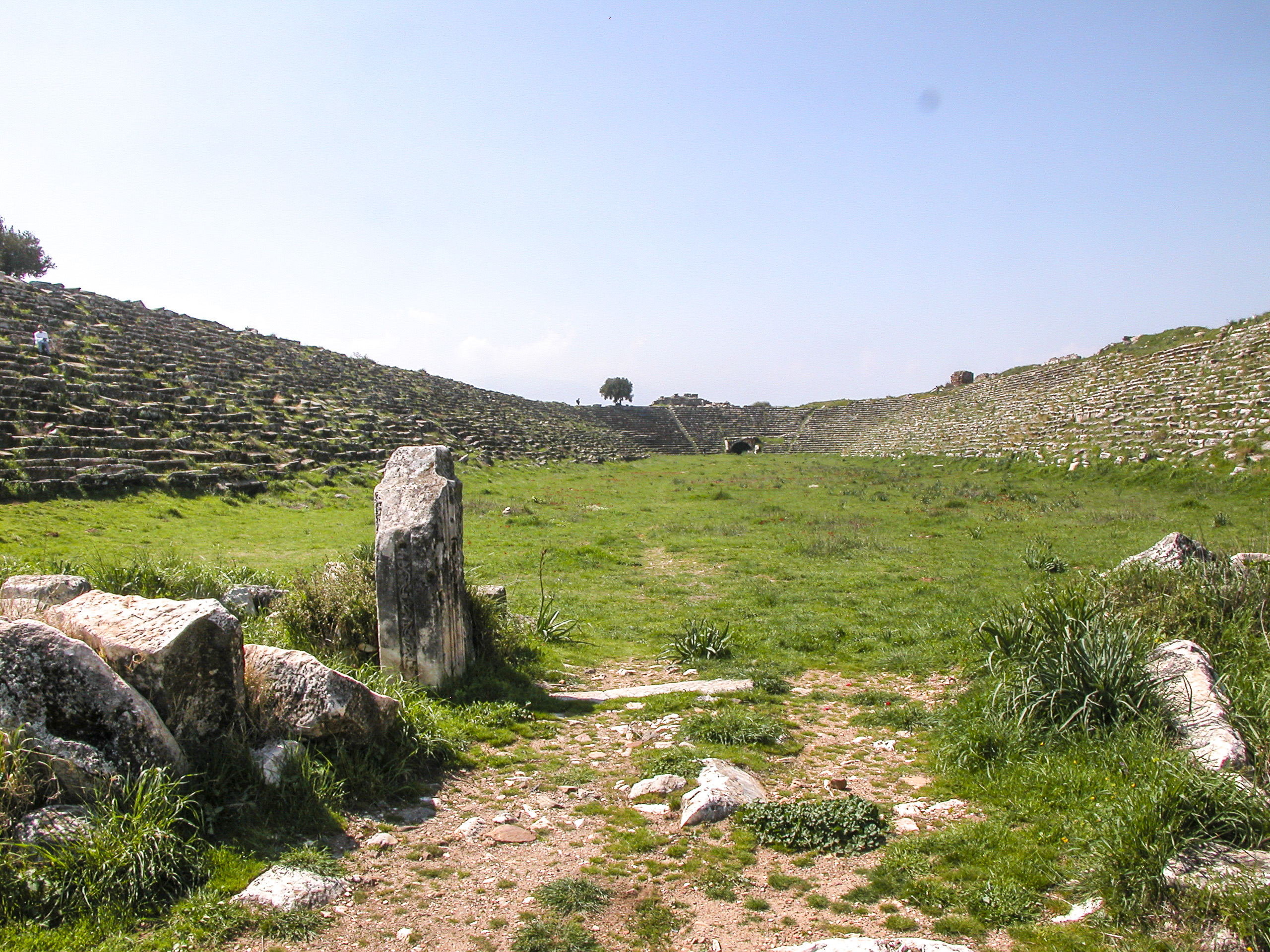
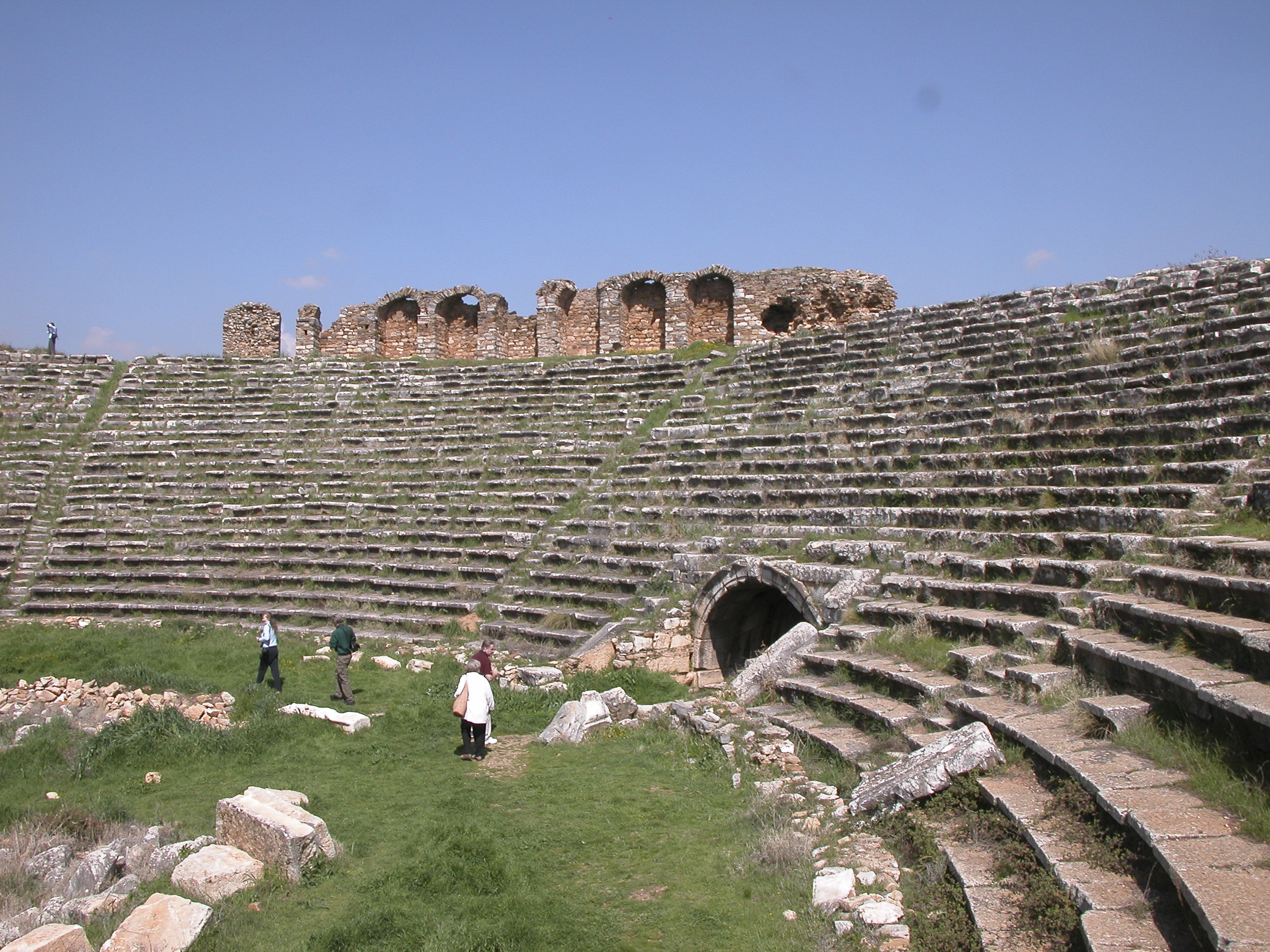
To me the most imposing edifice in Aphrodisias was the Stadium, or Hippodrome, one of the largest and best-preserve structures of its kind in all of classical antiquity. It measured 270 meters (890 ft) by 60 meters (200 ft), had 30 rows of seats on each side and around each end, and had a maximum capacity of around 30,000 spectators.
The Hippodrome of Aphrodisias.
The scale of the Stadium dwarfed the members of our tour group who infested it.
Humans infest the ruins of the Stadium of Aphrodisias.
Roman and Byzantine stadia were generally built to accommodate horse and chariot races – hence the name hippodrome. (Hippopotamus, for example, is a Greek word meaning river horse.) One can easily imagine Ben-Hur and his nemesis Messala duking it out in chariot races here.
Chariot racing was a frequent spectacle in stadia of this kind.
Atop the walls, the Stadium had structures which appeared to be VIP boxes, just as in modern-day stadia like the LA Coliseum.
Pam Bloxham, Jim Windlinger and the Lindquists check out the Stadium.
Culvert-like tunnels provided entry to the Stadium.
The culvert-like stadium entrance.
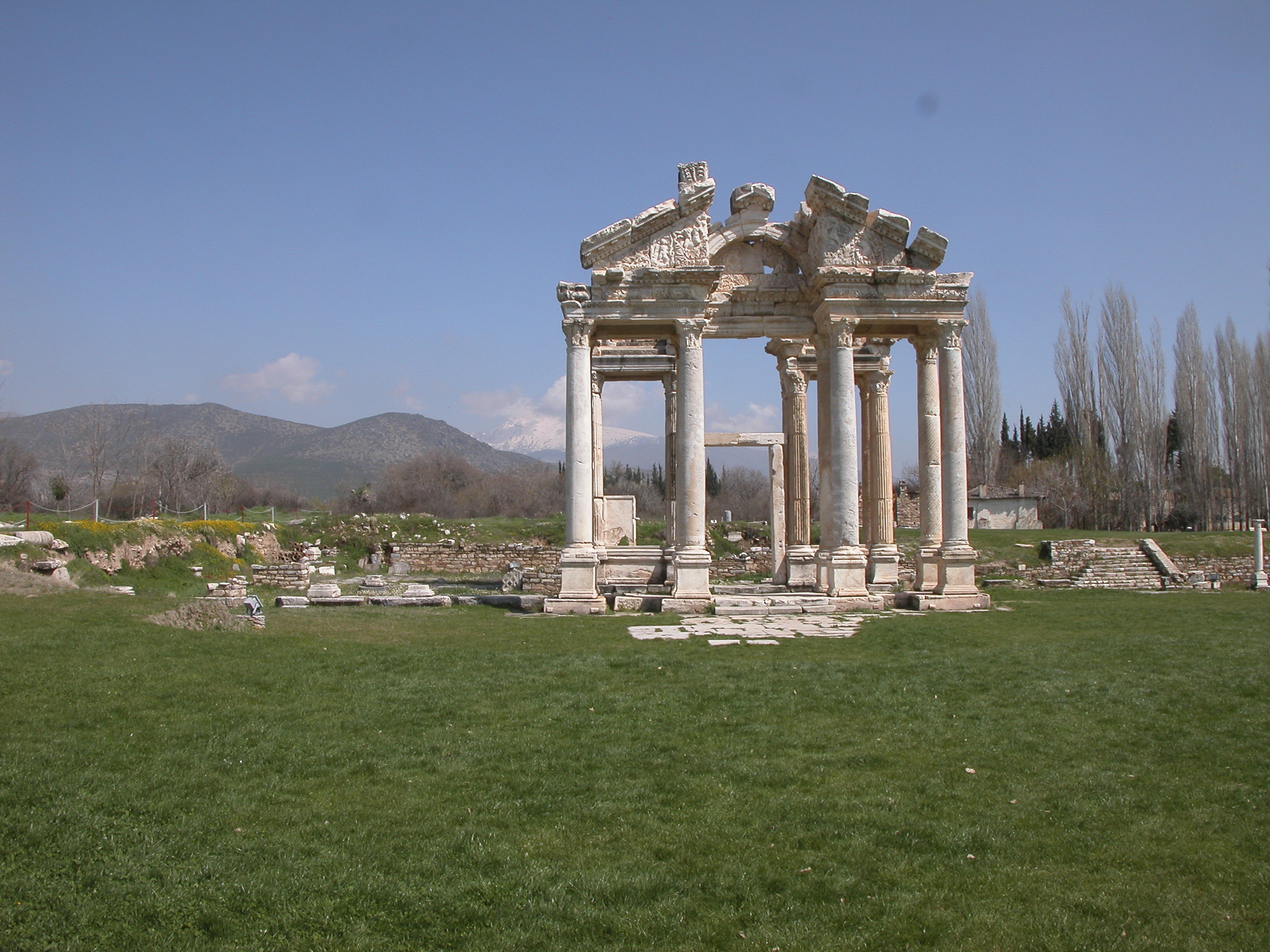
The first structure a visitor would normally see approaching Aphrodisias was the Tetrapylon, a monumental gateway opening to the sacred way to the Sanctuary of Aphrodite. For us it was the last structure we saw of the ancient city, because we toured it back to front, and from there headed back toward the Museum.
The Tetrapylon, gateway to the city of Aphrodisias.
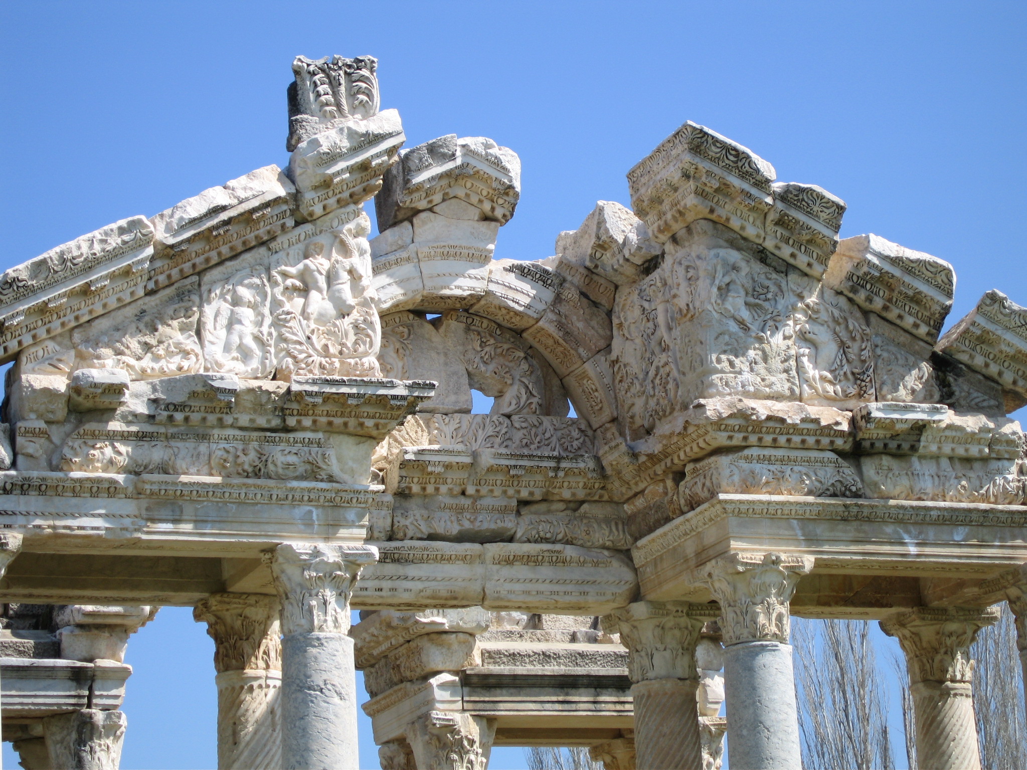
Built around 200 CE, the Tetrapylon consisted of four rows of four columns (tetra = four and pylon = gateway in Greek). The pediment was decorated with relief figures of Eros and Nike hunting among the acanthus leaves.
The pediment of the Tetrapylon.
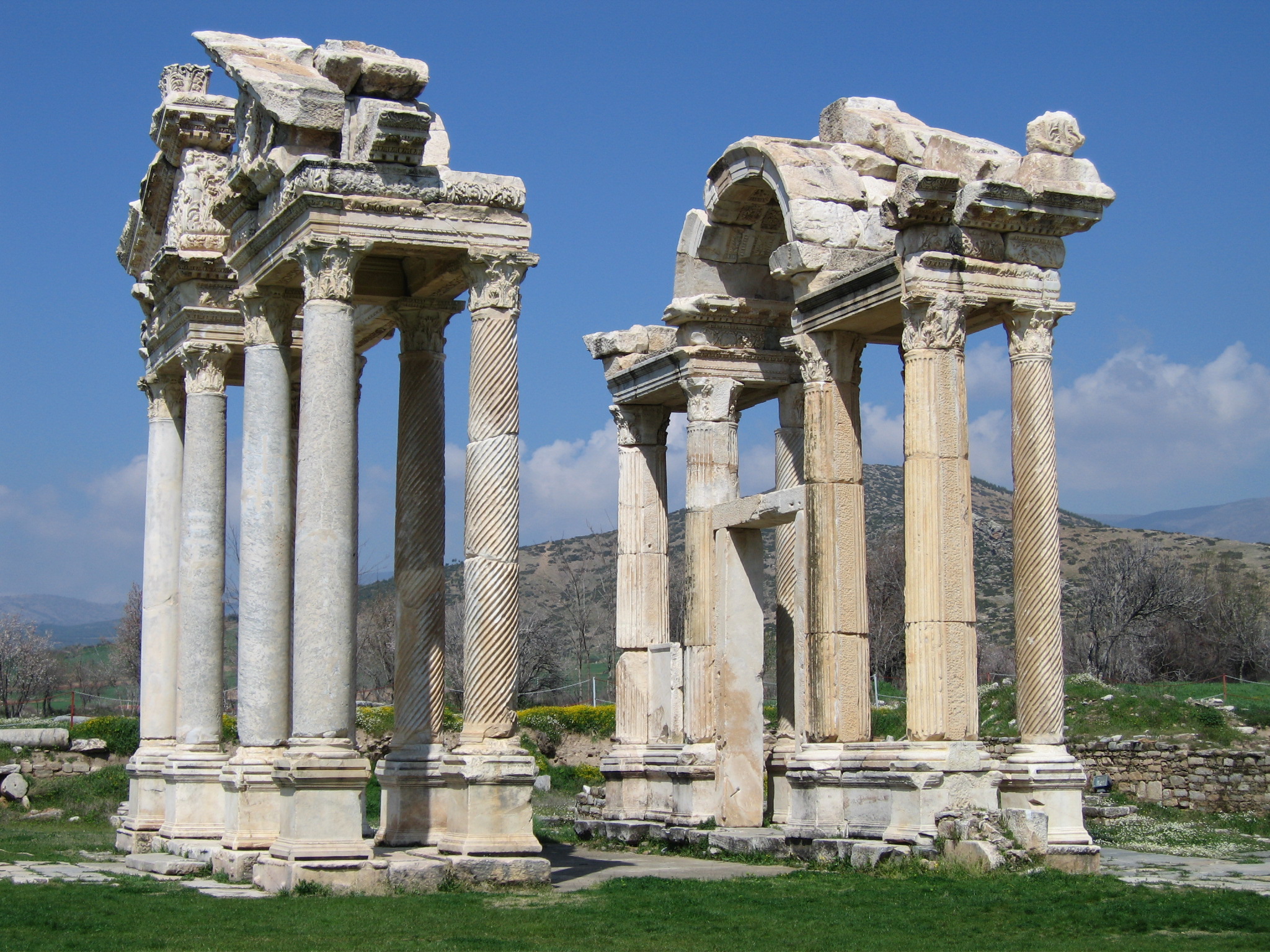
The Tetrapylon as seen here was in rather sorry shape by the time excavations began in the 20th century. It was the object of a massive restoration effort, culminating in its re-erection in 1990. Here we took our leave of the ancient city of Aphrodisias, and made our way through poppy fields back to the Museum.
Built in the second century CE, the Tetrapylon was restored in 1990.
In Flanders fields the poppies blow Between the crosses, row on row, That mark our place; and in the sky The larks, still bravely singing, fly Scarce heard amid the guns below.
We are the Dead. Short days ago We lived, felt dawn, saw sunset glow, Loved and were loved, and now we lie, In Flanders fields.
Take up our quarrel with the foe: To you from failing hands we throw The torch; be yours to hold it high. If ye break faith with us who die We shall not sleep, though poppies grow In Flanders fields.
— John McCrae
These words, written to commemorate the ghastly slaughter in Belgium and Northern France during World War I, equally well apply to Turkey, which was another major theater of battle in that war, and continued to be an area of bloody strife after the end of hostilities in the rest of the world.
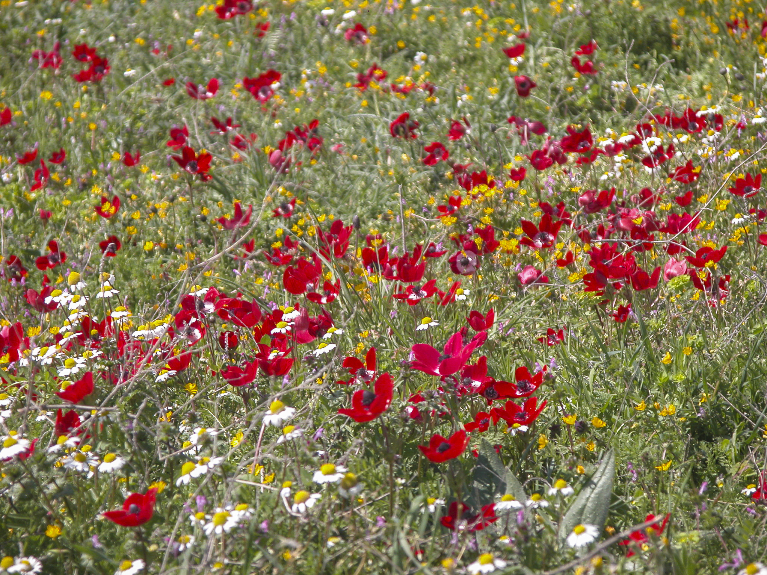
In Turkish fields the poppies grow…
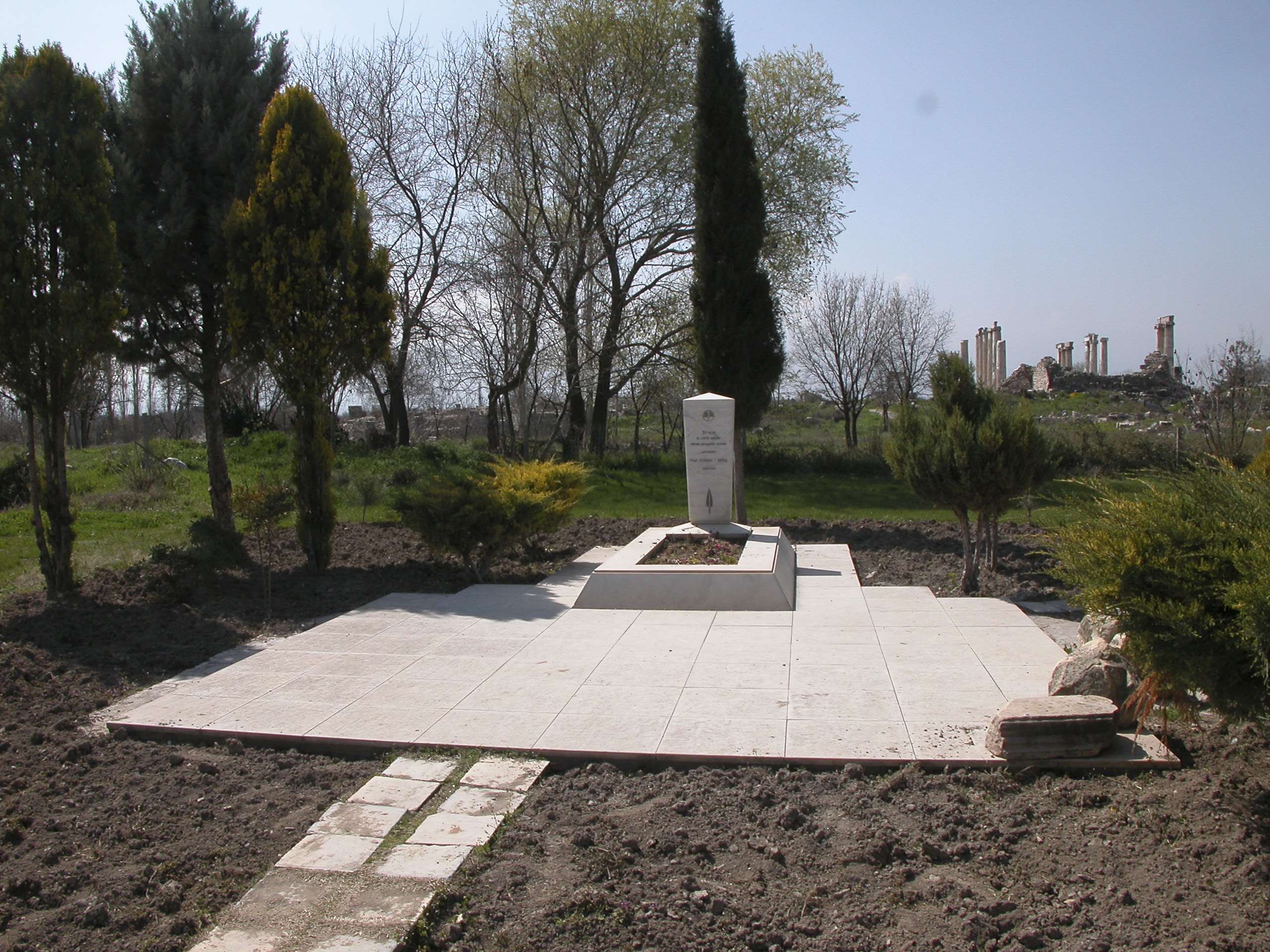
Speaking of graves, on the way back to the Museum we encountered the last resting place of Kenan Erim, theTurkish-born archaeologist who led the excavation and restoration of Aphrodisias from 1962 to 1990.
Grave of Kenan Erim, excavator of Aphrodisias.
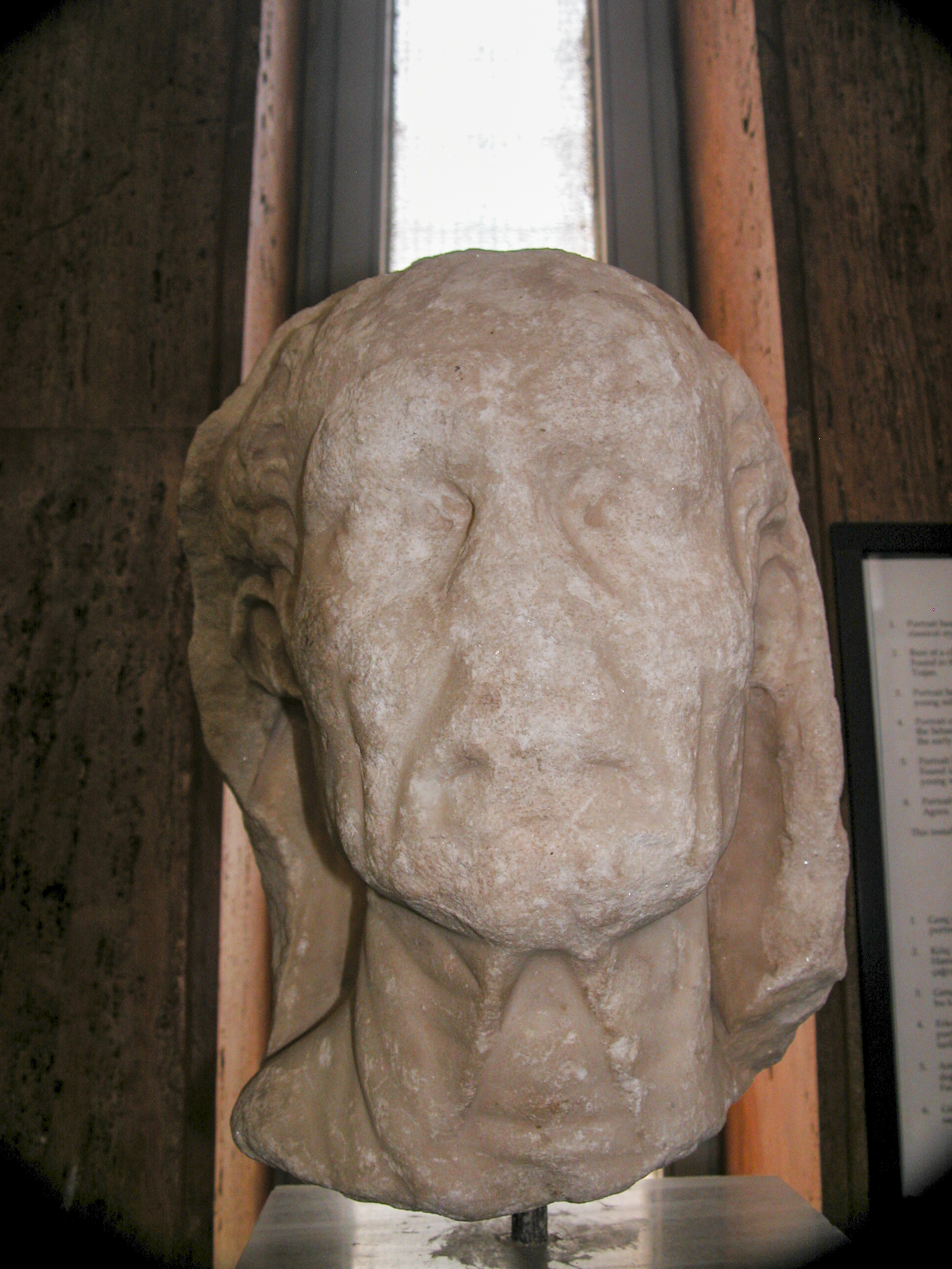
In the Museum we encountered a bust of Gaius Julius Zoilus. It has been suggested that Zoilus had been made a slave by pirates, who captured him and sold him to Julius Caesar. This was a common misfortune for inhabitants of the Mediterranean world in Greek and Roman times. In facdt, as a young man Julius Caesar himself had been captured by pirates off the coast of Turkey. Caesar, however, as a member of Rome’s elite, commanded resources that a commoner like Zoilus would not have had access to. He was able to ransom himself. Supposedly the pirates demanded a ransom of 20 talents of silver, but Caesar felt insulted at being valued so low, and insisted that they hold out for 50 talents. Other than that, his captivity was an easy one; Caesar treated the pirates as if they were his buddies, carousing and partying with them, all the while assuring them that when he was freed, he would raise a fleet, come after them and crucify them all. The pirates thought this was a great joke, until, after being ransomed, Caesar did indeed do exactly as he promised, although he had the good grace to have the pirates’ throats cut before hanging them on their crosses.
Bust of Gaius Julius Zoilus.
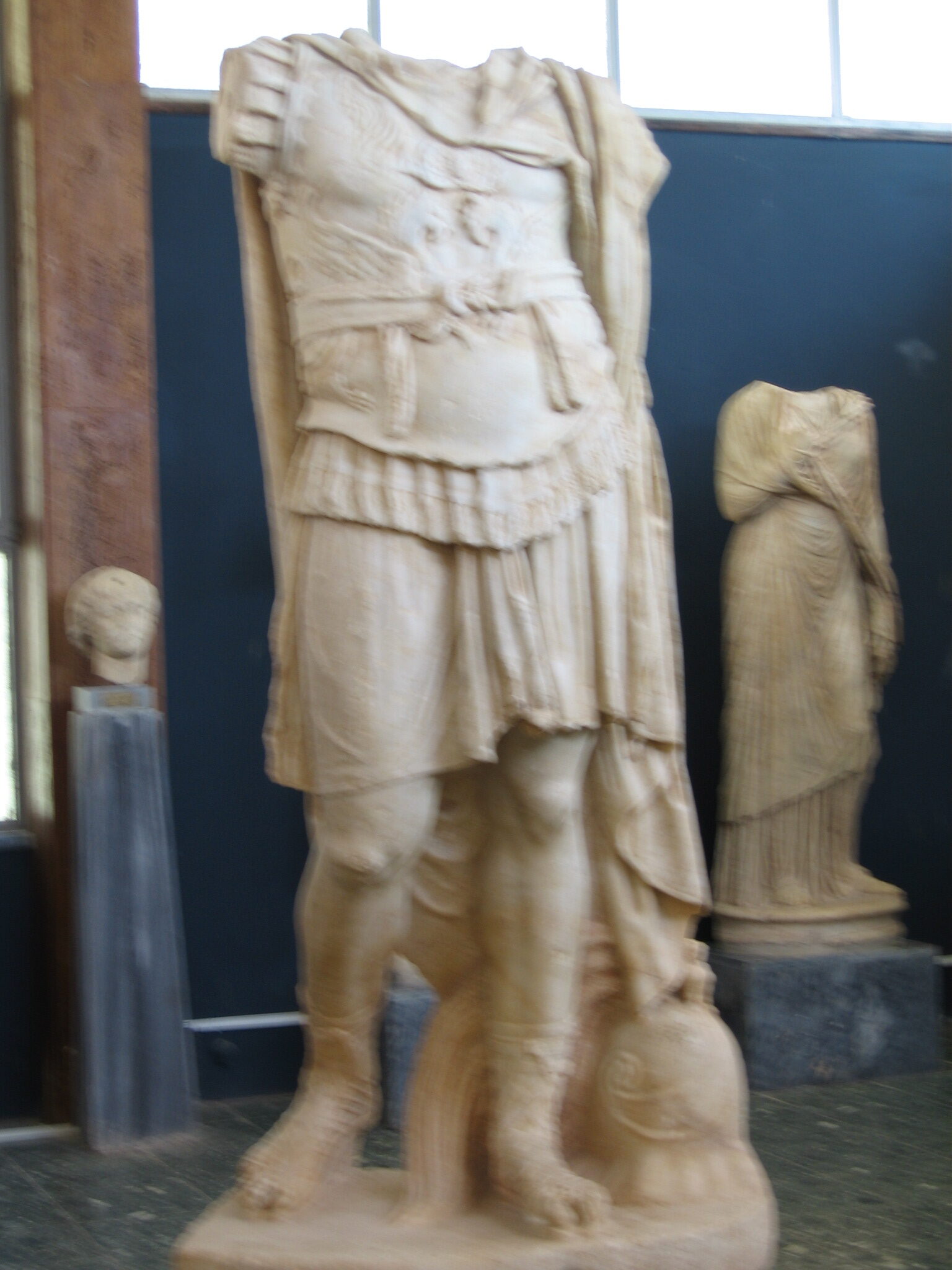
We also encountered a headless statue of a Roman. Since it was headless, I couldn’t tell whom it represented, but at a guess I’d say that it was most likely Zoilus’ patron Octavian.
The Headless Footman.
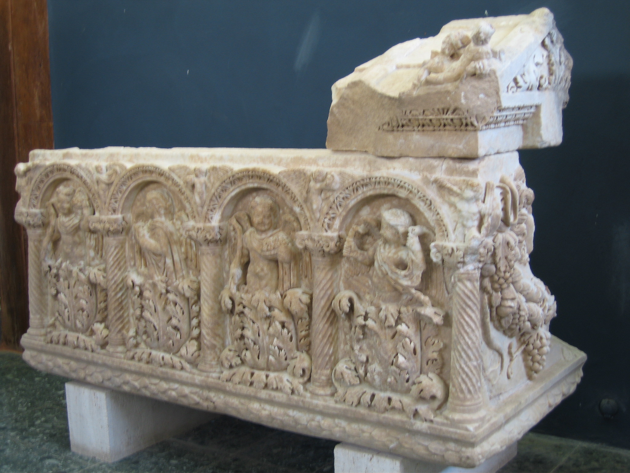
The Aphrodisian sculptors were very prolific, and their work was renowned in the ancient world. Part of the secret of their success, perhaps, was the plentiful supply of high-quality marble available in the region. We saw numerous examples of their work both inside and outside the Museum, such as the bas-relief below with its intricate stonework.
A bas-relief in the Aphrodisias Museum.
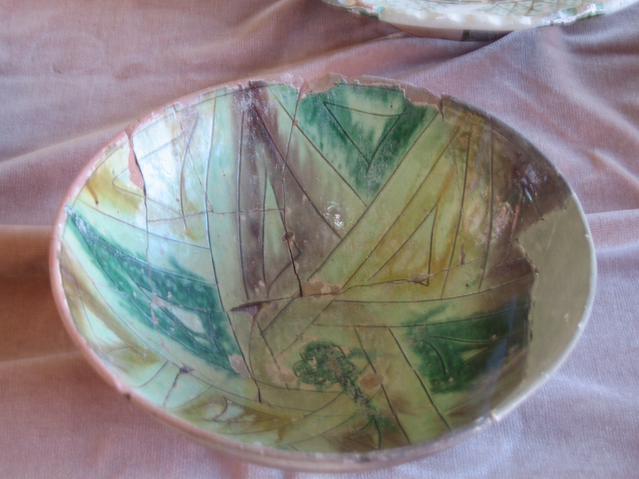
The Museum also had some nice pottery, such as this lovely multi-colored bowl, which Sandie much admired.
Colorful bowl in the Aphrodisias Museum collection.
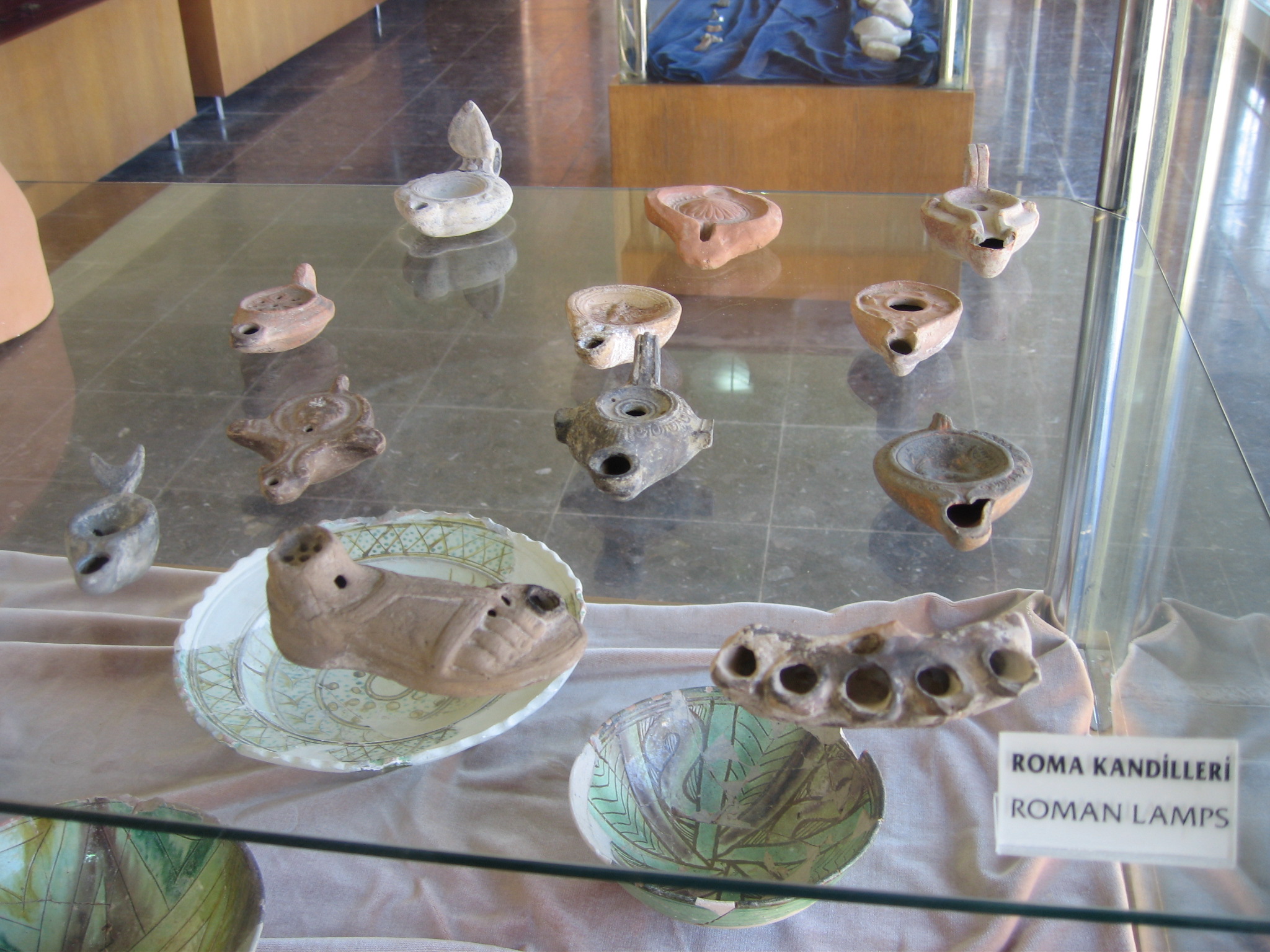
The Museum had a collection of exquisitely made “Roman Lamps,” actually candle-holders, excavated from the Aphrodisias site. I especially like the one shaped like a foot.
Candle-holders, in various interesting shapes.
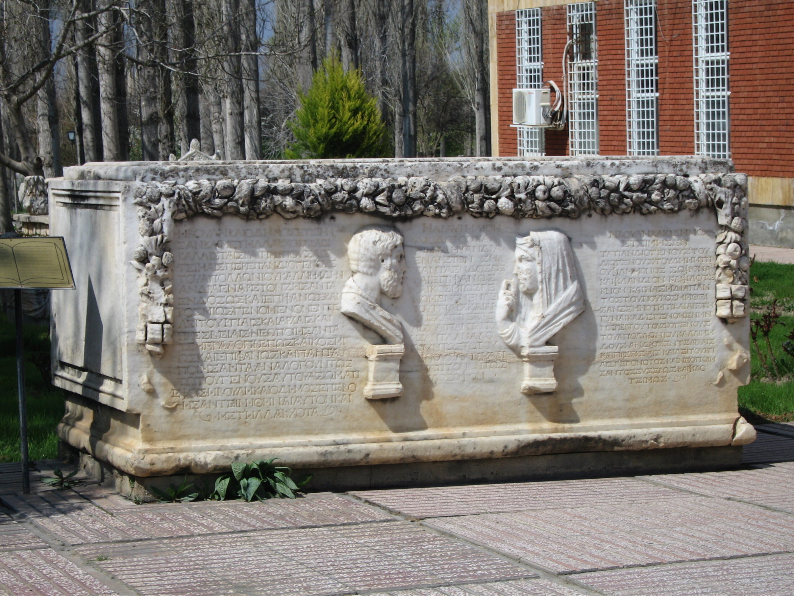
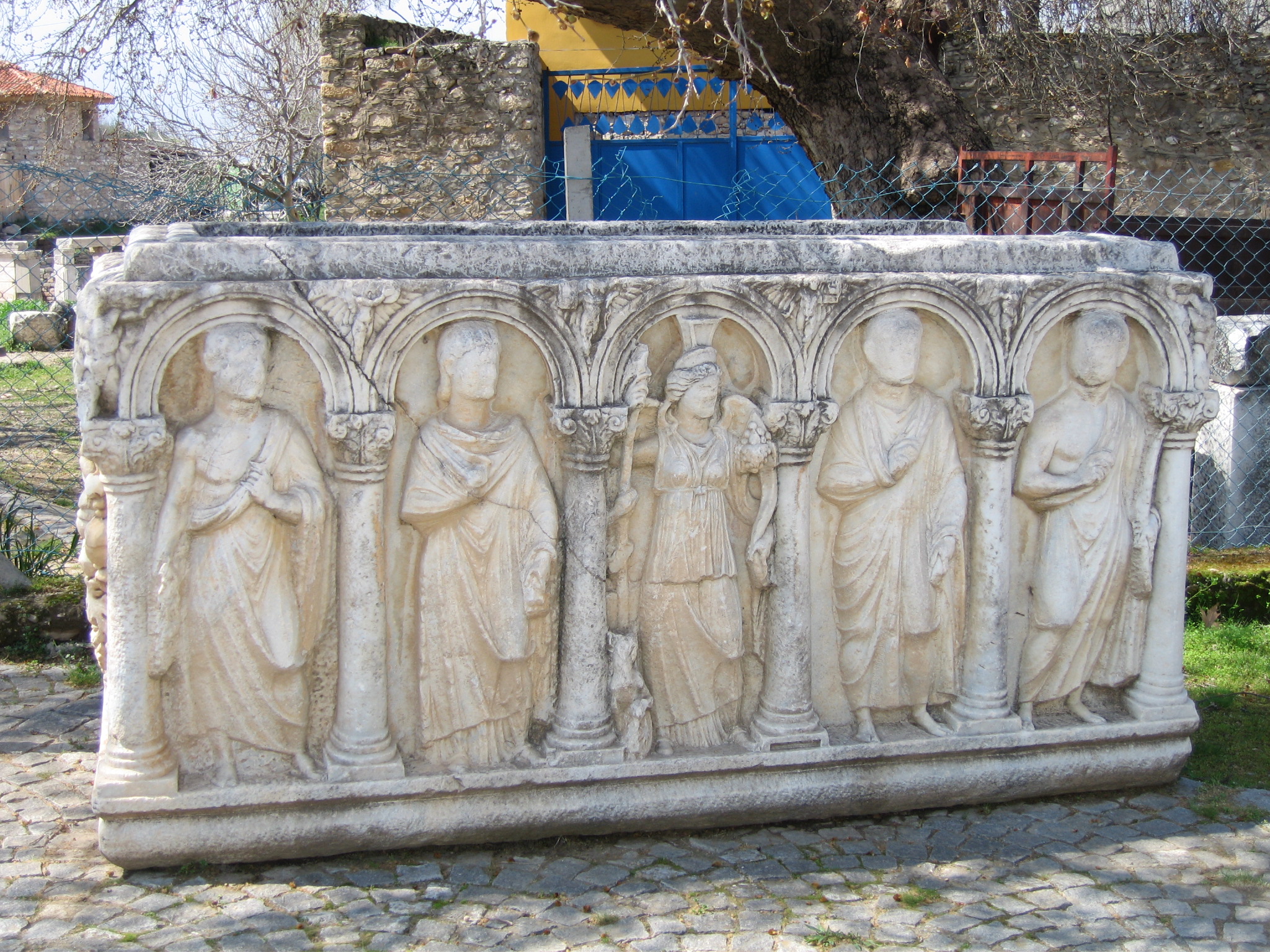
The Museum’s collection included a number of sarcophagi, stone coffins decorated with sculpture, many of them stored outdoors. I didn’t have time to decipher the inscriptions to determine whom had been buried in any of them.
Don’t know who belonged to this sarcophagus.One of the extensive collection of sculptures on display outside the Museum.
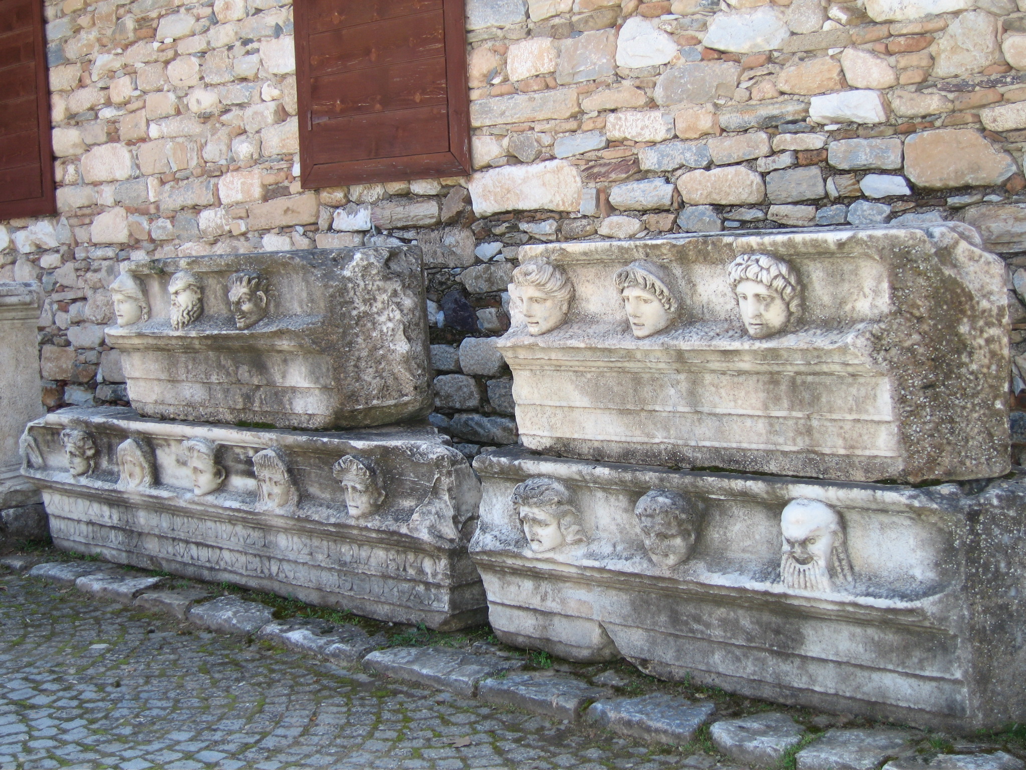
One of the last pieces we encountered on our way back to the bus featured a set of heads in bas-relief. I was tempted to purloin one of them to put on the decapitated statue in the museum. I think I would have chosen the rightmost one in the lower row.
Disembodied heads looking for bodies to be reunited with.
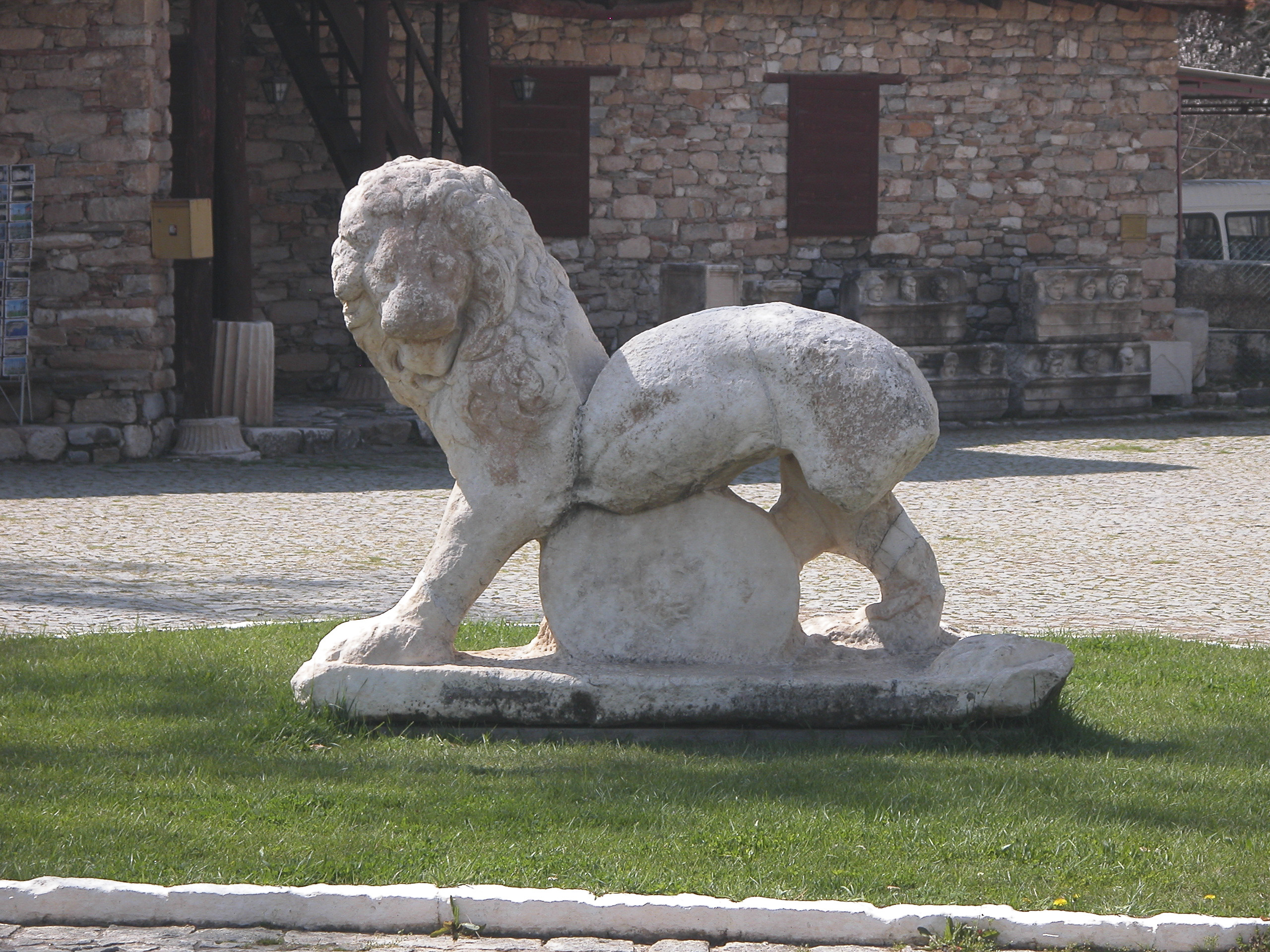
Also outside the Museum was the stone lion, everyone’s favorite.
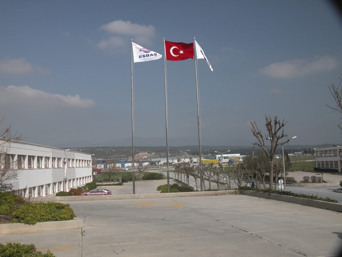
The Aegean Free Zone, near Izmir, is one of several free trade zones in Turkey. Free zones are sequestered areas given special regulatory treatment with the aid of promoting exports and attracting foreign investment. The Aegean Free Zone is home to Space Camp Turkey as well as a car museum and a wind turbine blade factory, all of which we visited on this date.
Finishing our Space Camp tour by early afternoon, we spent the rest of the afternoon exploring the Aegean Free Zone.
Beginning in 1987, Turkey began to establish a number of Free Zones — sequestered industrial parks offering special regulatory privileges for participating enterprises, with the particular aim of promoting export-oriented investment and production. The prime mover behind the establishment of the Aegean Free Zone in 1990 was Kaya Tuncer, and ESBAŞ, the company which he founded, is its developer and operator. ESBAŞ claims a trade volume of over $4 billion annually and employs 21,000 persons. With his wife Mary, Kaya Tuncer was also the founder of Space Camp Turkey.
Time constraints permitted us to visit only two additional attractions in the Aegean Free Zone. One was a plant which manufactures blades for wind turbines; the other was Kaya Tuncer’s car collection.
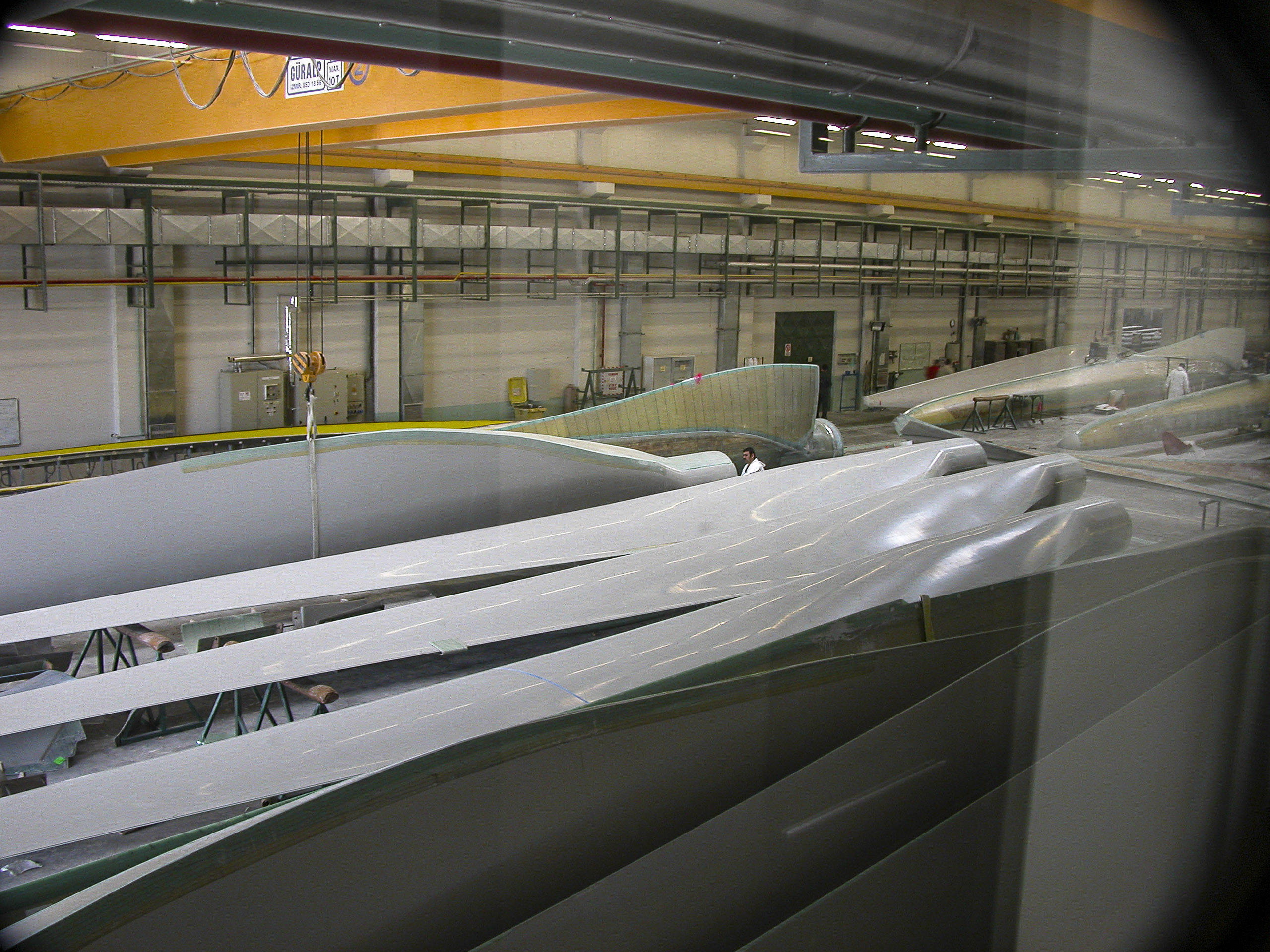
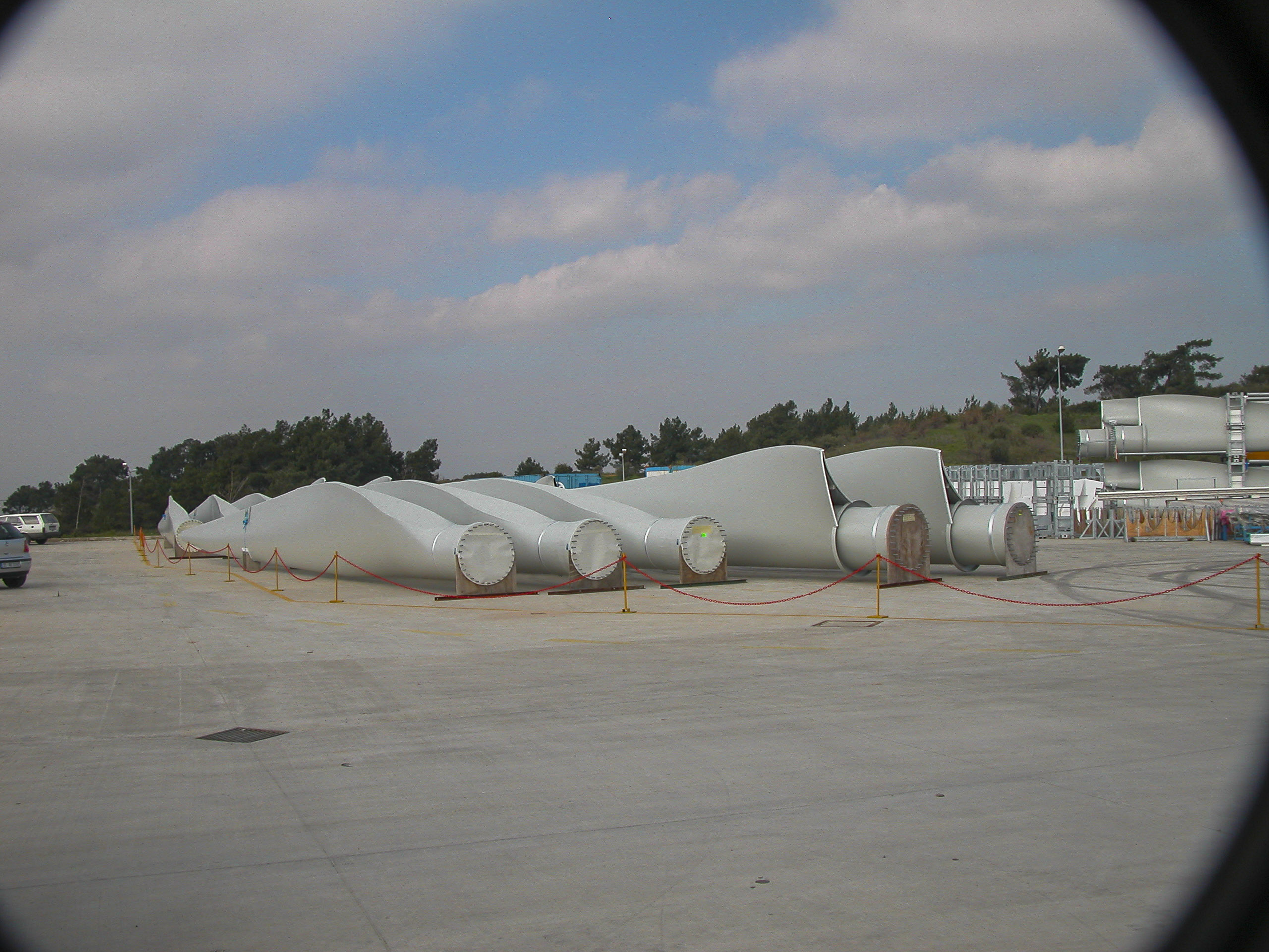
The manufacture of blades for wind turbines is one of the largest enterprises in the Aegean Free Zone. It is technologically a highly sophisticated business, consistent with the Free Zone’s emphasis on high-tech industry – because high-tech means more added value than low-tech, and hence more profit, benefiting both the investors and the host government, which realizes increased tax revenue.
A view of the interior of the turbine blade factory.
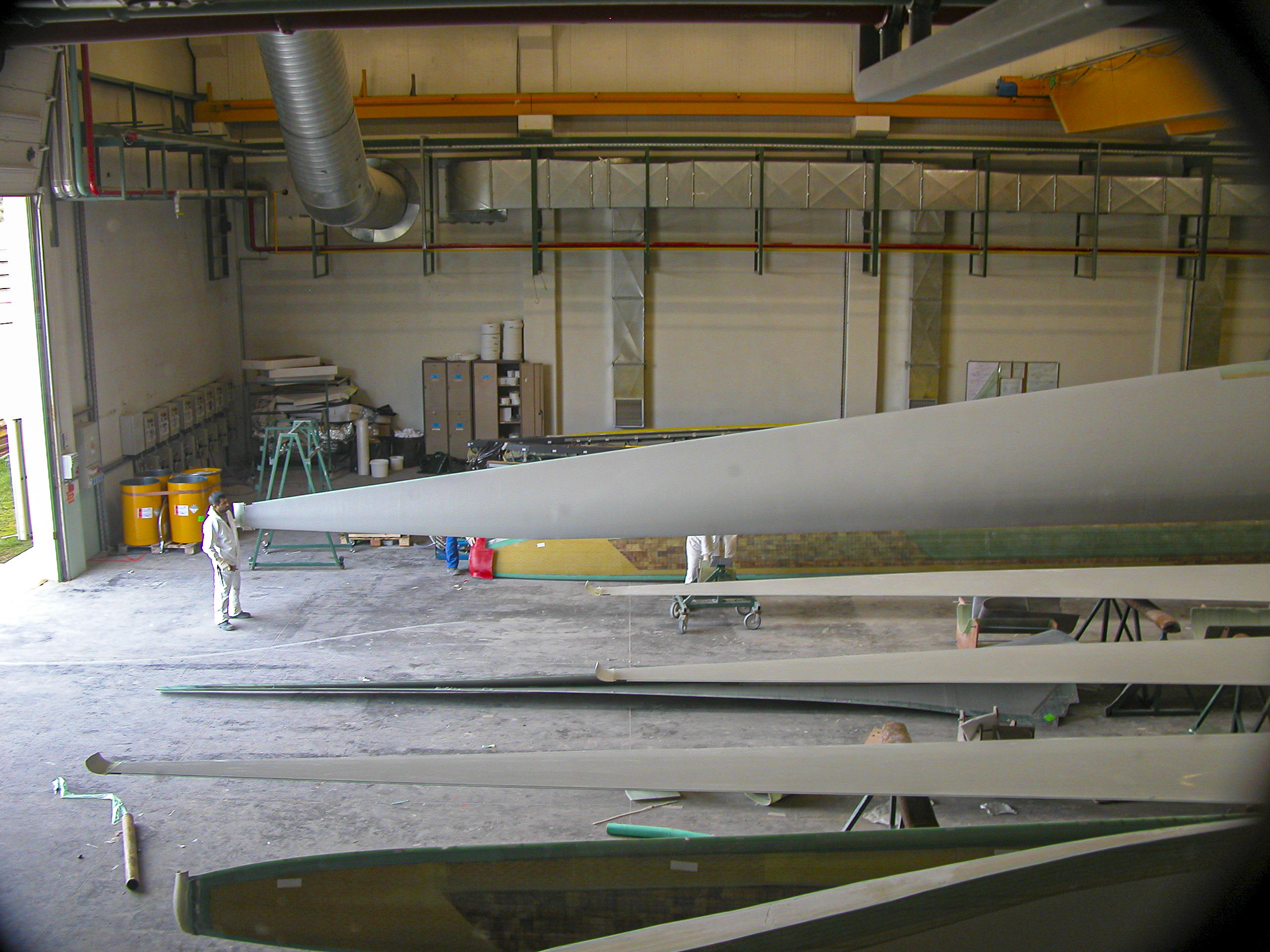
Wind turbine blades are enormous; you can get an idea of their size by checking out the tiny figure standing at the tip of one of the blades in the photo below.
The man standing by the tip of the blade gives you an idea of the size of these things.
The interior of the turbine blade factory reminded me of the Douglas (now Boeing) Aircraft plant in Long Beach. After all, airplane wings and turbine blades are both airfoils, so the same technology is involved. Here we see the finished blades coming off the production line.
The turbine blades come rolling off the production line and out to the storage area.
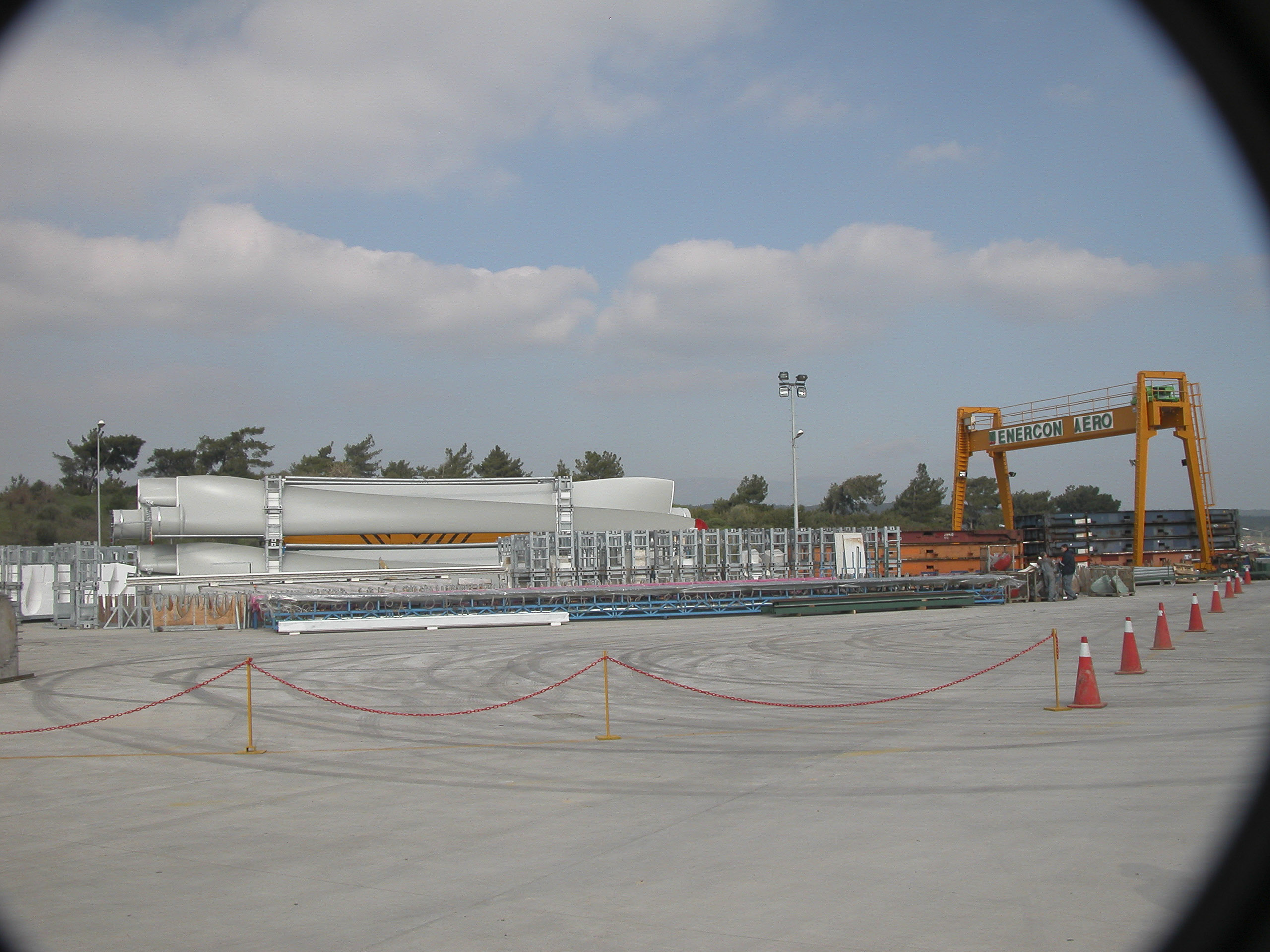
Giant cranes are required to move the turbine blades into and out of the storage area.
Here the completed turbine blades are stacked prior to shipping.
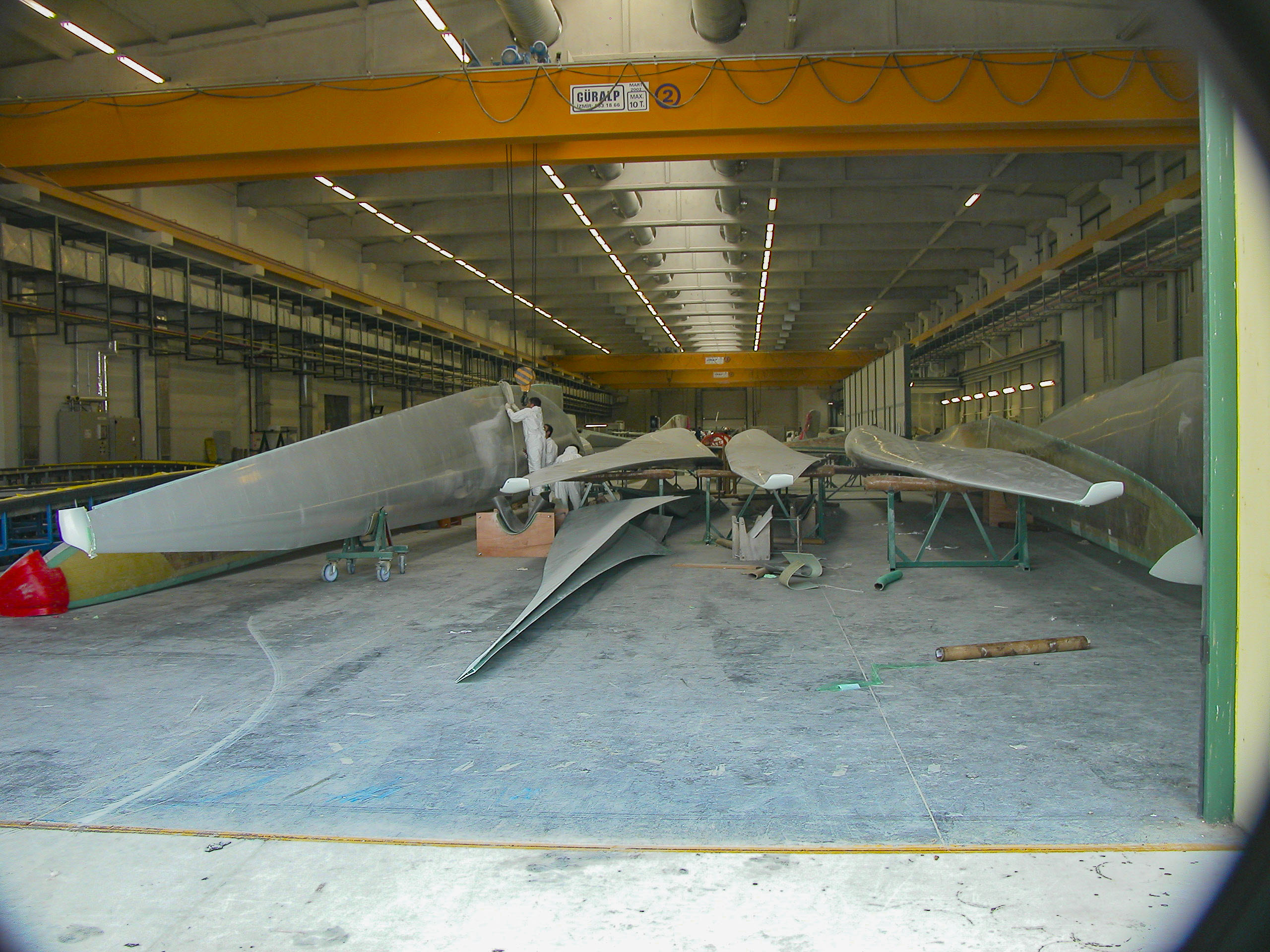
I wanted to get a shot of the turbine blades at the end where they attach to the rotor shaft. The blades in this picture appear to be of different types, but I wasn’t able to find out any of the specifics.
The end where the blades attach to the rotor shaft.
Kaya Tuncer’s car collection was not among the largest or most exotic that I’ve seen, but I found it great fun anyway. It seemed a little odd to go halfway around the world to see vintage American cars from the 20s and 30s, but it was gratifying to find that these old classics were valued and appreciated in Turkey as much as in the USA, if not more so.
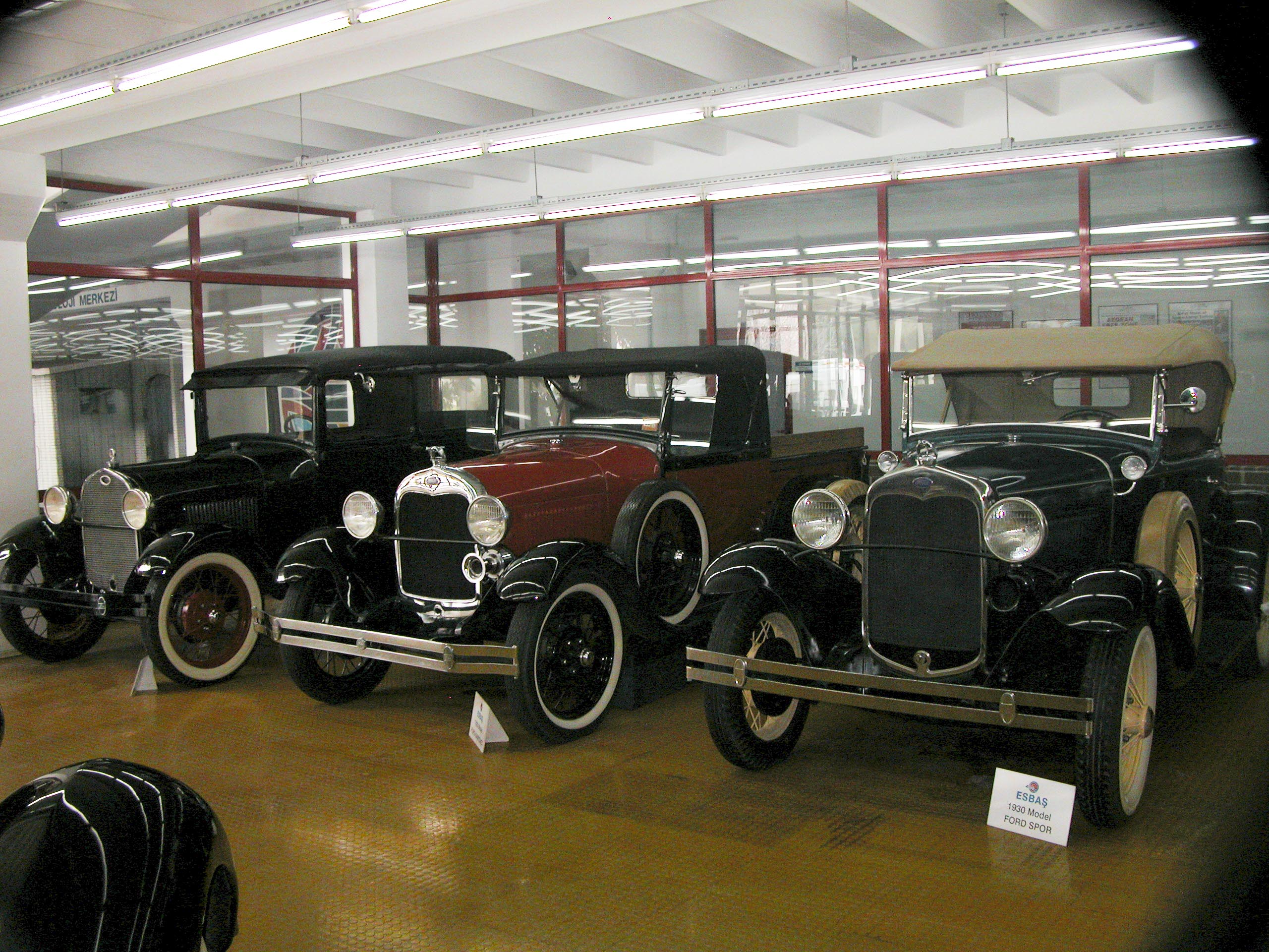
The collection included an amazing array of early Fords, including the late-20s Model As shown below. The leftmost is a 1928 sedan, the middle one a 1928 truck, and the rightmost a 1930 convertible.
Late 1920s Model A Fords in pristine condition.
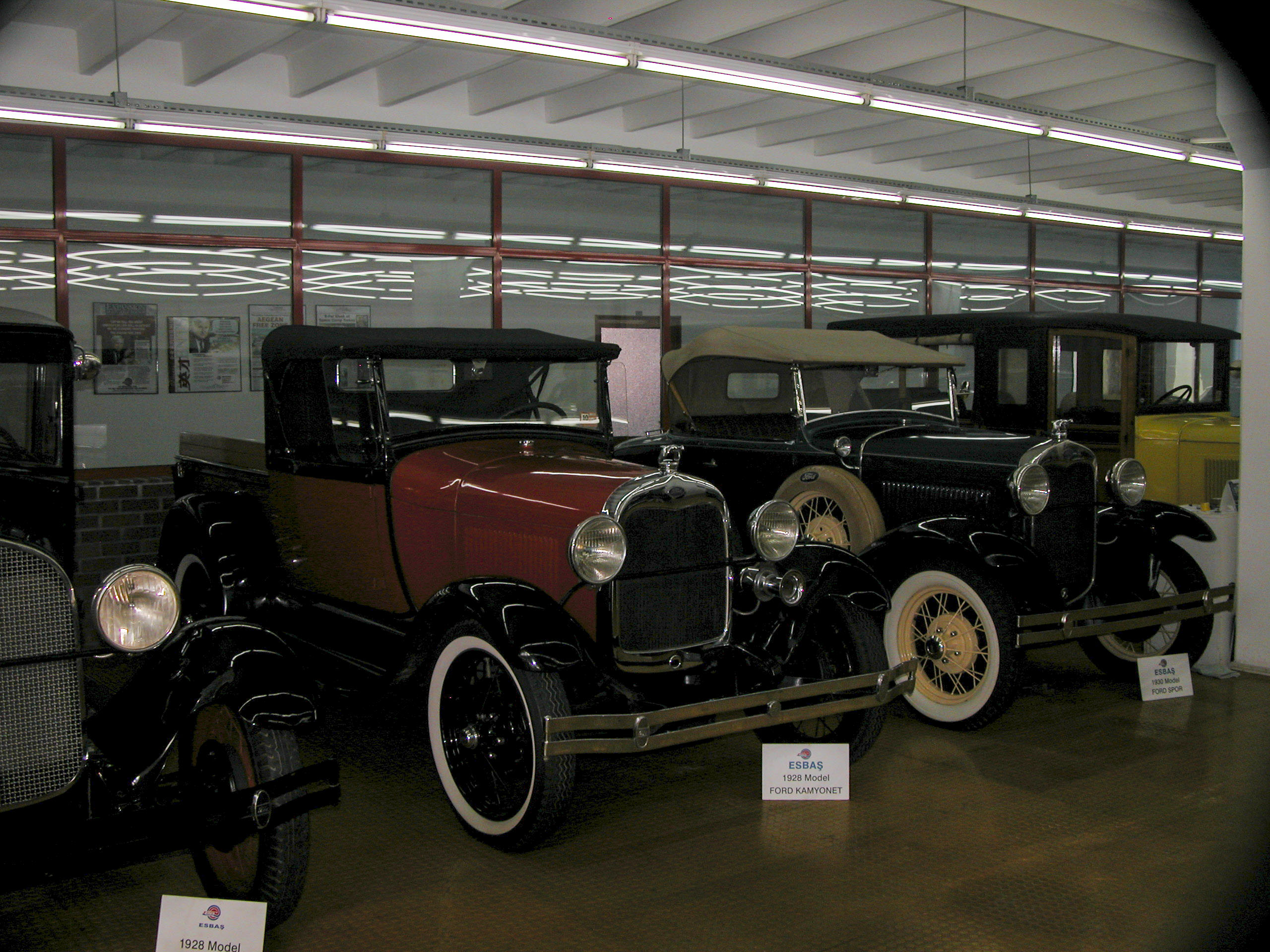
The placard for the Model A truck identified the model as a “Kamyonet,” which is a Turkified rendition of the French word “camionette,” which means “trucklet.” Quite appropriate. However, the model name listed for the convertible was “SPOR,” and I could only guess that this was meant to be “Sport.”
Model A “Camionette” and “SPOR” convertible.
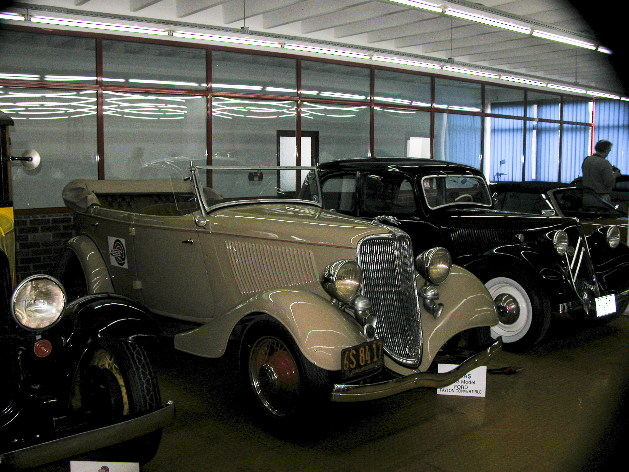
Another early Ford in the collection was a 1933 “Fayton” (Phaeton) convertible. When I was in high school in the 1950s, the 1932-34 Fords were the hot-rodders’ Holy Grail – I remember going around to car lots looking for them, but they were out of reach even then. The same was true for the Model As and Ts. I don’t think things have changed much since since then, except maybe that the later ’30s Fords, up through 1940, became equally sought-after. Hot rodders would kill to get these cars. I bet Mr. Tuncer shipped them to Turkey so that they wouldn’t get stolen.
1933 Ford Phaeton convertible
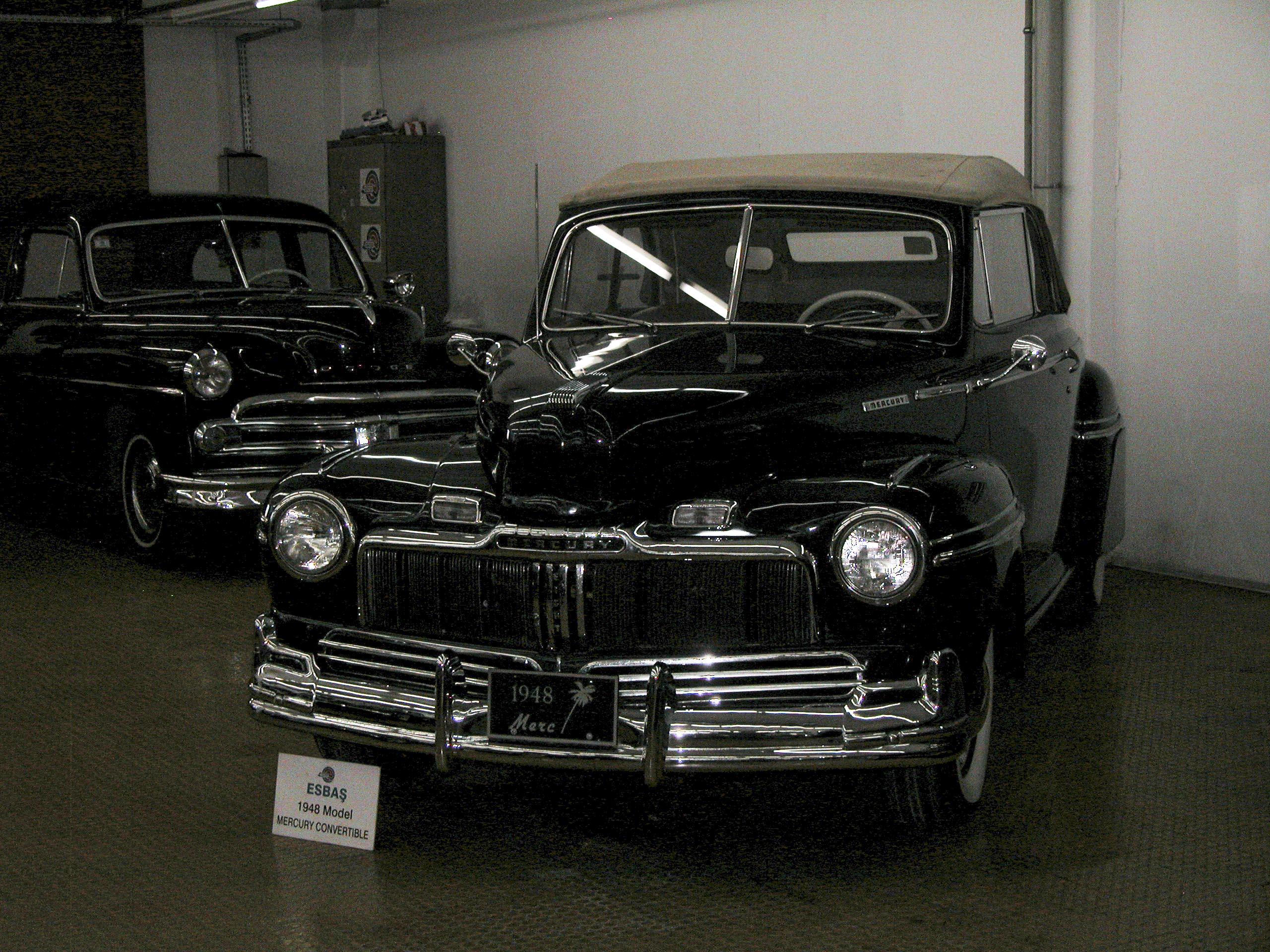
The early post-World-War II Ford lines, like this ’48 Mercury convertible, had nothing like the mystique of the prewar Fords; we considered them dowdy and ungainly, and they were assigned the derogatory sobriquet “Wombat”. Nevertheless, kids bought and drove them because they were plentiful and cheap.
1948 Mercury “Wombat” convertible. Behind it is an early ’50s Dodge.
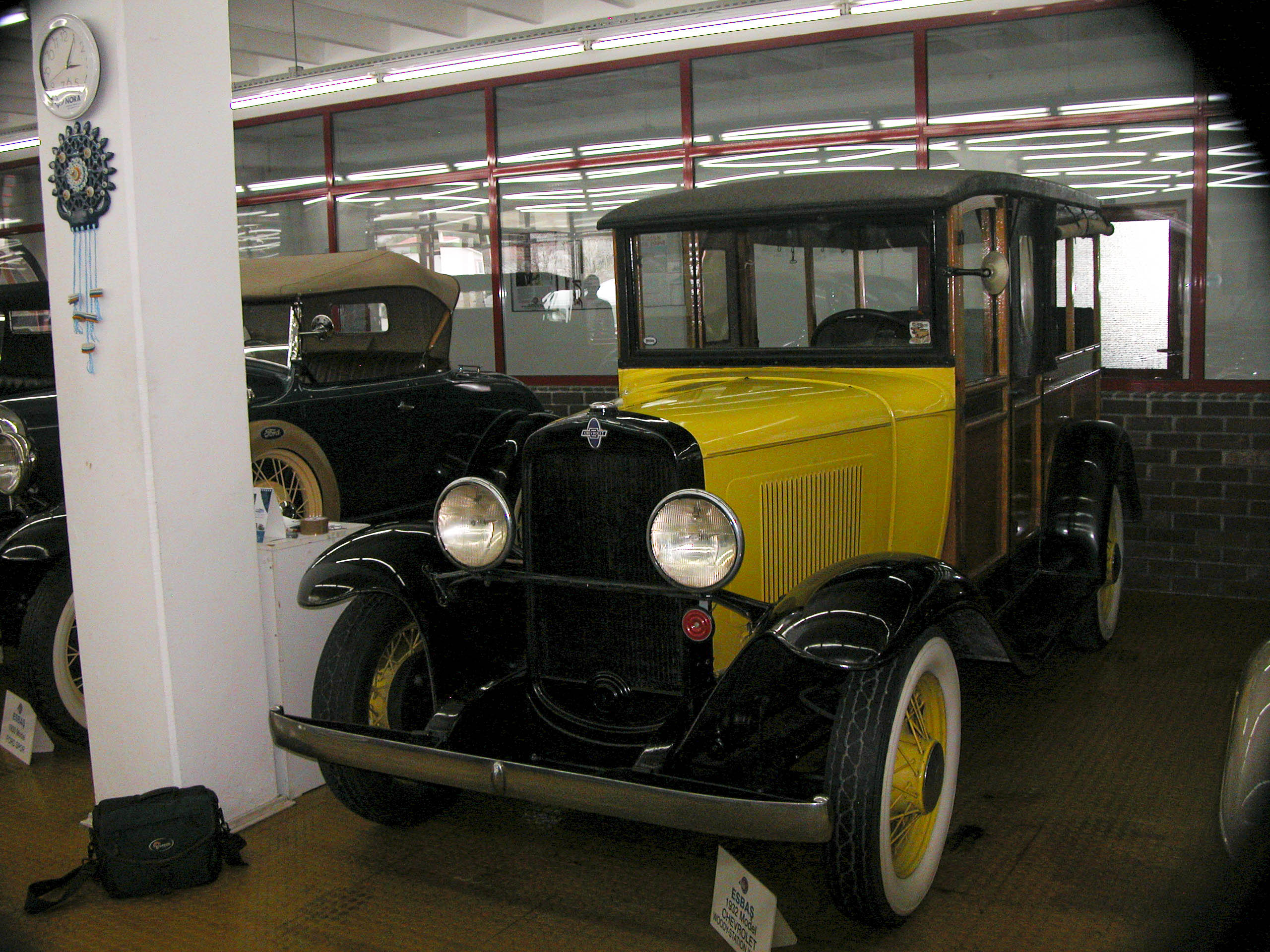
For the surfers of the ’60s – the generation after mine – the iconic vehicle was the Woody station wagon, which was ideal for transporting surfboards to the beach. Typically they were late ’30s or ’40s Fords, but the Tuncer car collection boasted a much more exotic one, a 1932 Chevrolet, one that would inspire unrestrainable lust in the heart of any self-respecting surfer.
1932 Chevrolet Woody Station Wagon
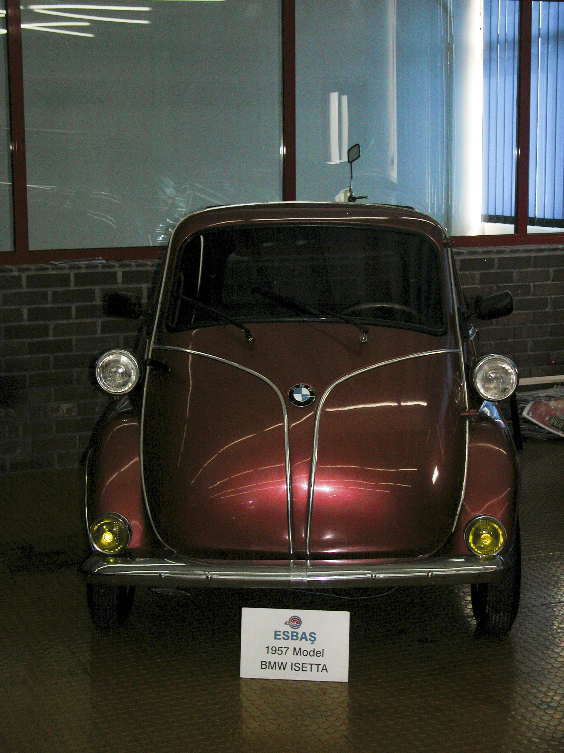
A departure from the usual fare of the museum was the 1957 BMW Isetta in the following photo, the result possibly of miscegenation between a motorcycle and a golf cart. These days it seems incredible that BMW would ever make such a car, but in the early post-WW-II years automobile ownership was an exotic and expensive luxury for most Europeans and there was plenty of demand for minimal, inexpensive, high-mileage cars (the Isetta got 78 mpg). The Isetta actually originated in Italy in 1953 with a company called Iso (hence the diminutive “Isetta”) and was made there, in France, Spain and South America before BMW acquired the marque. The Isetta had a one-cylinder 12-horsepower motorcycle engine, seated two plus one small child if squeezed hard, and the only door was at the front – actually it was the front – of the vehicle. It was derisively known in US sports-car circles as “The Egg” and more affectionately in Europe as the “Bubble Car.” It had a top speed of 47 miles per hour and took 30 seconds to get from zero to 30 mph. BMW ceased production in 1962 after 161,728 units had been sold. In 1957 a BMW Isetta sold for $1,048; today you would have to fork over $45,000 to $55,000 for an Isetta in top condition, like the one in the Tuncer collection.
Also known as “The Egg.”
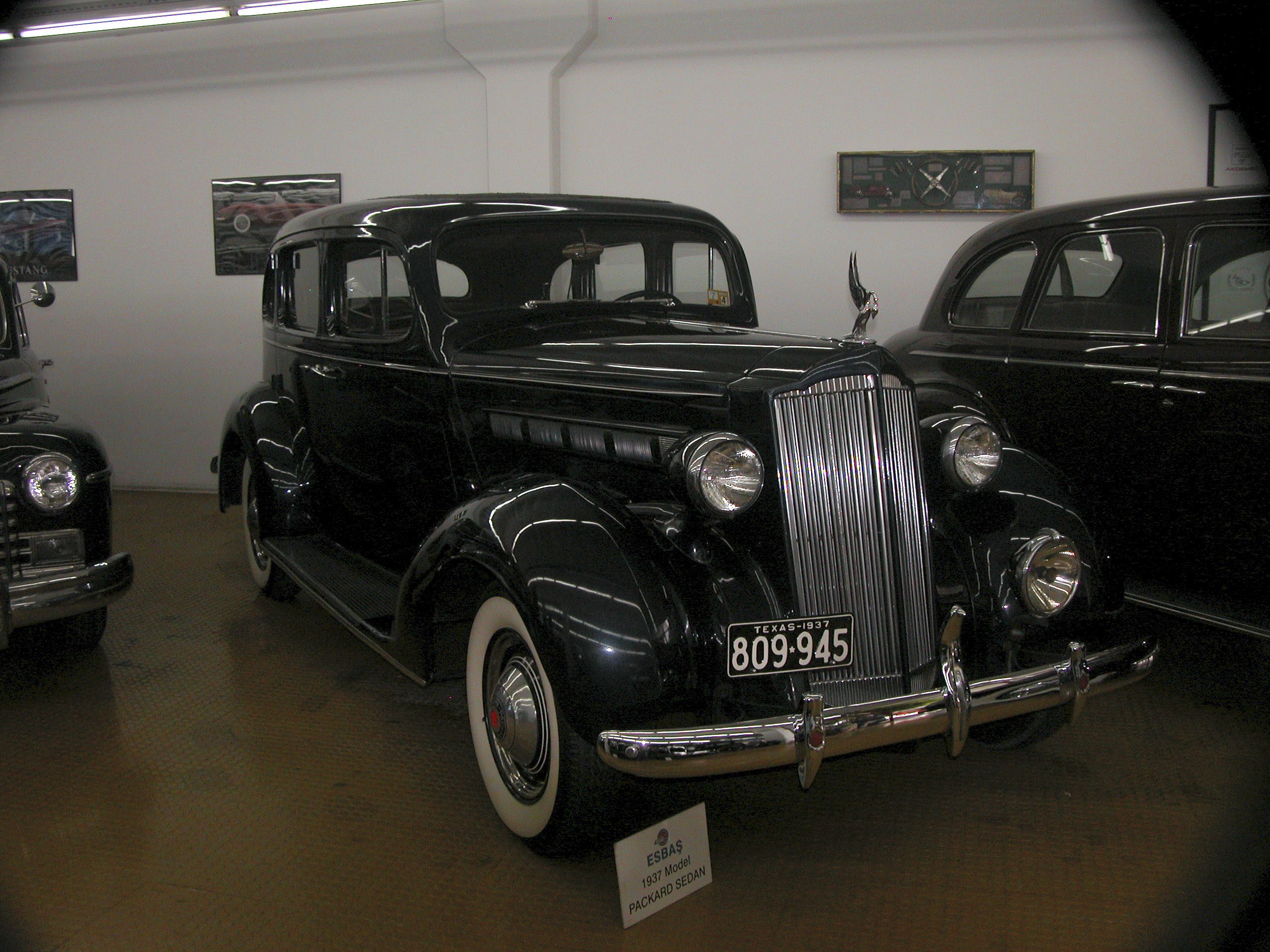
A more upscale vehicle was the 1937 Packard sedan shown in the following photo. At one time, during the late 1920s, Packard was the top-selling brand among American luxury cars, and enjoyed a worldwide reputation for quality, exporting more cars than any other in its price class. The company’s slogan, “Ask the Man who Owns One,” was a byword at home and abroad – you could ask the Tsar of Russia and Emperor of Japan about their Packards, for example. During the 1930s, buoyed by the support structure of their parent organizations GM and Ford, Cadillac and Lincoln began to catch up, but Packard remained strong until after World War II, when a series of poor business and engineering decisions, among other problems, led to its gradual decline and demise.
“Ask the man who owns one.” Damn few of those around anymore.
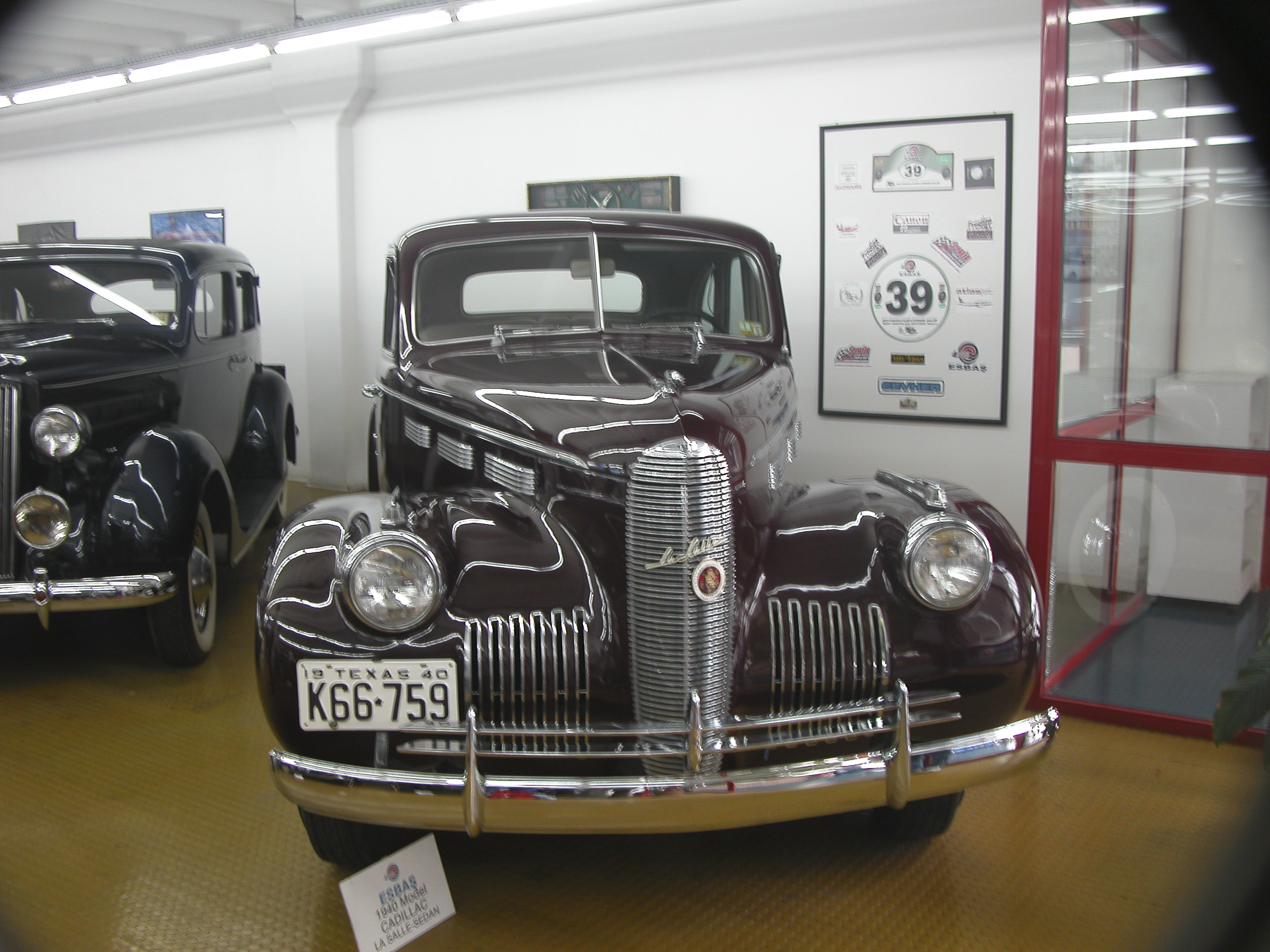
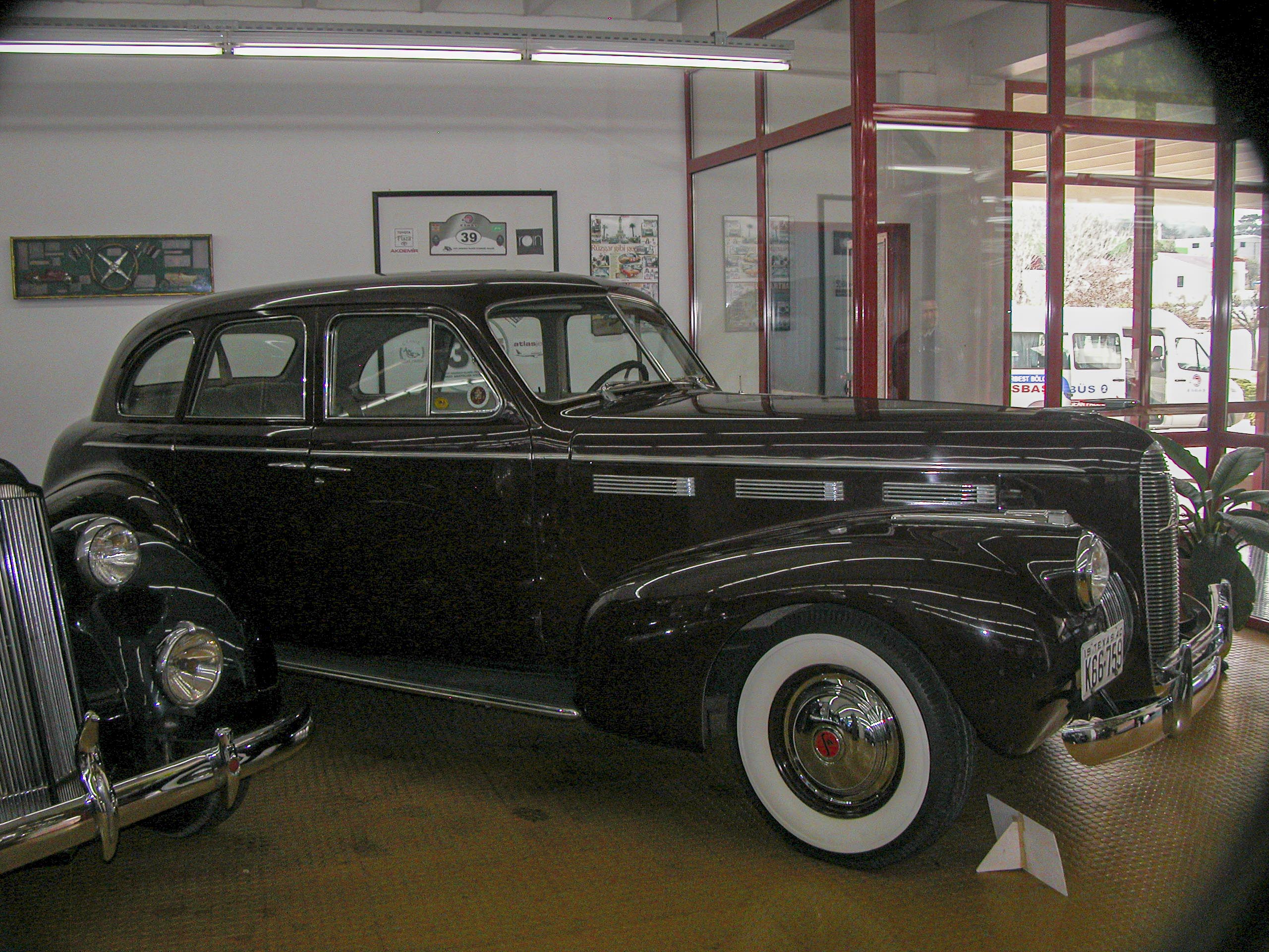
The Tuncer collection also included a 1940 Cadillac LaSalle. The LaSalle was kind of a junior Cadillac, built and marketed by Cadillac but marketed as a separate brand, and priced lower than a regular Cadillac. LaSalles were built from 1927 to 1940, so the car in the picture below is one of the last LaSalles ever built. GM’s management killed the LaSalle in 1941 because they had begun to see it as a superfluous sibling of Cadillac and Buick, overlapping the market positions of both and stealing sales from them.
1940 Cadillac LaSalle sedan.
The ’40 LaSalle 4-door sedan closely resembled a car I used to own, a 1940 Buick. It originally had a straight-8 engine, but it threw a rod, and the car was then acquired by the master mechanic and engineer extraordinaire Steve Stephenson, who dropped a 55 Buick V-8 into it before selling it to me for $150. I owned it during my last year in college, along with a Honda 305 Super Hawk motorcycle. I had it painted Honduras maroon metallic (a bad choice; Steve suggested a dark brown, which would have been far more appropriate for such a dignified automobile) and had it upholstered in Tijuana with black tuck-and-roll vinyl. After graduating from college, I went into the Navy and sold the car back to Steve.
The ’40 LaSalle 4-door sedan closely resembled a car I used to own, a 1940 Buick.
One summer night I was driving the Buick down Second Street in Belmont Shore, Long Beach, when some tough-looking dudes in an old Chevy pulled up alongside. They started shouting insults at me and following me as I drove down Second Street through Naples and turned right on Pacific Coast Highway toward Seal Beach. As I was driving down PCH they pulled up alongside and threw a full beer can at my car, which put a chip in the right rear windshield. At that point I slowed down, pulled behind them as if I were getting their license plate number, then shot around them on the left, took the Buick up to 75 mph and left the Chevy far behind in my rear view mirror as I rocketed toward Huntington Beach.
Space Camp Turkey is a space and science educational institution based in the Aegean Free Zone near Izmir, Turkey. According to its website, it opened in 2000 with a primary mission of motivating young people from around the world to pursue careers in science, math, and technology, using interactive, space-related simulations, in which “both youth and adults learn about communication, teamwork, and leadership in a dynamic, fun-filled environment….Programs at Space Camp Turkey focus on simulators to give participants the sensations of working and living in space.” Another major aim is to promote international amity: “Our state-of-the-art facility offers an ideal environment where young people from different nations can come together to build long-term friendships and understand other cultures.” I must say that we saw abundant evidence of this as we met participants from all over Europe and Asia, including from such nations not known for mutually friendly relations such as Greece and Turkey, who were clearly getting along very well together.
Our tour organizers and sponsors, the Orange County Space Society and Kaya Tuncer, had a long and close association with Space Camp Turkey, so a visit to their facility was a priority, and it turned out to be great fun as well as an edifying experience.
Space Camp Turkey is the second institution of its kind to open in the world, the first being the Space Camp in Huntsville, Alabama. It also claims to be the only such facility in Turkey, the Middle East, Europe and Asia.
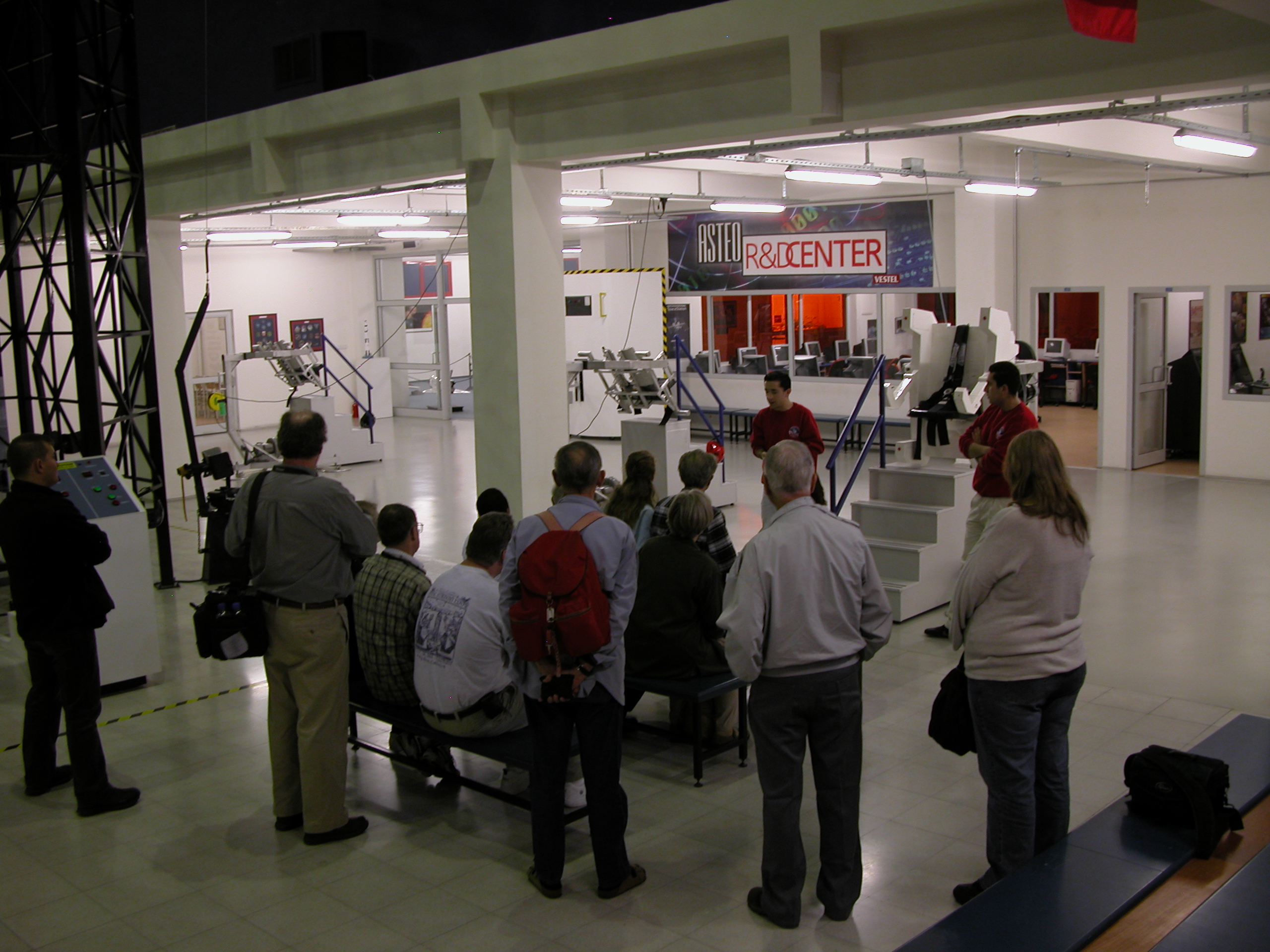
Upon our arrival at Space Camp Turkey, and following a brief meet-and-greet session with the staff, we were given an orientation which described the facilities, told us what to expect during the simulations, and gave us some idea of our chances of survival.
Orientation session at Space Camp Turkey
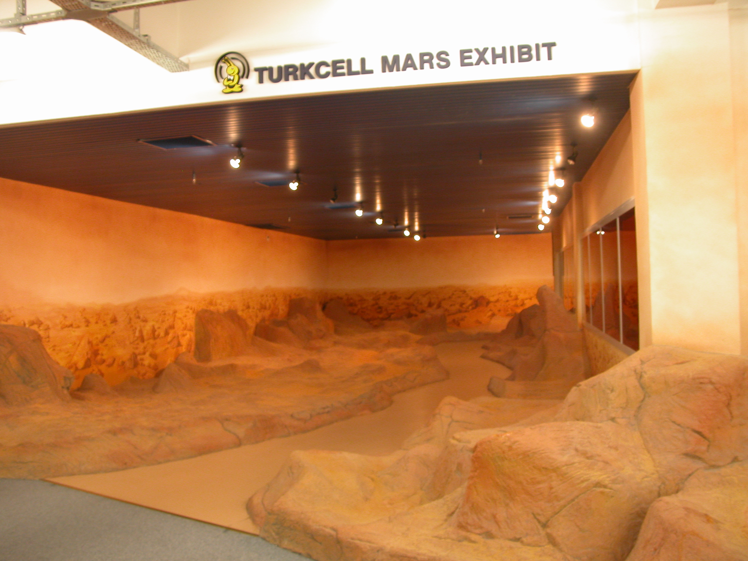
The Mars Exhibit was built to prepare prospective colonists for an eventual landing on the Red Planet. Here trainees would be cast adrift on the dry, inhospitable surface to survive as best they could, without food, water or protective clothing, subject to ambush by hostile Martians from the movie “War of the Worlds.” A few of our party wandered by mistake into this exhibit and were lost.
A simulation of the surface of the planet Mars. No Martians in evidence.
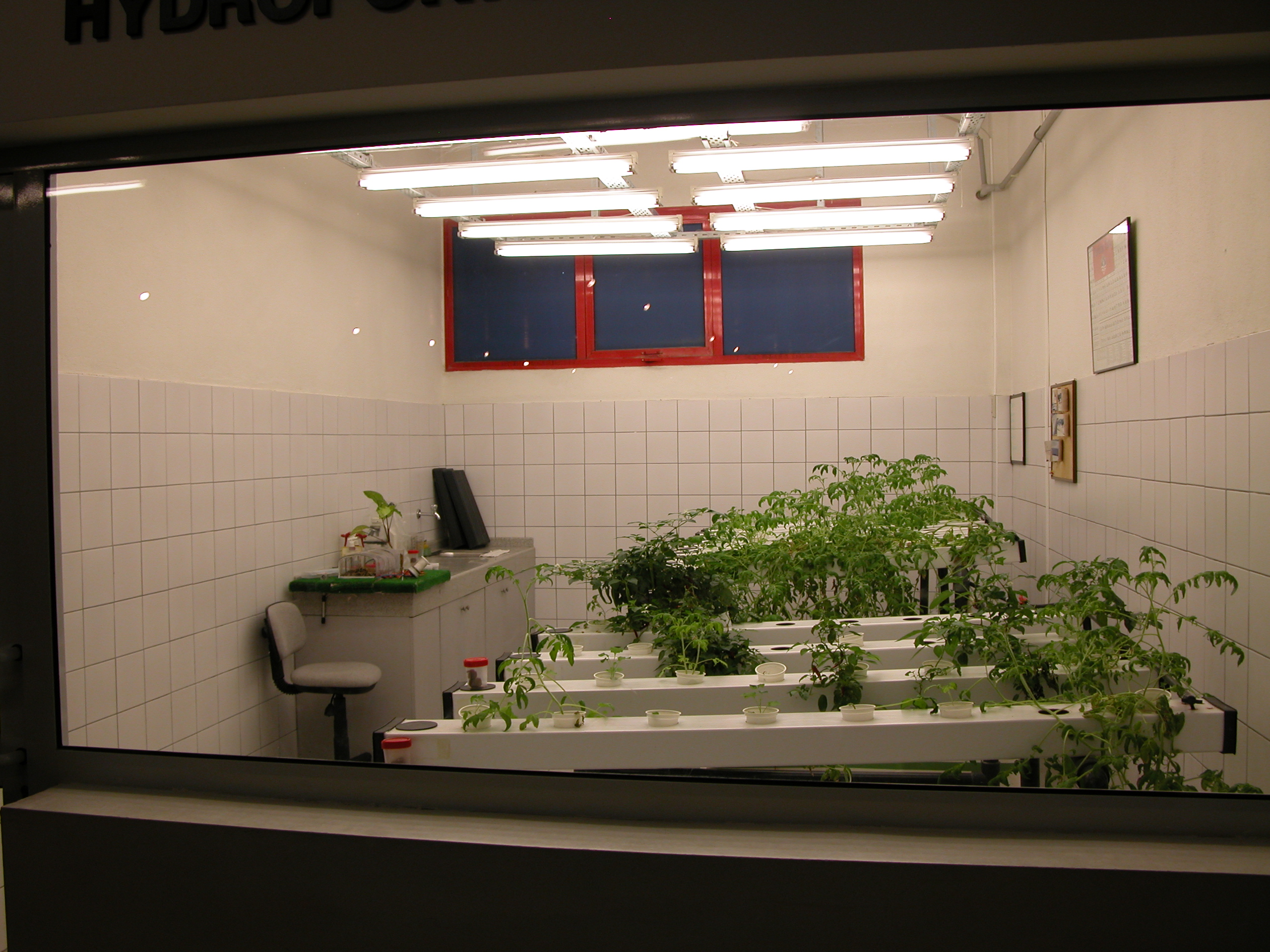
Part of Space Camp’s mission was to conduct research in support of space exploration and colonization. This included a lab where carnivorous Martian plants were grown to prepare trainees for conditions they would encounter when sent to colonize the Red Planet. We only lost one or two of our party to this hazard.
The lab where Martian carnivorous plants are grown to prepare trainees for an eventual landing on the Red Planet.
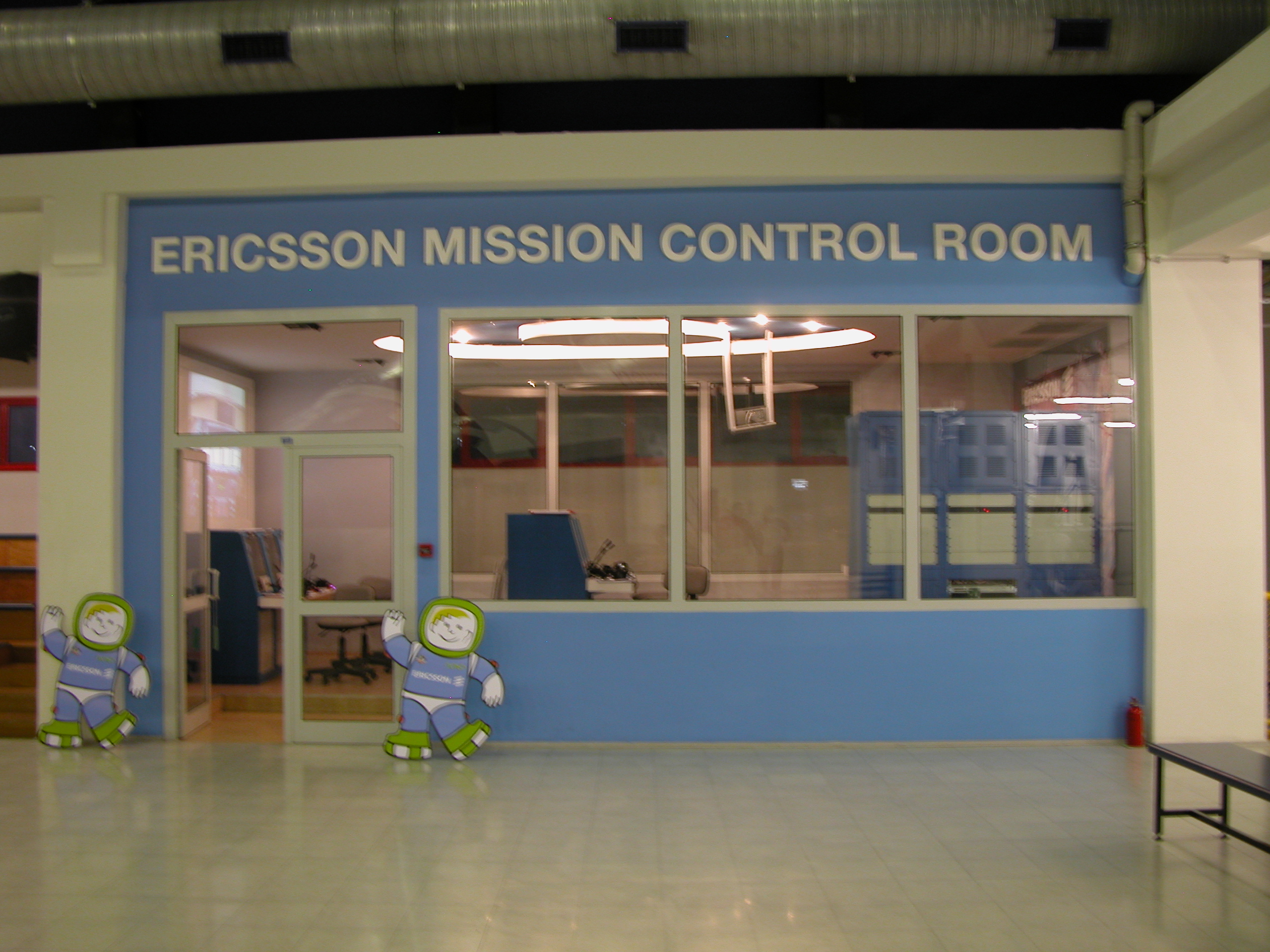
At the time of our visit in 2006, Space Camp training was largely focused on the Space Shuttle program, featuring a mockup of the Space Shuttle Discovery, complete with a ground-based mission control, shown in the picture below. Despite the demise of the real Space Shuttle program, I have the impression that it is still alive and well at Space Camp Turkey. In any case, we’ll be seeing lots more of the Space Shuttle on this page.
Ground control center for the Discovery Shuttle mockup. Named after Leif Ericsson, Viking discoverer of America. (I made that up, of course, just like I made up all the more outrageous statements in this blog; I have no idea who the Ericsson being honored here was.)
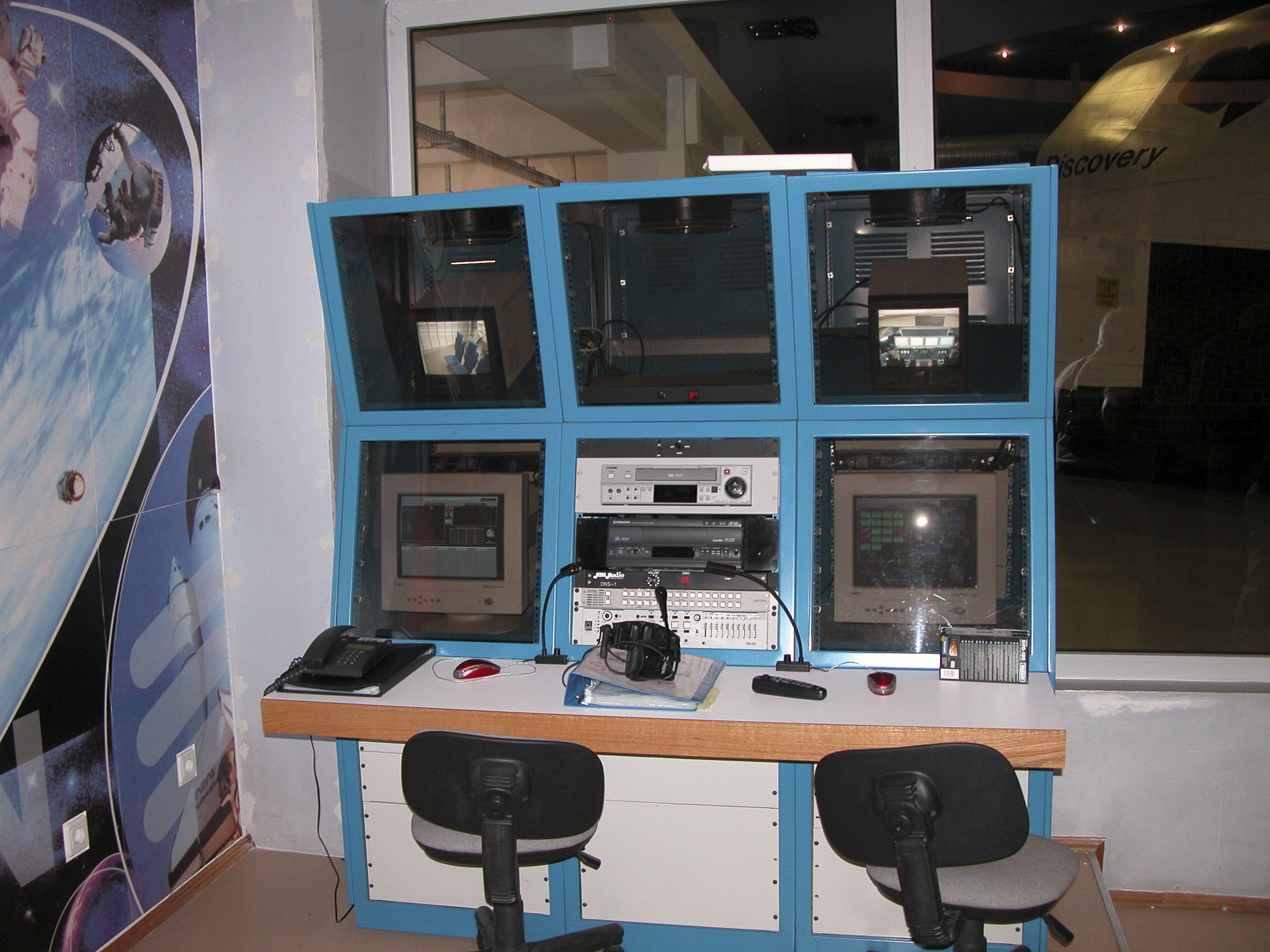
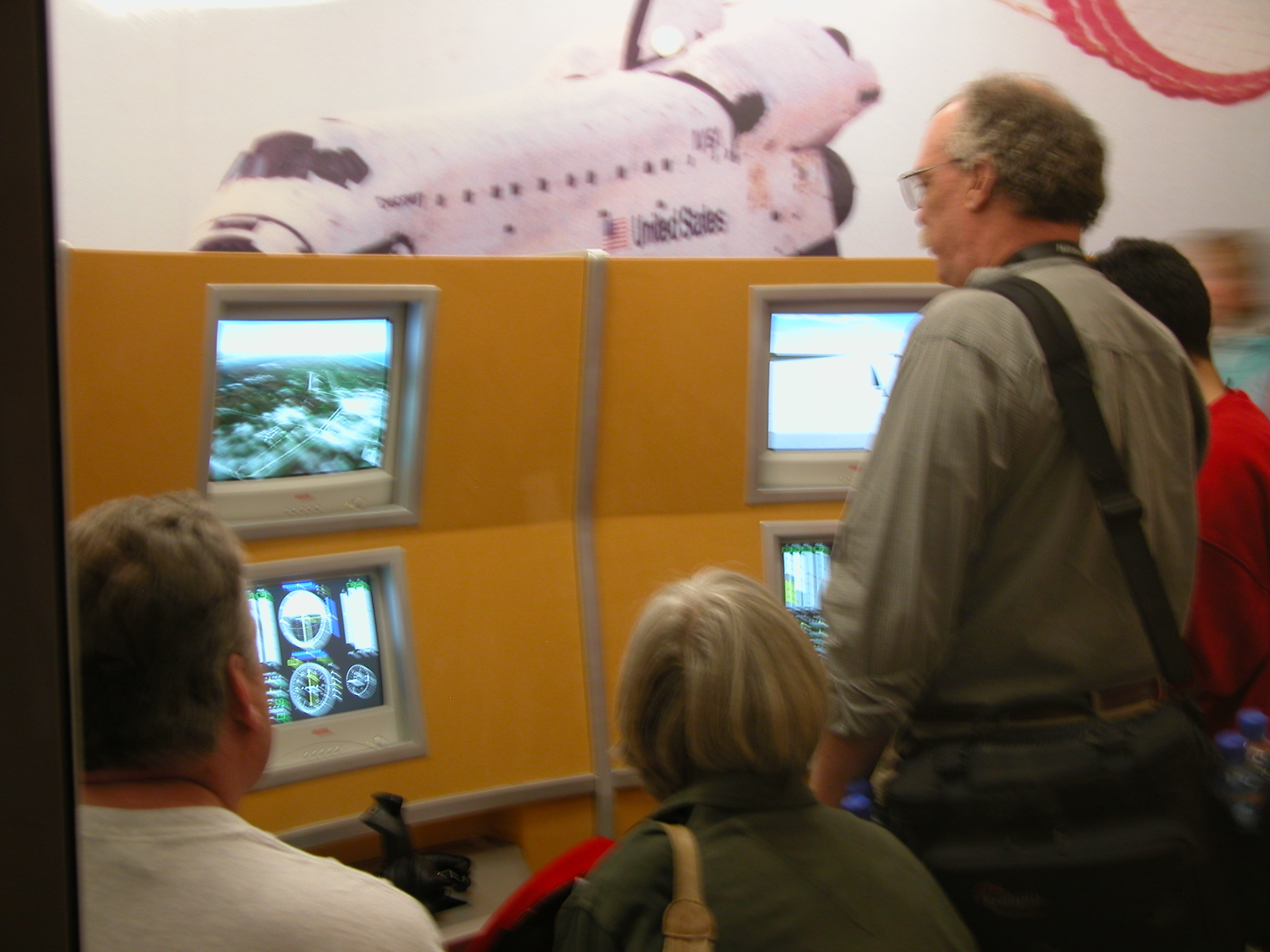
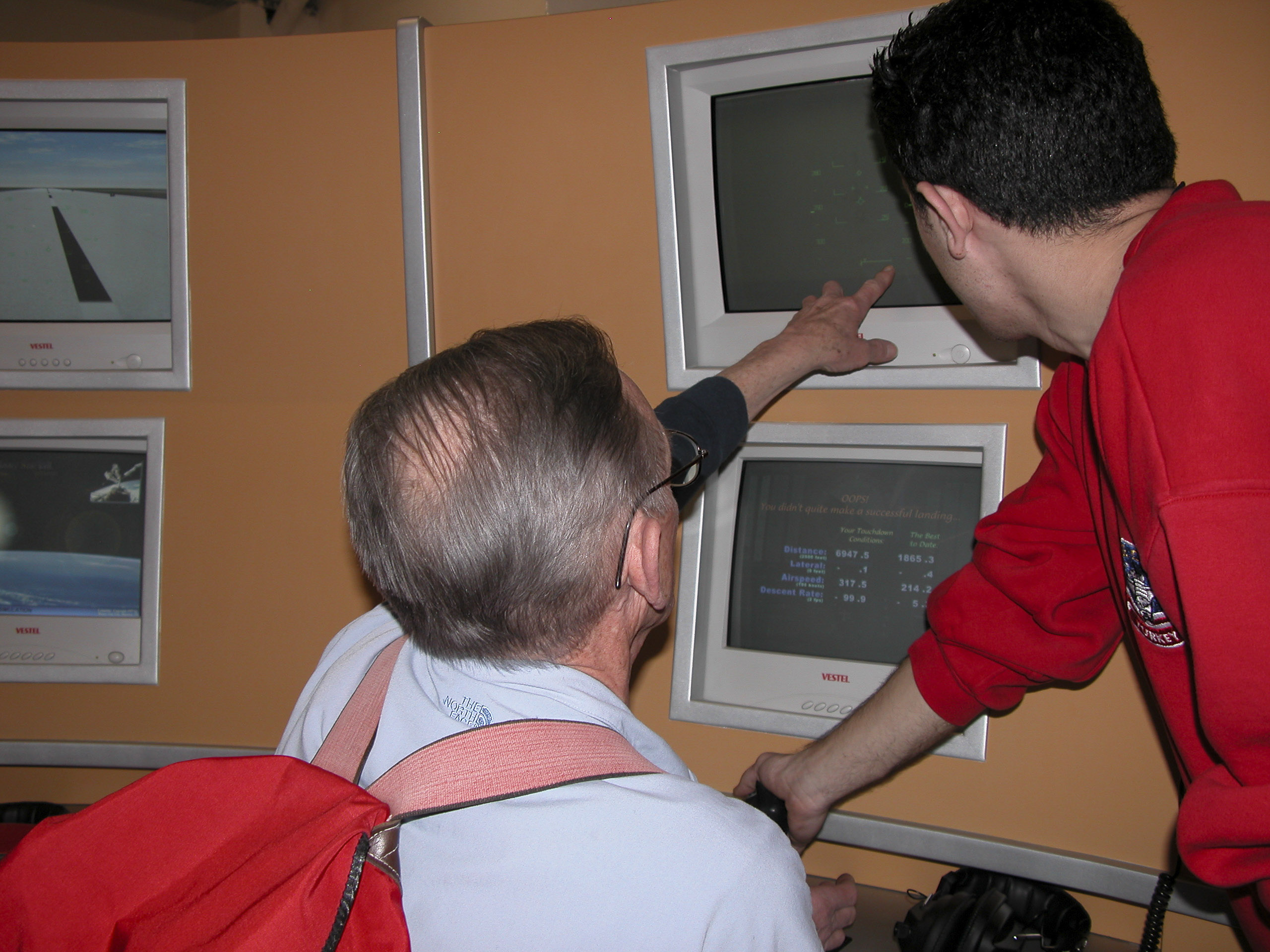
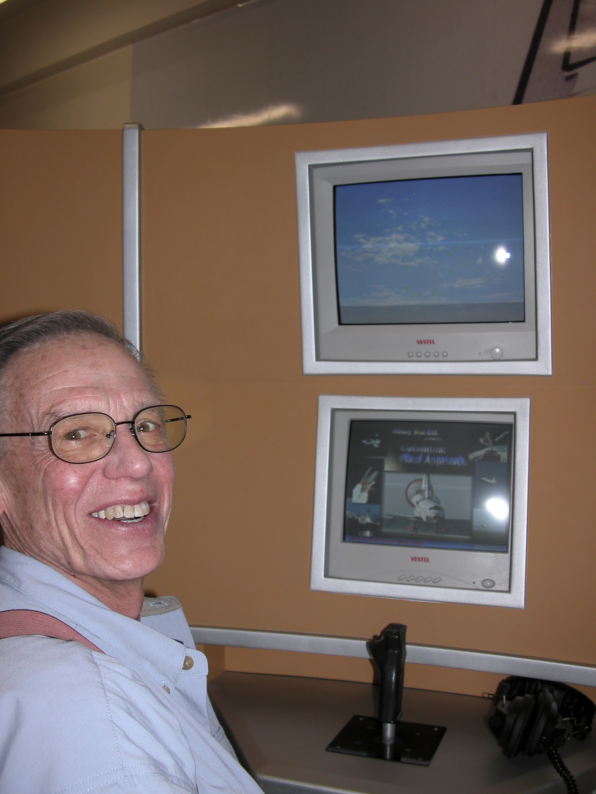
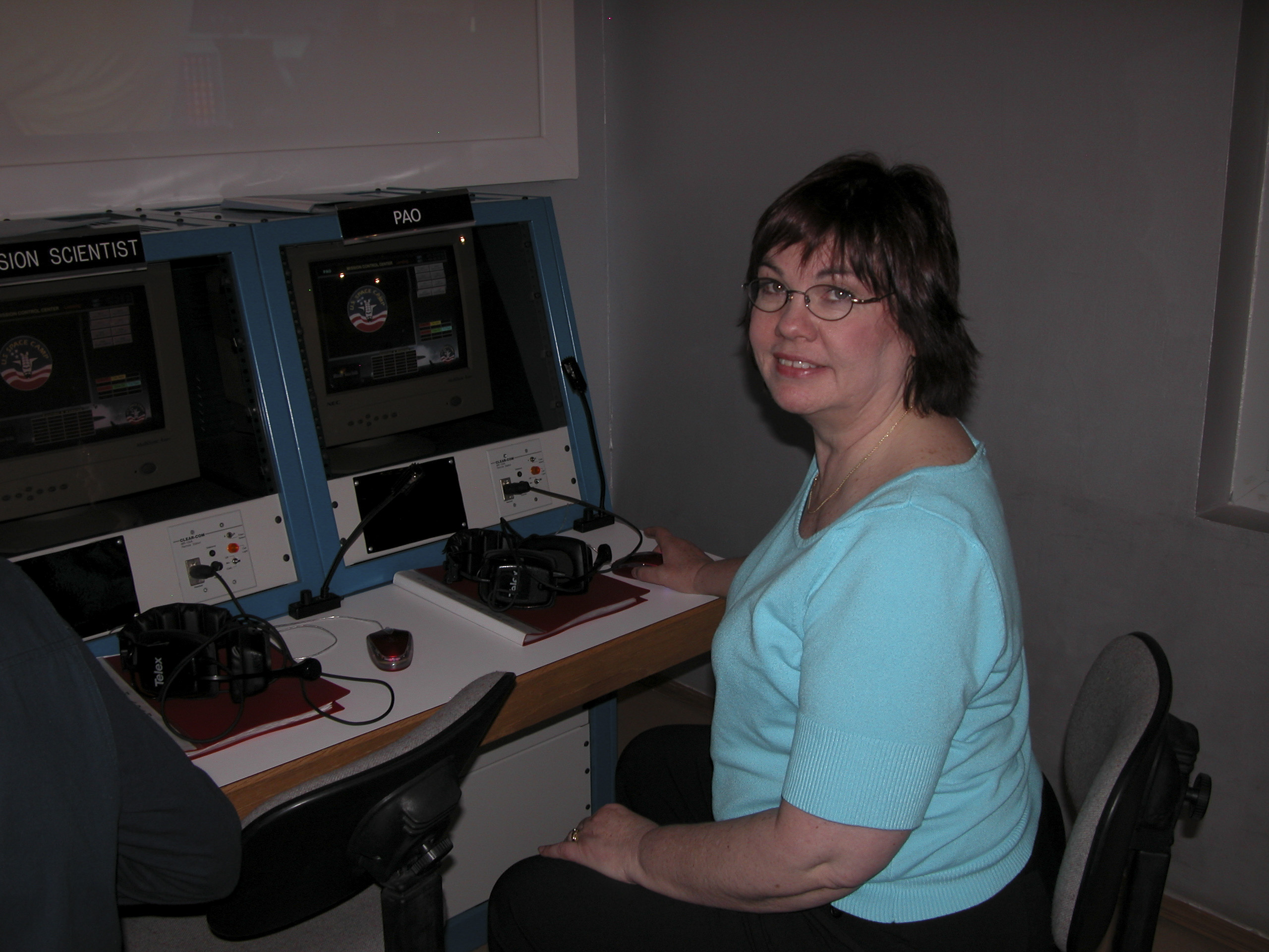
Inside the control center, there was a desk for controllers to sit at and do their thing. It probably wasn’t as elaborate as the one in Houston, but it worked for us.
Control desk for the Discovery Space Shuttle. Jim Windlinger, Pam Bloxham and Rick Gering in Mission Control.Chuck Mattox gets help from the instructor in learning how to guide the Space Shuttle.Chuck beams his satisfaction at bringing the Discovery to a successful touchdown.
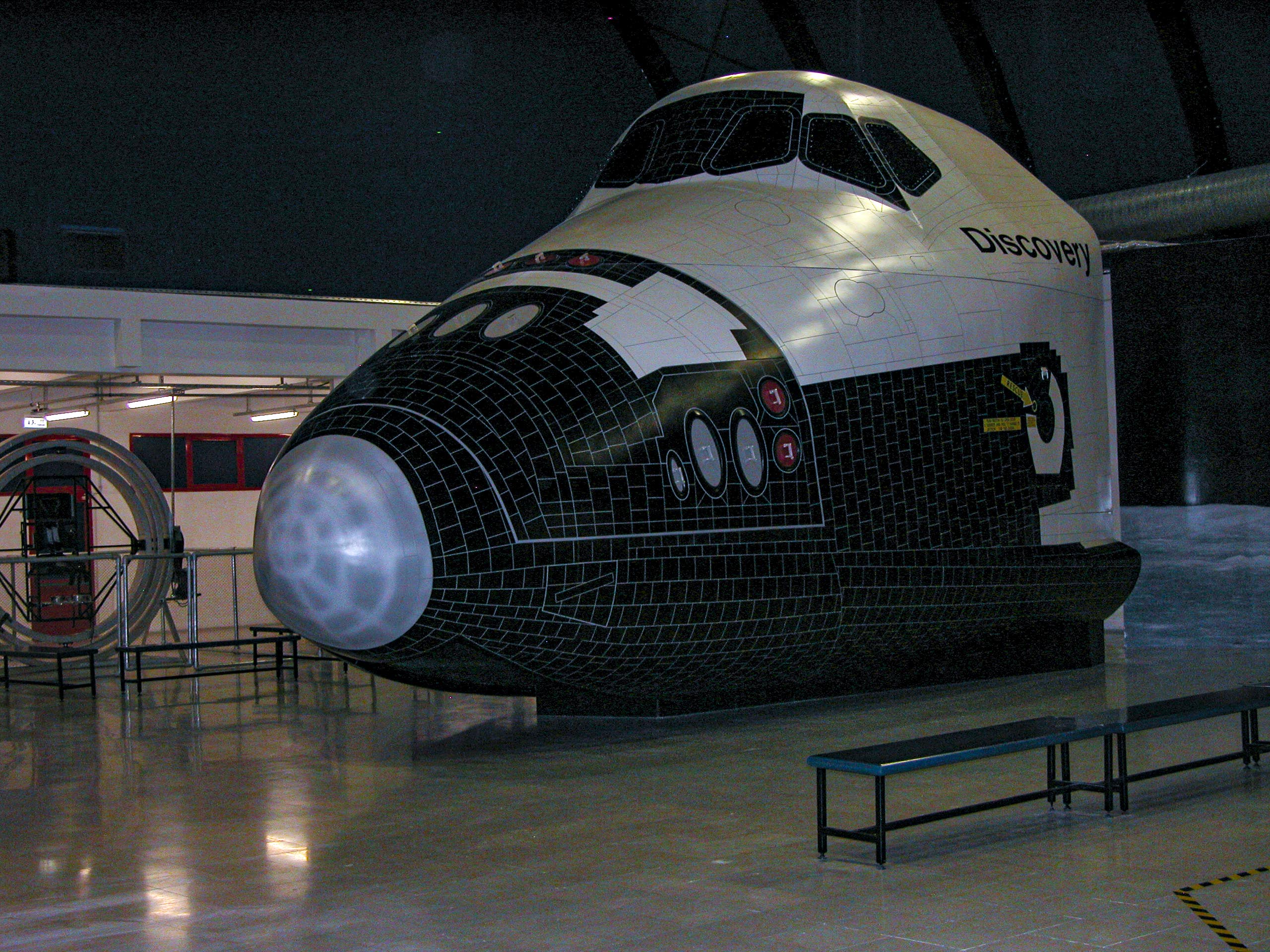
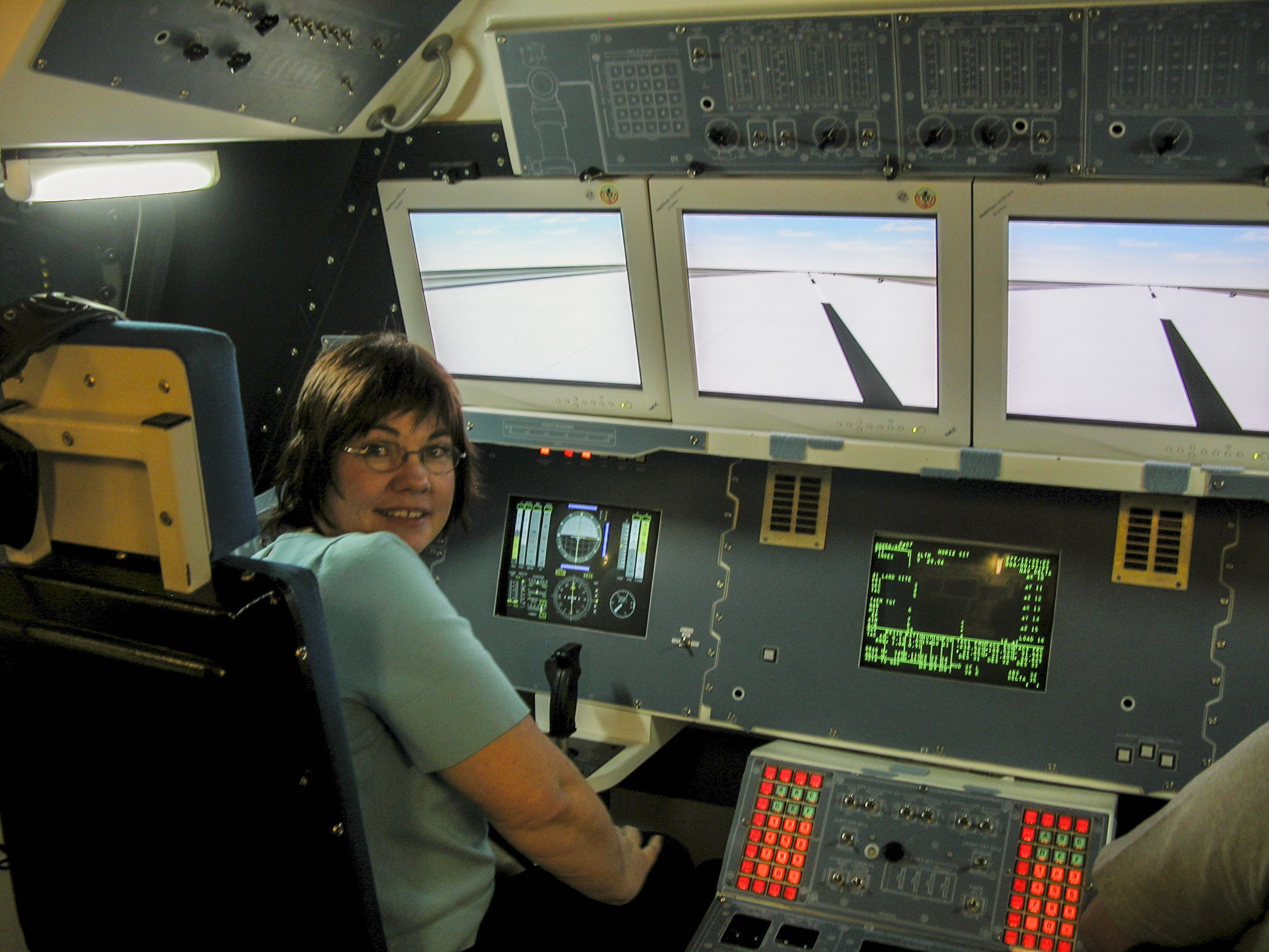
Space Camp Turkey’s mockup of the Space Shuttle was limited to the nose section, which included the cockpit and controls; it omitted the cargo bay, wings, tail, etc., which of course were unnecessary for its purpose and would have entailed a superfluous expense.
Space Camp Turkey’s mockup of the nose section. No cargo bay, wings, tail, etc.
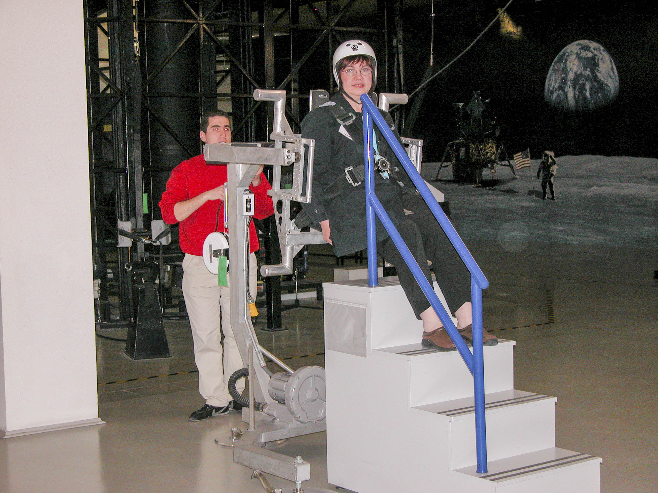
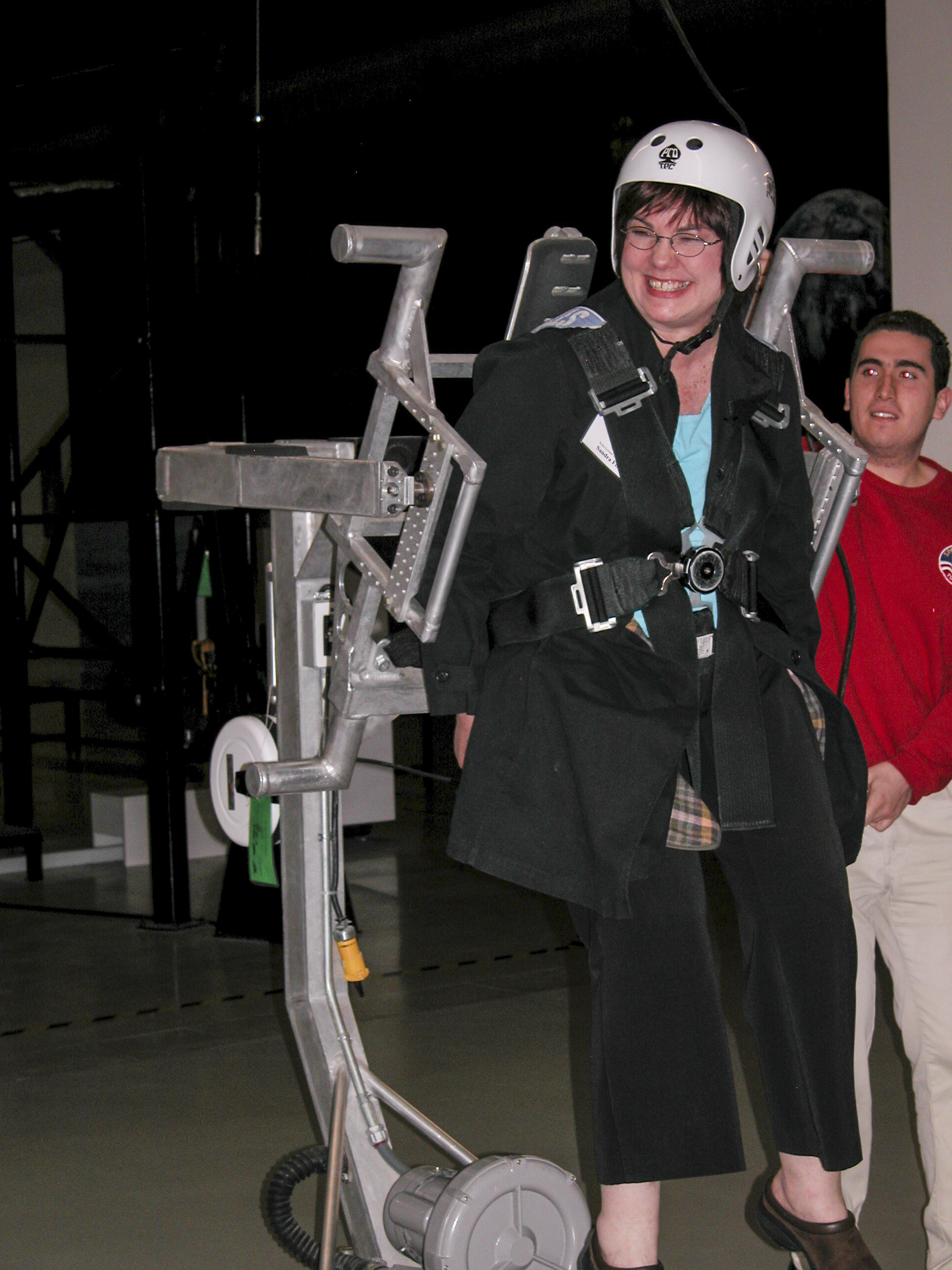
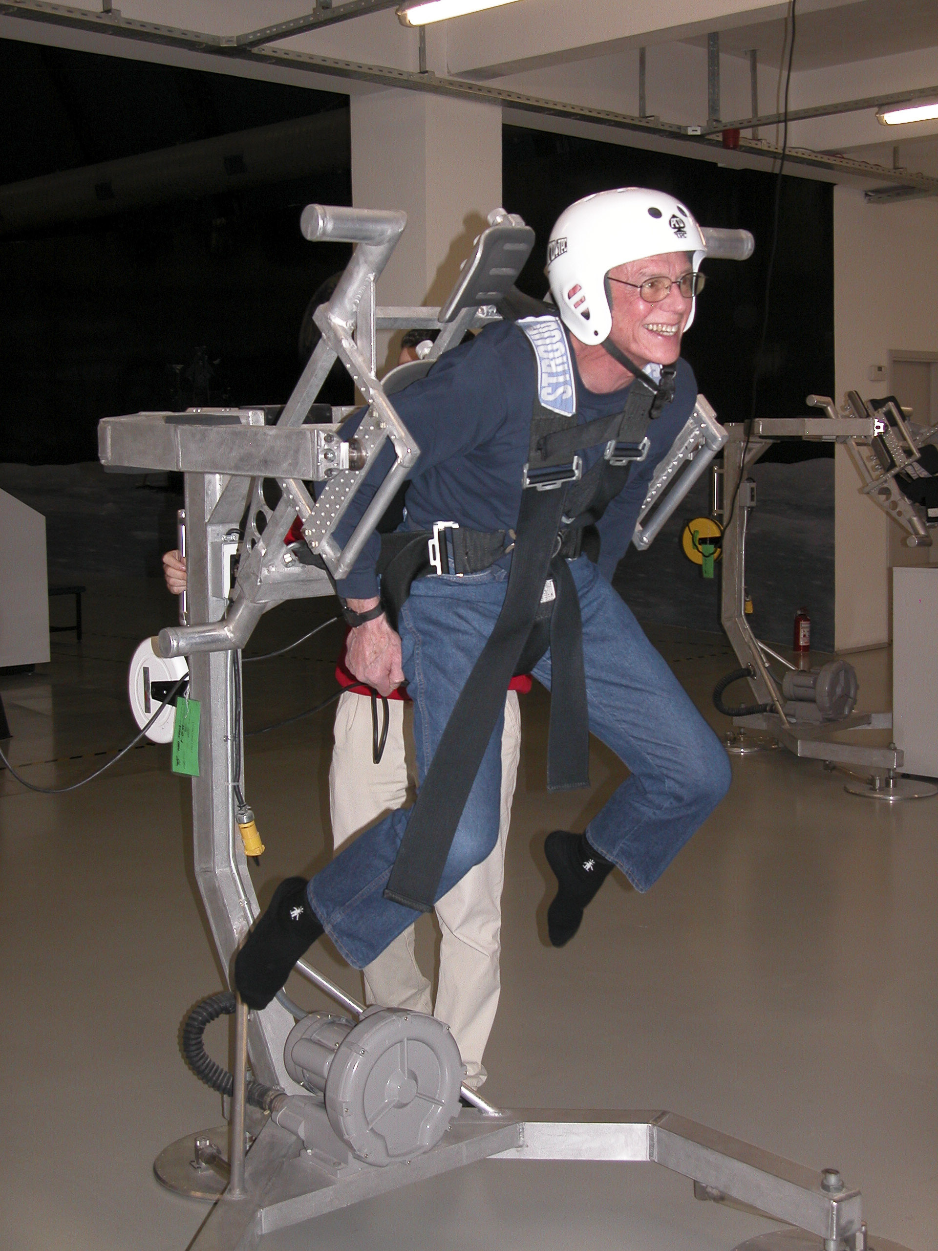
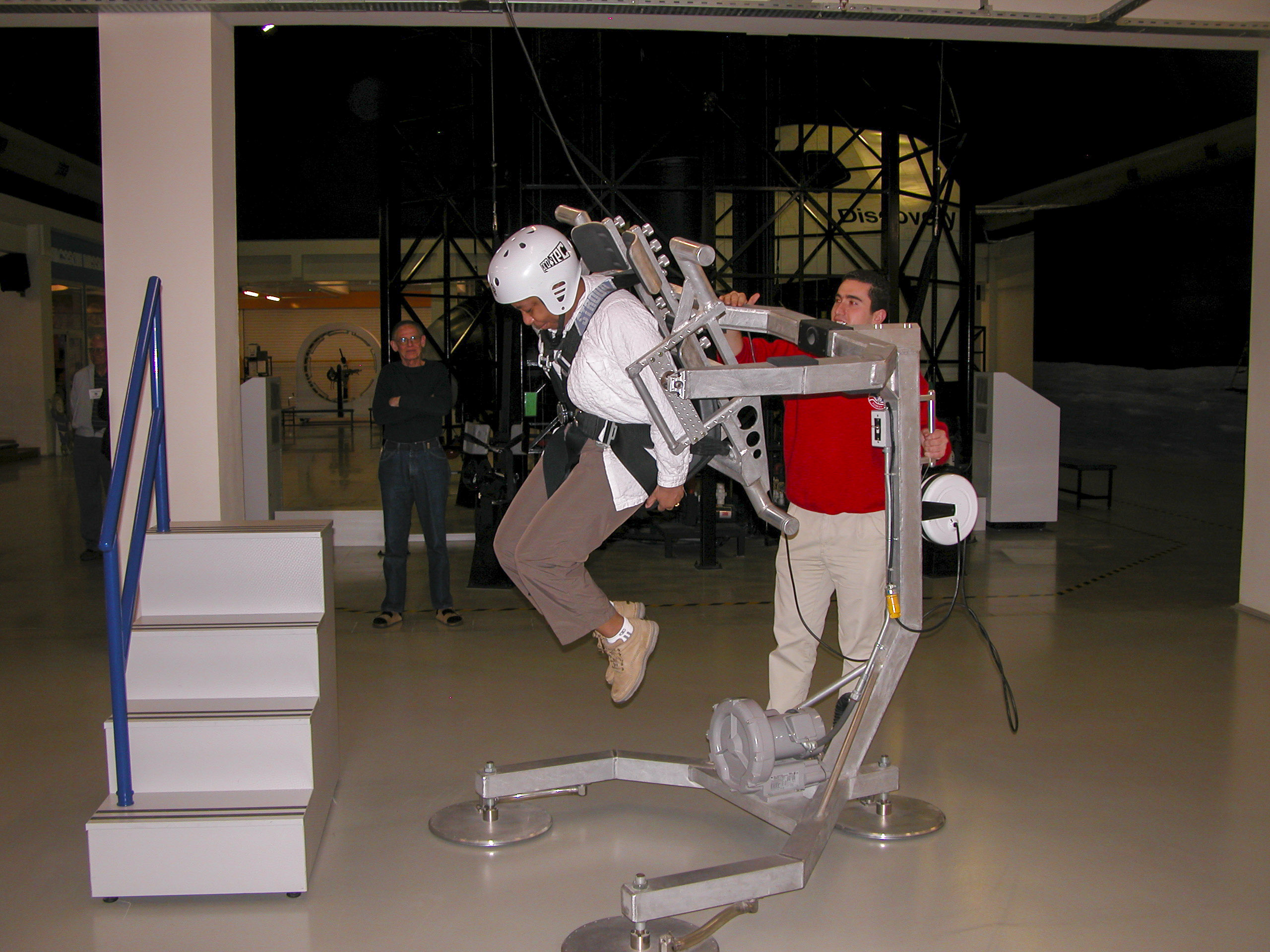
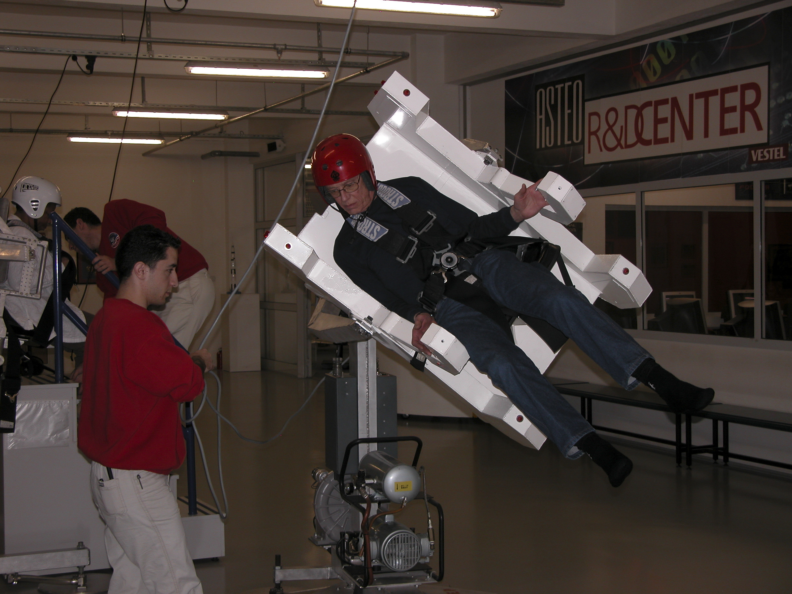
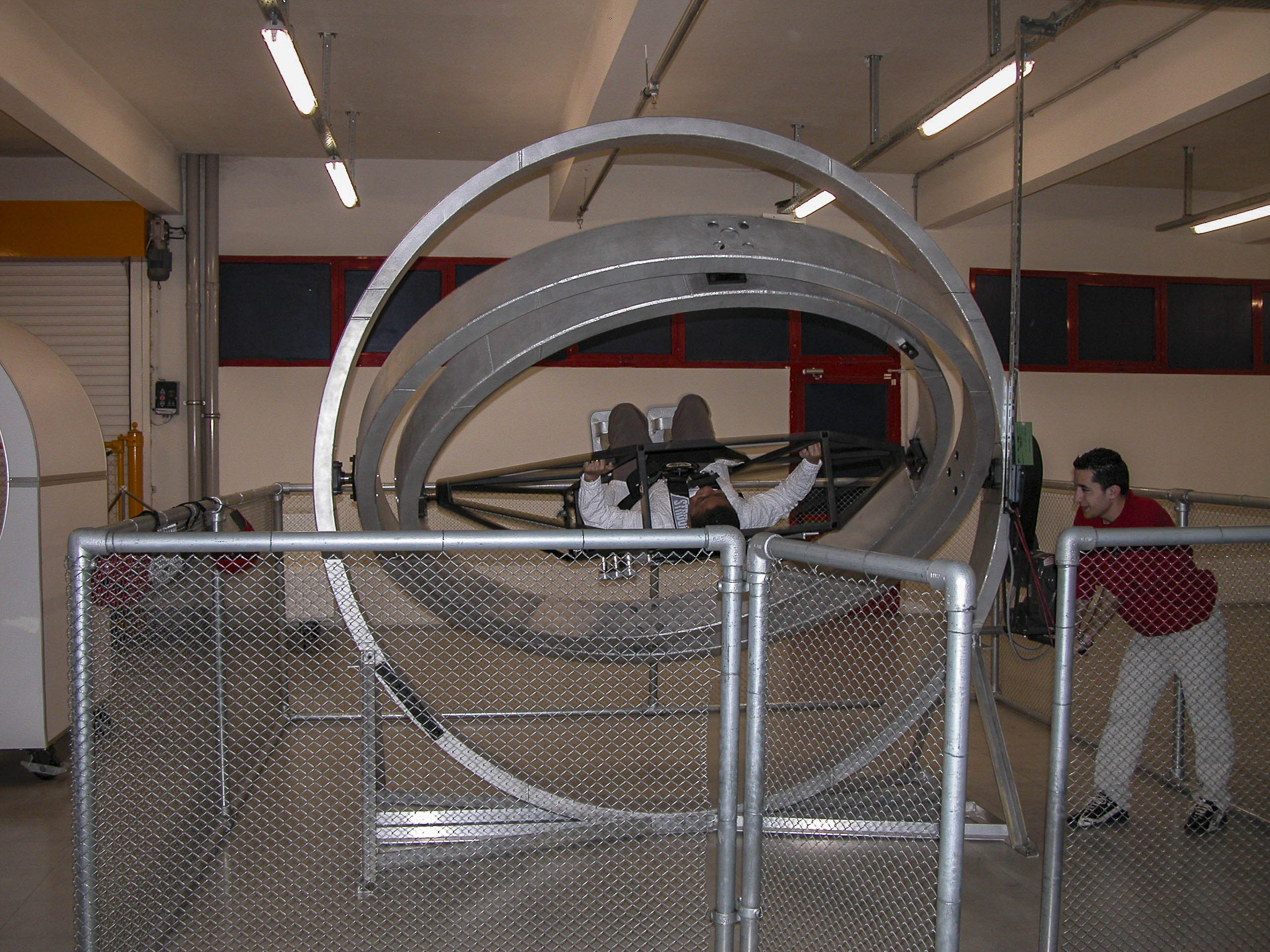
The real test of whether we were cut out to be astronauts was going on the simulators. There was a wide variety of these, most of them completely incomprehensible to me. I mean, I could understand the purpose of the Moon Walk trainer and the Zero Gravity Wall, but others, such as the 5-Degrees-of-Freedom trainer shown below, completely mystified me.
Sandie is about to go for a ride on the 5-Degree-of-Freedom (5DF) trainer, the purpose of which I’ve never been able to figure out.
Sandie, however, despite an initial moment of apprehension, quickly took to the 5DF like a duck to water.
Who’s afraid of the 5DF? Not Sandie – she’s having way too much fun on this contraption!
Another person who did well on the 5DF was Chuck Mattox. He had a blast on all of the simulators. He really should have been an astronaut.
Chuck seems to be having a blast. He should have been an astronaut.
Whereas for Patricia Bush, the 5DF was a matter of stoic endurance.
Pat Bush on the 5DF.
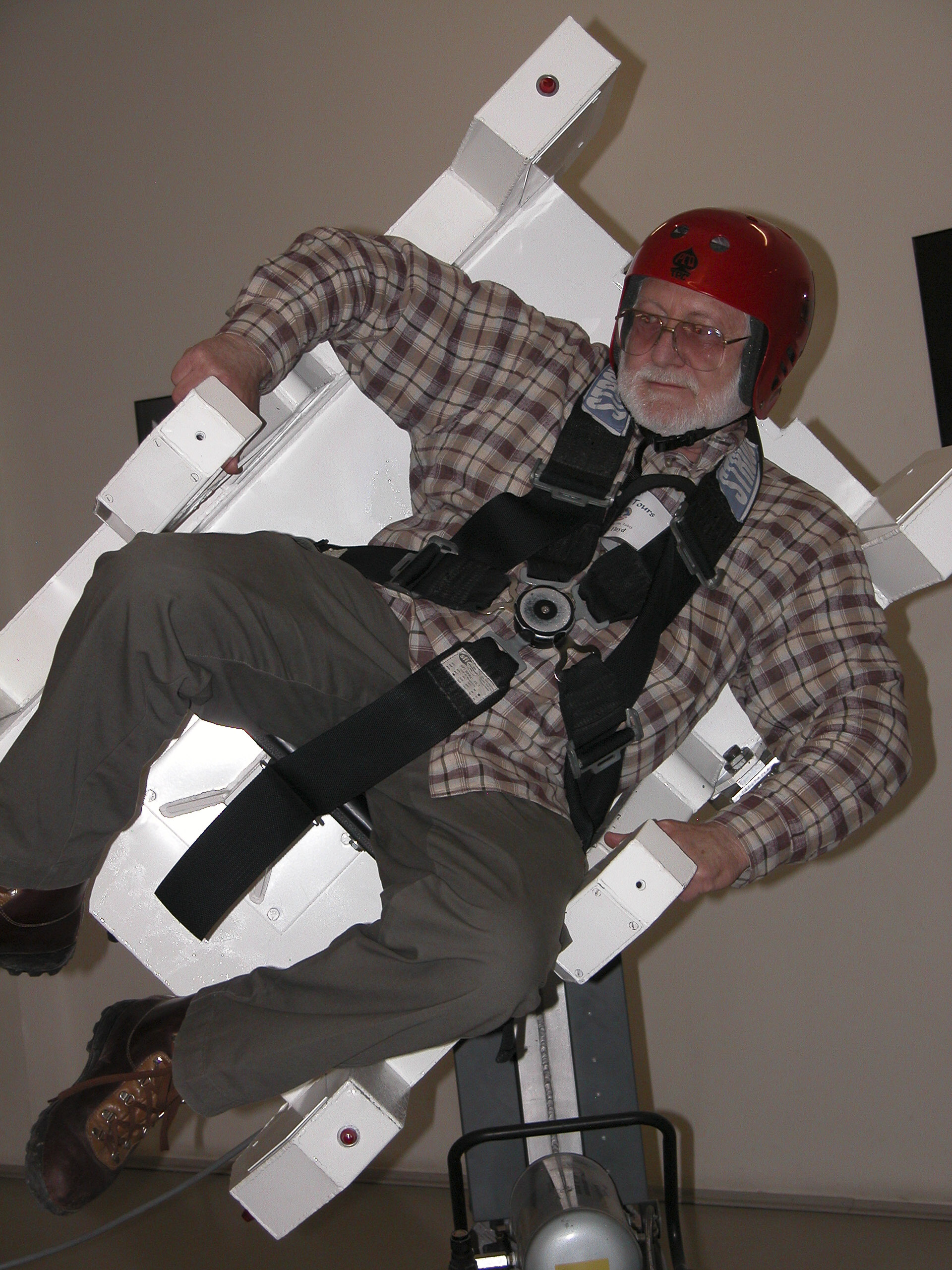
The Manned Maneuvering Unit (MMU) was and is another contraption the purpose of which I’m totally ignorant, and Chuck Mattox at first appeared to be a bit bemused by it too.
Chuck Mattox on the Manned Maneuvering Unit (MMU).
I let them strap me into the MMU also. I soon figured out that it wasn’t my cup of mung.
Get me outta here now!!!
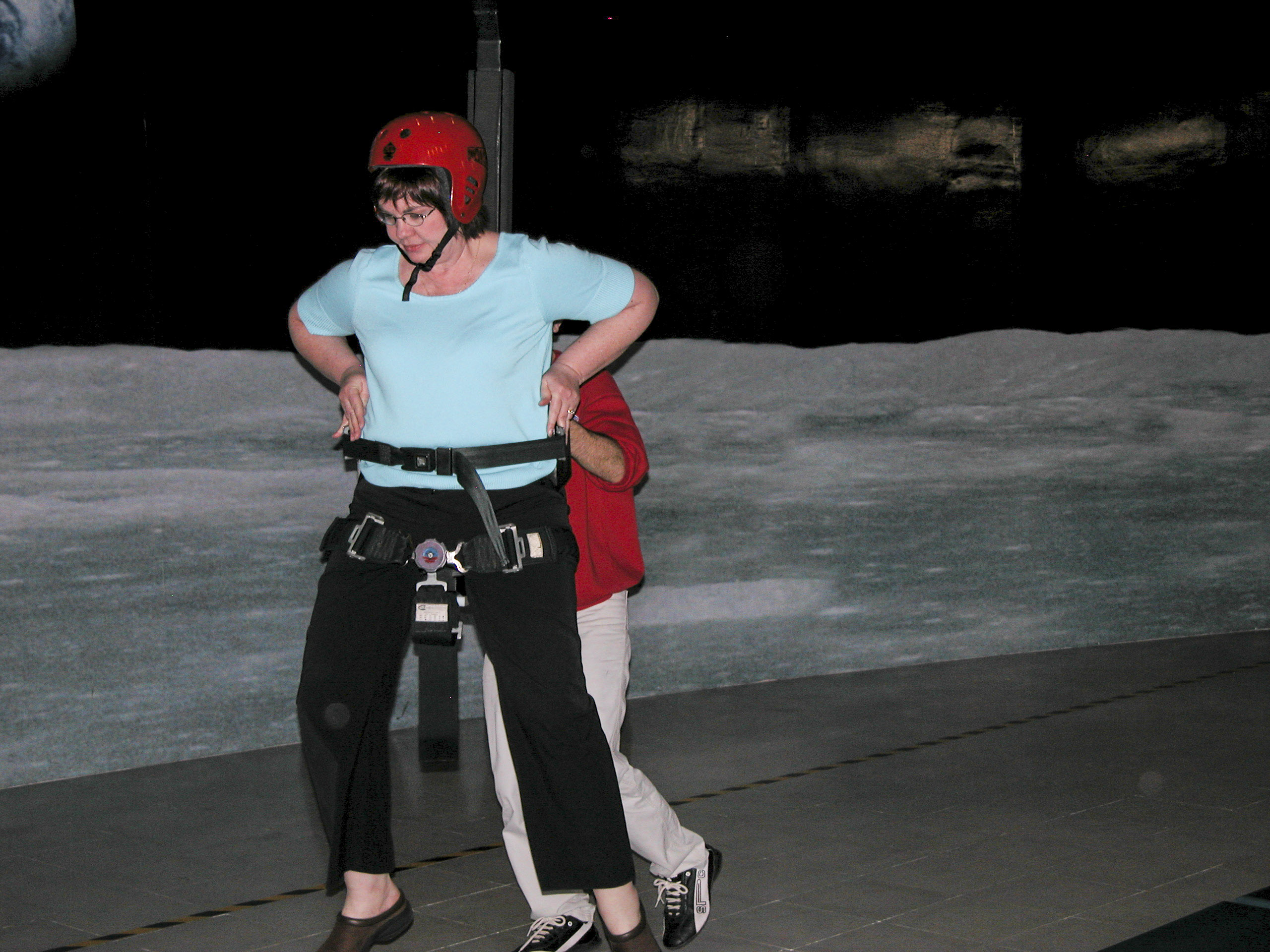
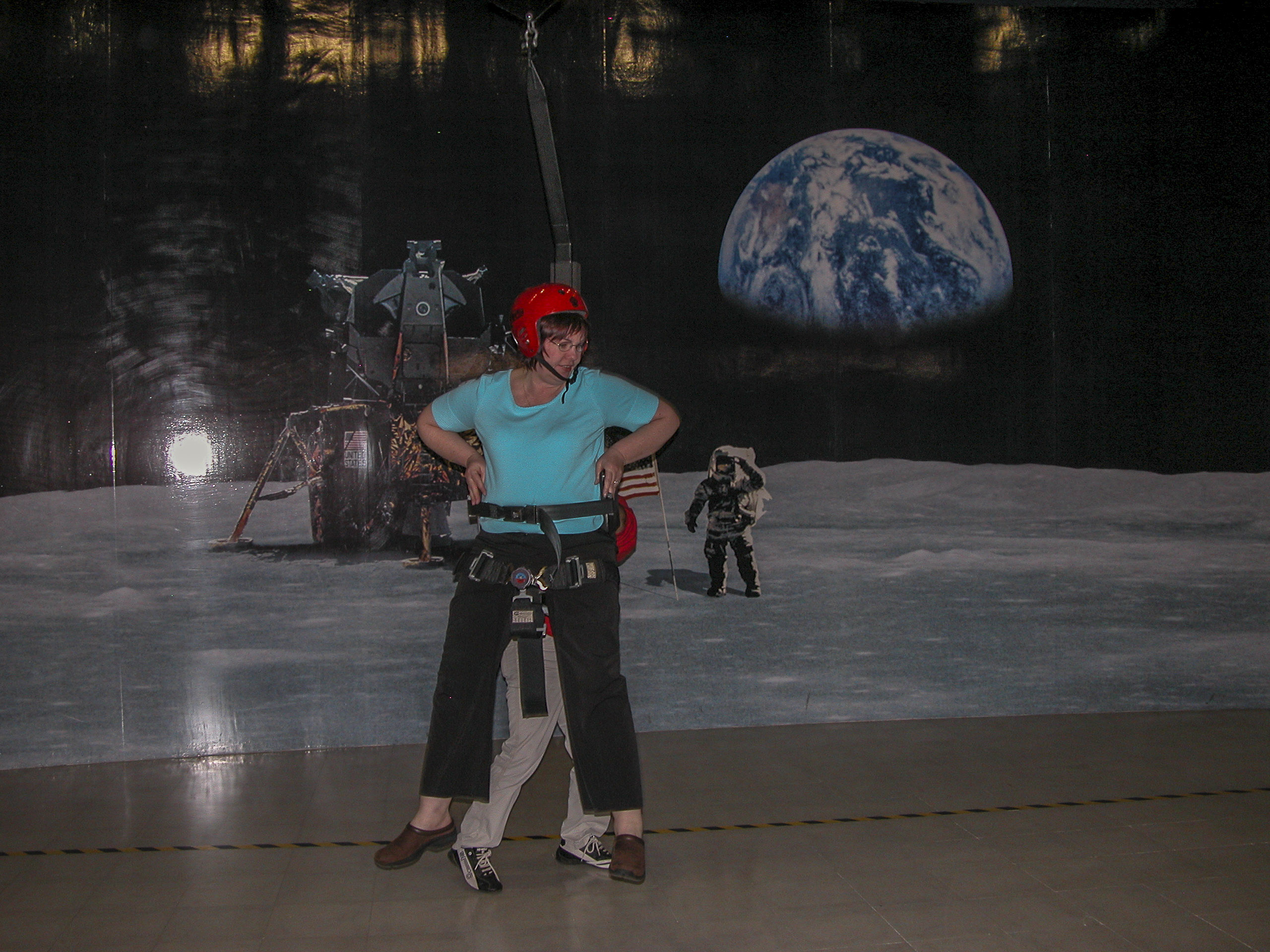
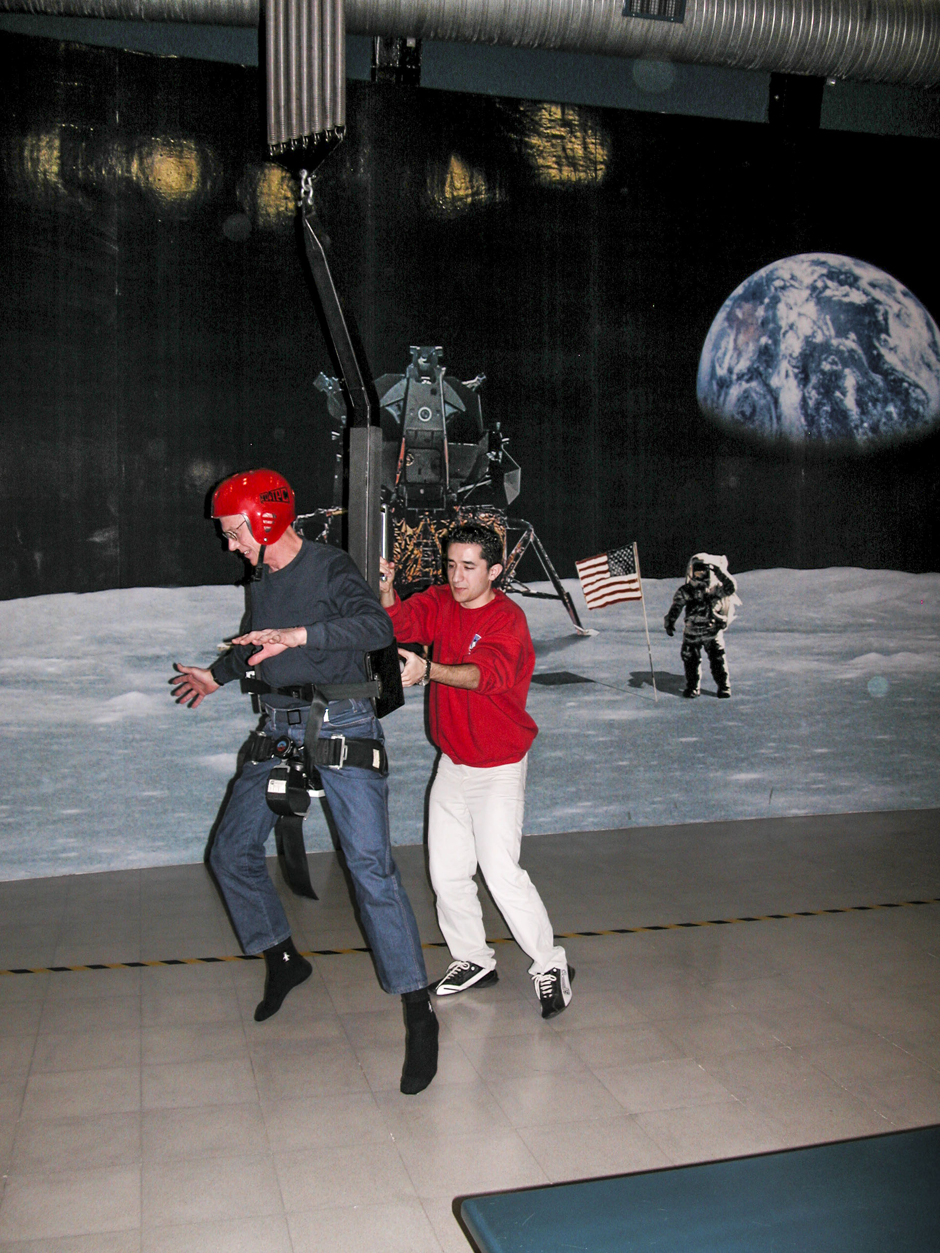
The moonwalk simulator involved being strapped into a chair contraption that simulated one-sixth of the gravity experienced on earth, then being guided by an instructor in mastering the delicate art of getting around safely and efficiently in the low-gravity environment found on the moon.
Sandie getting ready for a moonwalk.
Sandie loved it. She savored the exhilarating feeling of being one-sixth of her Earthbound weight.
Sandie doing the moonwalk
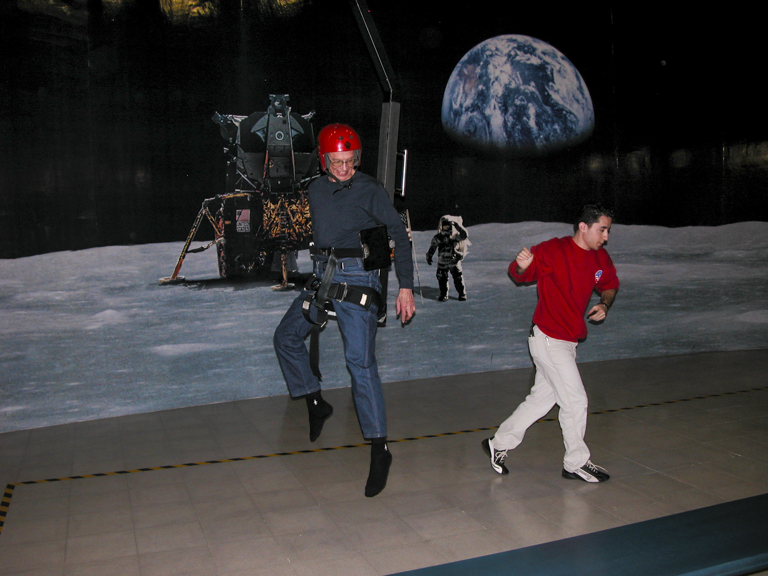
But it was Chuck Mattox who really got into the unbearable lightness of being on the moon (pace Milos Kundera). He took off like a shot, and there was no holding him back. The Space Camp instructor tried valiantly to keep him within the bounds of sanity, but failed miserably.
The unbearable lightness of being on the Moon, pace Milos Kundera.
Finally, unable to keep Chuck from breaking all the speed limits and safety rules, the Space Camp instructor gave up in disgust and ran away, leaving Chuck to savor his freedom gleefully.
Chuck Mattox running wild on the Moon.
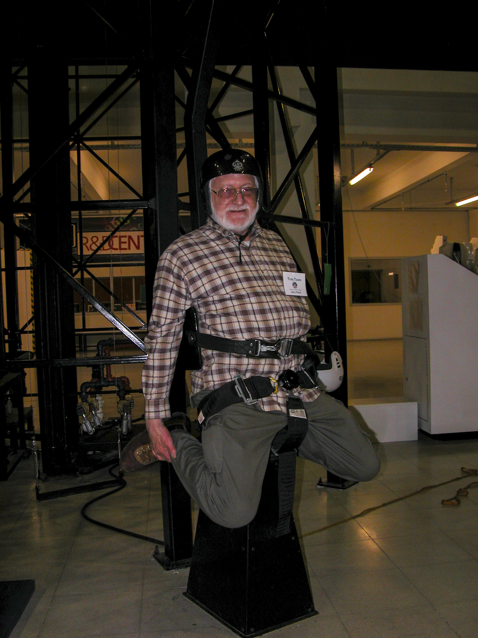
I tried the Zero Gravity Wall, which seemed tame enough for me – although I don’t usually do well with heights, being strapped into a chair made me feel reasonably secure.
I believe in lifting myself by my own bootstraps. It’s easy in zero gravity.
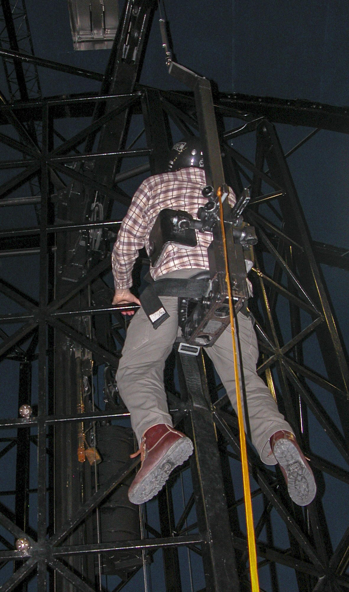
I thought of it as a zero-gravity jungle gym rather than a wall.
Up, up and away
The next simulator, the Multi-Axis Trainer, was one I didn’t dare try. But Pat Bush did fine.
Pat Bush on the Multi-Axis Trainer.
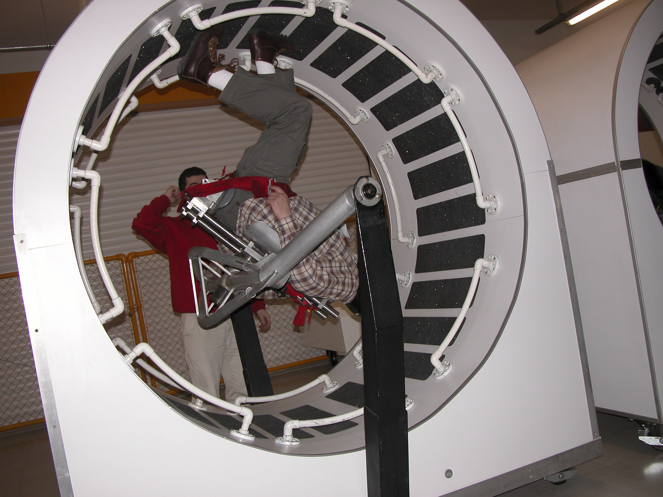
What NASA and the media never tell you is that because the Space Shuttle can carry only a limited amount of fuel, due to limitations of space and weight, is that once they arrive in orbit, having exhausted their fuel getting there, power for all operations thenceforth has to be generated by an apparatus similar to hamsters running in a treadmill cage, except that in this case, since hamsters are not allowed on the Shuttle, humans have to do the work instead. This was a closely guarded secret, and we didn’t find out about it until we went to Space Camp Turkey, where we learned about it the hard way. Here yours truly fulfills the hamster role on what was euphemistically called the “Space Station Mobility Trainer” (SSMT).
Upside down in the SSMT.
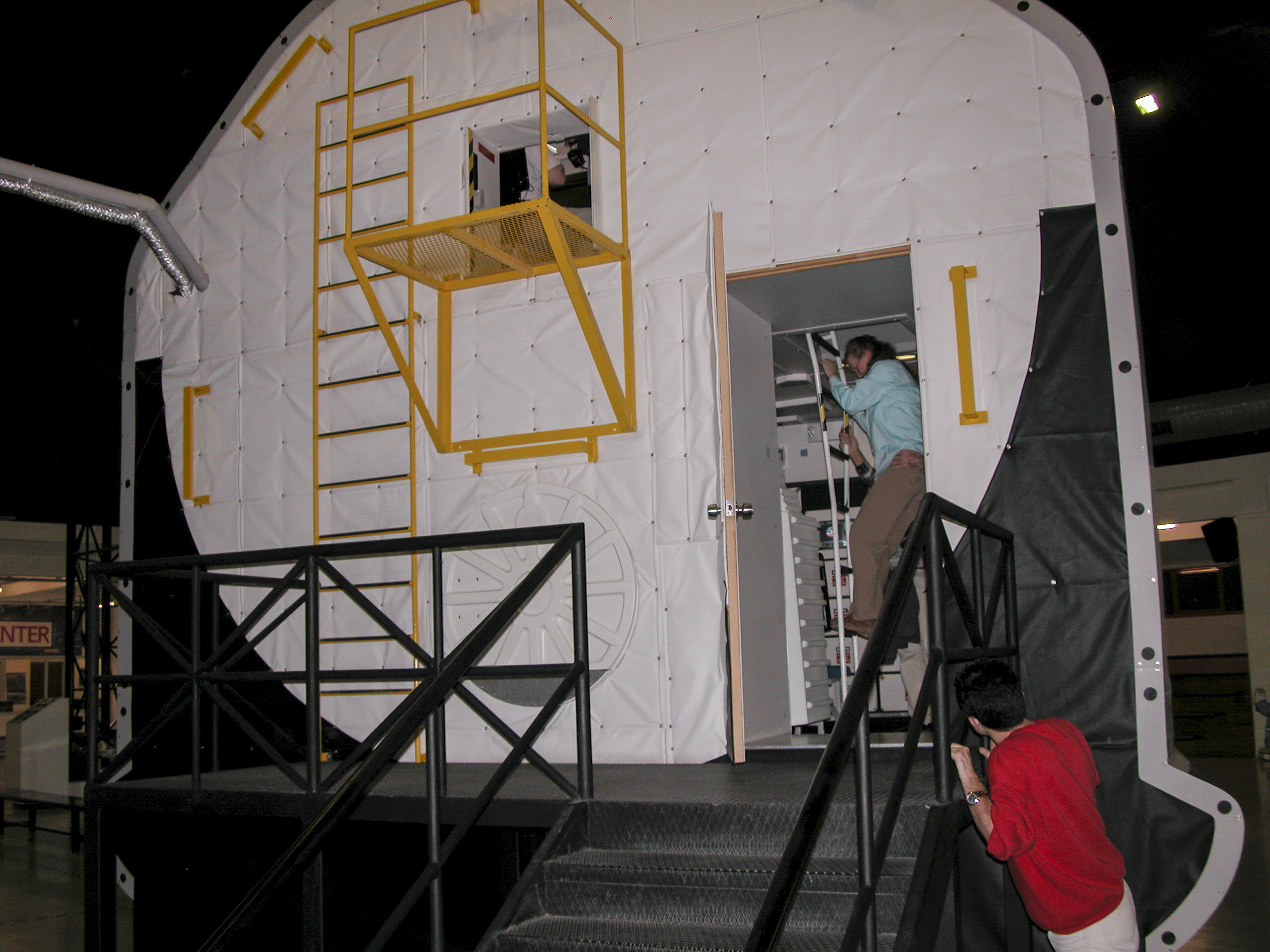
The finale for our tour group was the simulated Space Shuttle flight, in which we all got to be astronauts. However, in order to take the flight, each of us first had to pass a test, which proved to be unexpectedly difficult: we had to figure out how to get into the shuttle’s cockpit. I don’t know how it was done in the real Space Shuttle, but for us it involved entering by a back door, shown below, then climbing up a flimsy metal ladder, then contorting oneself to squeeze through a narrow hatch.
Kathy Lindquist picking her way through the Shuttle entry obstacle course.
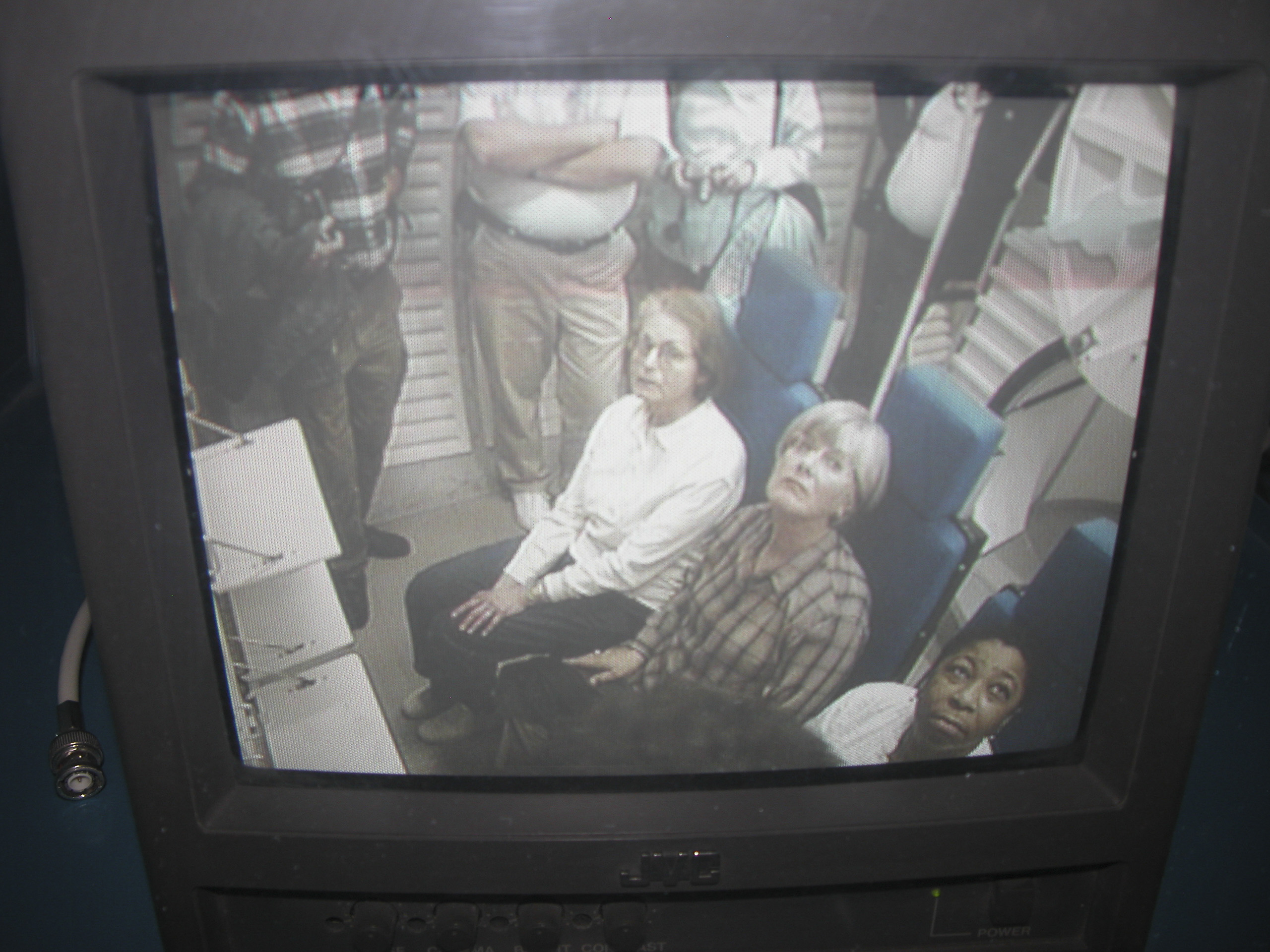
A camera linked to a monitor in the control room allowed the ground controllers to keep an eye on the Shuttle cockpit and crew during the flight. In this view, we see Elouise Mattox, Pam Bloxham and Pat Bush warily eyeing the camera, wondering just who is spying on them in the control room, while awaiting takeoff.
Elouise Mattox, Pam Bloxham and Pat Bush about to go for a ride in the Space Shuttle.
As it turned out, they needn’t have worried; it was Sandie who was spying on them from the control room, cooly and capably guiding their flight to crash into the Moon. Just kidding, of course. She brought them all safely back to Earth, then took her own turn on a Shuttle flight.
Sandie getting ready to bring Elouise, Pam and Pat safely back to Earth.
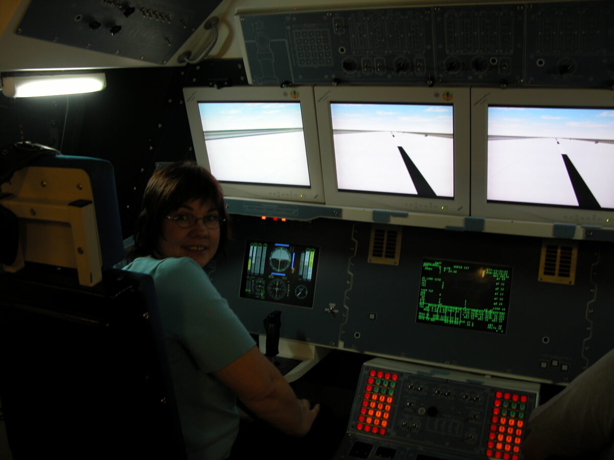
When Sandie’s turn came, she got to be the pilot, which was a big thrill for her.
Sandie had a blast piloting the shuttle.
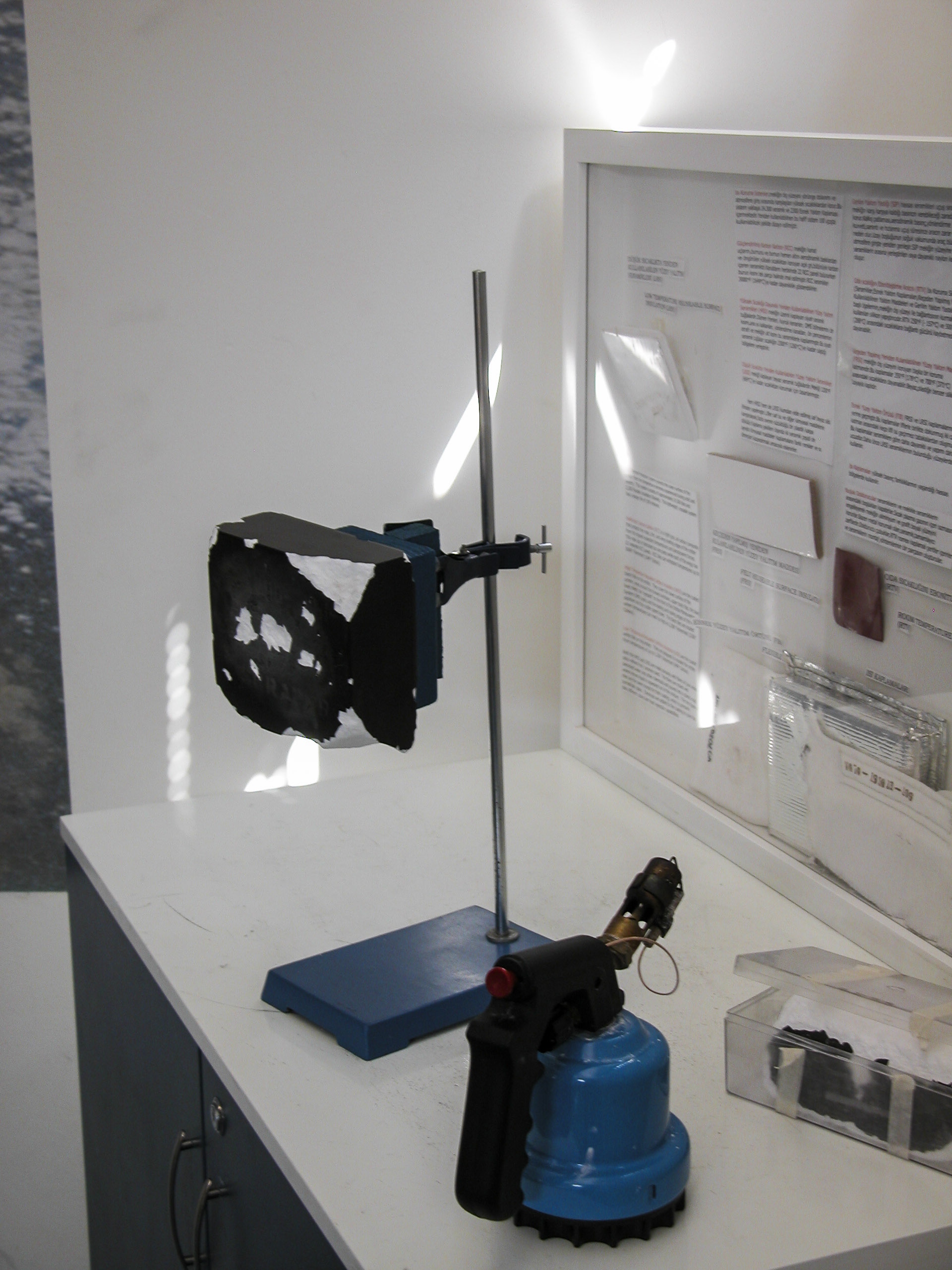
The Space Camp tour ended on a rather somber note: we were shown some of the tiles from the thermal protective system which prevents the shuttles from burning up in the atmosphere during re-entry. These were real tiles from real shuttles which had been obtained by Space Camp Turkey after completing several missions. The effects of the wear and tear to which they had been subjected were striking, and gave us some insight into the disaster which had befallen the Columbia.
A thermal protective system tile from one of the shuttles, showing the wear and tear inflicted during the course of several missions.
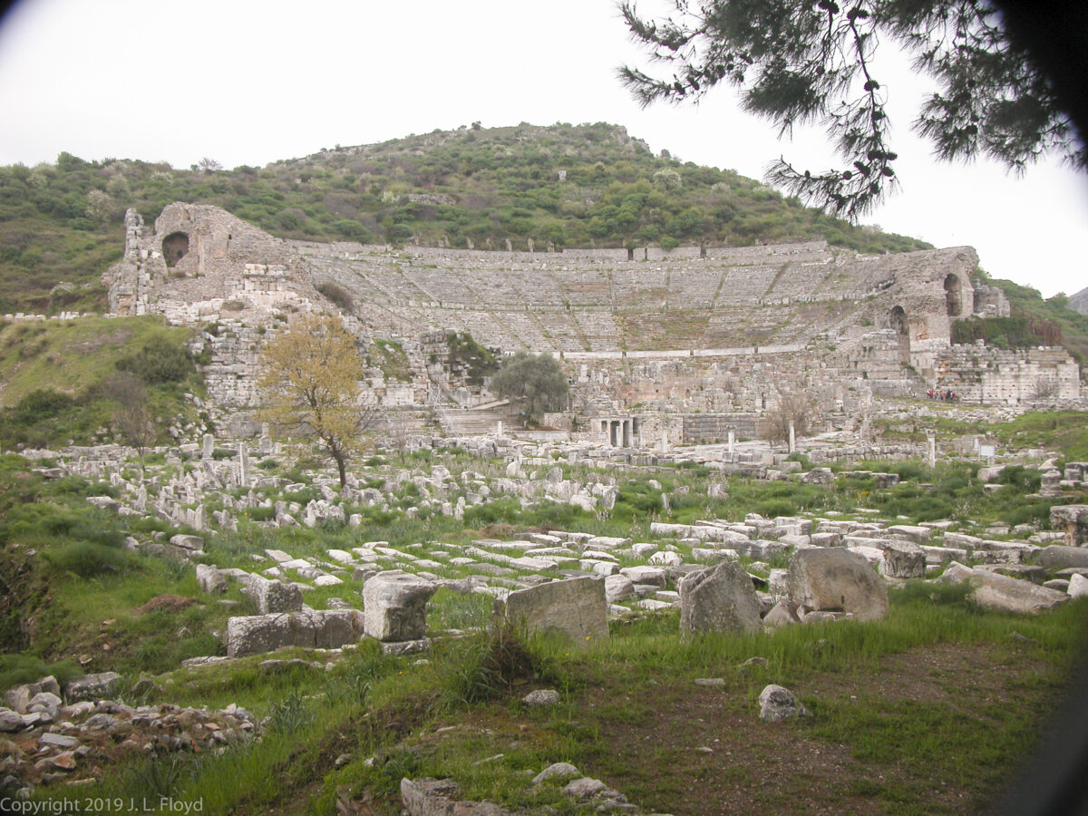
Built at the foot of Panayir Mountain, the Grand Theater dates from the first century A.D. Other than the Temple of Artemis, which no longer exists, it was the most imposing structure of Ephesus.
Ephesus was one of the great cities of the ancient world. It was founded by Greek colonists in the 10th century BCE and became the site of the Temple of Artemis, one of the Seven Wonders of the ancient world. It came under Roman rule in 129 BCE. It was an important center of early Christianity, and the Apostle Paul lived there for several years in the early 50s CE. The silversmiths of Ephesus, who made a living from crafting and selling statues of Artemis, felt threatened by Paul’s preaching, and one of them, named Dimitrios, famously instigated a riot against him. The rioters marched to the amphitheater shouting “Great is Artemis of the Ephesians!” City authorities intervened to prevent Paul from being lynched, but he was imprisoned for a while as a threat to public order and forced to leave Ephesus. The Gospel of St. John may also have been written in Ephesus ca. 90-100 CE. During antiquity Ephesus was one of the greatest seaports of the Mediterranean, and for a time the most important city of the eastern Roman Empire after Constantinople; it was destroyed by the Goths in 263 CE, but rebuilt afterward. Later, however, it began to decline owing to the silting up of its harbor by the Küçük Menderes river, which repeating dredging could not delay indefinitely. In 614 the city was wrecked by an earthquake, and the depredations of Arab and Turkish invaders thereafter completed its ruin.
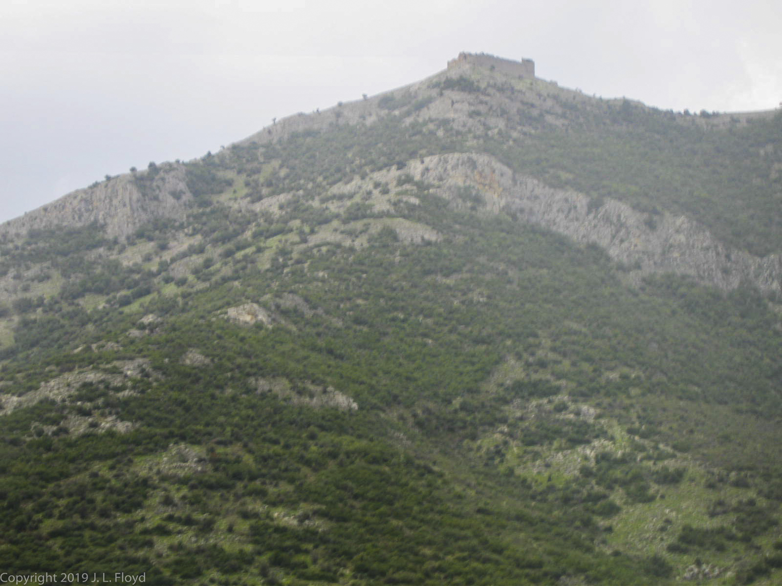
The castle where St. Paul was supposedly jailed prior to his expulsion from Ephesus. He ay have written the First Epistle to the Corinthians while staying there.
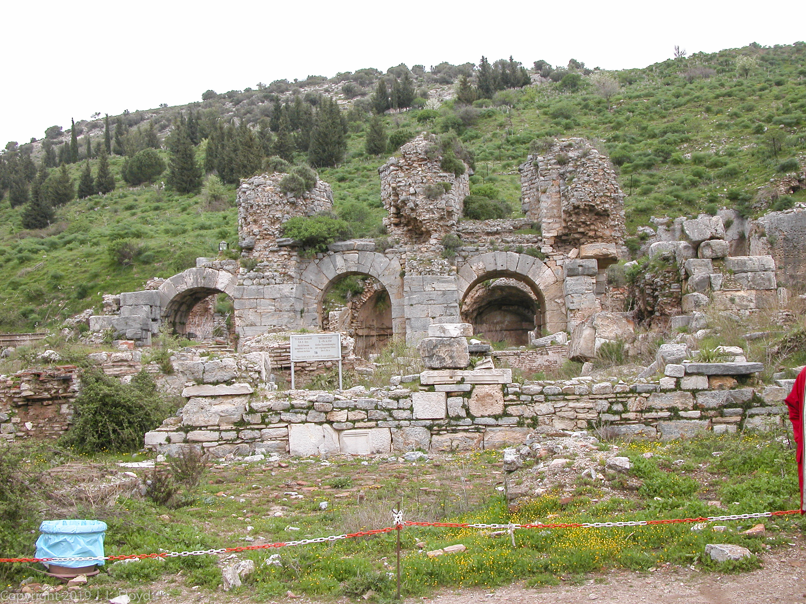
We entered the ancient city of Ephesus from the east, at the Varius Baths. The spelling of the name is not erroneous; there were not various baths at this location but rather one large bath complex, named after a wealthy citizen named Varius, who forked over the money to build it during the second century CE. The bath complex consisted of three sections: the frigidarium with cold water, the tepidarium with warm water and the caldarium with hot water. There were also resting, sitting and reading rooms.
The Varius Baths.
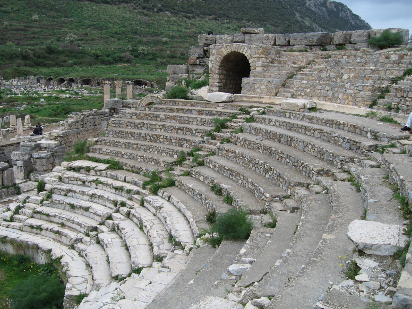
Just beyond the Varius Baths lay the Odeon, a “small” amphitheater (capacity 1500) commisioned in the second century by Publius Vedius Antonius, a wealthy citizen of Ephesus, and his wife. It was used for political meetings, concerts, theatrical performances, etc.
The Odeon at Ephesus
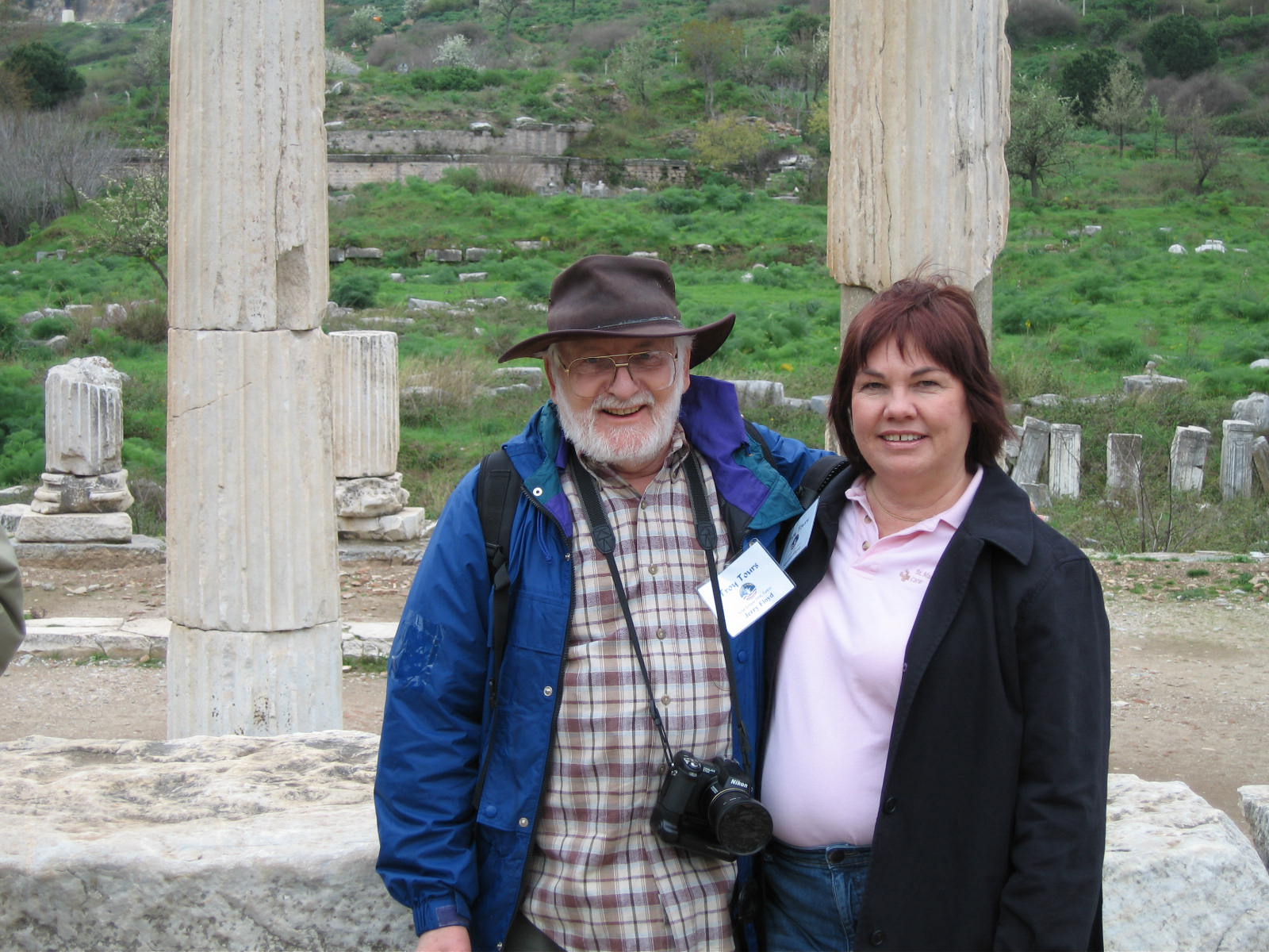
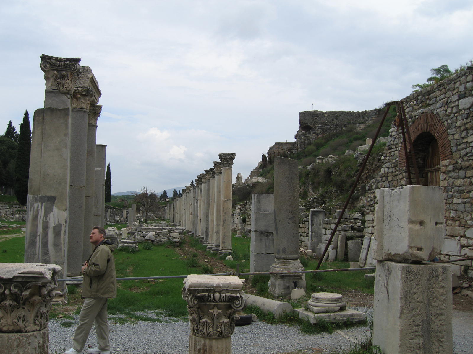
Ephesus had two agoras, one for state business and one for commerce. The Odeon stood on the north side of the State Agora. Dating from the reign of Augustus (d. 14 AD, this was a 160-meter arcade which hosted both commercial enterprises and law courts. It was connected via three gates to the Varius Baths, presumably so people who felt soiled by their dealings with lawyers could quickly duck out to cleanse themselves.
Jerry and Sandie pose for a picture at the State Agora of Ephesus.
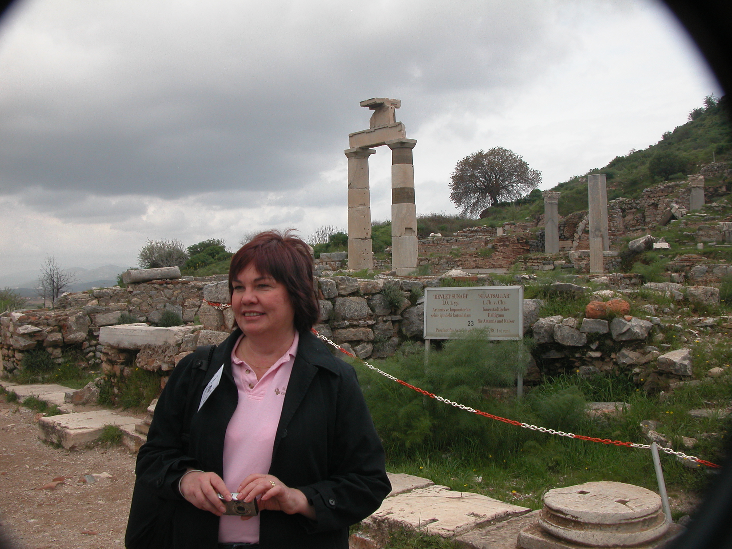
Just to the west of the Odeon stood the Prytaneion, a government building where receptions, religious ceremonies and banquets were held. It also contained the sacred fire of Hestia, which was supposed to never be extinguished. To that end it was tended by priests called Curetes, who gave their name to the main street which leads from the State Agora down to the main residential district and the Commercial Agora.
Sandie at the Prytaneion.
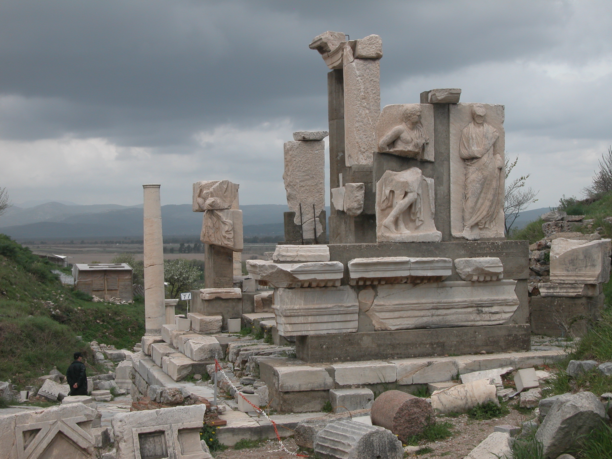
Roman rule in Asia was initially quite unpleasant for the Ephesians, as well as all the inhabitants of Roman Asia, who were subject to rapacious taxation and corrupt administration. This created an ideal opportunity for Mithridates VI, King of Pontus, who took advantage of the unrest to invade and massacre the Romans in 87 BCE. The hiatus in Roman rule, of course, was only temporary; in response Rome dispatched the general Lucius Cornelius Sulla, who defeated Mithridates, retook Ephesus and, using the cachet conferred by his army command, went on to make himself dictator of Rome. At the beginning of Curetes Street stands a monument erected by Gaius Memmius during the reign of Emperor Augustus to commemorate Sulla’s reconquest of Asia. Memmius was Sulla’s grandson.
The Memmius Monument
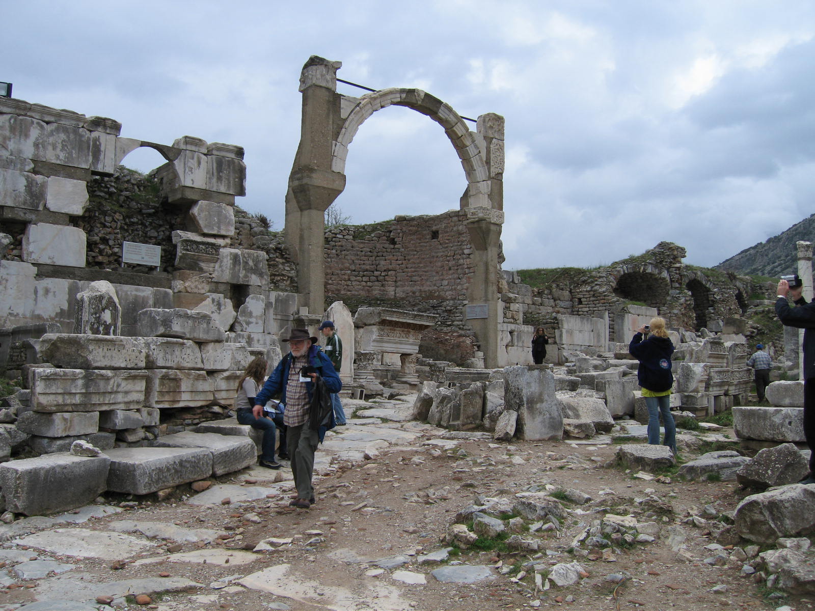
Just off the State Agora was the Fountain of Pollio, so-called because people who had polio were cured by bathing in it. No, I made that up. Actually, it is named for the Pollio family, a prominent Ephesus family who had it built in 97 AD. Unfortunately, the scene was spoiled by a scruffy tourist who happened to be strolling through when Sandie took the picture. You’d think that the Turks would know better than to let such riff-raff into their treasured historical sites.
The Pollio Fountain.
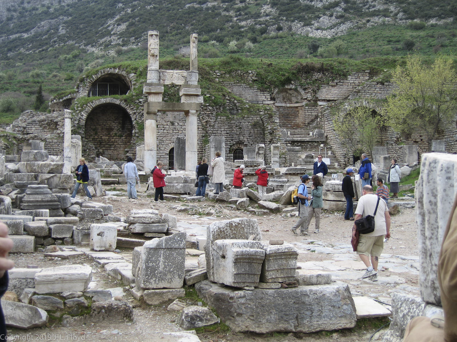
Near the southwest corner of the State Agora stands the Temple of Domitian, erected in the first century BCE. The name seems to have been given erroneously, since it is now believed to have been erected in honor of the Emperor Titus, who would have been a much better choice than his successor Domitian, a brutal and unpopular tyrant who was killed by one of his servants. The official name was the Temple of the Sebastoi (“venerable ones”), the Greek form of the Roman imperial title Augustus.
Temple of Domitian, or Temple of the Sebastoi
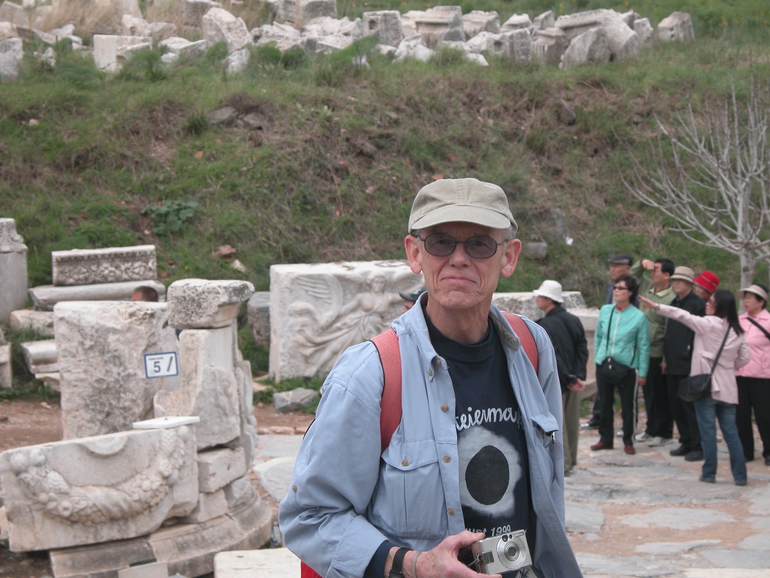
Chuck Mattox, who appears in the photo below, on this occasion was wearing a t-shirt he had acquired after a previous eclipse, which he and Elouise had viewed in Austria in 1999. Chuck and Elouise Mattox are inveterate eclipse-chasers; the one in 2006 was at least their fourth – I may have lost track!
Chuck Mattox at the Temple of Domitian
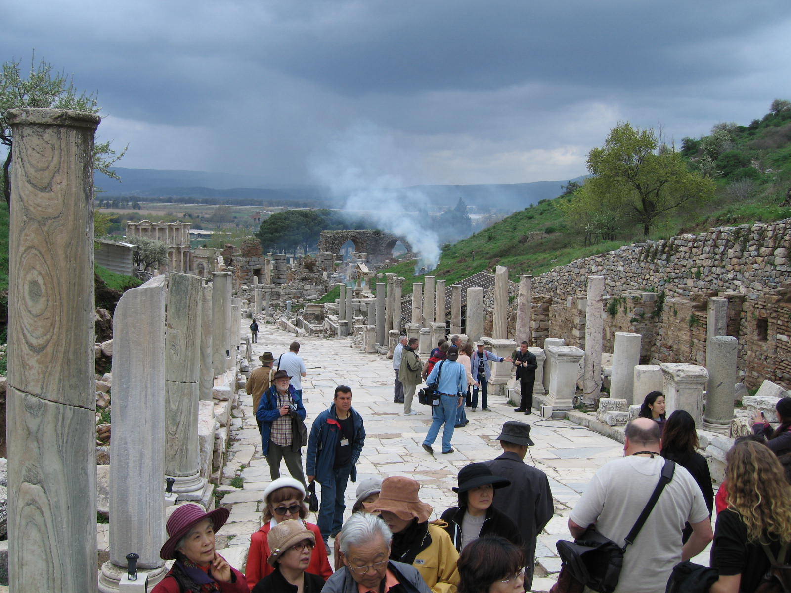
From the Temple of Domitian we strolled down Curetes Street toward the residential district. Along the way we noticed columns of smoke billowing from fires set at seemingly random places around the city. We concluded that these fires were set by descendants of the Goths, trying to emulate the exploits of their ancestors, who had burned the city in 263 CE. Fortunately, it was a rainy day (note the distant rain shower in the scene below), and the fires didn’t really do much damage.
A scene from Curetes Street, with our guide Attila holding forth to members of the group at center right.
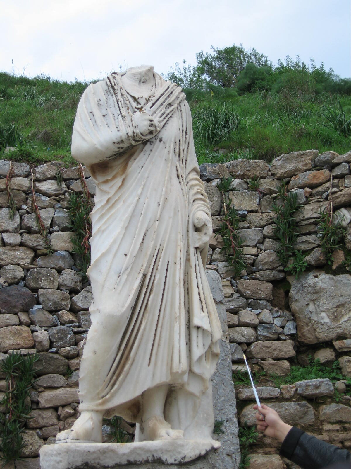
On the way down Curetes Street, we came across a statue of a woman with no head. We found out it had been erected during the Byzantine era in honor of a woman doctor who had rendered great services to the city. It was not known when the head was taken or by whom, but it was common for plunderers to cut the heads off statues since the entire statue was much heavier and hard to cart away.
The Headless Doctor.
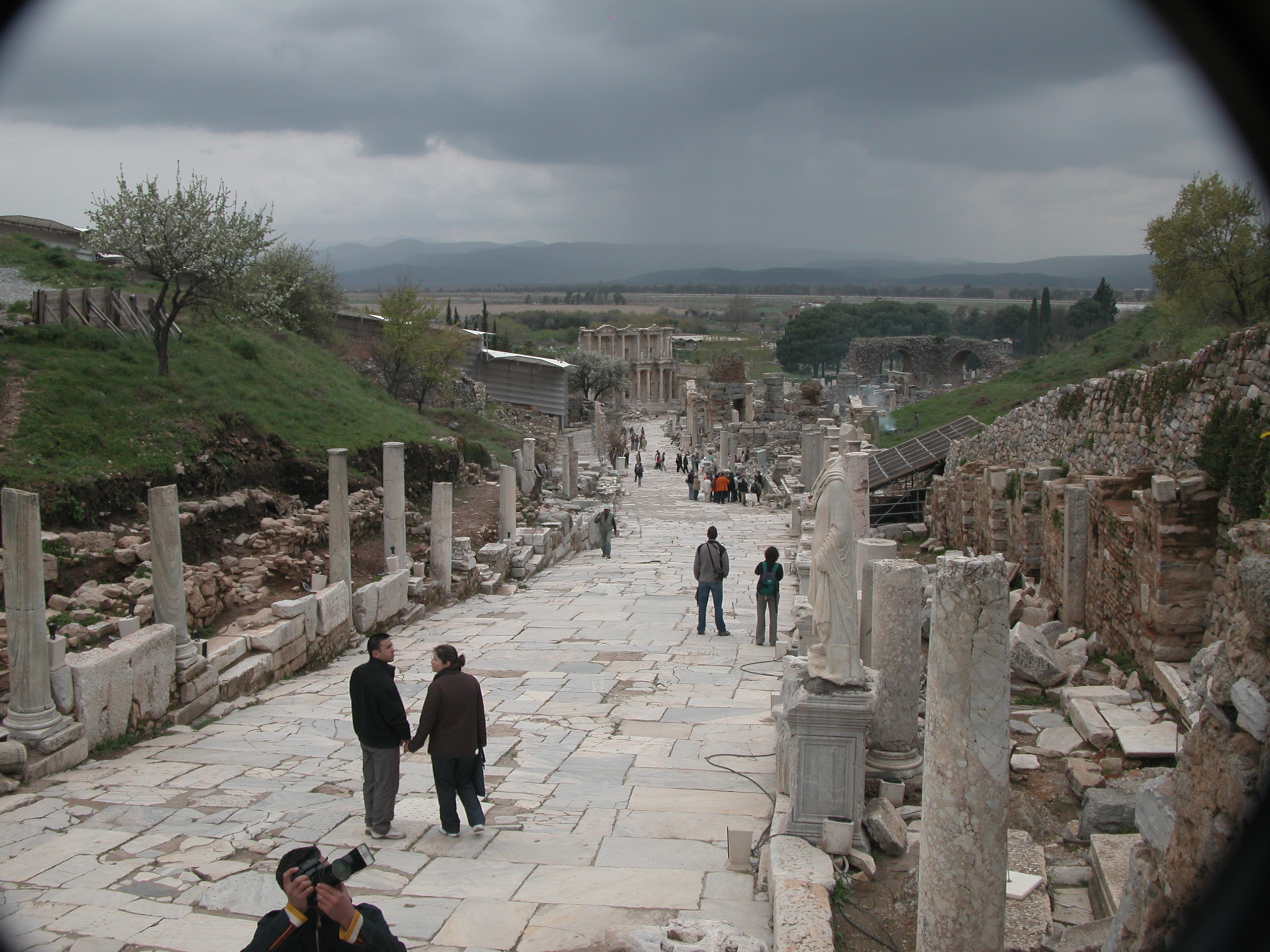
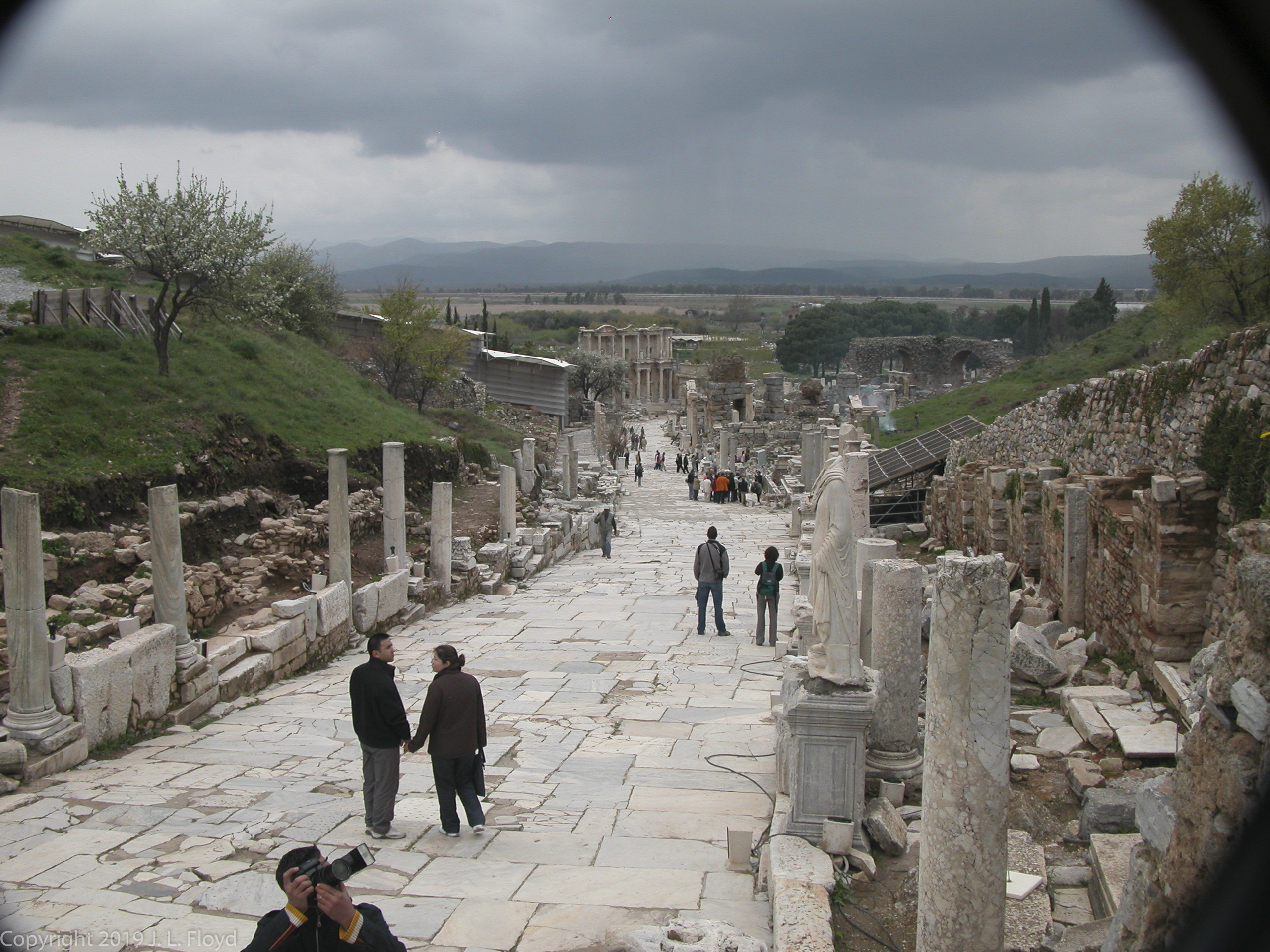
Curetes Street proved to be a bustling area, just as it must have been in antiquity, with many attractions.
A view of Curetes Street, looking down toward the Library of Celsus.
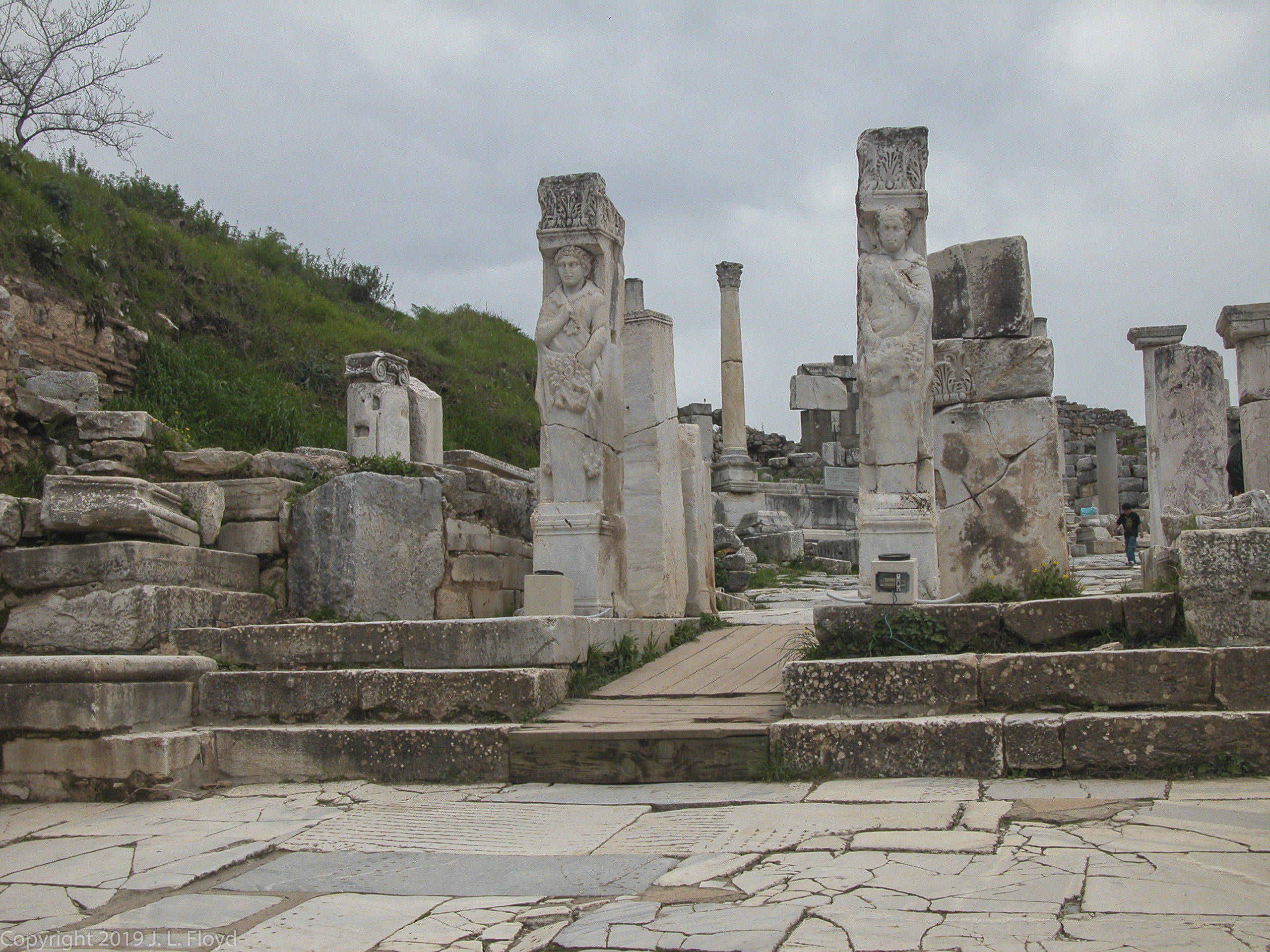
A side entrance to Curetes Street is framed by the Gate of Hercules, which features twin columns with reliefs of Hercules performing one of his Twelve Labors, strangling the Nemean Lion. Hercules had been tasked with killing a lion which had been terrorizing the people of Nemea. The lion had a skin so thick that arrows were useless against it, so Hercules had to strangle it instead.
The Hercules Gate
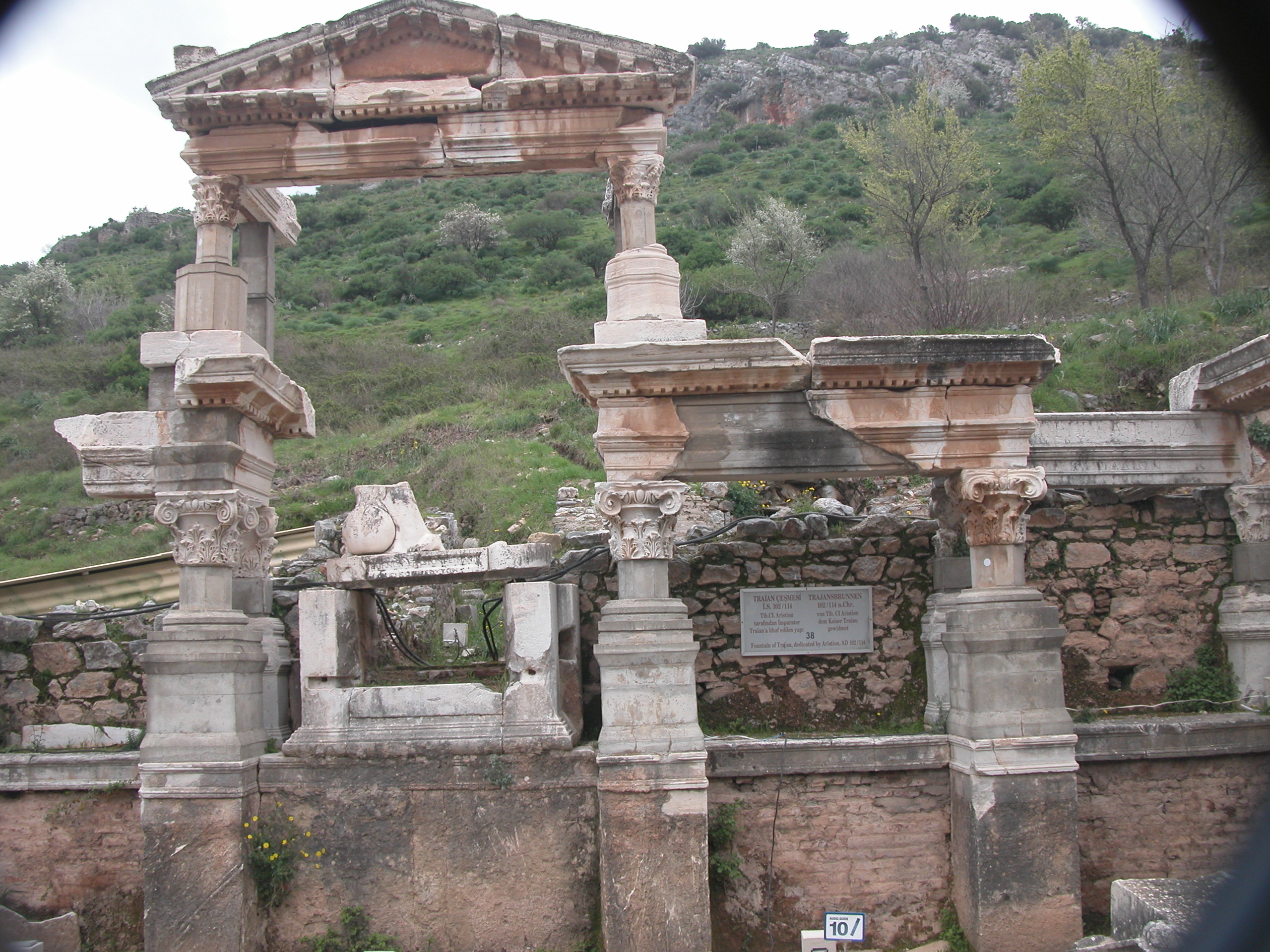
Beyond the Hercules Gate, we passed the Fountain of Trajan, dedicated to the Emperor who reigned from 98 to 117 BCE), under whom the Roman Empire reached its greatest territorial extent. Originally the fountain was graced by a gigantic statue of the emperor, but now only the feet remain.
The Fountain of Trajan.
Further down on Curetes Street, we came to the residential district, seen at left in the following photo. The exhibits feature excavated interiors of houses, which have been covered with tin and plastic to protect them from the weather. The two-story structure at the bottom of the hill is the Library of Celsus.
The residential district, seen at left along Curetes Street.
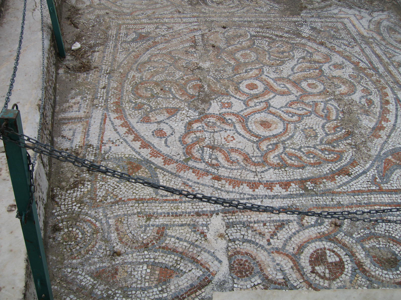
The floors of upscale houses in the Roman Empire often contained beautiful mosaics, and some of them still survive in Ephesus.
In the Houses on the Hill.
Toward the bottom of the hill we encountered the Baths of Scholastica. Originally built in the first century CE by Varius, these baths were renamed after a Christian woman who undertook their restoration in the 4th century. They were the largest baths in Ephesus.
The Baths of Scholastica
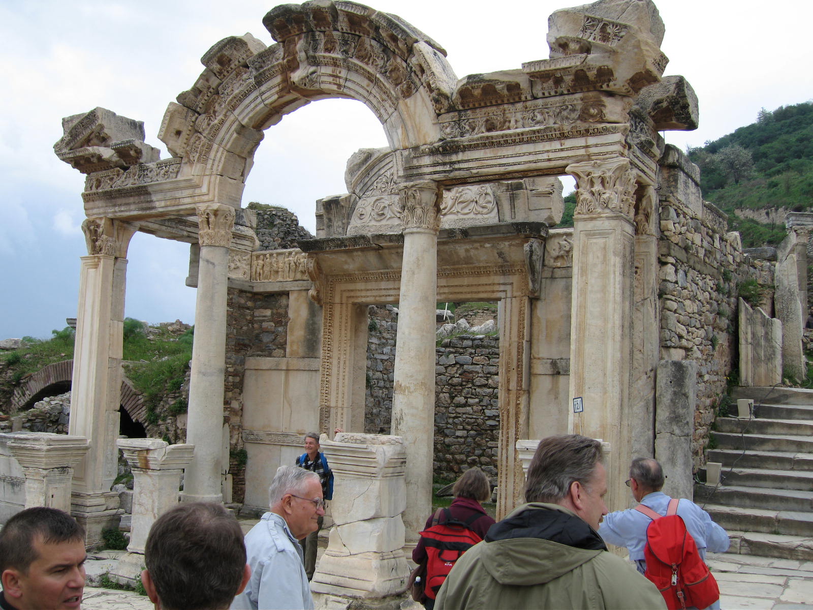
One of the best-preserved structures on Curetes Street is the Temple of Hadrian, built around 138 BCE to honor the Emperor Hadrian, who came to visit the city in 128.
The Temple of Hadrian, with members of our tour group in the foreground.
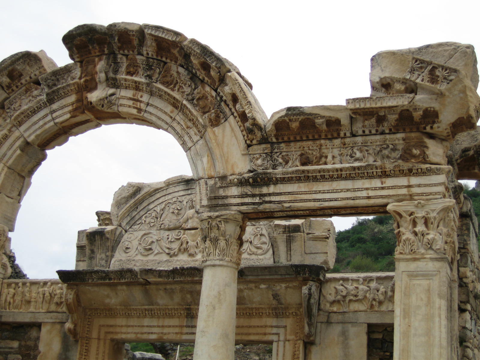
The facade of the temple has four Corinthian columns supporting a curved arch, in the middle of which is a relief of Tyche, goddess of victory.
Detail of the Temple of Hadrian.
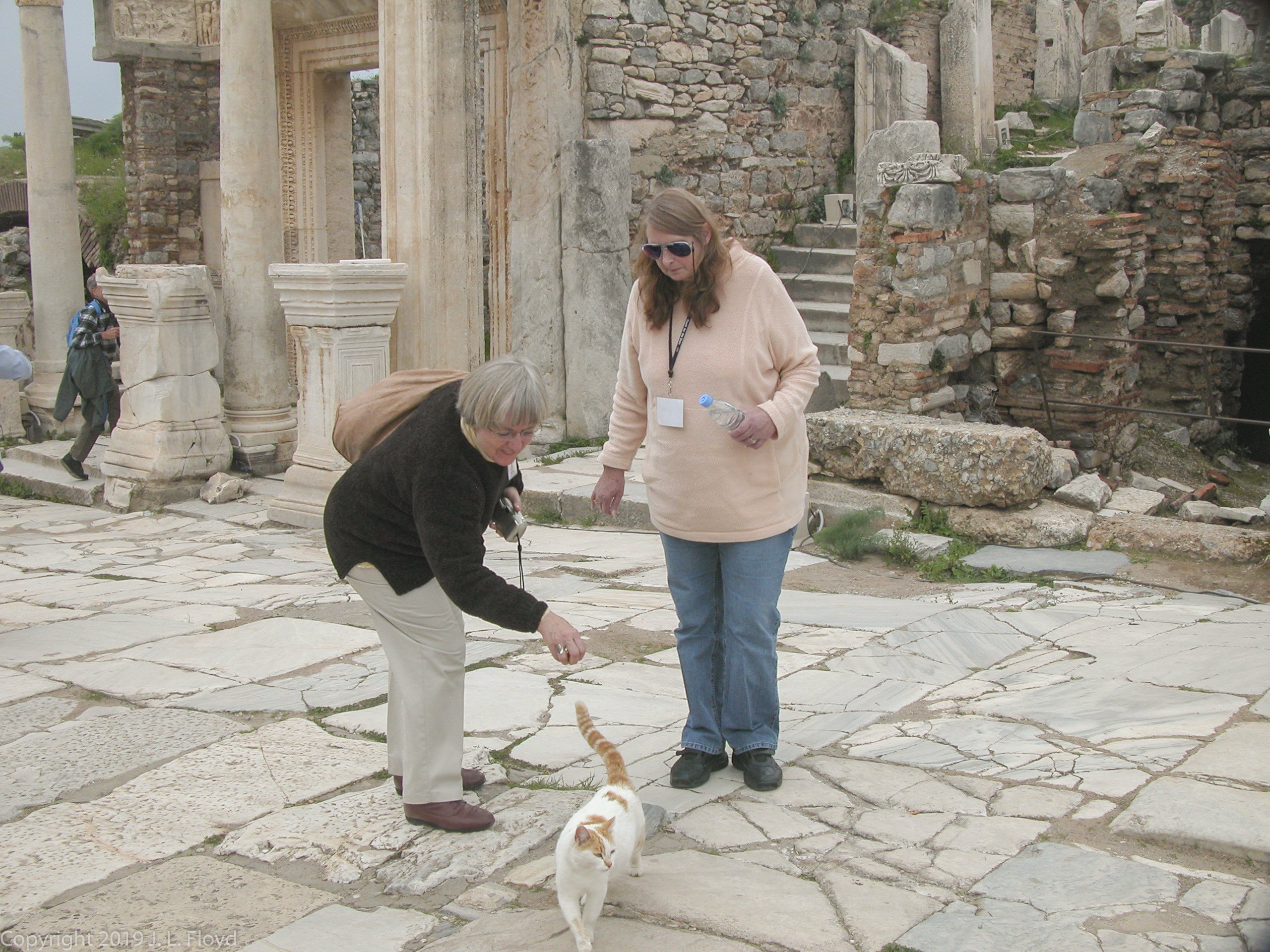
Near the Temple of Hadrian, Pam Bloxham and Cherie Rabideaux paused to frolic with one of the local felines who inhabited the ruins.
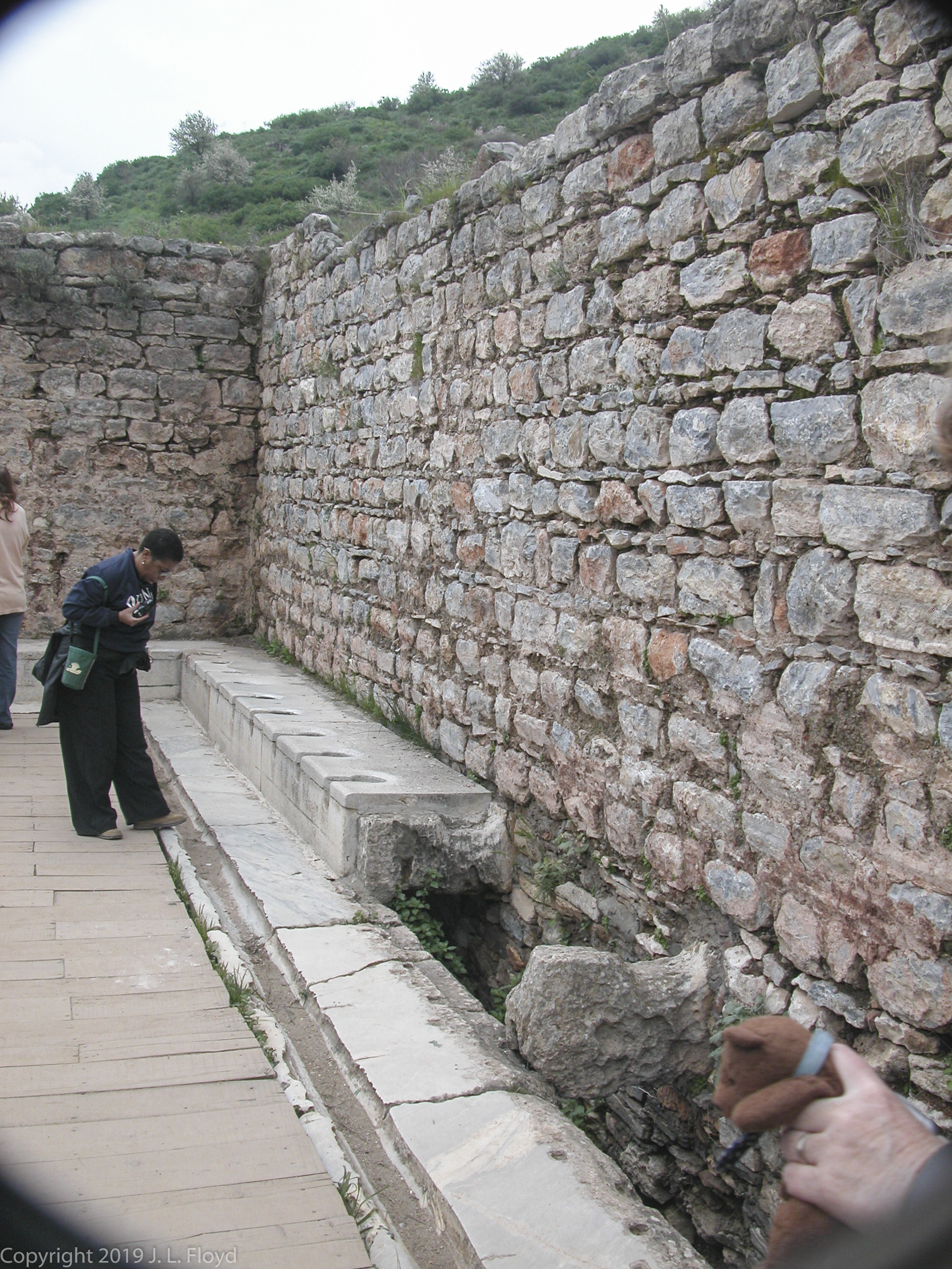
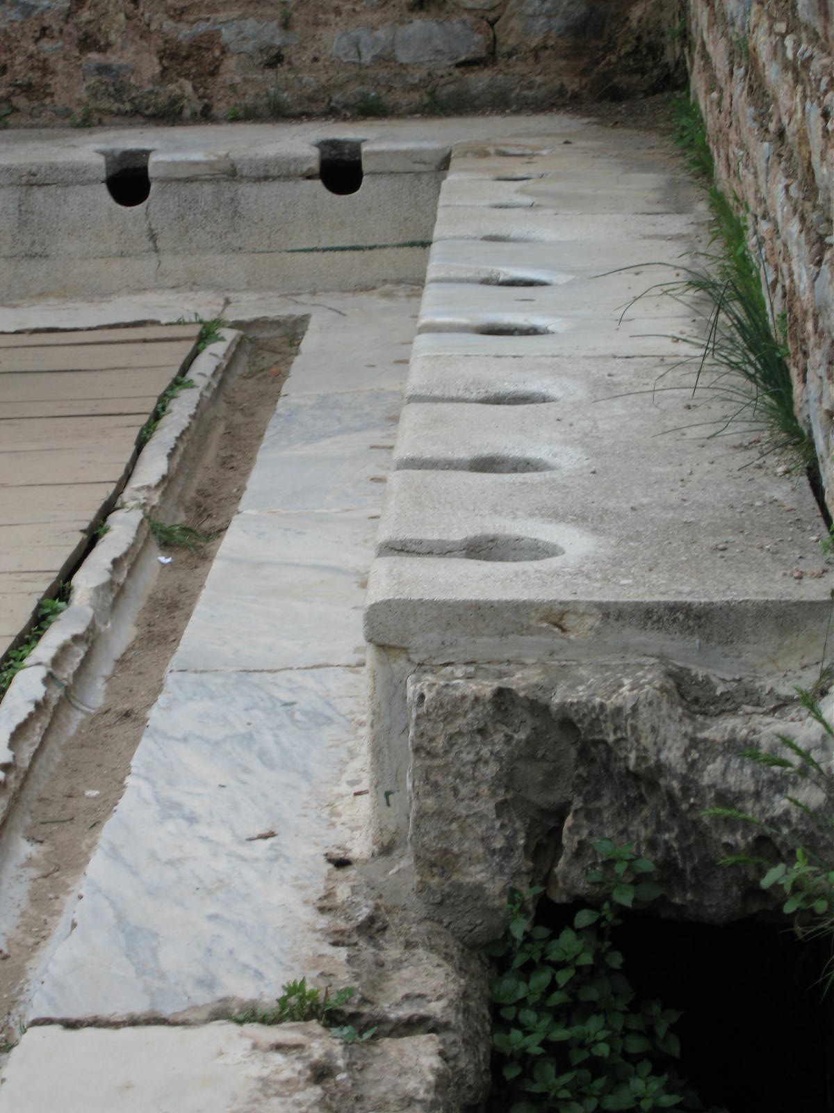
One of the most noteworthy features of ancient Greco-Roman cities was the abundant provision of running water, via the aqueducts built by the Roman authorities. Most houses did not have interior plumbing, but access to water was available via public fountains, baths and latrines. With the decline and fall of the Roman Empire, this amenity was lost and not regained in Europe until modern times.
A member of our tour group, Dr. Patricia Bush, M.D, inspects a public latrine in Ephesus. The latrines featured running water 24/7.
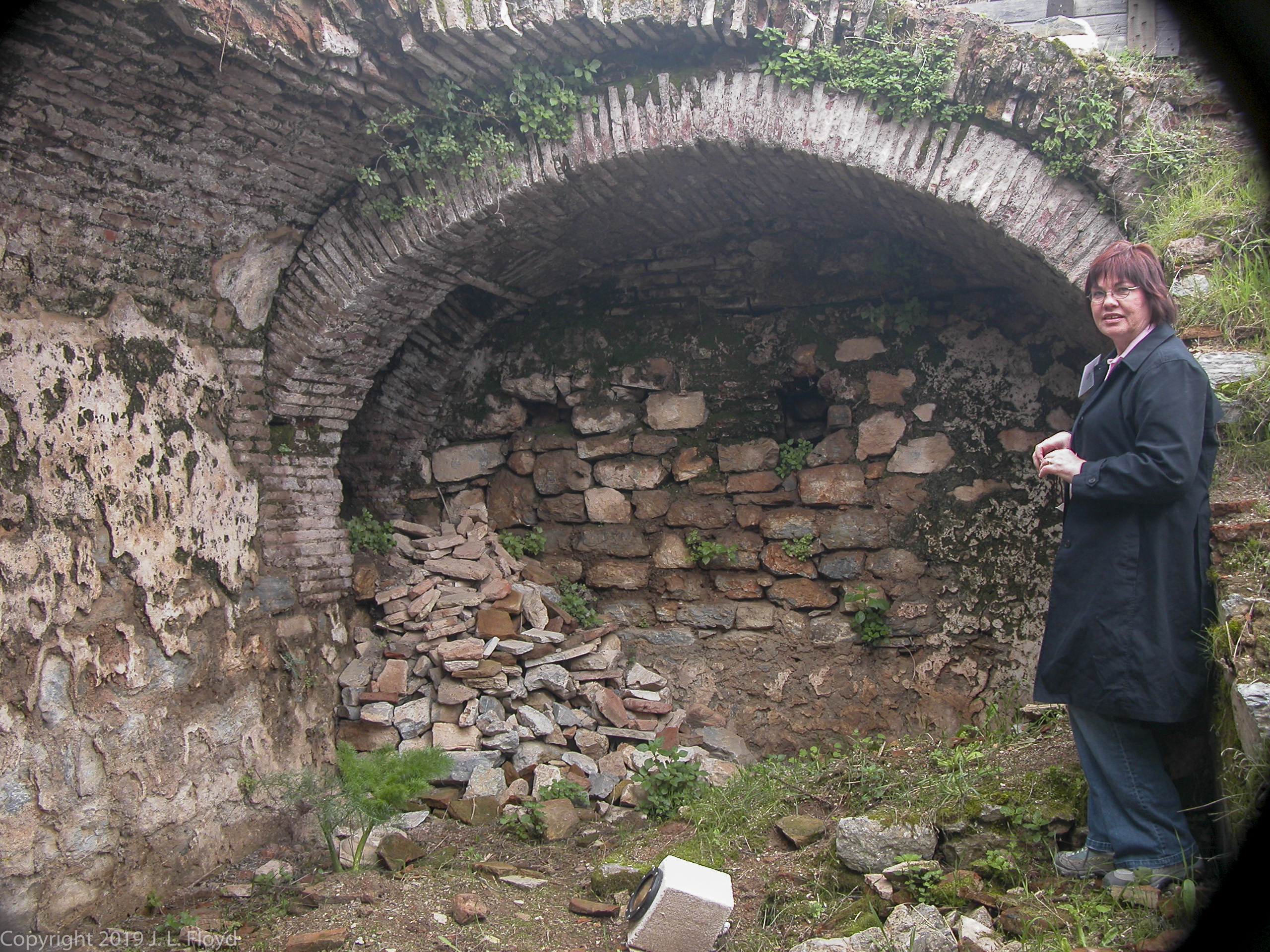
The toilet facility was conveniently located next to the Scolastica bathss. Unlike modern airport pay toilets, the ancient ones in Ephesus were not coin-operated.
The toilets were an adjunct to the Scolastica Baths, near the Temple of Hadrian.
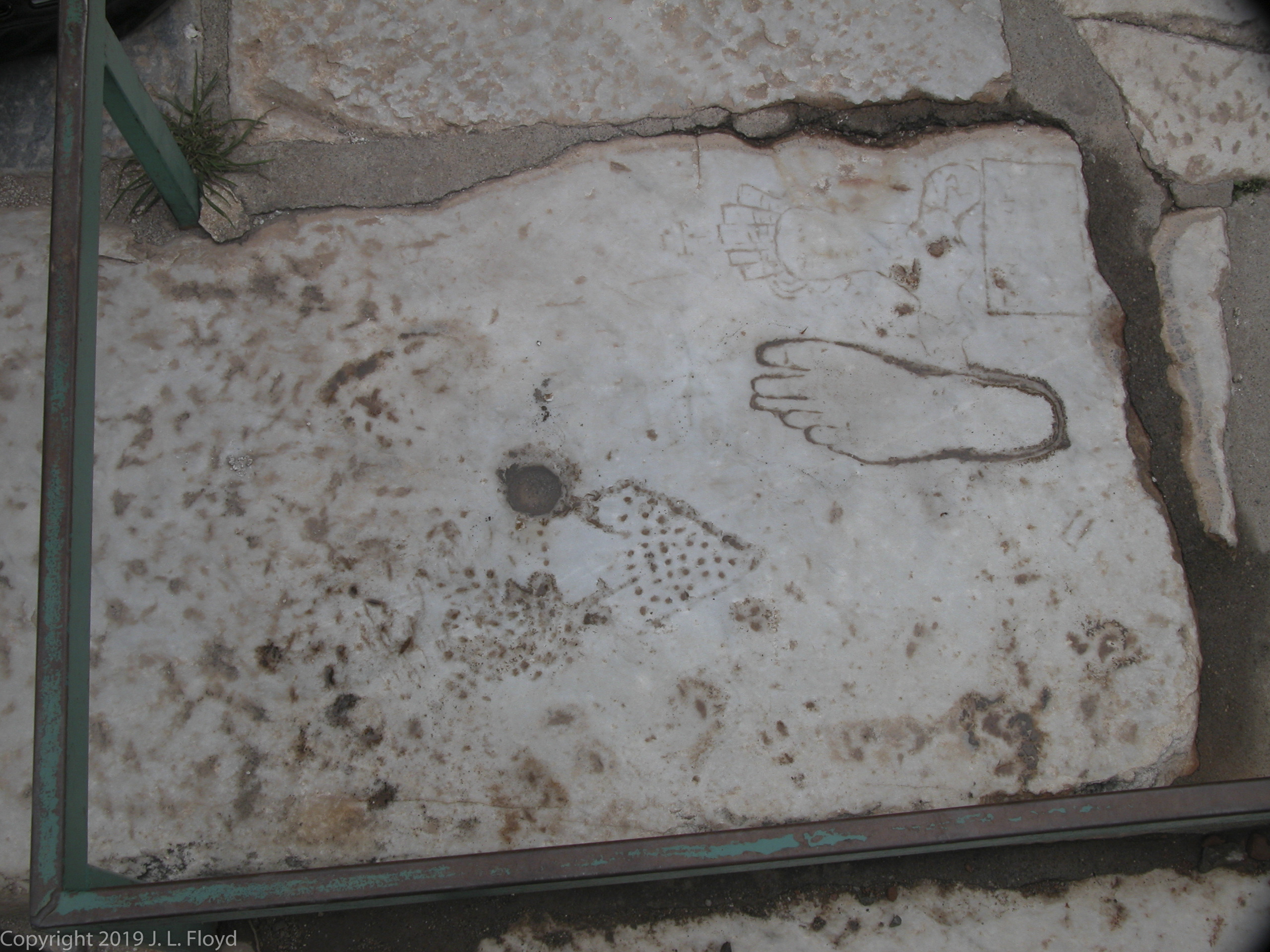
Since most people in antiquity were illiterate, public advertising had to take purely pictorial forms. On Curetes Street we encountered an ad for a brothel embedded in a concrete paving block. The footprint showed the way to go; the purse indicated that the service wasn’t free; and the hole provided a way to measure whether one had enough coins to afford it.
Advertisement for an ancient brothel.
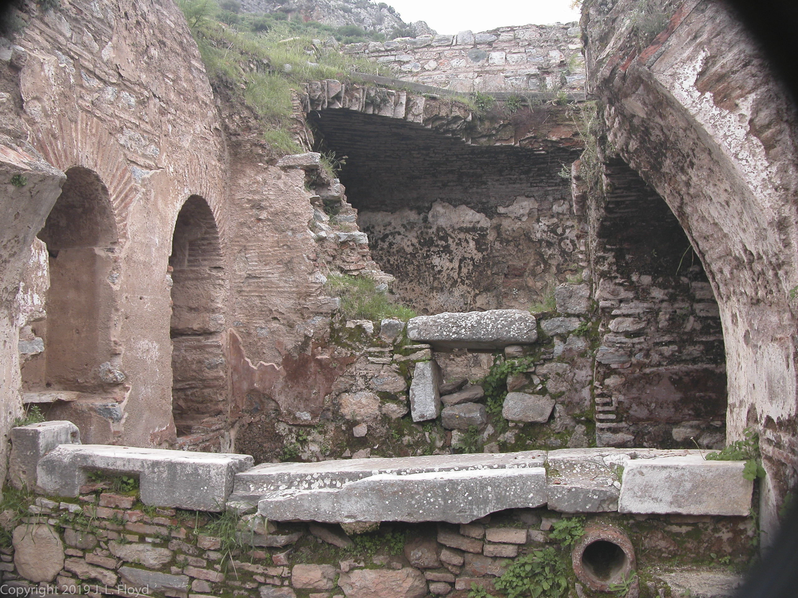
Located near the corner of Curetes and Marble Streets, the Brothel originally contained a figurine of Priapus, suitably endowed. Unfortunately, it was removed to the Ephesus Museum in the nearby town of Selcuk, which we didn’t get to visit.
The interior of the brothel.Sandie inspects the remains of the brothel, warily keeping an eye out for janissaries.
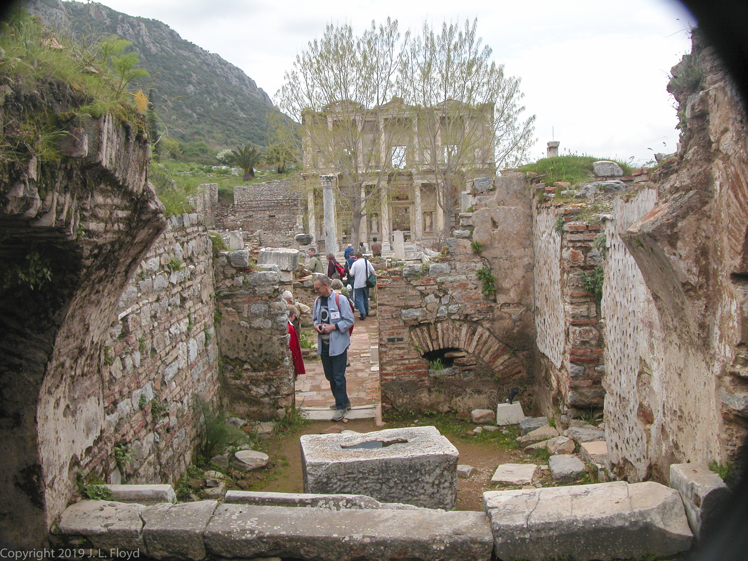
Below is a shot of another room of the brothel, this time looking through the interior toward the nearby Library of Celsus, with Chuck Mattox framed in the doorway. I have a theory that the altar in the center of the room was where virgins destined for the trade were brought to sacrifice their maidenheads.
Looking through a room of the brothel toward the Library of Celsus.
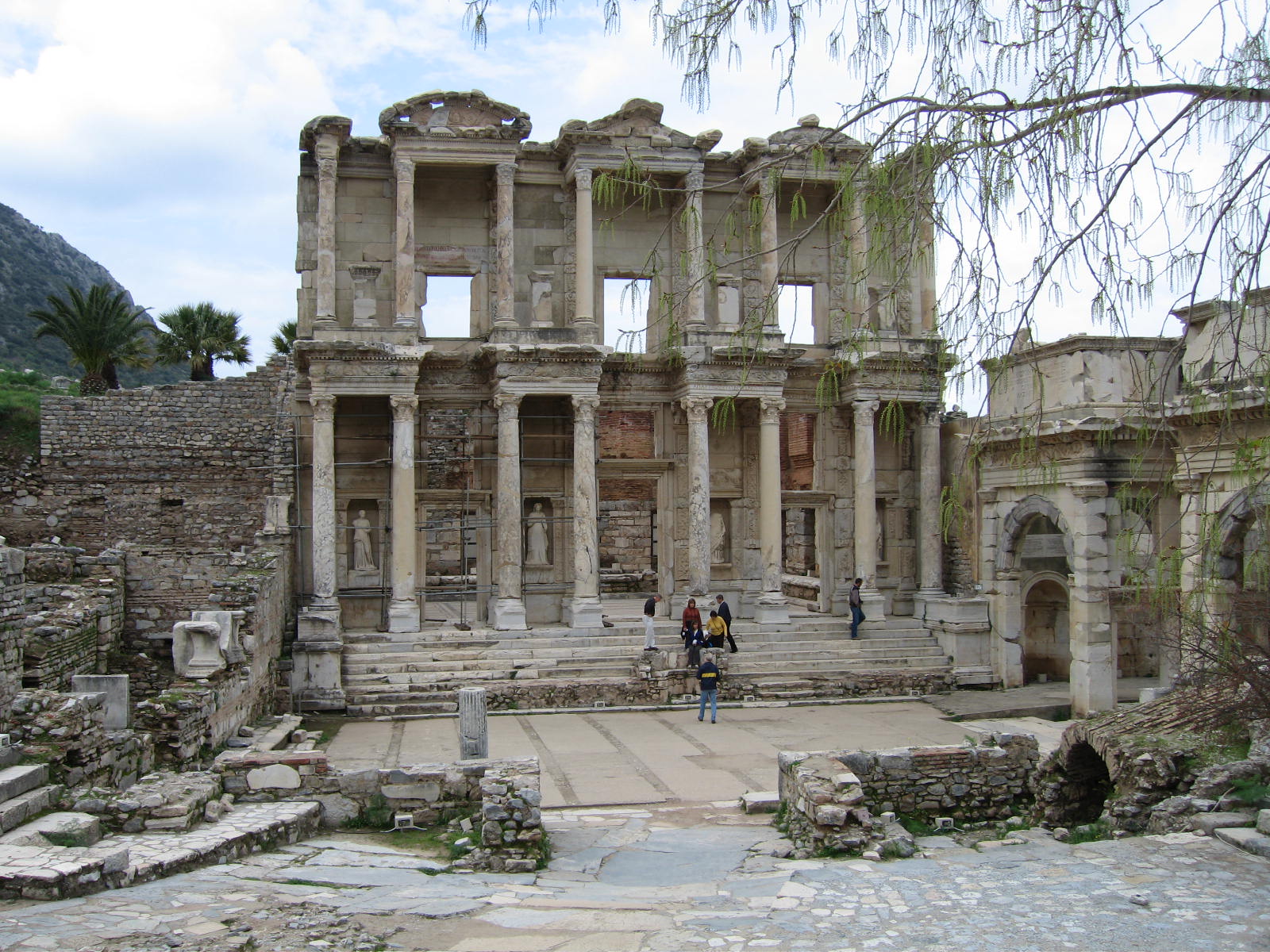
Tiberius Julius Celsus Polemaeanus was a Roman official of Greek origin, and a native of Ephesus, who served as governor of the province of Asia in 105/106 CE. At his death he bequeathed a large sum of money to have a library built by his son, Julius Aquila Polemaeanus, to serve as his monument and his burial place. The library was completed during the reign of Hadrian, after the death of Aquila himself, and came to hold more than twelve thousand scrolls, making it the third largest in the Roman Empire, after Alexandria and Pergamum. It was also an architectural triumph. The main floor served as a reading room and was lit exclusively by natural light from the windows.
The Library of Celsus, one of the great libraries of the ancient world, said to contain 12,000 scrolls.
Over the centuries invasions, fires and earthquakes left the library in ruins. In the 1970s archaeologists were able to reconstruct the facade, though the interior remains to be restored.
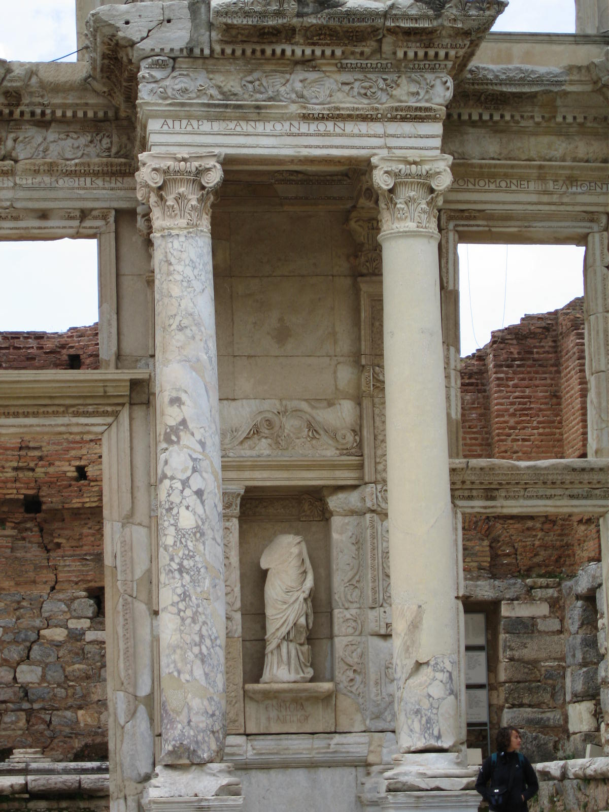
Detail of the Celsus Library. The four sets of columns adjacent to the doors of the library were adorned with statues depicting Wisdom, Knowledge, Intelligence and Fortune. This one would presumably be Intelligence.
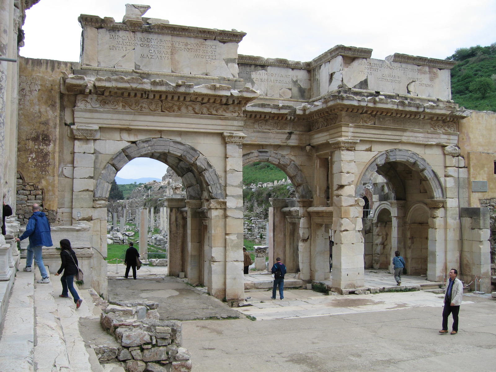
Next to the Library of Celsus stood the twin Gates of Mazeus and Mithridates, which led to the Commercial Agora. These predated the Library, having been built by two former slaves to honor the Emperor Augustus, who gave them their freedom.
The Gates of Mazeus and Mithridates.
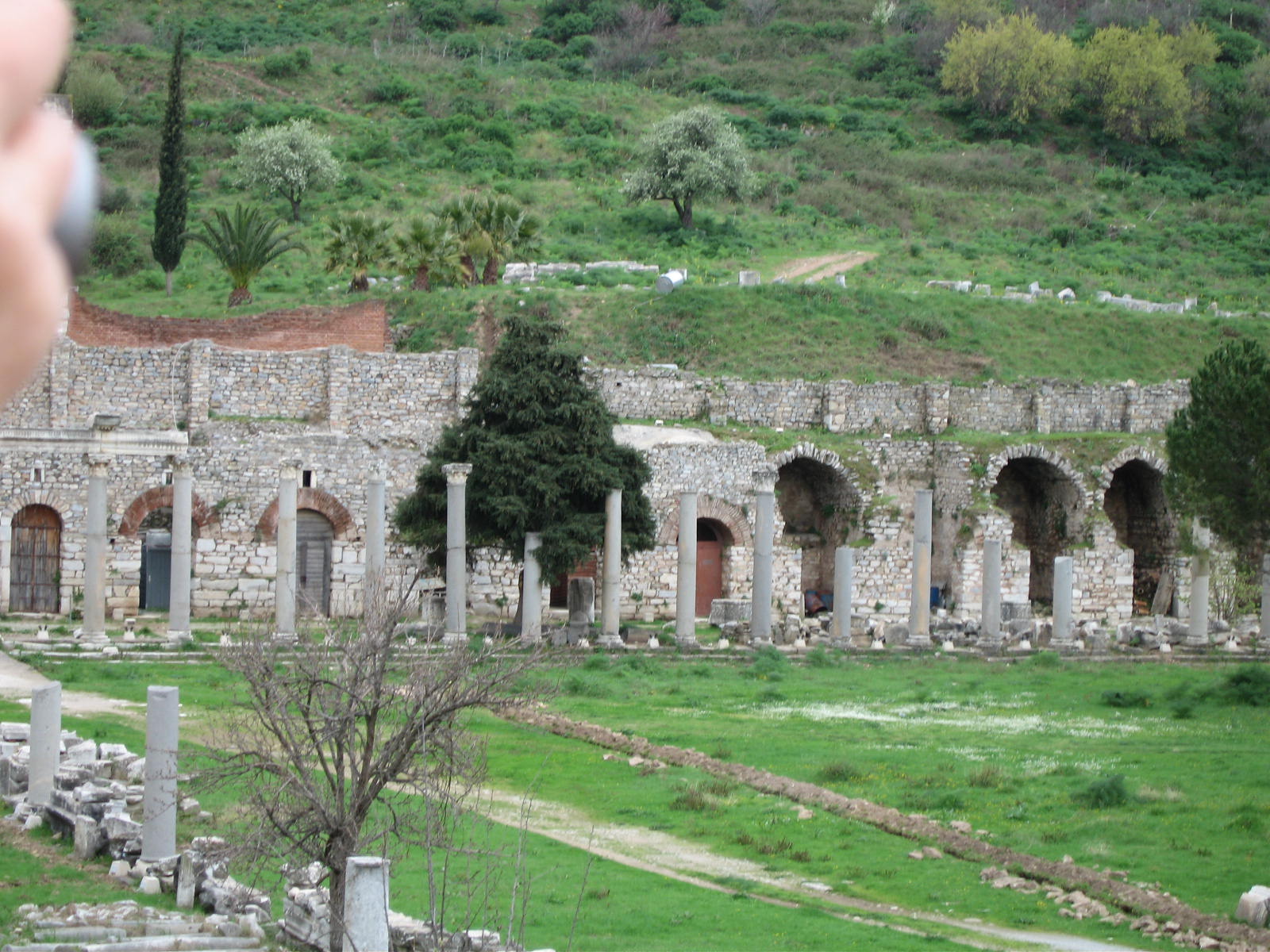
The Commercial, or Lower, Agora is the larger of the city’s two agoras.
Jim Windlinger strolling through the Commercial Agora.
The Lower Agora was indeed quite spacious.
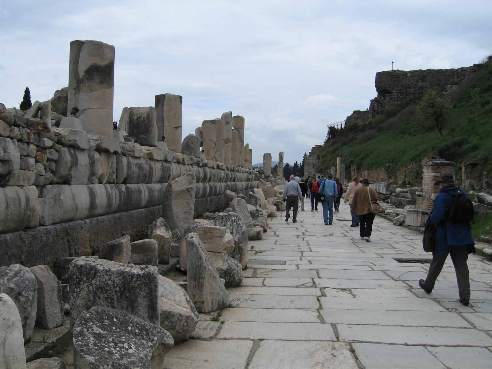
Along the east side of the Lower Agora, ran Marble Street, which led to the Great Amphitheater, our next destination.
Marble Street
The Great Amphitheater of Ephesus was first built in the third century BCE and expanded and renovated several times during the Roman period. It was the largest in Anatolia, with a capacity of about 25,000 spectators. (By comparison, the Colosseum in Rome could accommodate up to 80,000 people.)
Entrance to the Great Amphitheater of Ephesus.
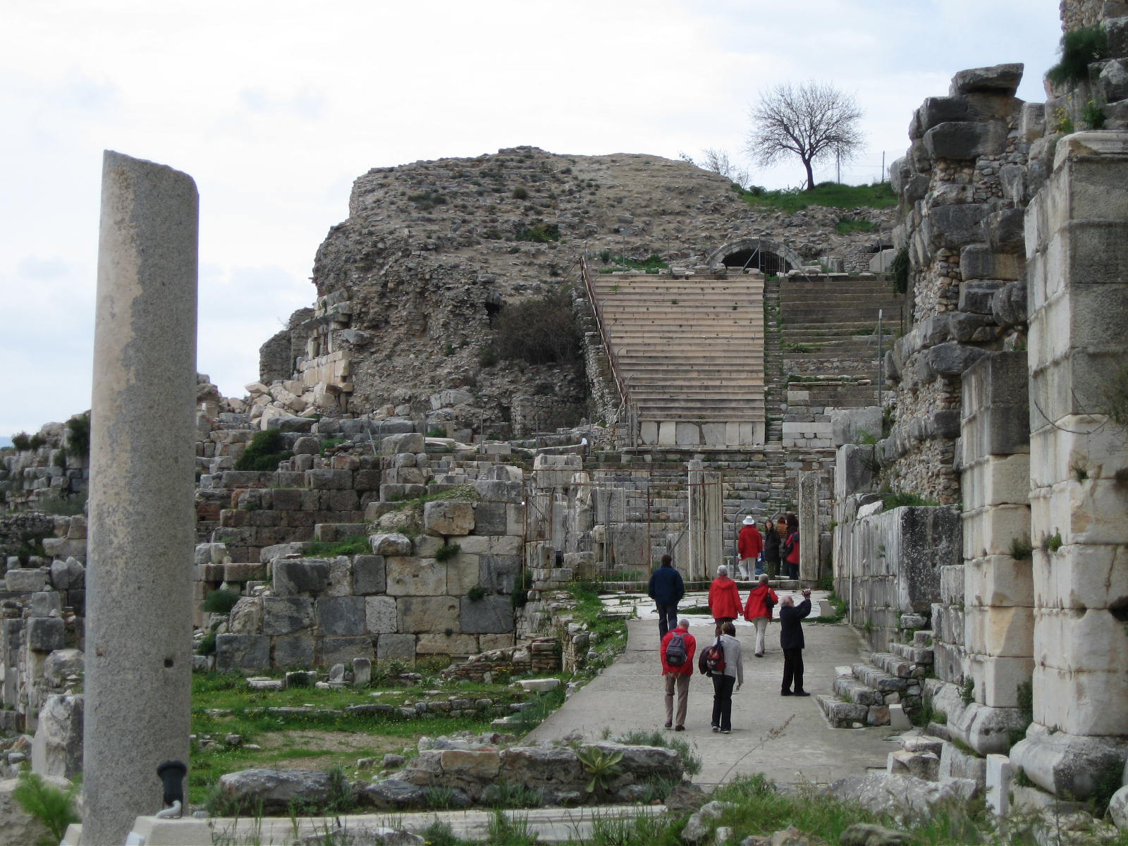
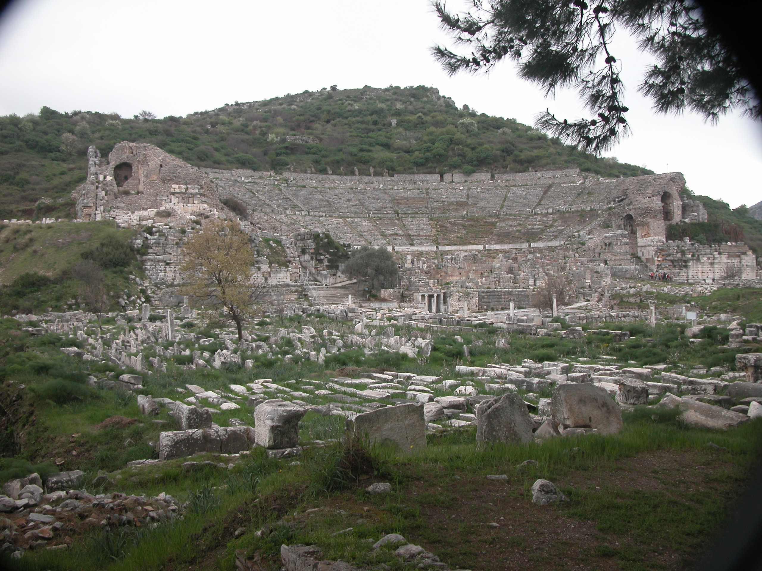
The Grand Amphitheater was built at the base of Panayir Mountain, using the rock of the mountain as a natural foundation for the seating. Other than the Temple of Artemis, which no longer exists, it was the most imposing structure of Ephesus.
The Grand Amphitheater is situated at the foot of Panayir Mountain.
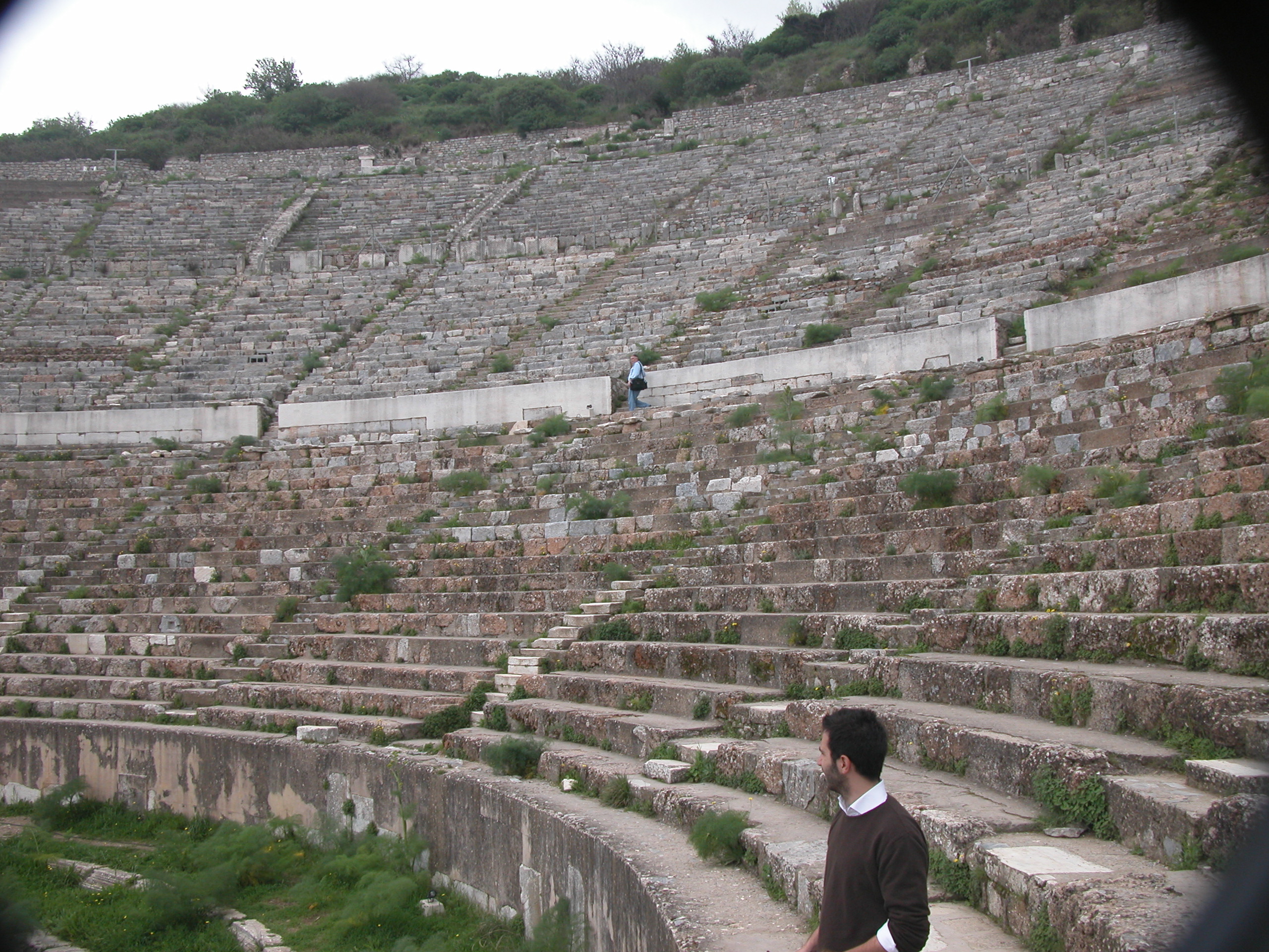
The Grand Amphtheater was also the scene of the Riot of the Silversmiths that ended St. Paul’s residence in Ephesus. The next photo provides an idea of the scale of the seating.
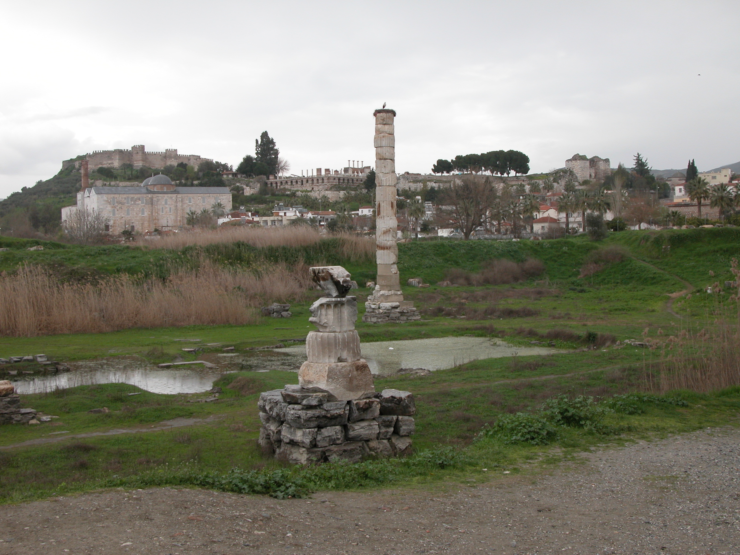
From the Great Amphitheater we headed for the site of the Temple of Artemis. Two paltry columns next to a drainage pond are all that remains of what was once one of the Seven Wonders of the ancient world.
Remains of the Temple of Artemis
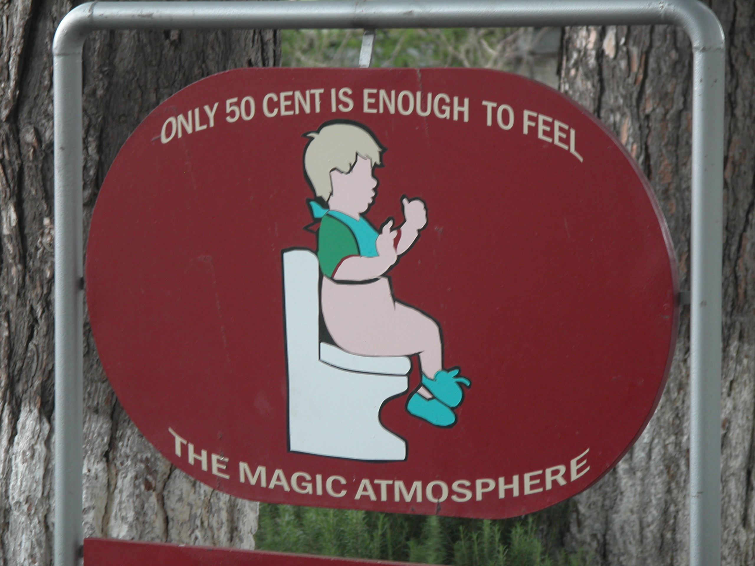
Near the exit which took us back to our bus, a sign advertised the location of the modern pay toilets, which are coin-operated.
On March 22 Sandie and I flew from LA to Chicago O’Hare to catch our Turkish Airlines flight to Istanbul, along with the rest of the OCSS group. In Istanbul we transferred immediately to our connecting flight to our first tour stop, the city of Izmir, formerly known by its Greek name of Smyrna. In olden times it was famous for its figs, which are still sold (at least in the USA) as Smyrna figs.
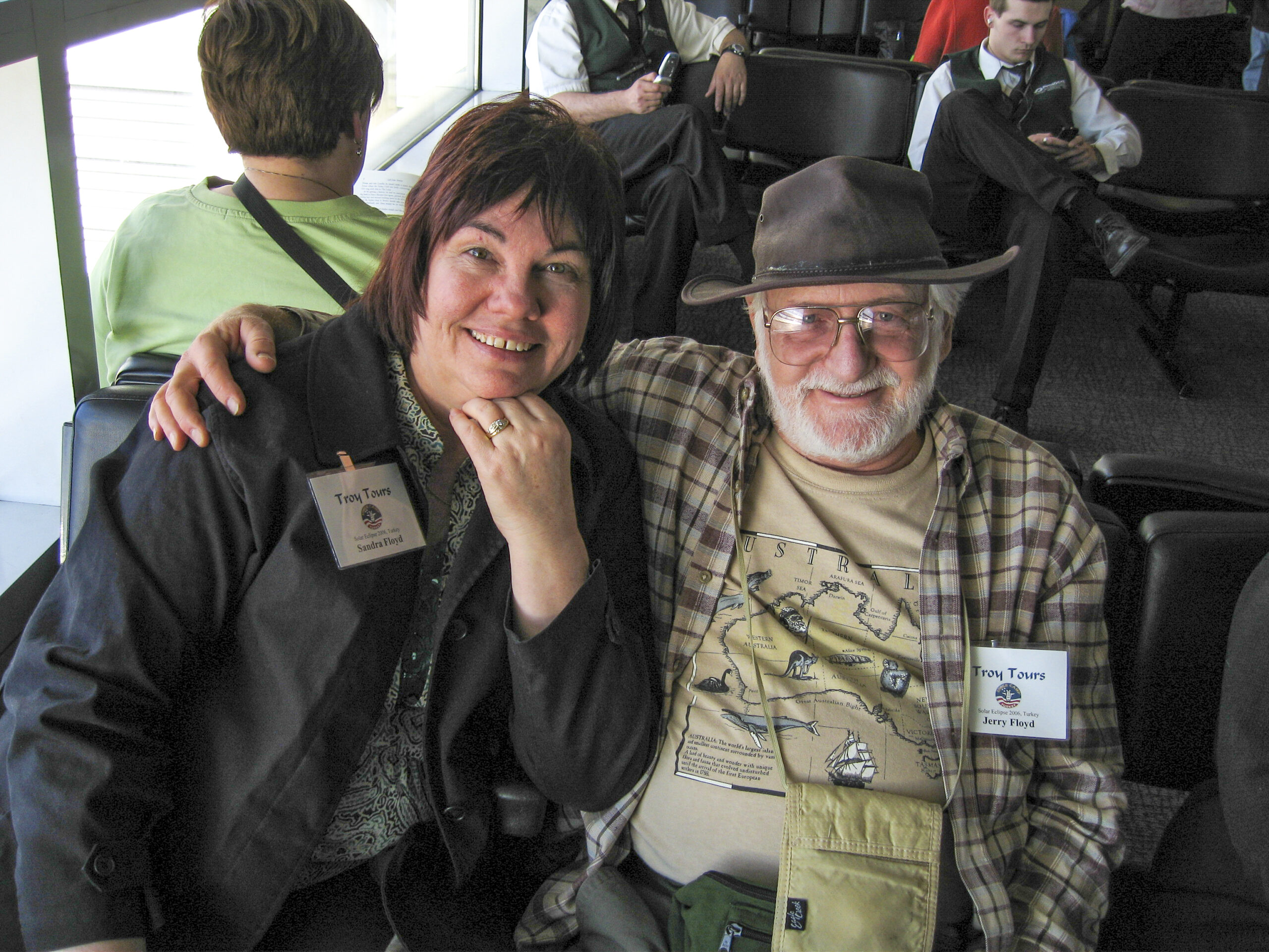
Sandie and Jerry, waiting in the airport for the flight to Turkey on March 22, 2006.
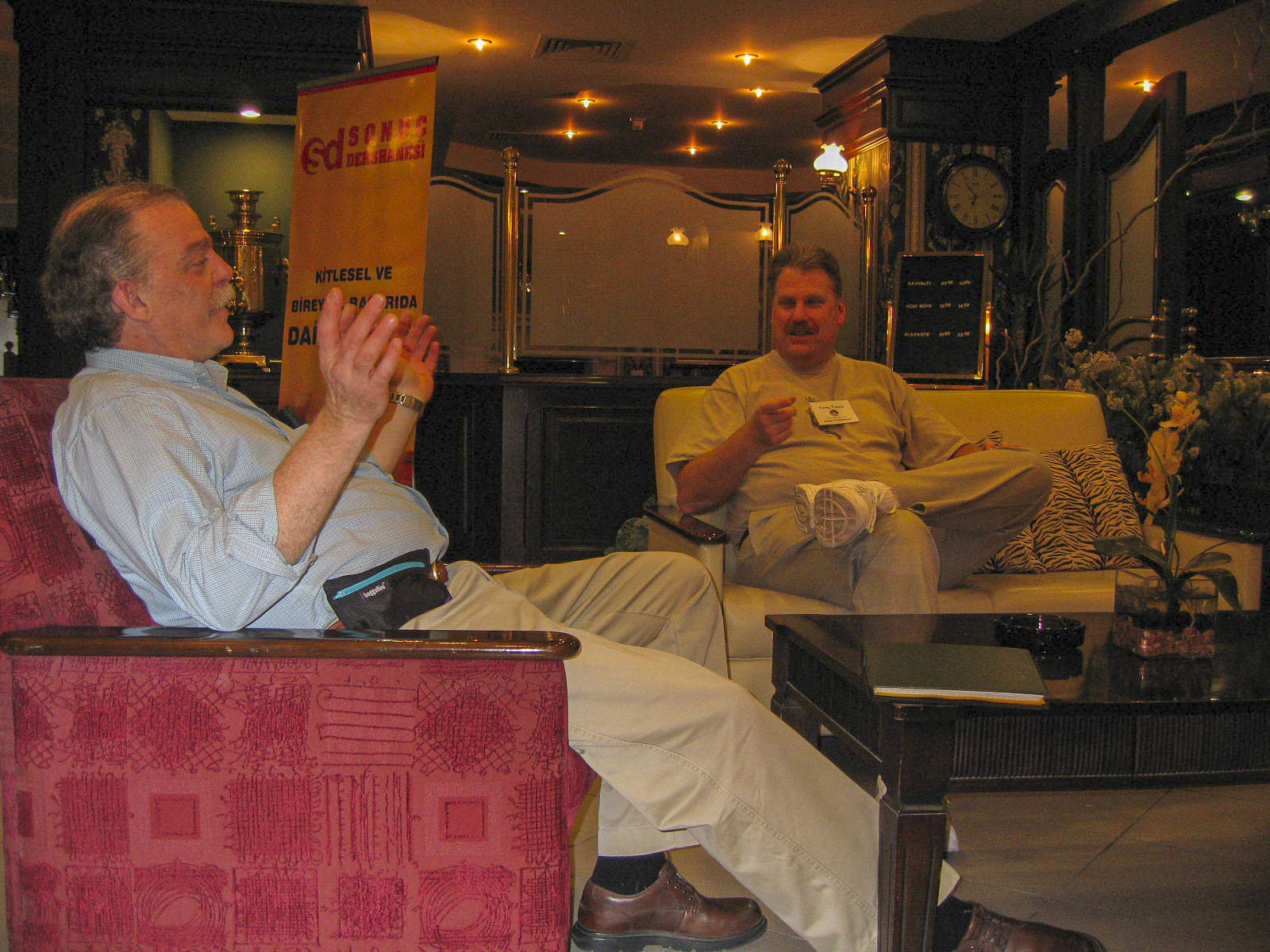
Upon arrival in Izmir, we were greeted by our guide from Troy Tours, Attila Mahur, later dubbed “Attila the Honey.” (The following pages will make it clear why he earned this sobriquet.) He whisked us to our lodging in the Hotel Karaca, where we shook the dust of travel off our feet, figuratively speaking, relaxed in the hotel lobby and began to get to know our fellow-travelers. Some Sandie and I already knew, such as Jim Windlinger of Fullerton, California, seen at right in the photo below; Jim is a member of Orange County Astronomers and a denizen of the OCA Anza observatory site, where now he has an observatory near mine. Others were new, such as Rick Gering of Chicago, at left in the photo.
Rick Gering and Jim Windlinger in the Hotel Karaca lobby in Izmir.
Another new acquaintance was Marvin Blaski, shown in the next photo.
Marvin Blaski, a member of our Turkey travel group and a retired aerospace engineer, relaxes in the Hotel Karaca lobby after arriving in Izmir.
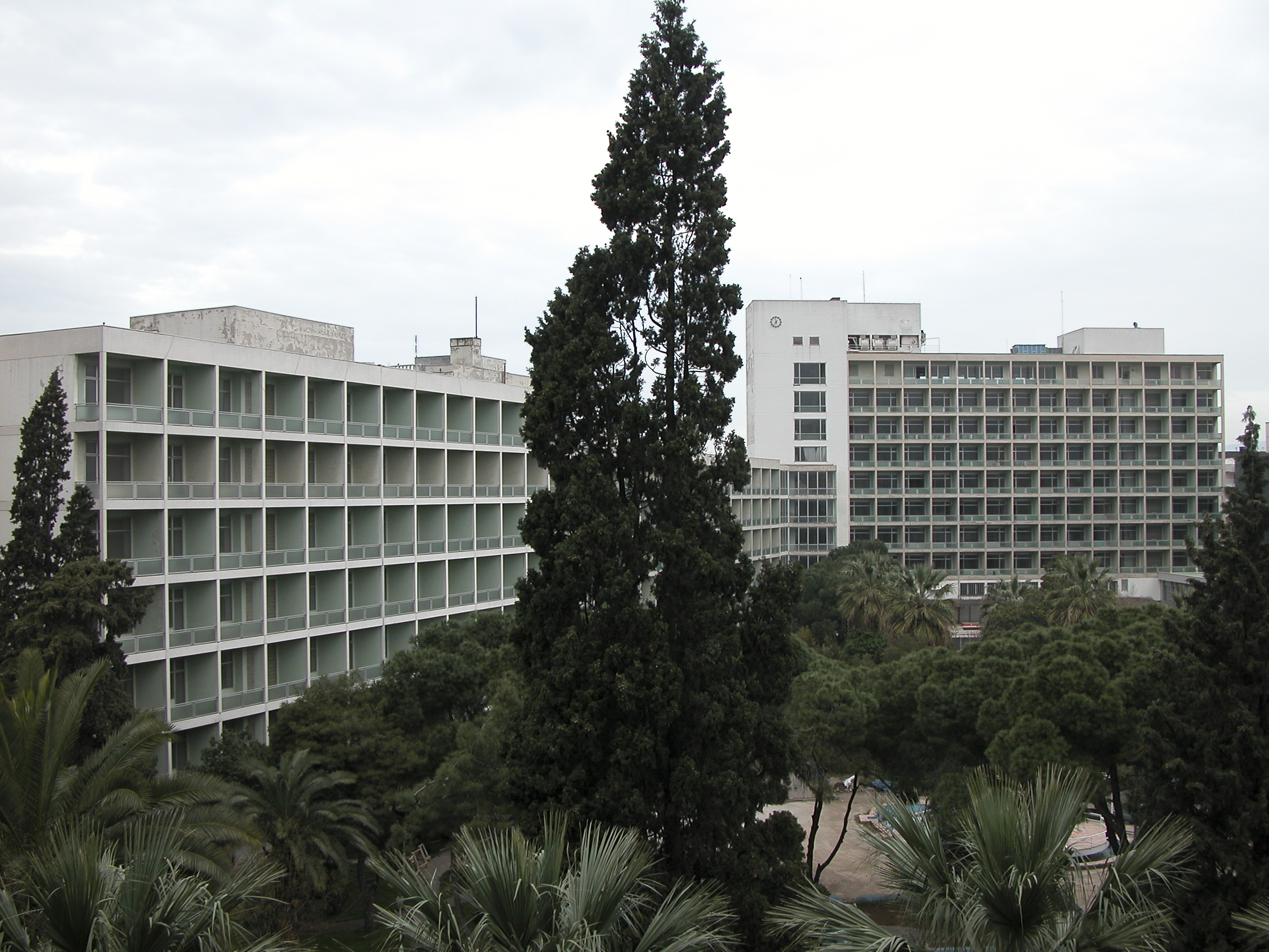
The exterior of the Hotel Karaca, as seen in the next photo, was unremarkable, but the interior more than made up for it. It was the first and probably least pretentious of the places we stayed in Turkey, but it was more than adequate.
The view from our room in the Hotel Karaca, our first accommodation upon arriving in Turkey on March 23, 2006.
From what we saw of it, Izmir appeared to be a thoroughly modern city. Appearances can be deceptive. The location has been settled since the Neolithic period, over 8500 years ago, and the city has over 3000 years of recorded history. For most of that time it has also been one of the greatest mercantile ports in the Mediterranean area. But whenever I think of Izmir/Smyrna I am reminded of Eric Ambler’s great spy novel The Mask of Dimitrios (published in the USA as A Coffin for Dimitrios). The career of the sinister title character begins in Smyrna at the time of the greatest disaster in its history, the fire which broke out after its capture by Turkish forces from the Greeks in 1922 and destroyed the Greek and Armenian quarters of the city, and the accompanying forced evacuation of the population of those quarters. Subsequently, the city was rebuilt and is now the third largest in Turkey, after Istanbul and Ankara.
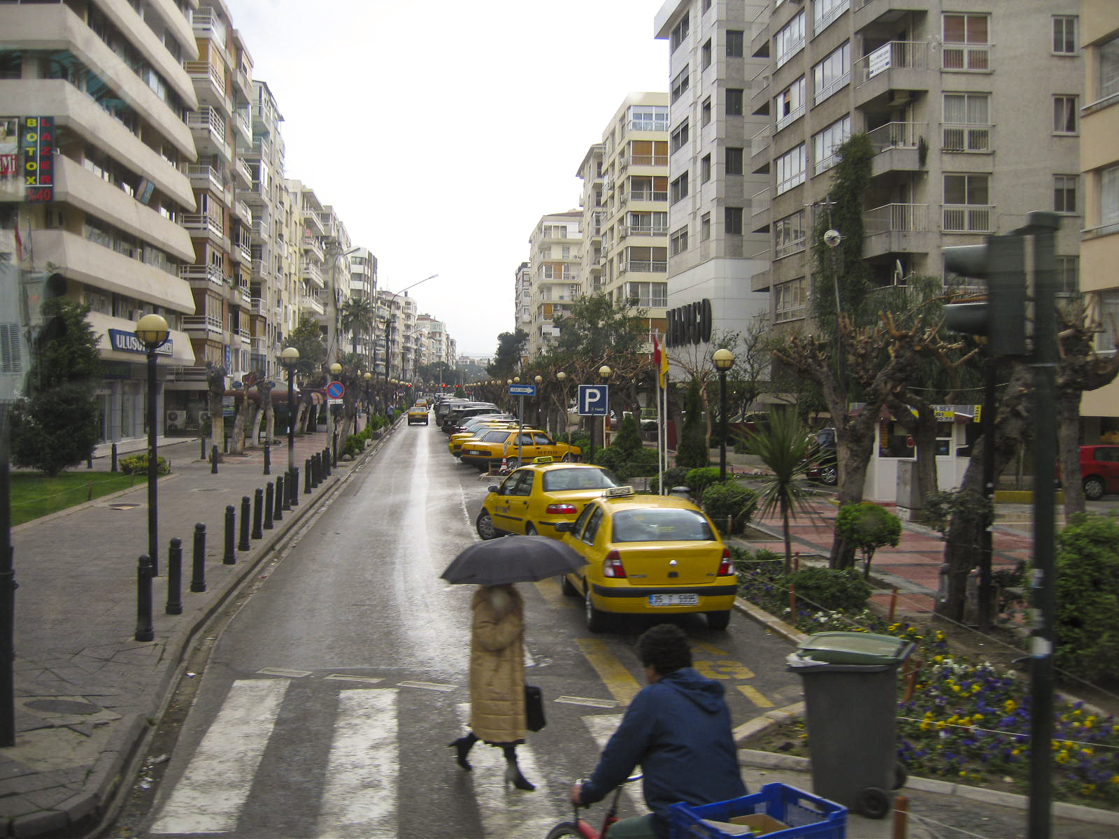
A light shower greeted us on our first day in Izmir, but it didn’t dampen our spirits.
In fact, to exterior appearances Izmir could have almost have been a city in Italy or Greece. In particular, women generally went out unveiled and unescorted, typically dressed in Levis and other trendy European clothing.
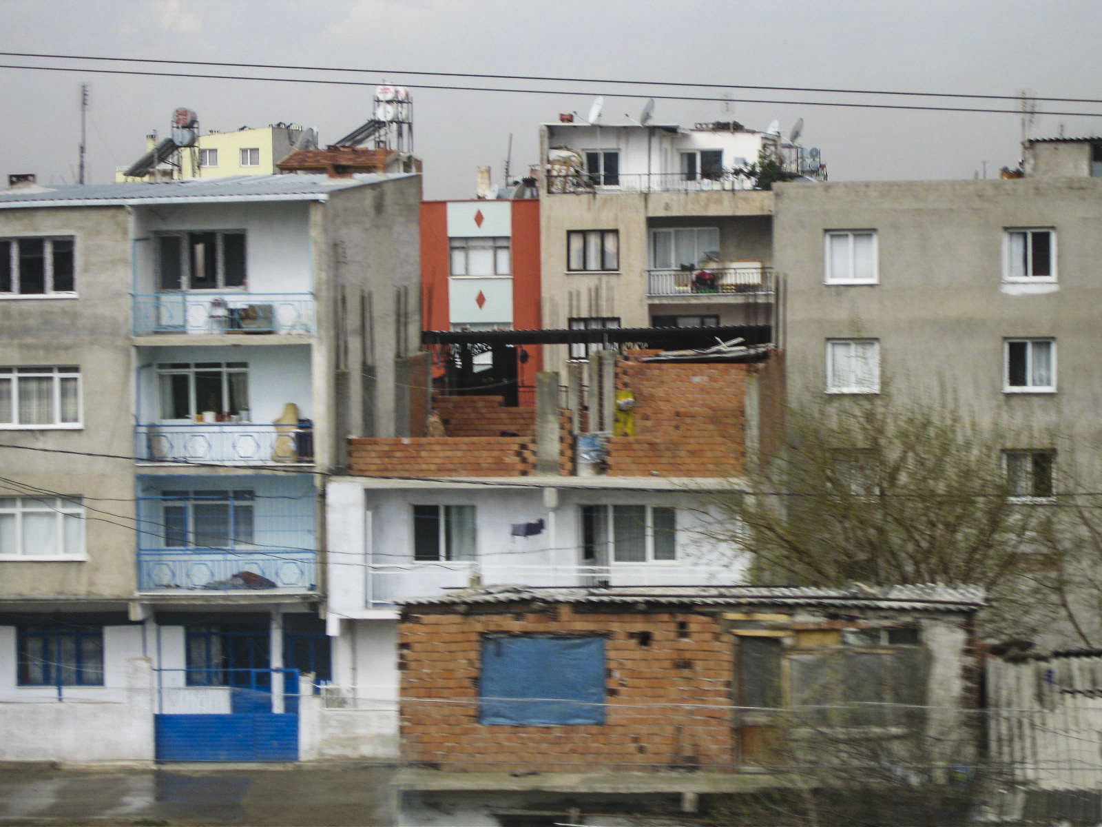
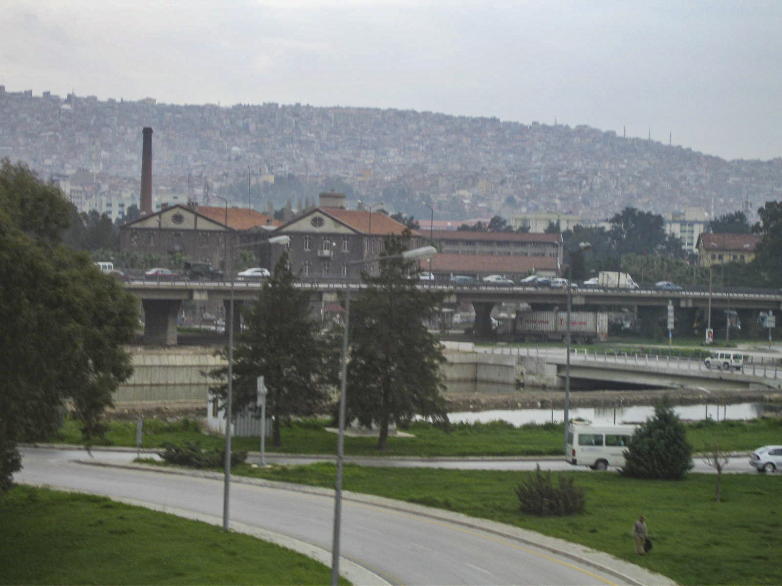
We saw very little of Izmir proper during our stay there, since we spent most of our time in Ephesus and the Aegean Free Zone. Most of our photos of the city were taken by Sandie from the bus with her versatile little Canon camera.
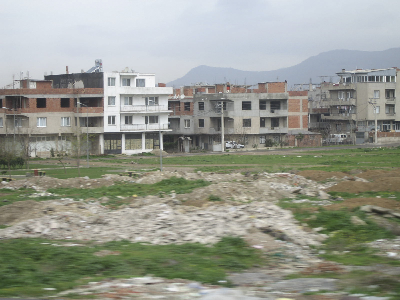
Apartment houses in Izmir. Shot from the bus by Sandie.
At the end of World War I, the victorious Allies dismembered the Ottoman Empire and parceled out its components to various members of the alliance via the Treaty of Sevres of 1920. That was how the British got the Mandate for Palestine and Iraq and the French got control of Syria and the Lebanon. The western parts of Anatolia, where Greeks had been living since time immemorial, were promised to Greece, but it didn’t work out that way. The Greek Army, anticipating the treaty, landed forces in Smyrna in 1919, but they underestimated the recuperative powers of the defeated Turks, who began a national revival under the leadership of the formidable Mustafa Kemal, later known as Ataturk. In 1922 Ataturk’s forces routed the Greeks, drove them out of Anatolia and retook Smyrna. The attendant violence and the fire which broke out four days after the Turkish capture of the city resulted in the deaths of tens of thousands of Greek and Armenian civilians, and all of the remainder who could fled. Many additional thousands, unable to find or afford passage aboard the few ships which would accept refugees, perished in the terrible conditions of those days. In Ambler’s novel, the fictional Dimitrios obtains the money to buy his passage aboard a ship in the harbor by killing a Jewish moneylender and framing a Turk for the crime. One of the non-fictional survivors was Aristotle Onassis.
A random view of the city of Izmir, shot from our bus by Sandie.Apartment houses and vacant lots in Izmir, shot from the bus by Sandie.
Following the victories of Mustafa Kemal, the new Turkish Republic founded under his leadership renounced the Treaty of Sevres, which was then superseded by the Treaty of Lausanne of 1923. By its terms Turkey retained control of Anatolia, including Izmir, and the Greek and Armenian communities which had existed there for centuries were never re-established.
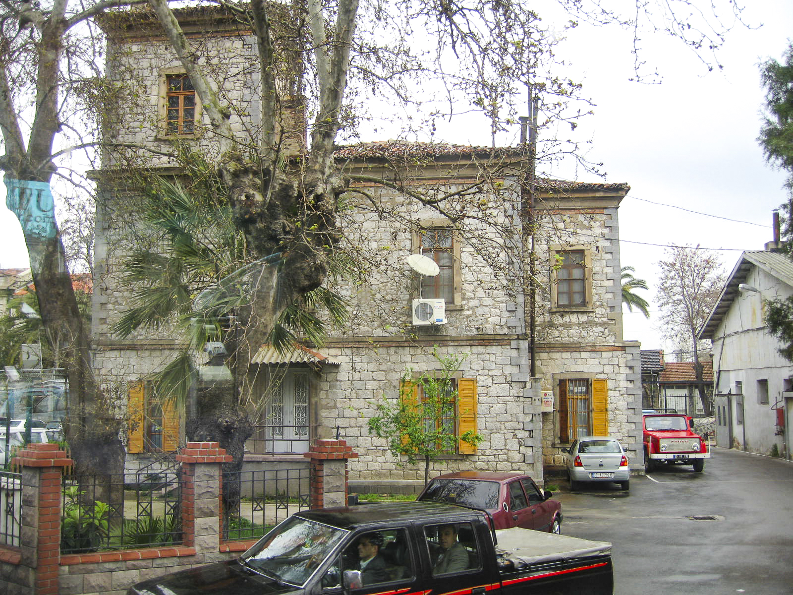
Picturesque old stone building in Izmir.
The disasters of the Greco-Turkish War caused the population of Izmir to shrink from around 300,000 to half that number, and it did not regain its former size until after World War II; but since then it has grown, largely by emigration from the interior of Turkey, to around 3 million. The city also now incorporates a number of ancient sites such as Pergamon, Sardis and Ephesus, the last of which which we visited on the following day.
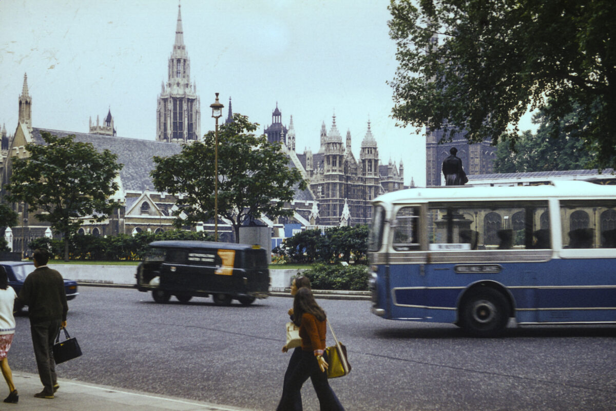
My last stop on the way home from the Soviet Union in July 1973 was London, England. I had been invited to stay with friends who were living there, in a house near Gatwick Airport to the south of London. I didn’t take many pictures during my short stay, and I have only a few to offer here.
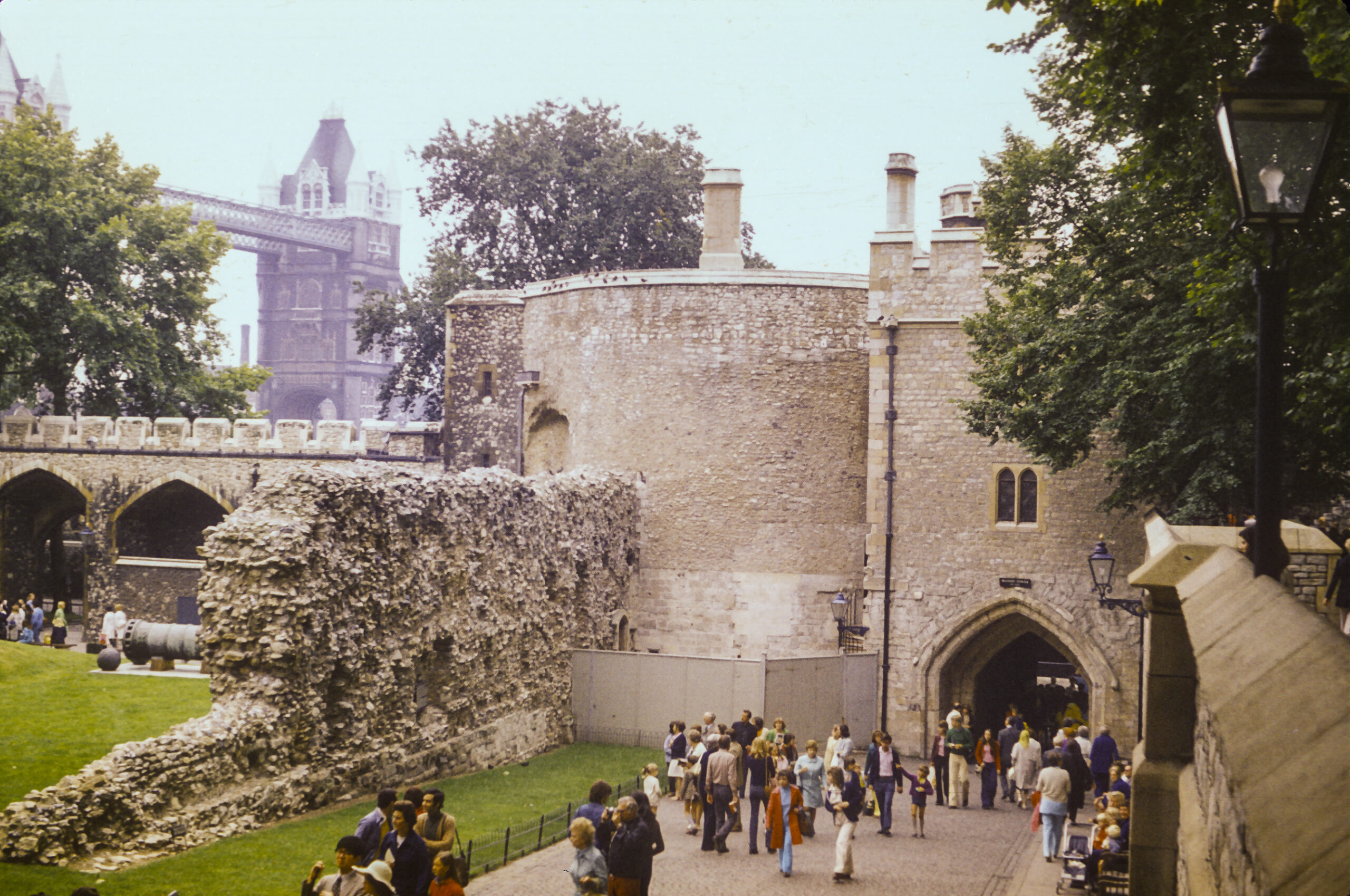
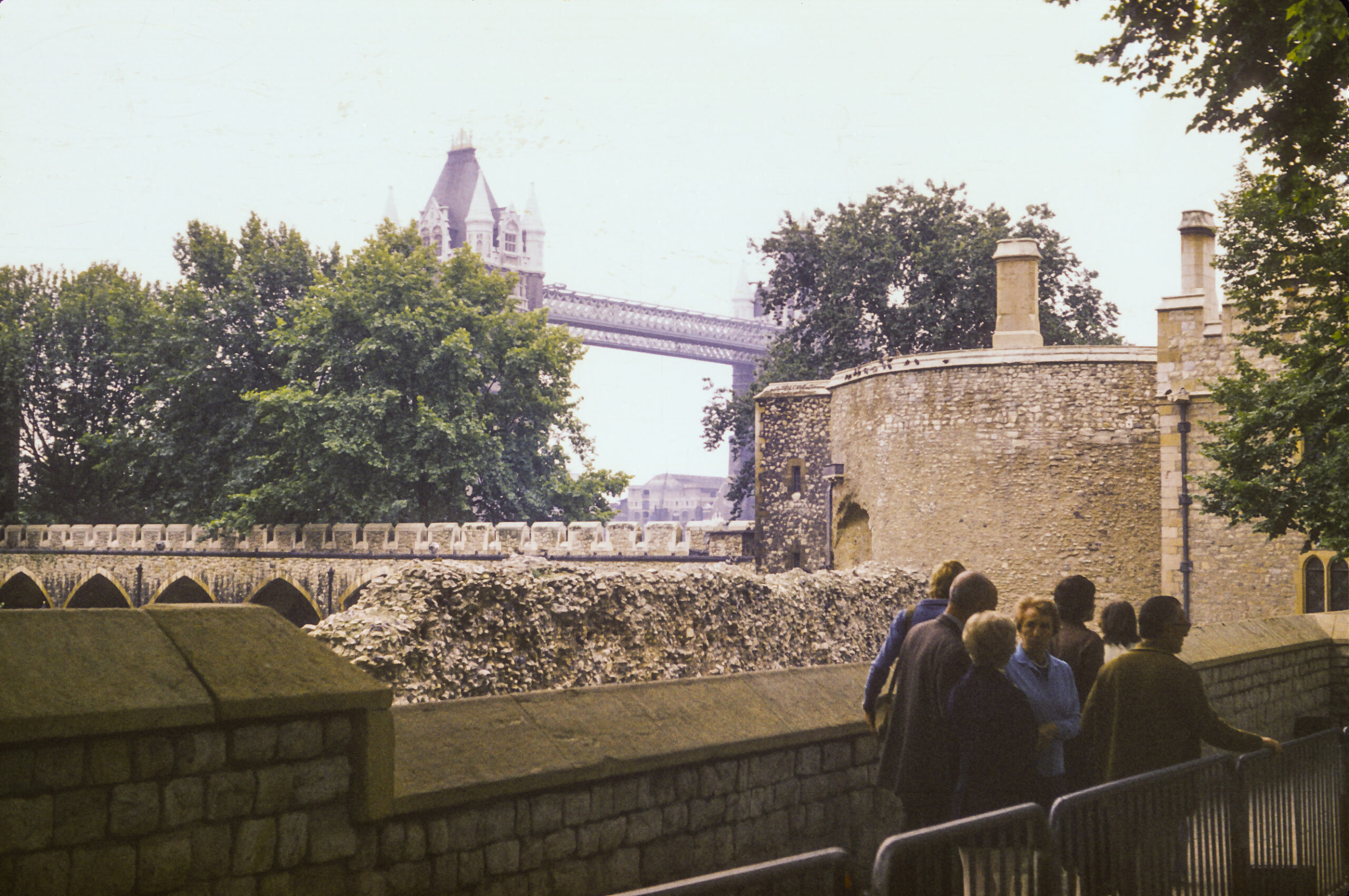
Of course I could not visit London without seeing the Tower of London, first built by William the Conqueror in 1068 and expanded during the following centuries. It has served as a royal residence and grand palace, armory, treasury, prison and public records office; it has also housed the Royal Mint and the Crown Jewels of England.
The Tower of London – Tower Bridge in background
Near the Tower of London stands the Tower Bridge. It is much newer than the Tower itself, having been built in the 19th century (1886-1894), but it is equally well-known as a landmark. It is often confused with London Bridge, but that is another bridge in a different location. That bridge, the one commemorated by the nursery rhyme, has a longer and rather interesting history, dating from Roman times. Originally it was built of wood, but under King John (who is also commemorated by a nursery rhyme, Humpty-Dumpty), a stone bridge was completed (1209). That bridge, known as Old London Bridge, lasted until the 19th century. Hundreds of houses were built upon it, and at the south end was a gatehouse where the heads of convicted “traitors” were impaled on pikes – figures such as William Wallace, Thomas More, and Thomas Cromwell.
The Tower Bridge – as seen from the Tower of London
In 1831 the Old London Bridge was replaced by the New London Bridge, which didn’t last as long. By the 1920’s it was found that the bridge was sinking by an inch every eight years, and in 1967 construction on a new one was begun; it was completed in 1973. The old New London Bridge was sold to an American businessman, Robert McCulloch. It was dismantled and shipped in pieces to Long Beach, California, whence it was trucked to Lake Havasu City, Arizona, and rebuilt over the Colorado River in 1971. It was reconstructed around a steel frame so it wouldn’t sink into the Colorado as it had in the Thames. The stones were used as cladding for the steel framework.
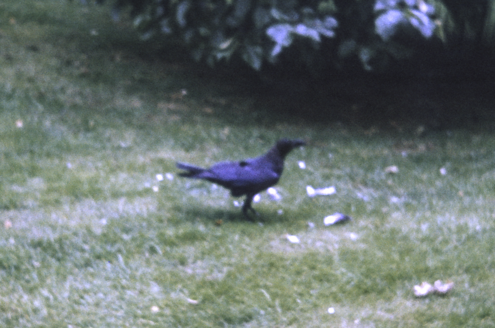
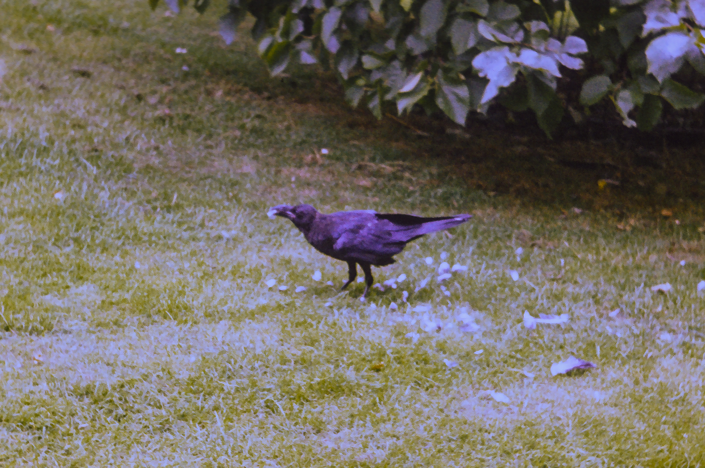
Tower Raven
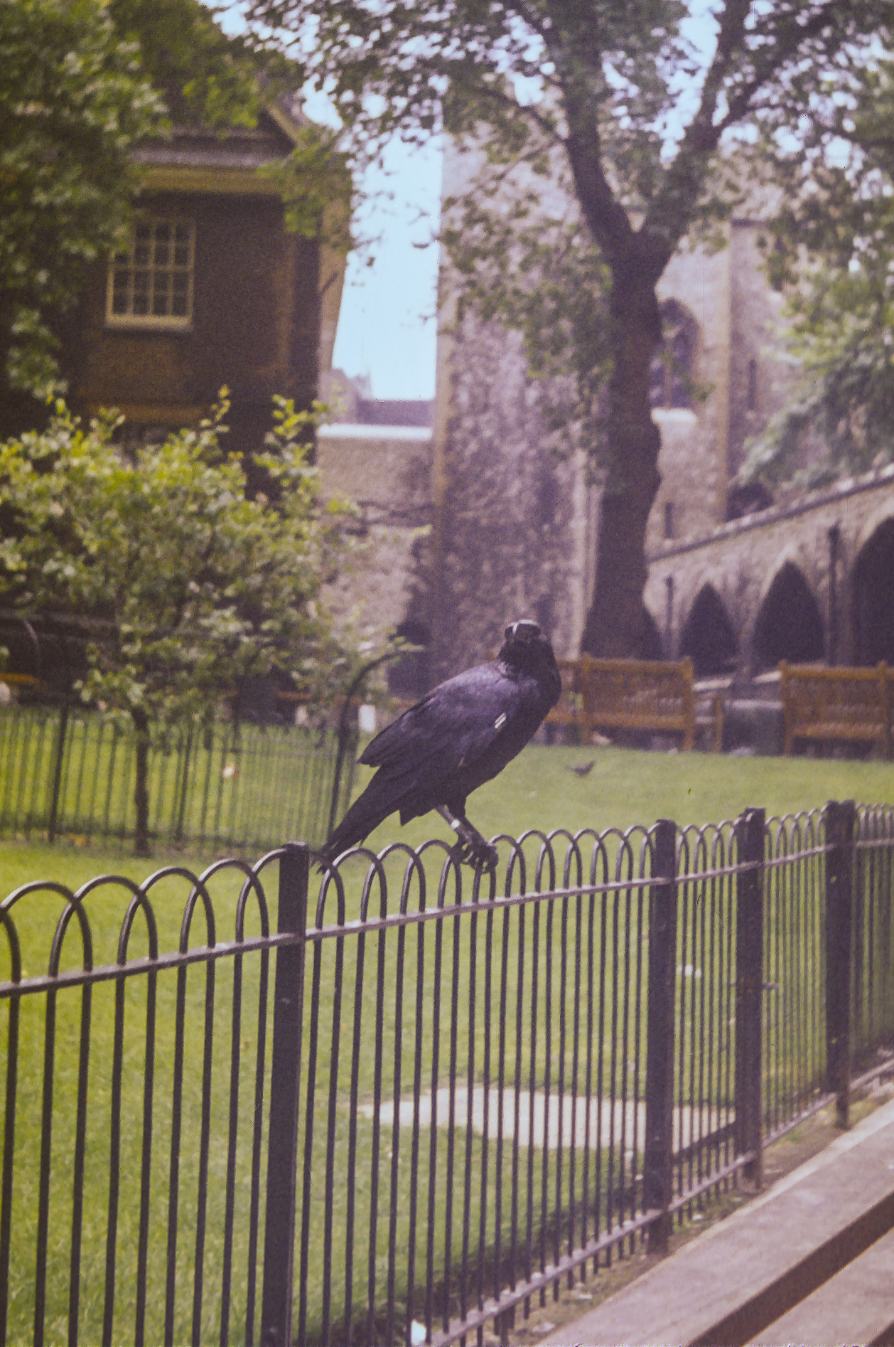
Nothing I had ever read or heard about the Tower of London prepared me for the spectacle of the Tower Ravens. These birds inhabited the garden and were quite accustomed to the presence of humans. Their wings were clipped so they could not fly far, though they were certainly able to get around the Tower grounds with ease. They were well-cared for by the custodians of the Tower; they had bands around their legs to keep track of them and were quite aware of their privileged status.
A Tower Raven enjoying its lunch in the garden.
The ravens were fractious and quarrelsome; they fought amongst one another ferociously, and at one point I saw one raven pinning another down on the ground and pecking its head like a hammer. I was not quick enough to get a picture of that episode, and when I turned back after retrieving my camera, the peckee was gone and its assailant was digging into a piece of bloody meat. I first thought with horror that the dominant bird had dismembered its victim and was eating it, but it turned out that while I wasn’t looking the victim had fled and the victor was merely enjoying chunks of meat that the keepers had thrown in the yard in the interim. But there was no doubt that these birds are rowdy characters.
The Tower Ravens had their wings clipped so they couldn’t fly away, but they could still hop on the fence
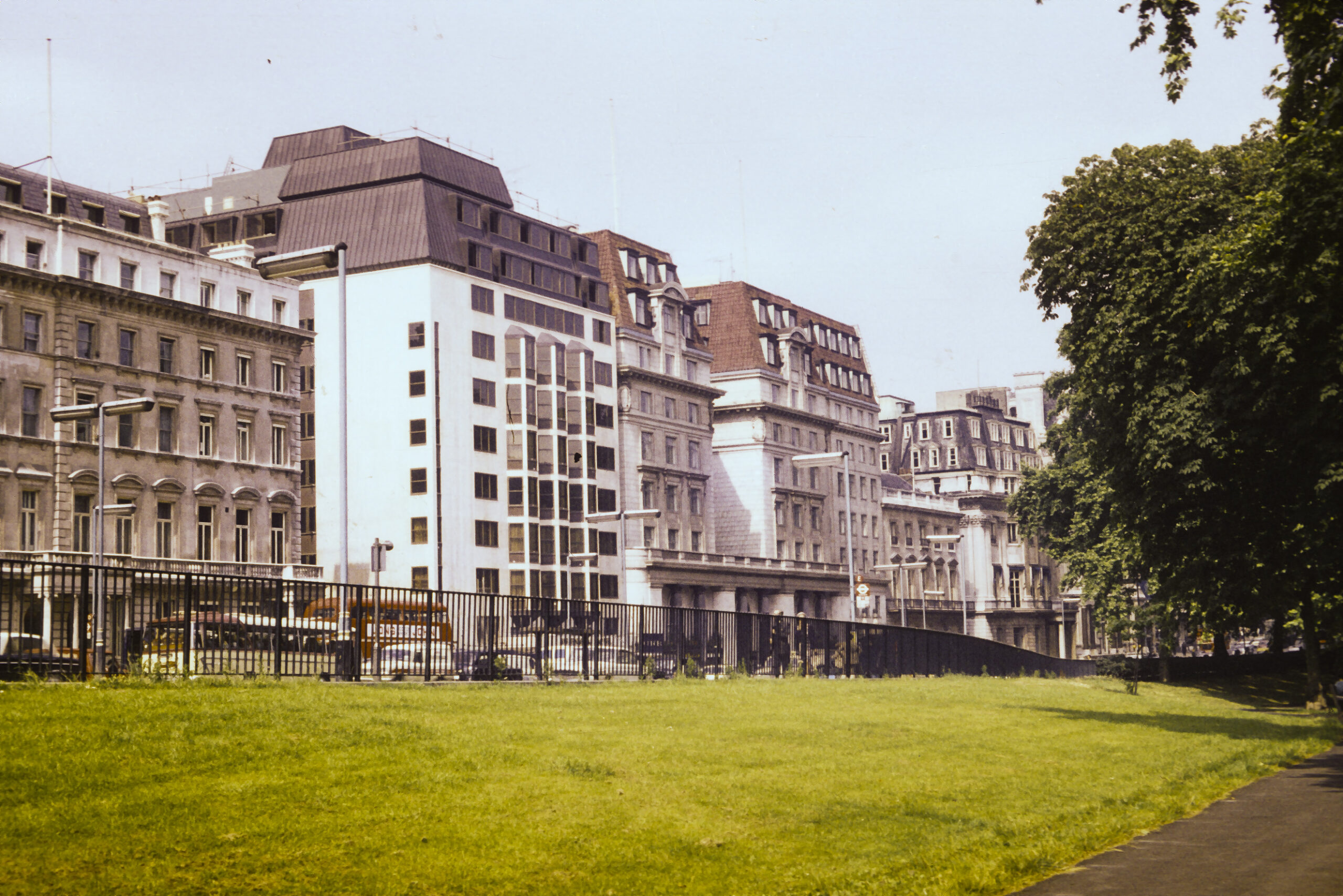
Elegant residential and office buildings facing a London park, which might have been the location of master detective Hercule Poirot’s office. Actually his office was in Florin Court, aka Whitehaven Mansions, on the eastern side of Charterhouse Square in Smithfield, London. But I didn’t know that at the time.
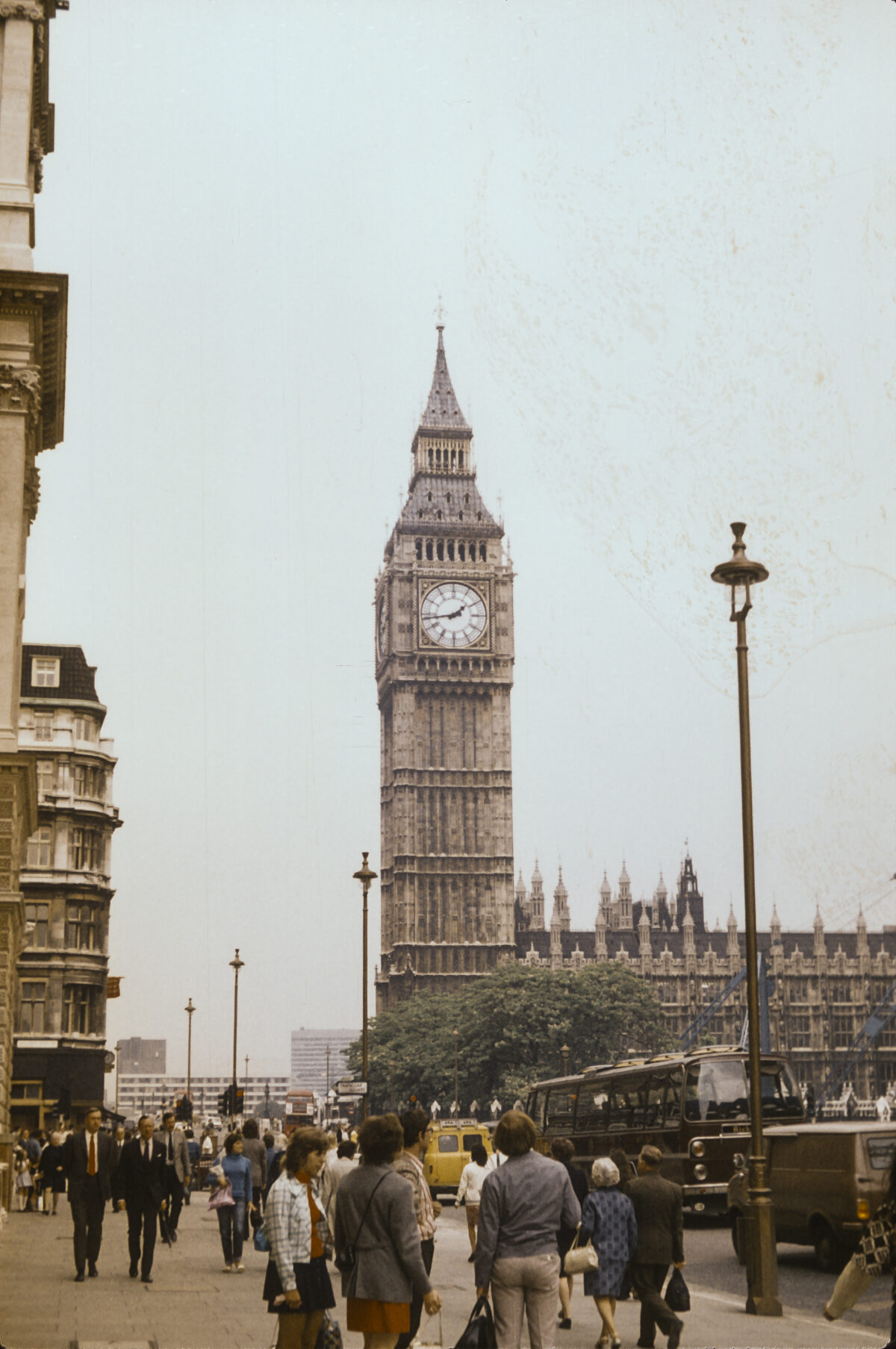
Mansard-roof office buildings in London
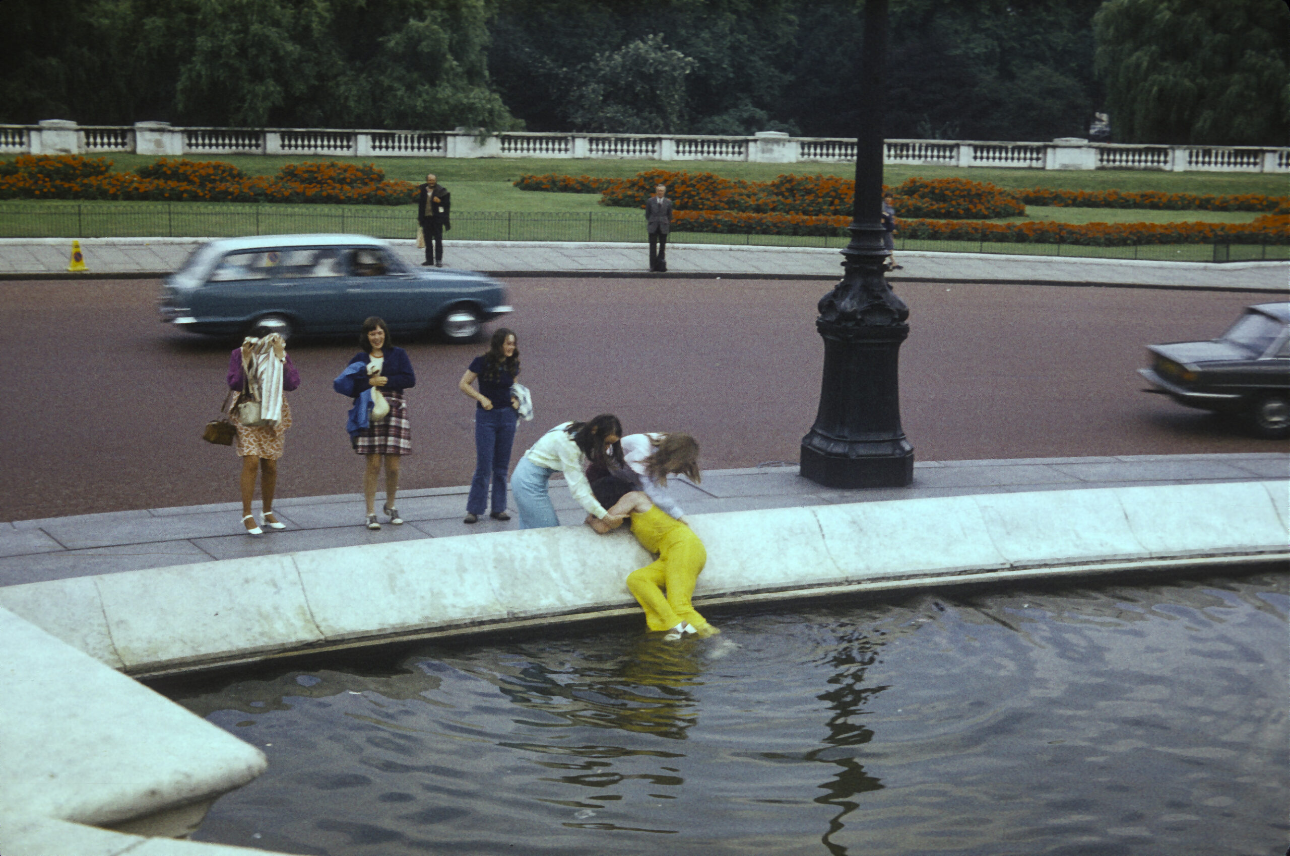
While strolling near Buckingham Palace I was witness to a scene where a girl got tossed into the pool beside Victoria Memorial by a couple of her friends, who then pulled her out, soaking wet. I called it the Case of the Drenched Debutante.
Someone got dunked in the pool at Victoria Memorial, near Buckingham Palace
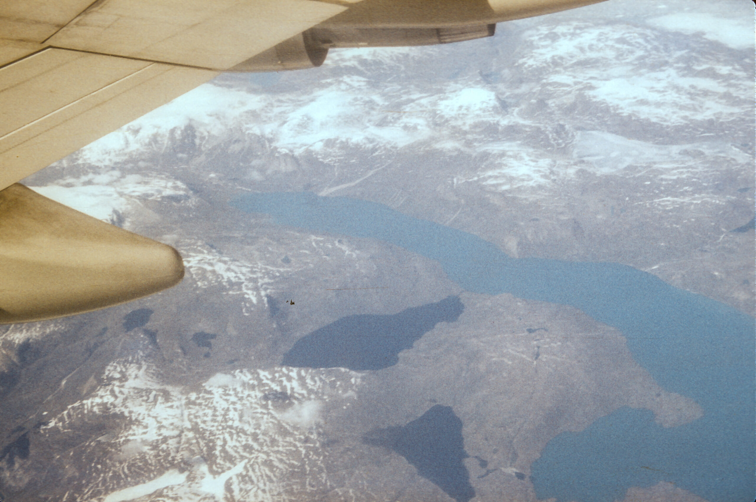
After an all-too-short stay in London, I hopped a Boeing 747 for the flight back to Los Angeles. On the way I was able to get a shot of the coast of Greenland from the plane.
The coast of Greenland, as seen from the window of a Boeing 747 en route from London to Los Angeles
The University of Bergen, founded in 1946, has 16000 students, 3000 faculty and staff, and is noted for climate research, petroleum geology (!) and medieval studies.
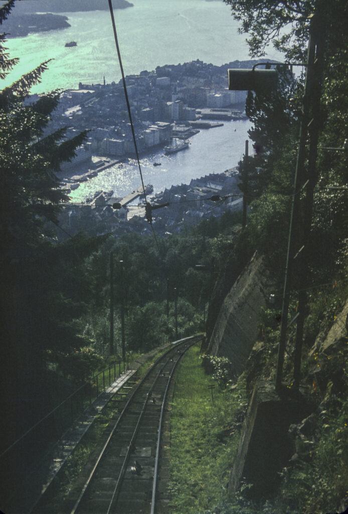
From the stop at Finse, the train embarked upon the final stretch of the Oslo-Bergen railway. First it passed through a long tunnel, then it embarked on a dizzying descent toward the city of Bergen, allowing me to get some nice photos along the way.
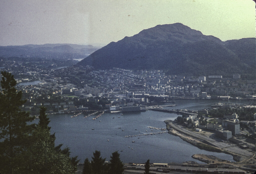
I caught my first glimpse of Bergen from the train as it descended from the mountains into the city.
Bergen is one of the most beautiful cities I have ever seen. I caught my first glimpse of it from the train on the crazy-steep descent from the mountains into the city. It has a magnificent harbor in one of Norway’s famed fjords, framed by the mountains. Fortunately I was able to get some shots from the train as it plummeted toward the harbor.
The Oslo-Bergen Railway makes a steep descent from the mountains toward Bergen Harbor.
In Bergen I stayed with Sidsel Larsen, one of the Norwegians I had met in the Moscow University dormitory, and she showed me around the city and its environs, starting with the harbor. In Bergen the harbor is ubiquitous; you cannot overlook it. For its entire history Bergen has been a maritime commercial city, as it is today. It was founded in 1070 and grew to be the largest city in Norway, which it remained for centuries until it was overtaken by Oslo in the nineteenth century, and for a while in the 13th century it was also the capital of Norway. It also became an outpost (kontor) of the Hanseatic League, the commercial and defensive confederation of merchant guilds and market towns that dominated trade in medieval northwestern Europe.. (The great medieval city-republic of Novgorod in Russia also hosted a kontor of the Hanseatic League, and I presume that is where the Russian word kontora, meaning office, came from.)
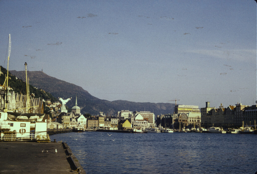
In the medieval period Bergen became a great entrepot for the export of cod caught in north Norwegian waters to the rest of Europe, and was granted a royal monopoly on the trade. The Hanseatic merchants came to Bergen each summer to buy fish from the fishermen from the north; they had their own separate quarter of the town, next to the wharf where their ships docked, which is called Bryggen; it is visible in the picture below.
Part of Bergen Harbor, with the Old Wharf (Bryggen), Schøtstuene (Hanseatic assembly hall, now a museum) and Holy Cross Church at left. On the right is an open-air fishmarket.
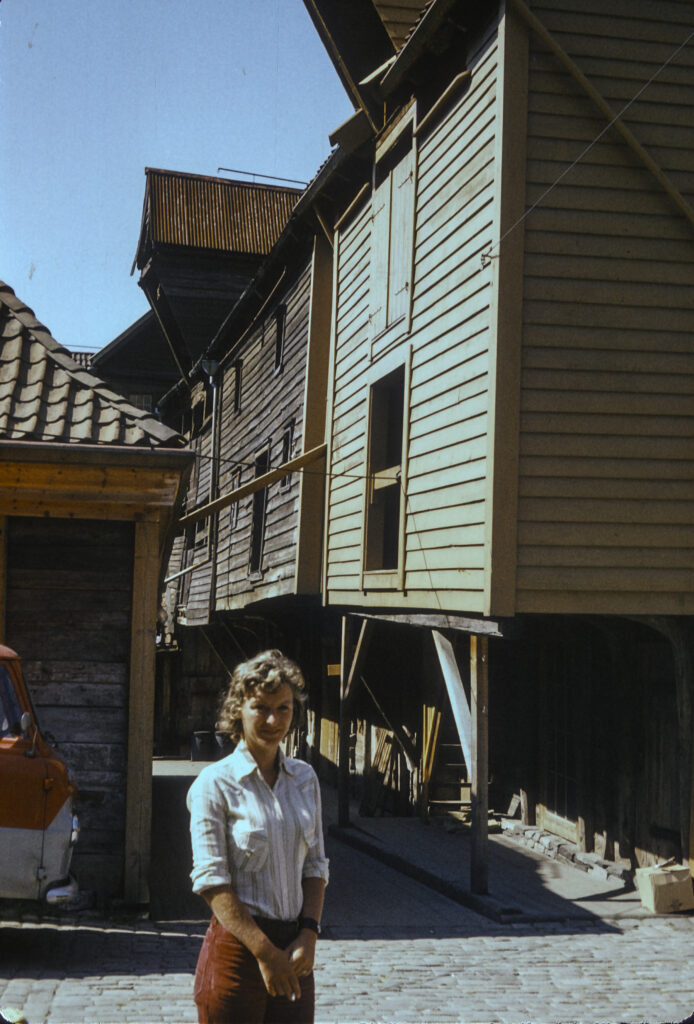
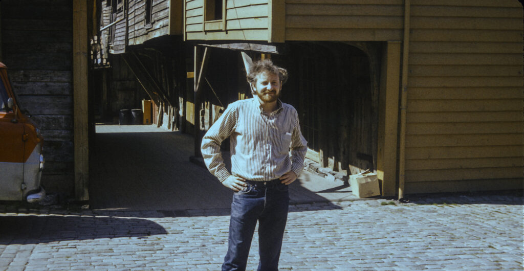
Sidsel Larsen took me on a walking tour of the Hanseatic Quarter. I was struck by the excellent state of preservation of the warehouses and other buildings. It turns out that they are not the originals; Bergen, like many other Scandinavian and Russian towns, was built almost entirely from wood in premodern times and was subject to terrible fires, the worst of which, in 1702, burned down 90% of the city. The structures I saw have all been built since then, and many of them rebuilt and restored multiple times. Nevertheless they are mostly authentic.
Sidsel Larsen, my hostess in Bergen, poses in front of some of the old Hanseatic warehouses in Bergen.
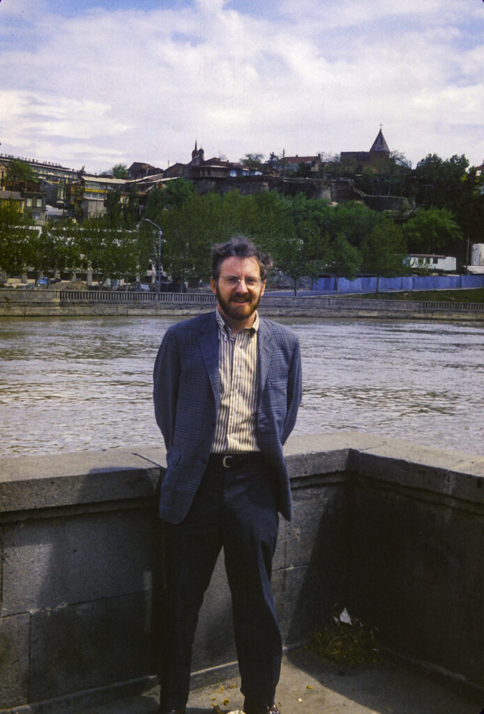
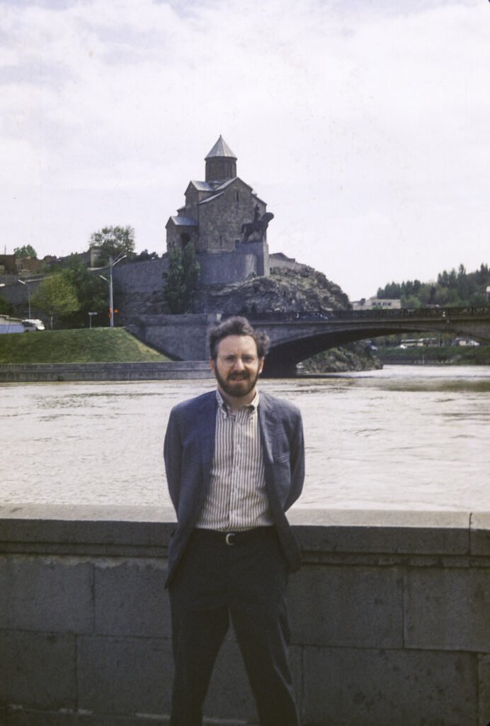
Oh NO! The disheveled ruffian has popped up again in Bergen! How did he follow me all the way from Tbilisi!
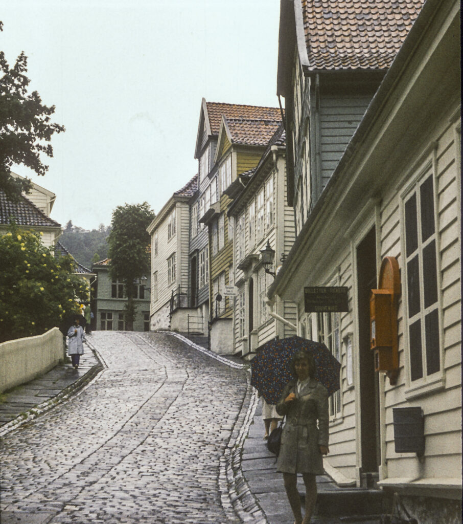
Bergen is one of the rainiest cities in Europe; the mountains surrounding it cause the moist incoming air from the Gulf Stream to rise, cool and precipitate their moisture onto the city. We had to take umbrellas everywhere and frequently found ourselves sheltering from the showers.
Sidsel Larsen shelters under an umbrella as we explore the old Hanseatic district of Bryggen.
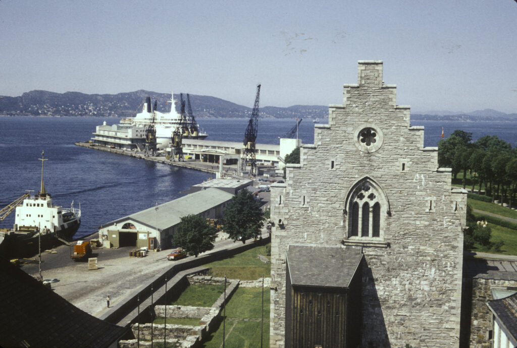
One exception to the predominance of wood construction in the medieval city was the Bergenhus Festning, a stone fortress (Fortress) guarding the entrance to the harbor, dating from the 1240s. It contains a tower called the Rosenkrantztårnet, which we were able to climb and get a great view of the city from. I also looked for a Guildensterntårnet, but couldn’t find one anywhere.
Harbor scene shot from an upper story of the Rosenkrantztårnet in Bergenhus Fortress. Visible in the foreground is Hakonshallen, the royal residence when Bergen was the capital of Norway. A cruise ship is docked at a pier in the background.
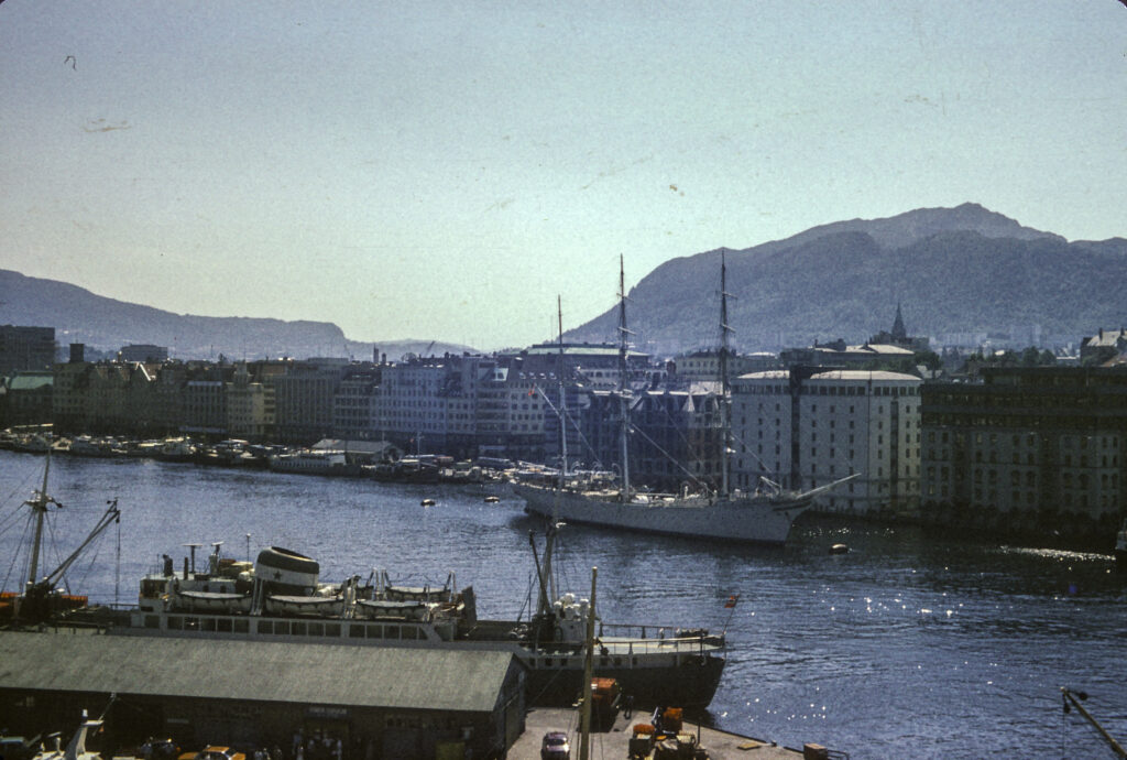
On the other side of the harbor, I saw the Norwegian Navy’s latest hi-tech dreadnought, the Statsraad Lehmkuhl, a three-masted barque which is actually used as a training ship for Norwegian naval cadets. It has an interesting history. It was originally built in 1914 as a training ship for the German merchant marine, under the name Grossherzog Friedrich August. At the end of the First World War the victorious British took it over as war booty, but then sold it in 1921 to a former Norwegian cabinet minister named Kristofer Lehmkuhl, who renamed it after himself (Statsraad = “cabinet minister”), and who donated it to his eponymous foundation. In World War II the Germans repossessed it when they invaded Norway, but of course they had to return it to the Norwegians upon being defeated. The Statsraad Lehmkuhl Foundation now contracts it out, mostly to the Norwegian Navy, but also upon occasion to other customers, including, ironically, the German Navy. Although I did not get a chance to board it during my visit to Bergen, years later the ship put in at Long Beach Harbor during a round-the-world summer cruise, and I was able to tour it then.
The latest advanced battleship of the Norwegian Navy, the 3-masted sailing ship Statsraad Lehmkuhl, docked in Bergen Harbor. Actually this was and is used as a training ship for naval cadets.
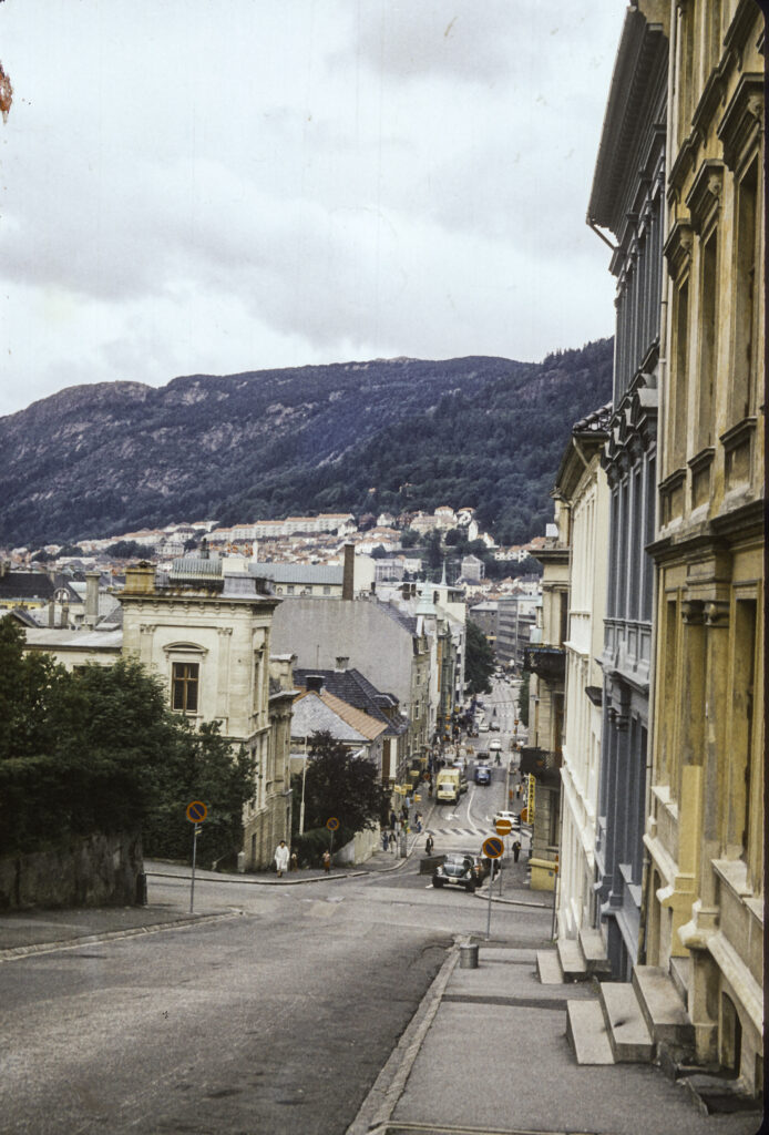
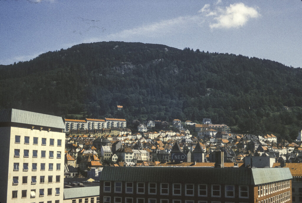
Bergen is a city built on hills. The seventeenth-century writer Baron Ludvig Holberg, who was born in Bergen, decided that since Rome was built on seven hills, Bergen must be the same. Unfortunately, there is much disagreement as to which ones are to be included in the seven or whether that is really the correct number – many would argue for nine. I think it’s a silly controversy, and the operative maxim is that Bergen is a city of very uneven terrain, with lots of hills and grades. If you like San Francisco, you should feel right at home in Bergen. And I did.
Bergen has a lot in common with San Francisco and other cities built on hills by the sea.
There is a caveat about that, though, which is that I visited Bergen in the summer; in the winter it gets a lot of snow – something you don’t see much of on the California coast. Be that as it may, the two most prominent mountains around Bergen are Ulriken and Fløyfjellet or Fløyen – the second is of course named after me. Fløyen is on the north side of the city, Ulriken to the east; Ulriken is the higher at 643 metres (2,110 ft), Fløyen comes in at 400 m (1,300 ft) above sea level. Both have aerial tramways running to the top. I’m not sure which one appears in the picture below.
An aerial tramway runs to the top of this mountain peak above Bergen.
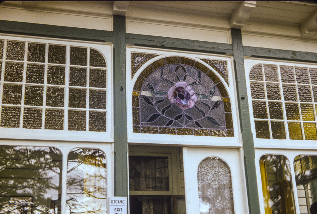
Perhaps the most illustrious native of Bergen is the composer Edvard Grieg (1843-1907), who composed the music for my favorite play, Henrik Ibsen’s Peer Gynt. (Ibsen, a contemporary of Grieg, came from the town of Skien in Telemark, in eastern Norway.) So it was a big thrill when Sidsel took me on an excursion to Grieg’s house and estate, Troldhaugen (which translates, appropriately for a fan of Peer Gynt, as “Troll’s Hill”). Now, as in 1973 when I visited, it is the Edvard Grieg Museum. When I visited the house itself served as the museum; in 1993 a separate structure was built to house the museum. The house has been described as “a typical 19th-century residence with panoramic tower and a large veranda,” which doesn’t do it justice. Built in 1885, it’s a beautiful late 19th-century house exhibiting not only outstanding craftsmanship but deft artistic features, most notably the wonderful stained glass transom window above the front door.
Entrance to Edvard Grieg’s house, focusing on the beautiful stained-glass transom window above the door.
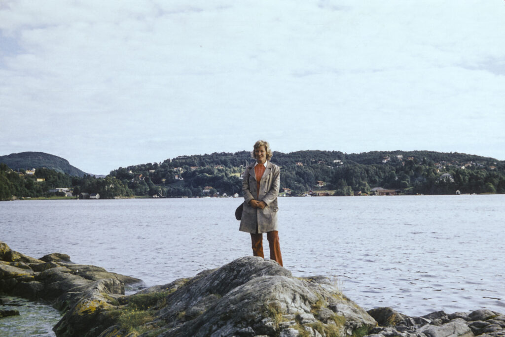
The Troldhaugen estate is situated on a small peninsula of a large lake or inlet from the ocean, with a jetty projecting into the water.
Sidsel Larsen pauses for a picture during our tour of Grieg’s estate.
We scrambled out on the jetty and took pictures of the lovely setting, which were again infiltrated by the ragged rapscallion who had followed me all the way through the Soviet Union.
While exploring the grounds of Grieg’s estate, we were again accosted by our pestiferous vagabond, who appeared out of nowhere.
Grieg and his wife Nina were Unitarians. Upon his death in 2006, Grieg was cremated, and his ashes were interred in a crypt in the side of a hill near his house. His wife Nina moved to Copenhagen after his death, but when she died, she also was cremated and her ashes placed beside her husband’s. Strolling around the estate, we encountered the hillside crypt where their remains are interred.
The final resting place of Edvard Grieg and his wife Nina.
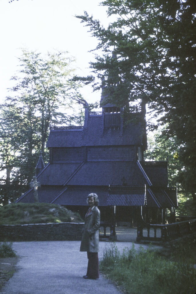
Returning to Bergen, we visited the Fantoft Stave Church. It had originally been built around 1150 at the village of Fortun, near the eastern end of Sognefjord, Norway’s longest and deepest fjord, about 60 miles northeast of Bergen. In 1879 a replacement church was built, and the original was slated for demolition, but was saved by a Norwegian businessman who had it disassembled and moved to Bergen, where it was reassembled.
In 1992, l9 years after I visited the Fantoft Stave Church, it burned to the ground. The cause was determined to be arson. A series of other Norwegian stave churches were also torched, and the police arrested and charged a man named Varg Vikernes with starting the fires. Vikernes was (and is) an interesting, though unsavory, character. He was born in 1973, the same year I visited Bergen. In the early ’90s he became an influential member of the Norwegian black metal scenc. Black metal (most readers will probably know this, but I did not, having never paid much attention to such matters) is an extreme type of heavy metal music, characterized by “fast tempos, a shrieking vocal style, heavily distorted guitars played with tremolo picking, raw (lo-fi) recording, unconventional song structures and an emphasis on atmospheres.” Many black metal artists paint themselves up as corpses and adopt pseudonyms. They also tend to espouse fringe viewpoints and ideologies, including extreme anti-Christian views, Satanism, ethnic paganism, and neo-Nazism. Some of them are fascinated with the lore and imagery of J. R. R. Tolkien’s Middle-Earth. Varg Vikernes was such a person. In 1991 he founded a one-man band named Burzum, which is the word for Mordor in the language of that land, which was the abode of Sauron the Great, the evil arch-villain of Middle-Earth and his minions, the orcs. Vikernes had previously been a member of a band called Uruk-hai, a name for a particularly nasty type of orc. He also took the stage name Grishnakh, from one of the orcs in The Two Towers. He flirted with neo-Nazism in his teenage years, and later developed his own ideology, which he described as “Odalism,” a fusion of paganism, traditional nationalism, racialism, environmentalism, simple living, self-sufficiency, and opposition to anything he deemed a threat to his vision of a pre-industrial pagan society, e.g. Christianity, Islam, Judaism, capitalism and materialism.
On August 10, 1993, Vikernes murdered his fellow-musician Øystein “Euronymous” Aarseth, one of the founders of the black metal “scene,” in circumstances that have never been completely clarified (Vikernes claimed self-defense). On August 19, Norwegian police arrested him for the murder of Euronymous, the arson burnings of Fantoft and several other churches, and the theft and possession of 150 kilograms of explosives which were found in his home. (He may have been planning to blow up a leftist enclave with the explosives, but this has never been proven.) In 1994 he was convicted of most of the charges, including the burning of some of the churches, but was somehow found not guilty of torching the Fantoft church. He was sentenced to 21 years in prison, the maximum penalty under Norwegian law (this was also the sentence passed on the mass murderer Anders Breivik), but he was released on parole after 15 years. He eventually moved to France, where he got in trouble with the French police for inciting hatred against Jews and Muslims.
However, in the end the mad vandalism of Vikernes failed in its intended purpose, at least in the case of the Fantoft Stave Church. Work on reconstruction of the church began soon after the fire and was completed in 1997. The restored church now has a security fence around it to impede recurrences of the 1992 attack. The picture below, of course, shows the church as it appeared in 1973.
Sidsel Larsen at the Fantoft Stave Church, an 1879 replacement for a medieval stave church built around 1150.
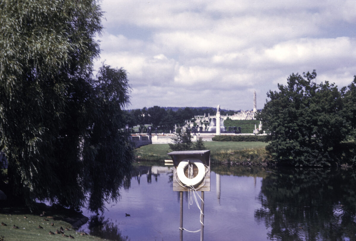
Vigeland Sculpture collection as seen across Frogner Pond, Frogner Park, Oslo, Norway.
I left the Soviet Union in July 1973. Living in the Moscow State University dormitory, I had struck up friendships with a number of visiting foreign students, including several Norwegians. I was not homesick, and I knew I would not have a chance to travel again for a while, so it was perhaps not strange that I decided to prolong my year abroad by making a detour via Norway instead of flying directly home.
My first stop was Oslo, where I stayed with a Norwegian lady named Eva, who showed me around the city. Oslo is of course the capital and largest city in Norway, with a population of over a million. It was founded in the eleventh century, at the end of the Viking Age, when Norway converted to Christianity, and the city celebrated its millenium in 2000.
Eva showed me around the city, taking me first to Frogner Park, the largest park in Oslo and also Norway’s largest tourist attraction. It was originally part of an estate called Frogner Manor, established in the eighteenth century. The manor house still stands and now houses the Oslo Museum. The park is also the location of the Vigeland Sculptures, a collection of 212 granite and bronze sculptures designed by Gustav Vigeland (1869-1943). This encompasses some of the most original and imaginative creations I have ever seen and makes Frogner Park worthy in itself of a visit to Norway.
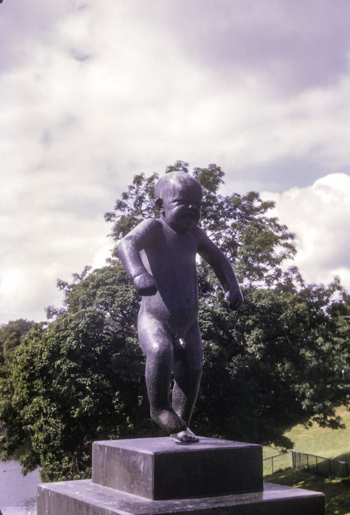
The sculptures occupy 80 acres of the park and are distributed along an 850-meter (2790 ft.) axis, starting at the main gate on the east. From there one crosses the 15 meter (49 feet) wide Bridge over Frogner Pond to arrive at the Vigeland Fountain, 100 meters (328 feet) west of the gate. The Bridge is lined with 58 statues, the most famous of which is the Angry Boy, depicting a toddler having a temper tantrum. I prefer to call it the “Screaming Spoiled Brat Having a Tizze” statue. Unfortunately, when I photographed it the light came from in back of it, making the Brat’s face difficult to see. You can see a better shot of it in the Wikipedia article on Frogner Park.
The Angry Boy (Sinataggen) statue in Frogner Park, Oslo, Norway.
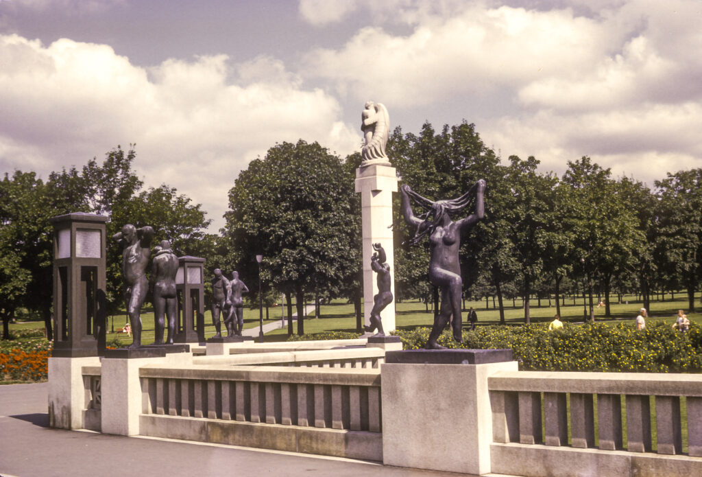
Like the Angry Boy, all the statues in the park depict naked people, both men and women, adults and children. Many of them are engaged in ordinary human activities such as walking, running, dancing, hugging, etc.; but some also represent more abstract conceptions. Some are pensive or placid, others are more animated and dynamic, some are surreal, a few are even violent. The next photo captures the full range: on the left is a group engaged in low-key activities; on the right, a woman dancing and pulling her hair out; behind her, in front of the white column, a man bouncing a small boy on his shoulders; on the column itself, a man fighting a huge lizard.
Dancing Young Woman sculpture in Frogner Park, with Old Man Holding Little Boy behind her, and others in background, including Man Fighting with Lizard on top of column.
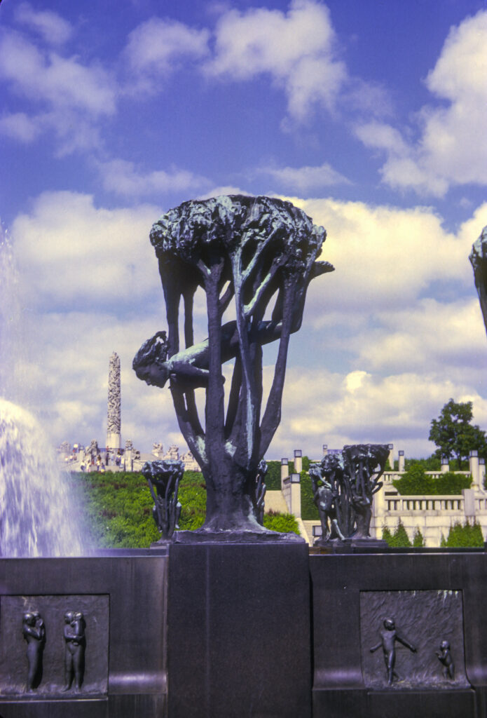
Sometimes I found it hard to figure out what the people depicted by the statues were supposed to be doing. For instance, the girl in the next picture might be swimming, but if so she appears to be doing so in a tree. One web page I came across calls it “Dreams and Flights of Fancy.”
I didn’t know what to make of these sculptures surrounding the fountain, which all seem to depict people caught in trees. The one in front, which I call “Falling Woman,” was one of the more interesting.
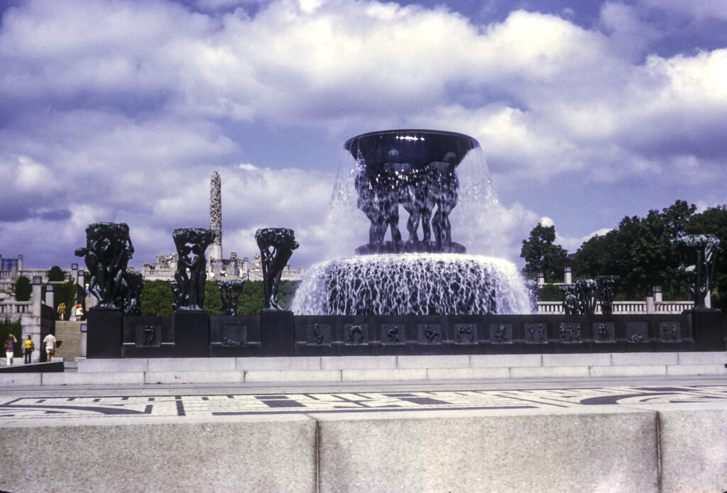
This was just one of 20 sculptures surrounding Vigeland’s Fountain, all depicting people involved with trees. According to the museum’s web page, “The tree groups represent a romantic expression of Man’s relationship to nature. They also form the setting for life’s evolving stages, stretching from childhood and adolescence through adulthood to old age and death.” The Fountain itself is a giant bowl held up by six men, who, according to the fountain’s web page, “representing different ages, may be interpreted as toiling with the burden of life.”
Vigeland’s Fountain, Frogner Park. Each of the 20 sculptures surrounding the fountain represents a different stage of human life, from childhood to death.
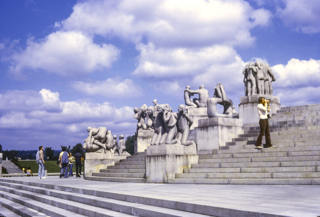
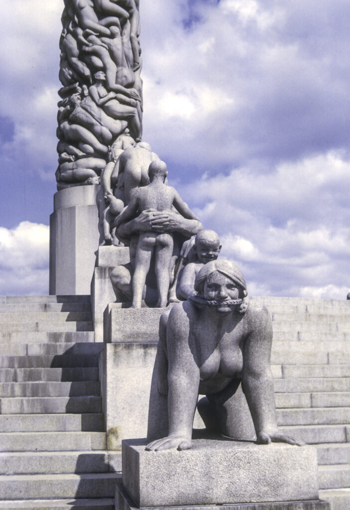
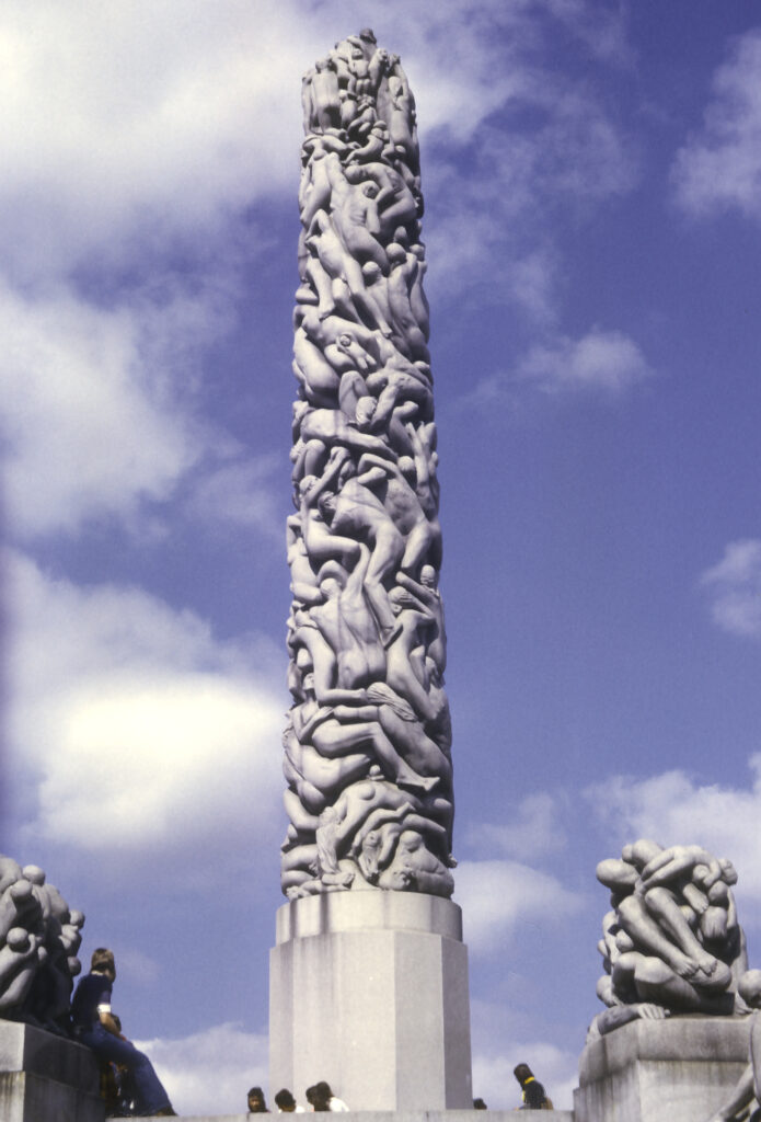
As you can see from the following photo, beyond Vigeland’s Fountain lies the centerpiece of Frogner Park, the Monolith. As you approach the Monolith, you climb a granite staircase festooned with statues of groups of people in all kinds of poses, some rather bizarre.
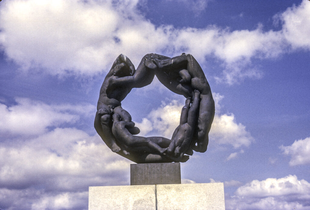
Surrounding the monolith, and scattered throughout the park, are a variety of sculptures depicting naked human bodies — male and female, young and old — in a vast spectrum of activities and relationships. Frogner Park, Oslo, Norway.
One of my favorites was a woman on her hands and knees, bearing a child on her back. Apparently they are playing horsey, with the child using a braid of the woman’s hair as a bridle, which also serves as a gag, while the child’s expression is one of sadistic delight. It all serves to convey the notion that motherhood turns women into beasts of burden, who are supposed to accept their lot meekly and in silence.
The foreground statue represents a woman on all fours, apparently harnessed with a bridle that also serves as a gag, carrying her gleefully callous child on her back.
The Monolith towers 46.12 meters – 46.32 feet – over its plaza and resembles a giant granite totem pole, with 121 human figures entwined in it, all seeming to struggle to get to the top.
According to the Vigeland Museum’s Monolith web page, “The sculpture depicts 121 human figures clinging and floating together. There are women and men of different ages, and the top of the Monolith is crowned with children. The sculpture has been interpreted as a kind of vision of resurrection, and our longing and striving for spirituality.”
Vigeland began designing the monolith in 1919 and continued working on it for the rest of his life. Construction actually began in 1927 when a huge granite block was brought to the site and a shed erected over it to protect the workers from the elements. Three stone masons worked on transferring the design from plaster to stone from 1929 to 1943. Vigeland, who died in 1943, did not live to see the unveiling of the Monolith to the public; this occurred in 1944, oddly enough during the Nazi occupation. Apparently the Germans were not hostile to Vigeland’s work, nor he to them, and some critics considered his designs to be an expression of Nazi or Fascist esthetics. Personally, I didn’t find that to be the case.
The Monolith, Frogner Park. Carved out of one enormous piece of granite 46 feet tall, this monument depicts 121 figures climbing in and around each other, all fighting their way to the top.
At the west end of the sculpture area stands the Wheel of Life, carved in 1933-34, depicting four adults, a child and a baby linked together in a circle.
The Wheel of Life sculpture
Not very far from Frogner Park, on the Bygdøy peninsula, I visited two fascinating museums, the Vikingskiphuset (Viking Ship Museum) and the Norsk Folkesmuseum, or Norwegian Museum of Cultural History. The former houses three famous Viking-era burial ships, named for the places at which they were excavated – Oseberg, Gokstad and Tune. Because I didn’t have flash equipment, I didn’t take any pictures of the ships, which are housed indoors. But the museum web site has plenty of them.
The Norwegian Museum of Cultural History, however, has a number of outdoor exhibits; in fact it claims to be the world’s first open-air museum, having been founded in 1881. It has extensive collections of artifacts from all regions of the country, including 150 buildings relocated from towns and rural districts. The centerpiece is the Gol Stavkirke, a wooden church originally built in the town of Gol sometime between 1197 and 1216, but disassembled, brought to Oslo and re-erected in 1880. Stave churches, a type of wooden church commonly built in northwestern Europe in medieval times, replaced an older type, the post church, in which the posts – the vertical timbers supporting the walls and roof – were sunk directly into the ground, making them vulnerable to rot and insects, whereas in the stave church the posts rested on stone foundations, affording better protection from decay. I have always been struck by the resemblance between the Norse stave churches and some types of Russian wooden churches such as those at Kizhi, on Lake Onega in Karelia. I wonder whether the similarity is the result of influence or convergent development.
Gol stavkirke – Stave Church originally built in Gol in the early 13th century; disassembled and rebuilt in Oslo in 1880.
Another legacy of medieval times is the 14th-century Rauland farmstead from Østerdal, consisting of several log buildings as seen in the next photo.
14th-century farmstead from Osterdal, Norwegian Museum of Cultural History, Oslo
The elegant wooden cabin with its carved balustrade is clearly designed for extreme Nordic weather conditions. The ground floor has a small footprint with sturdy timbers to support the weight of the larger upper floor, which contains the main living quarters and is so designed that in winter, when heavy snowfalls have inundated the ground floor, one can step off the balcony onto the snow wearing skis or snowshoes. The roof is extremely thick and robust in order to withstand huge weights of snow, and slanted to encourage the snow to slide off.
Elegant traditional wooden house, built to withstand long, cold, snowy winters
Another set of historical buildings had been transplanted from Hovin and Gransherad, former municipalities in the former county of Telemark. Telemark county is famous for originating a skiing technique that combines elements of Nordic and Alpine skiing. The municipalities are “former” presumably because they have become depopulated, while the county of Telemark is “former” because it has been combined with another county to form the county of Vestfold og Telemark. But this took place only in 2020, long after I visited in 1973. In any case the name Telemark remains forever memorialized in the skiing term.
Historic buildings from Hovin and Gransherad in Telemark – Norwegian Museum of Cultural History, Oslo
I did not have an opportunity to visit one of Oslo’s most famous historical attractions, the Akershus Festning (fortress). I was only able to snap a photograph of it from across the bay, and the view was obstructed by a stone rampart that I could not climb.
The construction of Akershus Fortress began around 1290, at the order of Norwegian King Haakon V, in the aftermath of an attack on Oslo by a rebel baron and pirate named Alf Erlingsson. Begun as a defensive bulwark, it also came to serve as a royal residence and eventually a prison as well. Its importance soon grew to such a degree that it was said that “Whoever controls Akershus, controls Norway.” Although it doesn’t appear particularly formidable compared to many other famous strongholds I have seen, in the many sieges it has endured over its long history it has never been taken by force. Even the great military genius Charles XII of Sweden failed to capture it. But it surrendered without a struggle to the invading Germans in 1940, when the Norwegian government evacuated Oslo. During World War II, the Germans and their puppet government, headed by the Norwegian traitor Vidkun Quisling, used the fortress as a prison and place of execution for members of the Norwegian Resistance. After the defeat of Germany, the Norwegian Resistance in its turn executed Quisling and other Norwegian traitors, as well as German war criminals, at Akershus. Today it contains two military museums, the Royal Mausoleum and government offices.
An obstructed view of Akershus Fortress. Built around 1300, it served as a defensive bulwark of Oslo as well as a royal residence.
Following my all-too-short stay in Oslo, I went on to Norway’s second-largest city, Bergen, via the Oslo-Bergen Railway, which runs over the rugged snow-covered interior of Norway. My relatively primitive camera allowed me to get only a few pictures from the train, but when it arrived at the halfway point of the journey, the mountain village of Finse, I was able to stroll around a little and get some decent shots of that picturesque hamlet.
The Troll at Finse Station, on the Oslo-Bergen Railway Line. Same one that plagued Peer Gynt.
I was enamored of Finse Station, and I suppose one of the major reasons was the railway station’s Troll, who reminded me of the Mountain King in my favorite play, Henrik Ibsen’s Peer Gynt (pace Elouise Mattox). In the play, the callow and foolish title character gets involved with a girl from the Troll community, whom he is to marry, after obtaining permission from her father, the Troll King, who lives in a mountain fastness. In the upshot, Peer arouses the ire of the King by rejecting some of his conditions for the marriage, barely escaping with his life, but not before he has accepted the motto of the Trolls: instead of “To thine own self be true,” which is the human version, the Troll motto is “To thine own self be enough.” This comes back later to haunt him.
Finse sits on the shore of a lake, Finsevatnet, at an elevation of 1,222 meters or 4,009 feet above sea level, the highest point on the Bergen line – or on any Norwegian railway line, for that matter. This doesn’t seem very high compared to the European Alps or the Sierra Nevada in California. In fact my astronomical observatory, in the hills near Anza, California, is higher, at an elevation of 4300 feet, and it rarely snows there. But Finse’s location in the far north ensures that the ground has snow on it the year round.
Lake Finsevatnet, Finse, Norway
Finse is said to be a Mecca for recreation both in winter and summer. It is also a base for training expedition personnel and first responders. In winter there is snow skiing and iceboat-sailing on the lake; in summer there is hiking, including hiking on the nearby Hardangerjøkulen glacier, and mountain biking. Finse was the location for the shooting of the Hoth ice-planet scenes in Star Wars: The Empire Strikes Back.
Finse also hosts a railway museum. I did not go into the museum, but I did note some of the external exhibits, such as the huge railway cars that were built to serve as snowplows. They had been decommissioned, presumably because they were obsolete; I was not able to find out what had replaced them.
Decommissioned snow clearing engine at Finse Railway Museum, Norway
One possible reason was that they were no longer needed, though I found this difficult to believe. It turned out that just west of Finse, a tunnel had been bored through the mountain to reroute the section of the road most prone to blockage by snow and avalanches. The entrance to the tunnel is visible in the next picture.
I took my leave of Finse after shooting one last picture of the Troll cavorting with children outside the railway station. I had wanted to wait until he had finished lulling them into complacency, in preparation for seizing them, trussing them up and cooking them for dinner. But the train was leaving, and I had to go.
The Finse Troll cavorts with kids in front of Finse railway station, lulling them into complacency before cooking and eating them…
A view of Central Tbilisi from Narikala Fortress area; in the picture are Rustaveli Theatre, Supreme Court of Georgia and other landmarks
Tbilisi was a fitting climax to our whirlwind April 1973 tour of Central Asia and the Caucasus. It is a magnificent city and the capital of one of the most distinctive, mysterious and intriguing countries in the world. Georgia, or Sakartvelo as the natives call it, is an ancient, unique and fascinating land. The inhabitants are possibly descended from the original modern humans to people the area and speak a language (actually several languages, the so-called Kartvelian group) related to no other known linguistic family in existence, written in its own script which is derived from neither Latin, Cyrillic nor Arabic. The country is mountainous, rugged, and stunningly beautiful. The men arc noted for being brave and skilled warriors, generous and welcoming but quick to anger, with a strong sense of honor; the women for being beautiful, proud and assertive – a Georgian woman is queen in her own household. Georgian hospitality is legendary, and we were to experience it in full.
Georgians have been Christian since the 4th century CE. Their national church belongs to the Eastern Orthodox branch of Christianity but is autocephalous, owing obedience neither to Rome, Constantinople or Moscow. The Georgian ecclesiastical architecture is also sui generis. Some of the most important examples of this genre are found in the town of Mtskheta, about 20 kilometers northwest of Tbilisi, which was also the destination of our first excursion in the Tbilisi area.
Mtskheta is a very old city; it was the capital of the early Georgian Kingdom of Iberia from the 3rd to the 5th centuries CE, and is still the site of the headquarters of the Georgian Orthodox Church. It lies at the confluence of the Mtkvari and Aragvi Rivers; from there the Mtkvari continues to flow eastward through the heart of Tbilisi.
The confluence of the Aragvi and Mtkvari Rivers at Mtskheta, Georgia
The crowning glory of Mtskheta is the 11th-century Svetitskhoveli Cathedral. The cathedral’s origins date back to the conversion of the Georgians to Christianity in 337 CE, when a wooden church was built on the site, followed by a stone basilica in the 5th century, and eventually by the current cathedral in the 11th century. The name Svetitskhoveli means “life-giving pillar” and is associated with a Georgian legend which holds that a Georgian Jew named Elias visited Jerusalem at the time of the Crucifixion of Christ, purchased the mantle of Jesus from a Roman soldier, and brought it back to Mtskheta. There he showed it to his sister Sidonia, who took it in her hands and immediately died from overexcitement. The mantle could not be extracted from her grasp and was buried with her; over her grave grew a great cedar tree. Many years later, it was decided to build a church on the site, the wood for which was to be acquired by cutting down the tree. However, the tree refused to fall and instead levitated into the air; when, following a full night of prayer, a local saint persuaded it to return to earth, it formed the first pillar of the new church. Its wood turned out to have magical properties, supposedly emitting a liquid that cured people of disease. The cathedral now contains a ciborium (freestanding canopy supported by columns), dating from the 17th century, under which the mantle of Jesus is supposed to have been buried along with Sidonia.
Svetitskhoveli Cathedral, Mtsekha – view from outside the gates
The current version of the cathedral was built between 1010 and 1029. It is constructed in the so-called cross-dome or cross-in-square style, which features a square central structure called a naos, topped by a dome, with rectangular extensions on the sides to form the overall shape of a cross. The cathedral has been damaged and restored several times since it was first built. It was destroyed by Tamerlane in the late 14th century and then reconstructed, with the present dome added, in the 15th.
Dome of the 11-century Svetitskhoveli Cathedral, southwest view
Svetitskhoveli Cathedral stands in the middle of a large courtyard, surrounded by walls built in the 18th century. Entrance to the courtyard is from the western wall.
IREX group and guides in the courtyard of Svetitskhoveli Cathedral
Entrance to the cathedral is also on the west. Originally there were portal galleries on the north and south sides as well. But in the 1830s, in anticipation of a scheduled visit by Emperor Nicholas I, the Russian authorities decided that the cathedral needed to be tidied up a bit and made to look more respectable; they chose to do so first by razing the portal galleries on the sides. They also thought it would be a good idea to improve the appearance of the interior walls by whitewashing them, thereby obliterating a number of priceless medieval frescoes. In the end the tsar’s visit was canceled. Fortunately, modern-day restorers have been able to recover some of the frescoes that were thus obscured.
Fresco above the main doorway at Svetitskhoveli Cathedral
The eastern facade of the church features two high and deep niches on either side, with a window in the middle illuminating the apse, framed in red stone and surrounded by stylized decorations, including two bull’s heads beneath the window.
Svetitskhoveli Cathedral – lower part of the eastern facade, featuring the central window and its decorations
Above the window on the eastern facade is a decoration resembling a peacock’s tail; still higher, just beneath the roof, are three small windows, and to the left of those is a bas-relief decoration representing an eagle with spread wings hovering above a lion.
Svetitskhoveli Cathedral – the upper part of the eastern facade. The decoration to the left of the three windows near the roof is an eagle with spread wings hovering above a lion.
From Svetitskhoveli Cathedral we moved on to the spectacular Jvari Monastery, which stands on top of the mountain of the same name overlooking Mtskheta. The religious significance of this site dates from the early 4th century CE. Legend says that Saint Nino, a female evangelist credited with converting the King of Iberia to Christianity in 337 (and also the same saint who prayed to bring the cedar tree back to earth as described above), erected a miracle-working wooden cross there. The cross attracted pilgrims from all over the Caucasus, and eventually, in 545, a small church was built over it. Later, between 590 and 605, a larger church was built to accommodate a growing influx of pilgrims, and that became the “Great Church” of Jvari, pictured here.
Jvari – 6th Century Georgian monastery near Mtskheta, former capital of Iberia
The Great Church of Jvari monastery is perched on the edge of a cliff overlooking the confluence of the Mtkvari and Aragvi Rivers, with a dizzying drop down to the river below.
Jvari Monastery Great Church, view from the south
From its juncture with the Aragvi, the Mtkvari River continues to flow down through the middle of Tbilisi a few kilometers to the east.
View of the Mtkvari River from Jvari Monastery, Mtskheta, Georgia
The Great Church was built in a style known as “tetraconch” – from the Greek words for “four shells” – which is characterized by a cruciform plan with an apse at the end of each cross arm, and three-quarter cylindrical niches between the apses. (An apse is “a large semicircular or polygonal recess in a church, arched or with a domed roof, typically at the eastern end, and usually containing the altar.”)
Jvari Monastery, view from the east
The three-faceted apsis (projective enclosure) on the eastern facade is decorated with bas-reliefs depicting scenes of Georgian rulers consorting with Christ and the archangels.
Eastern facade of “Great Church” at Jvari Monastery, 6th Century CE.
Above the southern entrance to the Great Church is another bas-relief featuring two angels lifting a Bolnisi cross, known as the Ascension (or Glorification) of the Cross. The Bolnisi cross is a Georgian national symbol which traces its origin to the oldest surviving Georgian Orthodox church, Bolnisi Sioni Cathedral, built in the fifth century CE in the village of Bolnisi (which we did not visit). Unfortunately, it closely resembles variations of the cross used by medieval crusading orders, including the Teutonic Knights, which evolved into the Iron Cross used by the German military, with which the Bolnisi cross is often confused.
Ascension of the Cross, bas-relief above the southern entrance of the Great Church at the Jvari Monastery
The monastery complex is surrounded by the ruins of walls and towers, as seen in the picture below. In 1973, at the time we visited, access to Jvari Monastery was supposedly severely restricted because of its proximity to a nearby Soviet military base, but it was a scheduled stop on our tour and we had no trouble getting permission to visit it.
Ruins of part of Jvari Monastery
Our lodging in Tbilisi was a typical Soviet hotel, not exactly the Ritz-Carlton but better than some I’ve stayed in. After the breakup of the Soviet Union, it was abandoned for a while, but eventually it became a hostel for refugees fleeing the upheavals in the Caucasus.
The Hotel Abkhazeti, where we stayed in Tbilisi.
There appeared to be some major construction going on not far from our hotel. I never found out exactly what was being built; the concrete structures under the crane in the picture below look like sections of tunnels for subway cars, but if so they must have been replacements for parts of existing lines since the Tbilisi subway had been completed in 1966.
Construction in Tbilisi
Georgia is a mountainous country, and Tbilisi is nestled amidst mountains. The highest point in the city is Mount Mtatsminda, at 770 meters (2526 feet). In 1930, the Soviet government established a park atop the mountain. TV towers and a restaurant pavilion were also built there.
A view of Mount Mtatsminda, from Narikala Fortress area to the southeast, with the restaurant pavilion at the base of the TV towers and the Mtatsminda Pantheon visible halfway down.
You might think that Tbilisi, being a very hilly city, would have a number of aerial tramways and cable cars. You would be right, and this was true while we were there. The top of Mount Mtatsminda can be reached both by road and by a funicular railway which has been in existence since 1905. There were also seven aerial tramways. One of them ran from Rustaveli Avenue to the top of Mount Mtatsminda. However, on June 1, 1990, there was an accident on that line which resulted in 20 deaths. The ultimate cause of the accident was never determined, but its lethality was the result of a failure to maintain the equipment properly, causing a malfunction of the brakes which would have stopped the cars if they had been working properly. The line was closed, and after the collapse of the Soviet Union, all the other aerial tramways, and the funicular railway as well, were shut down. In 2012 the funicular reopened, and eventually some of the aerial tramways as well. In 2017, construction began on a new aerial tramway line to the top of Mount Mtatsminda.
Looking up the slope toward the restaurant pavilion on the top of Mt. Mtatsminda
We rode the funicular railway up to the park. Halfway up there is a station where one can get off and walk to the Mtasminda Pantheon, a necropolis where a number of celebrities are buried, and which I’ll describe in more detail later.
Park and Funicular Railway
When we visited, the Mt. Mtatsminda park was just a quiet landscaped area where one could stroll amidst the trees, and the serenity was only occasionally interrupted by events such as the ceremony pictured here. But in recent years, since Georgia became independent again, the locale has been transformed into an amusement park, with carousels, water slides, a roller-coaster, dark ride, funicular, and a ferris wheel.
A public ceremony being held at Mount Mtatsminda Park
Up the hill from the restaurant pavilion we came across a flat, open area with a pedestal for a statue, but instead of a statue we found only a Georgian flag. It turned out that the pedestal had once been occupied by a statue of Joseph Stalin.
Park at the top of Mount Mtatsminda Park; now an amusement park with a giant ferris wheel. A statue of Stalin once stood on the pedestal.
As one might expect, Mtatsminda Park offers spectacular views over the city. Here is one to the north.
Looking from the summit of Mt. Mtatsminda to the north. I don’t know what the egg-shaped structure in the foreground contained, but my guess is that it was a radar dome constituting part of an aircraft control system.
And here is a view to the south. I found, however, that some of my most interesting shots were to be taken from locations lower down, which provided better resolution and enabled me to more easily identify the points of interest.
View of Tbilisi from the summit of Mt. Mtatsminda to the south.
Taking a bus from the top of Mt. Mtatsminda, we rode down to the Pantheon halfway up the mountain. Debarking from the bus, I was able to admire and photograph some of the fine stonework which borders the winding road leading to the Pantheon.
The Mtatsminda necropolis is located in the churchyard around St. David’s Church, as seen in the following photo taken from Mtatsminda Park. Among the notables buried there are the Russian diplomat and playwright Alexander Griboedov. Chiefly remembered today for his play Gore ot Uma (Woe from Wit), in 1829 Griboedov was appointed Minister Plenipotentiary to Persia. Russia had just defeated Iran in the Russo-Persian War of 1826-28 and forced its Shah to sign a humiliating treaty; anti-Russian sentiment in Iran was strong. Shortly after arriving in Tehran, an incident arose in which several Armenian escapees from the royal harem – a eunuch and two women – sought sanctuary in the Russian Embassy. When the Shah demanded their return, Griboedov refused, on the grounds that the Treaty of Turkmenchai, which ended the recent war, Georgians and Armenians held against their will in Persia were to be repatriated to their homelands. The Iranian mullahs refused to acknowledge that this provision applied to women in Muslim harems, and stirred up a mob to storm the Russian embassy, slaughtering Griboedov and the rest of the legation. Griboedov’s body was mutilated and dragged through the streets. Eventually his remains were recovered and returned to Georgia, where he was buried. Also buried at the Mtatsminda Pantheon are Nino Chavchavadze, Griboedov’s wife, and other members of the Chavchavadze family; the first democratically elected president of Georgia, Zviad Gamsakhurdia; and various Georgian artists, scientists, scholars, and public figures.
St. David’s Church and Mtatsminda Pantheon as seen from Mtatsminda Park
At the Pantheon I encountered the first, and to my recollection still the only, public drinking fountain I saw in the Soviet Union. Jerman Rose obligingly posed for me to take a picture of him drinking from it.
Jerman Rose takes a sip from the first public drinking fountain I encountered in the Soviet Union
In one corner of the cemetery I came across a plain marble headstone, with an alabaster decoration, inscribed only in Georgian script. Here was interred one Ekaterina Geladze, the mother of Iosif Vissarionovich Jugashvili, better known as Joseph Stalin.
Grave of Ekaterina Geladze, mother of Iosif Vissarionovich Jugashvili, at Mtatsminda Pantheon Park
From Mount Mtatsminda, we took a road which runs eastward on a ridge to Sololaki Hill. To celebrate the 1500th anniversary of Tbilisi in 1958, the twenty-meter-tall (65 feet) Kartlis Deda statue was erected on the top of Sololaki Hill. Also known as Mother of Kartli or Mother Georgia, the statue depicts a woman holding a winecup and a sword—the winecup symbolizing the hospitality accorded to friendly visitors, the sword expressing the readiness to defend against enemies.
Kartlis Deda (Mother of Kartli) monument in Tbilisi
The Kartlis Deda site also provides a viewpoint offering some of Tbilisi’s most striking vistas. At the base of Sololaki hill are a pair of fine old churches, the Upper and Lower Bethlehem.
In foreground – Holy Mother of God Church of Bethlehem; down the hill at left is Church of St. Stepanos of the Holy Virgins (Lower Bethlehem Church).
Further to the north of the Kartlis Deda viewpoint, near the river, lie the Sioni Cathedral, the Norashen St. Virgin Mary’s Armenian Church and a church with the improbable name of Jvari’s Mama’s Church.
View to north (or NNE) of a Tbilisi residential district from Kartlis Deda viewpoint, with Sioni (Zion) Cathedral at upper right near river, Norashen St. Virgin Mary’s Armenian Church (back) and Jvari’s Mama’s Church (front) at left
To the northeast of Kartlis Deda one obtains a stunning view of the Mtkvari River, crossed by the Metekhi Bridge. Near the bridge, on the far bank, is the Metekhi Street Virgin Church, and on the near bank is the St. George Armenian Church. On the bridge stands a statue of King Vakhtang I Gorgasali of Iberia (c. 449-c. 522), traditionally recognized as the founder of Tbilisi.
View to ENE from Kartlis Deda View Point, featuring Metekhi Bridge, with Metekhi Street Virgin Church at right on far bank and St. George’s Armenian Cathedral on near side of river. Statue of King Vakhtang Gorgasali stands between bridge and Metekhi Church.
The Metekhi Street Virgin Church, properly the Metekhi Church of the Assumption, stands on an elevated cliff above the Mtkvari River. I was later able to photograph it from the northeast. It was originally built in the late thirteenth century, during the reign of King Demetrius II, and was damaged and restored several times thereafter. It was built in a style called cross-dome, with three projecting apses on the east side and four freestanding pillars supporting the dome. Stalin’s fellow Georgian and head of the NKVD Lavrenti Beria wanted to demolish it, but somehow it survived; it was used as a theater until the 1980s, when the Soviet regime acceded to popular demand and returned it to the control of the Georgian Patriarchate.
Metehki Church of the Assumption.
Continuing along the ridge from the Kartlis Deda statue, we arrived at the Narikala Fortress. Originally built in the 4th century by the Sassanian Persians, the fortress was expanded and rebuilt over the years, most recently in the 16th and 17th centuries; but an earthquake in 1827 damaged it badly, and it fell into ruin.
Narikala Fortress, originally built in the the 4th century AD; current fortifications date from 16th-17th centuries; damaged by earthquake in 1827
Another section of Narikala Fortress
The Narikala Fortress is another great location for capturing panoramic views of the city.
Looking upriver from the Narikala Fortress – Sioni Cathedral and Tbilisi History Museum in lower right corner; lower left of center, Norashen St. Virgin Mary’s Armenian Church (back) and Jvari’s Mama’s Church (front) at left; Baratashvili Bridge center-right
We had plenty of free time in Tbilisi to stroll the streets and wander on our own. Except for the churches, which somehow have survived the vicissitudes of the ages, most of the construction in Tbilisi dates from no earlier than the nineteenth century. Prior to that time, for several centuries Georgia had been carved up between the Ottoman Empire and Persia, with the western part subject to the Turkish sultans, and the eastern areas vassals of the Persian shah. In 1783, however, Erekle II, ruler of the eastern Georgian kingdom of Kartli-Kakheti, hoping to improve the security of his domain by finding a more reliable protector, signed the Treaty of Georgievsk with Empress Catherine II of Russia, which made his kingdom a protectorate of the Russian Empire. Unfortunately this move backfired, provoking a Persian invasion, the destruction of Tbilisi and the massacre of its inhabitants, which the Russians failed to prevent, in 1795. In 1800 Catherine’s successor, Tsar Paul, proclaimed the outright annexation of Kartli-Kakheti to the Russian Empire, deposing the king. Under Tsar Alexander I the Russians secured their control of Georgia by defeating the Persians and forcing them to acknowledge Russian hegemony in Georgia by the Treaty of Gulistan in 1813. Alexander I also began the incorporation of Western Georgia into the Russian Empire, a process which was completed during the Russo-Turkish wars of the 19th century.
The Mtkvari River flows through the middle of Tbilisi.
The Mtkvari River is very scenic and provided many vantage points for beautiful photos, but it seemed that wherever we went there was this slovenly, disreputable character, perhaps a terrorist, who kept popping up and insinuating himself into my pictures. Somehow we could never get rid of him.
This disheveled ruffian kept popping up everywhere we went. Here he is on the banks of the Mtkvari River in Tbilisi.
The advent of Russian rule, though heavy-handed and insensitive, provided the peace and security which enabled the rebuilding of Tbilisi to proceed unhindered, and the Russian authorities placed their stamp on the city by devising a new city plan and commissioning new buildings in Western styles.
Interesting facade with bas-relief and baroque carving above doorway. Sadly, the light globe on the right of the doorway is broken or missing.
Whimsically decorated building facade with Tritons supporting the balcony above the entrance transom.
An elegant portico with intricate ironwork fringes fronting an entrance to a building in Tbilisi
Finely wrought iron fences and gates, elegant stonework and elaborately decorated lampposts were another legacy of 19th century Imperial Russian rule
I remember being impressed by the apparent modernity and prosperity of Tbilisi, and the general European appearance, in contrast to many of the towns we had visited in Russia itself. Also, there seemed to be many foreign cars – Mercedes, Volvo, even a few American cars – on the streets.
Residential district of Tbilisi, with Narikala Fortress on hill in background
Except for the scheduled tours, for which buses were furnished, we did our sightseeing via public transportation. On one occasion, several of us took a bus to the downtown area, and when we got off, I discovered that my wallet was missing. I immediately realized that someone on the bus had picked my pocket. This was was not a hazard exclusive to Tbilisi; in Moscow my first roommate, Ariel, had once had his pocket picked on a subway escalator by a man who had bumped into him pretending to be a drunk. I reported the theft to the guides, though of course I knew that nobody would be able to do anything about it. They were quite apologetic about the incident, but we all had a good laugh when I told them that the stolen wallet, which I had kept in my pants pocket, contained nothing more than seven rubles and an expired California driver’s license. I kept my passport and most of my cash in another wallet, much more securely concealed.
Many buildings in Tbilisi are built on the edge of precipices and are vulnerable to earthquakes
The major legacy of Georgian architecture surviving from before the 19th century are the many Georgian and Armenian churches (historically many of the inhabitants of Tbilisi have been Armenian). The Sioni (Zion) Cathedral in downtown Tbilisi is an outstanding example. Its basic elements date from the 12th century, but it was destroyed and rebuilt many times since then. At the time of our visit, the Sioni Cathedral was the seat of the Catholicos-Patriarch of all Georgia, and remained so until 2004, when it was replaced by the newly built Holy Trinity (Sameba) Cathedral in the Avlobari district on the other side of the Mtkvari River.
Tbilisi Sioni (Zion) Cathedral – the main Georgian Orthodox cathedral and seat of Catholicos-Patriarch of All Georgia until 2004.
On April 12, 1802, the Russian Commander-in-Chief in the Caucsasus, General Karl von Knorring, assembled the nobles in the Sioni Cathedral and read to them the proclamation of the annexation of Kartli-Kakheti to the Russian Empire. He also required them to take an oath of allegiance to the Empire, enforcing it by having the soldiers which he had previously disposed around the cathedral arrest those who refused.
Slovenly terrorist lurking on bank of Mtkvari River, with Metekhi Bridge, Metekhi Church and the statue of Vakhtang I Gorgasali in the background. We just couldn’t get rid of him.
On the last day of our stay in Georgia, our hosts took us to the cave monastery site of Vardzia. The caves were carved in the cliffs of Mount Erusheti, on the south bank of the Mtkvari River over 200 kilometers west of Tbilisi. Although cave settlements have existed there for thousands of years, it was only in the twelfth century CE that large-scale development of the site began. Most of the work was done in the 12th and 13th centuries, during the “Golden Age” of Georgia under Queen Tamar. A severe earthquake in 1283 devastated Vardzia, and though it was partially rebuilt, further development was at an end. With the decline and fragmentation of Georgia in the 14th and 15th centuries, along with ruinous foreign invasions, Vardzia fell into decline. In the 16th century, after the division of Georgia by the Ottoman Turks and the Safavid Persians, with the eastern areas going to the Persians and the western parts, including Vardzia, to the Ottomans, Vardzia was abandoned.
Upon our arrival at Vardzia, we found this pleasant park with a huge old oak tree and a wayside shrine.
Our tour bus brought us to a pleasant park setting, presided over by a stone church nestled under the cliffs towering nearby.
Monastery church at Vardzia
Whatever notes I took at the time have not survived, and I don’t remember the name of the church or anything else about it, such as when it was built. I think it must have been of relatively recent construction. The main church at Vardzia is the Church of the Dormition, which is carved out of the rock at the foot of the mountain, but it was not open to the public at that time.
Starting from the church, we explored the approaches to the monastery caves
From the church, we proceeded up a path to the foot of the cliffs, where we were able to get a closer view of the caves in which the monks had lived.
Part of the cliff wall containing the monastery caves of Vardzia
Some members of the group even tried to climb up to the caves themselves, but I don’t think any of them actually made it that far.
Some of the more intrepid members of the American IREX group scale the cliffs of Vardzia
View of the monastery church from the mountainside above
After we tired ourselves out hiking round the site and taking pictures, our Georgian guides lit a fire and prepared a barbecue for us, which served as our farewell dinner. They had brought abundant supplies of pork, beef and lamb, which they cut up into kebabs and roasted over the fire. In the Caucasus, shishkebab is known as shashlik, and this usage has spread to Russia as well, where kebab restaurants are known as shashlichnye. Our hosts had also brought abundant supplies of Georgian wine, and we feasted and toasted our hosts until nightfall.
Georgian guides and American IREX exchange scholars enjoy a picnic in the Vardzia cave monastery reserve.
Our Georgian guides hosted a barbecue with grilled beef, lamb and pork near the church
Georgian guides in the center, Americans on the sides; Mel Nathanson at left, Bob Drumm at right, sipping on wine provided by our hosts.
Chris Buck takes a picture of me while I take a picture of the group at Vardzia
A mountainside full of cave retreats where monks lived
Another section of the cliff wall containing monastery caves at Vardzia
The next day we boarded a TU-104 twin-engined jet for Moscow. This was our second flight on a TU-104; we had also flown on one from Tashkent to Tbilisi. I don’t remember much about the first flight, but I do remember the second. The Tbilisi airport is distinguished by a takeoff runway with a sharp drop-off, in fact a high cliff, at the end, so if the aircraft hasn’t reached takeoff speed by the time it reaches the end of the runway, the results can be unpleasant. The TU-104 was the world’s second passenger jet aircraft to enter service, after the British Comet in the early 1950s – not an auspicious precedent since the Comet was taken out of service following several disastrous crashes which resulted from design defects. The TU-104 also had its problems. It was unreliable, unstable, control response was poor, and it had a tendency to stall at low speeds. This last shortcoming caused pilots to make their landing approaches at higher than recommended speeds, with attendant risks. One person I knew had been on a TU-104 flight to Kiev, where the aircraft came in too fast, overshot its touchdown point and ended up a couple hundred feet beyond the end of the runway in a swamp. Our flight from Tbilisi was relatively sedate, but I do remember that when taking off the aircraft seemed to take forever to get up to takeoff speed, and I wondered whether we were going to fall off the end of the runway before we became airborne. The plane did dip a little when the runway ended, but did not stall, and off we went to Moscow. On the plane I sat next to my Moscow roommate, Chris Buck. On our approach to Moscow, the crew turned off the cabin pressurization at 15,000 feet. The drop in pressure causes Chris’s sinuses, which had been giving him trouble, to explode, and I was alarmed to see him suddenly doubled over in agony. Fortunately this didn’t last long; the pressure shortly equalized and by the time we landed he was more or less back to normal.
Later I learned a little verse that Russians sang about the TU-104: TU-sto-chetyre luchshe v mire samelyot, Skazal, vylezaya, obuglennyi pilot. “The TU-014 is the best airplane in the world, said the charred pilot as he crawled out [of the burned cockpit].” The TU-104 was retired from service in 1979.