Categories
Europe, Summer 1964

Munich, Summer 1964

The Russian Summer School class at the Institute in Munich began in early June, forcing me to miss my college graduation ceremony on June 12 (not that I cared about that), and was supposed to last until about the middle of July, when we were to leave for the USSR.  At least that was the plan.  Actually, as I’ll explain in another post, things worked out somewhat differently.  Nevertheless, I had time to see the major landmarks in Munich, and to capture them on film.

The Institute for the Study of the USSR

This was a CIA front, a subsidiary of Radio Liberty, which broadcast American propaganda into the USSR. It existed from 1951 to 1972, when the US Congress cut off its funding, though support for Radio Liberty continued. Staff consisted largely of Soviet emigre scholars. Its headquarters was located on Mannhardtstrasse in Munich. I’m not actually sure whether I took the following photo on Mannhardtstrasse, but it does give you an idea of what the place looked like, since all the streets in that local looked very similar.
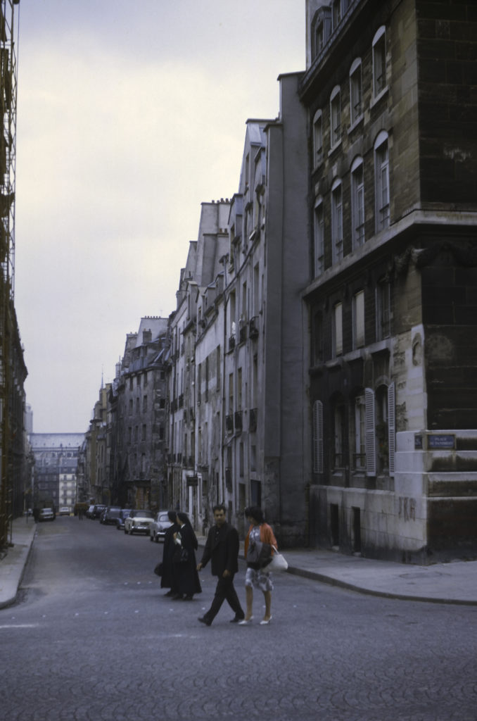
Street Scene in Munich, Germany – July 1964
Lodgings

A number of us were quartered in a pension (rooming house) down by the Isar River, which flows through the middle of Munich. It was a very pleasant area, the rooms were small but adequate, and the proprietor, Frau Burge, was an efficient German hausfrau who kept the place neat and spiffy. The only thing I didn’t like about the rooms were the beds, or rather what was on them. Here I was introduced to duvets, heavy quilts which to my mind were not at all appropriate for summer; under a duvet I was hot and sweaty and found it hard to sleep.
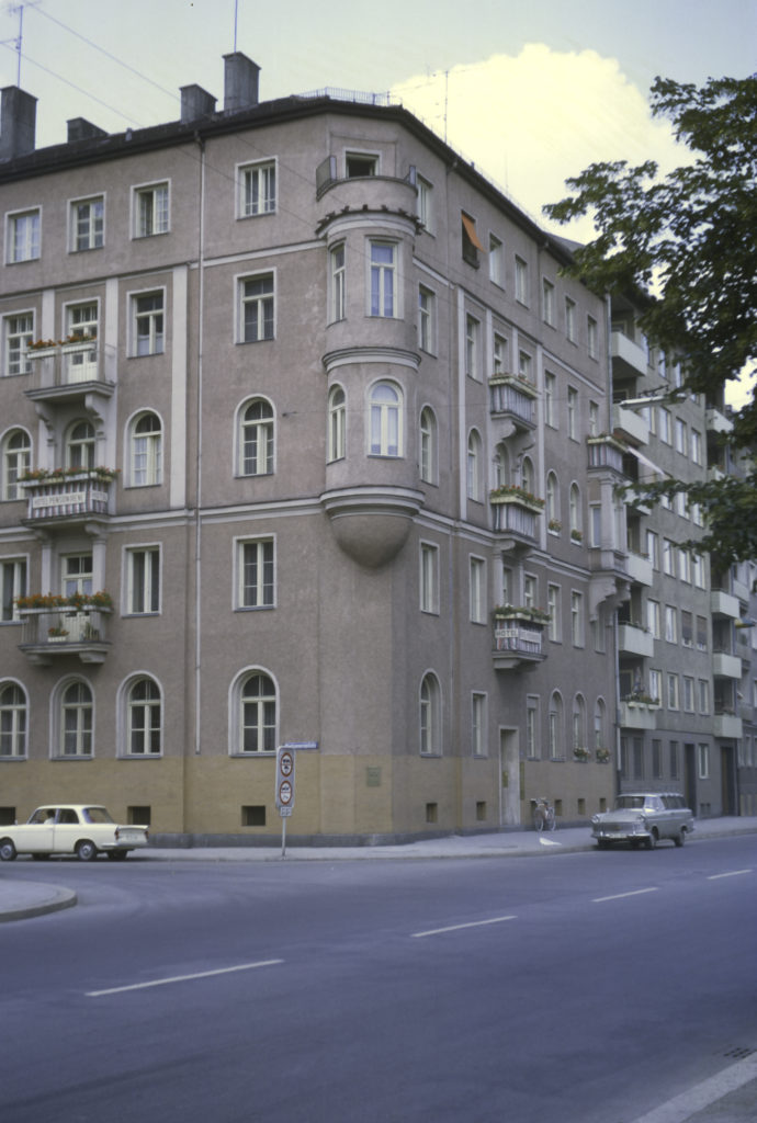
Our Lodging – Frau Burge’s Pension

The neighborhood was quite pleasant, with the Isar River right across the street from the pension, and it was a great area to start my career as a travel photographer.
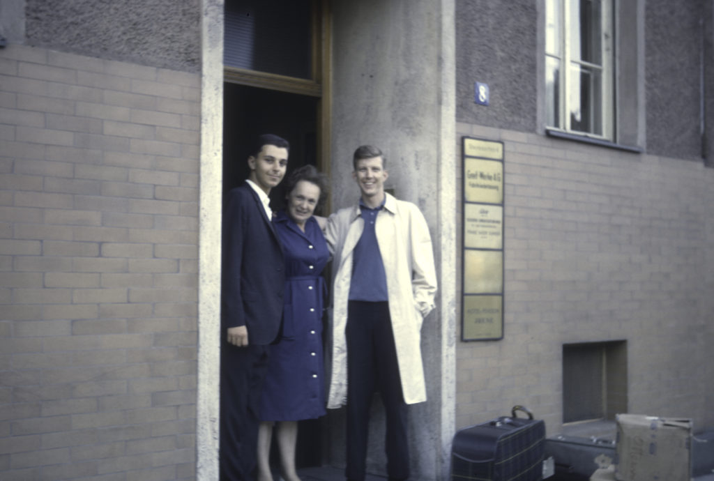
Frau Burge and two of my fellow-“pensioners” – the one on the left being my roommate, Alan, from New York City
The Isar River

Wandering the banks of the Isar was a good way to start seeing Munich. The riverside is quite picturesque, lined with parks and historical sites.
Isar River, St. Luke’s Church in distance

St. Luke’s is a Lutheran church in a historically a Catholic city where Protestants were generally unwelcome until the 19th century. It was built in the 1890s and is the largest Protestant church in Munich. It is a very imposing church, with a central dome is almost 64 meters (209 feet) high and two secondary towers that are little less tall. The architecture is a combination of Romanesque and Gothic; the architect chose these styles with the express purpose of conforming to the local traditions and catering to the preferences of the Catholic rulers.
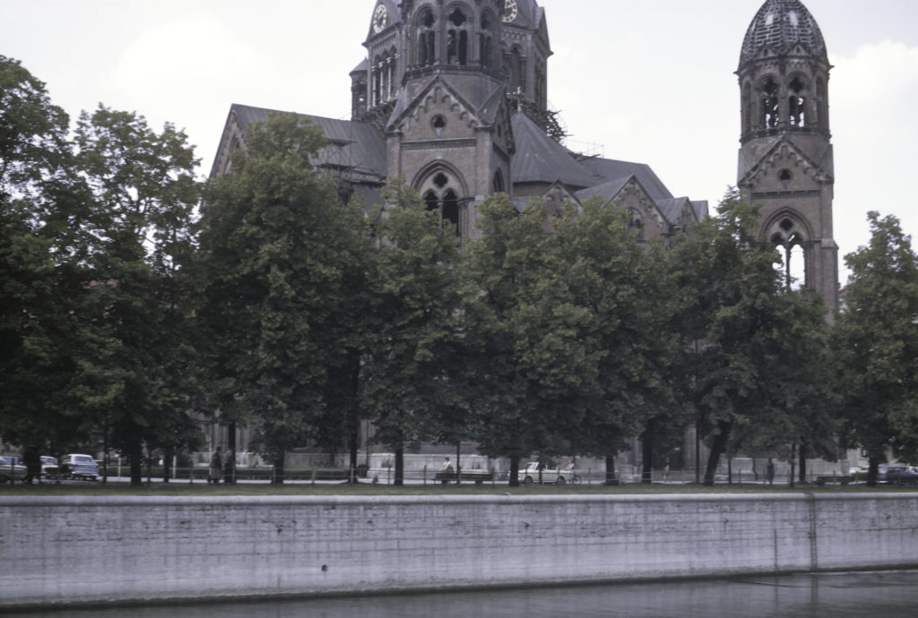
St. Luke’s Church, on the banks of the Isar

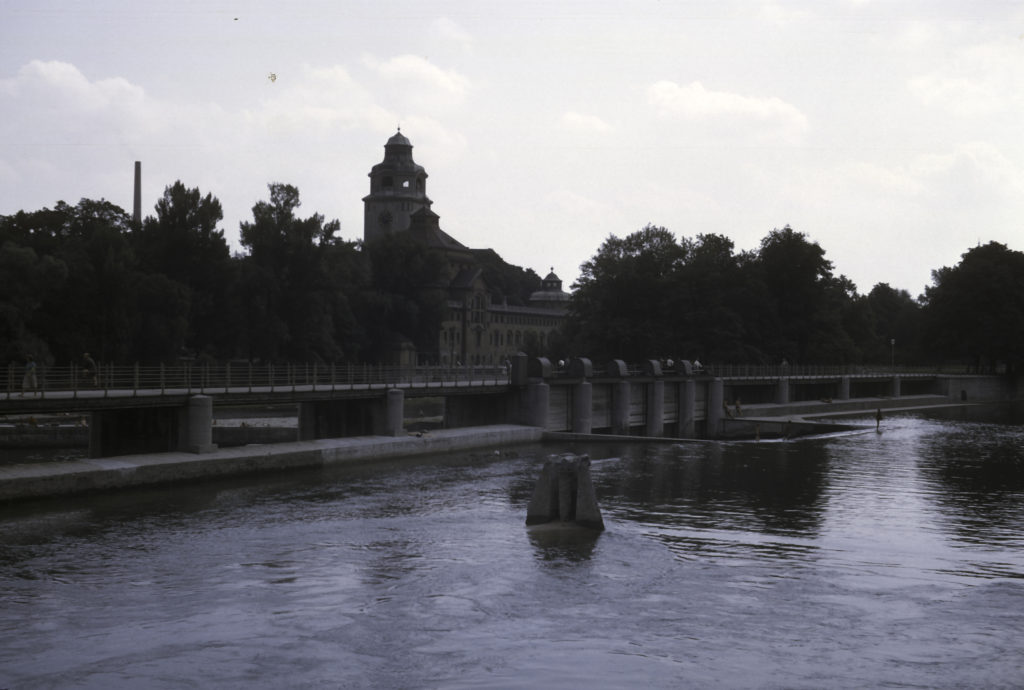
The Isar is, improbably, the birthplace of surfing in Germany. This came about in the 1970s, long after I was there, so I did not see any of it myself. It mostly happens at the Eisbach, near the English Garden, somewhat upstream of the location in the picture below, which was taken near the pension where we were staying. The salient feature of this photo is the weir – a low dam built to raise the upstream height of the river and regulate its flow. There was also a Fischentreppe – a “fish stairway” to allow fish to bypass the weir and prevent them from being trapped on the upstream side, but it is not visible in this picture. In the background is the Maximiliansbrücke (Maximilian Bridge), named after Maximilian II, King of Bavaria from 1848 to 1864.
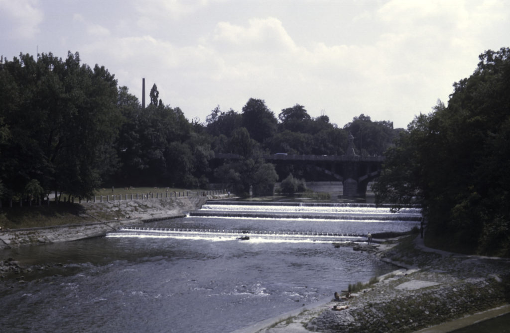
Isar River – Maximiliansbrücke – “Maximilian’s Bridge”

Continuing along the banks of the Isar, I came to a park called Maximiliansanlagen, and eventually to the monument shown below, which is the Friedensengel, the Angel of Peace. Originally built to commemorate the 25 years of peace following the Franco-Prussian War in 1870-71, it was completed in 1899 and is located on Prinzregentenstrasse (Prince-Regent Street), where it crosses the Isar on the Luitpoldbrücke. The gilded bronze figure atop the 82-foot column is modeled after a statue of Nike, the Greek goddess of victory, unearthed by German archaeologists at the Temple of Zeus in Olympia in 1875. In 1981 the statue fell off the column and was damaged, but it was subsequently repaired and replaced on top of the column in 1983.
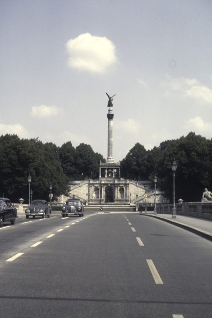
Friedensengel (Angel of Peace) Monument on Prinzregentenstrasse

Further up along the Isar, and after crossing the river, I finally arrived at the English Garden, an enormous (900-acre) park on the Isar River, which, as already noted, is famous for river surfing, and also for naked sunbathing. It also holds a structure called the Monopteros, which is a Grecian-style bandstand located on an artificial hill, another product of King Ludwig I’s building spree in the 19th century.
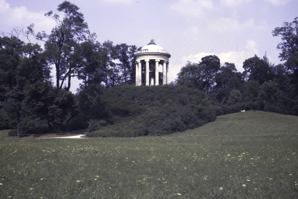
Monopteros, English Garden

The vast open fields of the English Garden also provide a nice view of downtown Munich, as seen in the photo following. The twin towers at the center of the picture belong to the Frauenkirche (“Cathedral of Our Lady”) , the largest and most famous church in Munich. Built in the fifteenth century, it is the seat of the Archbishop of Munich and Freising and holds the tombs of a number of members of the Wittelsbach dynasty, the rulers of Bavaria from medieval down to modern times. For some reason I never took a proper picture of it while I was in Munich, but thanks to municipal restrictions on the height of buildings, it remains the tallest building in town and is visible from a long way off, dominating the city skyline.
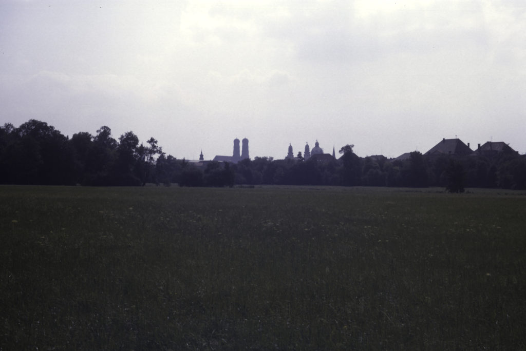
View of Downtown Munich, with the Frauenkirche at Center

Heading west toward the city center from the English Garden, I came across another famous Munich monument, the Siegestor, (“Victory Gate”). Initially commissioned by King Ludwig I (Bavaria was an independent principality until the formation of the German Empire in 1871), the Siegestor was completed in 1852 and was dedicated to the glory of the Bavarian Army. It was heavily damaged in World War II and only partially restored by the time I saw it in 1964. The inscription above the arches reads “Dem Sieg geweiht, vom Krieg zerstört, zum Frieden mahnend, “Dedicated to victory, destroyed by war, urging peace”. I didn’t realize it at the time, but I only shot the back side of the Siegestor, not the front. Originally the Siegestor had statues on top; in the early 21st century the monument was more fully restored and the statues with it.
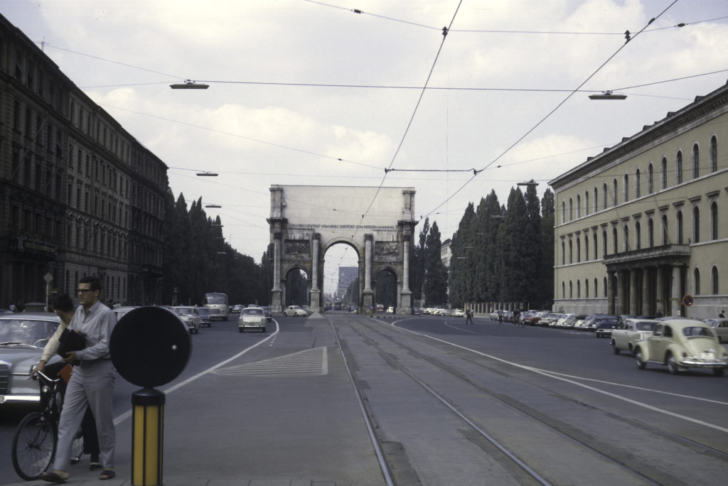
Siegestor

Just south of the Siegestor, on Ludwigstrasse, is the academic center of Munich, where one finds the University, formally titled the Ludwig-Maximilian University of Munich, and the Bavarian State Library. Next to the Library is another of the major Catholic churches of Munich, name of (surprise!) St. Ludwig’s. Constructed in the neo-Romanesque style and completed in 1844, St. Ludwig’s proved to be quite influential, serving as a model for numerous other churches, synagogues and even secular buildings, especially in America. It also contains a number of frescoes by the famous German painter Peter von Cornelius, one of which, depicting the Last Judgment, claims to be the second largest altar fresco in the world – 62 feet high by 38 feet wide.

The University Area
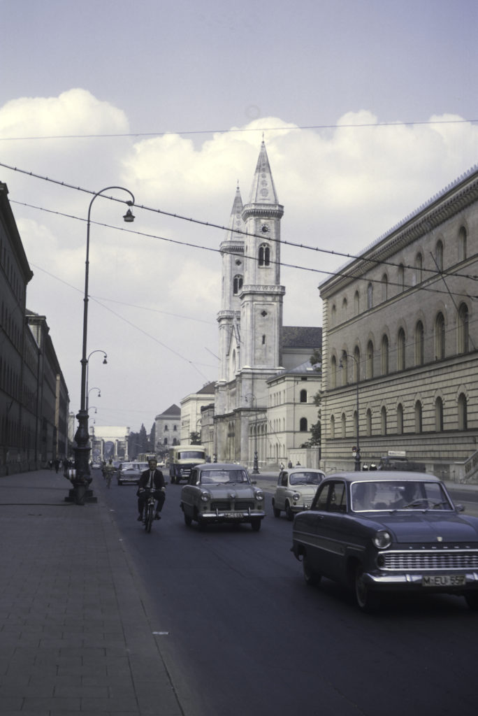
Ludwigstrasse – St Ludwig’s Catholic Church with University buildings at left and Bavaria State Library at right; Siegestor in background

Near the University I came upon a couple of French art students hoping to sell their oeuvres to passers-by on the street. I didn’t have enough Deutschmarks with me to purchase any of them, so I wished them well and went on my way.
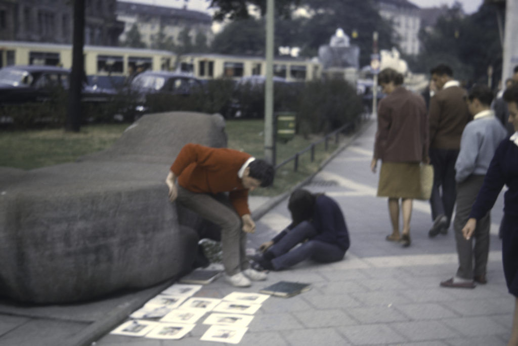
French Art Students

Continuing south down Ludwigstrasse, I came to Odeonsplatz, the site of the Feldherrnhalle (“Hall of Field Marshals”). This is a 19th century monument commissioned by King Ludwig I and dedicated to the Bavarian Army. The statue on the left side of the monument is of Johann Tserclaes, Count of Tilly, the commander of the forces of the Catholic League (of which Bavaria was a member) in the early years of the Thirty Years’ War. He won a series of great victories against the Protestant forces in the early years of the war, but he was not a Bavarian – he was originally from the Netherlands, and spent many years in the service of the Spanish trying to suppress the Dutch Revolt before coming to fight the Protestants in Germany. The statue on the right is of Karl Philipp Josef, Prince von Wrede, who was thus honored for being a leader in the German resistance against Napoleon in the early 19th century. However, though he was indeed a Bavarian, and the leading Bavarian soldier of his day, the distinction is dubious; at first he fought for Napoleon, and even led the Bavarian contingent in the French invasion of Russia in 1812; after the debacle in Russia, Bavaria switched sides and fought against the French, but Napoleon badly mauled Wrede’s troops at the Battle of Hanau in 1813.
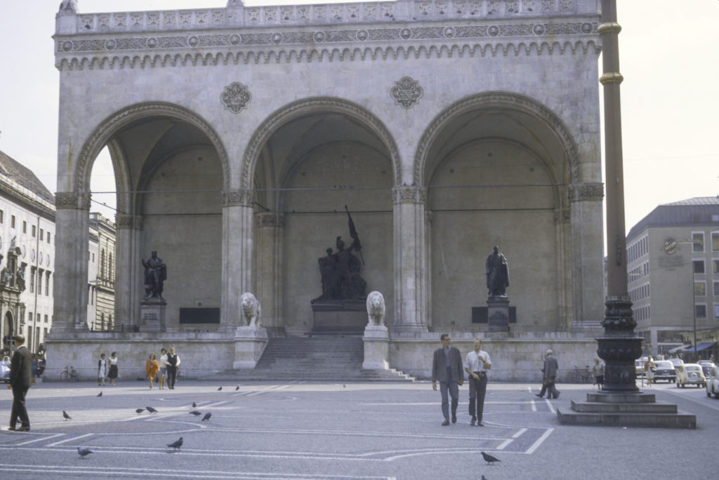
Odeonsplatz, with Feldherrnhalle Monument

The sculptural group in the center of the Feldherrnhalle was added in 1892 to commemorate the German victory in the Franco-Prussian War of 1870-71, and the subsequent unification of Germany.

When the Nazis staged the abortive Beer Hall Putsch in 1923, they marched from the Bürgerbräukeller to the Odeonsplatz, where they had a brief gun battle with the Bavarian State Police, leaving 4 policemen and 14 marchers dead. The coup was suppressed and Adolf Hitler was convicted of treason and sentenced to five years in prison, of which he served only nine months. Later, after Hitler took power in 1933, the Nazis turned the Feldherrnhalle into a monument to the members killed in the Putsch, and used the Odeonsplatz for rallies and ceremonies in which new members of the SS were sworn in. After World War II, the Feldherrnhalle was restored to its pre-Nazi condition. But right-wing groups still occasionally try to use it as a venue for rallies and demonstrations.

Not far from the Odeonsplatz, on Max-Joseph-Platz, stands the Bavarian State Opera House, opened in 1818. The statue in front of the Opera House is a memorial to Maximilian I Joseph, King of Bavaria from 1806 to 1825. Beneath the square there is an underground garage, and if I remember correctly, the Munich subway system was under construction at the time I was there, which would account for the work site in front of the monument.
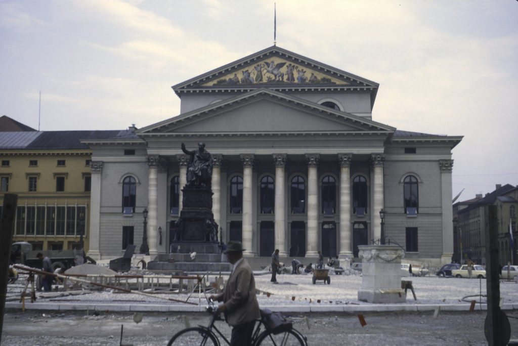
Munich Opera House, Max-Joseph Platz

A couple blocks south of the Opera House stands the world’s most famous beer hall, the Hofbräuhaus. Founded in 1589, the Hofbräuhaus was originally a brewery; it was remodeled into a beer hall in 1897, when the brewery was relocated to the suburbs. In 1919, just after the end of World War I, it became the headquarters of the short-lived Bavarian Communist government in 1919. It was not the scene of the abortive Beer Hall Putsch of 1923 – that dubious honor belongs to another beer hall, the Bürgerbräukeller, which no longer exists – but the Nazi Party did hold a number of its early organizational meetings in the Hofbräuhaus. It was bombed heavily during World War II, but was rebuilt afterward and fully restored by 1958, long before my arrival. Besides Adolf Hitler, famous or infamous patrons and visitors across the centuries include Wolfgang Amadeus Mozart, Vladimir Ilyich Lenin, Mikhail Gorbachev, Louis Armstrong, Thomas Wolfe, John F. Kennedy and George H. W. Bush.
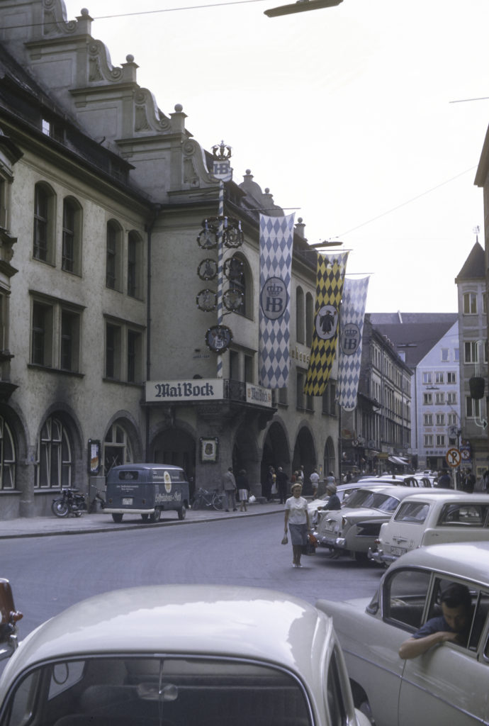
Hofbräuhaus am Platz, Munich

At this point, I found myself at the very center of Munich. It was a crowded, bustling area in 1964, and I doubt that it is any less so today.
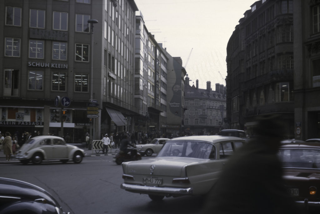
Downtown Munich

In Marienplatz, the central city square, stands the New City Council building – in German, Neues Rathaus (there is also an Old City Council building, as we’ll see shortly). (I always thought that the word “Rathaus” was most appropriate to the seat of municipal government in English as well as in German.) The Neues Rathaus is a neo-Gothic building constructed during the 19th century. The tower balcony houses the famous Glockenspiel: Three times a day, at 11 AM, 12 PM and 5 PM, little clockwork figures emerge from the tower and chase each other round and round on two levels.
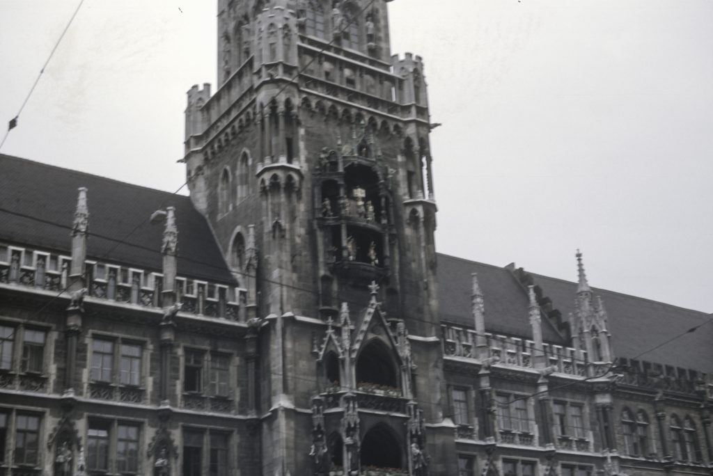
Das Glockenspiel

The Neues Rathaus is also adorned with sculptures and reliefs depicting various real and legendary figures, including most of the rulers of the city from its founder, Henry the Lion, and the Wittelsbach line of dukes and kings, as well as the allegorical slaying of the dragon in the picture below.
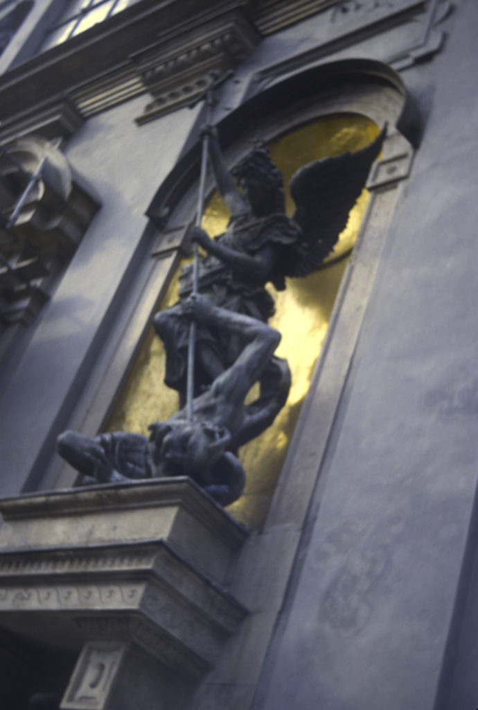
Neues Rathaus – Architectural Detail

Looking away from the Neues Rathaus to the east, one sees the Mariensäule, a 68-foot column with a statue of the Virgin Mary on top; the Old Town Council House (Altes Rathaus) at left, with spires; and the Church of the Holy Ghost (with white tower, at right). The Altes Rathaus, unlike the Neues Rathaus, is indeed old, dating from the fourteenth century.
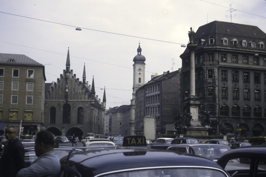
View from Marienplatz, with Mariensaule (Mary column) in foreground, above sea of taxis; Altes Rathaus in background at left, Holy Ghost Church (with tower) at right

From Marienplatz, I turned west and strolled to Karlsplatz, known locally as Stachus, another major plaza in downtown Munich. It was named after Karl Theodor, Duke and Elector of Bavaria from 1777 to 1799. However, the Bavarians detested Karl Theodor and celebrated joyously when he died, and ever since they have called the square Stachus, after an old pub that previously existed there. Karlsplatz is the site of a Gothic-style gate (seen at the left of the picture below), which was part of the medieval fortifications of the city and had been known for centuries as the Neuhauser Tor until Karlsplatz was built. Judging from photos I have seen recently, the appearance of the area has changed quite a bit since 1964; there is now a fountain in front of the Karlstor, and an ice-skating rink operates there in wintertime.
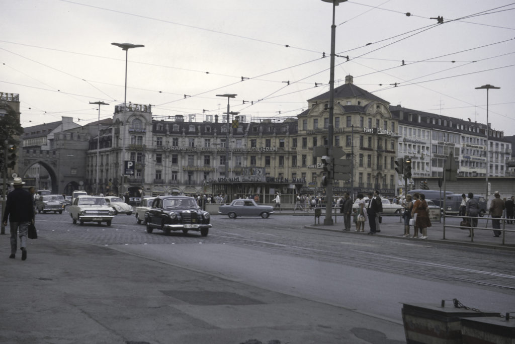
Karlsplatz/Stachus as it appeared in 1964

Not far from Karlsplatz/Stachus is Lenbachplatz, site of the Wittelsbacherbrünnen, a monumental fountain in neoclassical style dating from the 1890s. The fountain’s design celebrates the elemental force of water: the horseman tossing a boulder, on the left side of the fountain, depicts water’s destructive power, and on the right, the woman seated on a bull, holding a bowl, symbolizes water’s healing qualities.
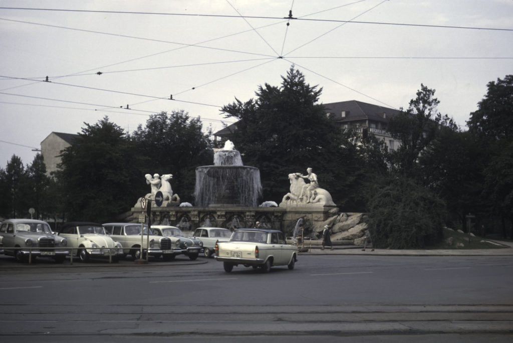
Wittelsbach Fountain, late nineteenth century, on Lenbachplatz

This modernistic tower on Pacellistrasse, just east of Lenbachplatz, caught my eye; it appears to be an elevator for the building next to it, which happens to be the Amtsgericht, the Munich Municipal Court.
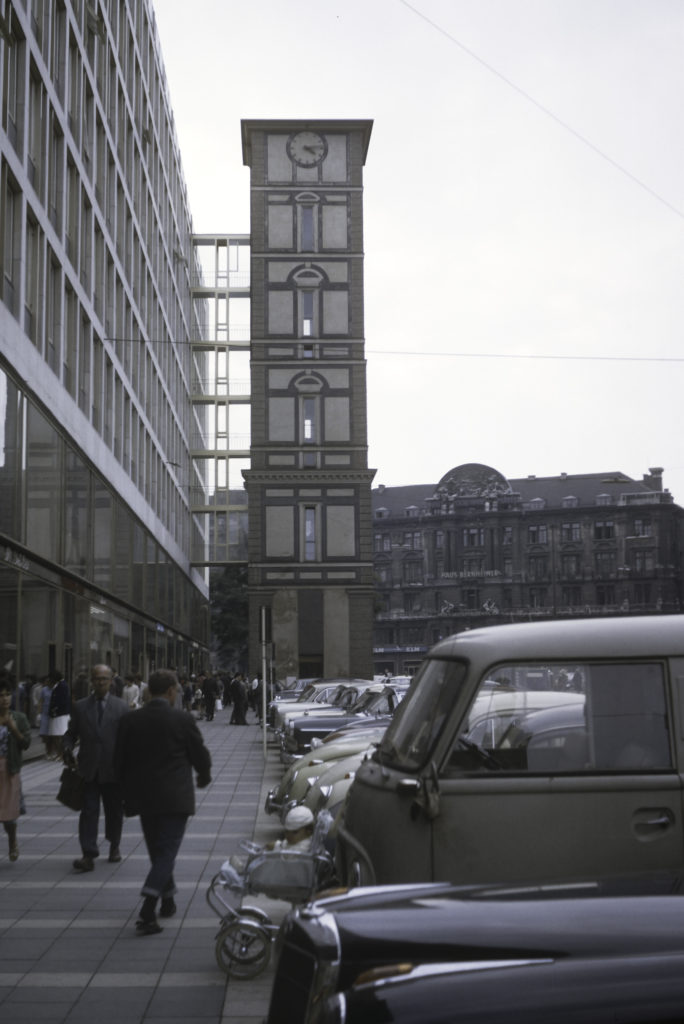
Pacellistrasse – Amstgericht (Municipal Court); Lenbachplatz and Bernheimer Palais in background

Somewhere in my Munich wanderings, I encountered this Baroque-appearing structure, which I have not been able yet to identify. A sign nearby said “Prinz-Carl-Palais,” but that name actually belongs to a Neoclassicist mansion – see https://en.wikipedia.org/wiki/Prinz-Carl-Palais.
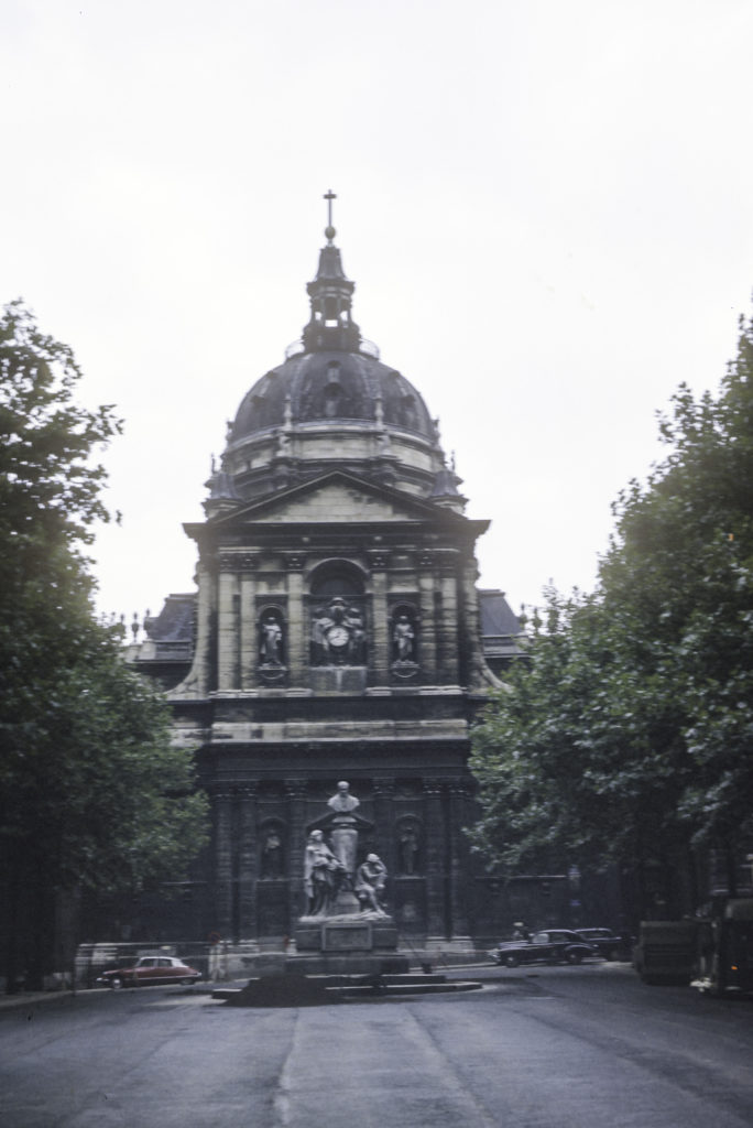
Unidentified Baroque Palace, Munich

Munich is a city of many fountains – we have already encountered the Wittelsbacher Fountain on Lenbachplatz – but the one I liked best, probably because of the naked woman in the middle, is the Fortuna, which I encountered in Isartorplatz, on my way back to my pension from downtown Munich.
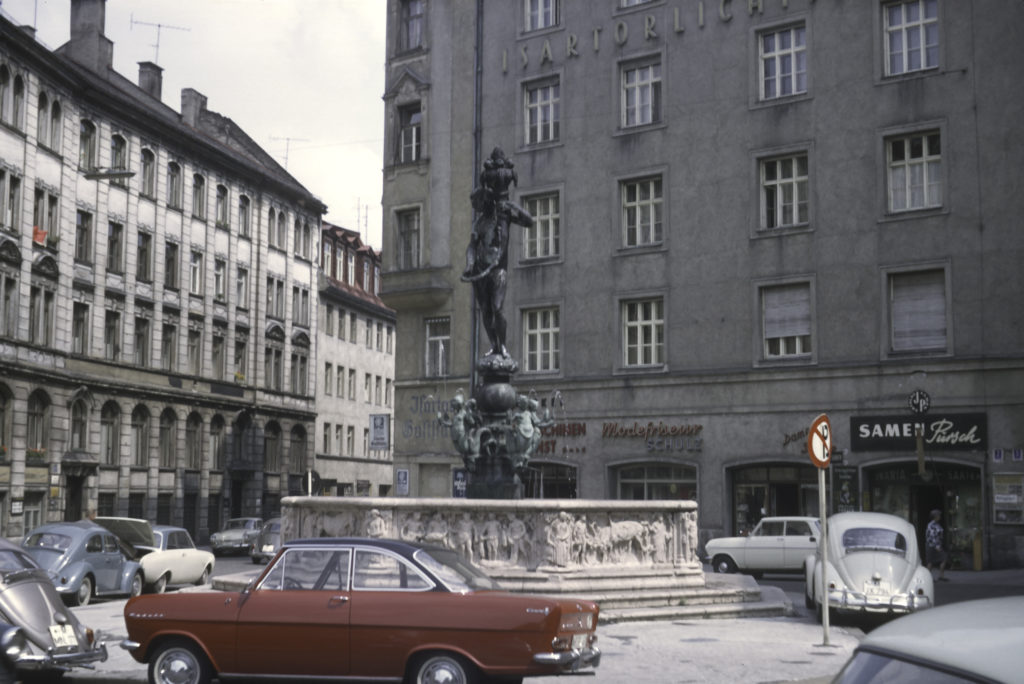
Fortuna Fountain, Isartorplatz
Categories
Death Valley October 2019

Shoshone, October 27, 2019

For Sunday afternoon, October 27, JoAnn, who had been on the road for weeks or maybe even months or years, wanted to go home, and none of the rest of us wanted to venture into the sand-blown maelstrom on the floor of Death Valley, so we piled into Red Sonja (Sandie’s Subaru Outback) and drove south to Shoshone, a hamlet just east of Death Valley which claims a population of 31, a grocery store, gas station and museum, a wetland in the middle of the desert, and, of all things, a hobbit ghost town.

Our first stop was the Shoshone Wetland, a haven for fish (!) and migratory birds in the middle of a desperately dry and dusty desert.

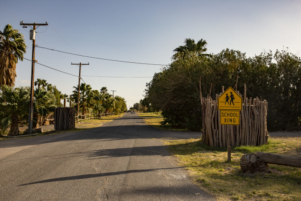
The wetland is hidden out of sight in an area which is also the site of an RV park and a school; you reach it via an access road which takes off from the side of the highway near the Charles Brown General Store.

This road leads to Shoshone’s RV park, school and wetland.
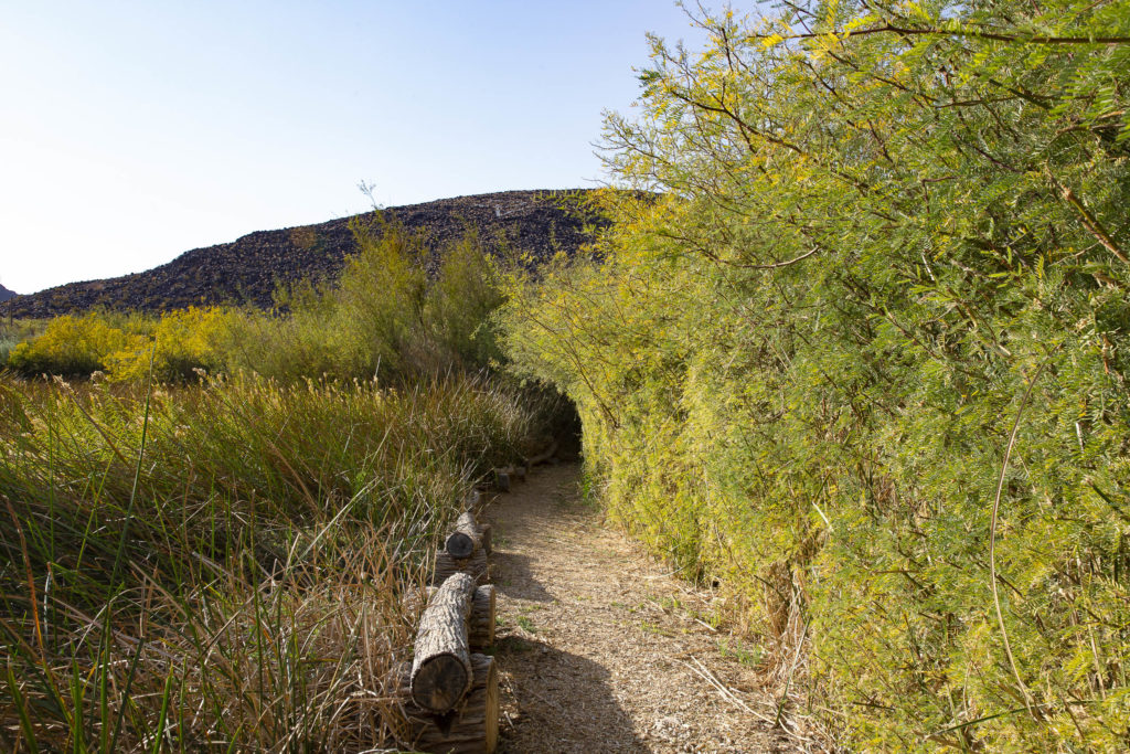
This is the entrance to the Shoshone Wetland.

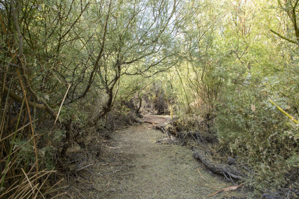
As you venture into the wetland, the path widens and is kept cool and shady by overhanging vegetation.

Shady Lane

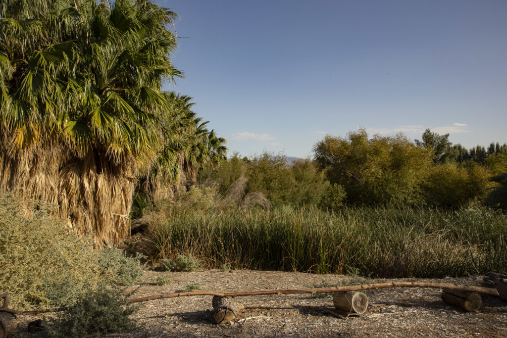
Reeds, palms, willows and other oasis vegetation populate the desert wetland biosphere.

Reeds, palms, willows and other oasis vegetation populate the desert wetland biosphere.

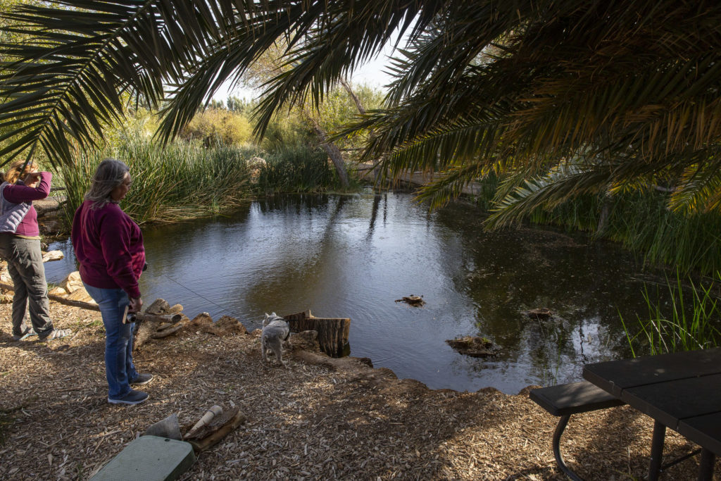
Eventually you reach a lovely shaded pool, complete with table, a perfect spot for a picnic.

Picnic Area

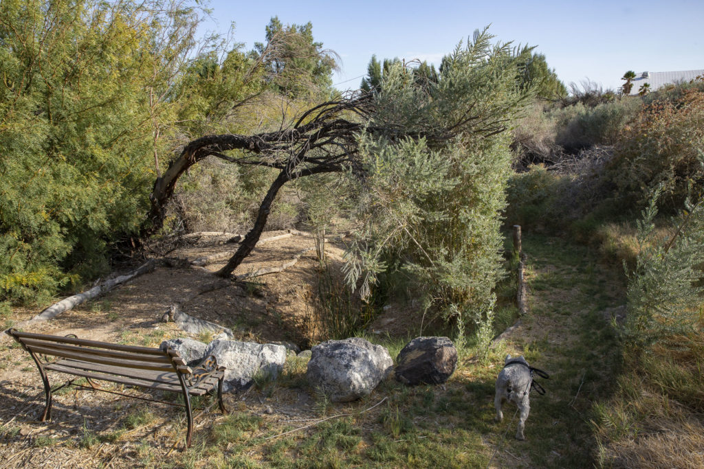
Jock loved exploring the wetland paths, and being on a leash didn’t cramp his style at all. He just draged us along wherever he wanted to go.

Jock goes exploring.

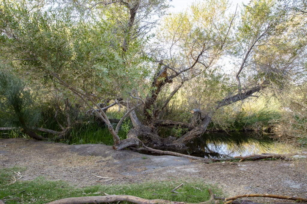
Growing by the waterside was an old gnarled willow tree, which reminded me of Old Man Willow in the Lord of the Rings, who lurked along the Withywindle in the Old Forest, waiting for unsuspecting hobbits to come by.

Old Man Willow

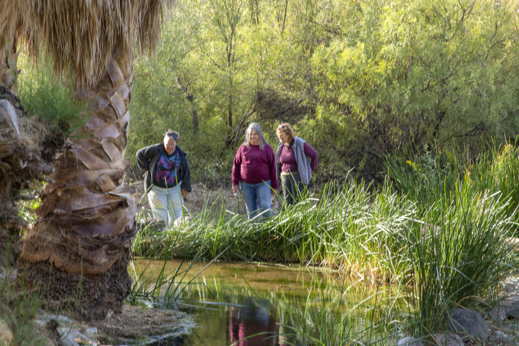
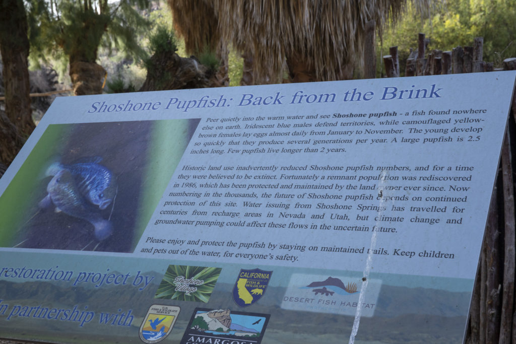
The Shoshone Wetland is a sanctuary for desert pupfish, of which it claims to have its own species. Here Diana, Sandie and Kelly contemplate a pool full of them.

Diana, Sandie and Kelly check out the desert pupfish.

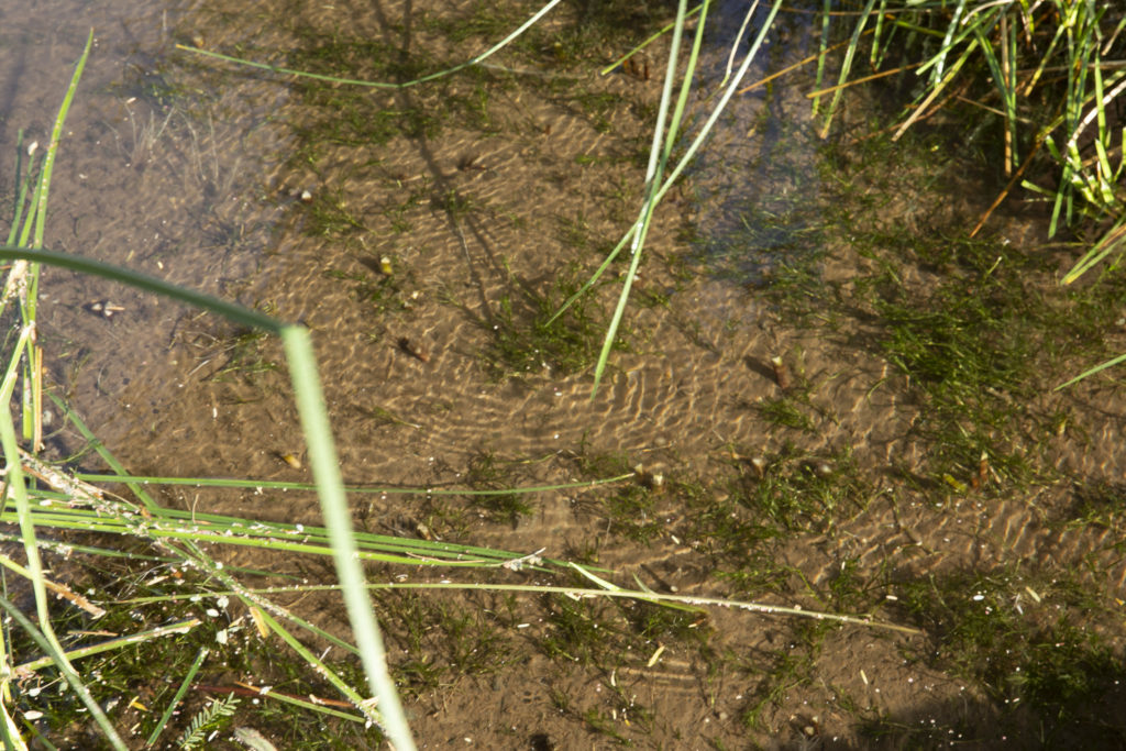
Pupfish are quite small and not easy to see even in a clear pool. At least they don’t have to worry about fishermen, since they are far too small for people to eat.
How many Shoshone Pupfish can you find in this picture?

Next to the pool was a placard telling us all we needed to know about the Shoshone Pupfish.

All about the Shoshone Pupfish.

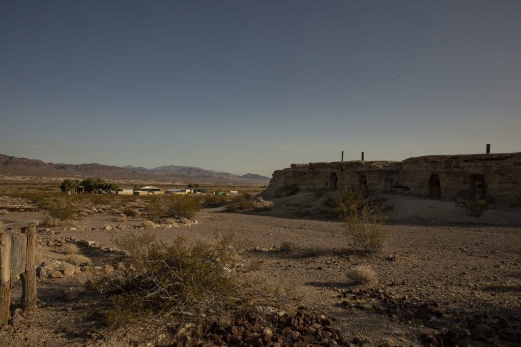
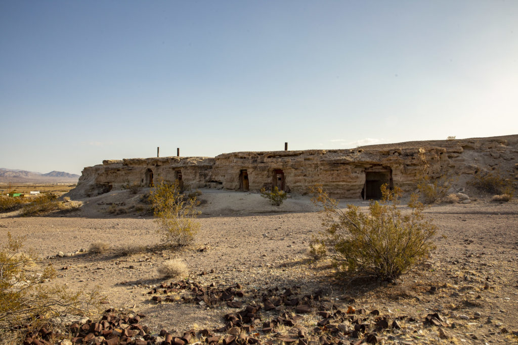
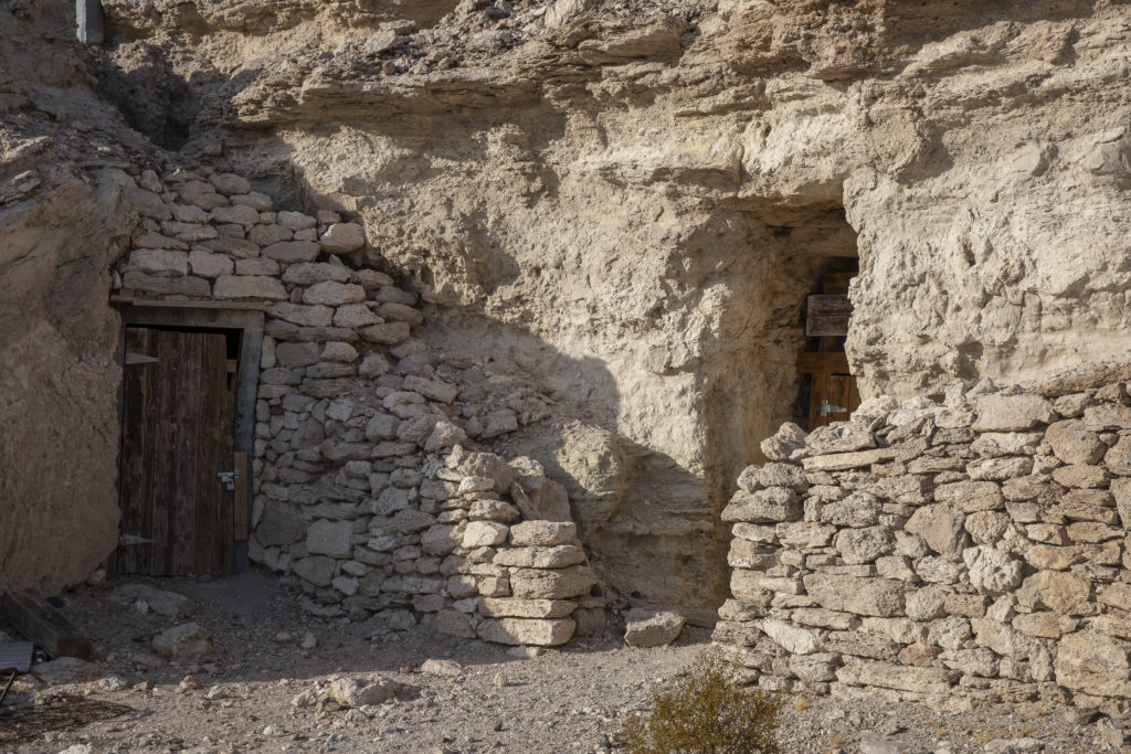
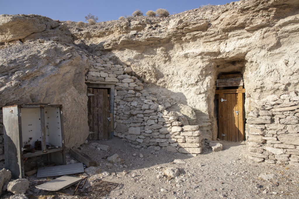
On the opposite (south) side of town we found another distinguishing attraction of Shoshone – a series of little dwellings, dug into the side of rocky hills. There were two sets of them, one on either side of a broad wash; the places on the south side, dug into the side of a low mesa-like outcrop, were more numerous – there were five or six of them, while there were only one or two on the north side – it was hard to tell whether there were two separate dwellings or just one with two doors. To me it seemed as if a small tribe of hobbits had somehow made their way to the Mojave Desert, and carved out hobbit-holes here, perhaps later abandoning them (for they were vacant) when the Big People invaded the area.

The north side of the hobbit ghost town, with dwellings of Big People in the background.

In keeping with the hobbit theme, I named the north set Bagshot Row.

Bagshot Row in the Desert

The south side, although it was completely detached from the north, I decided it was one house with two doors, and named it named Bag End.

Desert Bag End – A veritable hobbit mansion, with two doors.

Unfortunately, the desert version of Bag End was rather dilapidated and run-down. I decided that maybe Saruman/Sharkey had lived in it after being expelled from Middle-Earth.

This version of Bag End had seen better days.
Categories
Death Valley October 2019

Death Valley, October 2019

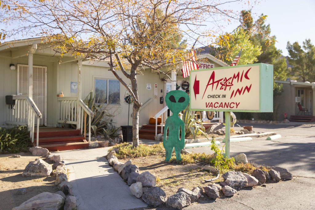
This was the second trip to Death Valley that Sandie, Jock and myself have made together as well as in the company of our friends Mike, Diana and JoAnn, with JoAnn’s friend (and now ours, too) Kelly as a new and welcome addition for us. Like the first, the organizer and prime mover was JoAnn, who has been going to Death Valley for years and knows her way around it quite well. On this trip, as on the first one in November 2016, we stayed in the Atomic Inn in Beatty, Nevada. The Atomic Inn is a great place to stay for several reasons: it is affordable, its location provides quick access to Death Valley National Park, and little doggies are welcome there.

This is the usual view at the front of the Atomic Inn, except for the decorations on the office porch, which are hidden behind the marquee in this shot.

We arrived at the Atomic Inn the evening of Wednesday, October 23, and left the morning of Monday the 27th. Here are the links to the various excursions and events of our stay.

Categories
Death Valley October 2019

Keane Wonder Mine, October 27, 2019

JoAnn had planned a hike at Keane Wonder Mine for Sunday morning, October 27, and a hike to Telegraph Canyon for Sunday afternoon, and Diana, Kelly and I had intended to keep her company; but Saturday night, a tremendous wind arose and blew all our plans into a cocked hat. Nevertheless, we decided to take a drive down toward the mine, if for no other reason than to see how bad things in Death Valley were.

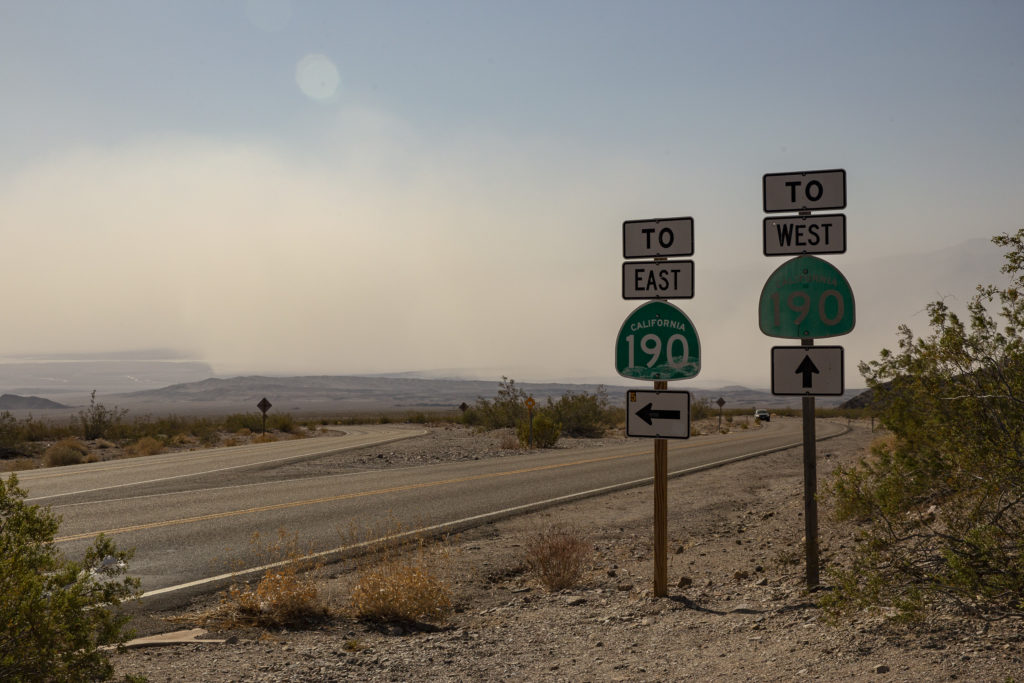
To get to Keane Wonder Mine from Beatty, you take the Daylight Pass Road to Hell’s Gate, turn off at the Beatty Cutoff Road, and go another 4.7 miles to the Keane turnoff, which takes you onto a dirt road, on which you bump along for another 2.8 miles to the parking lot.

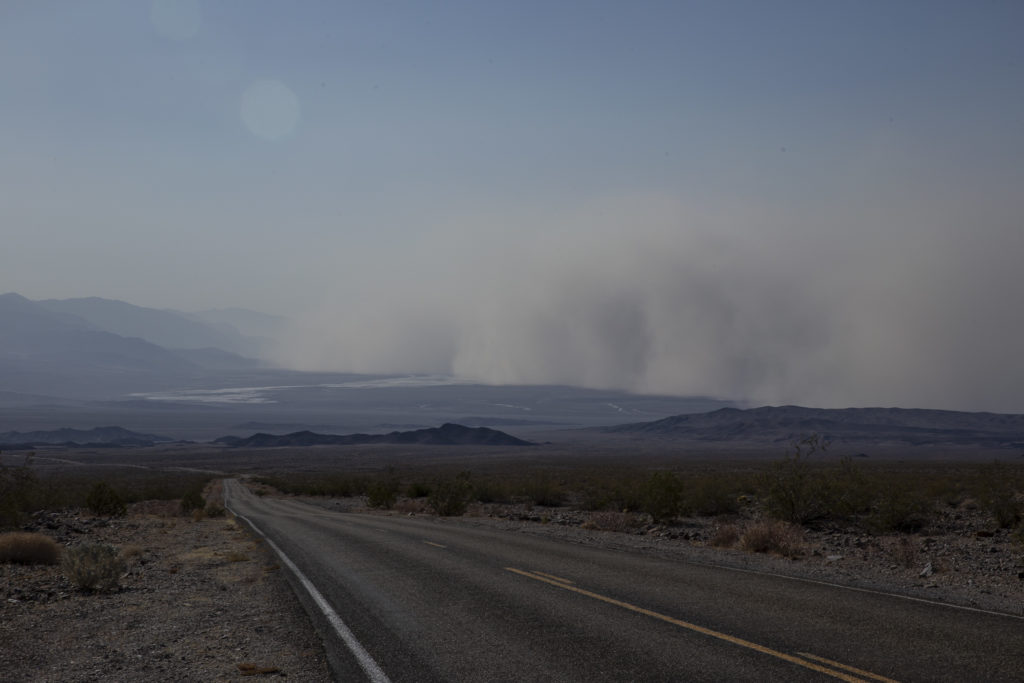
When we got to Hell’s Gate, it was obvious that the situation in Death Valley was not good. The floor of the Valley was obscured by an enormous dust cloud.

Looking into Death Valley from Hell’s Gate, Sunday morning, Oct. 27, 2019.

However, the dust cloud did not reach up to the Keane Wonder Mine turnoff, which is less than halfway to the Valley floor, so we persevered. And when we got to the turnoff, the dust cloud didn’t look any closer than it had from Hell’s Gate.

The floor of Death Valley as seen from the turnoff to Keane Wonder Mine on the Beatty Cufoff Road at 10:03 AM on Sunday, Oct. 27.

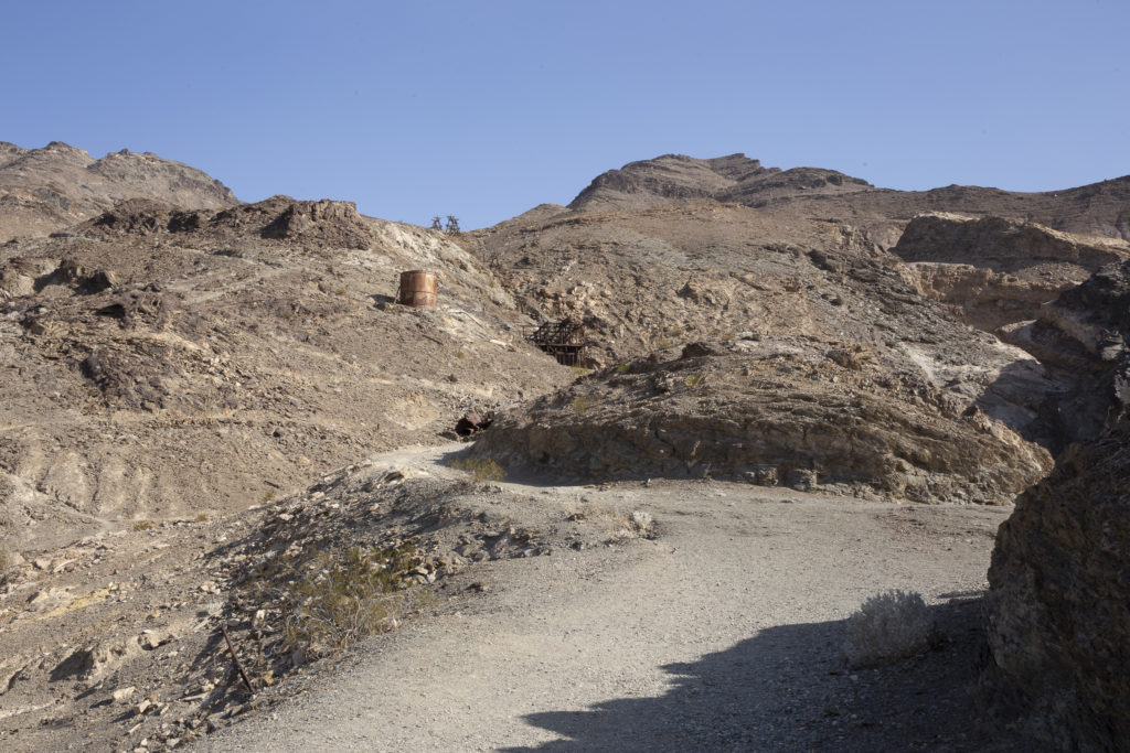
Once you get to the parking lot, you have to hike a short way uphill to reach the mine camp and mill area.

The path from the parking lot up the hill to the mine camp and mill area.

To be clear, the mine itself is at the top of the ridge, 1,500 feet up from the camp. An aerial tramway connects the camp to the mine. I wanted to take the tramway, but it turned out that it wasn’t operating that day.

The Aerial Tramway.

Actually, the aerial tramway hasn’t operated since at least 1941. The alternative is to take a steep path up the hill, which climbs the 1,500 feet in 1.4 miles, and that was what JoAnn and Kelly proposed to do.

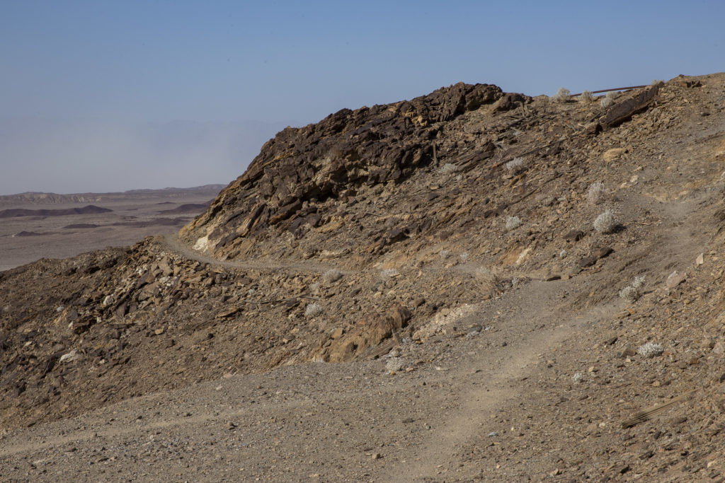
This trail takes you up 1.4 miles and 1,500 feet to the top of the tramway, where the actual mine is located.

But in the end, we decided to leave that hike for another trip. The wind was blowing as hard as ever, and we weren’t sure that the dust storm wouldn’t blow up from the valley to engulf us before we could get up to the top and down again. So we settled for just checking out the camp and mill area, which was interesting enough.

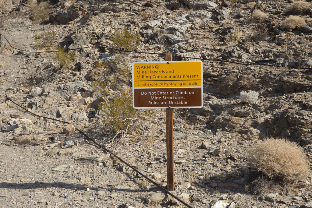
Hazard Warning Sign

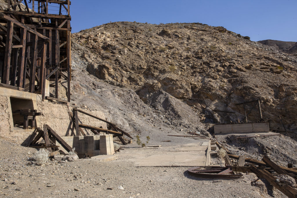
There were signs posted along the trail to the mill area warning about mine hazards, contaminants, etc. and enjoining people not to enter or climb on mine structures. I couldn’t imagine why anyone would have thought they were necessary; everything seemed to be perfectly new, spiffy and in great working order.

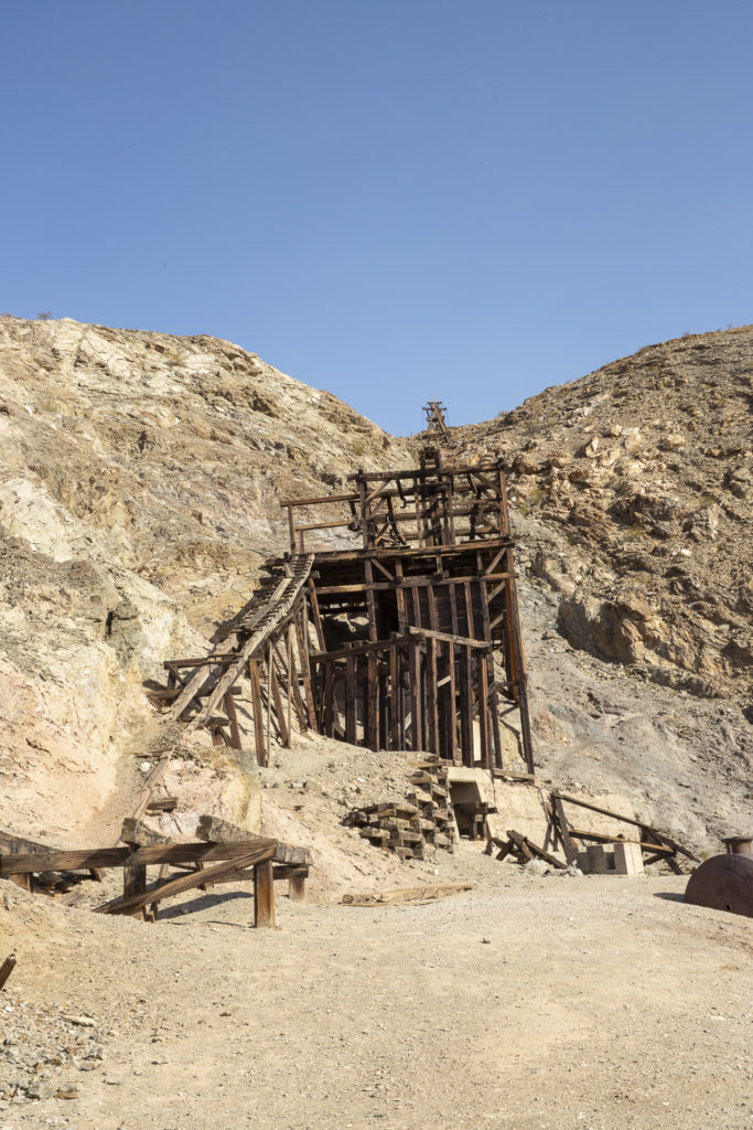
The Stamp Mill Site

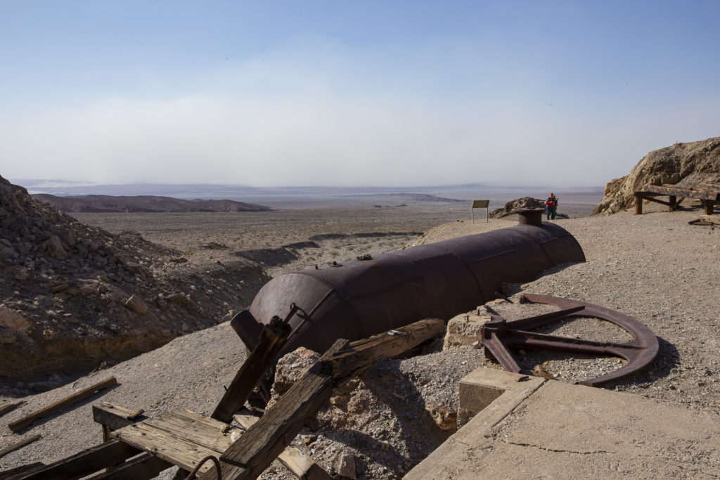
Among the mine relics we saw was a huge cylindrical tank, which at first I mistook for a stranded WWI German U-boat. Lots of water was necessary to process the ore from the mine, and this tank was where it was stored. The tank seemed to be in surprisingly good shape considering it was abandoned at least 80 years ago.

This tank held water used to process the ore from the mine.

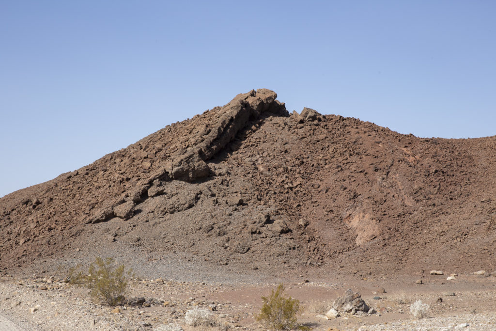
Heading back toward the parking lot, I happened to notice this odd-looking hill off to the side of the path; it sported a rock formation which resembled a giant lizard climbing up the side of the hill. A real lizard that big would have been pretty scary.

Lizard Hill

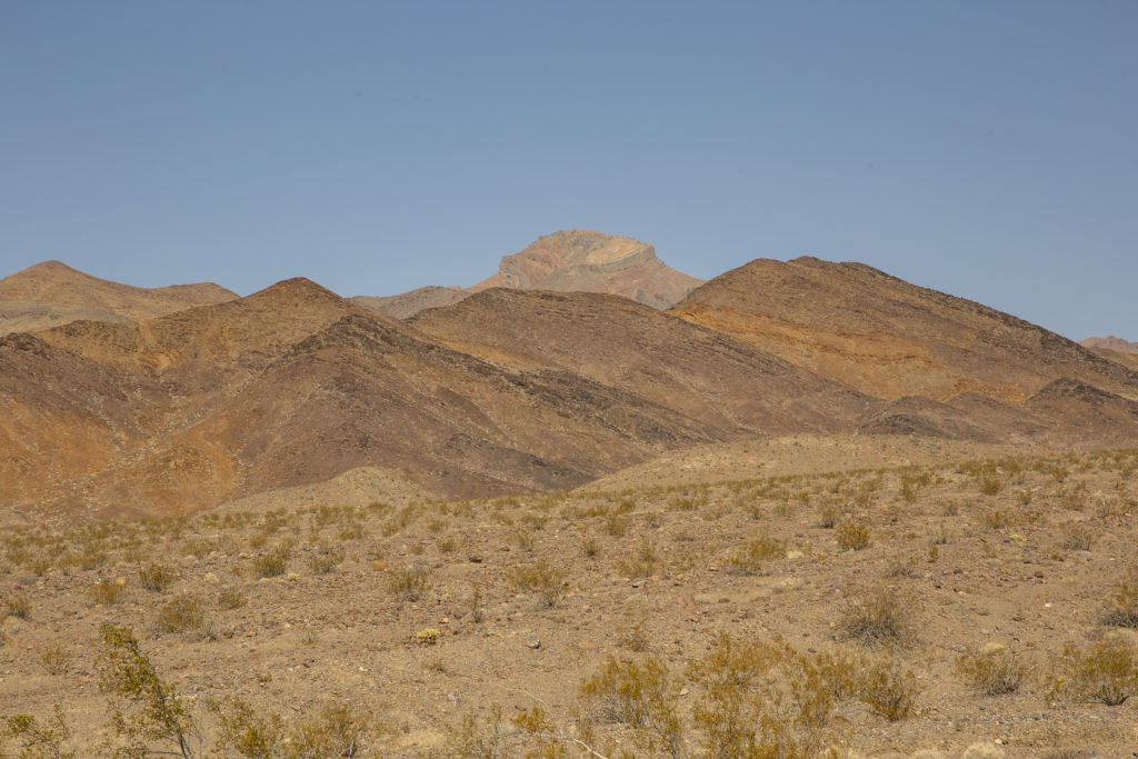
Not wishing to have our windshields sandblasted, we avoided going down any further into the Valley, and instead headed back to Hell’s Gate and thence to Beatty.

Looking toward Corkscrew Peak (5804 feet, 1769 meters) from Hell’s Gate.
Categories
Death Valley October 2019

Beatty Days, October 26, 2019

It was a complete surprise to us.  Coincidentally, our sojourn in Beatty fell on the weekend of the major festival of the year – featuring a big parade, a carnival in the town center and various other events and attractions.  The parade began at 10 AM on Saturday the 26th, and that whole day we just stayed in town and enjoyed it all.

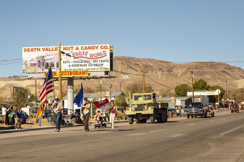
Flags, stuffed animals and a military truck kick off the parade.

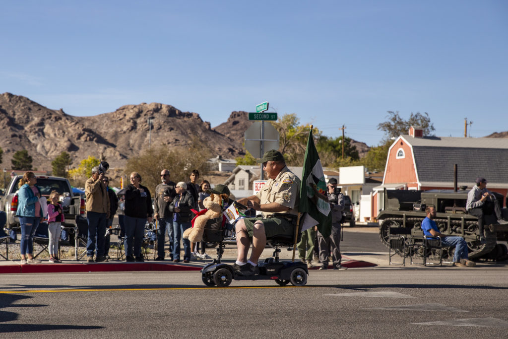
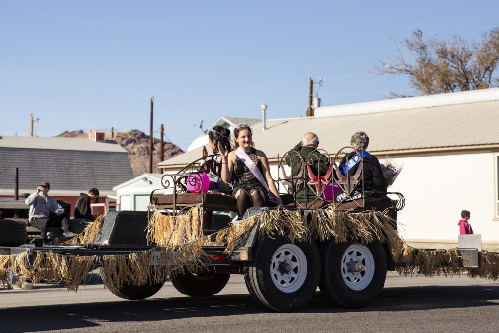
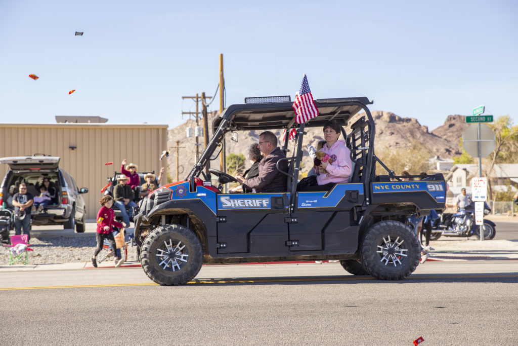
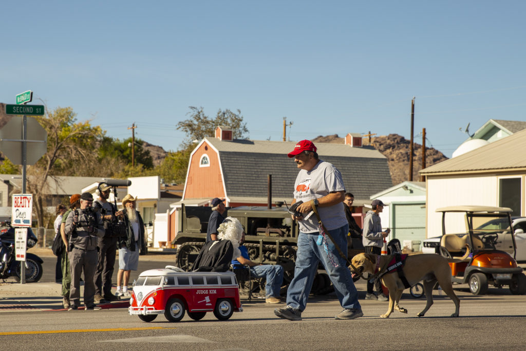
The flag-bearers were followed by various dignitaries – the Parade Marshal (a stuffed Winnie-the-Pooh bear), the festival and her court, the Nye County Sheriff in his latest high-powered police interceptor (a dune buggy), and the local justice of the peace in his Volkswagen minivan.

The Parade Marshal (left) and his driver (right).
The festival queen and her court.
The Nye County Sheriff rode in his high-powered police prowler.
The local justice of the peace, Judge Kim, with his valet and mascot.

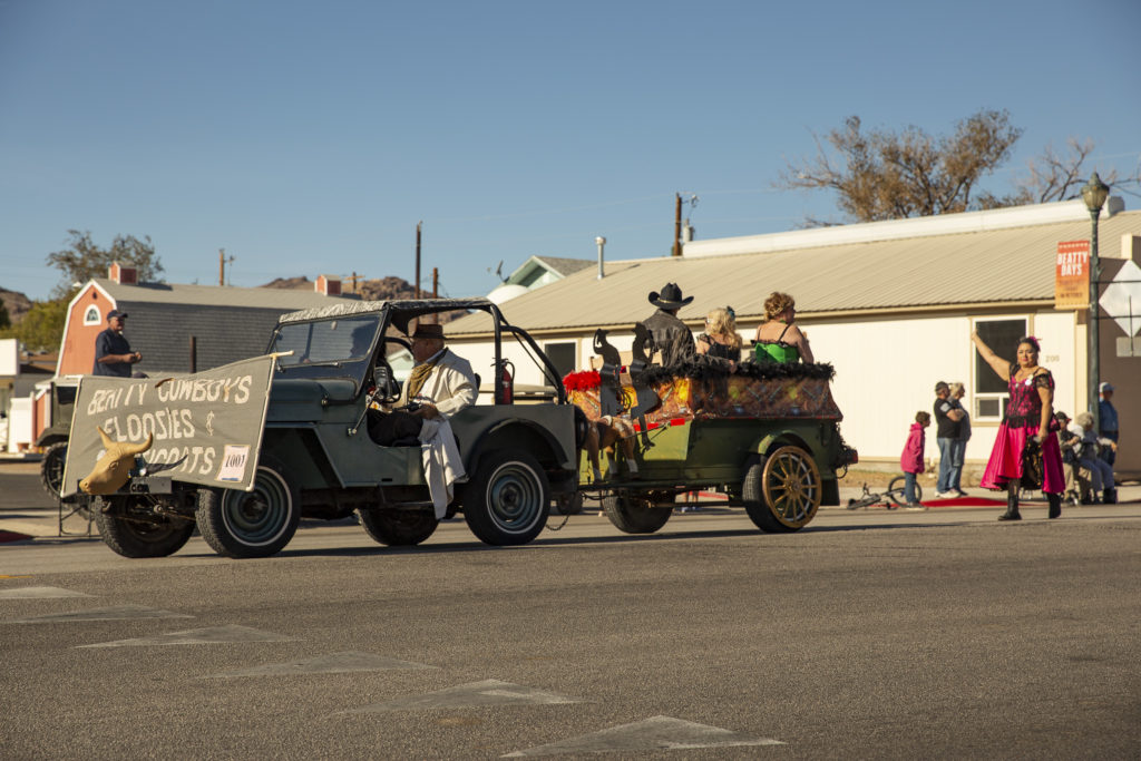
Then came a seemingly endless variety of floats and other entries. One of the first was devoted to the town’s ladies of the evening.

The town’s ladies of the evening both rode and walked.

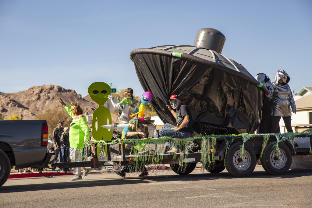
We had seen the Atomic Inn’s float – a flying saucer with aliens – under construction in the parking lot, so we knew what to expect. It was our favorite float, and it won the Grand Prize.

The Atomic Inn’s entry won the sweepstakes – for the third year in a row.

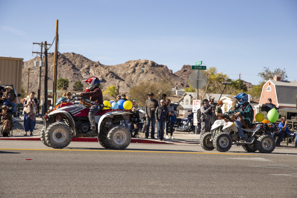
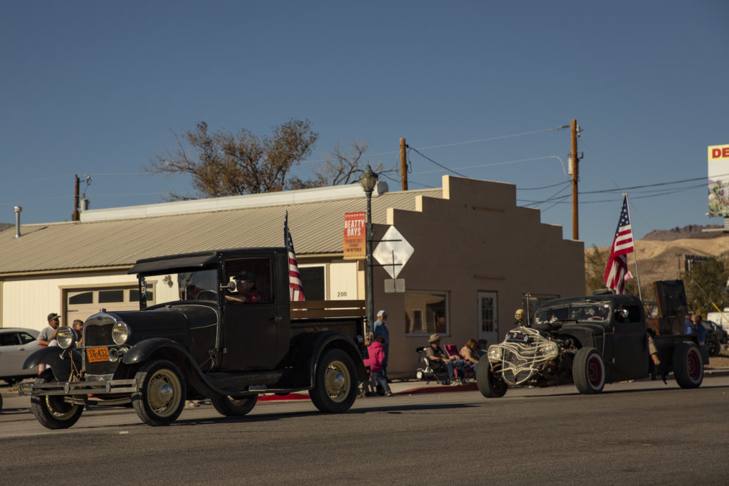
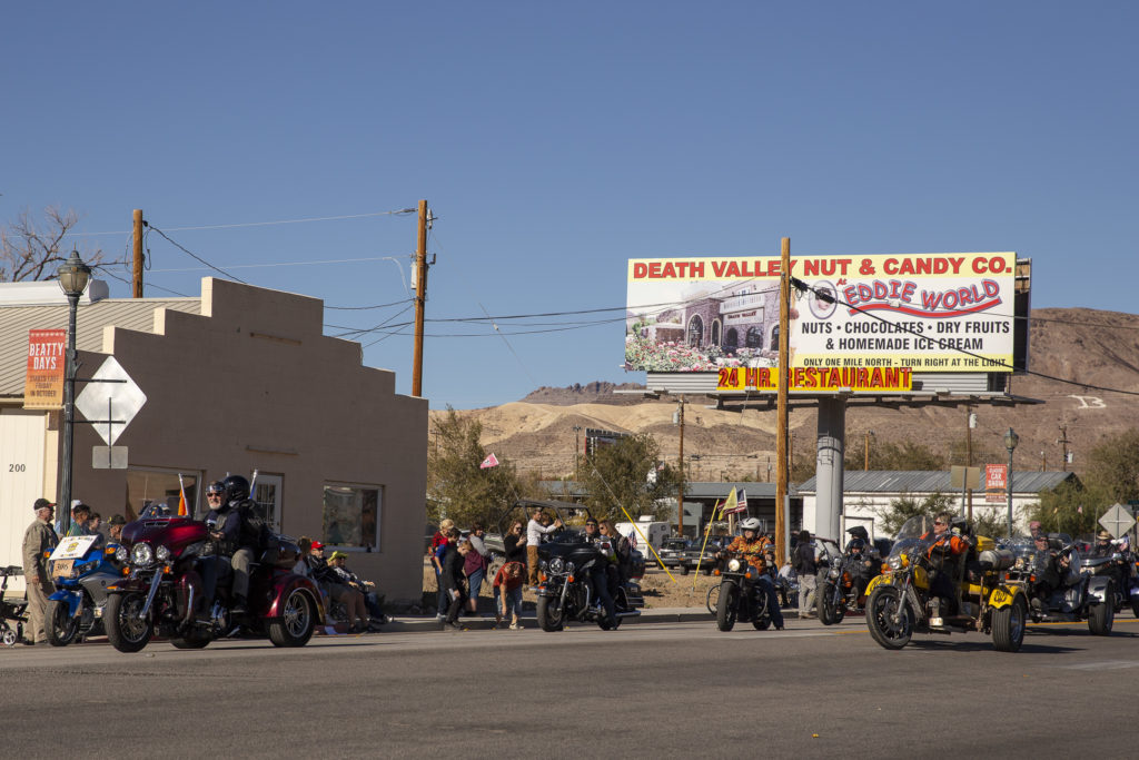
There was a wide variety of different kinds of entries – vintage cars and hot rods, motorcycles, motor-tricycles, bicycles, jeeps and other 4-WD vehicles, ATVs, trucks – it went on and on.

ATVs comprised a sizeable contingent of the parade vehicles.
Vintage restorations and hot rods came from hundreds of miles around, not only for the parade but for a car show that was also part of the Beatty Days festival.
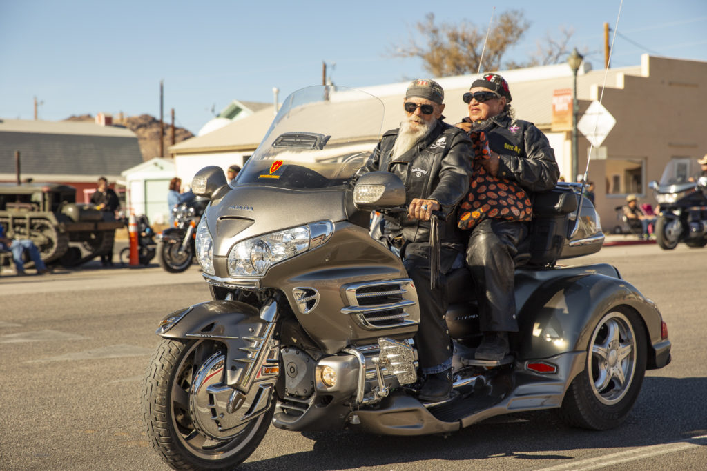
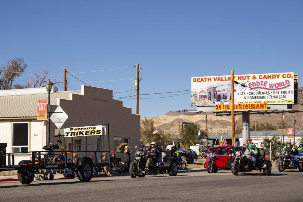
The motor-tricycles were among the most prolific and colorful participants in the parade.
The people on the trikes were no less colorful than their rides.
One of the more colorful examples of the Jeep genre.
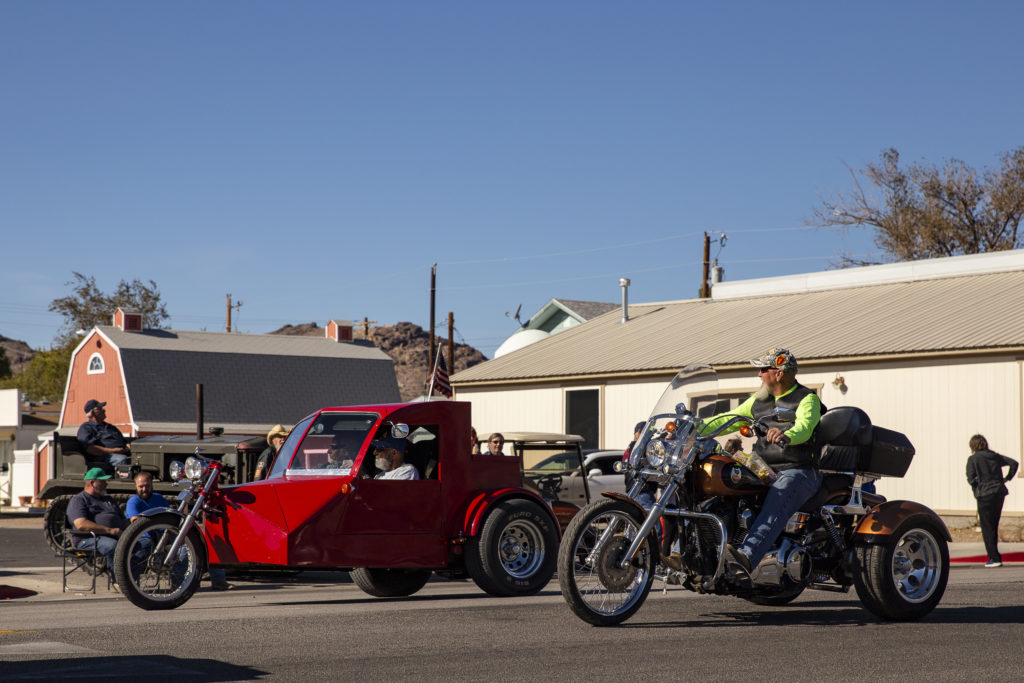
The Pahrump trikers had some of the most radical rides.
This red half-trike, half-car should have won a prize for most bizarre and original vehicle in the parade.

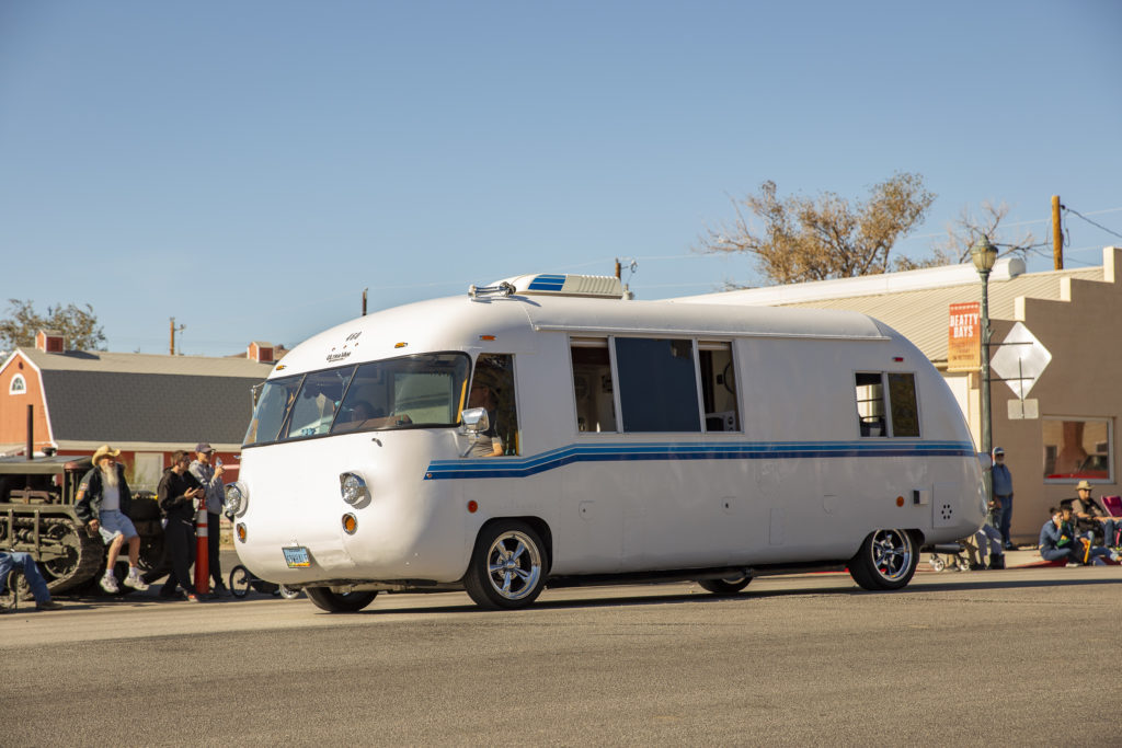
Also represented in the panoply of vehicle types were motor homes. In particular, the motor home pictured below aroused my curiosity. I think I’ve seen ones like this before, but I have no idea who made it and when. I suspect it’s from the ’60s or ’70s, but I haven’t a clue. If anyone knows about it, I’d appreciate hearing from them!

Vintage Motor Home

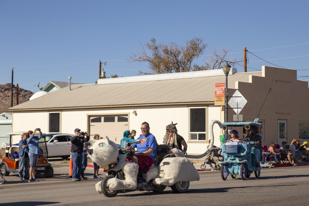
Not surprisingly, since it was late October, some of the entries had Halloween-related motifs, like the Catmobile pictured here, though ideally the cat should have been black.

Catmobile

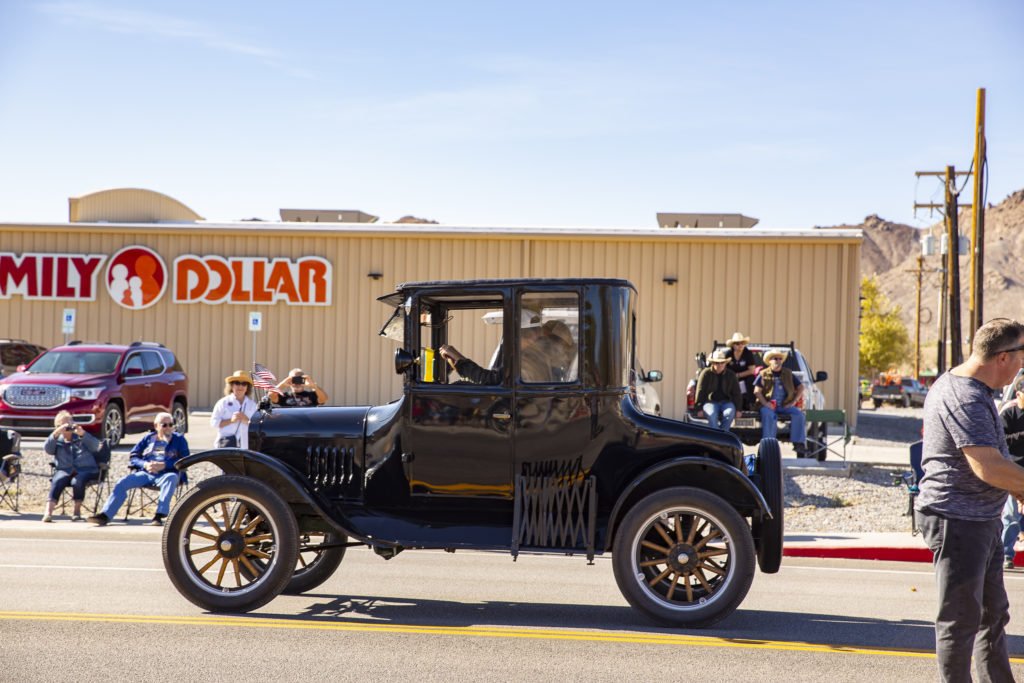
It was a great day for viewing early Fords – Model Ts, Model As, Deuces and ’34s and so on.

One of Old Henry’s mass-produced masterpieces. In very good shape.

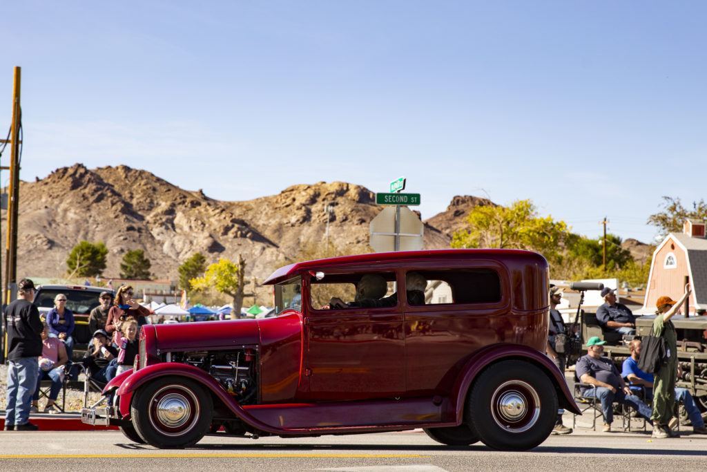
Both original restorations and hot-rods were well represented. Among the latter was this ruby-red Model A crackerbox sedan, with a modern OHV V-8 under the hood.

Model A 4-door crackerbox sedan.

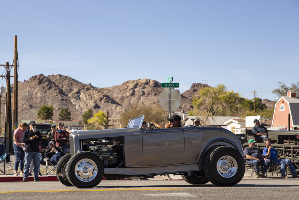
And not to be left out, the epitome of the classic hot rod, a Deuce (1932 Ford) roadster, also sporting a modern V-8.

Beautiful classic Deuce roadster with modern V-8 under the hood.

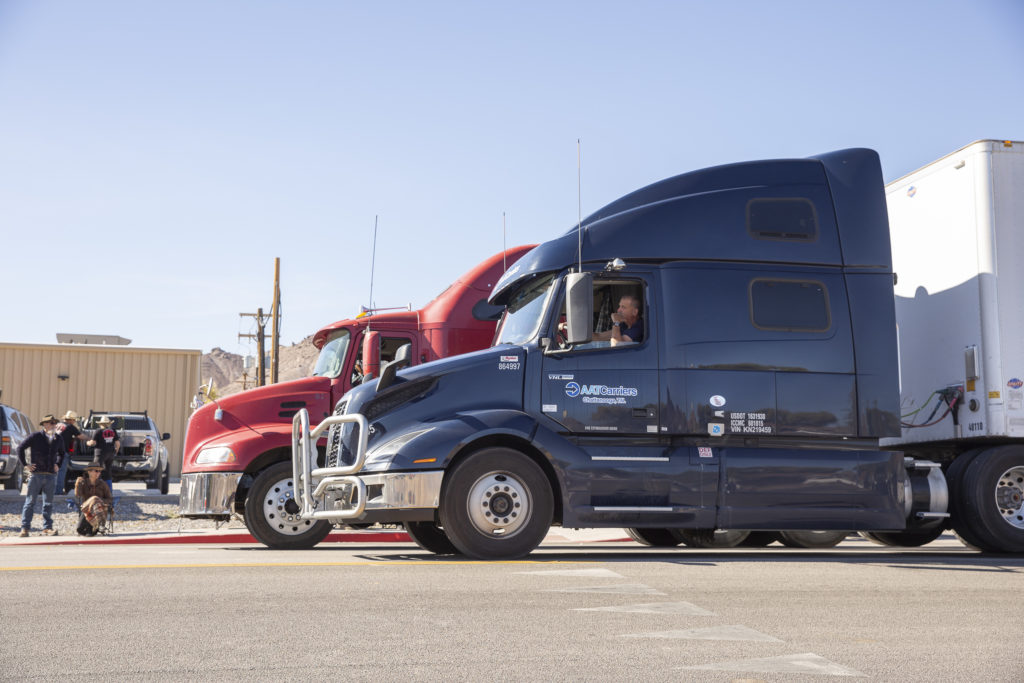
A gaggle of semis brought up the rear of the parade. Actually, they weren’t part of the parade; they were just the trucks that had been waiting until the parade was over to pass through Beatty – because the parade ran down the main highway (US 95), which had been closed for the event!

The end of the parade allowed normal traffic to resume, and these guys are the normal traffic. They had to wait a long time and probably weren’t happy.

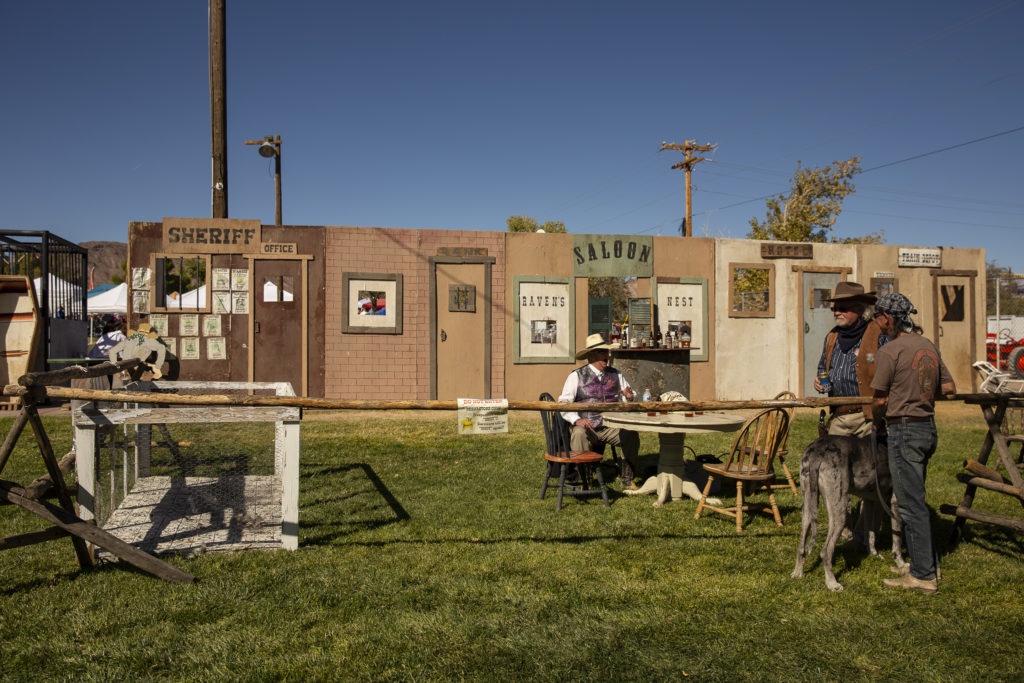
After the parade was over, everybody went over to the carnival, which was held on the Beatty village green. Among the attractions was an Old West mockup town where re-enactments of famous gunfights and other events were held.

The sign on the barrier rail says “Reenactors Only. Trespassers will be shot. Survivors will be shot again.”

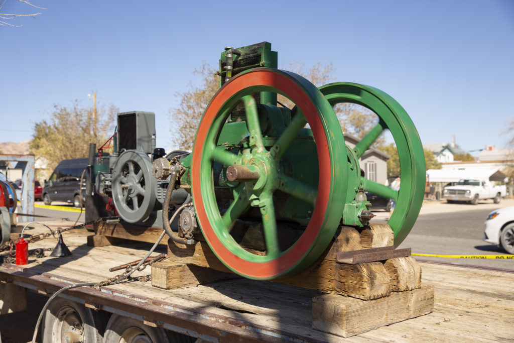
The fair’s electric power requirements evidently exceeded the capabilities of the Beatty (population 1000), so diesel generators were brought in to augment the supply.

Diesel generator mounted on truck bed (it was in the parade, too).

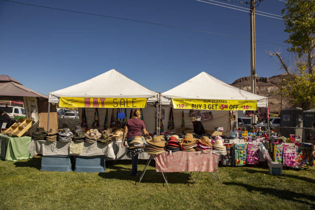
There were dozens of booths selling all kinds of wares – all kinds of food, of course; clothing, trinkets of various kinds, etc. There was a Hat Pavilion, where I bought myself a camo hat with a chin tie-string (which my regular Aussie leather hat doesn’t have) to keep it on my head when the wind is blowing. This turned out to be a very fortuitous purchase, in view of subsequent events.

Hat Pavilion

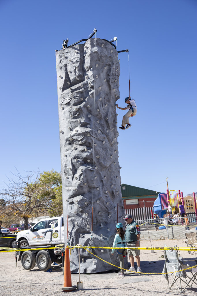
Something I would never have expected was a tower for rock-climbers. After all, it’s not like there aren’t any good places for rock-climbing around Death Valley.

The climber is on the way down after scaling to the top.

Beatty Days was scheduled to last three days, from Friday the 25th through Sunday the 27th. But on Saturday night a tremendous wind came up and blew away the whole shebang, putting a premature end to the celebration as well as whipping up a blinding dust storm on the floor of Death Valley.

Categories
Death Valley October 2019

Monarch Canyon, October 25, 2019

For our second excursion with the Jeep, we set out for Chloride Cliffs, also known as Chloride City, an old mining district high in the Funeral Mountains.  It is reached by a 4WD road that leaves Daylight Pass Highway somewhere between Hell’s Gate and Beatty.  As in our morning excursion, we came to a fork in the road, but this time there was no sign to direct us and, instead of Chloride Cliffs, we ended up in Monarch Canyon.  But that was OK, because the distance to Chloride Cliffs was much longer, and we probably would have had to come back on that 4WD road in the dark.

We arrived at Monarch Canyon after 4 in the afternoon, when shadows were creeping over the parking area.

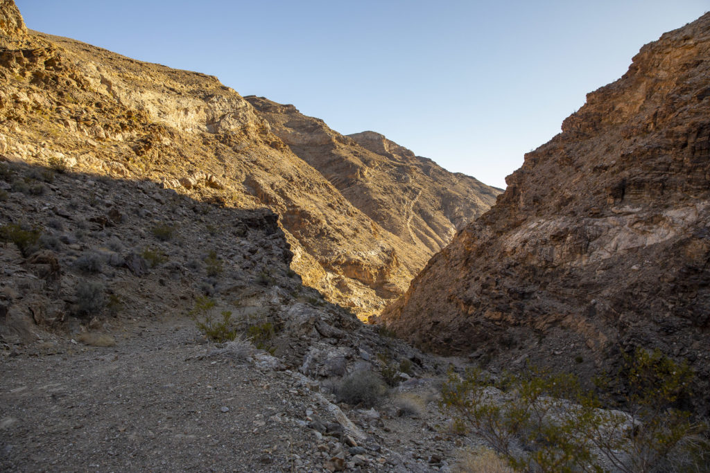
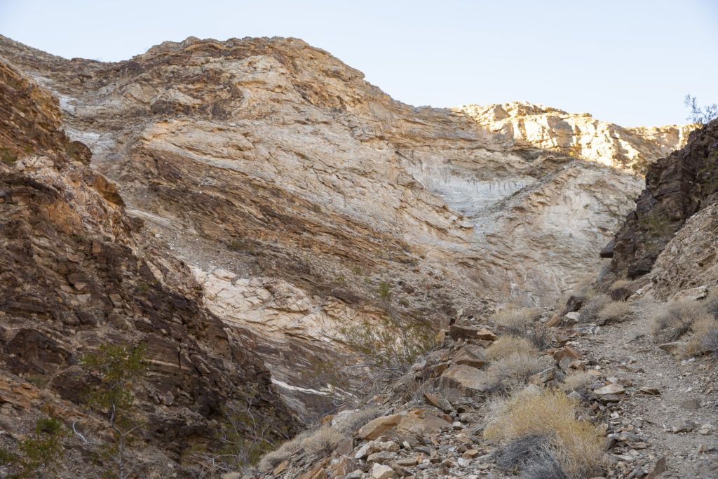
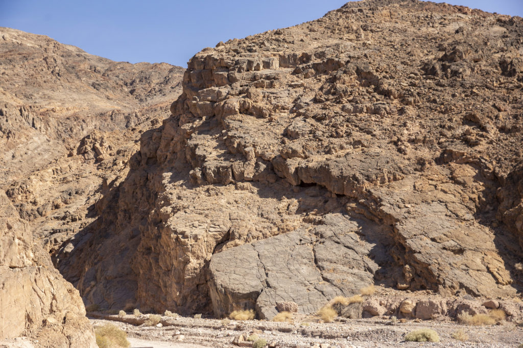
Monarch Canyon is if anything more colorful than Marble Canyon – a geological potpourri with banded cliffs and multicolored rocks all round.

Lots of interesting striations, dribbles and splotches in these varicolored rocks. Looks like someone spilled white paint over some of them.

A little trail led us down deeper into the canyon, and we took it, not knowing how far we’d go or what to expect when we got down further into the canyon.

The trail into the canyon can be seen at lower right.

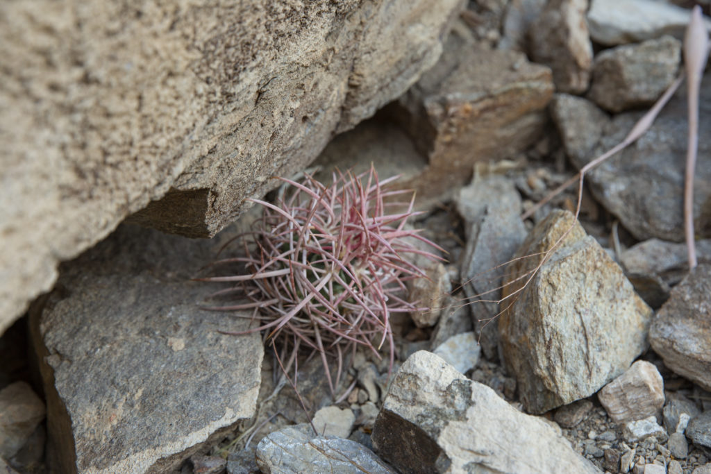
In addition to the colorful rocks, we encountered some interesting flora on the way, such as a tiny cactus nestling under a rock, with rose-colored needles all seeming to spring out from a hidden center.

This cactus looks as if it consists entirely of curved pink needles all rolled up into a ball.

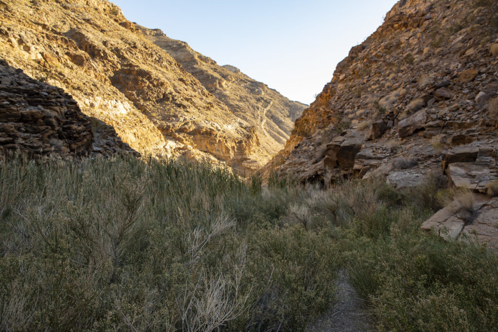
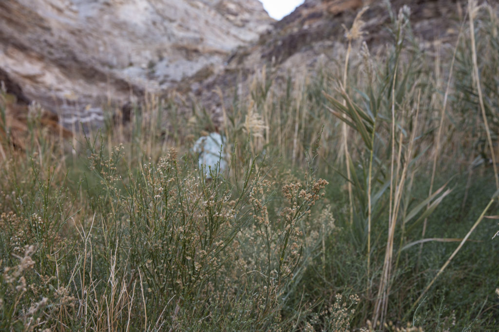
Upon reaching the canyon floor, we found it to be covered with a dense thicket of reeds and long grass, fed by a small spring.

Wetland, such as it was

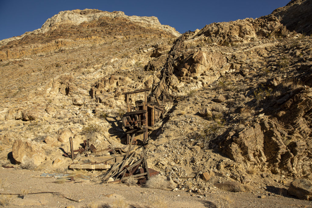
Proceeding further, we encountered an old stamp mill, designed to crush rock containing gold ore by pounding it, thereby preparing it for further processing. The ore is fed in via buckets carried down from the mineshaft on an aerial tramway.

The Old Stamp Mill

By now it was getting late, and there didn’t seem to be much point in going any further, so we turned back at the stamp mill and wended our way back up to the parking lot. Again we had to plow our way through the little jungle of tall grass and reeds that constituted the quasi-wetland, no big deal, except that this time I seemed to have an allergic reaction to something in the vegetation and emerged sneezing and coughing. I quickly recovered, but I’m still wondering what it was in there that set me off.

On the way back through the little “wetland.”

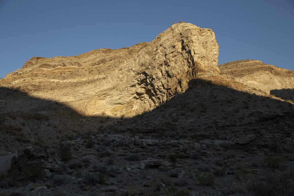
Climbing back up the trail, I saw a splendid promontory jutting from the mountain above the parking lot with its upper half gleaming in the late afternoon sun while its lower depths were in shadow. It reminded me of Yosemite’s El Capitan, and of course I couldn’t resist getting a shot of it.

Monarch Canyon’s answer to Yosemite’s El Capitan.

Back at the top of the trail, the Jeep was waiting to take us back to Farrabee’s, with Josie at the wheel.

JoAnn at the wheel of the rented Farrabee’s Jeep in Monarch Canyon.
Categories
Death Valley October 2019

Marble Canyon, October 25, 2019

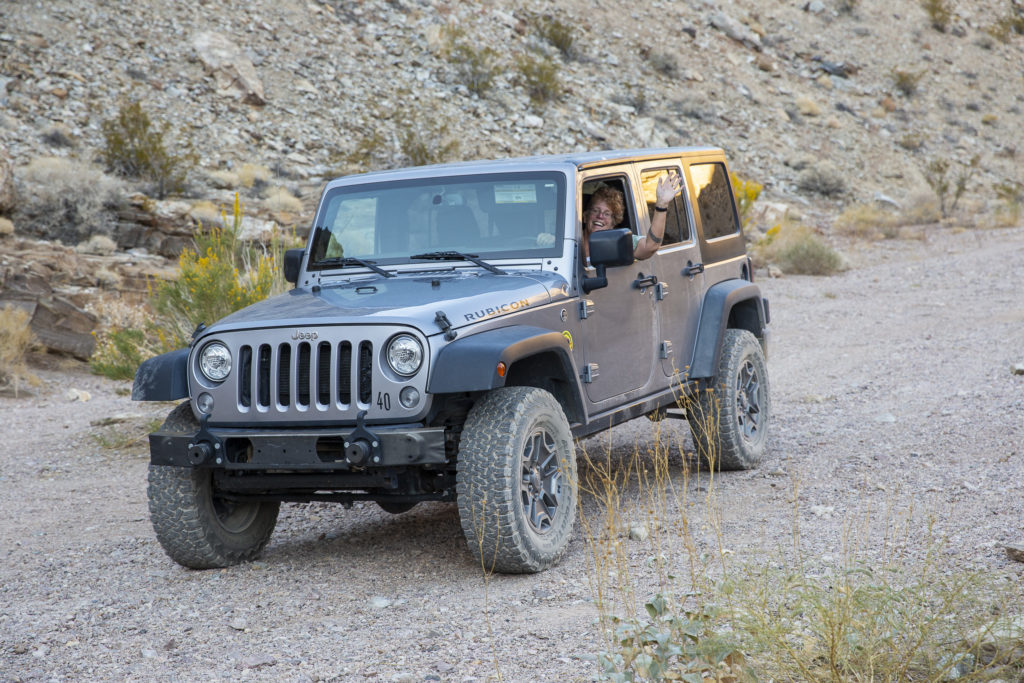
On Friday the 25th, JoAnn, Kelly and I rented a 4-door Jeep Rubicon for the day.  Our first destination was Marble Canyon, which is reached by a road which begins at Stovepipe Wells and runs west toward the Cottonwood Mountains.  The first 8 miles is bumpy but navigable for any high-clearance vehicle, but after that you really want four-wheel drive.

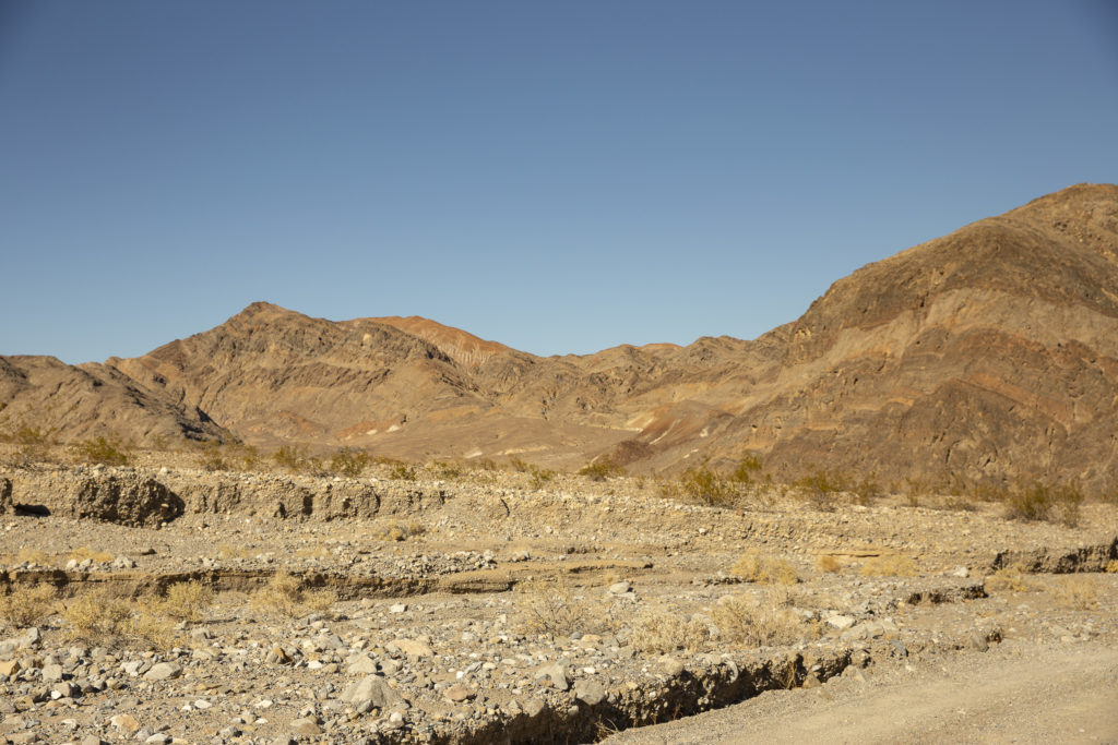
The road from Stovepipe Wells to Marble Canyon is passable for high-clearance 2-WD vehicles, but 4WD is highly recommended.

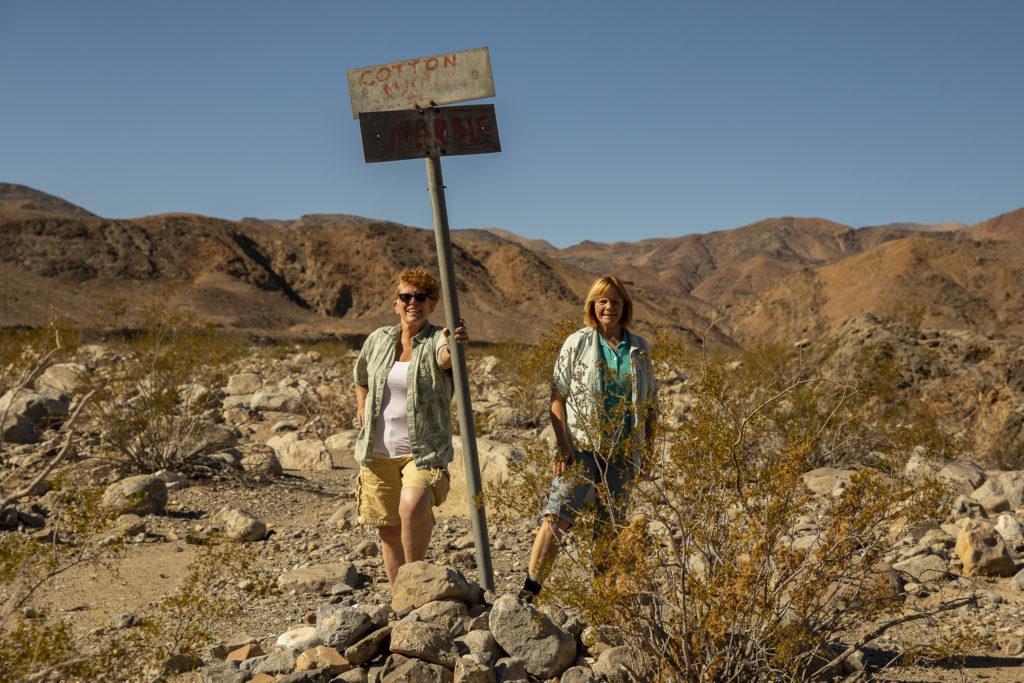
After a few miles of bumping along over small boulders and through deep gravel pockets, we reached a fork in the road, and following the advice of Yogi Berra, we took it. The left fork goes to Cottonwood Canyon; we took the right, which continues to Marble Canyon.

JoAnn (left) and Kelly (right) at the Cottonwood/Marble Canyon fork.

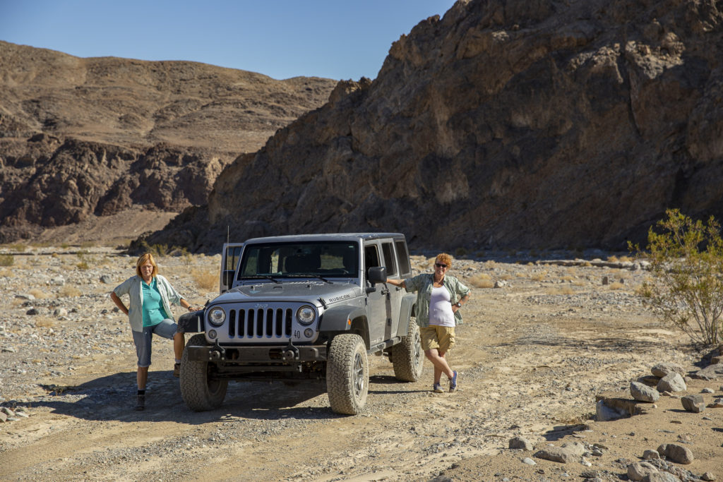
Our Jeep Rubicon, with JoAnn (right) driving and Kelly riding shotgun.

JoAnn drove, and Kelly and I were passengers on the way to Marble Canyon.

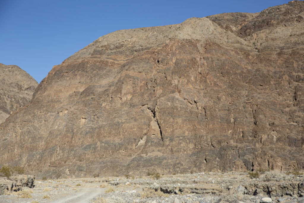
At about the 8-mile point we passed through a gap in the hills and continued onto the rougher section of the road. Looking back at the western side of the hills through which we had passed, I noted that the cliffs were pock-marked with little holes, plus one big one, which to me looked a bit like a keyhole. I have no idea whether it leads to a cave, of if it already has a name, but I gave it one: Keyhole Kave.

Keyhole Kave

Eventually we reached the Marble Canyon trailhead, where vehicular traffic ends and further progress has to be made on foot. We parked the Jeep and set forth on the Marble Canyon trail.

JoAnn starts the trek into Marble Canyon from the trailhead, where we parked the Jeep.

The Marble Canyon trail is part of a loop, known as the Cottonwood Marble Trail, 26 to 28 miles long; the other end of the loop is at the end of the fork in the road from Stovepipe Wells that we didn’t take, i.e. the Cottonwood Canyon road. The loop trail is classified as difficult, with a 3882-feet elevation gain, but the part we hiked on was pretty easy. If you want to backpack the whole trail, it takes two or three days.

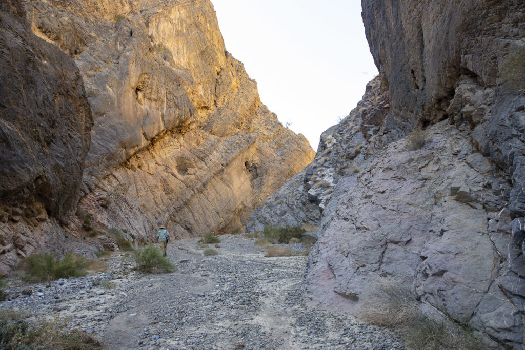
JoAnn directs traffic in the narrow entrance to the next stretch of Marble Canyon.

Jo and Kelly only wanted to hike to a dry falls about 5 miles into the canyon, and I set forth with them, but after a mile or so, I realized that I wasn’t equipped for even that short a hike: I hadn’t worn my hiking boots and I hadn’t brought enough water. So I turned back while they continued on to the falls; and I meandered back to the Jeep, shooting pictures of the rocks along the way. The rocks in Marble Canyon are amazing.

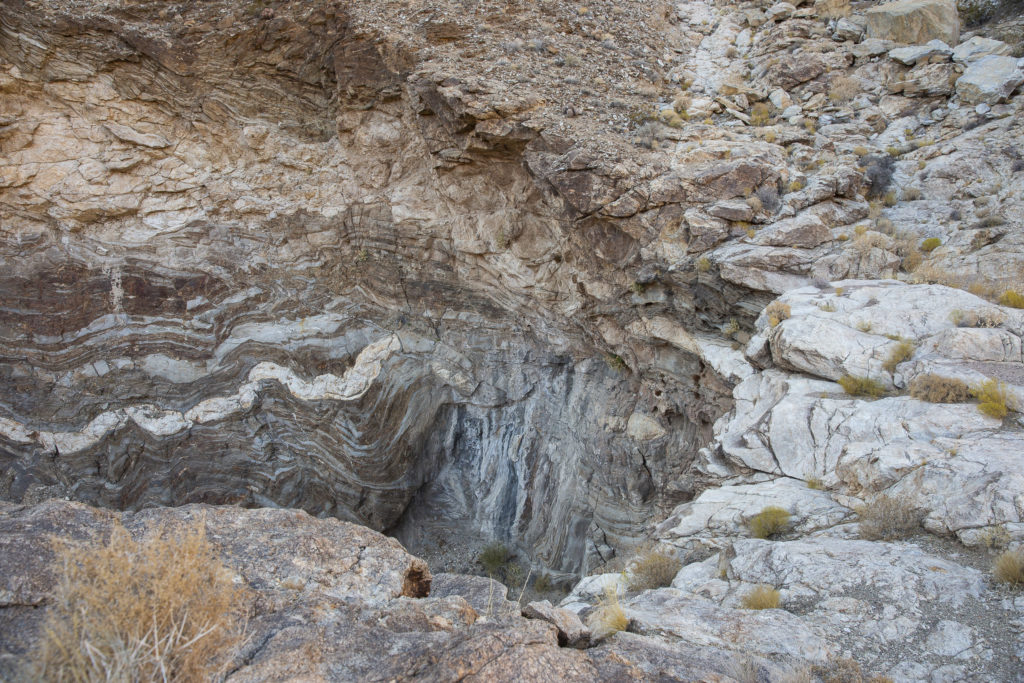
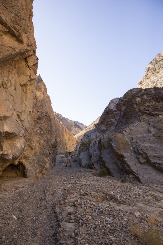
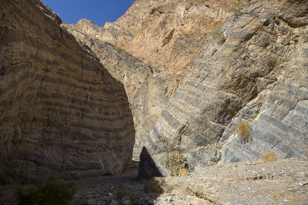
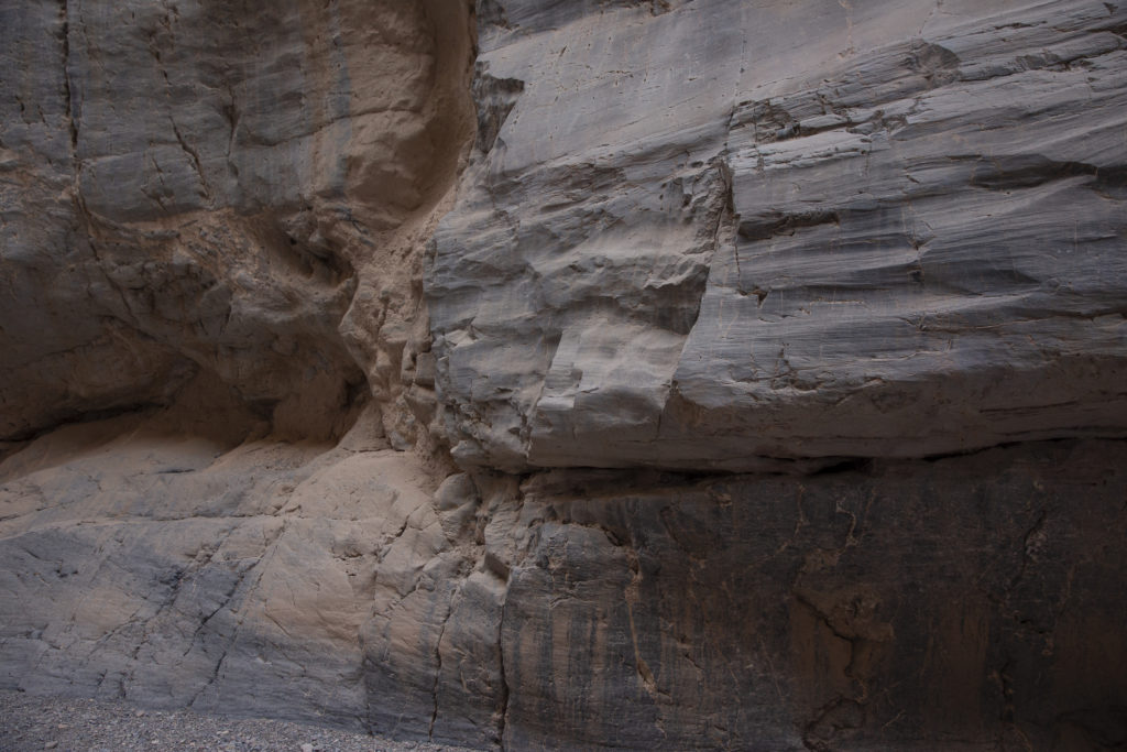
The cliffs lining the sides of Marble Canyon consist of layers of rock tilted at a sharp angle to the horizontal, and in many places banded with alternating light and dark strata.

Colorfully banded strata comprising the canyon walls.

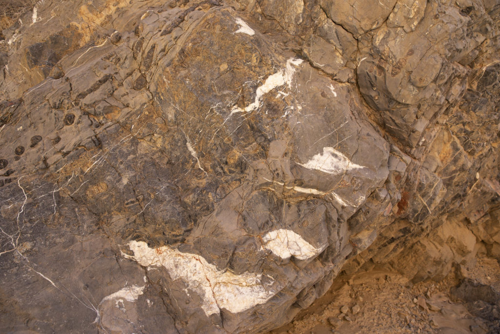
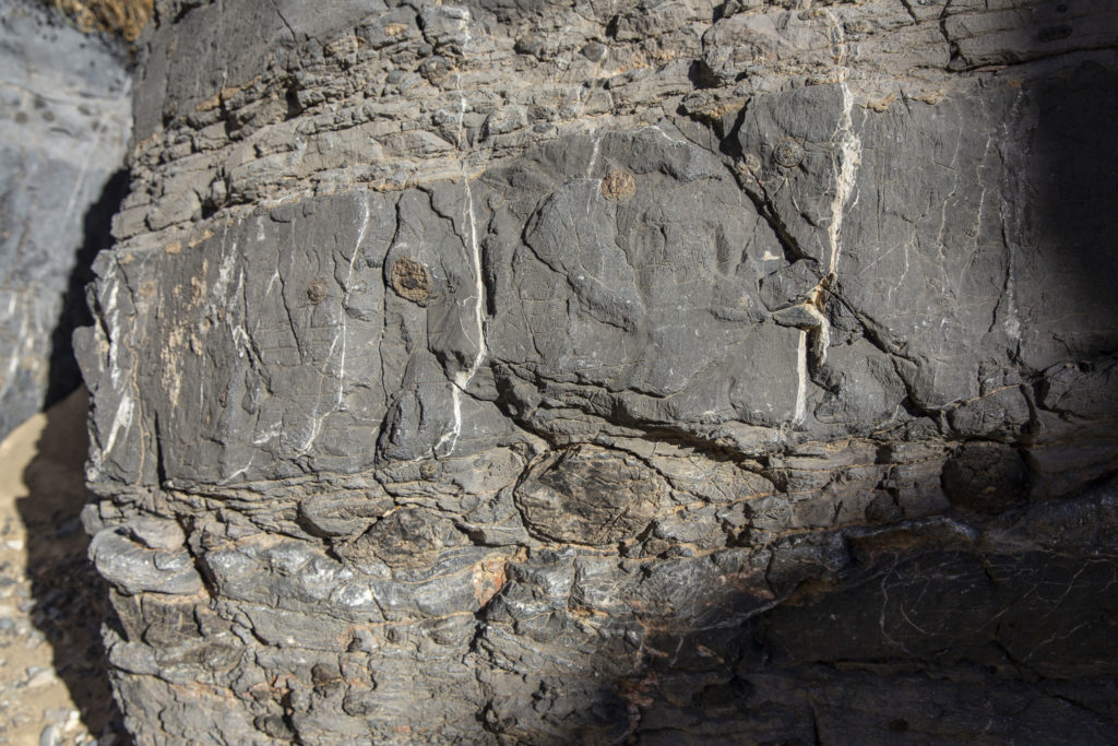
Interspersed with the banded layers were rocks with idiosyncratic features such as irregular “splotches” of white embedded in a matrix of completely different character.

At first glance it seems as if some demented vandal had splattered white paint on the canyon walls.

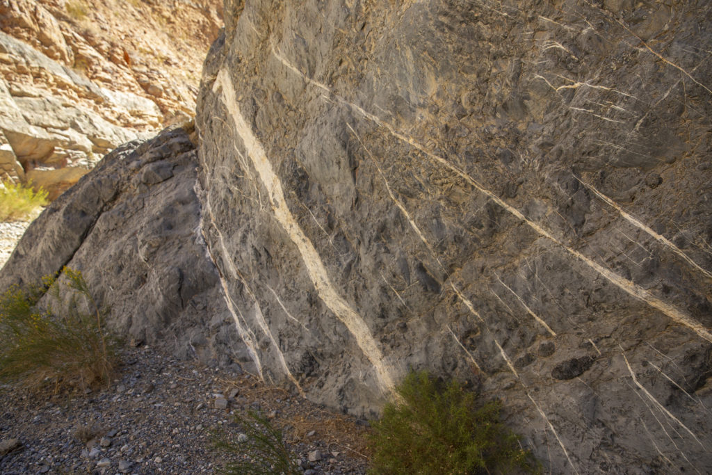
There were also places where instead of splotches there were white streaks, as if the same vandal responsible for the splotches had brought a brush and a bucket of paint and started painting the rocks white before being caught and hustled off.

These white stripes or striations are natural features in the rock, not the work of a maniac with a paintbrush.

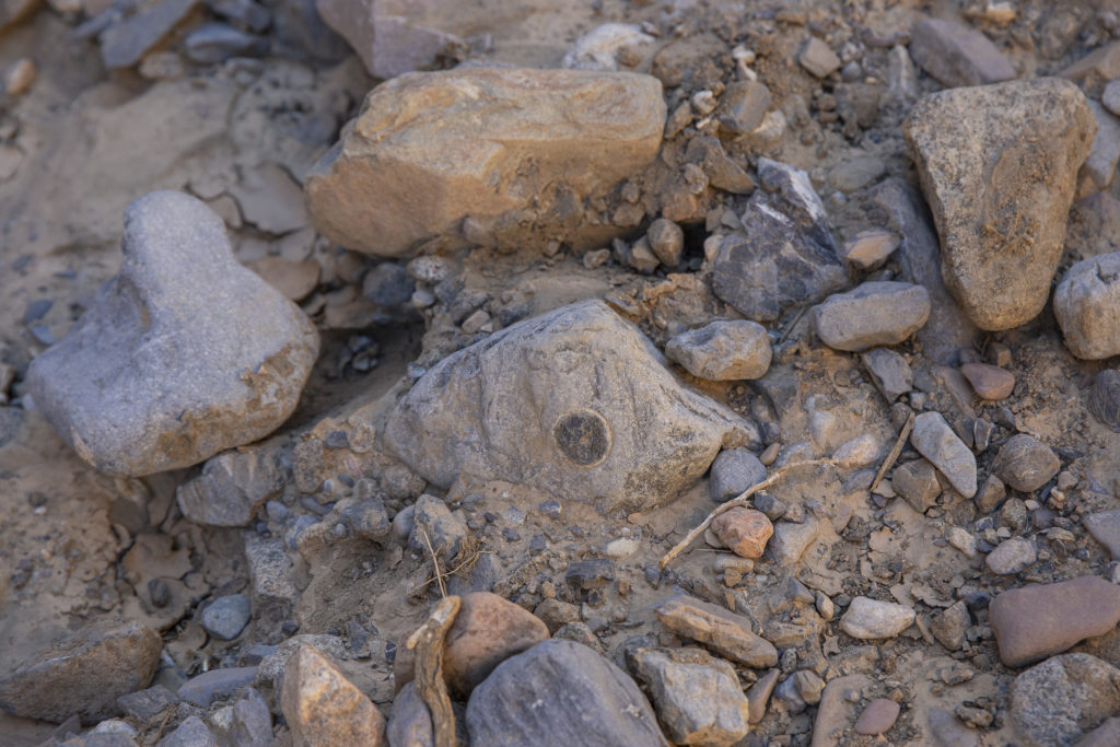
We also noticed a great many circular or oval “patches”, looking as if someone had drilled a hole in the rock and inserted a plug. These had many different colors and textures; some just consisted of different-colored rock, others looked as if they were surfaced with lichen or moss.

Here there are vertical rather than horizontal white striations, and there is a large round “plug” in the rock.
Is the circular blotch on the rock a lichen growth or an “insert” of some sort?

After arriving back at the parking lot, I took a nap in the Jeep while waiting for Jo and Kelly to return. Then we drove back to Stovepipe Wells, and, after a short sojourn, went on to our next destination, Monarch Canyon.

Categories
Death Valley October 2019

Titus Canyon, October 24, 2019

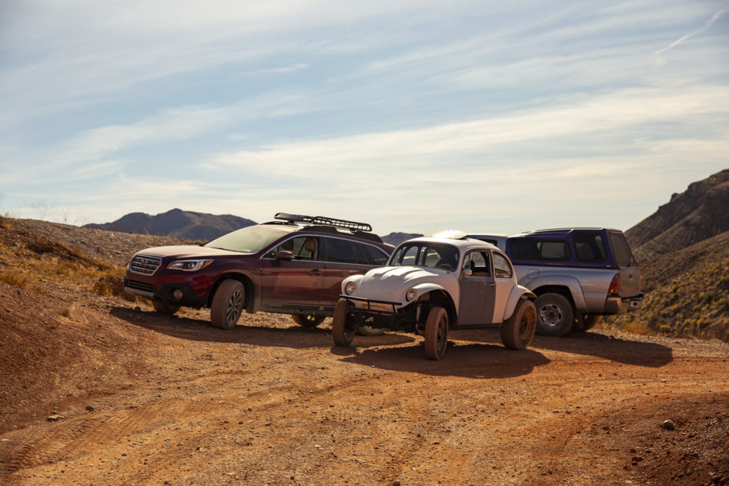
Mike wanted to test his Baja Bug on some of the unpaved roads in DVNP, and he got his chance the morning after we arrived, when we made an excursion through Titus Canyon. JoAnn and Diana rode in Boudicea (Jo’s truck), Kelly went with Mike in the Baja Bug, and Sandie and I took Red Sonja, our Subaru Outback, with Sandie driving and Jock, as usual, riding in the back seat.

Our Vehicles, left to right: Red Sonja (Sandie’s Subaru Outback), Mike’s Baja Bug and JoAnn’s Toyota Tacoma. Of the three, only the Outback has 4-wheel drive; the others are 2-wheel drive, but all are equally at home in Titus Canyon.

The Titus Canyon road was considered an engineering marvel when it was originally built during the 1920s. It is a spectacular route, winding up through mountain passes to heights of over 5000 feet, then down through the rugged fastnesses of the Narrows to Death Valley. It is an unpaved road, rugged and bumpy but easily traversed by high-clearance two-wheel drive vehicles, though you might not want to drive your Corvette on it.

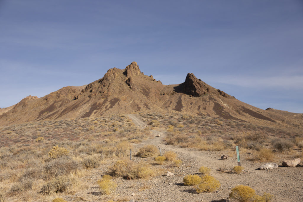
Here is where we left the highway to embark on our Titus Canyon adventure.

The Titus Canyon road takes off from Highway 374 about five miles east of Beatty, two miles west of the DVNP boundary. The first three miles or so are fairly level, though washboarded and rocky, and wide enough to turn around and go back if you get cold feet. But before long, the road climbs into the Grapevine Mountains and then descends through White Pass into Titanothere Canyon, the location of extensive fossil beds; the name commemorates a fossil rhinoceros-like animal whose remains were found here in 1933.

Titanothere Canyon

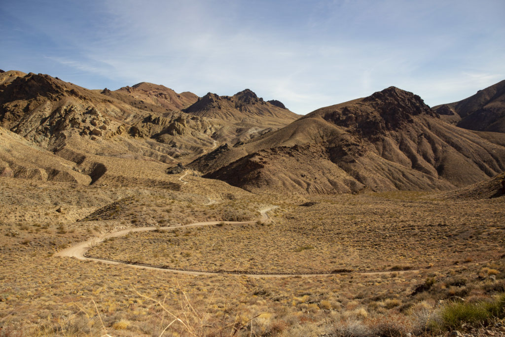
The high point of the drive is at Red Pass, where some of the most spectacular views are to be had.

Looking West from Red Pass

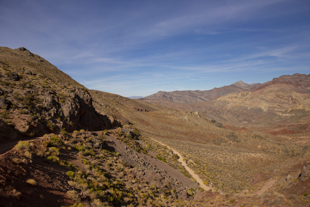
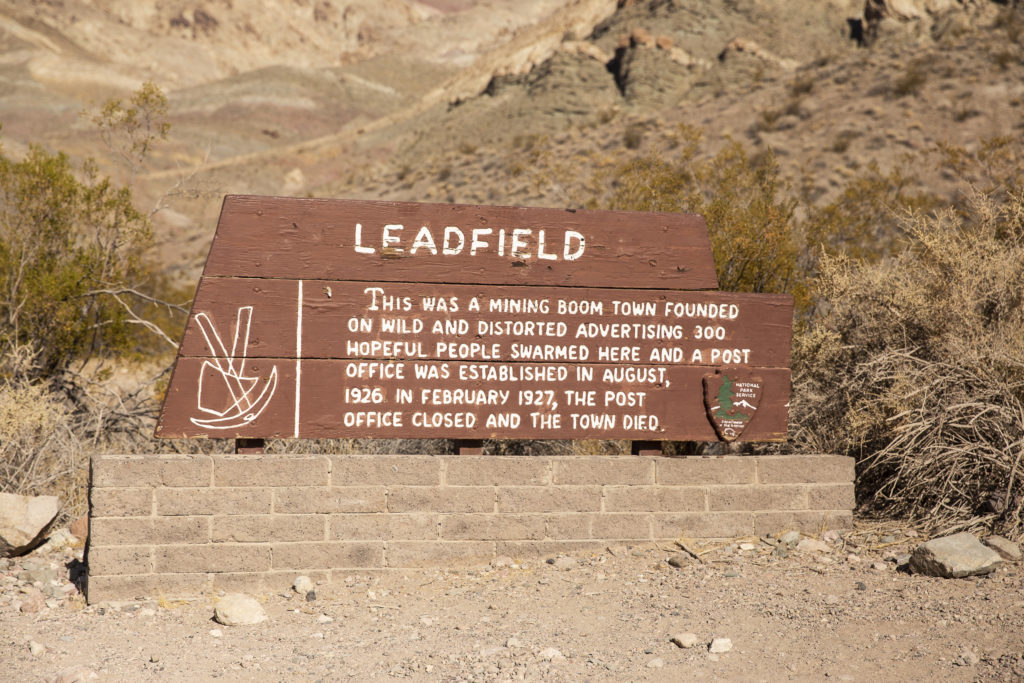
From Red Pass we descended via a dizzying series of hairpin turns to the ghost town of Leadfield. The Titus Canyon road was originally built in 1926 to provide access to Leadfield, which was the offspring of a brief lead-mining boon in the 1920s, fueled by what might most kindly be characterized as highly optimistic promotions. The boom fizzled when no high-grade ore was found, and the town died in 1927. You can read the whole story at https://www.nps.gov/parkhistory/online_books/deva/section4a8.htm .

The sign says it all.

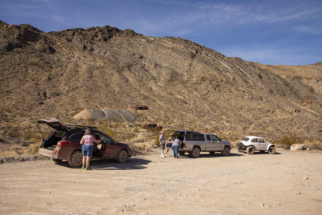
We stopped for lunch at Leadfield, where you can see the remains of some of the mine structures, as well as tailings from the extraction operations.

Some of the structures of the abandoned town, as well as tailings from the erstwhile mine, can be seen behind our vehicles.

Resuming our journey from Leadfield, we continued our descent toward Death Valley via a broad wash hemmed in on either side by towering cliffs, culminating in a relatively verdant spot known as Klare Springs. On previous trips, some of us had seen bighorn sheep, who come to drink at the springs, but on this trip none of us spotted any.

Klare Springs “Oasis”

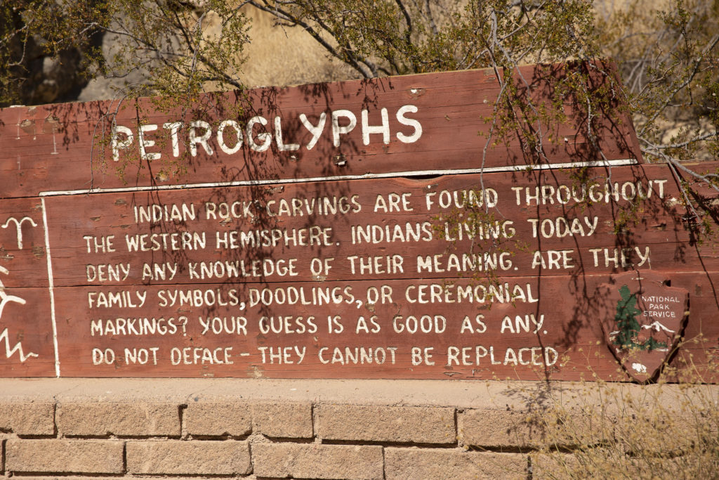
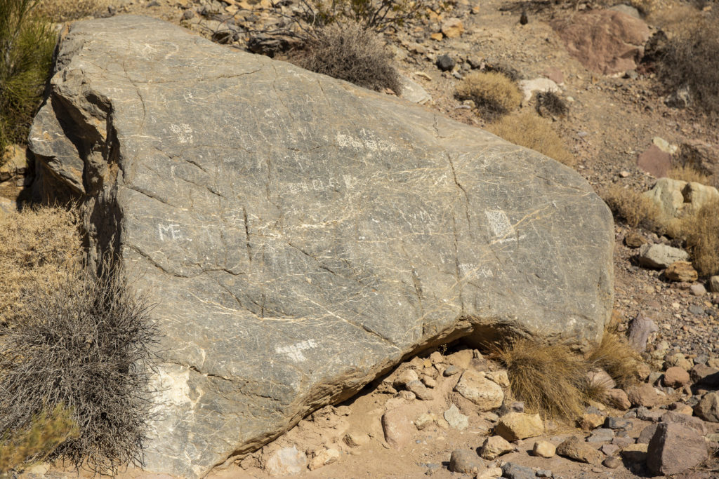
In the vicinity of Klare Springs are found some ancient Native American graffiti, more formally known as petroglyphs. At least that is what the sign tells us; for all I know, the scratchings on the rocks could have been left by modern-day passers-by. In fact, some of them were left by modern-day passers-by, who ignored the injunctions on the sign to refrain from defacing the irreplaceable Indian petroglyphs.

“Indians living today deny any knowledge of their meaning.” – Of course! They’re no fools – they are not going to admit to posting graffiti!!
There definitely are petroglyphs on this rock. At least some of them are clearly the work of modern-day barbarians.

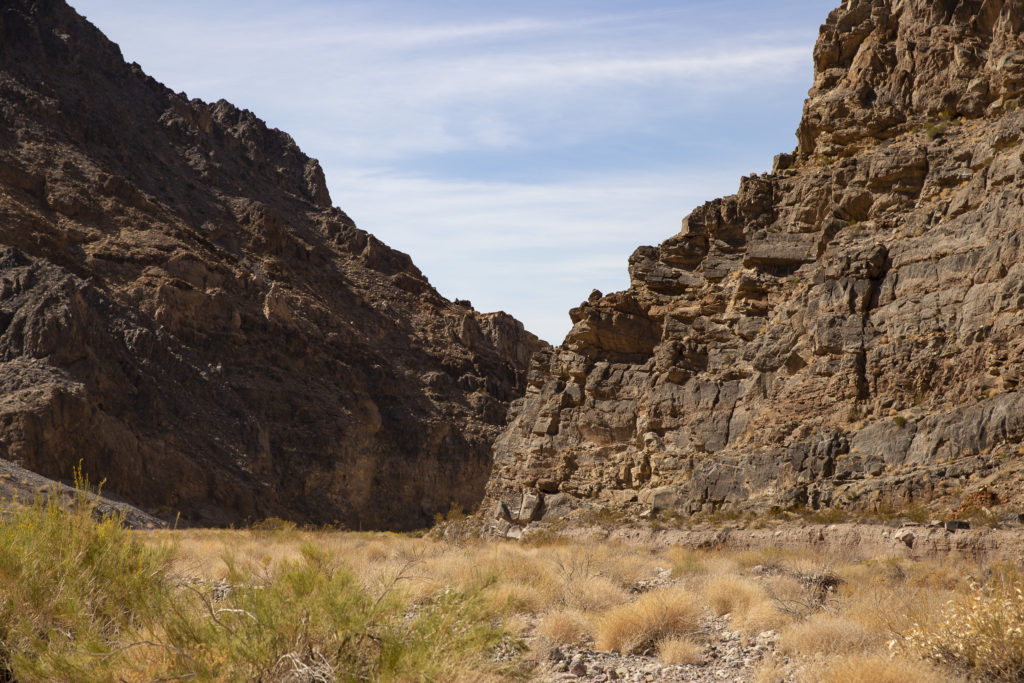
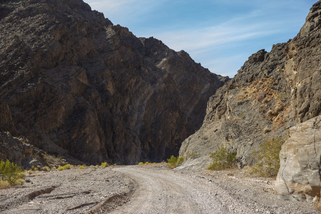
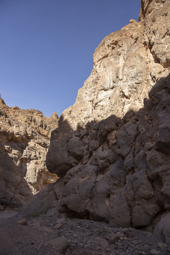
Now we reached the climax of the drive, the venture into the dreaded Narrows, a one-and-a-half mile stretch where the road shrinks to a narrow strip less than 20 feet wide in places, with overhanging cliffs hundreds of feet high which look as if a mild earthquake could send them crashing down on top of your car.

The canyon walls loom over the road as we approach the entrance to the dreaded Narrows.
In the Narrows the cliff walls are sometimes so close that you can reach out and touch them from the window of your car.
These cliff walls don’t inspire a great deal of confidence as to their stability.

When we finally emerged from Titus Canyon, it was like a cork popping out of a bottle.

The exit portal from Titus Canyon.

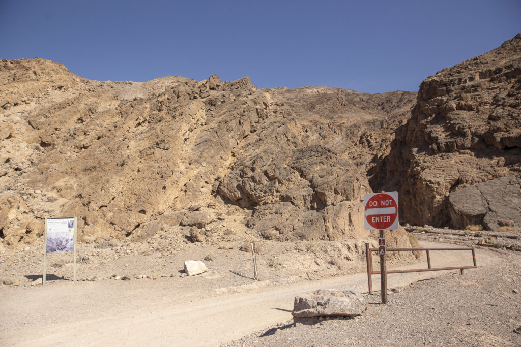
At the exit is found a sign barring entry, because Titus Canyon is a one-way east-to-west road.

The Titus Canyon Road is one-way.

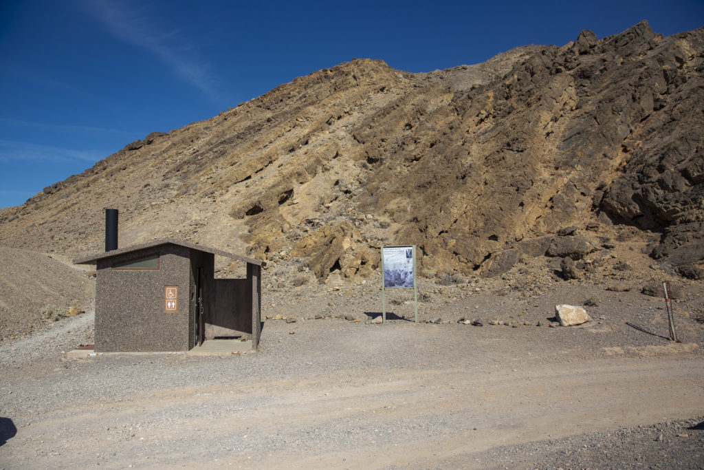
Also at the exit from the Narrows is found a very welcome convenience – rest rooms.

A sine qua non upon exiting Titus Canyon.

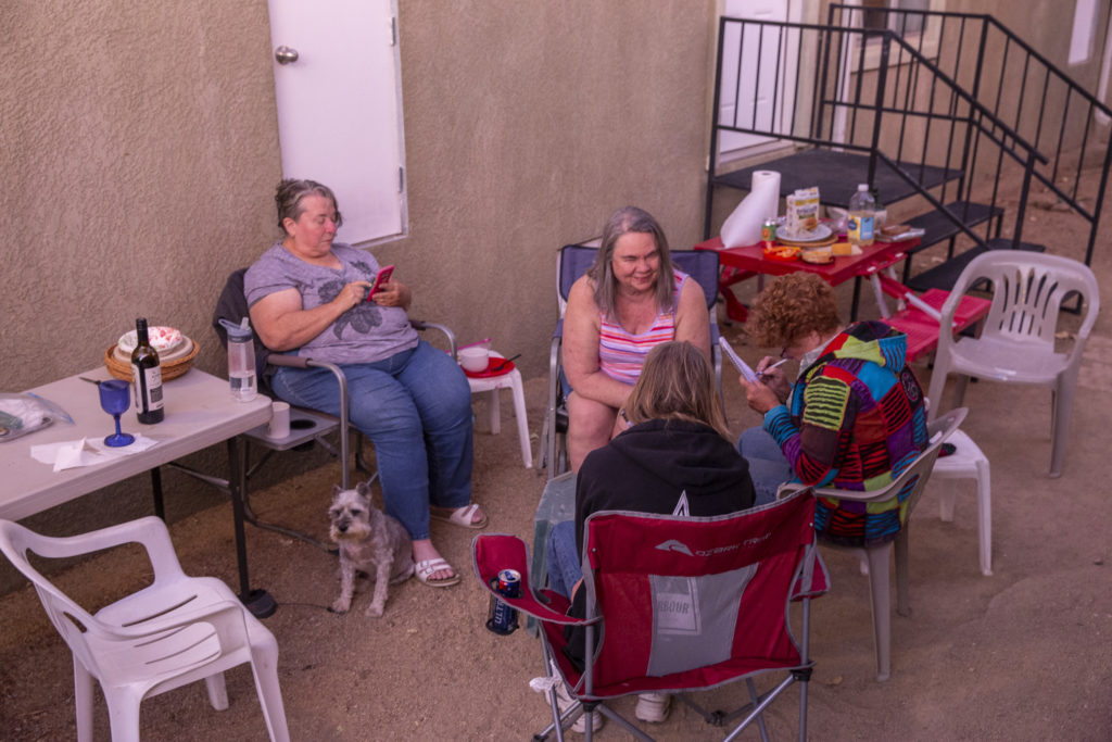
In the evening, back in Beatty at the Atomic Inn, we put up tables and chairs outside our motel rooms and relaxed over noshes and beverages.

Clockwise from left: Jock, Diana, Sandie, JoAnn, Kelly, at the Atomic Inn. Thursday evening, Oct. 24, 2019.

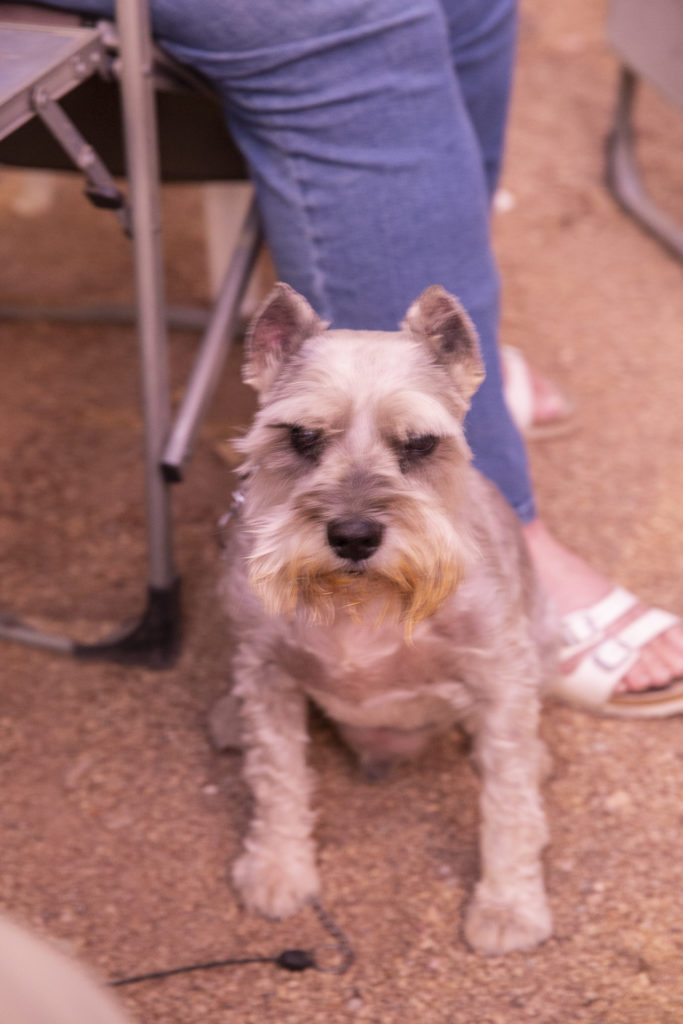
And Jock was very happy to hang out with his old friend Diana again.

Jock sitting next to Diana outside our rooms at the Atomic Inn, Thursday evening, Oct. 24, 2019.
Categories
Rude Rhymes

The Cormorant

The common cormorant, or shag,
Lays its eggs in a paper bag.
The reason you will see, no doubt,
Is to keep the lightning out.
But what these unobservant birds
Have never noticed is that herds
Of wandering bears may come with buns
And steal the bags to catch the crumbs.

Categories
Rude Rhymes

The Slithergadee

The slithergadee has crawled out of the sea.
He has caught all the others, but he won’t catch me.
No, you won’t catch me, old slithergadee.
You may have caught all the others, but you wo–